A collection of France Maps; View a variety of France physical, political, administrative, relief map, France satellite image, highly detalied maps, blank map, France world and earth map, France’s regions, topography, cities, road, direction maps and atlas.
Exploring France is much easier with a detailed map of France with cities and regions. Whether you’re planning a trip to iconic cities like Paris, Marseille, Nice or Lyon, or discovering charming towns tucked away in the regions, a France map of cities and towns is the perfect guide. From bustling urban centres to picturesque countryside, a France map of cities will not only help you navigate, but also reveal the country’s diverse beauty. Use a France cities map to explore every corner of this fascinating destination!
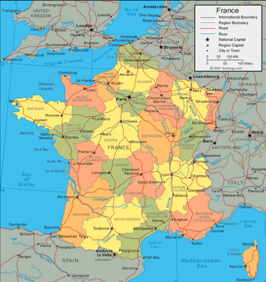
France Political Map with Cities and Regions

Highly detailed France political map with cities and regions, road map.
This political map of France highlights its regions, cities and neighbouring countries. From Paris to Marseille, explore major cities and regional boundaries. Perfect for understanding France’s geography, planning travel or studying its political divisions and urban layout.
France Map with Earth
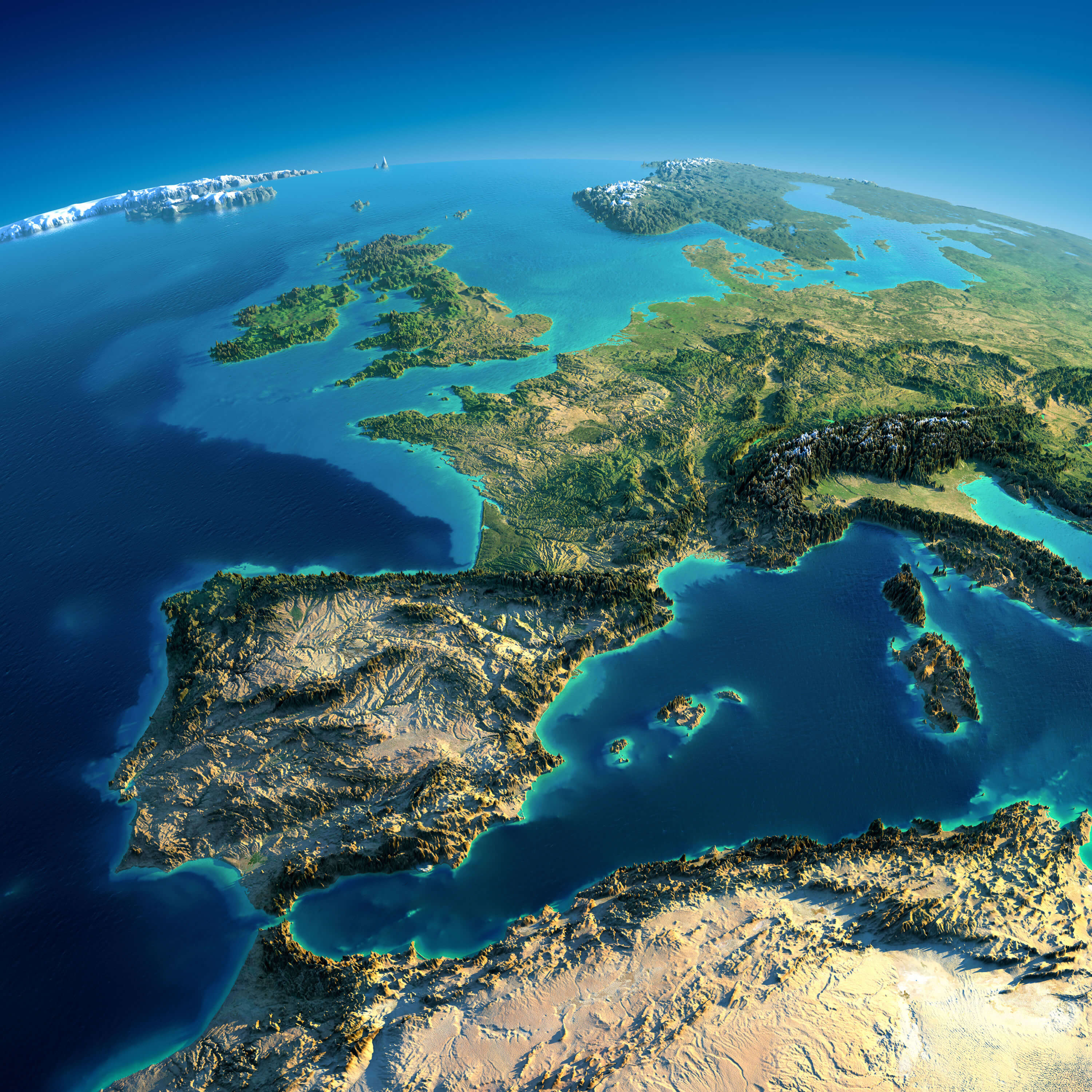
France Earth Map from Space.
Highly detailed France map with planet Earth. Exaggerated precise relief is illuminated by the rising sun from the east. Part of Europe, Spain, UK, Atlantic Ocean the Mediterranean Sea.
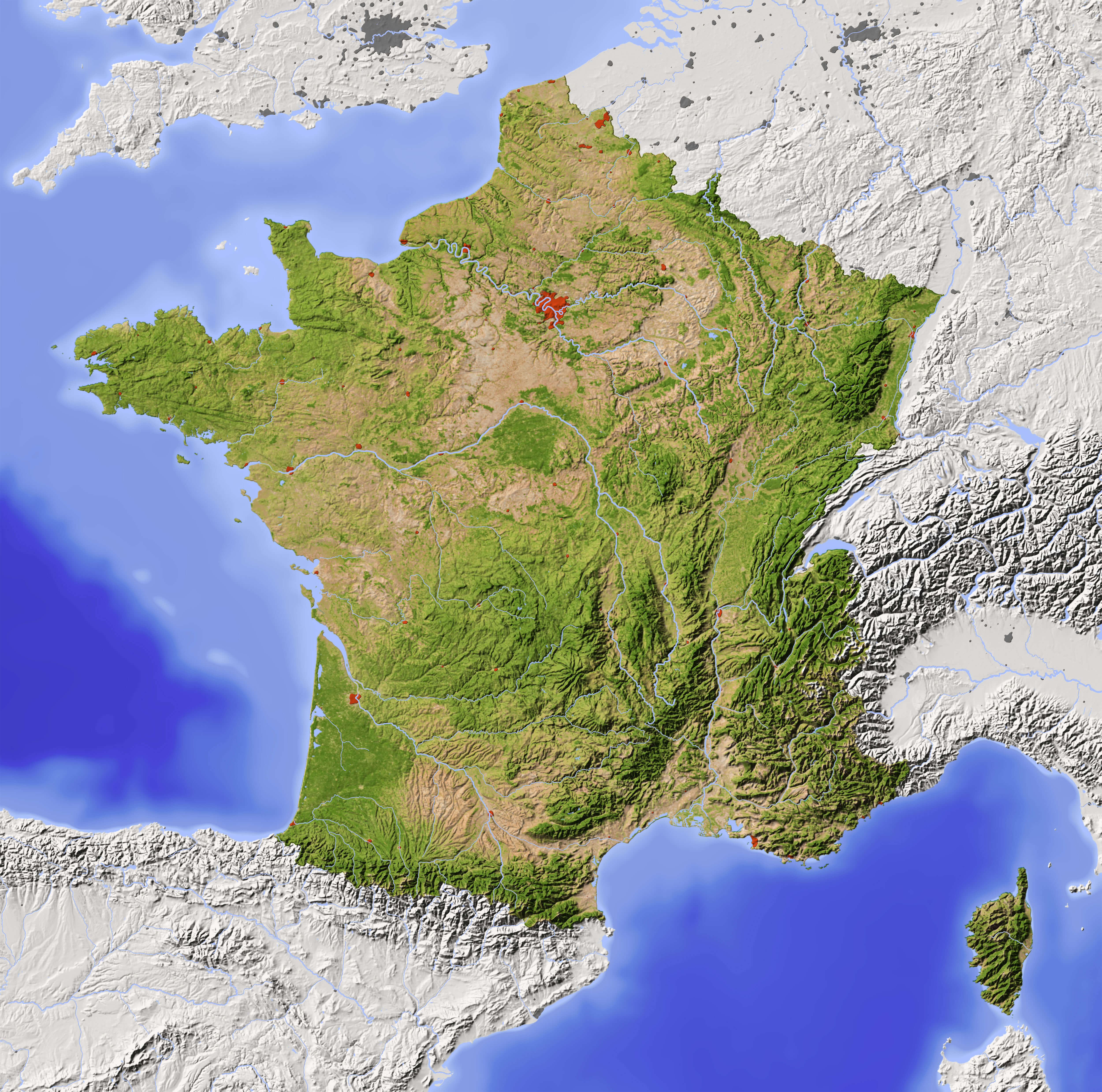
France Relief Map: Rivers and Mountain Ranges

Shaded France Relief Map with major urban areas. Surrounding territory greyed out. Colored according to vegetation. Includes clip path for the state area.
This relief map of France highlights the country’s rivers, mountain ranges and varied terrain. From the Pyrenees to the Alps and major rivers such as the Seine and Rhône, it offers a detailed look at France’s natural geography. Ideal for geography enthusiasts or for educational purposes.
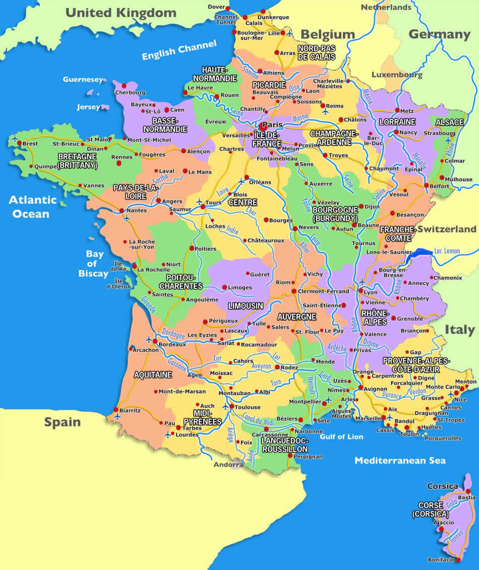
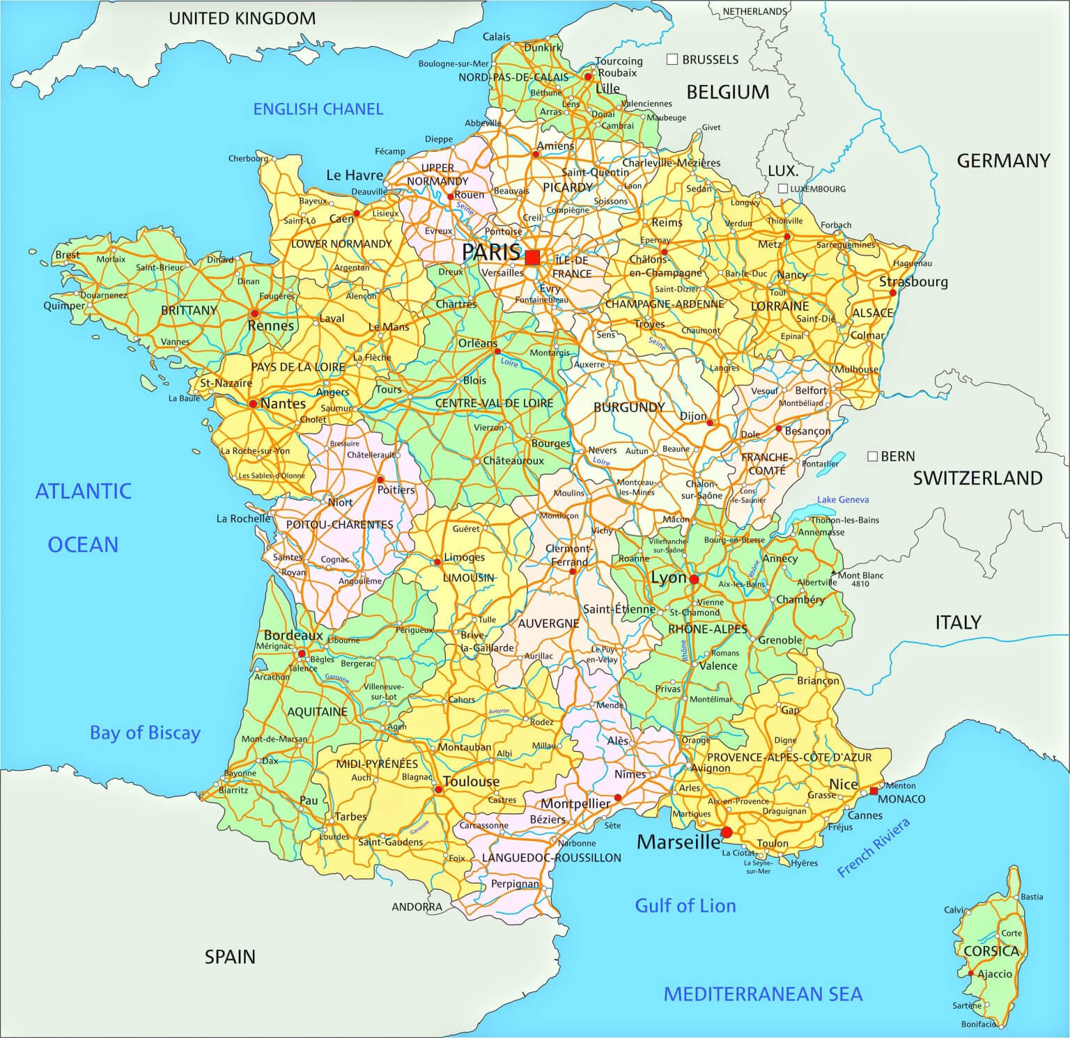
France Map: Roads, Rivers, and Major Cities
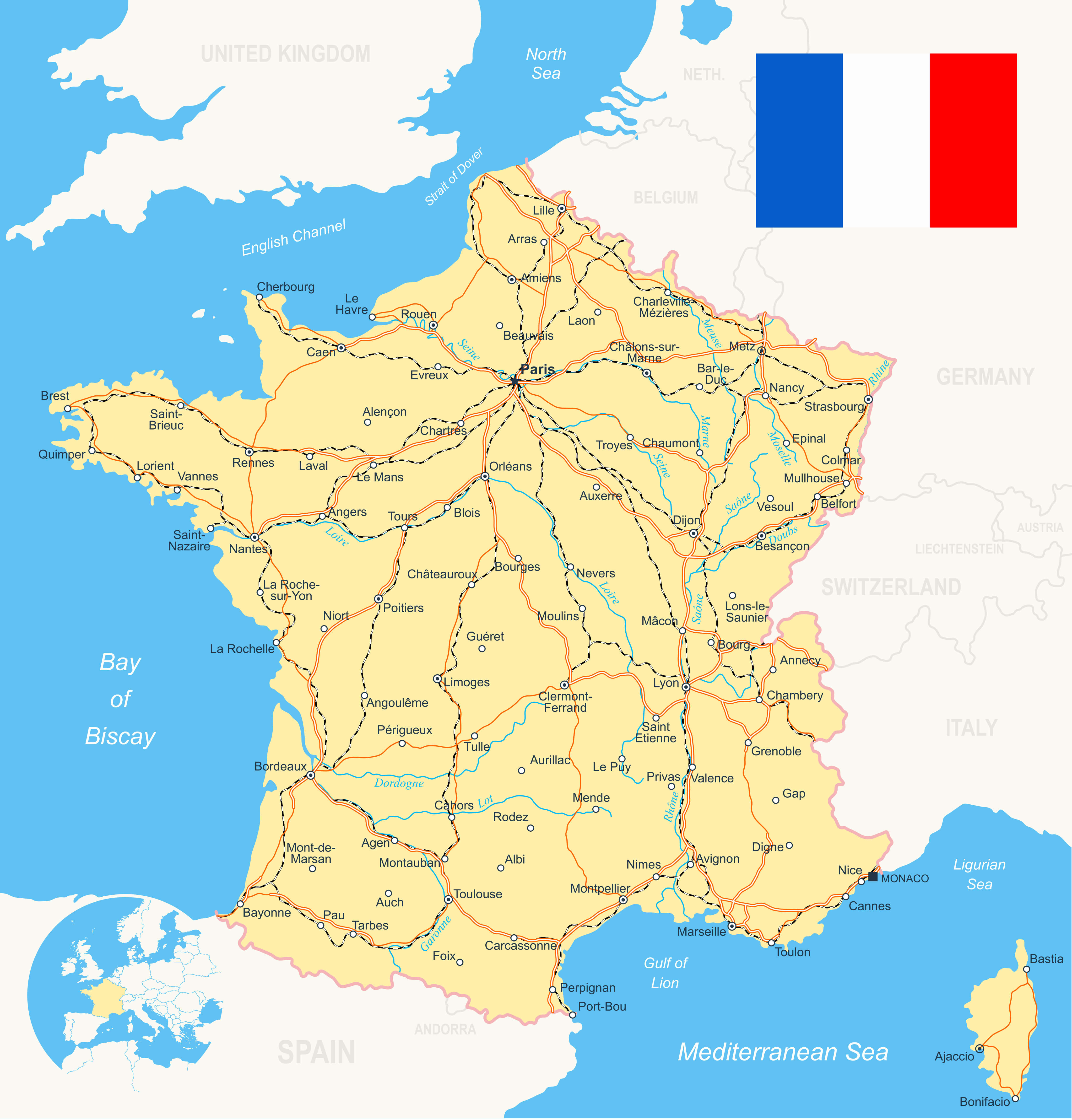
France Road River Map with flag, navigation icons, roads, rivers, land contours.
This map of France displays its road network, major rivers, and key cities. Ideal for planning road trips, studying transportation routes, or exploring geographical connections across the country. A detailed view of France’s infrastructure and waterways.
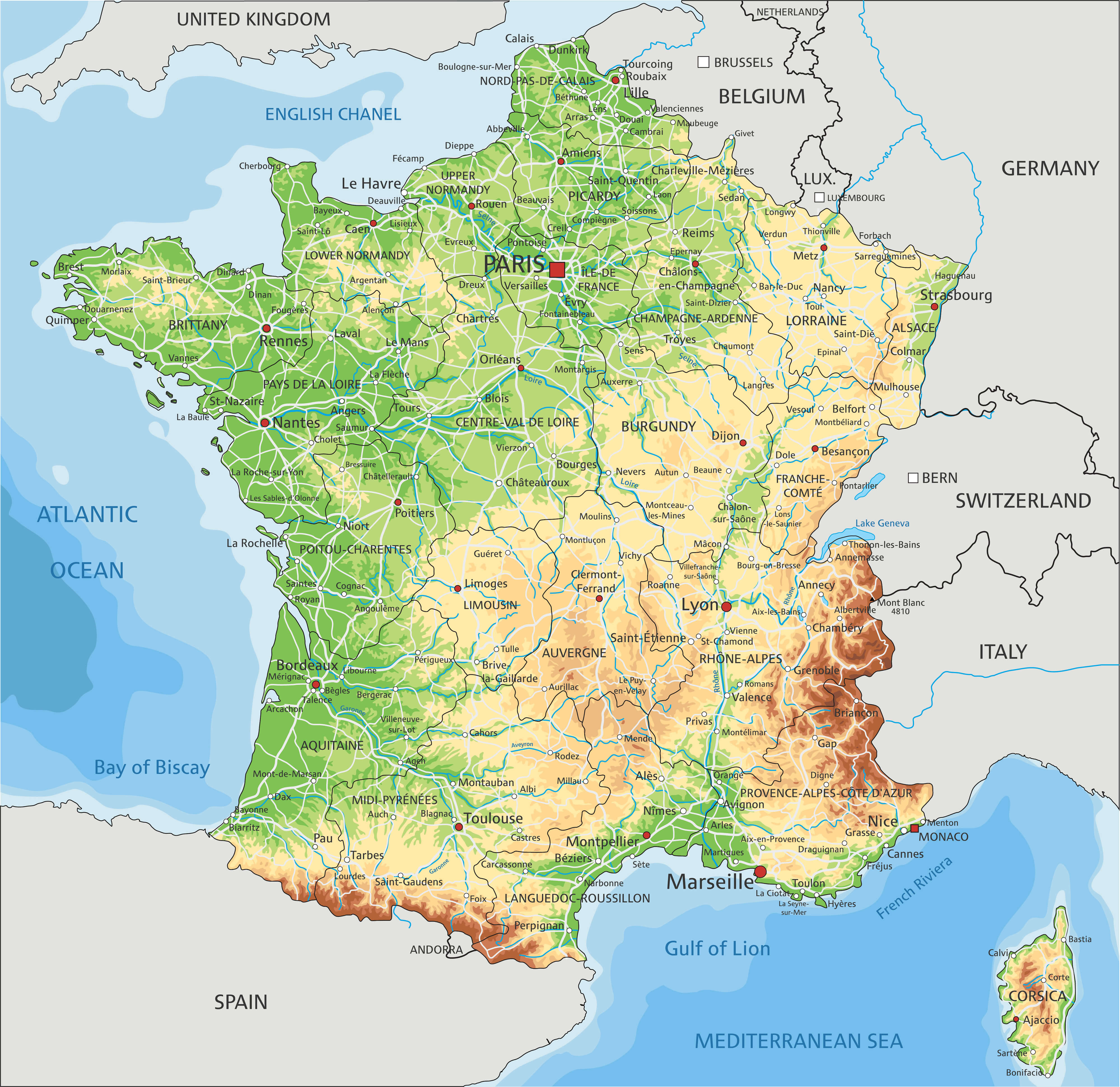
Map of France with Major Cities and Rivers

Map of France as an overview map in green, major cities and rivers.
This map of France highlights major cities such as Paris, Marseille and Lyon, as well as main rivers such as the Seine and Rhône. It also shows the surrounding countries, providing a clear geographical context. Perfect for getting to know France’s urban centres and waterways.
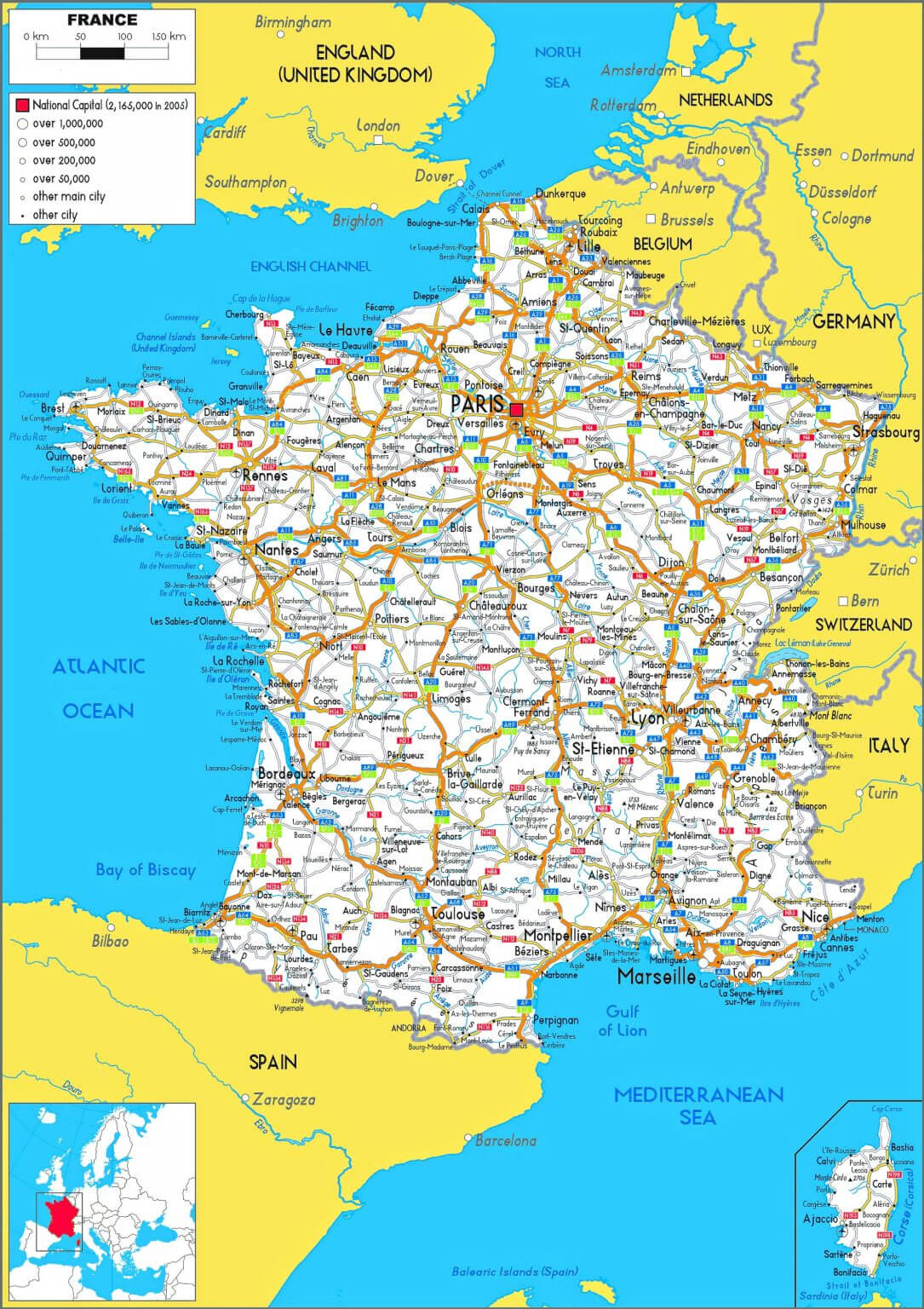
France Major Cities Map
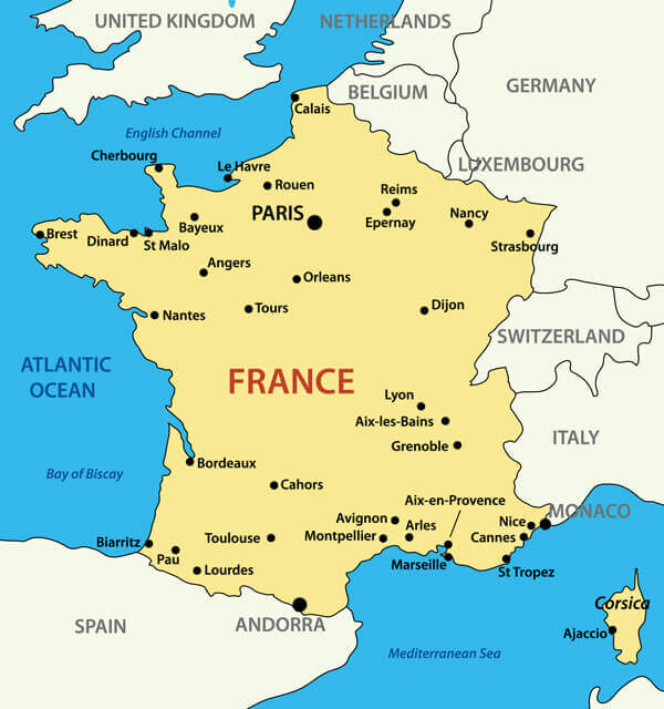
Map of France with Major Cities.
This map of France highlights the country’s major cities, including the capital, Paris, as well as other notable locations like Lyon, Marseille, Bordeaux, and Nice. Each city is positioned relative to the surrounding regions and neighboring countries, providing a clear view of France’s geographic and urban landscape. The map also marks the location of important landmarks such as the Mediterranean coast and the Bay of Biscay, making it useful for understanding both the country’s urban centers and its coastal borders.
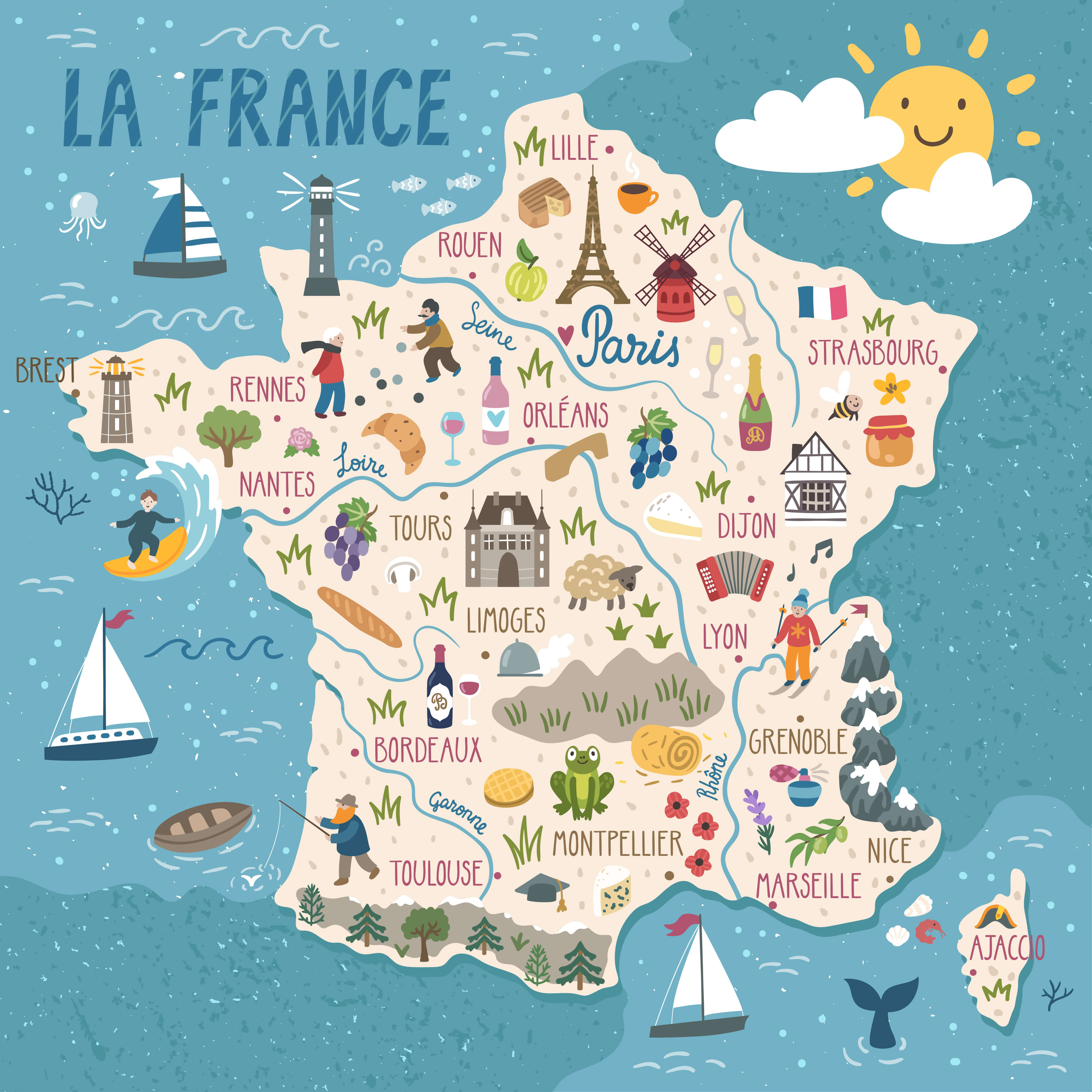
France Travel Map
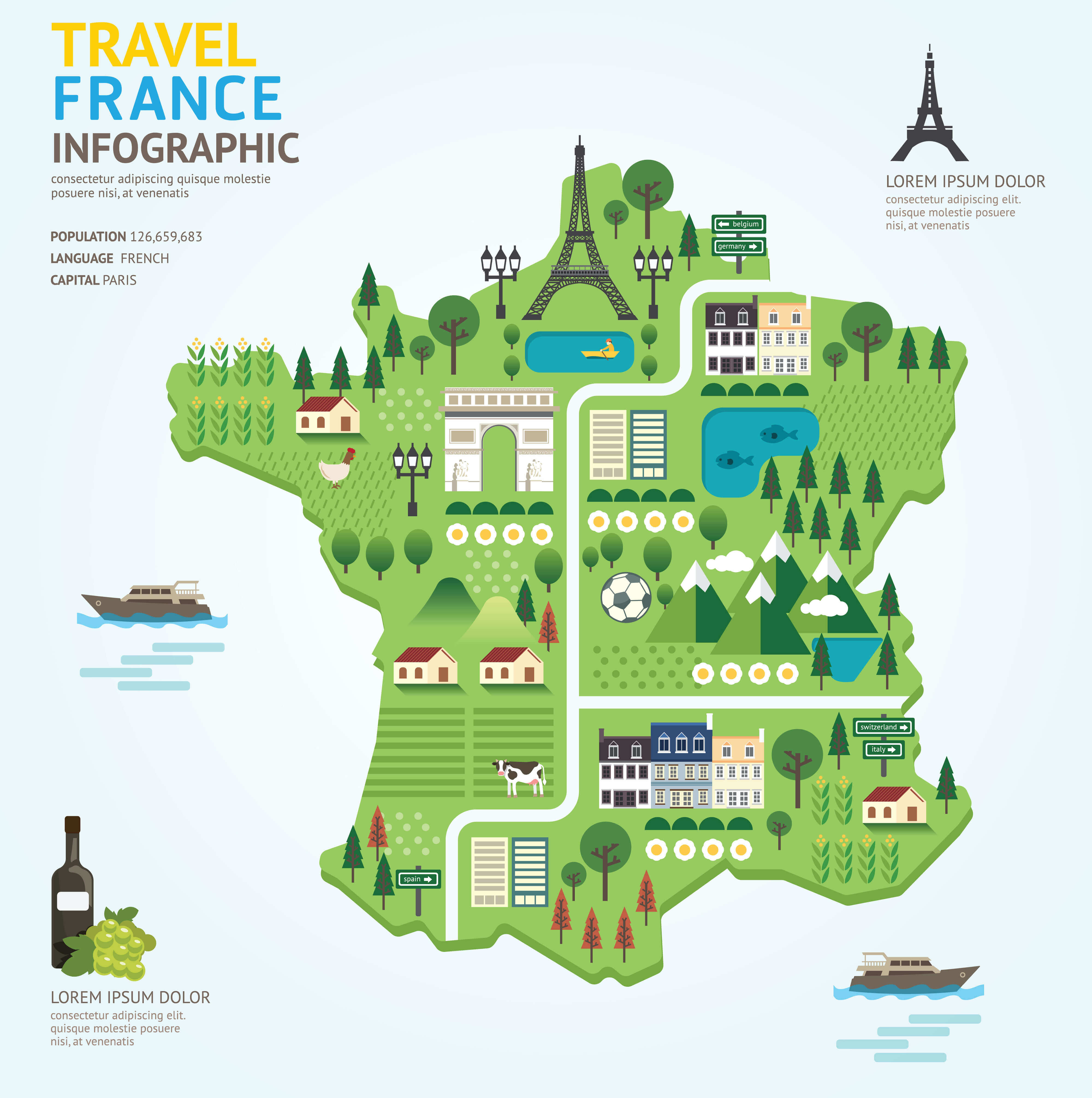
France Tourism Map with Destinations and Landmarks.
This is a fun and colorful infographic map of France that highlights key travel landmarks such as the Eiffel Tower, vineyards, riverside activities, and the Arc de Triomphe. The design uses a playful approach to showcase famous sights and local culture, including countryside scenery, famous monuments, and rural life. Perfect for travelers wanting a visual snapshot of what to explore in France!
Colorful France Map with Regions
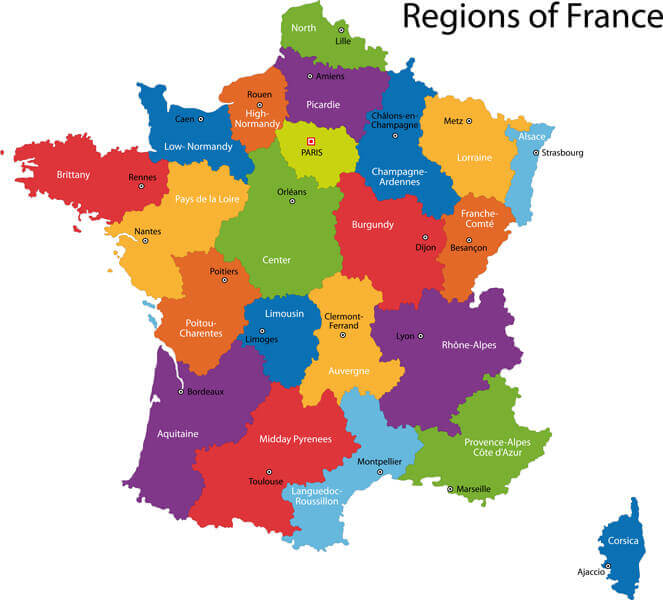
Map of Regions of France with main cities.
This colorful map of France highlights its various regions, each distinguished by vibrant hues. From the sunny Provence-Alpes-Côte d’Azur in the southeast to Brittany in the northwest, it provides a clear and visually engaging overview of the country’s administrative divisions. Major cities like Paris, Lyon, and Marseille are clearly marked, making it a useful reference for understanding France’s geographical layout and cultural diversity. The map also includes the island of Corsica, emphasizing its position in the Mediterranean.
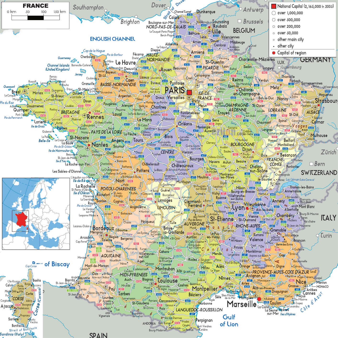
Administrative Map of France: Regions and Major Cities
Map of France displaying administrative regions and major cities.
This administrative map of France highlights the country’s regions and major cities, including Paris, Marseille and Lyon. It’s a useful tool for understanding France’s regional divisions and key locations. Ideal for educational purposes, travel planning or general reference.
Map of France with Rivers and Cantons
France map with rivers, cantons and main cities.
This map of France highlights the country’s rivers, regions, and major cities. It presents a colorful display of administrative divisions, showing important features like rivers such as the Seine, Loire, and Rhône, running across various regions, and significant cities like Paris, Lyon, and Bordeaux. It provides a clear and detailed look at how France is geographically structured, emphasizing both natural and political boundaries within the country.
Brief information about France
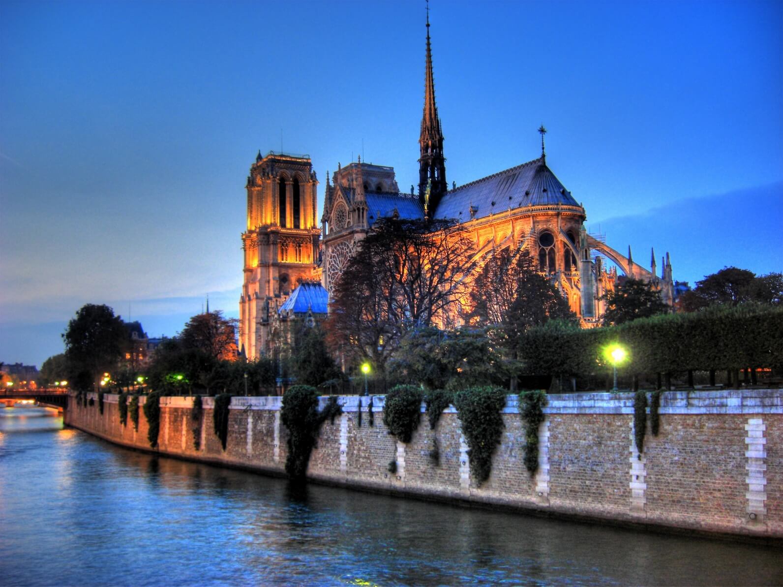
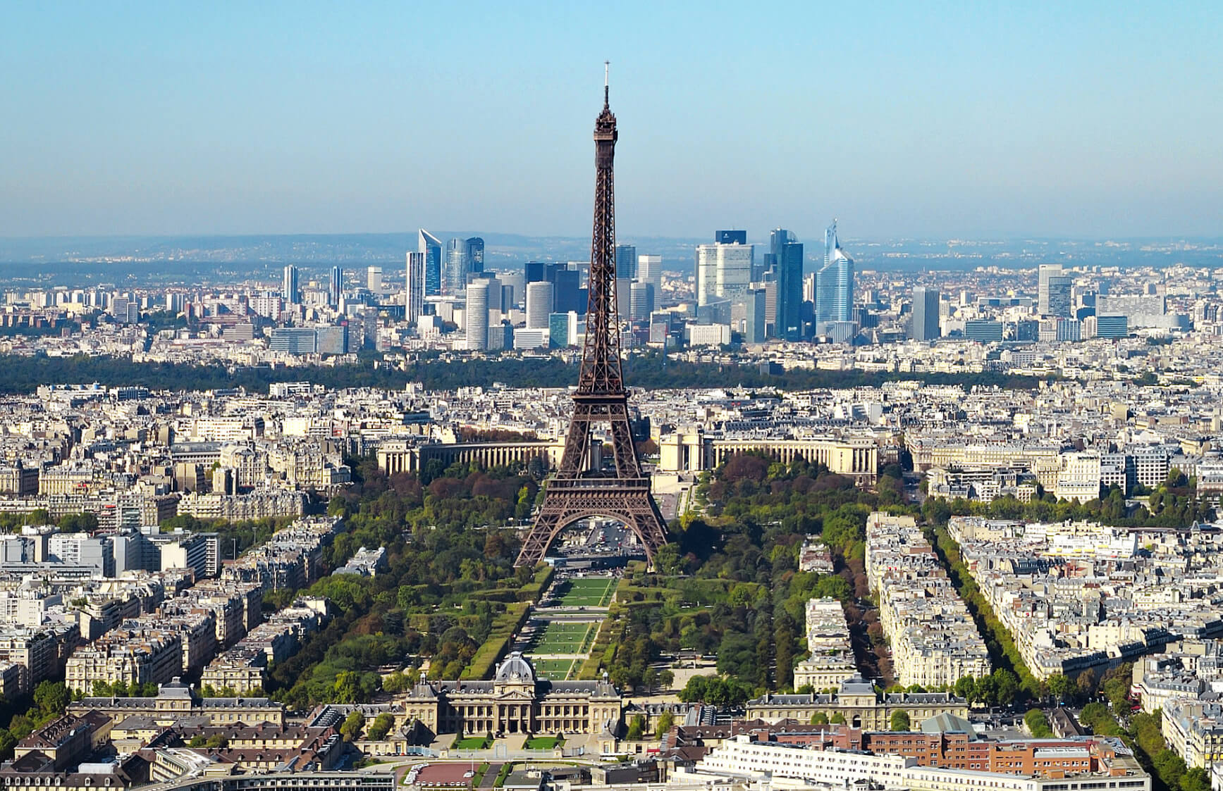
France, located in Western Europe, is known for its rich history, cultural heritage and iconic landmarks. Known as the ‘Hexagon’ for its shape, the country boasts diverse landscapes, from the snow-capped Alps and picturesque vineyards of Bordeaux to the golden beaches of the French Riviera. Its capital, Paris, is celebrated worldwide as the epicentre of fashion, art and gastronomy, with iconic landmarks such as the Eiffel Tower, the Louvre Museum and Notre Dame Cathedral. France’s commitment to preserving its historical and natural sites is evident in its many UNESCO World Heritage Sites, including Mont Saint-Michel and the Palace of Versailles.
Area: 207,595 km2 (80,153 sq mi)
The French lifestyle, often defined by an emphasis on quality food, wine and leisurely living, is a major draw for visitors and expats alike. France is also a world leader in art, philosophy and science, producing the likes of Voltaire, Monet and Pasteur. The country is famous for its cuisine, offering delicacies such as croissants, snails and crème brûlée, as well as some of the world’s finest wines. Whether exploring vibrant cities, charming rural villages or historic monuments, France continues to captivate millions as one of the world’s most visited destinations.
Where is located France on the World Map
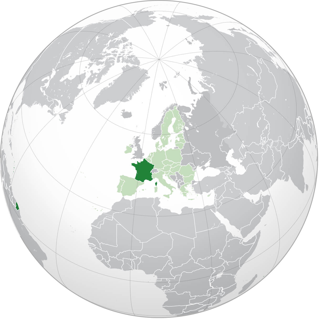
Where is France on the World Map
France is located in Western Europe, bordering Belgium and Luxembourg to the north-east, Germany, Switzerland and France to the east and Spain to the south. It is surrounded by the Atlantic Ocean to the west and the Mediterranean Sea to the south-east, giving it a varied coastline. The country’s geography is remarkably varied, with the rugged peaks of the Alps and Pyrenees, the rolling hills of the Massif Central and fertile plains such as the Loire Valley.
France is also home to major rivers such as the Seine, Rhône and Garonne, which flow through its cities and countryside, contributing to its picturesque landscapes. Its strategic position in Europe and varied topography make France a geographically and culturally significant nation.
Here are some statistical information about France:
Area: 672,051 km2 (259,480 sq mi)
Population: 68,373,433 (2024 estimate)
France Historical Population (1806-2022)
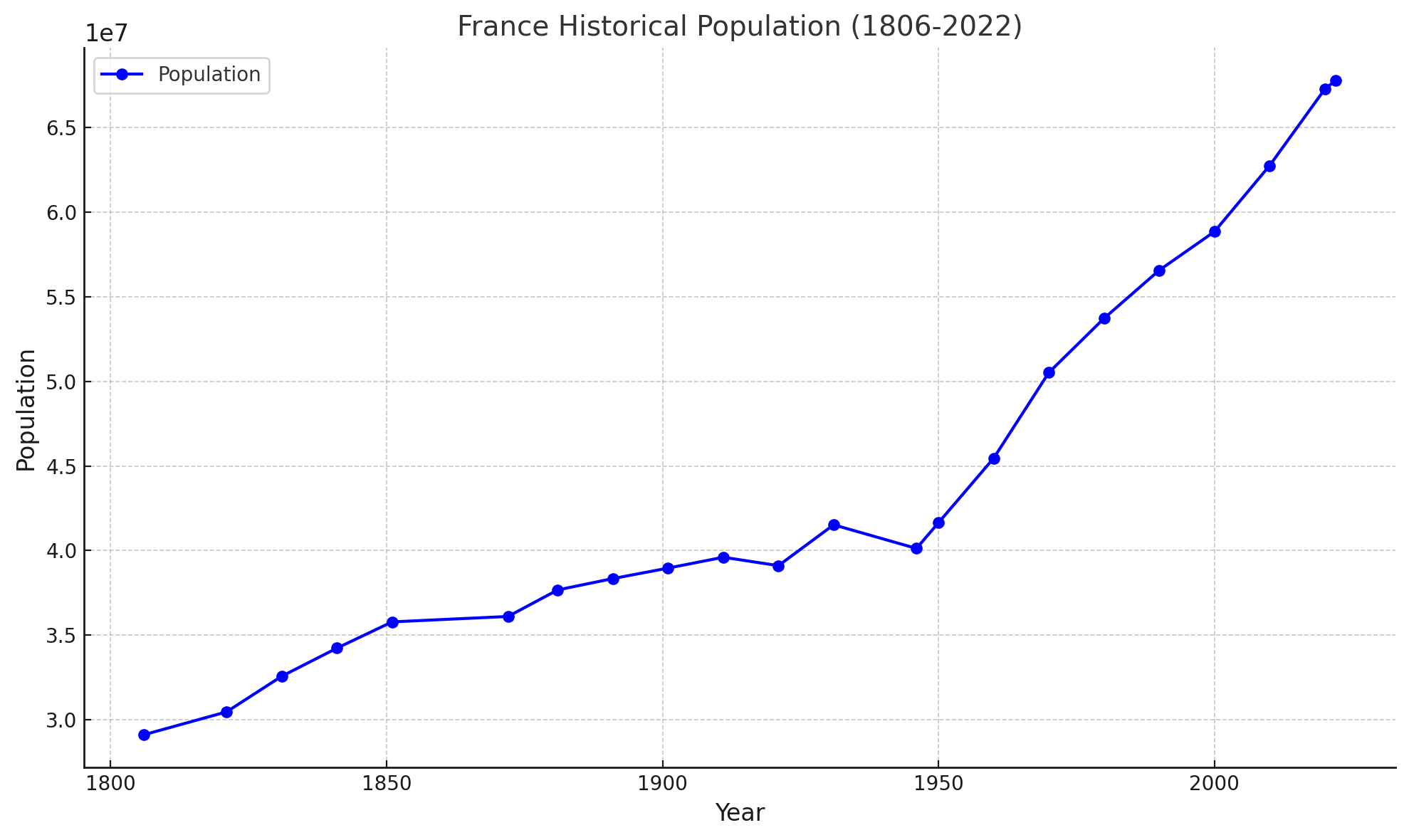
This chart shows France historical population between 1806 and 2022.
This line graph shows the historical population of France from 1806 to 2022. It illustrates population growth over time, showing periods of steady growth, slight declines and rapid increases, reflecting historical events and demographic changes. Let me know if you’d like further customisation or insights.
Capital and Largest city: Paris
Official languages: Italian
France Ethnic Demographic Composition 2004
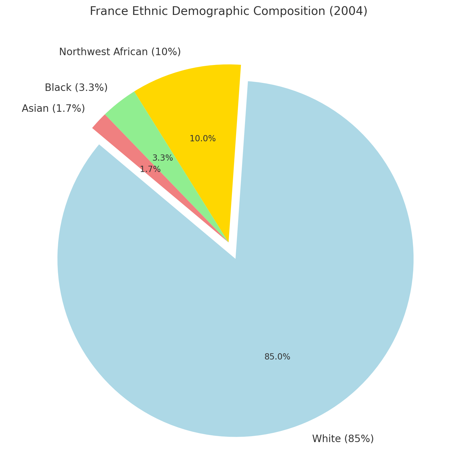
France Ethnic Demographic Composition 2004
This pie chart illustrating France’s ethnic demographic composition in 2004. It shows that 85% of the population was White, 10% Northwest African, 3.3% Black, and 1.7% Asian. Let me know if you need further details or adjustments.
Religion In France (2021 Census)
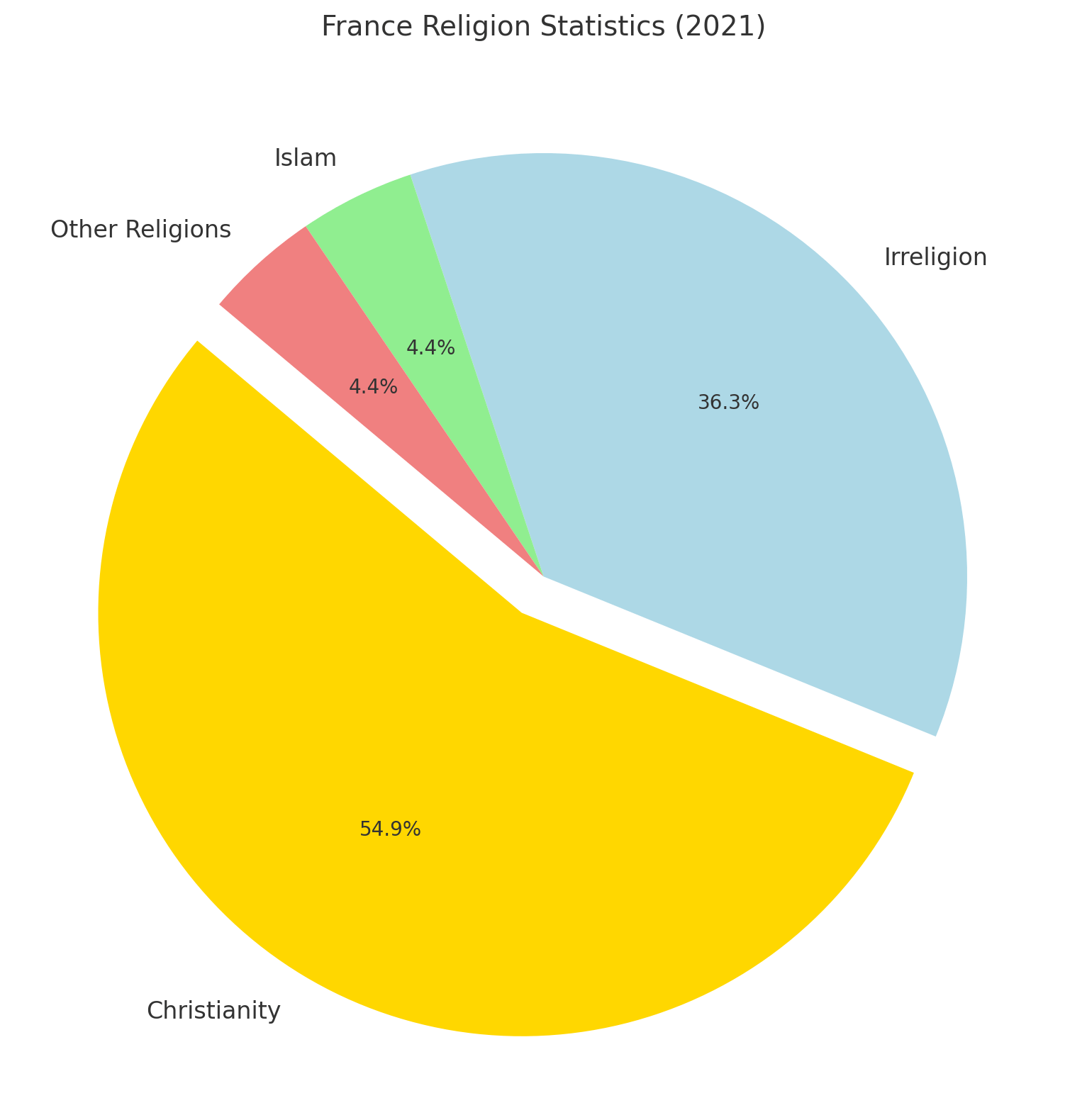
France Religion Statistics (2021)
This pie chart displaying the distribution of religious affiliations in France for 2021. It shows 50% Christianity, 33% Irreligion, 4% Islam, and 4% other religions. Let me know if you’d like to add further details or adjustments.
GDP (nominal): 4.359 trillion (2024 estimate)
Per capita: $48,011 (2024 estimate)
Currency: Euro (€) (EUR)
Calling code: +33
Time zone: UTC+1 (CET)
France Regions Map with Roads and International Boundary
France Regions Map with Rivers, Roads, Cities, Towns and International Boundary.
This map of France shows its regions, national boundaries, and major cities, providing a clear geographic breakdown. Key cities like Paris, Lyon, and Bordeaux are marked along with important rivers, roads, and borders connecting France with its neighboring countries.
France Highways Map with Cantons and Population
France Administrative Map with Cantons, Cities, Routes, Towns, and Population.
This map of France highlights the country’s extensive highway network, outlining major routes connecting key cities like Paris, Marseille, and Lyon, as well as smaller cantons across the regions. It’s an excellent guide for travelers planning road trips, offering a clear depiction of regional capitals, highways, and the connectivity between various towns and cities throughout France. The inclusion of cantons adds a layer of detail, perfect for those exploring the less tourist-heavy areas of the country.
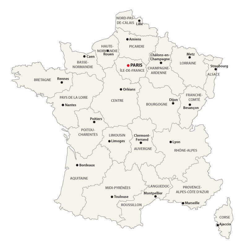
France Provinces Map
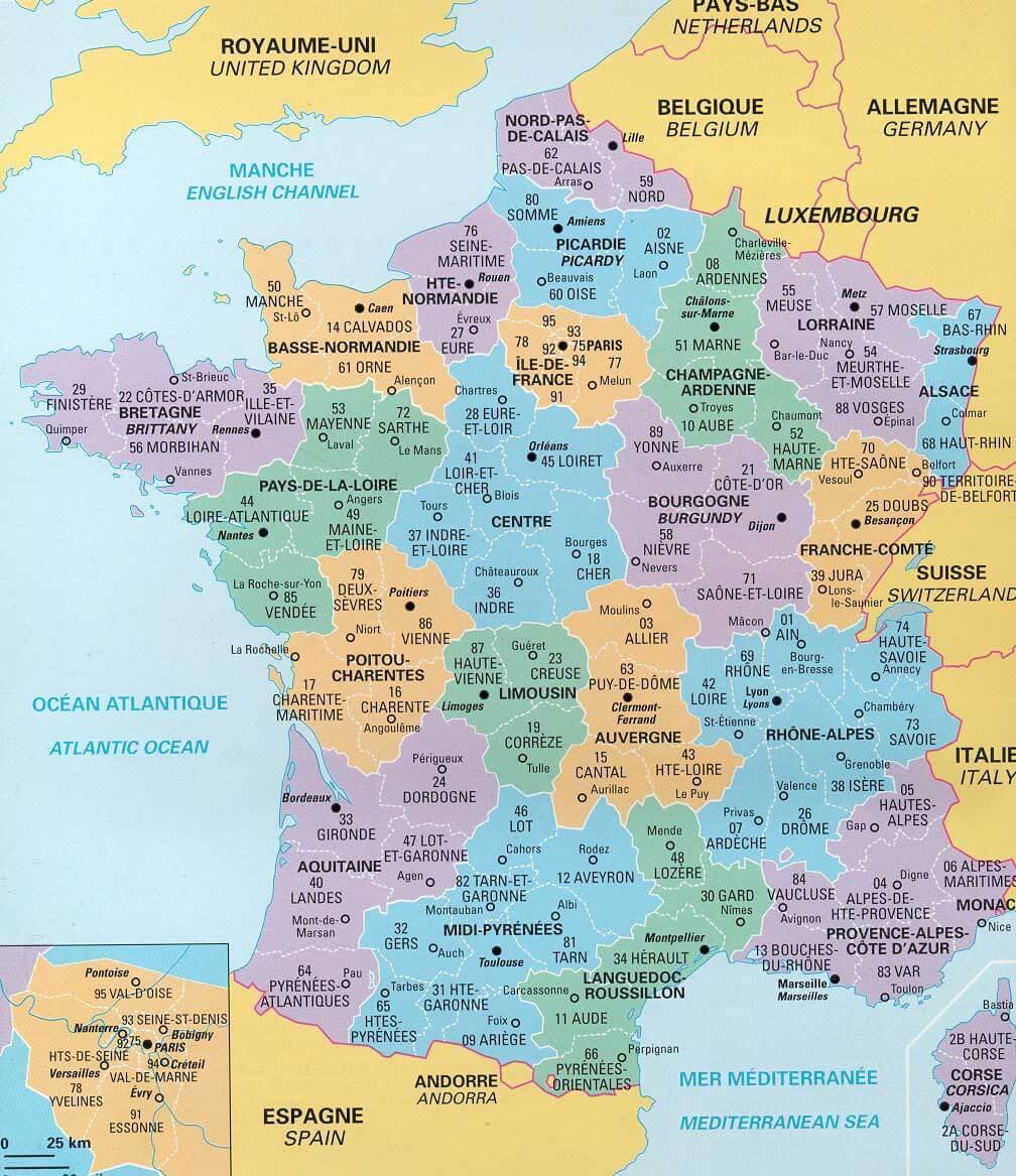
France administrative numbers and regional boundaries map.
This map of France shows the country’s various provinces, along with their respective administrative numbers and regional boundaries. It highlights each province’s unique geographic location, as well as nearby bordering countries such as Spain, Germany, and Belgium. The map is a useful tool for understanding France’s internal divisions and is often used for administrative or regional planning purposes. Each province is color-coded, making it easier to differentiate between regions and understand the layout of France’s provincial structure.
France Topographic Map
France topographic map.
France Physical Map: Landforms and Geographic Features
Physical map of France showing mountains, rivers, and coastal areas.
This physical map of France highlights its diverse landforms, including the Alps, Pyrenees, and Massif Central, alongside rivers like the Seine and Rhône. It also depicts the country’s coastal regions along the Atlantic Ocean and Mediterranean Sea. Ideal for understanding France’s topography.
France Tourism Map: Highlights and Attractions
Illustrated map of France featuring famous landmarks and tourist attractions.
This fun and colourful tourist map of France highlights major landmarks, cultural symbols and regional specialities, including the Eiffel Tower in Paris, wine regions such as Bordeaux and coastal areas along the Mediterranean. Perfect for travellers who want to explore France’s unique charm and attractions.
France Administrative Map: Regions and Roads
Administrative map of France displaying regions, cities, and major road networks.
This administrative map of France highlights its regions, major cities and road networks. It provides a detailed view of France’s internal divisions and transport routes, making it an excellent tool for planning travel or understanding the country’s geography.
France Highways Map: Major Cities and Roads
Map of France showing highways, cities, and transportation networks.
This highways map of France highlights the extensive road network connecting major cities such as Paris, Marseille, Lyon, and Bordeaux. It provides an excellent guide for planning road trips, navigating urban areas, and understanding France’s transportation infrastructure.
France Geologic Map: Rock Types and Geological Features
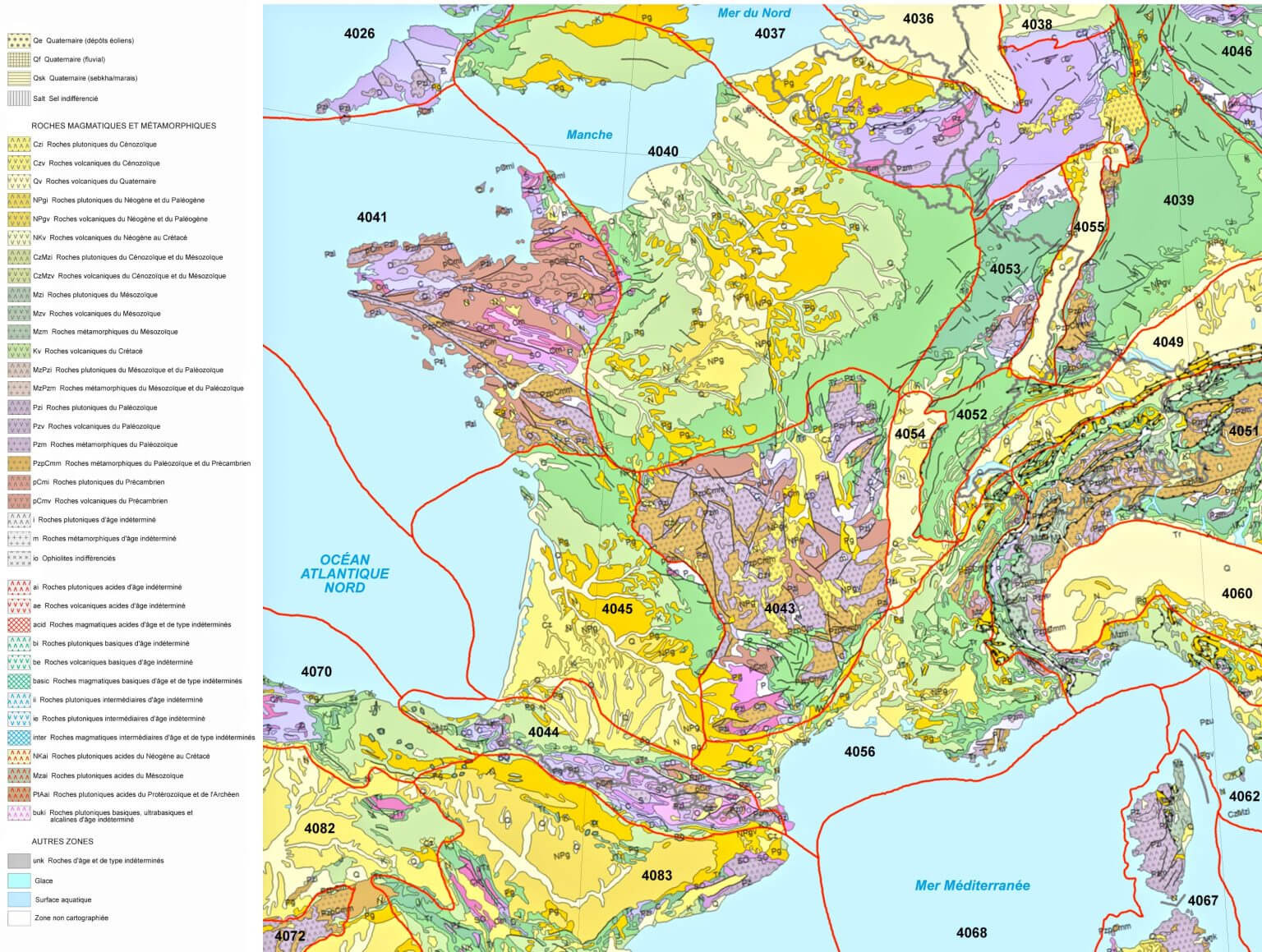
Detailed geologic map of France showcasing rock formations and geological zones..
This geological map of France shows the distribution of various rock types, including volcanic, sedimentary and metamorphic formations. It highlights geological features and tectonic zones, providing a detailed perspective for geologists, researchers and geography enthusiasts.
France Historical Map: Territories in 1453
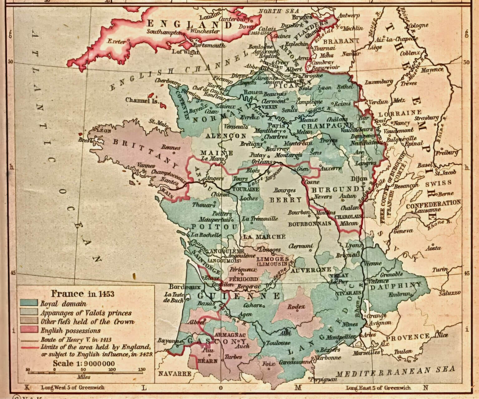
Historical map of France in 1453 showing royal domains and English possessions.
This historical map of France shows the territorial division of France in 1453, highlighting the royal domains, the territories under the Valois princes and the regions held by England during the Hundred Years’ War. It provides an insight into the political geography and conflicts of medieval France.
France Satellite Map: Elevation and Natural Features
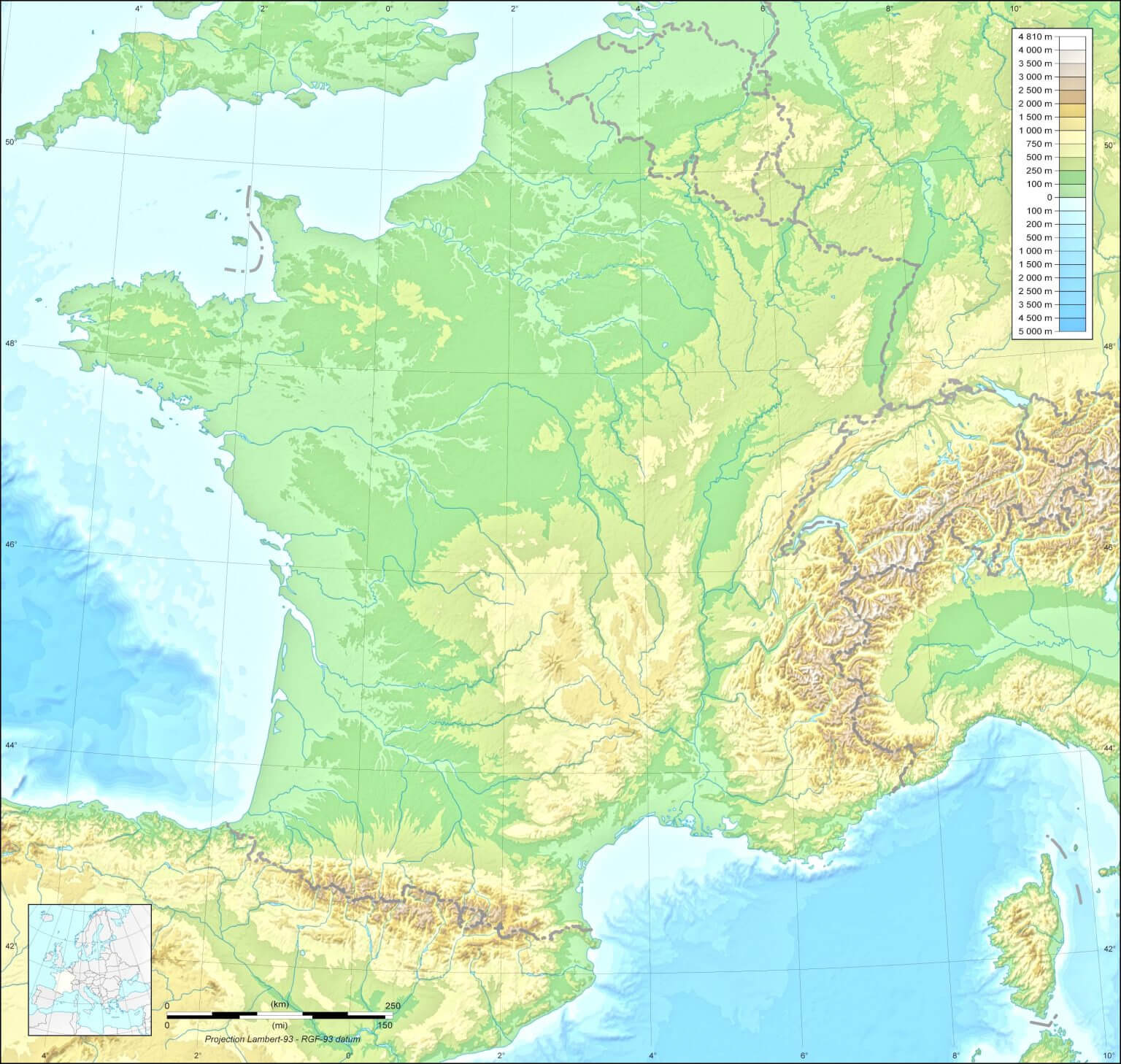
Satellite map of France showcasing terrain elevation and geographic features.
This satellite map of France illustrates the country’s elevation levels, mountain ranges, rivers, and valleys. From the Pyrenees to the Alps, it offers a clear view of France’s diverse landscapes and natural geography, ideal for educational and environmental analysis.
France Railway Network Map: Major Connections
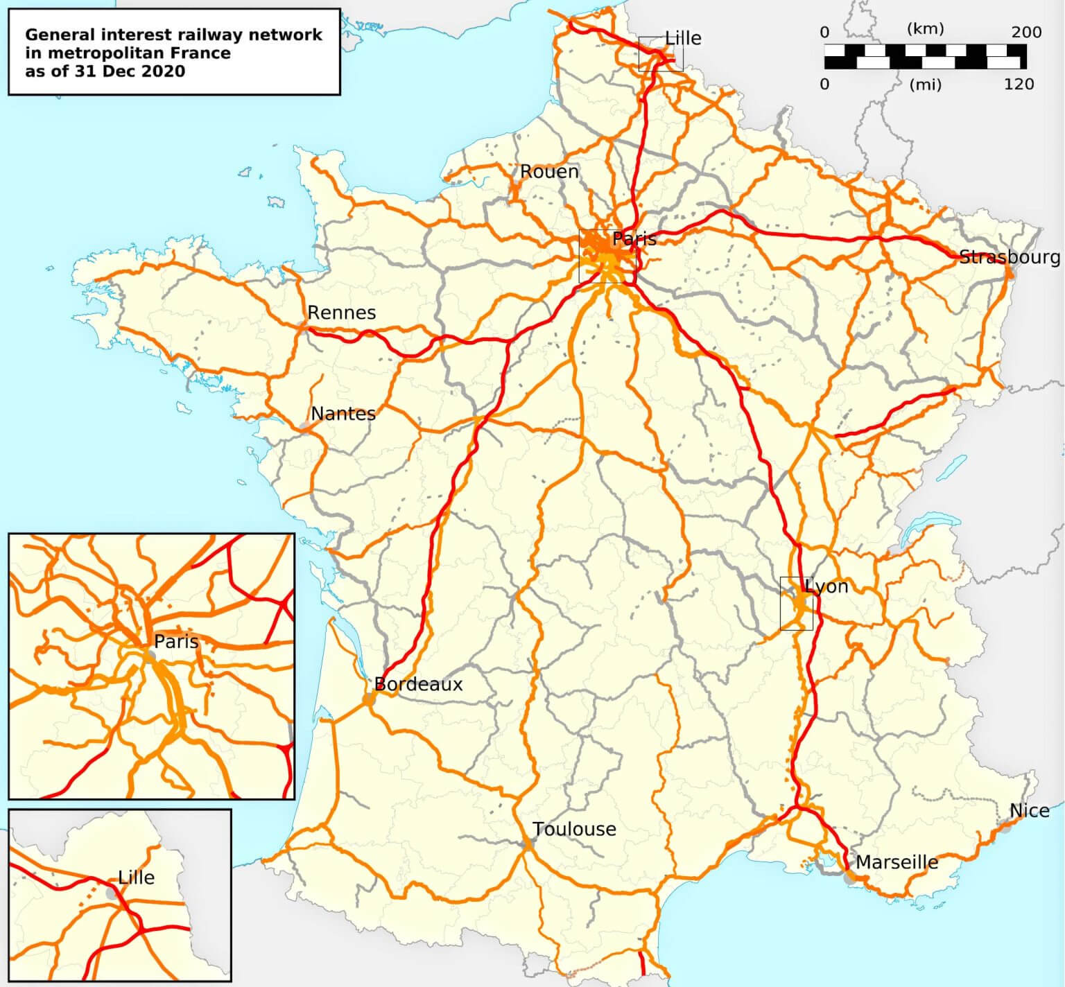
Map of France showing railway networks and connections between major cities.
This rail network map of France shows the rail lines of general interest as of December 2020, connecting major cities such as Paris, Lyon, Marseille, Bordeaux and Lille. It highlights the extensive rail infrastructure, ideal for travel planning and understanding regional connectivity.
France Population Density Map (1999 Census)
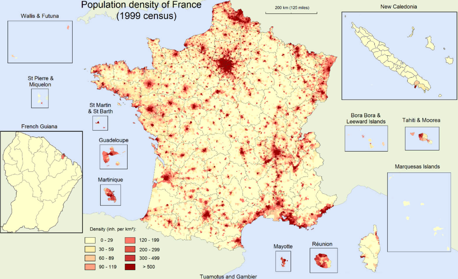
Map of France showing population density by region, based on the 1999 census.
This population density map of France highlights areas with varying levels of inhabitant concentrations as per the 1999 census. Dense regions like Paris stand out, while overseas territories such as Guadeloupe and French Guiana are also included. Ideal for demographic analysis and urban planning.
France Linguistic Map: Regional Languages and Dialects
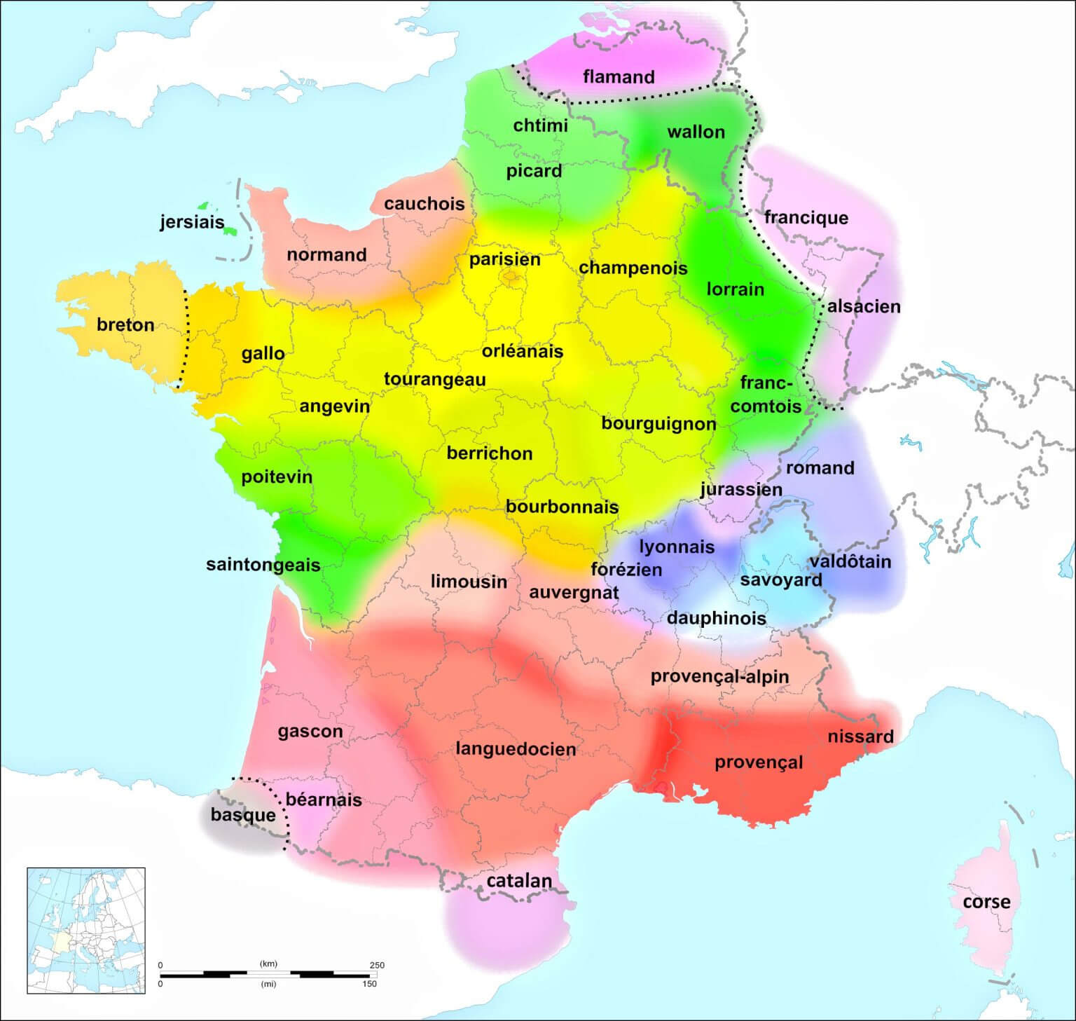
Linguistic map of France showing regional languages and dialects across the country.
This linguistic map of France highlights the diversity of regional languages and dialects such as Breton, Basque, Alsatian and Provençal. It shows the rich cultural and linguistic heritage of France, reflecting the influence of historical and regional identities.
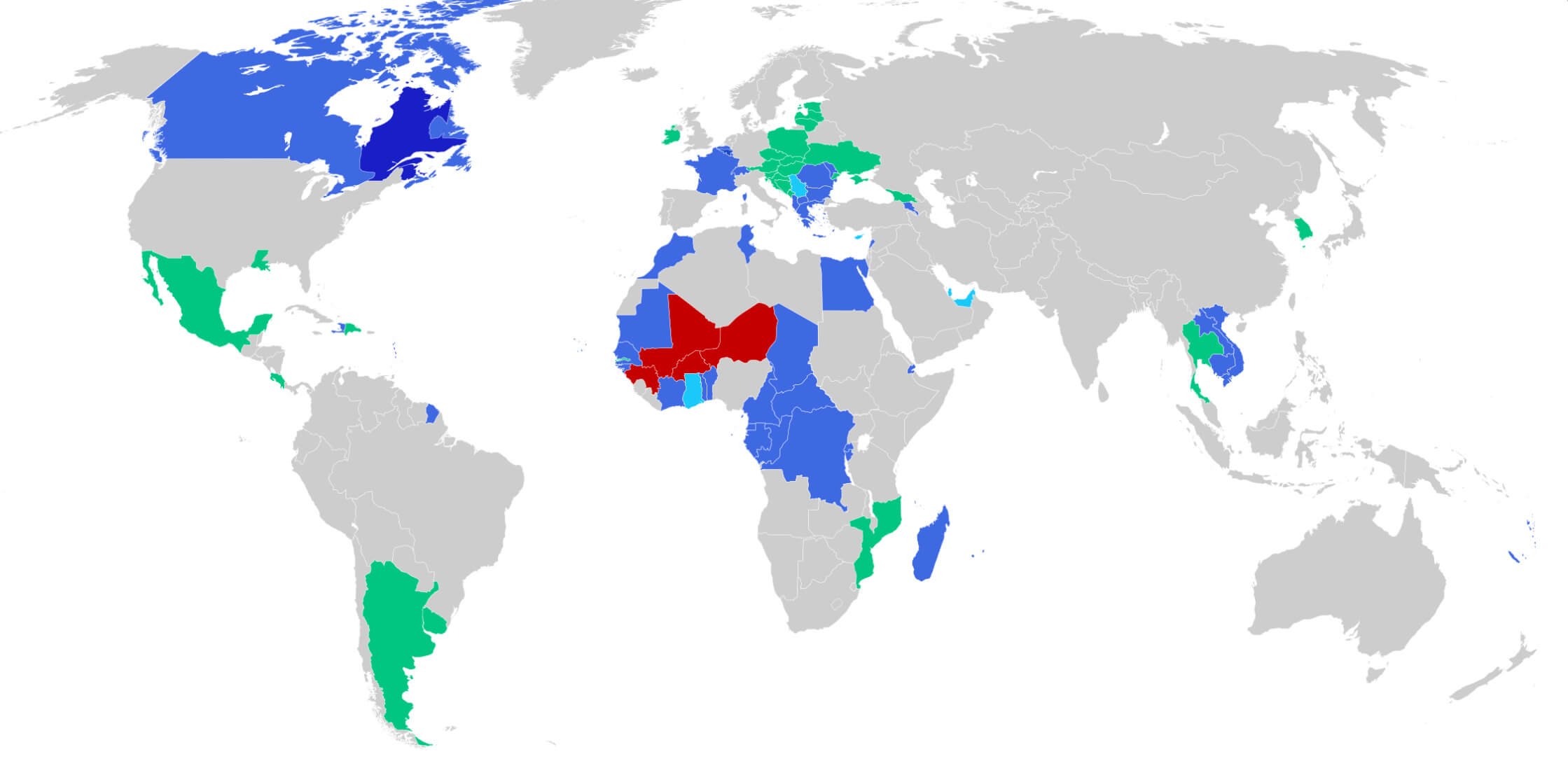
Map of the Francophone World: French-Speaking Countries
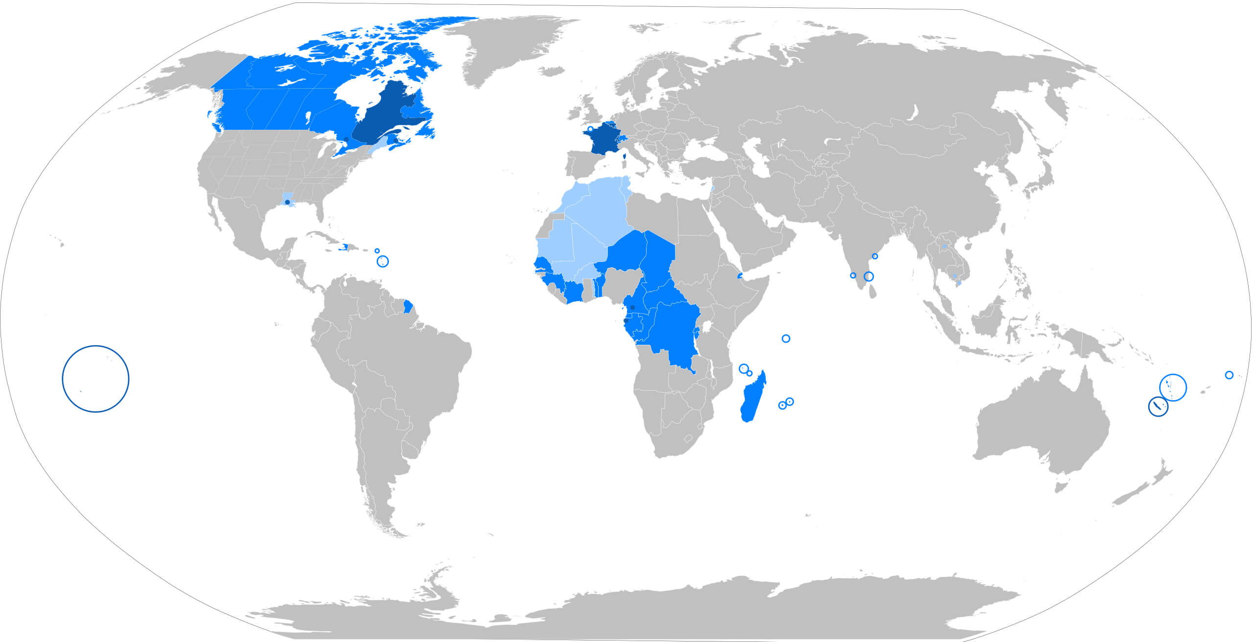
World map highlighting countries and regions where French is spoken.
This map of the Francophone world highlights countries and regions where French is an official language or widely spoken. It spans continents including Europe, Africa, North America and Oceania, demonstrating the global influence of French language and culture.
France Climate Map
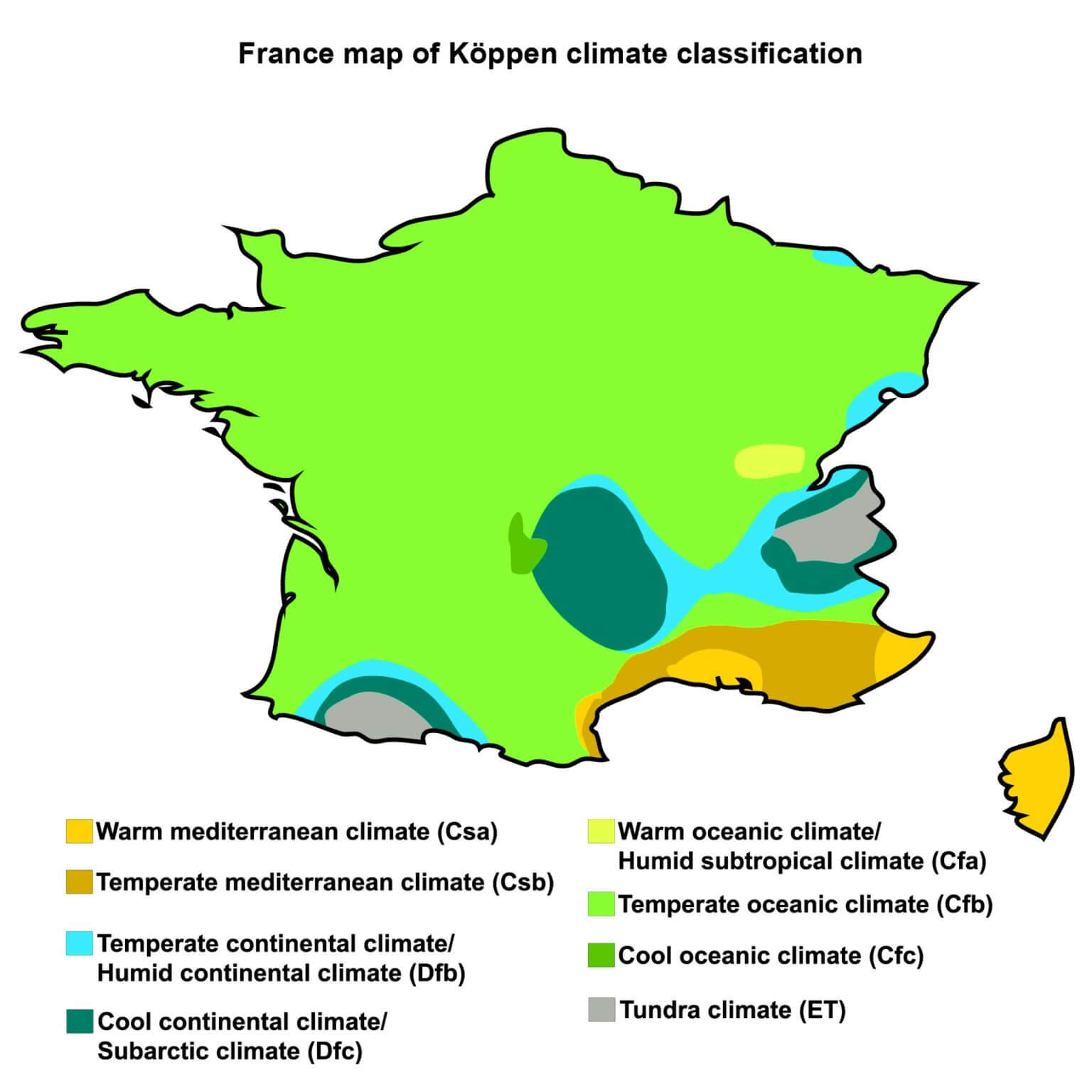
Climate map of France showing Köppen classification zones.
This climate map of France illustrates regions based on the Köppen climate classification, including Mediterranean, oceanic, continental and subarctic climates. It highlights the different weather patterns across France, from the warm southern coasts to the cooler inland and mountainous areas.
France Population Density Map: Regional Distributions
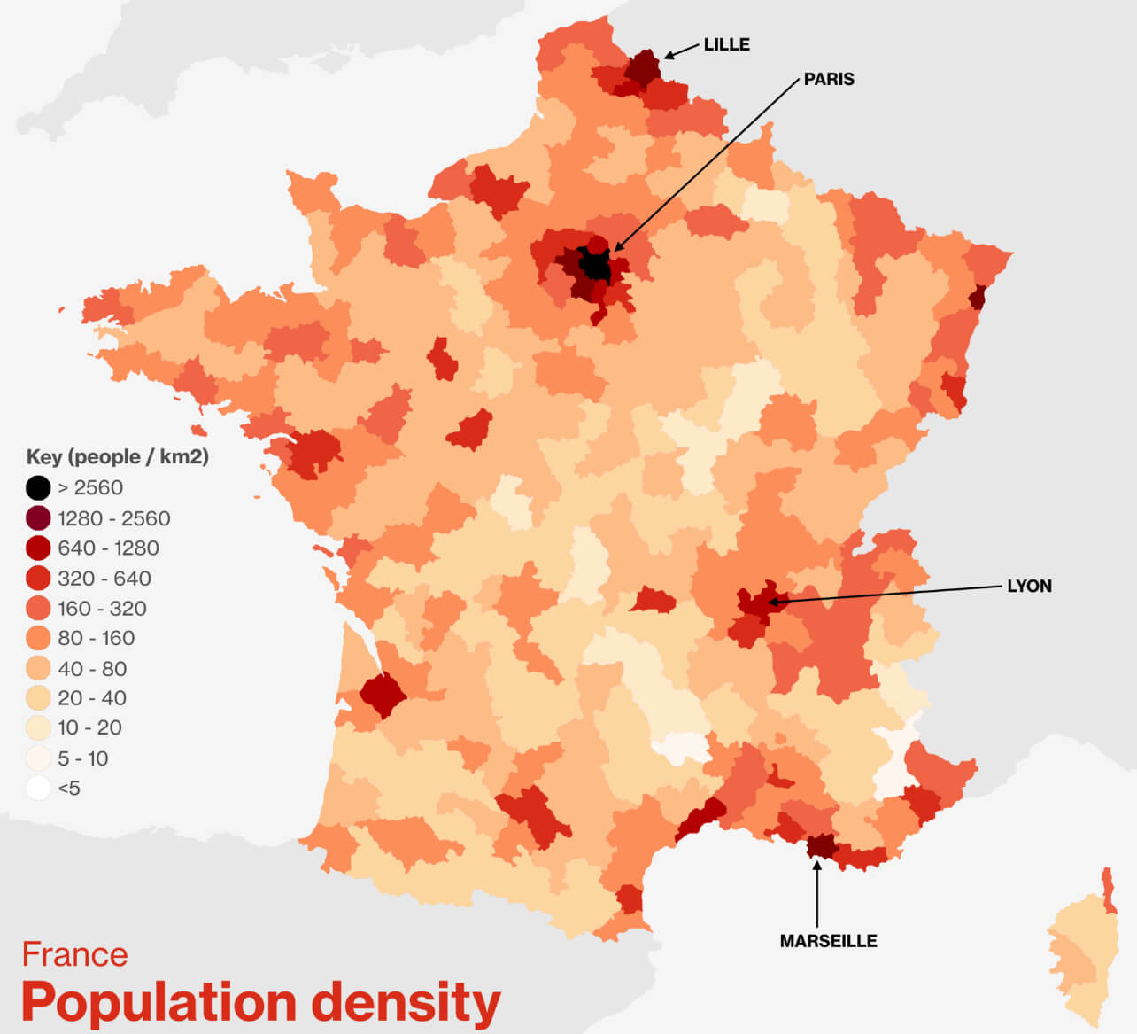
Map of France showing population density by region in people per square kilometer.
This population density map of France highlights areas with varying levels of inhabitant concentrations. Urban centers like Paris, Lyon, and Marseille are densely populated, while rural regions have lower density. Useful for demographic studies and urban planning.
Francophone Countries Map: Global French-Speaking Nations
World map highlighting Francophone countries where French is widely spoken.
This map shows Francophone countries around the world where French is an official or widely spoken language. It includes countries in Europe, Africa, the Americas and Asia, demonstrating the global reach and cultural influence of the French language.
Côte d’Azur Province Map: Provence-Alpes-Côte d’Azur Region
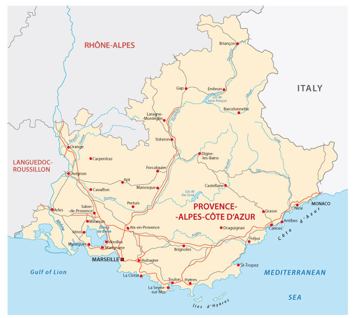
Map of the Côte d’Azur province in France showing cities and roads.
This map depicts the Provence-Alpes-Côte d’Azur region, also known as the Côte d’Azur, in southeastern France. It highlights major cities like Marseille, Nice, and Toulon, as well as road networks and coastal landmarks along the Mediterranean Sea.
France Flag Map: National Colors on Country Outline
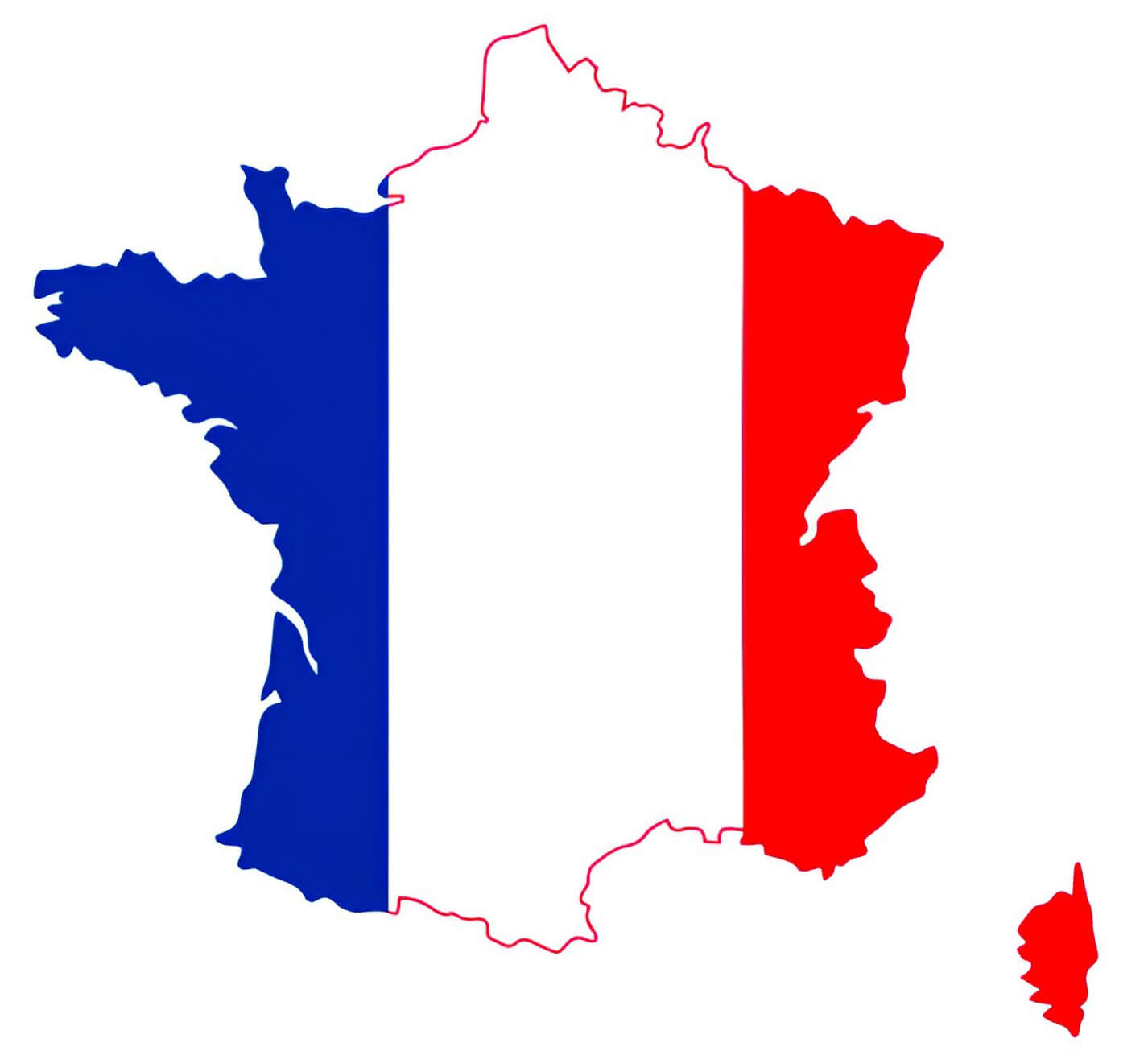
Map of France with the French flag’s blue, white, and red colors inside its borders.
This map combines the outline of France with the national flag, featuring the iconic blue, white, and red tricolor. It’s a symbolic representation of French identity, patriotism and unity, often used in educational and cultural contexts.
Where is France in the World Map?
Show Google interactive map, satellite map, where is the country located.
Get direction by driving, walking, bicycling, public transportation and travel with street view.
Feel free to explore these pages as well:
- France Map ↗️
- Map of France ↗️
- France Physical Maps ↗️
- France Political Map ↗️
- France Cities Map ↗️
- France Population Map ↗️
- France Road Map ↗️
- France Map Collection ↗️
- Top 10 Destinations in France ↗️
- Discovering Angers: The Gem of France’s Loire Valley ↗️ ↗️
- Nice’s Top 10 Attractions for Every Traveler ↗️
- Muslim Population Map in Europe by Country ↗️
- Europe Map ↗️
- Map of Europe ↗️
- A Collection of Europe Maps ↗️
- France Map ↗️
- Map of Spain ↗️
- Italy Map ↗️
- Ireland Map ↗️
- Political Map of the World ↗️
- United Kingdom Map ↗️
- Israel Map ↗️
- Germany Map ↗️
- Turkey Map ↗️
- Map of Sweden ↗️
- Map of Portugal ↗️
- Poland Map ↗️
- Switzerland Map ↗️
- Belgium Map ↗️
- Norway Map ↗️
- Finland Map ↗️