A collection maps of Spain; View a variety maps of Spain physical, political, relief map. Satellite image of Spain, higly detalied maps, blank map of Spain, World and Earth. And find more Spain’s country, regions, topography, cities, road, rivers, national, directions maps and atlas.
Spain Main Cities Map
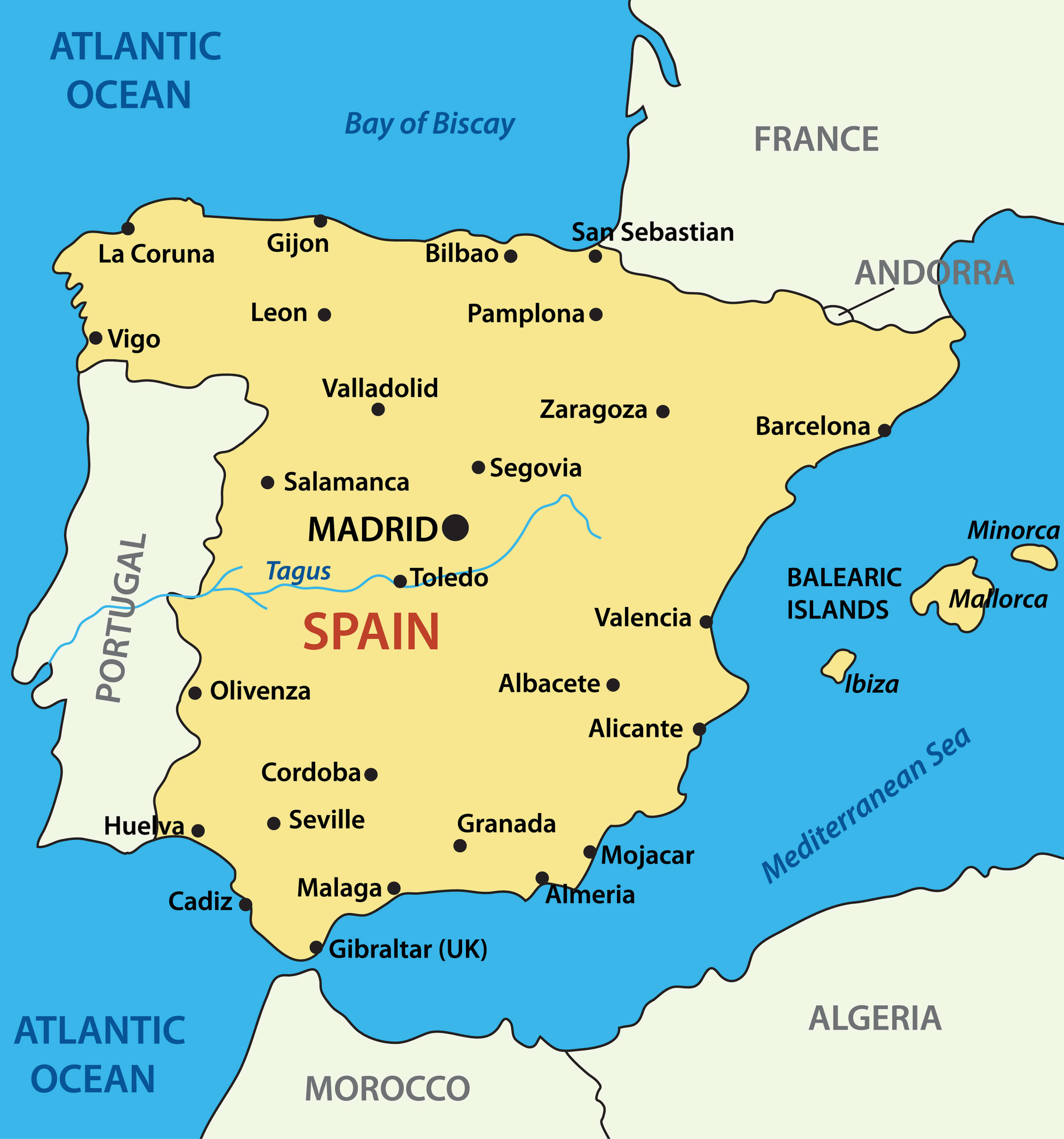
Spain Blank Map
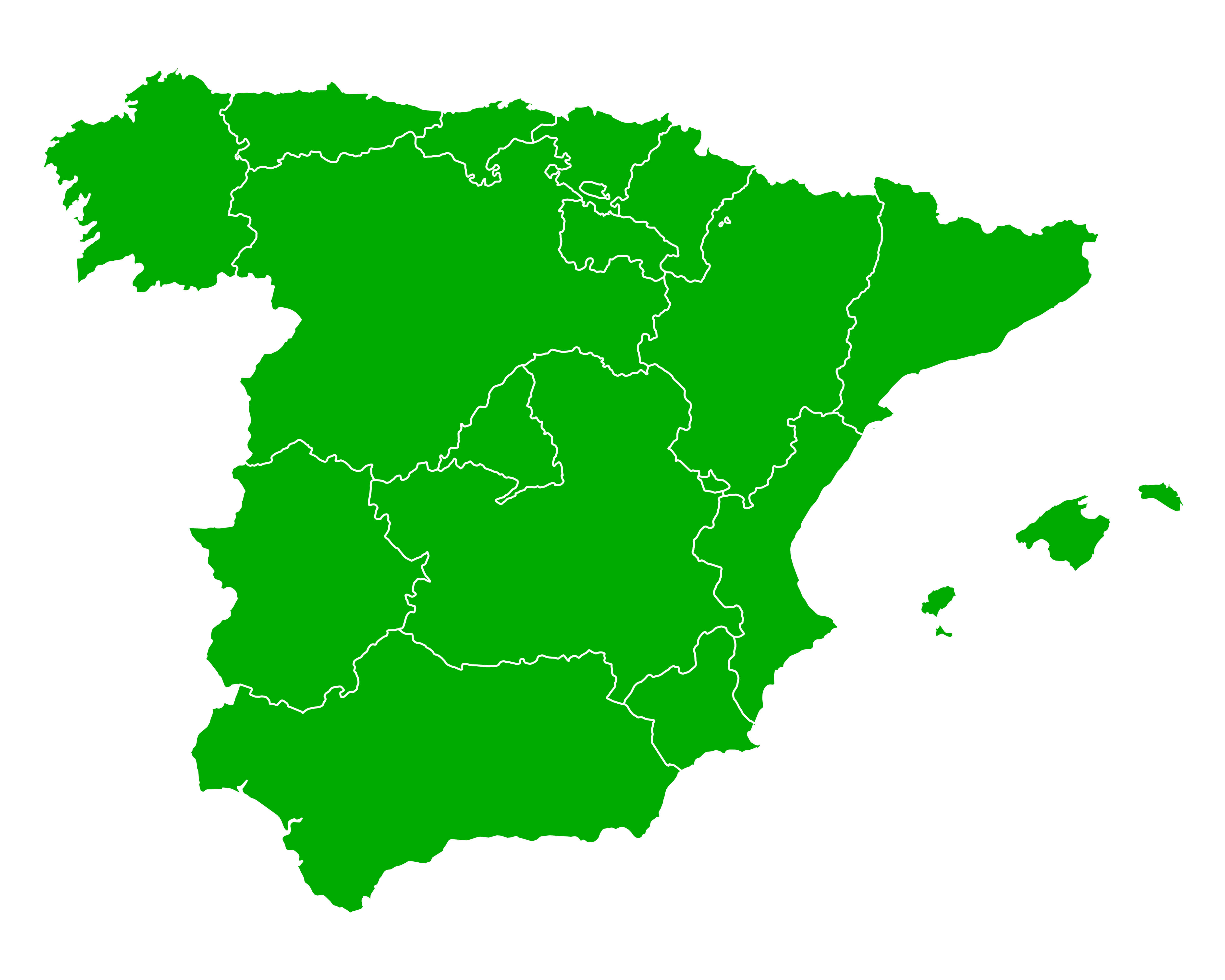
Spain blank map
Spain Regions Map
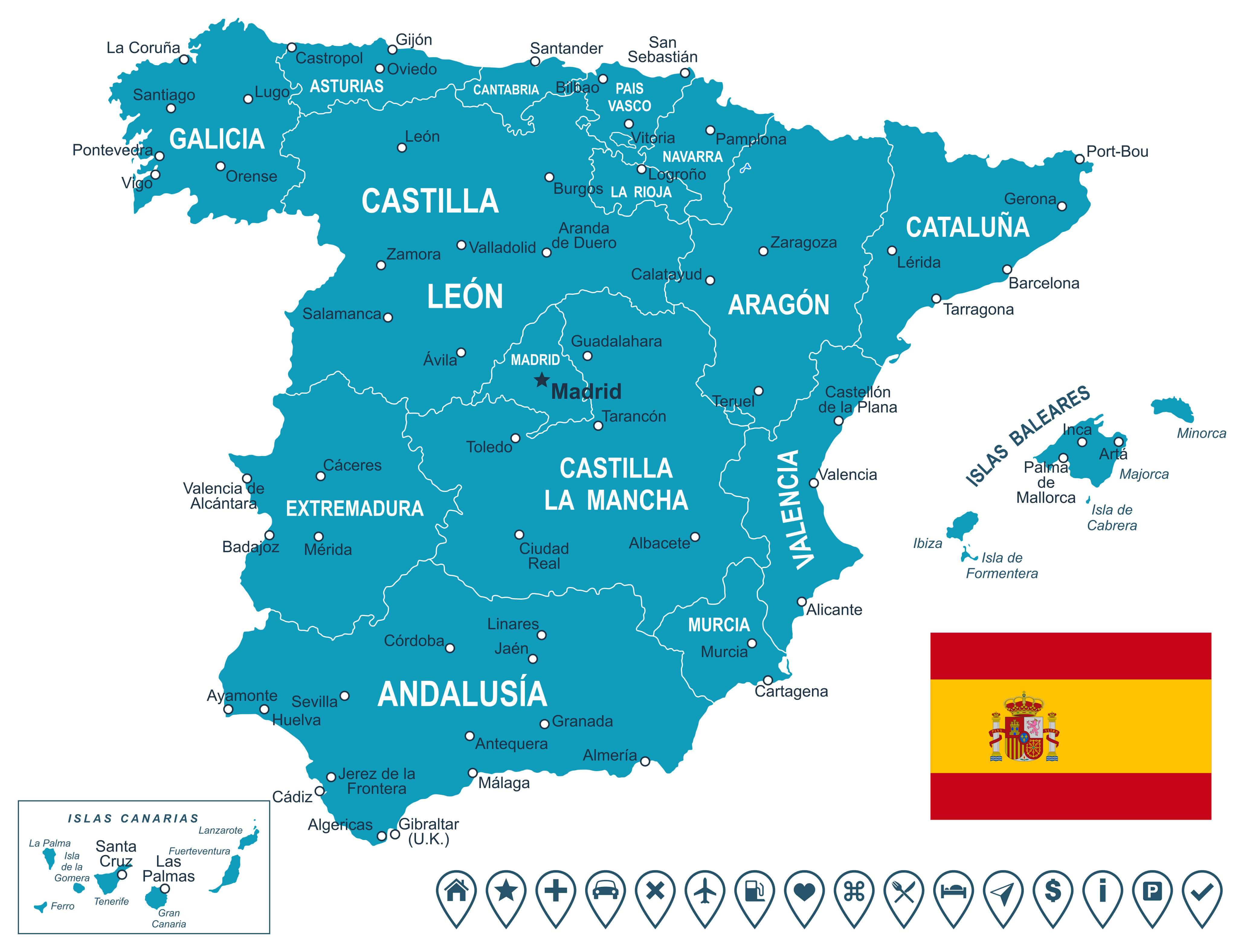
Illustrated Cities Map of Spain
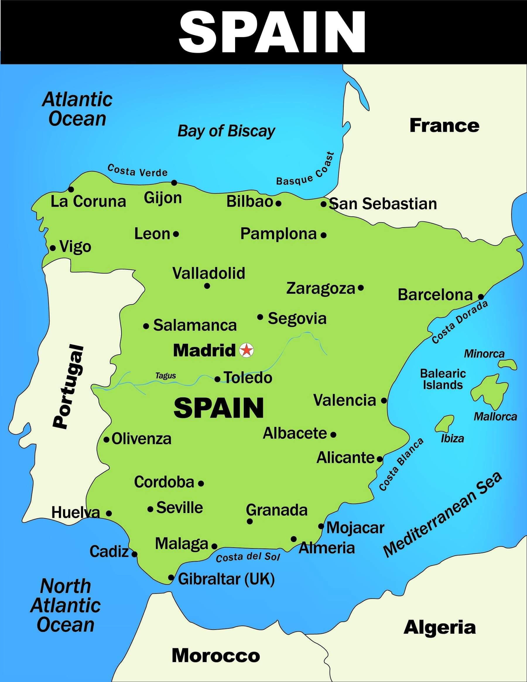 Illustrated map of Spain with major cities.
Spain Rivers and Cities Map
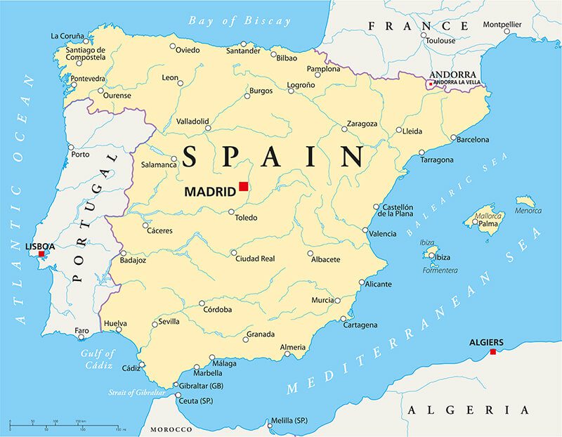 Spain Political Map with capital Madrid, national borders, most important cities, rivers and lakes.
Spain Administrative Map
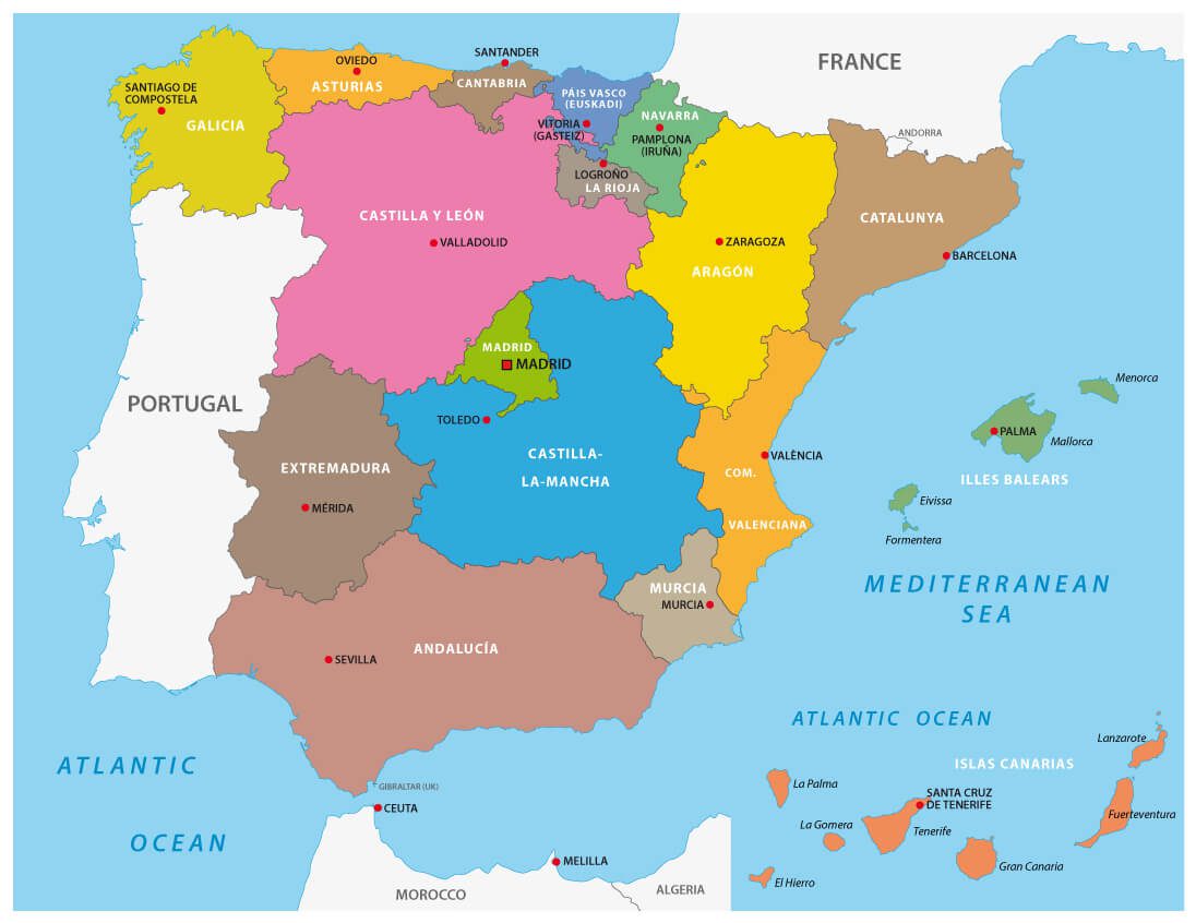
Autonomous communities map of Spain
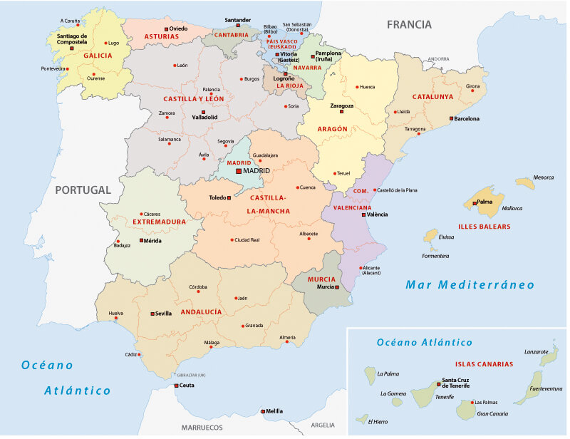
Spain Kingdom Map
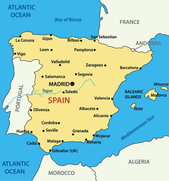
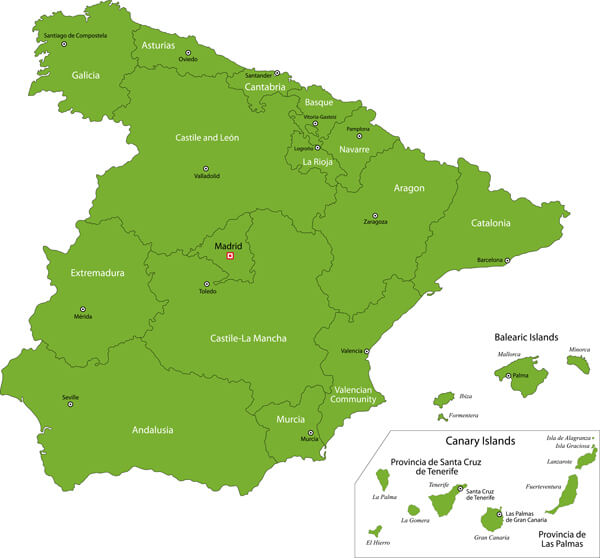
Green Spain Map with Regions
Here are some statistical information about Spain:
Area: 505,990 km2 (195,360 sq mi)
Population: 48,797,875 (2024 estimate)
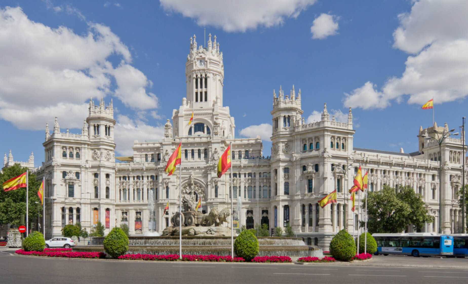
Capital and largest city: Madrid
Official languages: Spanish
Ethnic groups: 86.5% Spanish, 13.5% foreigners
Religion: 56.0% Roman Catholicism ( 37.5% non-practicing Catholic, 16.5% practicing Catholic), 14.9% atheist, 12.6% agnostic, 12.3% indifferent or no religion, 2.7% other religion, 1.5% unanswered
GDP (nominal): $1.731 trillion (2024 estimate)
Per capita: $35,788 (2024 estimate)
Currency: Euro (€) (EUR)
Calling code: +34
Time zone: UTC±0 to +1 (WET and CET)
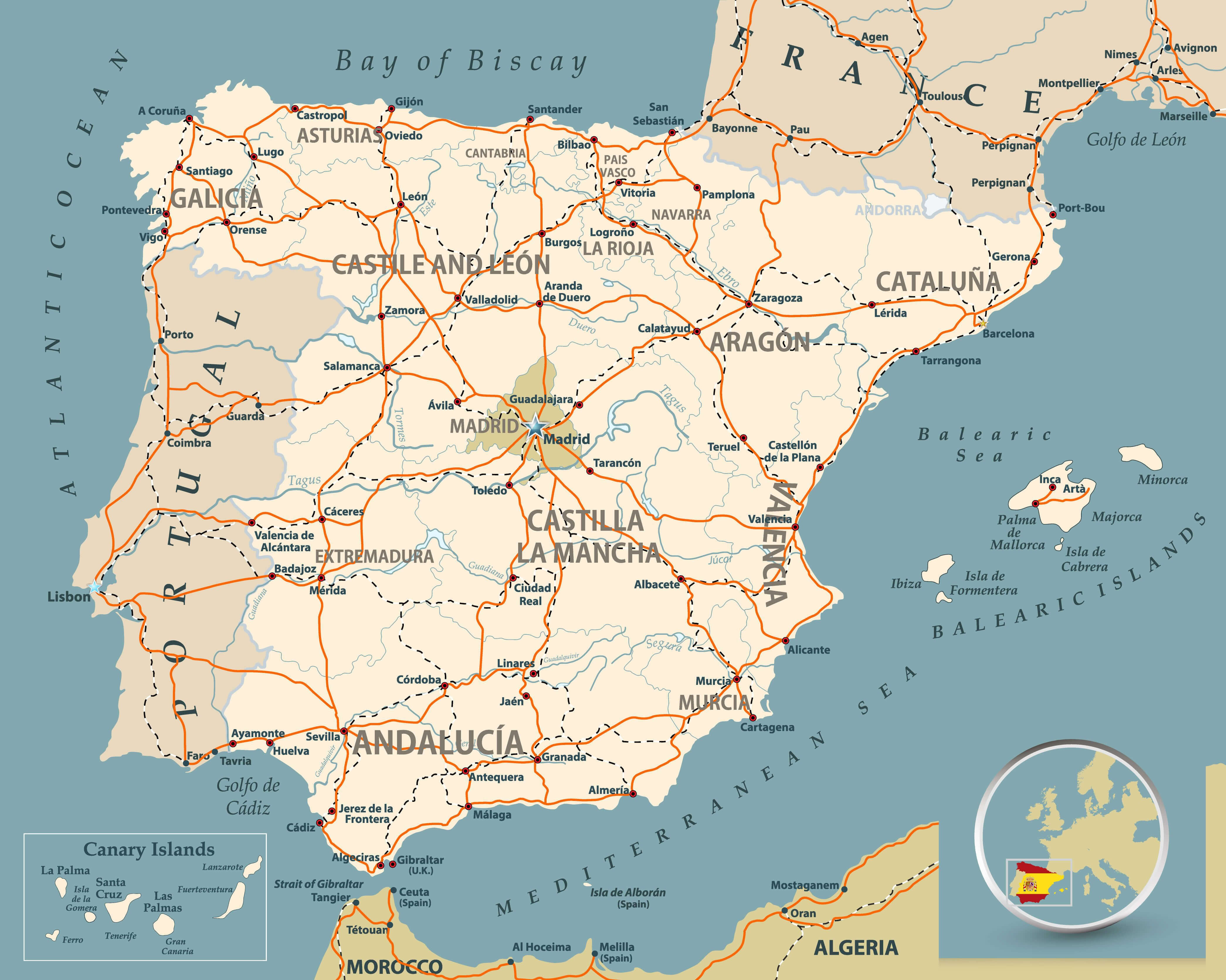
Overview of Spain’s Regions and Major Transportation Routes
Severe Flooding in Eastern Spain (Valencia and Murcia) – October 30, 2024
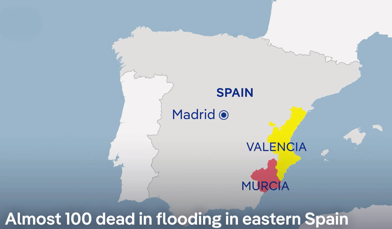
Map showing flooding in Valencia and Murcia, eastern Spain, October 30, 2024.
This map shows the regions of Valencia and Murcia in eastern Spain, where severe flooding has tragically claimed nearly 100 lives as of 30 October 2024. The map shows Valencia in yellow and Murcia in red, indicating the severely affected areas. Unusually heavy rainfall has led to catastrophic flooding, affecting communities, infrastructure and emergency services. The proximity of these regions to the Mediterranean Sea, combined with recent weather patterns, has contributed to the extent of the flooding. This event highlights the severe impact of extreme weather on the east coast of Spain.
Rainfall Distribution in Spain (October 2024)
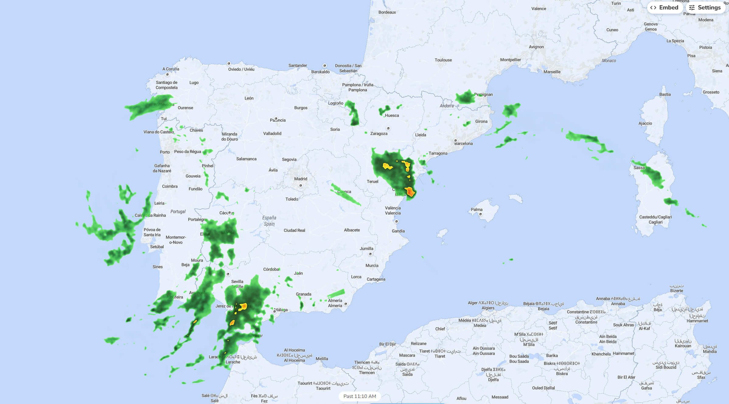
Rainfall map of Spain in October 2024, showing precipitation areas.
This rainfall map of Spain from October 2024 shows areas of precipitation across the country. Dark green areas indicate moderate rainfall, while yellow areas indicate heavier rainfall. The heaviest rainfall is concentrated in the southeastern region around Valencia and in the southern parts near Seville. Other areas, such as Galicia in the north-west and parts of the north coast near the Pyrenees, will also see rain. Some lighter, scattered showers are present in central Spain, while the eastern Mediterranean coast and parts of the Balearic Islands show minimal precipitation. This map reflects Spain’s varied autumn weather, with coastal and mountainous regions receiving more rain than inland areas.
Spain Satellite Rainfall and Weather Map (October 30, 2024)
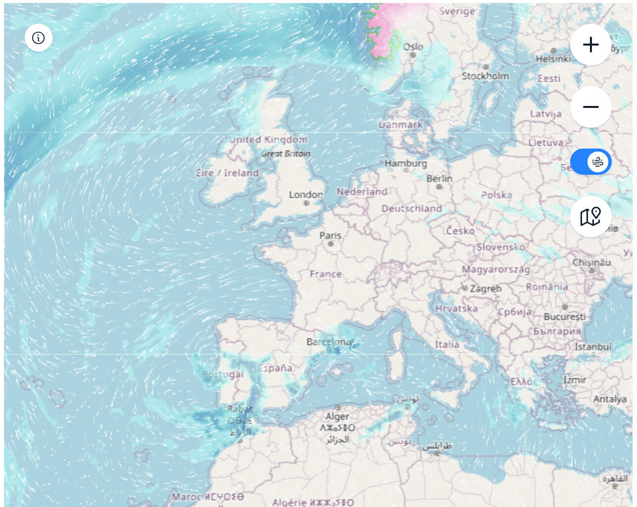
Satellite map of Spain’s rainfall and wind patterns on October 30, 2024.
This satellite weather map from 30 October 2024 shows rainfall and wind patterns affecting Spain and surrounding areas in Europe. Heavy rainfall is seen over parts of Ireland, the UK and Norway, while lighter precipitation is seen over parts of western France and the northern coast of Spain. Wind flow lines over the Atlantic indicate a strong circulation, pushing rain-bearing clouds towards the European mainland and influencing the weather over Spain and its neighbours. Spain itself experiences light rainfall along its northern coast, while the central and southern regions appear mostly dry. This map shows the movement of Atlantic weather fronts affecting European weather on this particular day.
Elevation Map of Spain
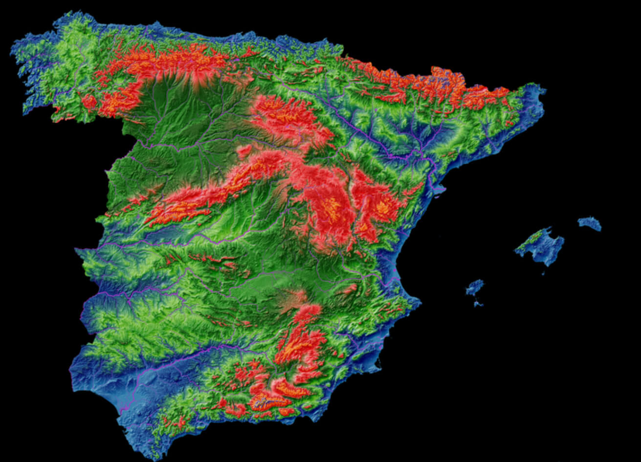
Elevation map of Spain showing mountain ranges and altitude variations.
This elevation map of Spain uses colour gradients to represent different altitudes, with red indicating higher elevations and blue indicating lower areas. The Pyrenees in the north-east and the Sierra Nevada in the south appear prominently in red, highlighting their significant altitude. The central meseta plateau, which covers much of inland Spain, is shown in shades of green, indicating moderate altitude. Coastal regions, particularly along the Mediterranean and Atlantic coasts, are shown in blue, reflecting the lowland areas. This map visually emphasises Spain’s mountainous terrain and the contrast between the highland interior and the lower coastal plains.
Map of Spain showing regions, major cities, and transport routes
This detailed map of Spain shows its autonomous communities, major cities and transport routes. Key regions such as Andalusia in the south, Catalonia in the north-east and Galicia in the north-west are labelled to emphasise the country’s administrative divisions. The map highlights the main motorways and railway lines linking major cities such as Madrid, Seville, Barcelona and Valencia, illustrating Spain’s well-integrated transport network. Surrounding features include the Bay of Biscay to the north, the Mediterranean Sea to the east and the neighbouring countries of France, Portugal and Morocco across the Strait of Gibraltar. The Canary Islands are shown in an inset, providing a comprehensive view of Spain’s geography and infrastructure.
Political Map of Spain and Portugal (1894)
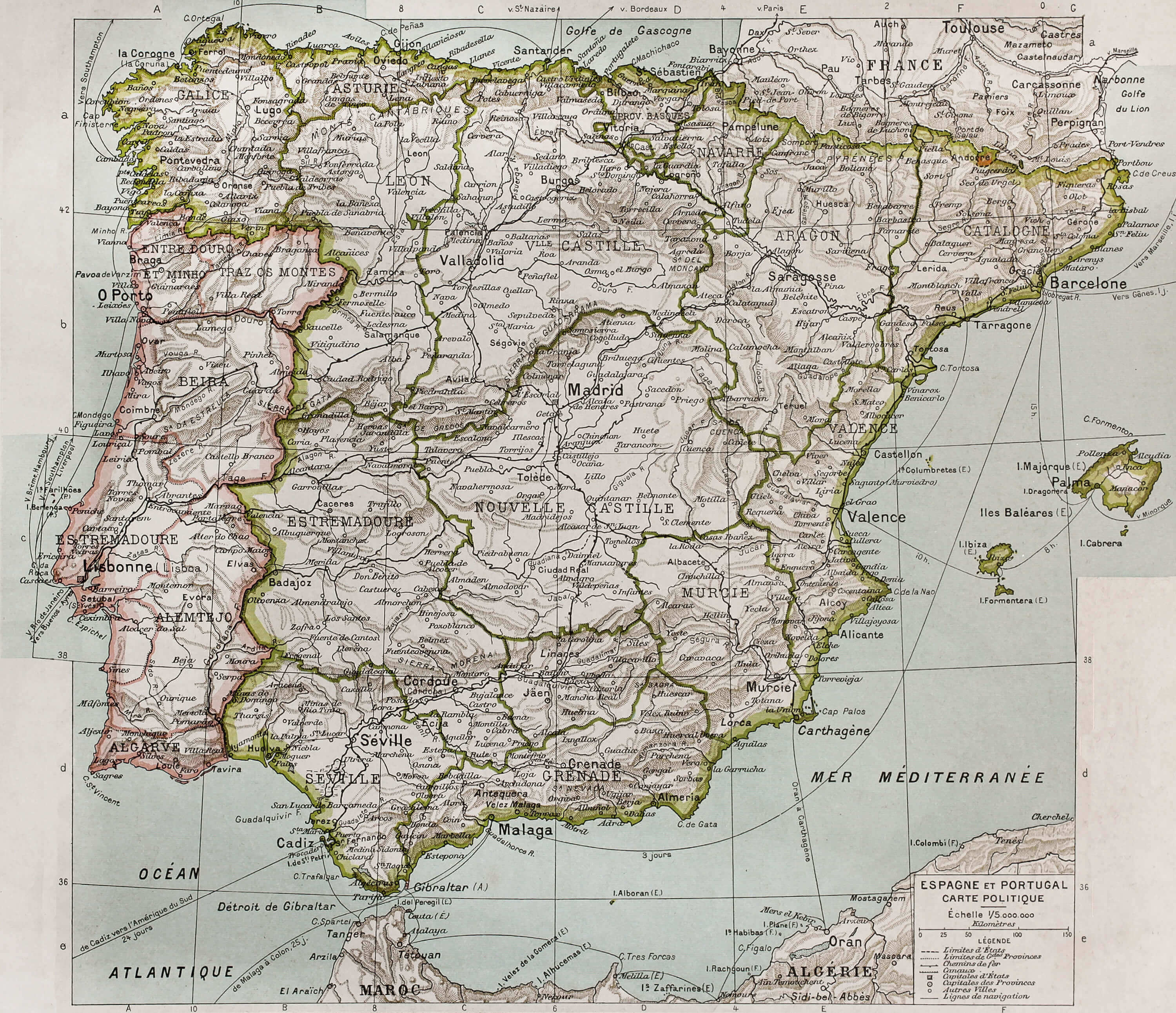
Political map of Spain and Portugal in 1894, showing regions and cities.
This historical political map from 1894 shows the administrative divisions, cities and major geographical features of Spain and Portugal at the time. Spain’s regions, such as Castile, Aragon and Catalonia, are labelled with boundaries indicating provincial divisions. Major cities such as Madrid, Barcelona, Lisbon and Seville are prominently featured. Key geographical features, including mountain ranges, rivers and the Atlantic and Mediterranean coastlines, are shown in detail, illustrating the influence of terrain on political boundaries. This map reflects the historical territorial organisation and infrastructure of the Iberian Peninsula in the late 19th century, with an emphasis on the provincial and regional structures of both countries.
Pushpin Marking on Map of Spain
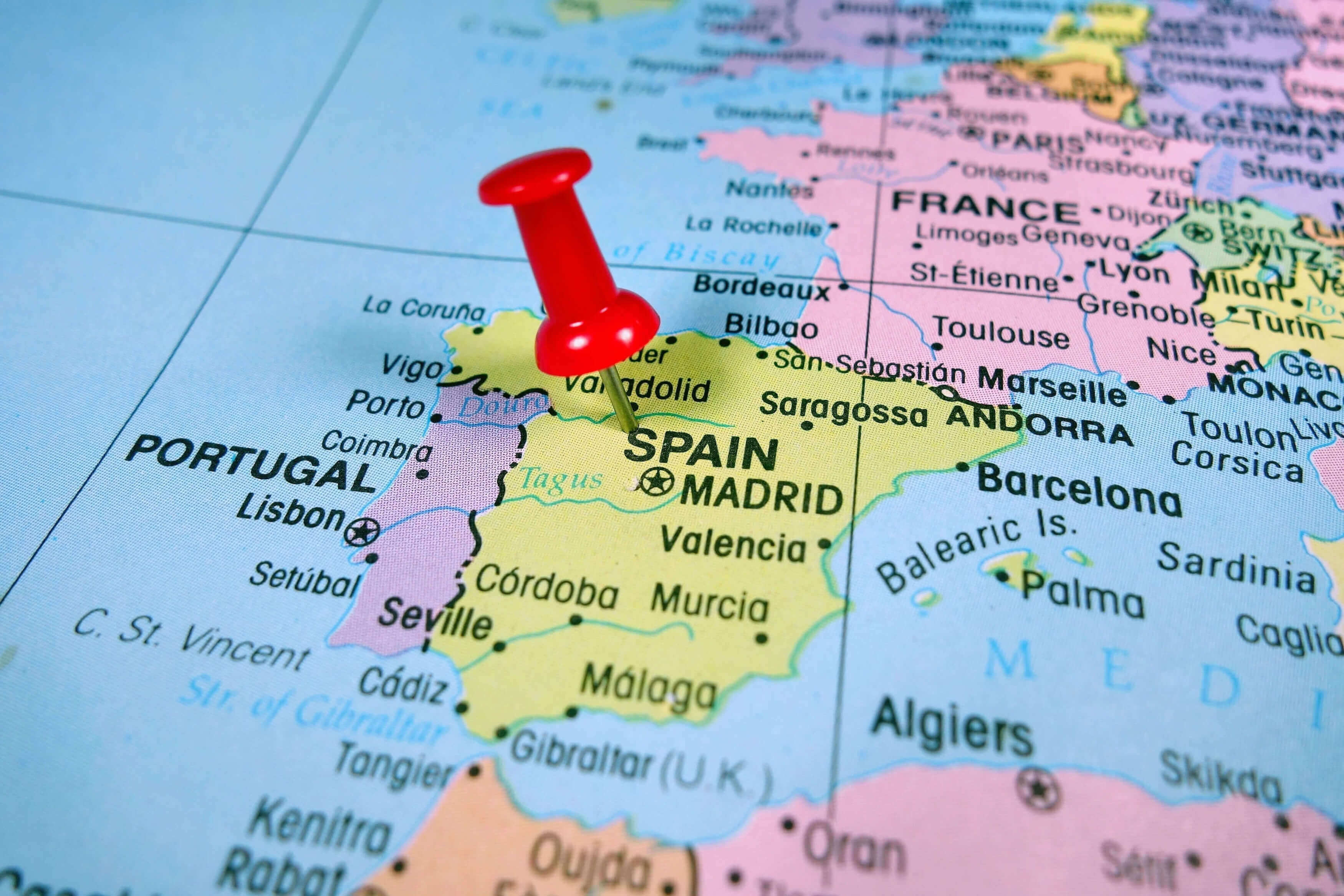
Close-up map of Spain with a pushpin marking Madrid’s location.
This close-up map shows a red pin marking the location of the Spanish capital, Madrid. The surrounding regions, cities and neighbouring countries are also visible, including Portugal to the west, France to the north and various Mediterranean cities such as Barcelona and Valencia. Key geographical features such as the Bay of Biscay, the Balearic Islands and the Strait of Gibraltar are labelled to provide context for Spain’s position in southern Europe. The pin draws attention to Madrid as a focal point of travel or interest, commonly used to indicate an important location on a map.
Satellite View of Spain and the Mediterranean Sea
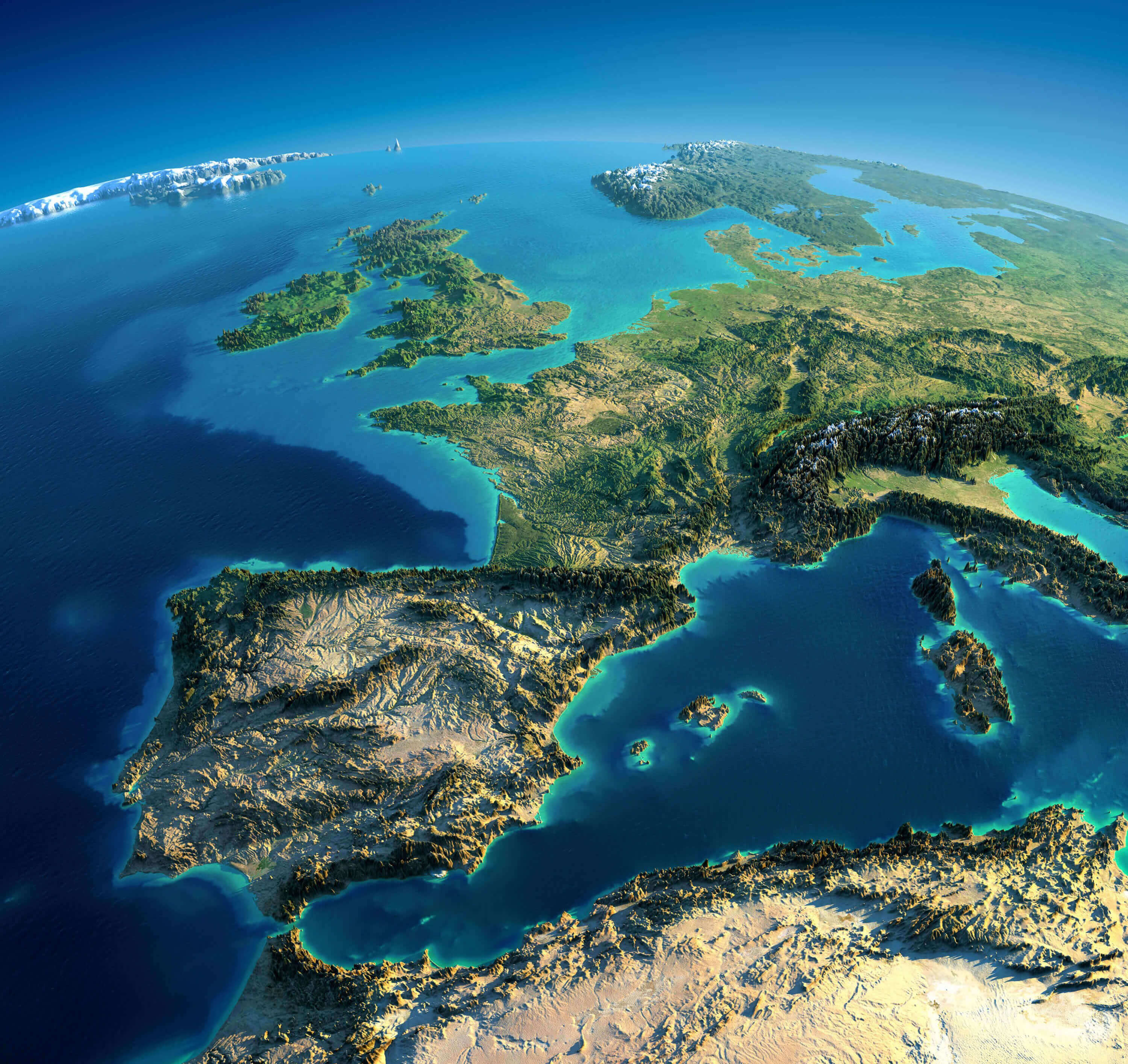
Satellite view of Spain, Iberian Peninsula, and Mediterranean Sea regions
This satellite image provides a striking perspective of the Iberian Peninsula, with Spain and Portugal clearly visible in the foreground. The map captures the rugged terrain of Spain, including prominent mountain ranges, valleys and coastal areas. The Mediterranean Sea stretches out to the east, showing Italy, parts of North Africa and the islands of Corsica and Sardinia. The Alps are visible in the background, adding depth to the European landscape. This view highlights Spain’s geographical position as a gateway between Europe and North Africa, with the Atlantic Ocean to the west and the Mediterranean Sea to the south-east.
Historical Map of Spain and Portugal (1808-1814)
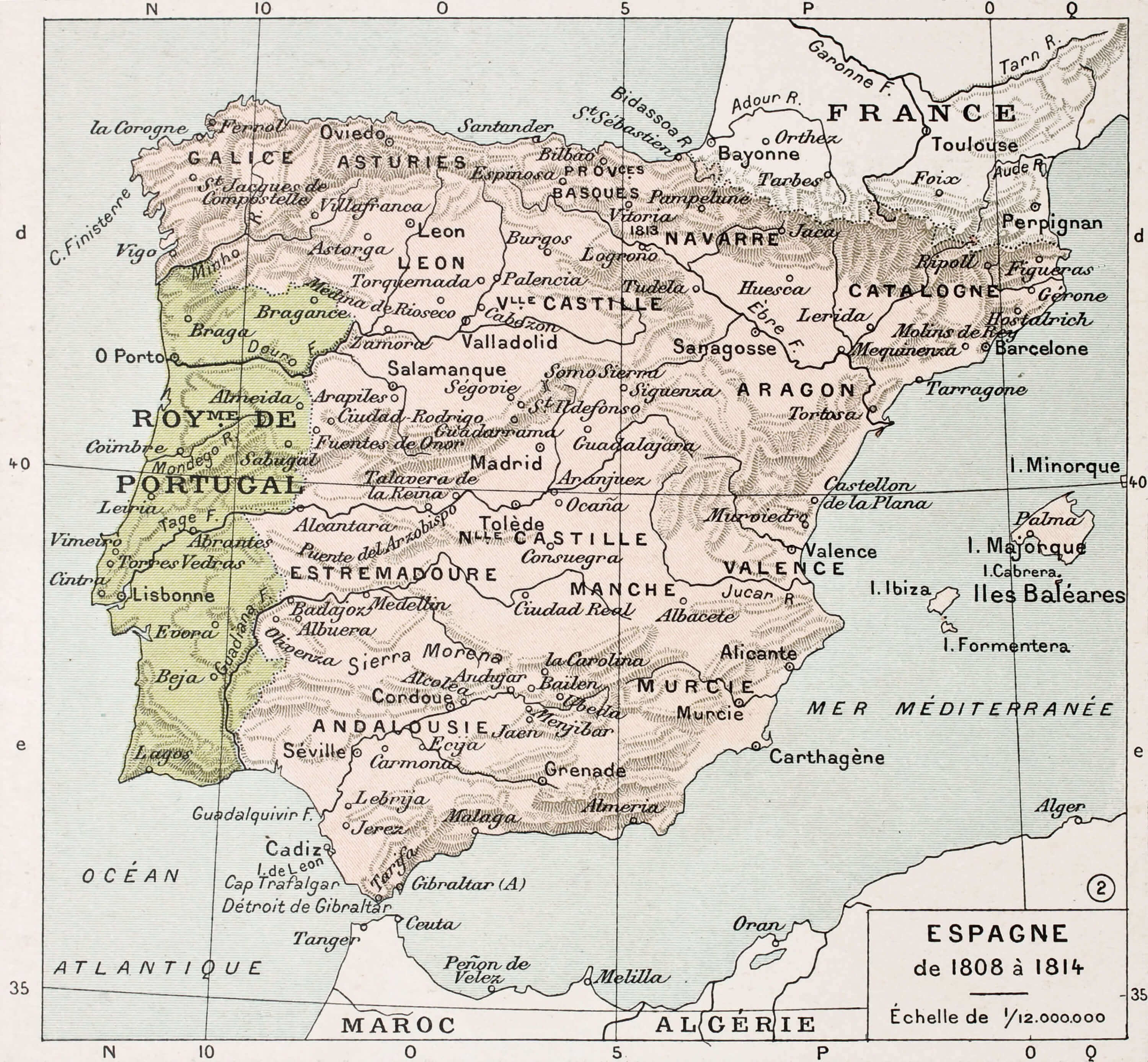
Historical map of Spain and Portugal from 1808-1814 with regional names.
This historical map shows Spain and Portugal as they appeared between 1808 and 1814, during the period of the Peninsular War when Napoleon’s forces occupied parts of the Iberian Peninsula. The map shows Spain’s regions labelled by their historical names, such as ‘Aragon’, ‘Navarre’ and ‘Andalousie’ (Andalusia), and important cities such as Madrid, Barcelona and Seville. Portugal, marked as ‘Royaume de Portugal’, is also shown with its major cities, including Lisbon and Porto. The map reflects the territorial divisions and place names of the time, providing a view of the region during a significant period of political upheaval and resistance to French occupation.
Map of Spain with Islands and Autonomous Regions
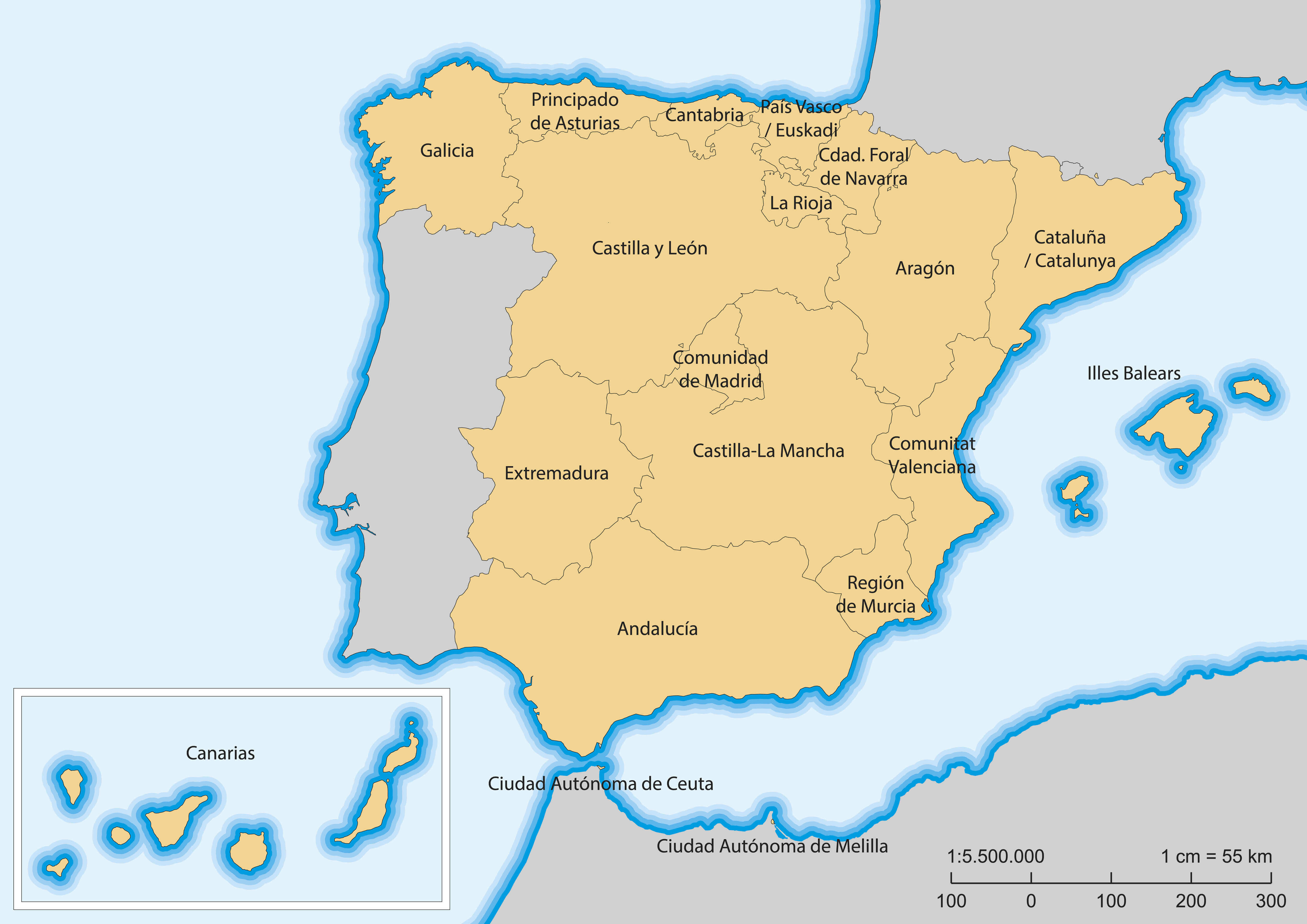
Map of Spain showing autonomous regions, Balearic and Canary Islands.
This map shows the autonomous communities of Spain, including the island territories. Each mainland region is labelled, such as Andalucía, Cataluña and Comunidad de Madrid, showing Spain’s administrative divisions. In addition, the map highlights Spain’s island territories, including the Balearic Islands (Illes Balears) in the Mediterranean Sea and the Canary Islands (Canarias) in the Atlantic Ocean off the coast of Africa. The map also shows Spain’s autonomous cities of Ceuta and Melilla on the north coast of Africa. This view provides a comprehensive layout of Spain’s mainland and island regions, emphasising the country’s geographical diversity.
Topographic Map of Spain Highlighting Madrid
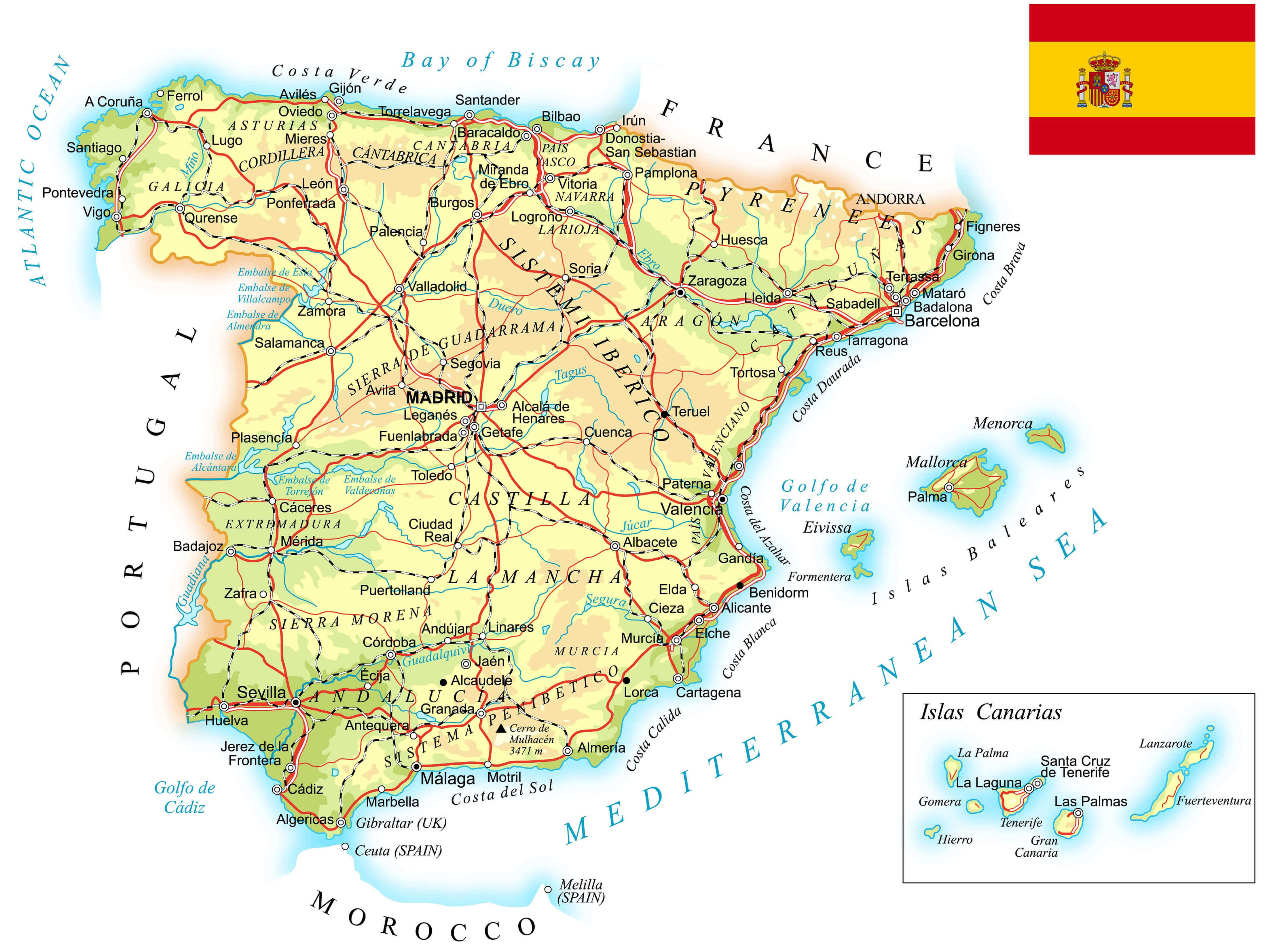
Topographic map of Spain highlighting Madrid, mountains, and main rivers.
This topographical map of Spain highlights the country’s varied landscape, major cities and transport routes, with a focus on Madrid as the central hub. The map shows mountain ranges such as the Sierra de Guadarrama near Madrid, the Pyrenees on the border with France and the Sierra Nevada in the south. Major rivers such as the Ebro, Tajo and Guadalquivir are labelled to reflect Spain’s natural topography. In addition, prominent regions such as Catalonia, Galicia and Andalusia are shown, as well as island territories such as the Balearic and Canary Islands. This map provides an overview of Spain’s geographical diversity and its main landmarks.
Antique Map of Spain by Abraham Ortelius, 1570
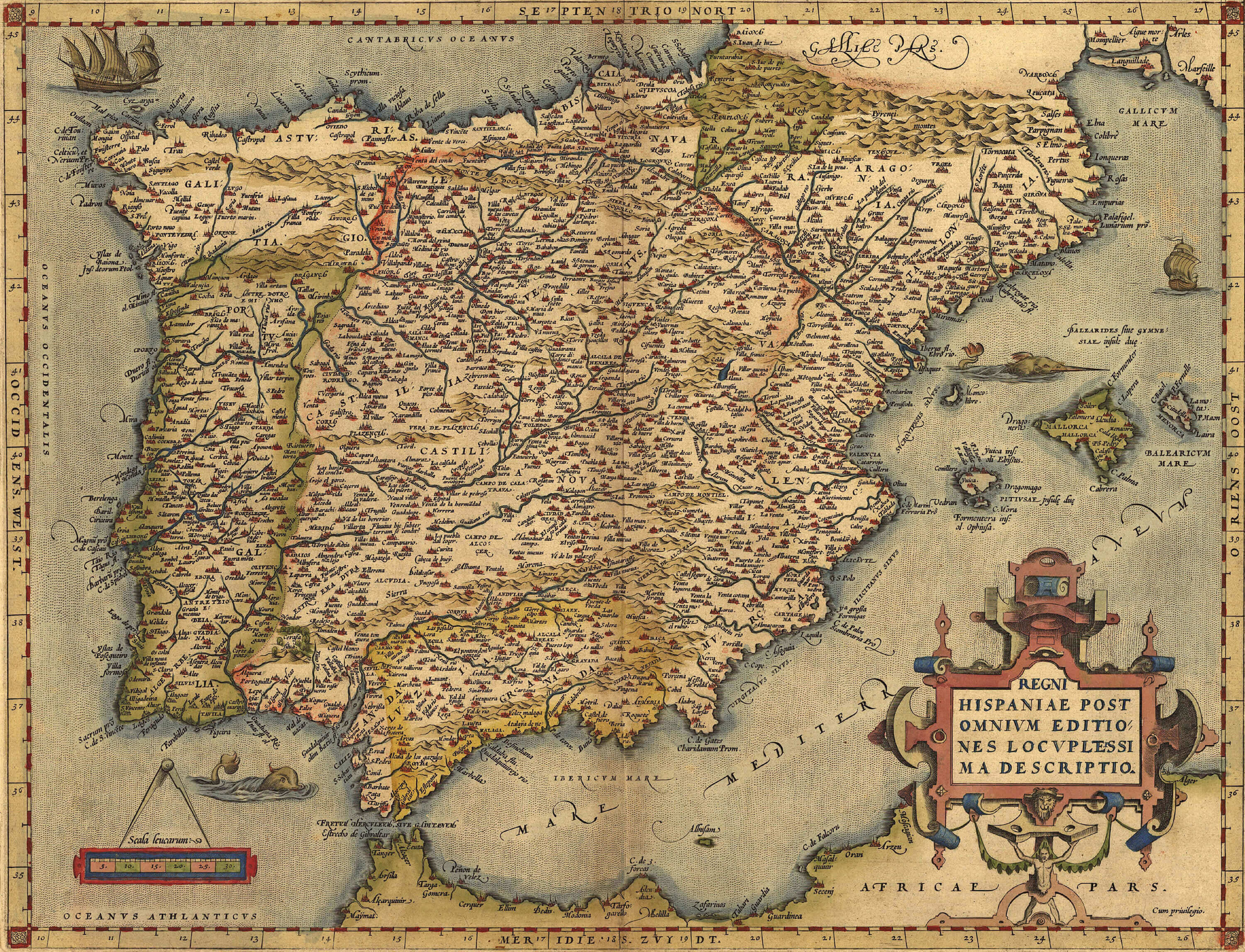
Antique 1570 map of Spain by Abraham Ortelius showing old regions and towns.
This antique map of Spain, created by the renowned cartographer Abraham Ortelius in 1570, provides a detailed look at the Iberian Peninsula during the 16th century. Titled Regni Hispaniae Post Omnium Editiones Locupletissima Descriptio, the map shows the major regions, rivers and cities of Spain and Portugal, with intricate detail typical of Ortelius’ work. Coastal areas and islands such as the Balearic Islands are also prominently featured. Decorated with period artwork, including sea creatures and ships, this map reflects Ortelius’s artistic approach to cartography and provides a fascinating insight into the understanding of Spanish geography during the Renaissance.
Satellite Map of Spain with Portugal and Gibraltar
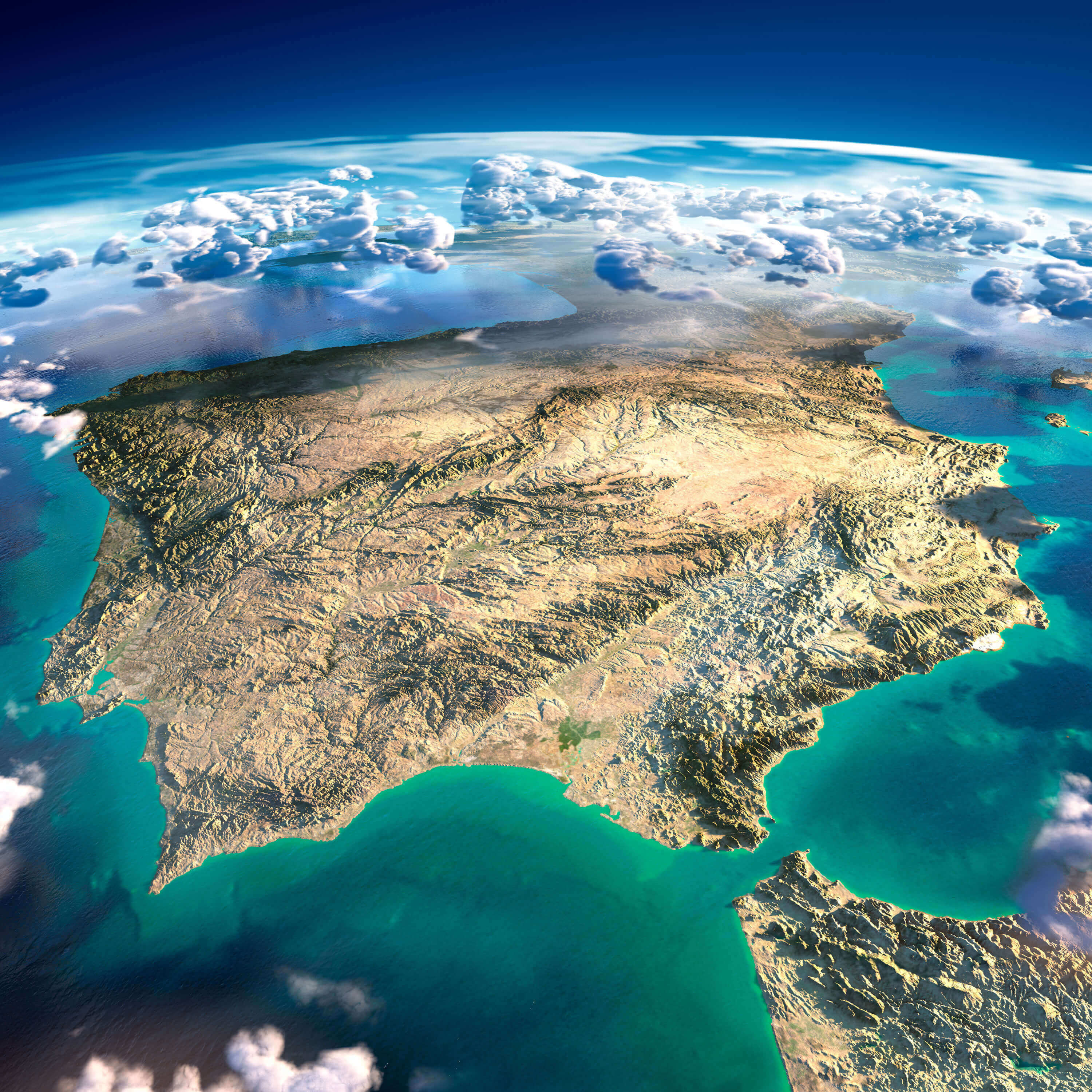
Satellite map of Spain with Portugal and Gibraltar showing topography
This satellite image provides a stunning view of the Iberian Peninsula, encompassing Spain, Portugal and the strategic region of Gibraltar. The map highlights the varied topography, from the central plains of Spain to the mountain ranges in the northern and southern regions. The coastline contours show the vibrant turquoise waters of the Mediterranean Sea to the east and the Atlantic Ocean to the west, while Gibraltar sits prominently at the southern tip near the narrow strait that connects the Mediterranean to the Atlantic. The satellite perspective also shows partial cloud cover, adding depth to this realistic geographical visualisation.
Regional Map of Spain
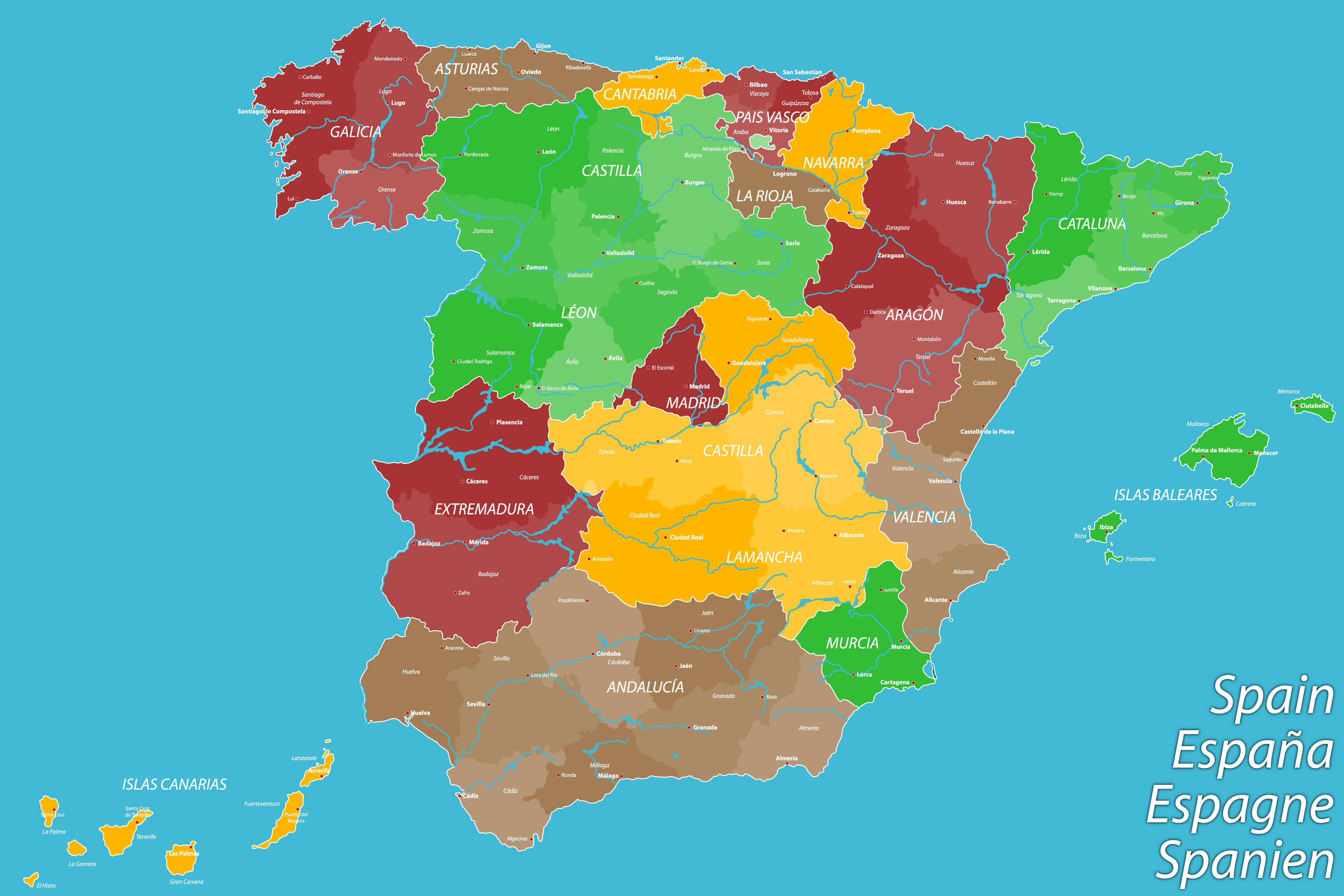
Map of Spain showing regions and major cities
This map of Spain highlights the country’s various autonomous communities, each shown in a different colour for easy identification. Regions such as Catalonia, Galicia, Castile and Andalusia stand out, illustrating Spain’s rich geographical and cultural diversity. The map also includes the Canary Islands and the Balearic Islands, showing Spain’s territories beyond the mainland. Major cities such as Madrid, Barcelona, Seville and Valencia are highlighted, giving a sense of the distribution of urban centres across the regions. This map effectively captures the administrative divisions within Spain, reflecting the distinct identities of each area.
Europe and Spain Satellite Map Under Moonlight
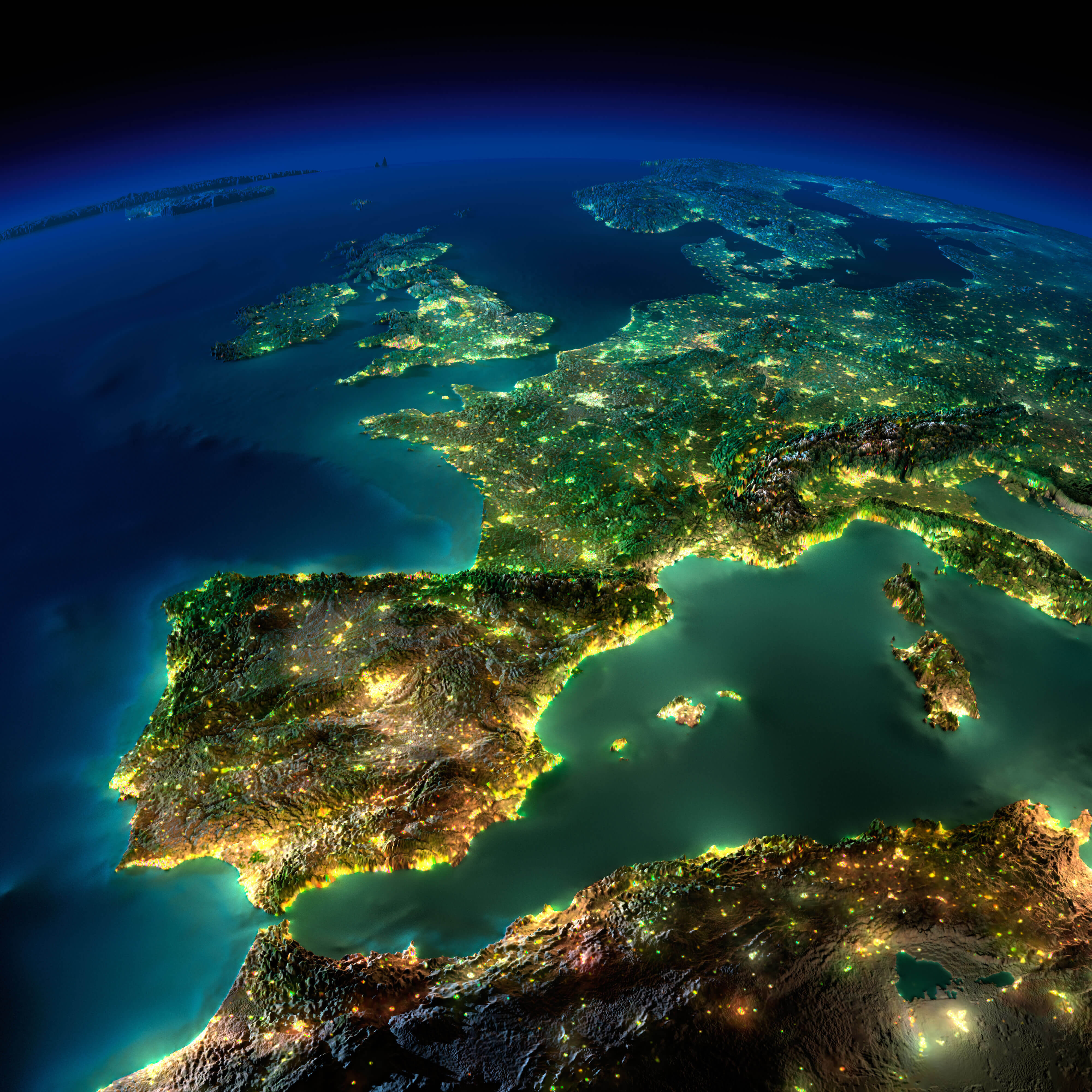
Satellite view of Spain and Europe under moonlight with city lights
This stunning satellite image captures a detailed view of Spain and surrounding parts of Europe by moonlight. The map shows illuminated urban areas, highlighting major cities and their surrounding regions, as well as subtle topographic details of mountains, valleys and coastlines across the Iberian Peninsula, France and Italy. The image reflects the European landscape from a perspective that emphasises the continent’s night-time lights, making the urban density and infrastructure of Spain and neighbouring countries visible even in low light. The visual effect of moonlight enhances natural boundaries and coastlines, giving a sense of the geographical layout of Europe at night.
World Map Collection – Youtube
Where is Spain on the Europe Map?
Show Google map, satellite map, where is the country located.
Get directions by driving, walking, bicycling, public transportation and travel with street view.
Feel free to explore these pages as well:
- Spain Map ↗️
- Valencia Map ↗️
- Murcia Map ↗️
- Exploring the Vibrant Corners of Cartagena, Spain ↗️
- Discovering Alicante: The Gem of Spain’s Costa Blanca ↗️
- A Collection of Spain Maps ↗️
- Discover Moorish Andalucia, Spain 1 ↗️
- Discover Moorish Andalucia, Spain 2 ↗️
- Italy Map ↗️
- France Map ↗️
- Europe Map ↗️
