Ciao, dear readers! If you’ve ever found yourself yearning to know more about the sunny landscapes of Italy, you’ve stumbled upon the perfect blog post. From the jagged peaks of the Alps to the coastal elegance of the Amalfi Coast, Italy is a land of geographical and cultural diversity. One of the best ways to truly understand this stunning country is through maps. In this comprehensive guide, we’ll delve into various types of Italy maps to give you an in-depth look at the country. Buckle up; we’re going on a cartographic tour of Italy!
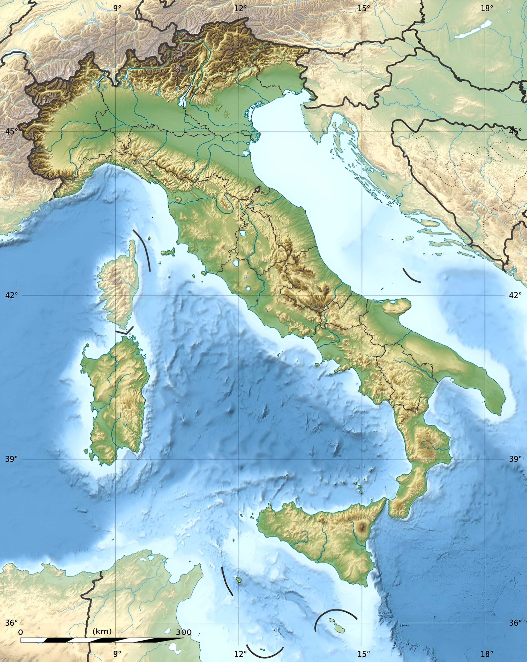
1. Italy Physical Map
A physical map gives you a detailed look at the natural landscapes of Italy. From the rugged Alps in the north to the sun-kissed beaches in the south, get a feel of the diverse terrains that make Italy a geographical marvel.
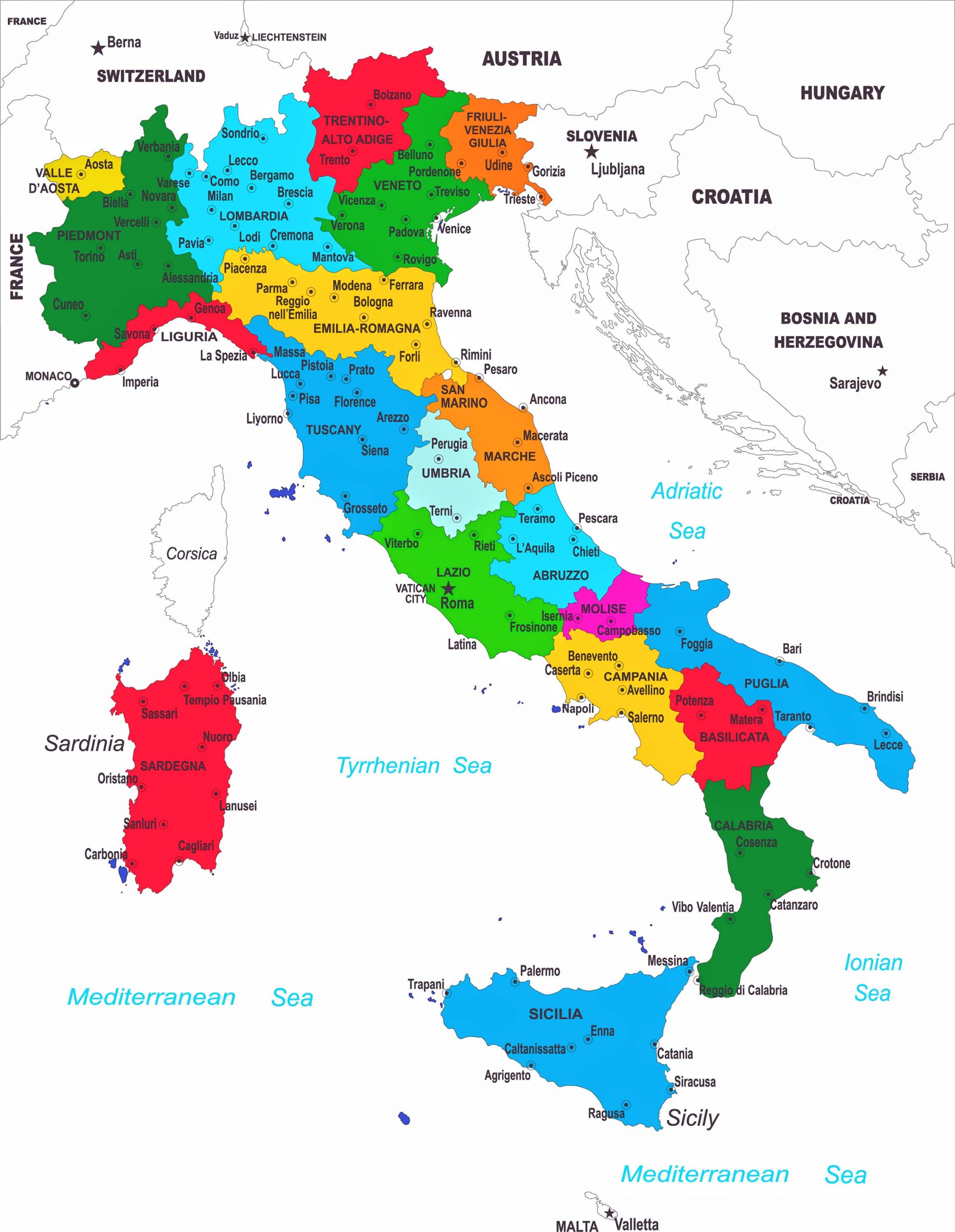
2. Italy Political Map
Political maps highlight the territorial boundaries, including regions, provinces, and cities. It’s the go-to map if you’re looking to understand the political divisions within Italy.
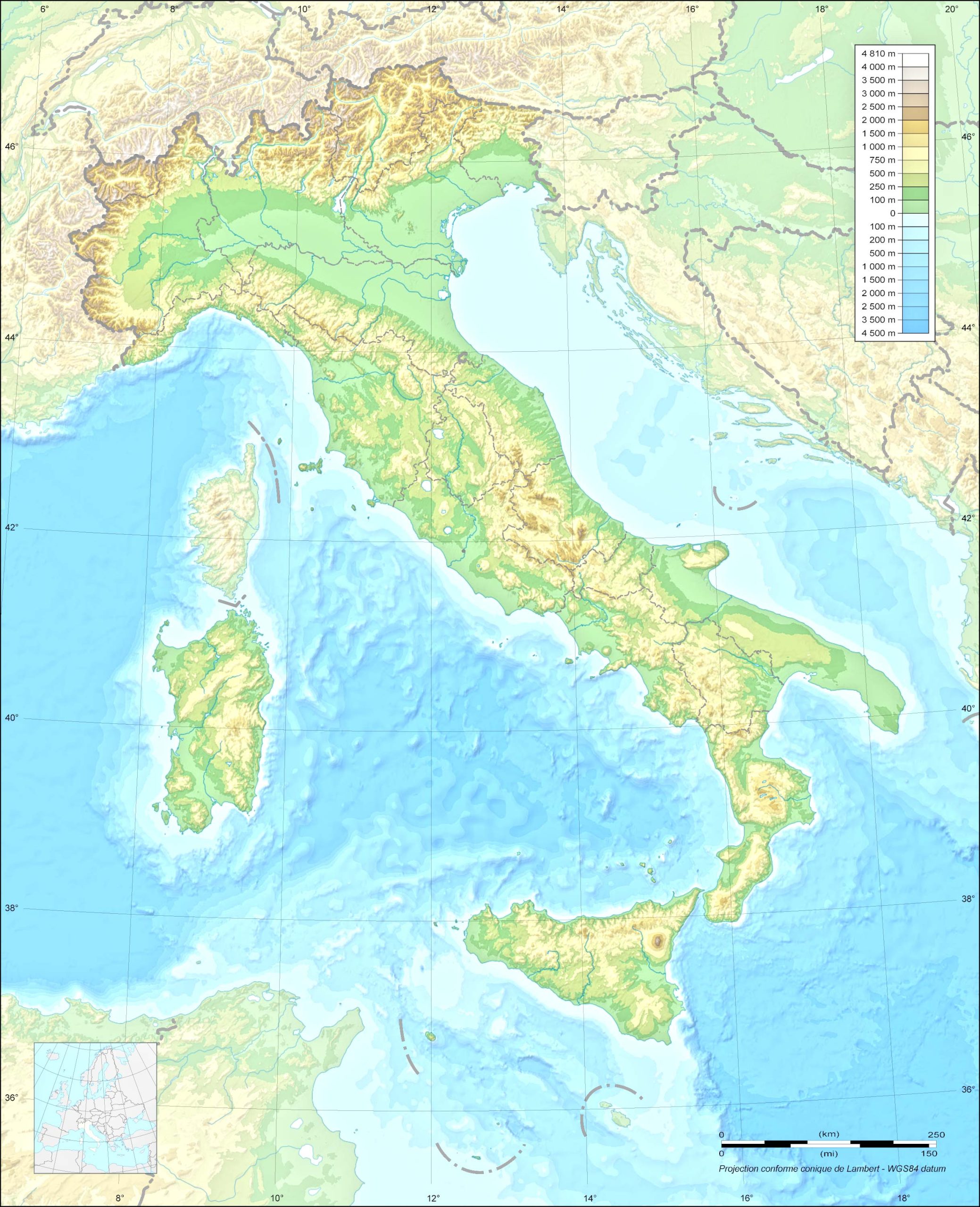
3. Italy Topographic Map
Ideal for trekkers and hikers, the topographic map provides details about the elevations, contours, and distances between places.
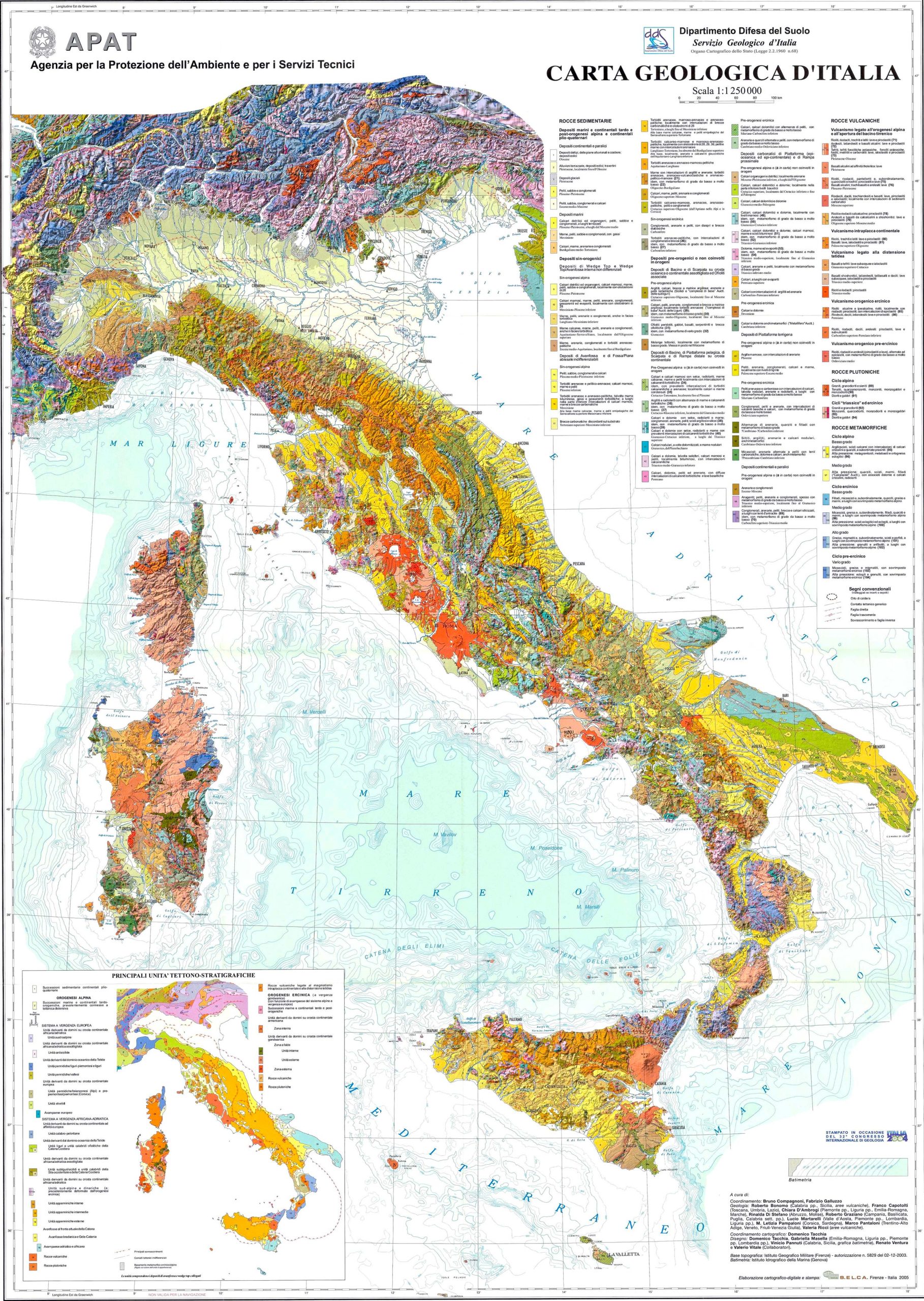
4. Italy Geological Map
A geological map offers insights into the rock formations and geological features of Italy. An excellent tool for geologists and academics!
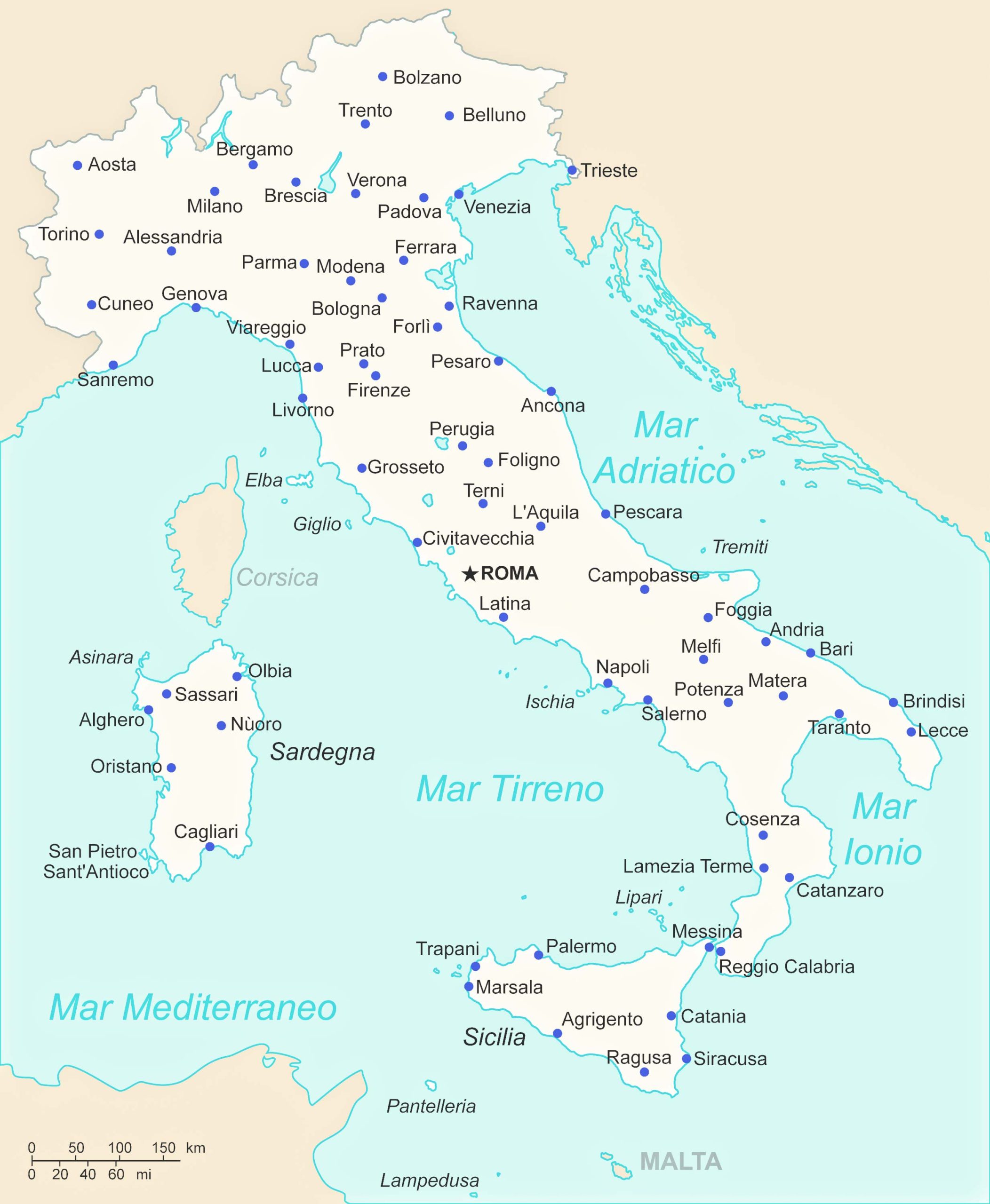
5. Italy Cities (Urban) Map
City maps are your guides to the urban landscapes. They are great for locating landmarks, parks, and essential services within a city.
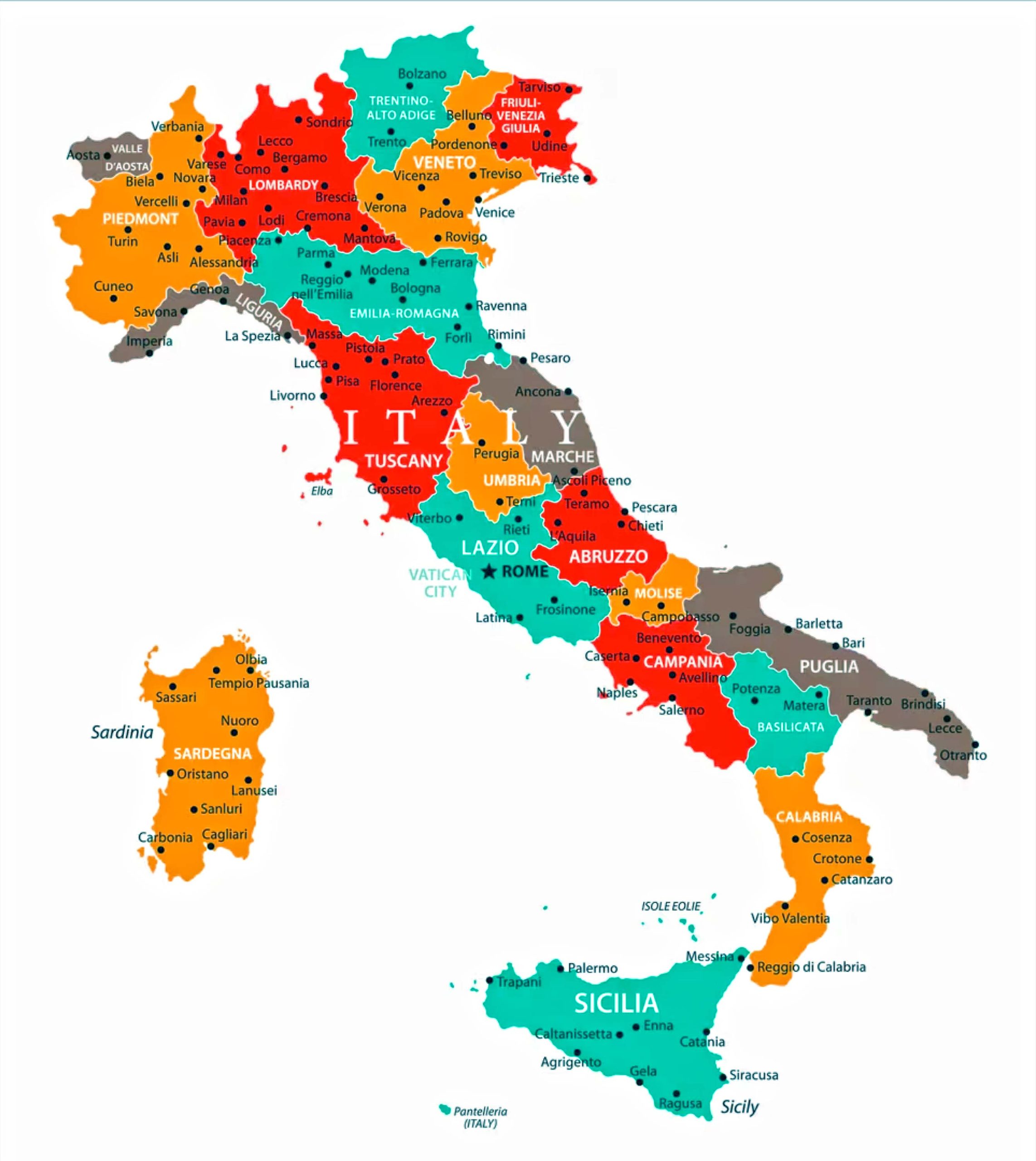
6. Italy Regions Map
Each of Italy’s 20 regions has its charm. This map will help you understand the geographical divisions of Italy’s regions.
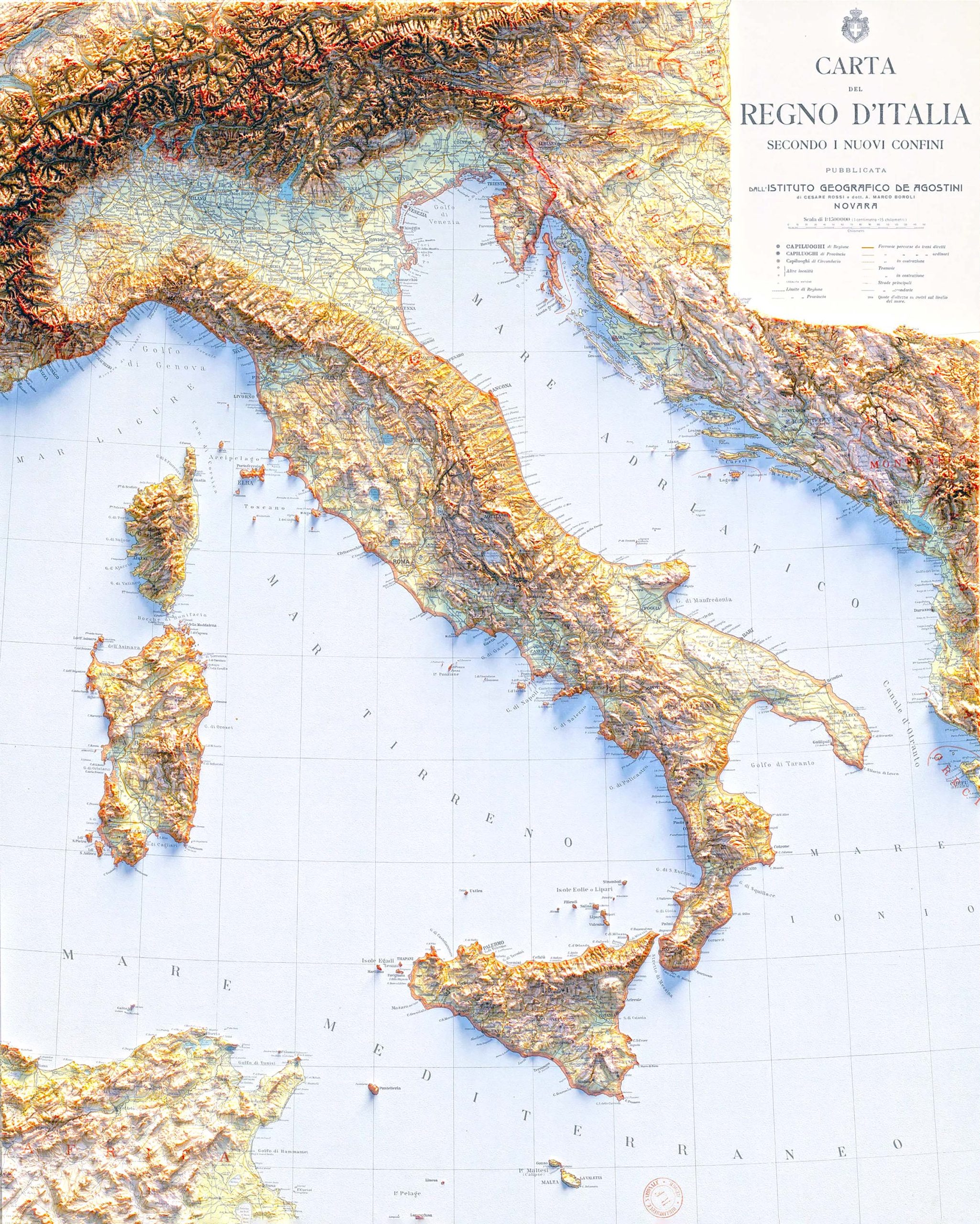
7. Italy Relief Map
Relief maps offer a 3D representation of the landscape, providing an almost real-life experience of the terrain.
8. Italy Transit Map
Perfect for tourists and locals, the transit map shows you public transport routes including trains, buses, and metro lines.
9. Italy Historical Map
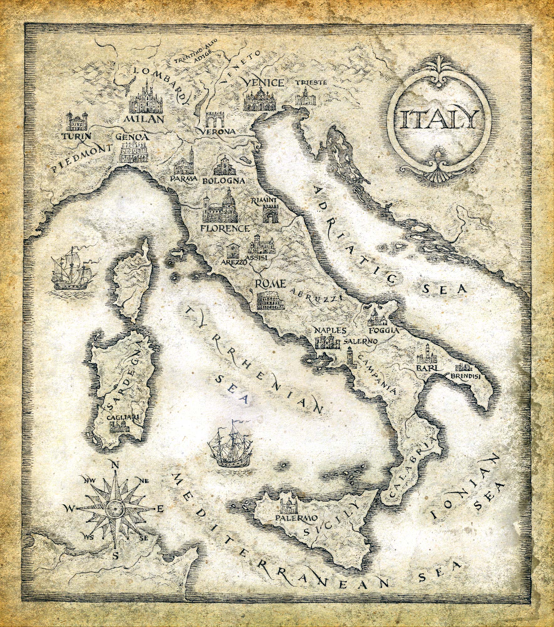
A journey through time, historical maps showcase Italy’s transformation through various eras.
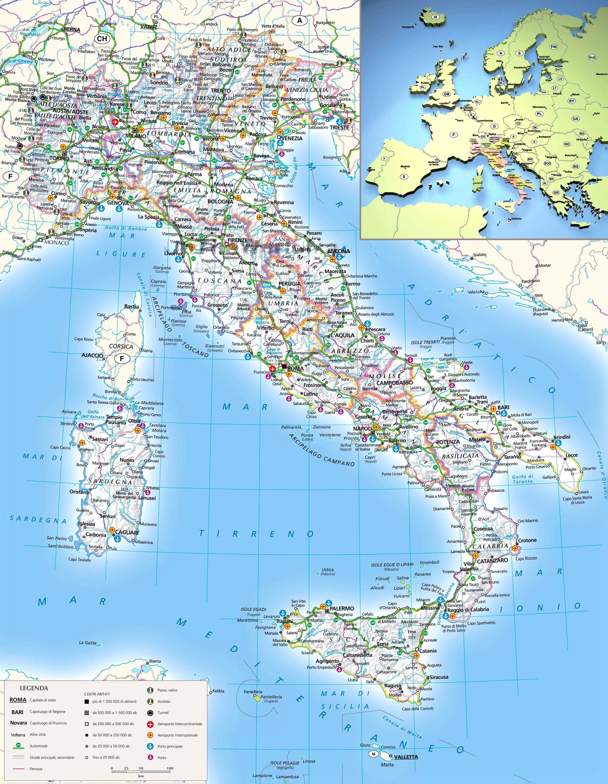
10. Italy Road Map
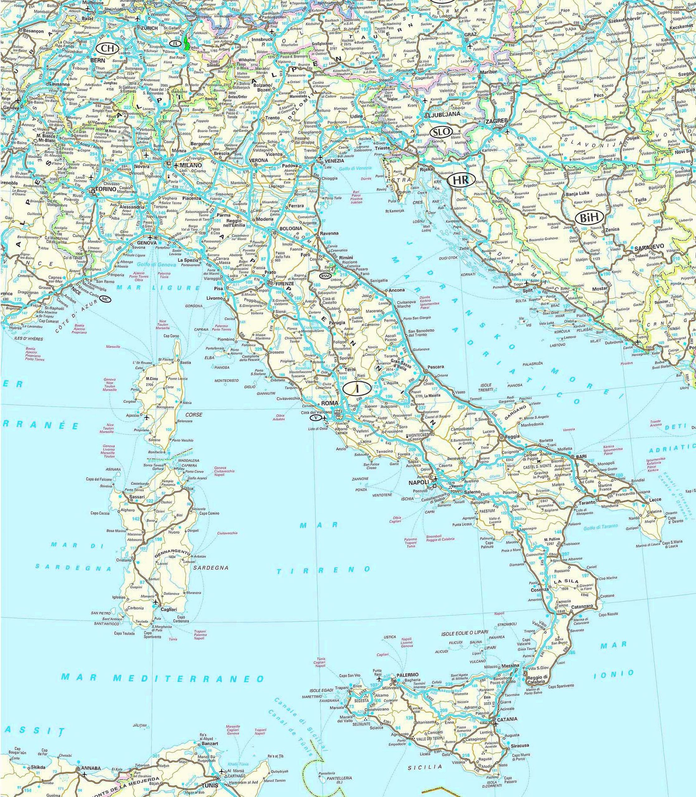
Ideal for road trippers and explorers, road maps show highways, main roads, and rural routes.
11. Italy Train-Rail Map
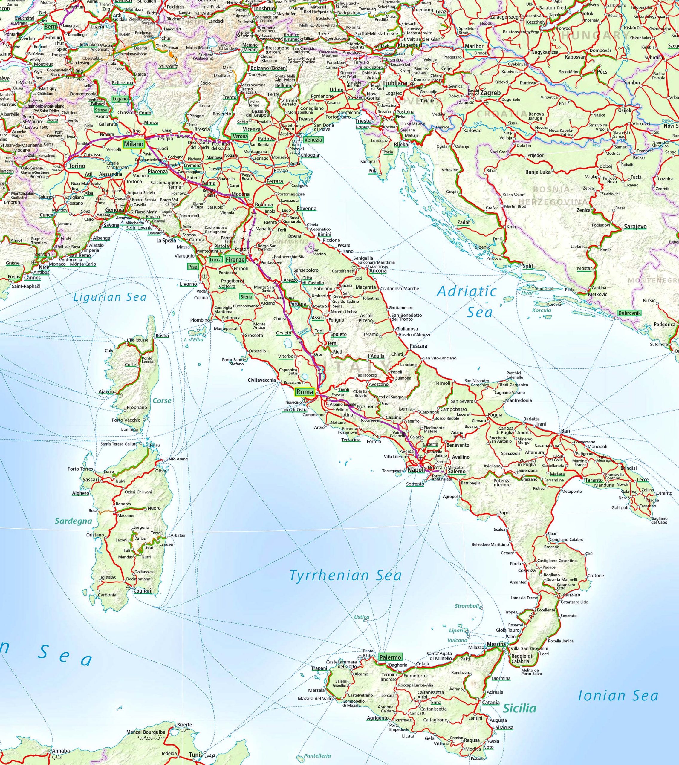
Discover Italy’s extensive rail network that connects not just cities but also small towns.
12. Italy Climatic Map
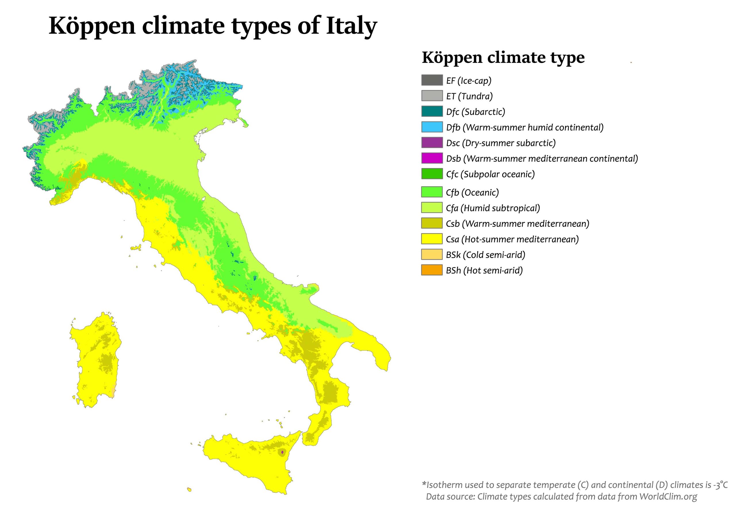
Understand the varying weather conditions across Italy. It’s not all sunshine and beaches!
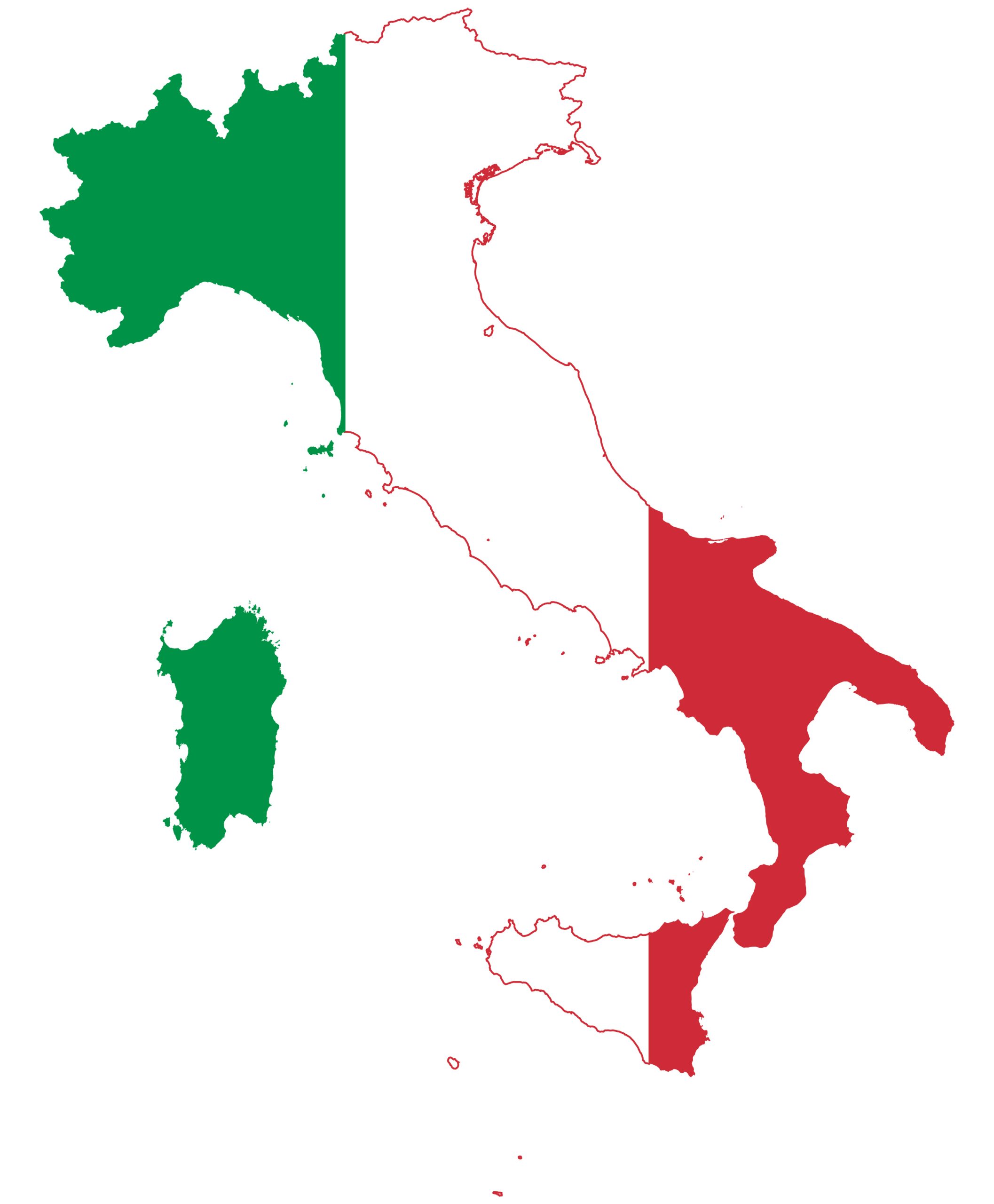
13. Italy Flag Map
A creative representation of Italy, the flag map combines the Italian flag with its geographical outline.
14. Italy Travel Map
Travel maps are the Swiss army knives of maps, featuring tourist attractions, routes, and even dining spots.
Diving deep into these diverse maps of Italy has been a voyage of discovery, offering us intricate details that bring the country’s landscapes, history, and culture to vivid life. As we traverse through each map, from the rolling hills of Tuscany, the bustling streets of Rome, to the serenity of Lake Como, we grasp not only the geographical intricacies but also the heartbeat of Italy itself. It’s incredible how a simple piece of cartography can transport us to the very soul of this enchanting nation. Whether you’re an ardent traveler, a passionate student, or just someone mesmerized by Italy’s allure, these maps serve as a window, bridging our world to the essence of La Bella Italia. So, the next time you think of Italy, remember there’s always a map to guide you deeper into its heart. Until our next cartographic adventure, let Italy’s essence linger in your thoughts, and may it inspire journeys, dreams, and a continuous quest for knowledge. Arrivederci!
Where is Italy on the World Map?
Show Google Maps and satellite maps of where the country is located.
Get directions by driving, walking, bicycling, public transportation, and travel with street view.
Feel free to explore these pages as well:
- Italy Map ↗️
- Map of Italy ↗️
- Italy Time Zone Map ↗️
- Italy Cities Map ↗️
- The 10 Best Things to Do in Venice ↗️
- A Tourist’s Guide to Venice’s Top 10 Attractions ↗️
- A Collection of Italy Maps ↗️
- Discovering Catania: A Jewel at the Foot of Mount Etna ↗️
- Experience Venice: A Complete Guide for the Adventurous Traveler ↗️
- A Tourist’s Guide to Venice’s Top 10 Attractions ↗️
- The 10 Best Things to Do in Venice ↗️
- Explore Italian Riviera Cinque Terre ↗️
- Discover Bari: Italy’s Enchanting Port City ↗️
- San Marino Map ↗️
- Vatican Map ↗️
- Discover Croatia: A Comprehensive Map Collection of Its Stunning Coastlines and Historic Cities ↗️
- A Collection of Europe Maps: Exploring the Continent in Detail ↗️
- Map of Europe ↗️
- Europe Map ↗️
- Map of Europe ↗️
- France Map ↗️
- Map of Spain ↗️
- Ireland Map ↗️
- United Kingdom Map ↗️
- Germany Map ↗️
- Turkey Map ↗️
- Map of Portugal ↗️
- Switzerland Map ↗️

