- Advertisement -
View comprehensive detailed Australia time zone maps including UTC offsets, longitude-latitude coordinates, and regional divisions. View combined time zones for Asia, Oceania, Indonesia, and Australia with road and territory references.
Australia and Oceania Time Zone Map with Daylight Saving Details
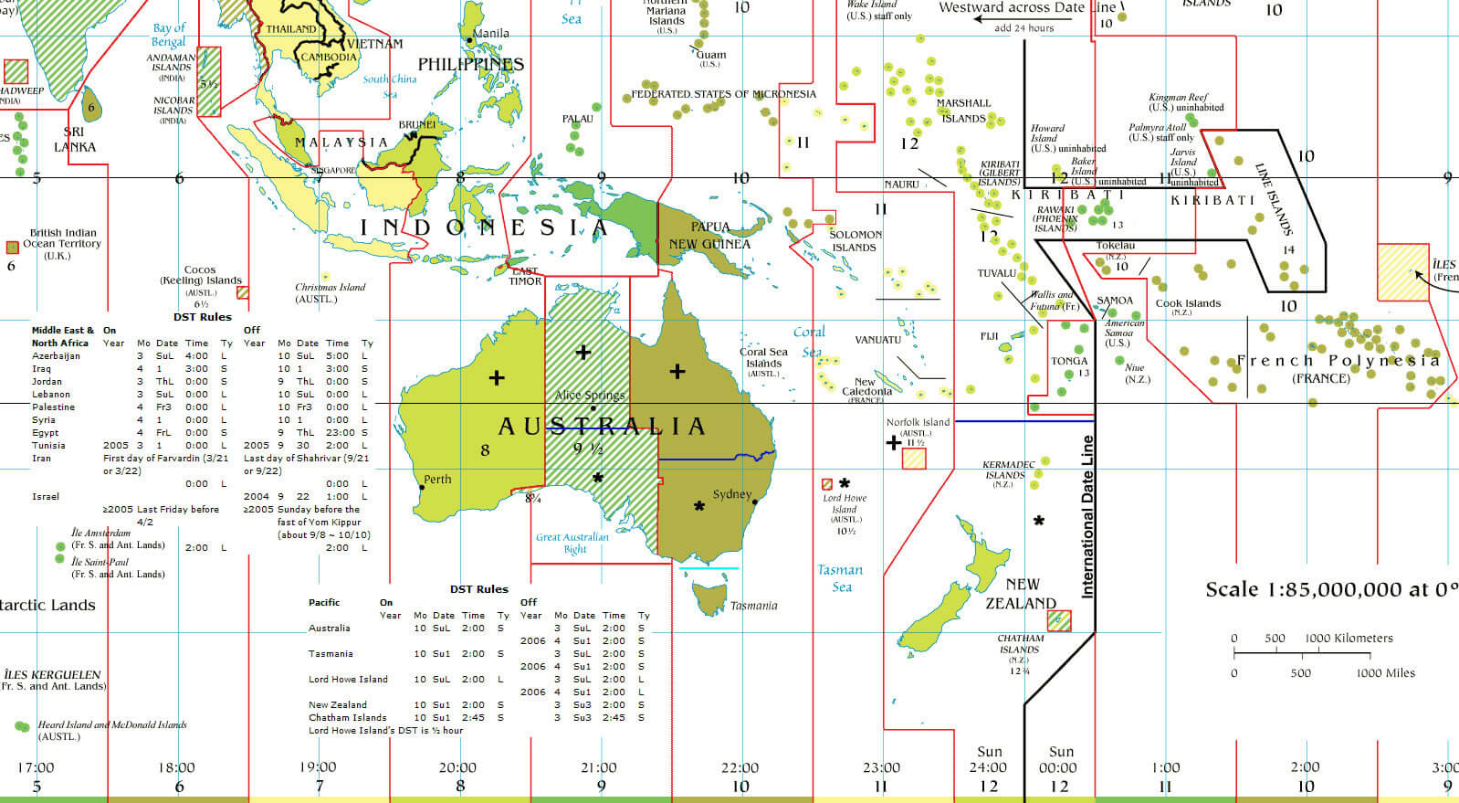 Australia and Oceania time zones map with international date line and DST info
Asia and Australia Time Zone Map with Regional UTC Offsets
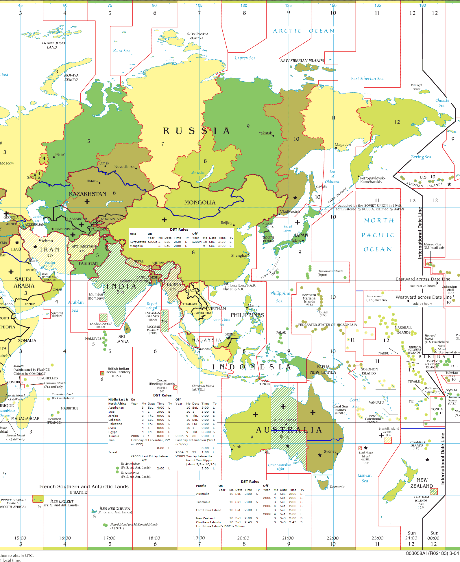 Asia and Australia time zones map with clear UTC offset divisions.
Australia time zone map with universal time

Australia and Indonesia time zone map
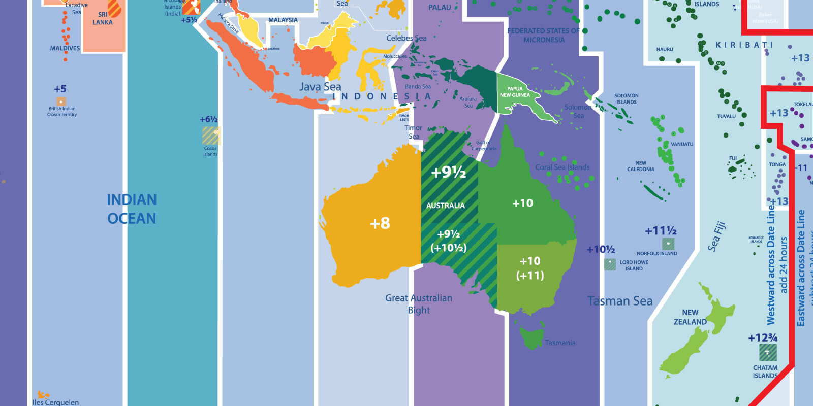
Australia time zone and road map
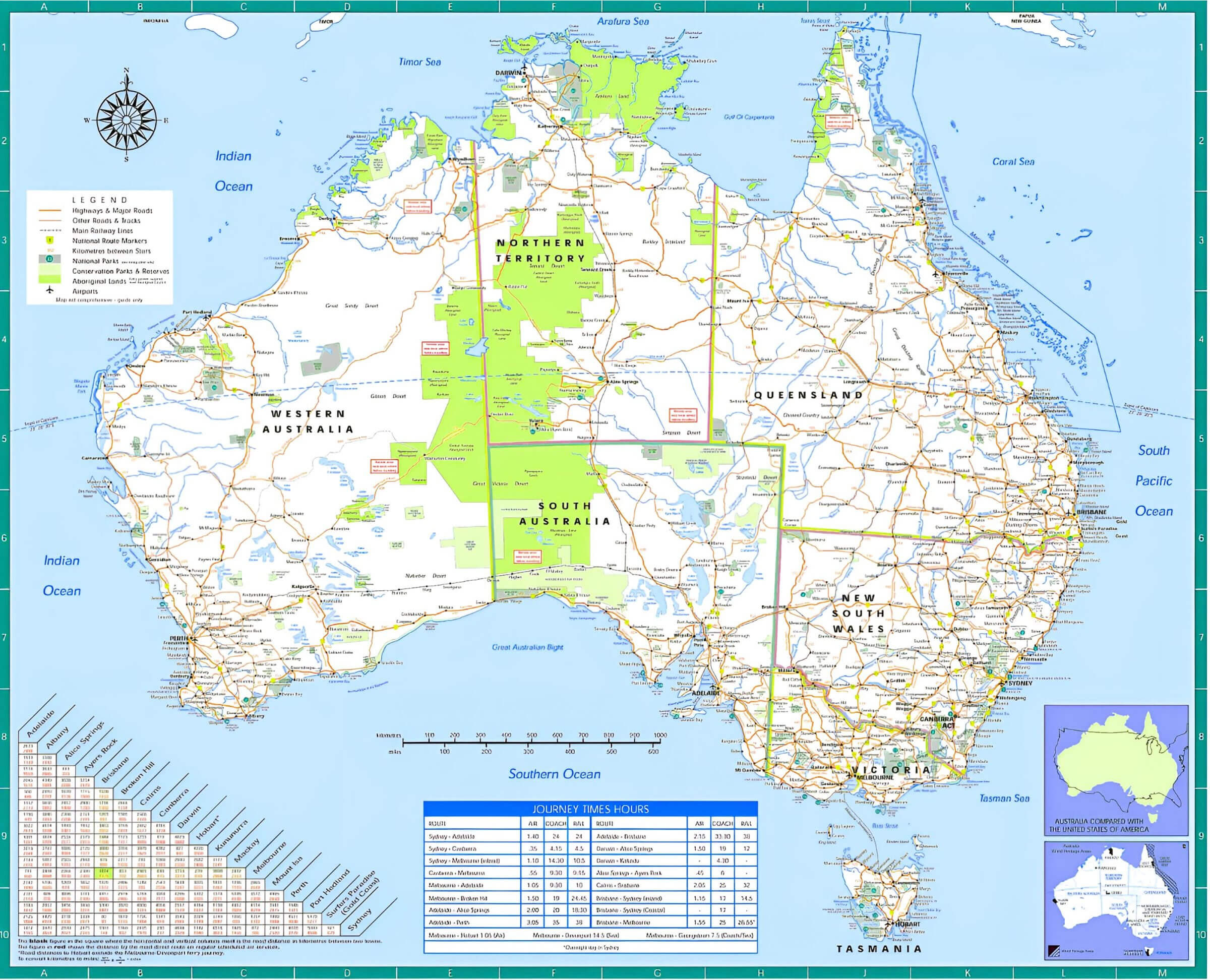
Australia time zone map with longitude latitude
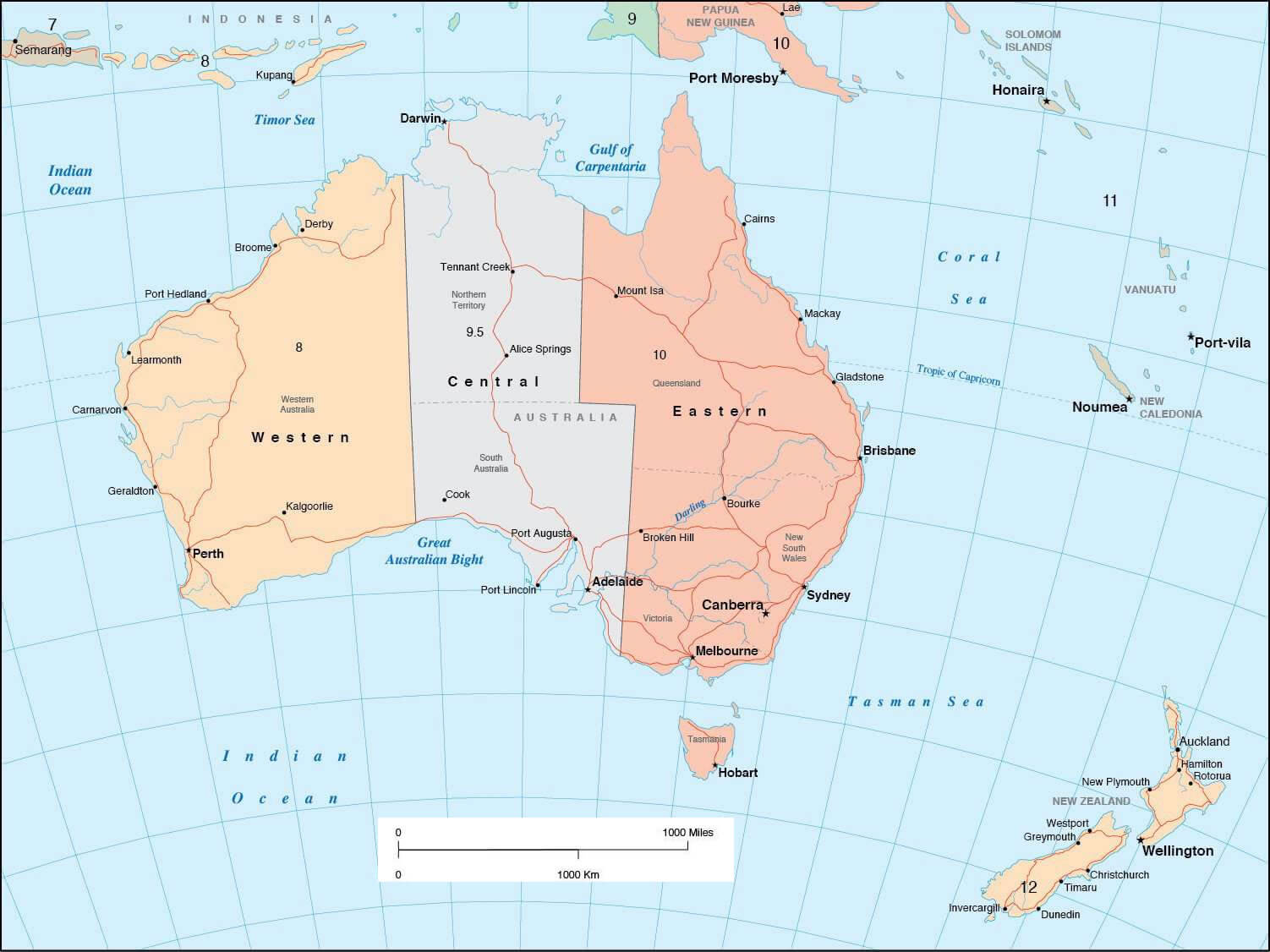
Australia Time Zone Map: A Guide to the Land of Many Clocks
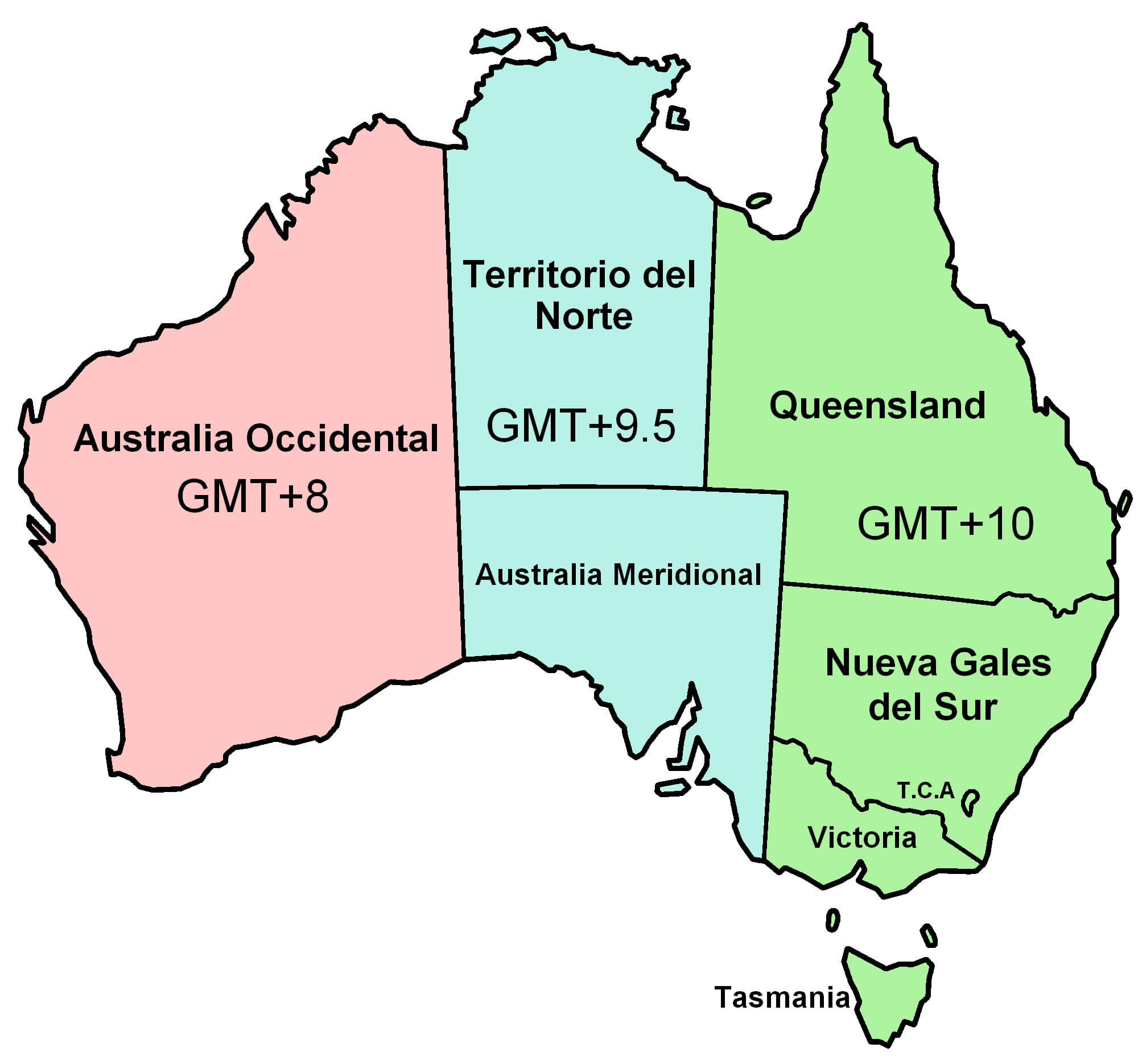
Australia is a vast country that stretches across multiple time zones, making it essential to understand its regional time differences—especially if you’re traveling, doing business, or scheduling meetings. The country primarily spans three standard time zones: Australian Western Standard Time (AWST, UTC+8), Australian Central Standard Time (ACST, UTC+9:30), and Australian Eastern Standard Time (AEST, UTC+10). Additionally, during Daylight Saving Time (DST), some states adjust their clocks forward by one hour, further diversifying local times.Here’s a quick breakdown of the time zones for 10 major cities:
- Sydney – AEST (UTC+10) / AEDT (UTC+11 in DST)
- Melbourne – AEST / AEDT
- Brisbane – AEST only (no DST)
- Perth – AWST (UTC+8, no DST)
- Adelaide – ACST / ACDT (UTC+10:30 in DST)
- Darwin – ACST only (no DST)
- Canberra – AEST / AEDT
- Hobart – AEST / AEDT
- Alice Springs – ACST (no DST)
- Gold Coast – AEST (like Brisbane, no DST)
Australia time zone map
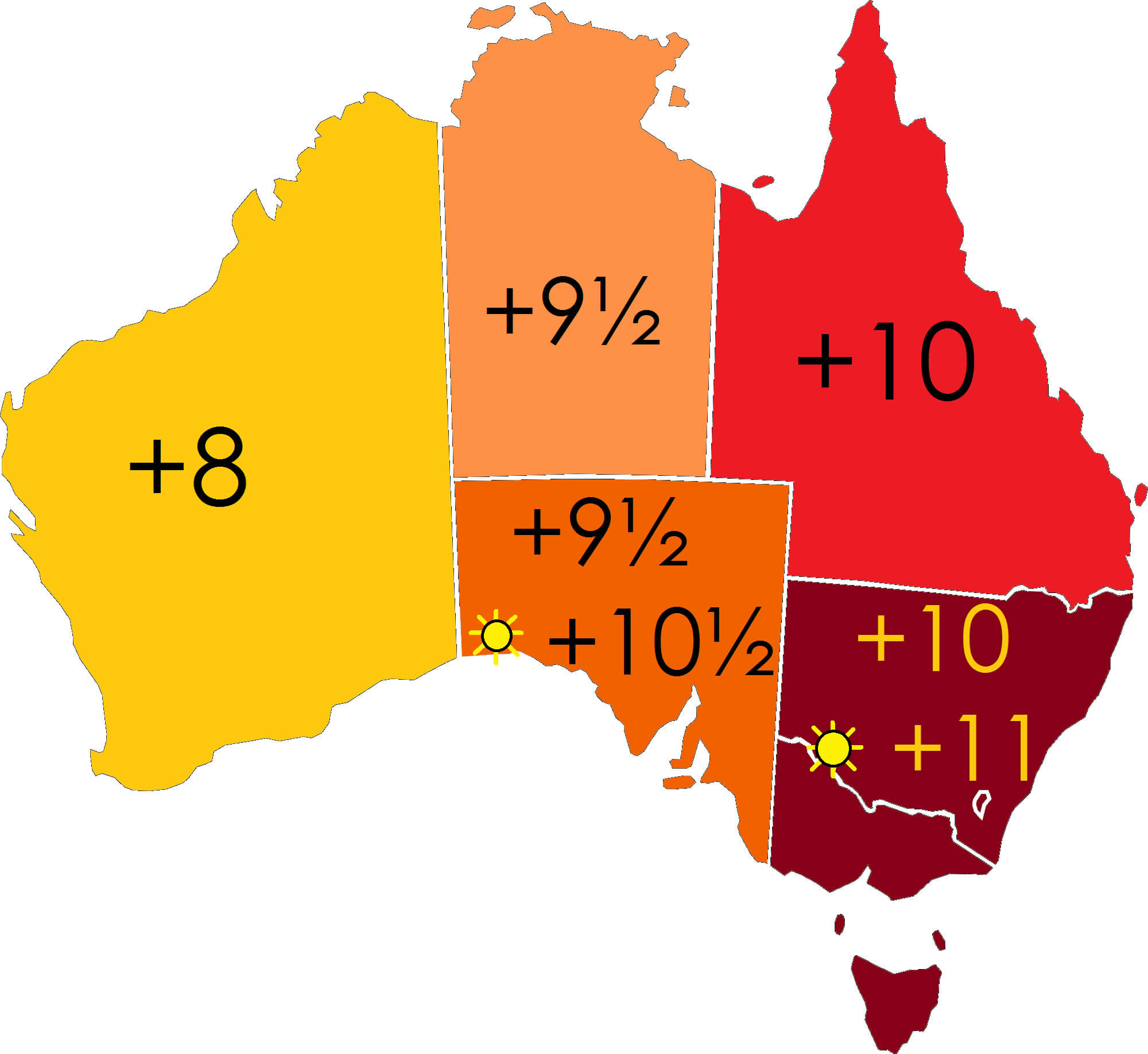
Australia time zones map
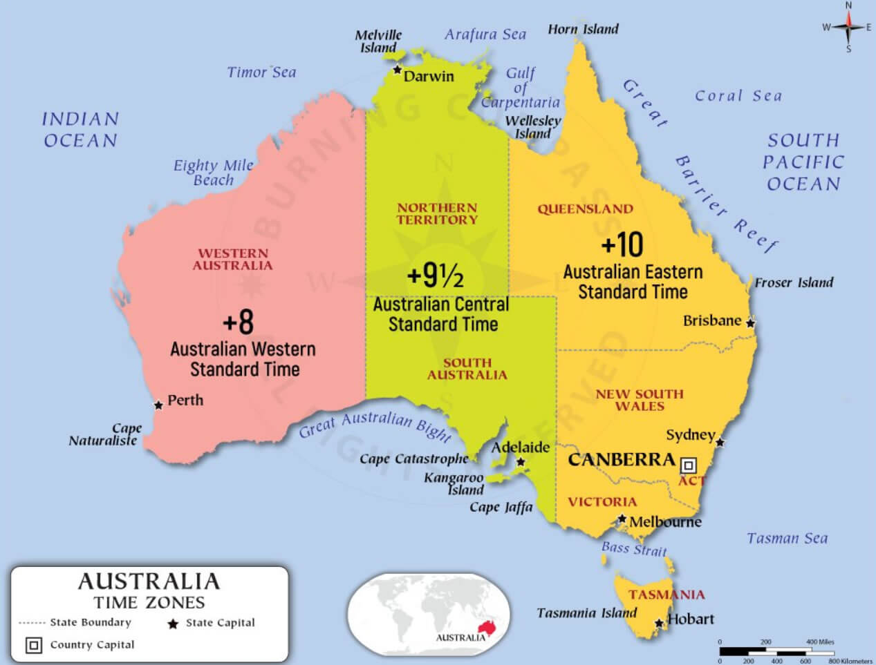
Australia time zones UTC map
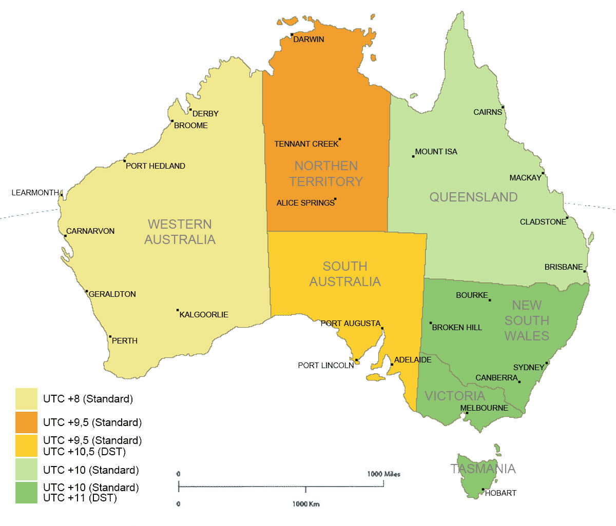
Oceania time zones map with Australia
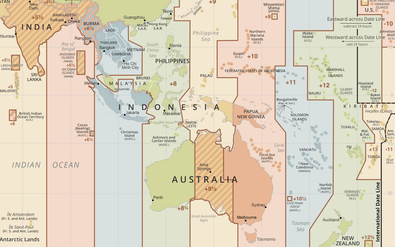
Time zone map of Australia with territories
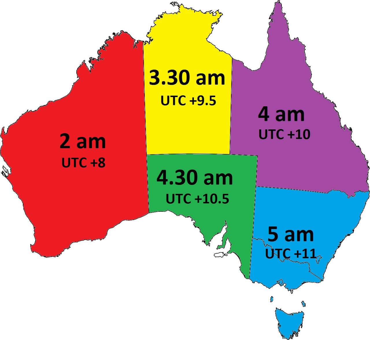
Time zones Australia map
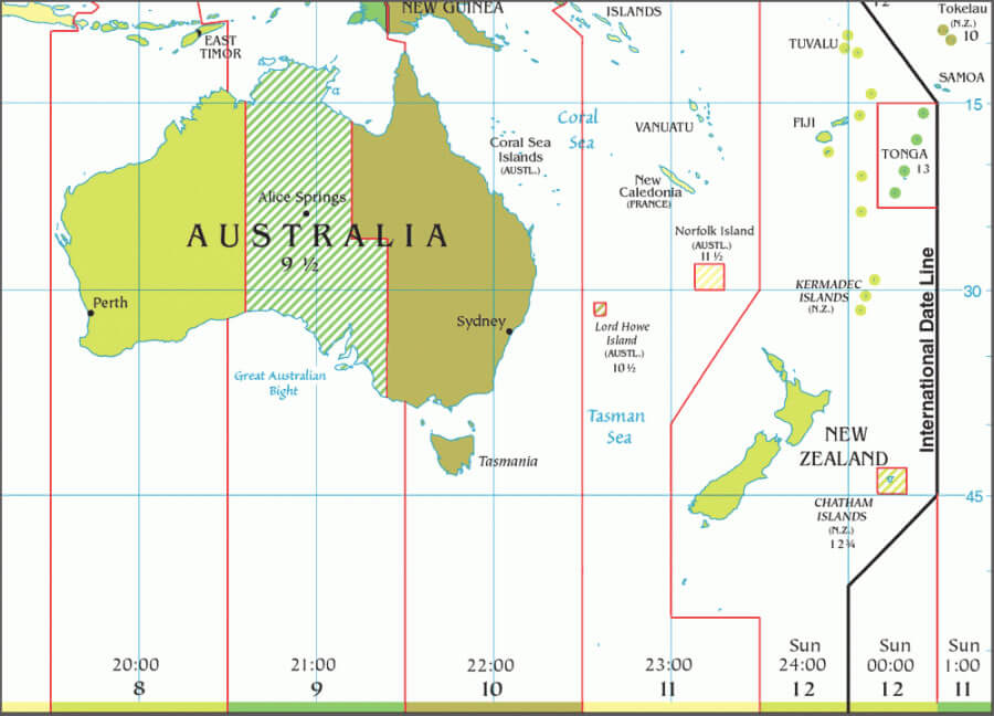
Time zones map Australia centralled
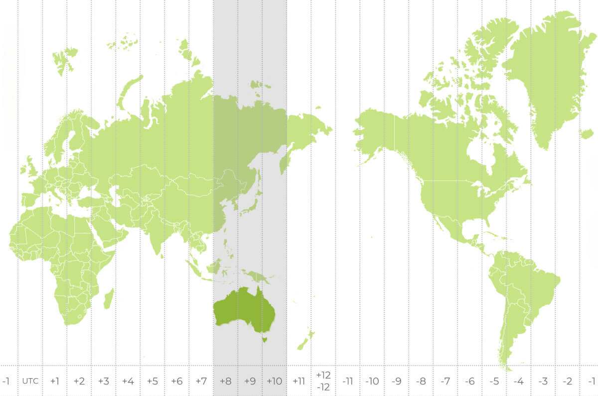
Time zones map of Australia
World time zones and Australia map
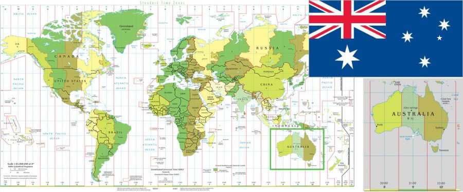
Where is Australia on the Oceania Map?
Show Google map, satellite map, where is the country located.
Get directions by driving, walking, bicycling, public transportation and travel with street view.
Feel free to explore these pages as well:
- Australia Map ↗️
- Map of Australia ↗️
- Australia High-resulution Map ↗️
- Australia Cities Map ↗️
- Diverse Maps of Australia ↗️
- Exploring the Hidden Gems of Central Coast, Australia ↗️
- Australia Time Zone Map ↗️
- Map of Oceania ↗️
- Oceania Time Zone Map ↗️
- Map of Oceania ↗️
- Oceania Map ↗️
- Australia Map ↗️
- Map of Australia ↗️
- Diverse Maps of Australia ↗️
- Europe Time Zone Map ↗️
- World Time Zone Map ↗️
- China Time Zone Map ↗️
- North America Time Zone Map ↗️
- Canada Time Zone Map ↗️
- Asia Time Zone Map ↗️
- US Time Zone Map ↗️
- Russia Time Zone Map ↗️
- Africa Time Zone Map ↗️
- Spain Time Zone Map ↗️
- UK Time Zone Map ↗️
- France Time Zone Map ↗️
- Italy Time Zone Map ↗️
- Turkey Time Zone Map ↗️
- California Time Zone Map ↗️
- Advertisement -
