- Advertisement -
Explore the Tennessee Cities Map to see major cities like Nashville, Memphis, and Knoxville along with highways, rivers, and county borders. This map of the state of Tennessee USA highlights the state’s geography, counties, and interstates. Whether you’re looking for a Tennessee political map, a road map with cities, or a physical map of Tennessee with counties, this detailed resource helps you understand the state’s layout and travel routes across its main regions.
Map of the State of Tennessee USA
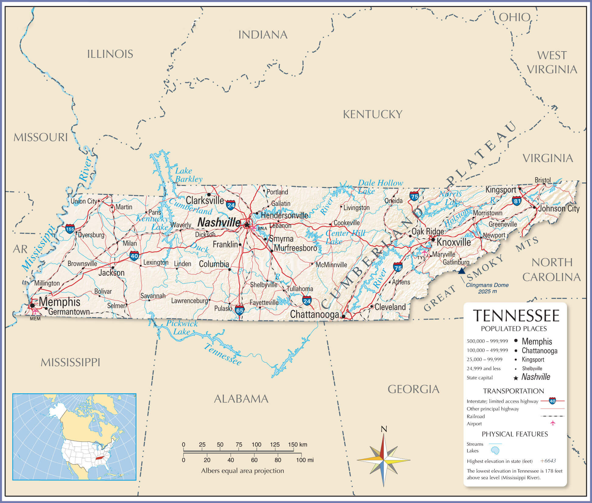
Tennessee physical map with main cities
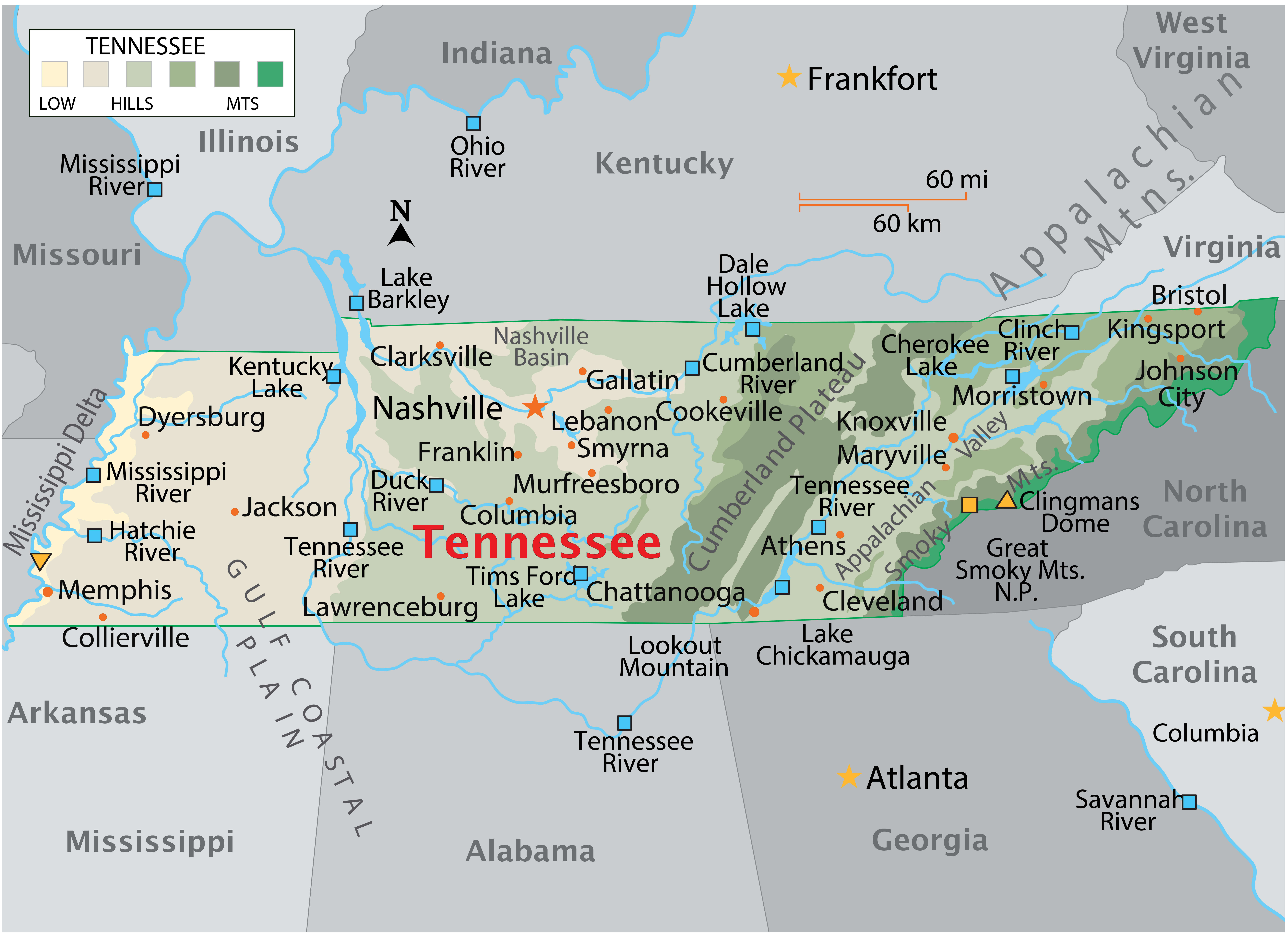
Map of Tennessee with cities
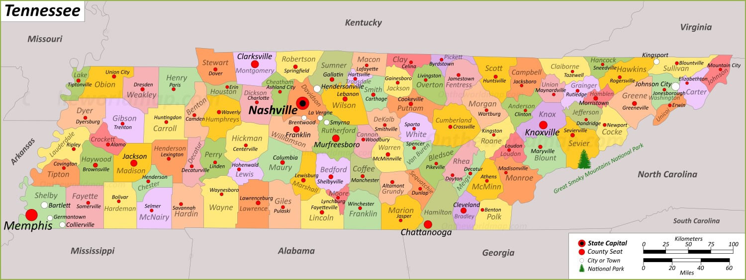
Geographic political map of Tennessee
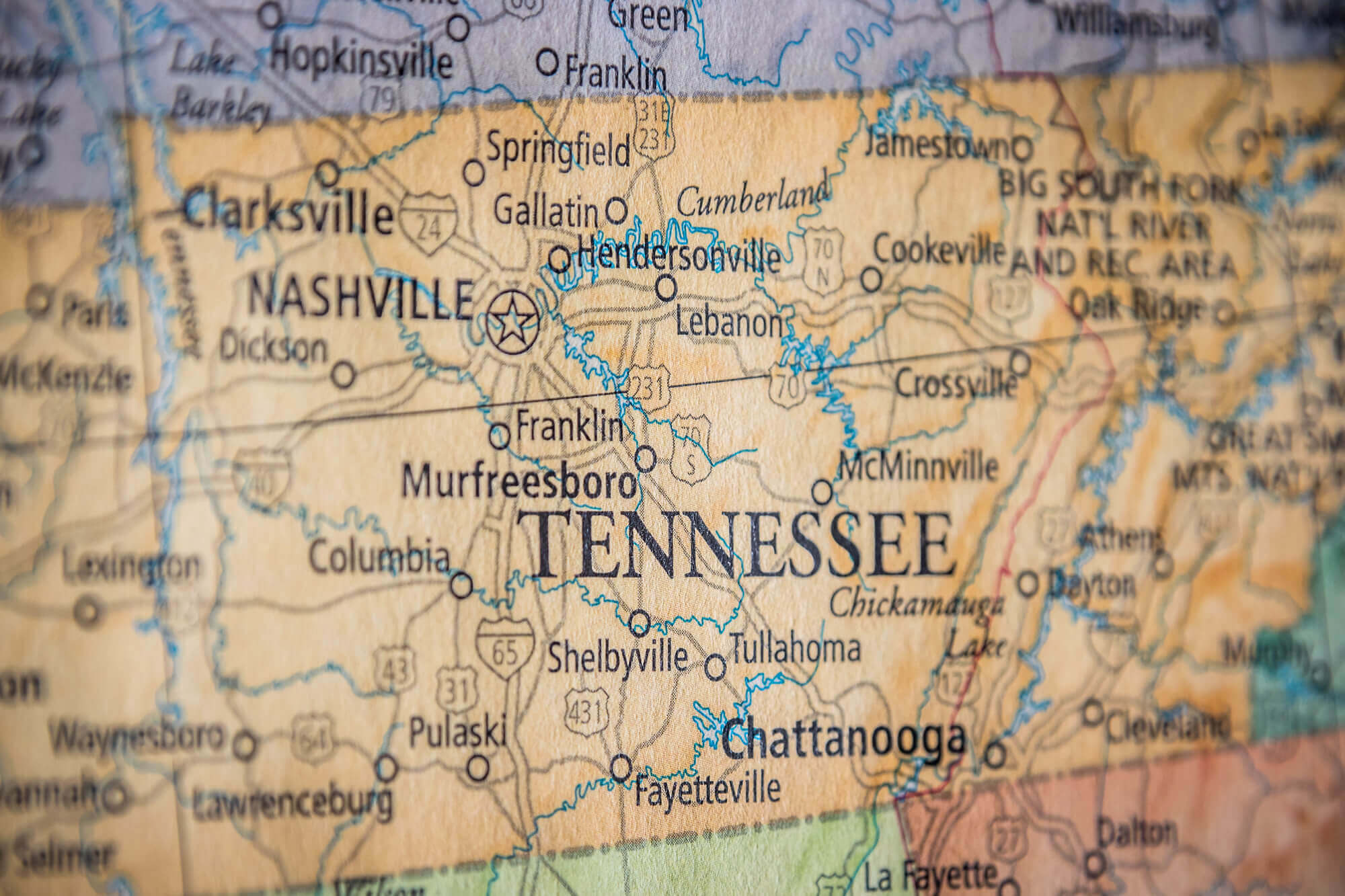
Map of Tennessee cities and roads

Physical map of Tennessee with cities
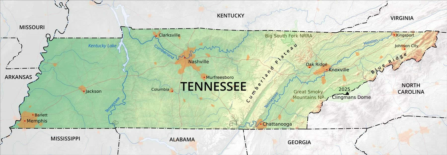
Road map of Tennessee with cities

Tennessee cities map with nashville
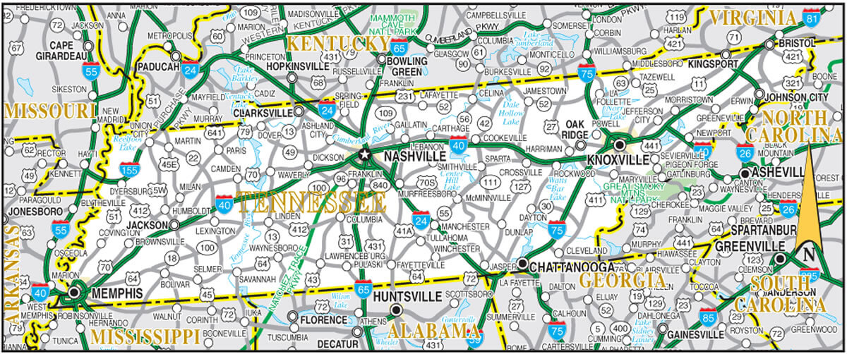
Tennessee cities map

Tennessee counties map US location
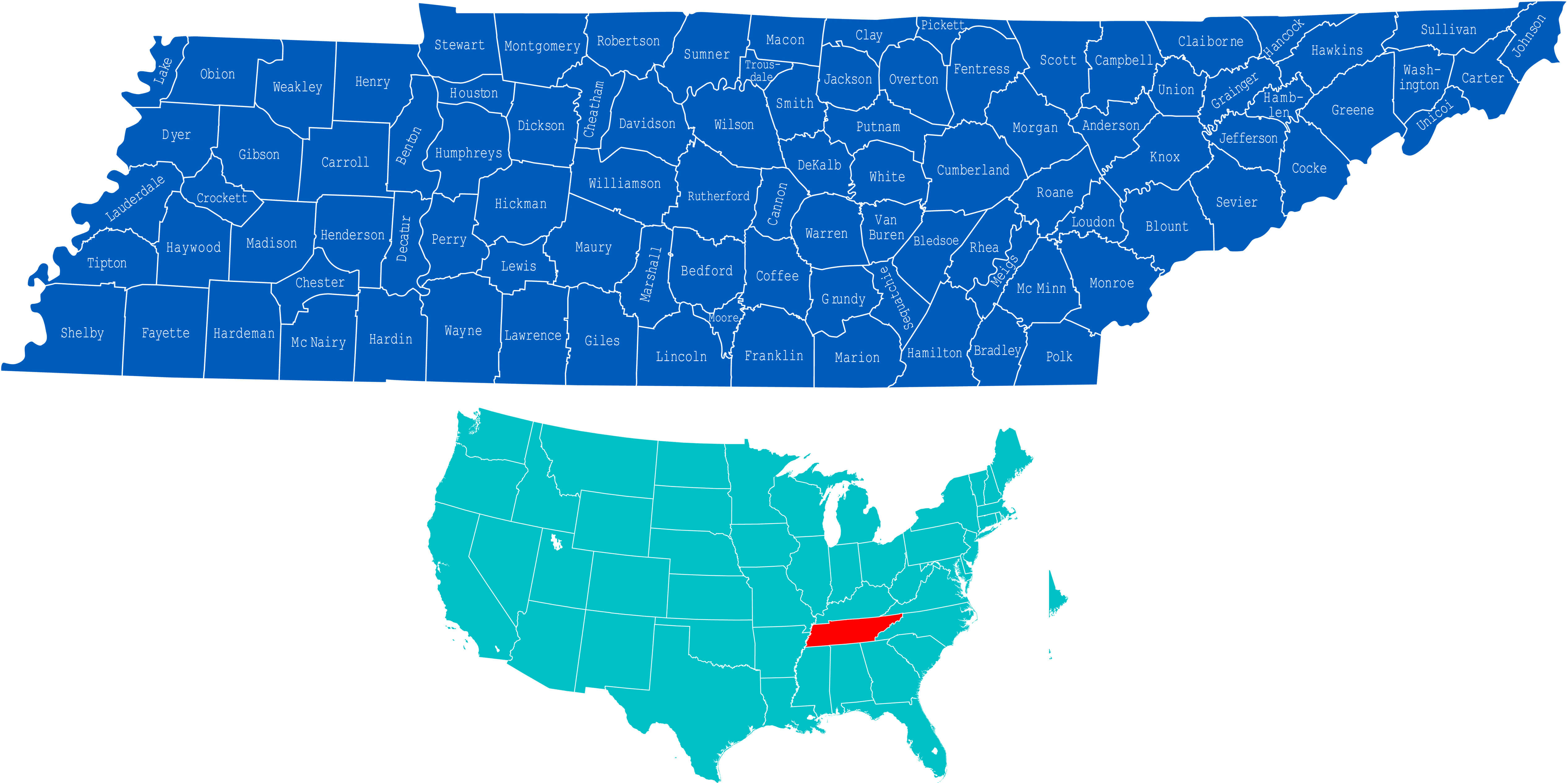
Tennessee counties map

Tennessee counties map

Tennessee county map with cities
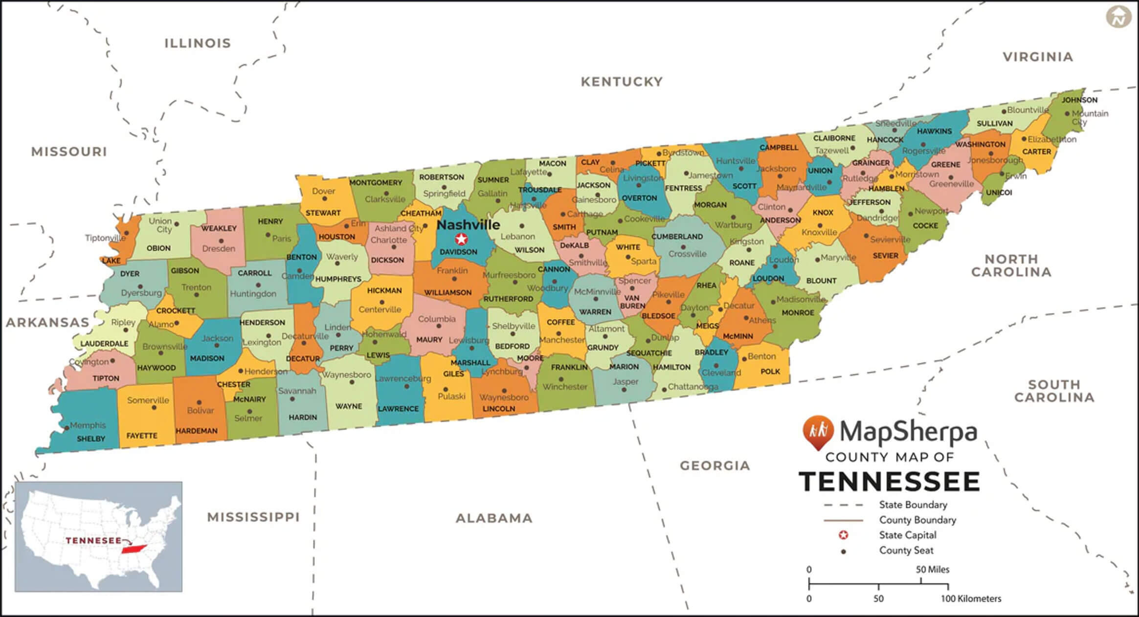
Tennessee interstate map with cities

Tennessee major cities map

Tennessee map boundaries with cities
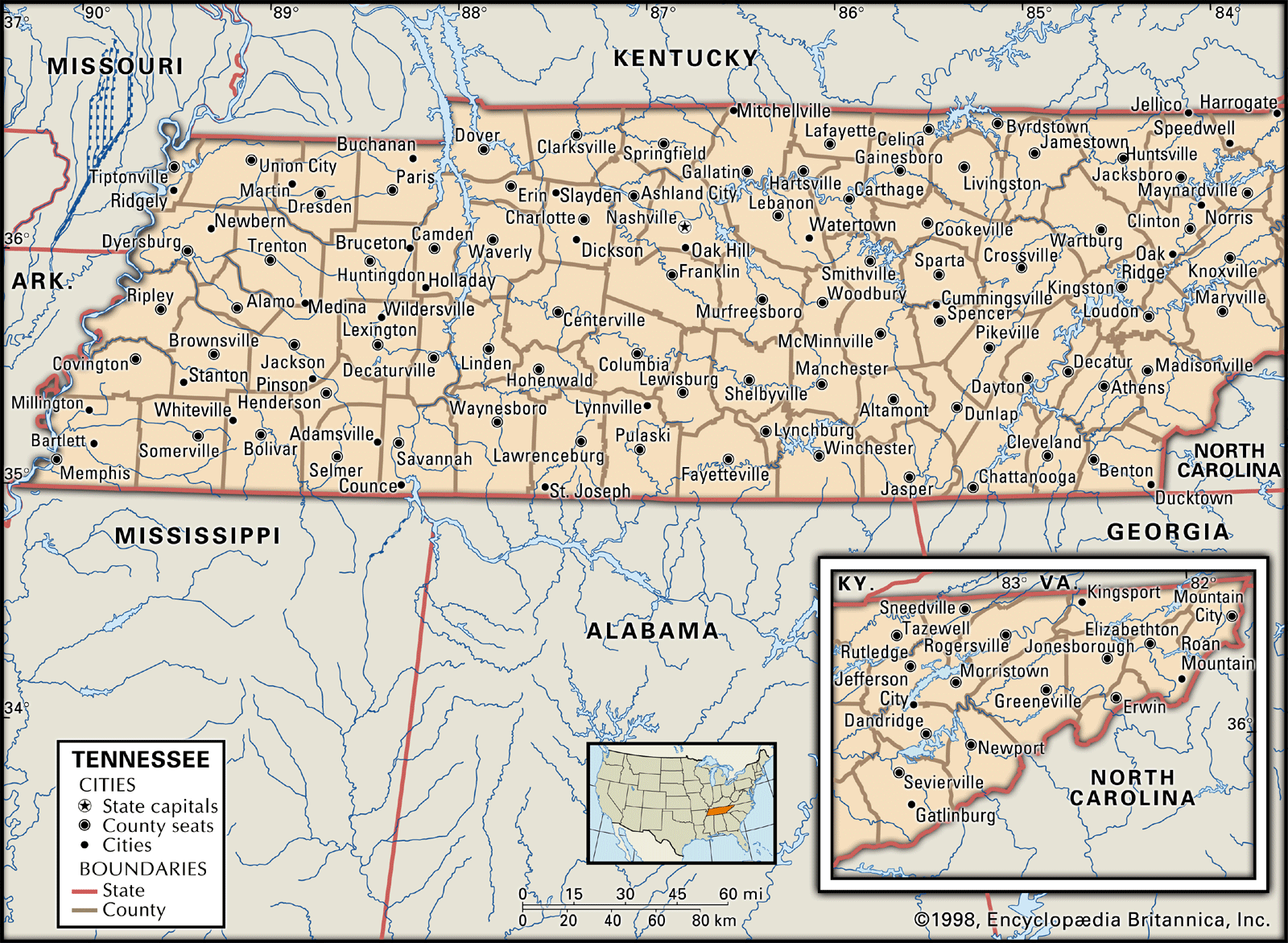
Tennessee map with counties capitals and major cities

Tennessee rivers map with cities

Tennessee road map with cities

Tennessee road map with cities

Tennessee state cities counties map with US
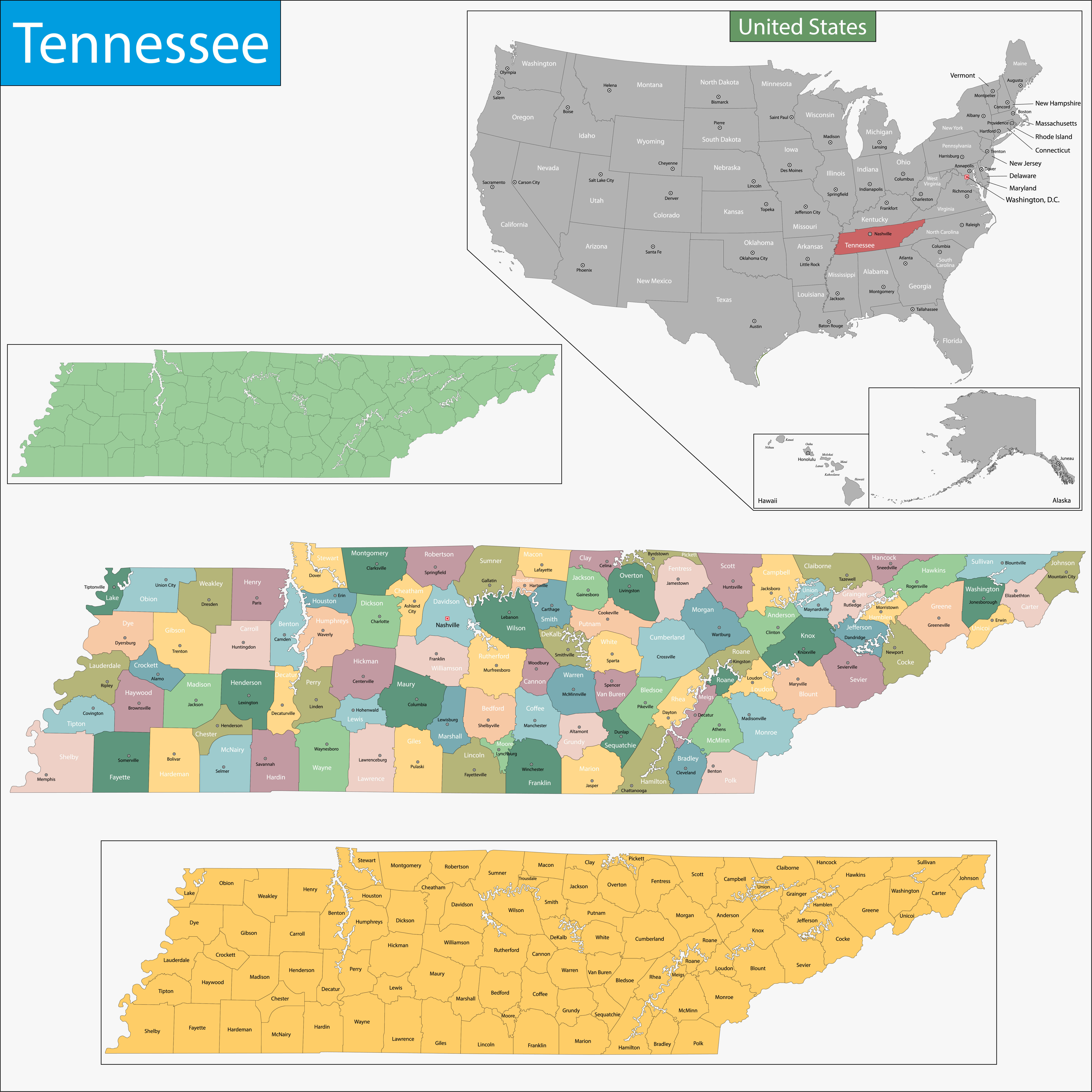
Tennessee state map with counties US
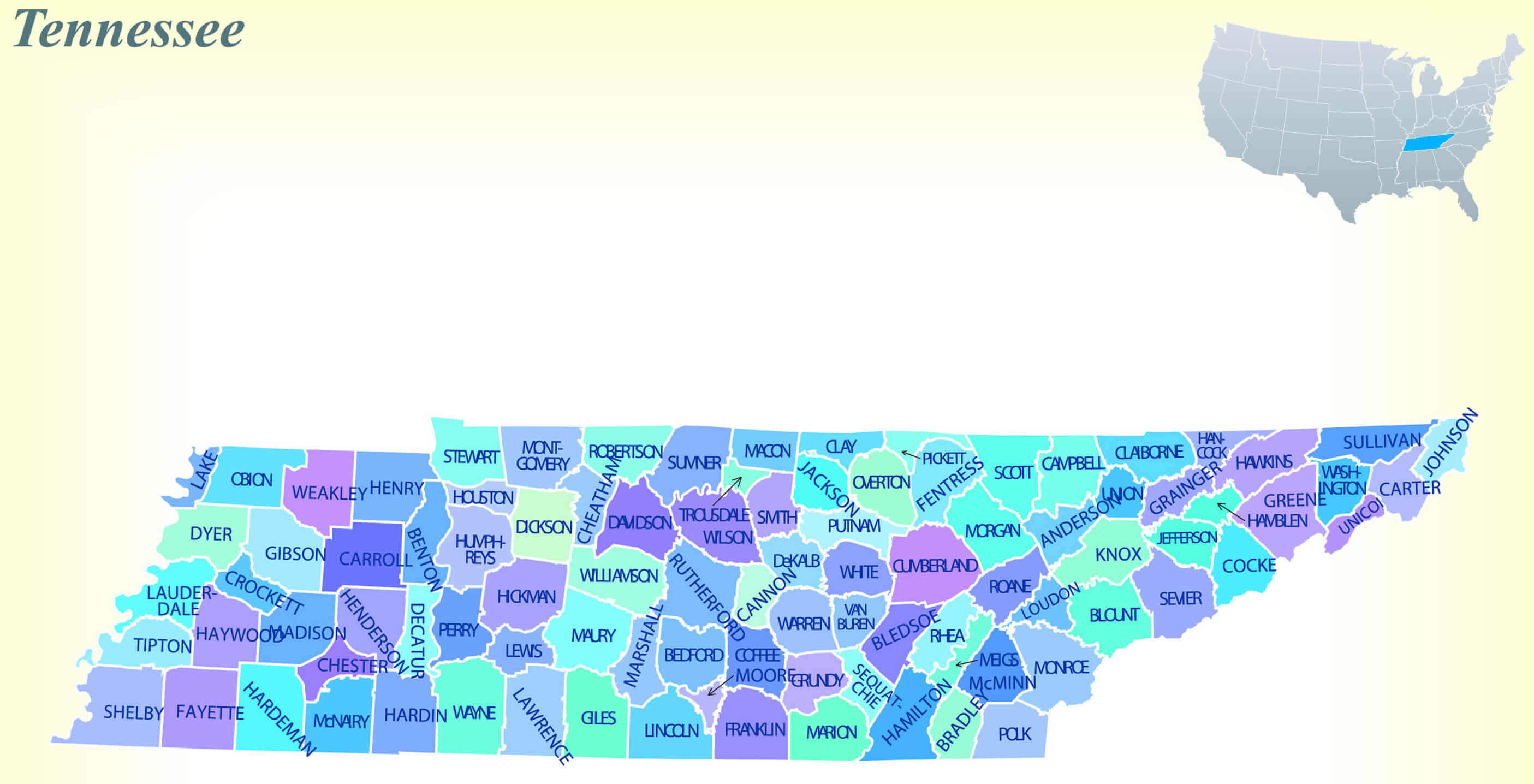
Where is Tennessee on the United States Map?
Show Google map, satellite map, where is the country located.
Get directions by driving, walking, bicycling, public transportation and travel with street view.
Feel free to explore these pages as well:
- Tennessee Map ↗️
- Map of Tennessee ↗️
- Tennessee Photos ↗️
- US Cities Map ↗️
- United States Cities Map ↗️
- California Cities Map ↗️
- Texas Cities Map ↗️
- New York Cities Map ↗️
- Florida Cities Map ↗️
- Pennsylvania Cities Map ↗️
- Illinois Cities Map ↗️
- Ohio Cities Map ↗️
- Georgia Cities Map ↗️
- North Carolina Cities Map ↗️
- Michigan Cities Map ↗️
- New Jersey Cities Map ↗️
- Virginia Cities Map ↗️
- Arizona Cities Map ↗️
- Washington Cities Map ↗️
- Massachusetts Cities Map ↗️
- Indiana Cities Map ↗️
- Maryland Cities Map ↗️
- Missouri Cities Map ↗️
- Wisconsin Cities Map ↗️
- United States Map ↗️
- Map of United States ↗️
- North America Map ↗️
- Advertisement -
