Discover a comprehensive Indiana Cities Map that brings together the state’s major cities, counties, interstates, rivers, and historical boundaries in one place. This collection includes colorful cities and counties maps, detailed Indiana cities and roads maps, physical maps with cities, populated city maps, and even rare historical resources such as the Indiana historical map of 1817 and the Indiana Indian treaties map of 1816.
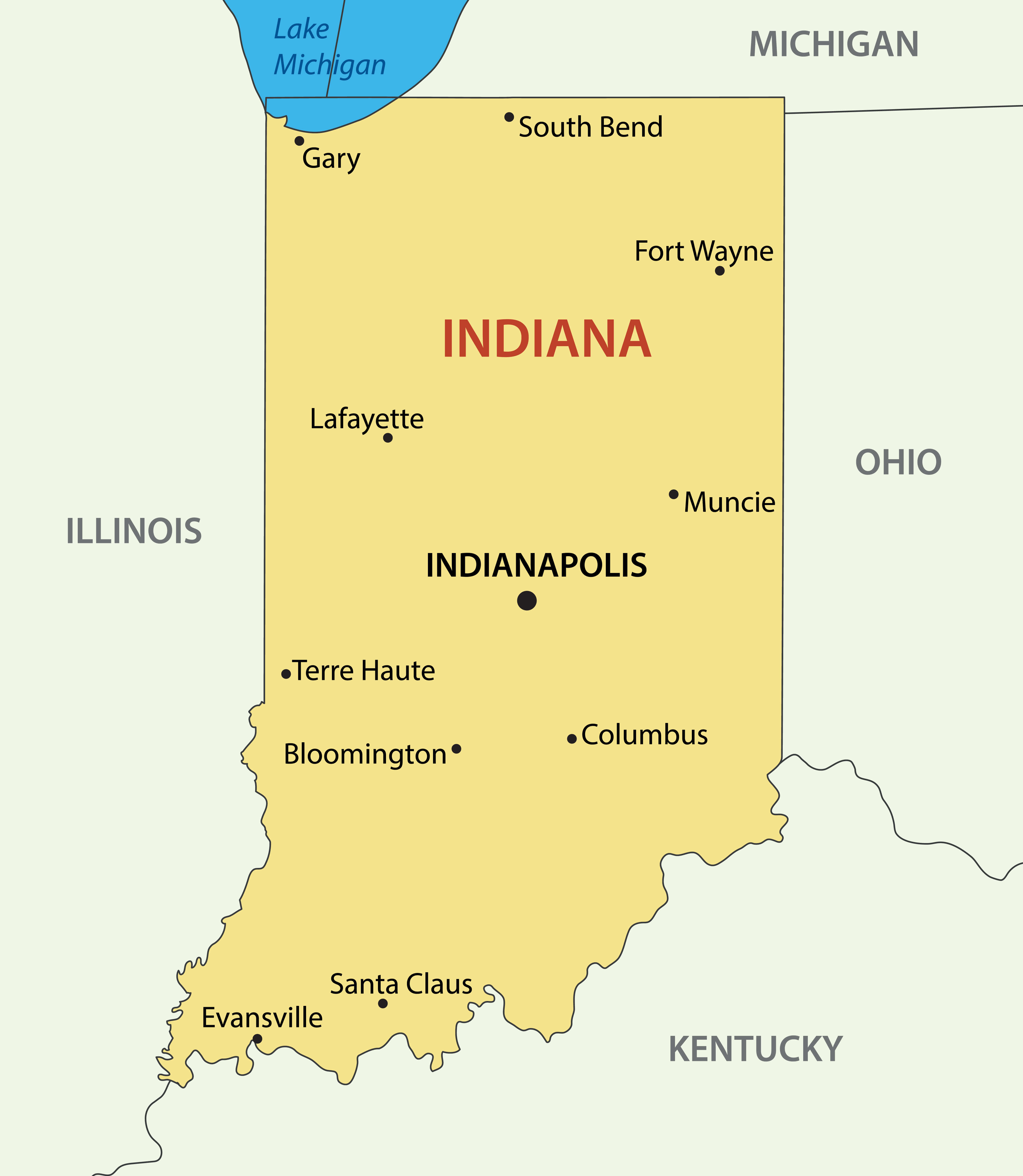
Indiana Largest Cities Map with Capital City
 Indiana map showing largest cities, major rivers, borders, and capital Indianapolis.
Whether you’re looking for the largest cities map, county maps, state road maps, or a large detailed regions map of Indiana, this page offers everything—from modern layouts to Indiana cities maps from the 1900s. Explore accurate boundaries, counties, and highways with easy-to-read visuals, including a unique Indiana map with cities, counties, and the state flag.
Indiana cities map

Indiana major cities map

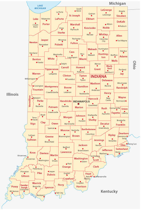
Cities and counties map of Indiana state

Colorful cities detail_map of Indiana

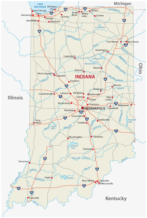
Indiana cities and rivers map

Indiana cities and roads map with flag

Indiana cities map in 1900

Indiana counties and cities map

Indiana counties and cities map

Indiana counties and highways map

Indiana counties map

Indiana counties map

Indiana county map US

Indiana historical map 1817

Indiana indian treaties map in 1816

Indiana main cities map

Indiana map boundaries map with cities

Indiana physical and cities map with roads

Indiana physical map with cities

Indiana populated cities map

Indiana state road map

Interstate road map of Indiana

Large detailed regions map of Indiana state with cities

Map of Indiana with cities and roads

Map of the state of Indiana with cities

State map of Indiana with cities and counties

Where is Indiana on the United States Map?
Show Google map, satellite map, where is the country located.
Get directions by driving, walking, bicycling, public transportation and travel with street view.
<Feel free to explore these pages as well:
- Indiana Map ↗️
- Map of Indiana ↗️
- Indiana Photos ↗️
- US Cities Map ↗️
- United States Cities Map ↗️
- California Cities Map ↗️
- Texas Cities Map ↗️
- New York Cities Map ↗️
- Florida Cities Map ↗️
- Pennsylvania Cities Map ↗️
- Illinois Cities Map ↗️
- Ohio Cities Map ↗️
- Georgia Cities Map ↗️
- North Carolina Cities Map ↗️
- Michigan Cities Map ↗️
- New Jersey Cities Map ↗️
- Virginia Cities Map ↗️
- Arizona Cities Map ↗️
- Washington Cities Map ↗️
- Tennessee Cities Map ↗️
- Massachusetts Cities Map ↗️
- Maryland Cities Map ↗️
- Missouri Cities Map ↗️
- Wisconsin Cities Map ↗️
- United States Map ↗️
- Map of United States ↗️
- North America Map ↗️
