Florida Cities Map

HomeMapsFlorida Cities Map
- Advertisement -

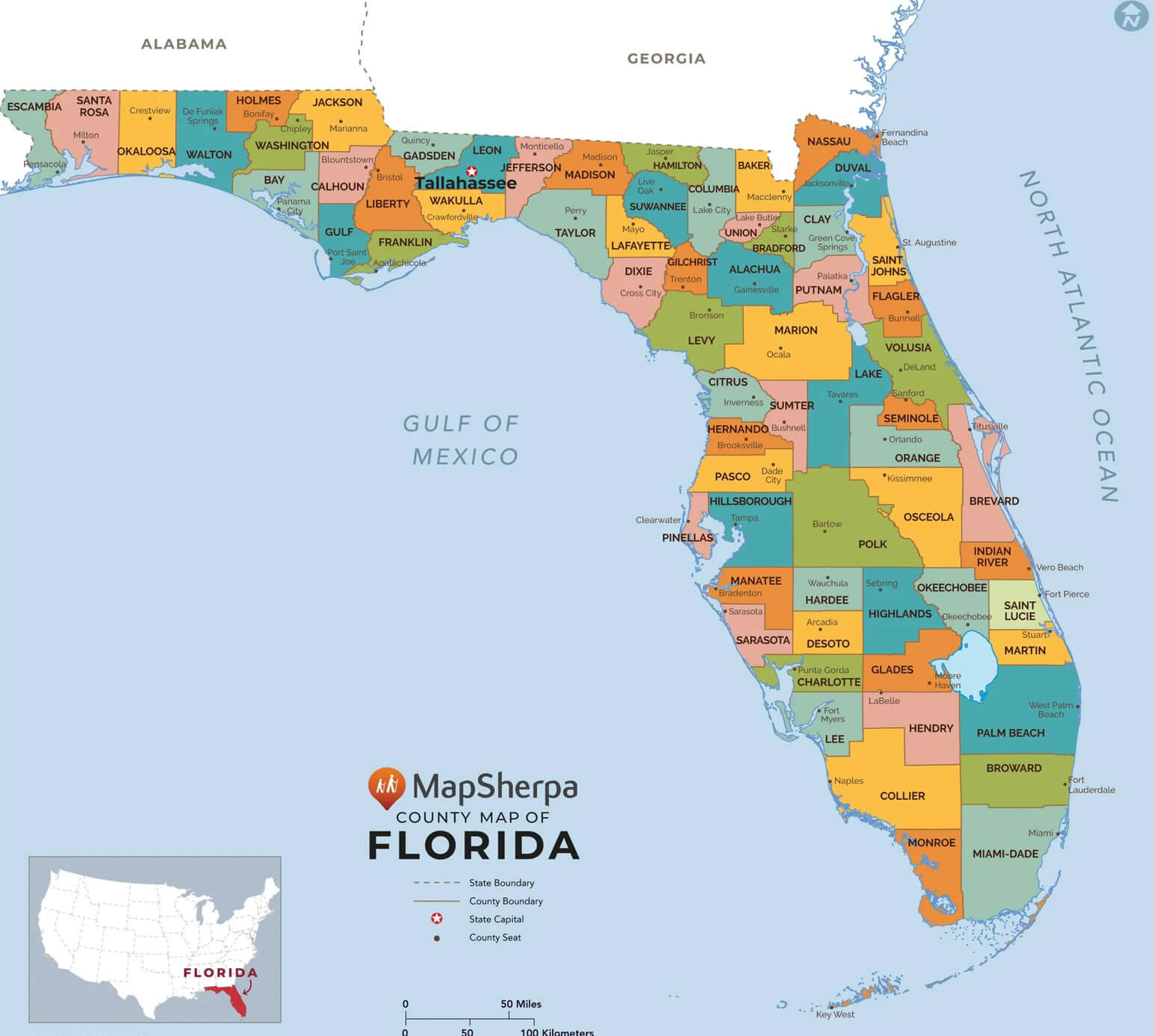
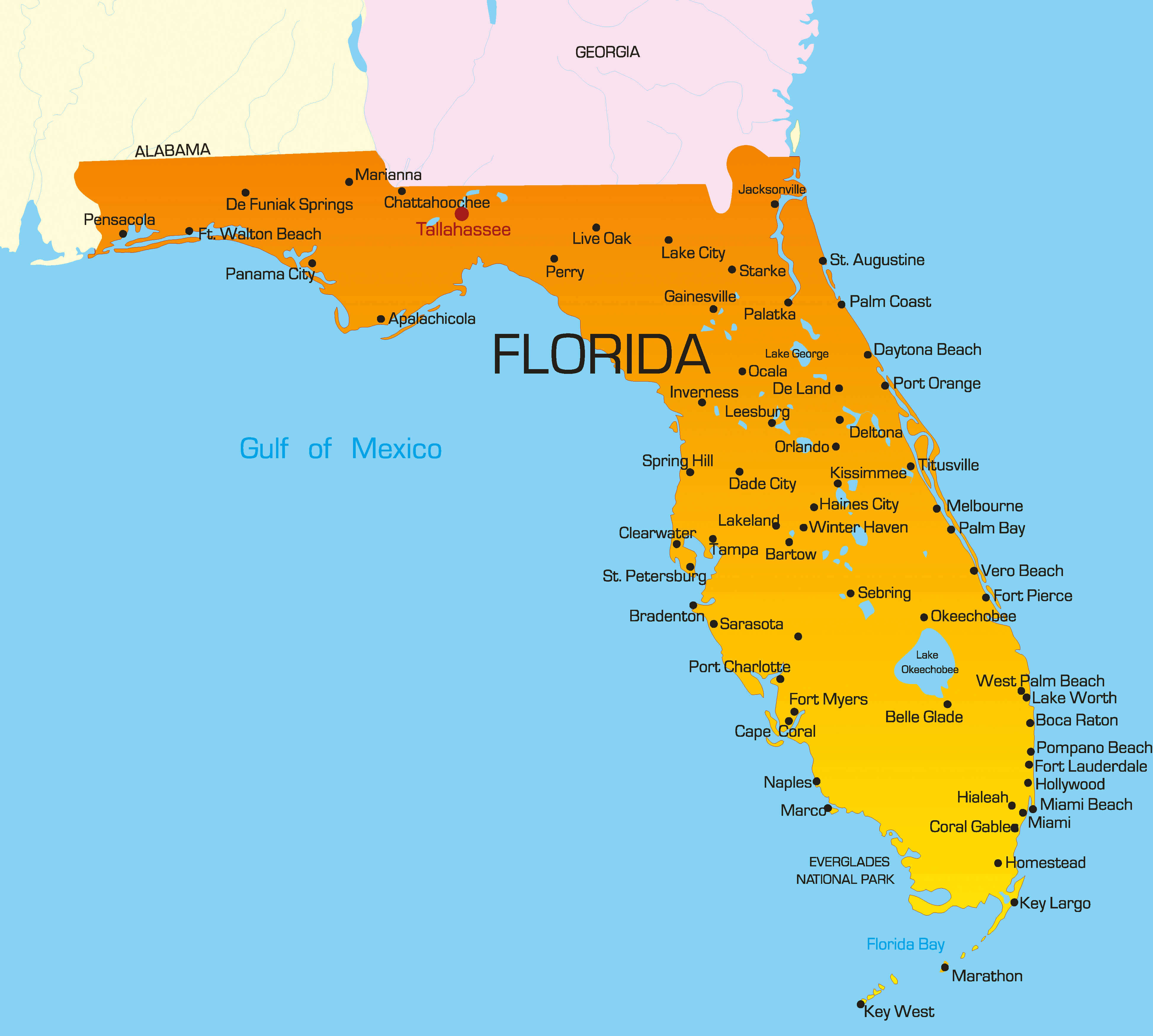
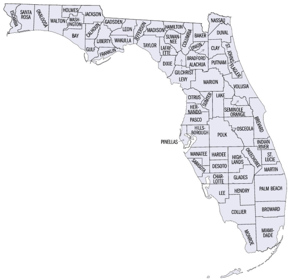
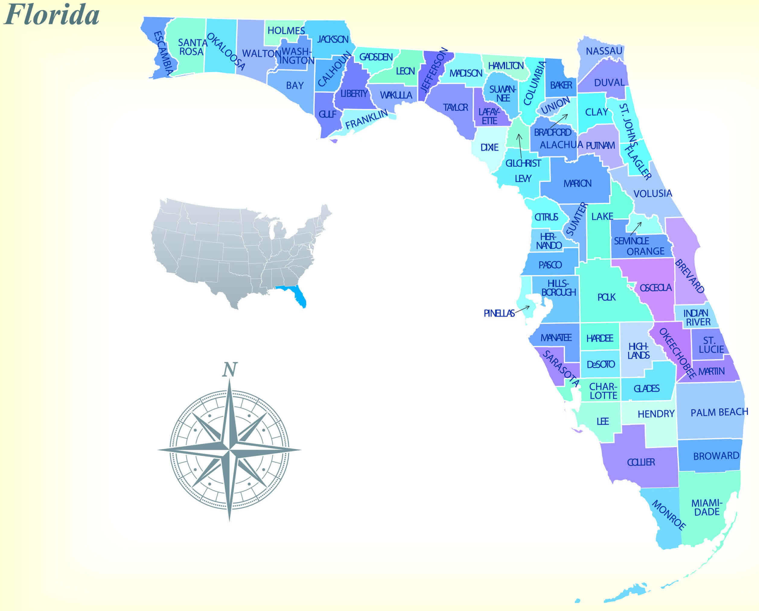
Explore our detailed Florida Cities Map, featuring all 67 counties of Florida and their major cities, roads, and highways. This interactive Florida administrative map helps you easily locate Florida’s regions, national parks, and populated places.

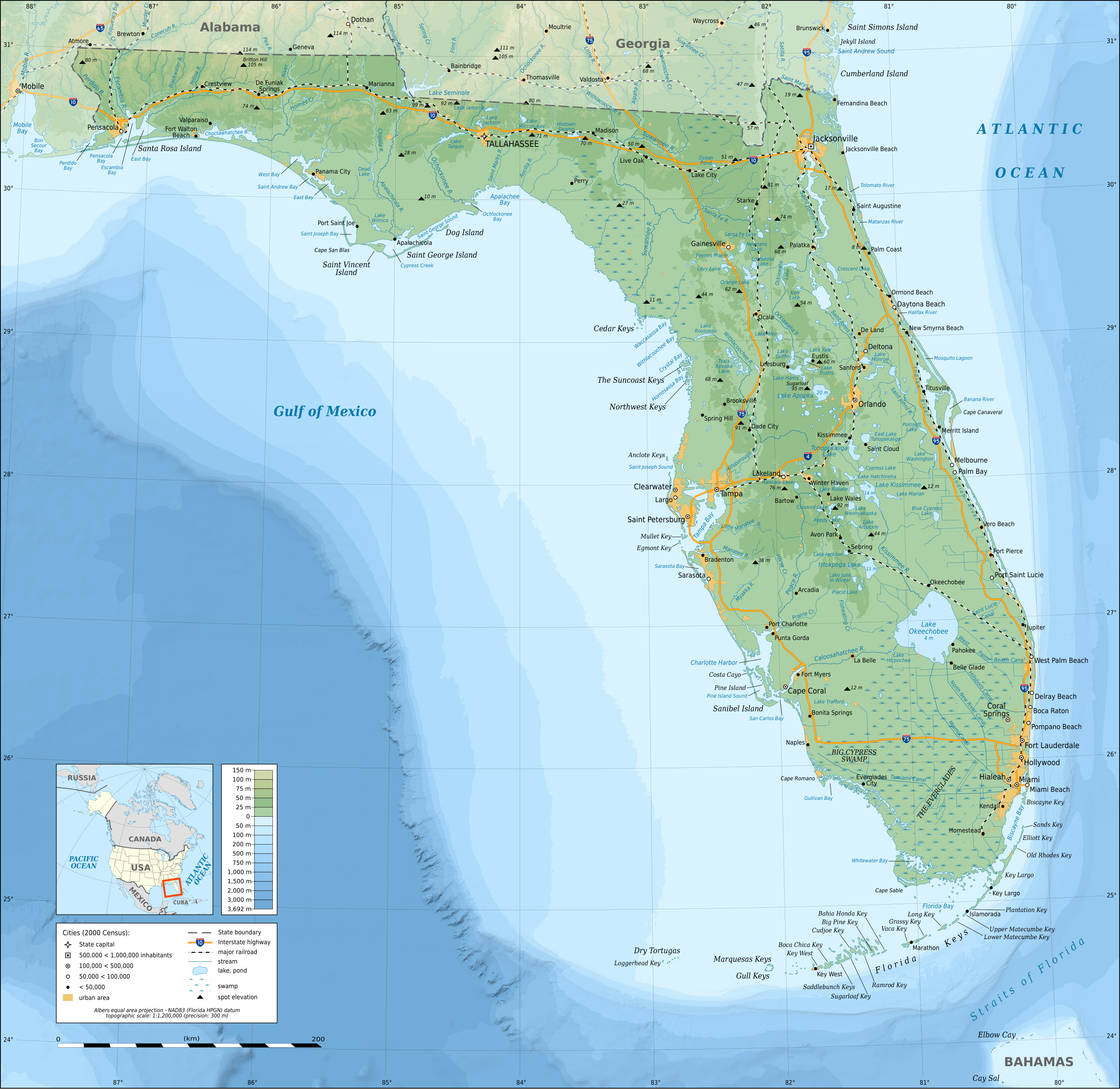
Whether you’re planning a road trip, studying Florida counties by population, or just exploring, this Florida state map with cities and counties provides a clear view of Florida’s major cities, colorful regions, and topographic details across the US state of Florida.

Florida State Map with Largest Cities
Florida state map with largest cities
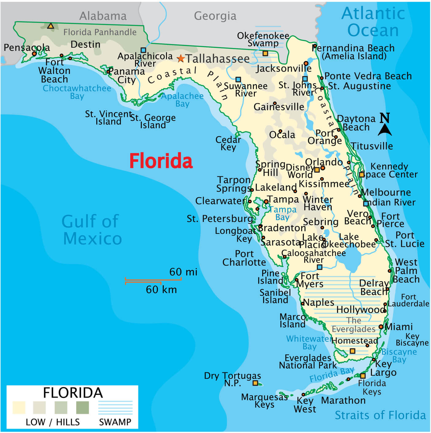
Florida state map showing major cities, roads, rivers, and coastal regions.

This Florida state map displays the largest cities including Miami, Orlando, Tampa, and Jacksonville. It highlights major highways, rivers, and coastal areas along the Gulf of Mexico and Atlantic Ocean, offering a clear overview of Florida’s geography and key urban centers.

Florida counties cities map US

Florida counties cities map US

Cities map of Florida
Cities map of Florida

67 counties map in Florida
67 counties map in Florida

Florida administrative map
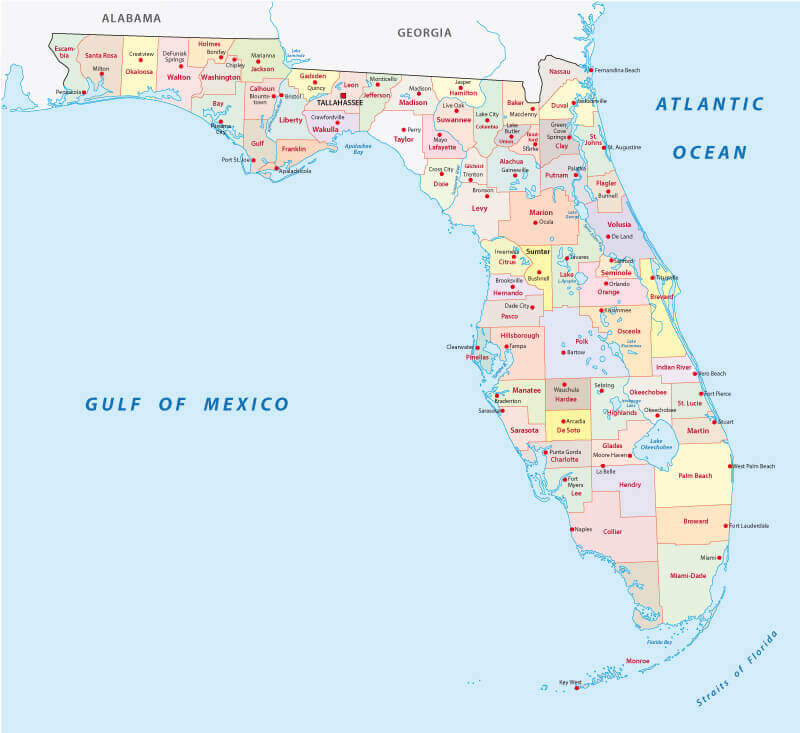
Florida administrative map

Florida area map with cities
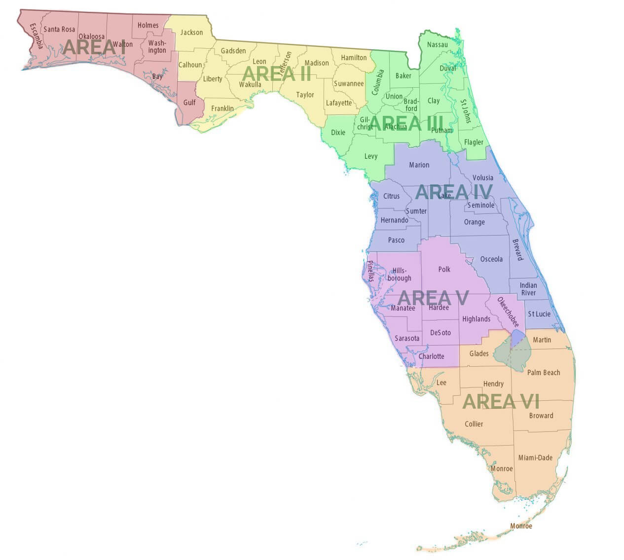
Florida area map with cities

Florida cities map by population in the US
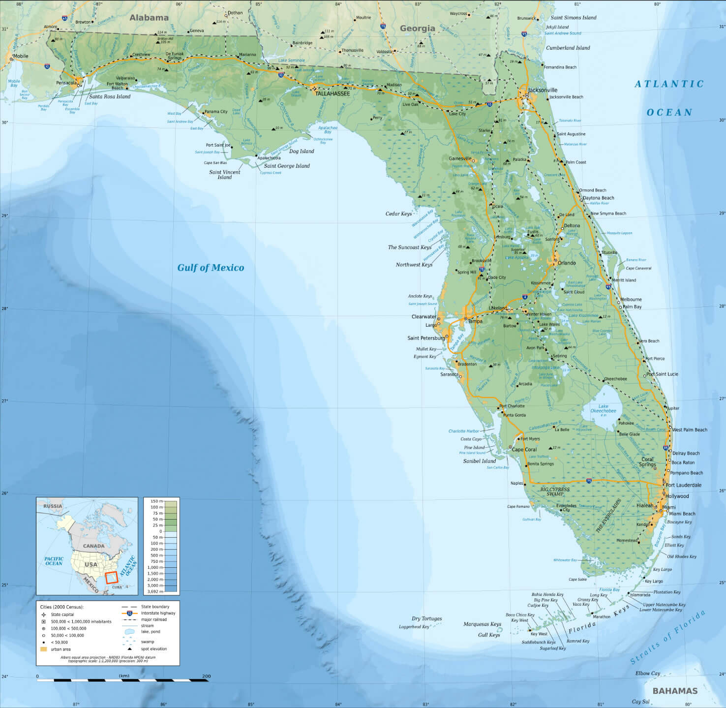
Florida cities map by population in the US

Florida cities map with national parks
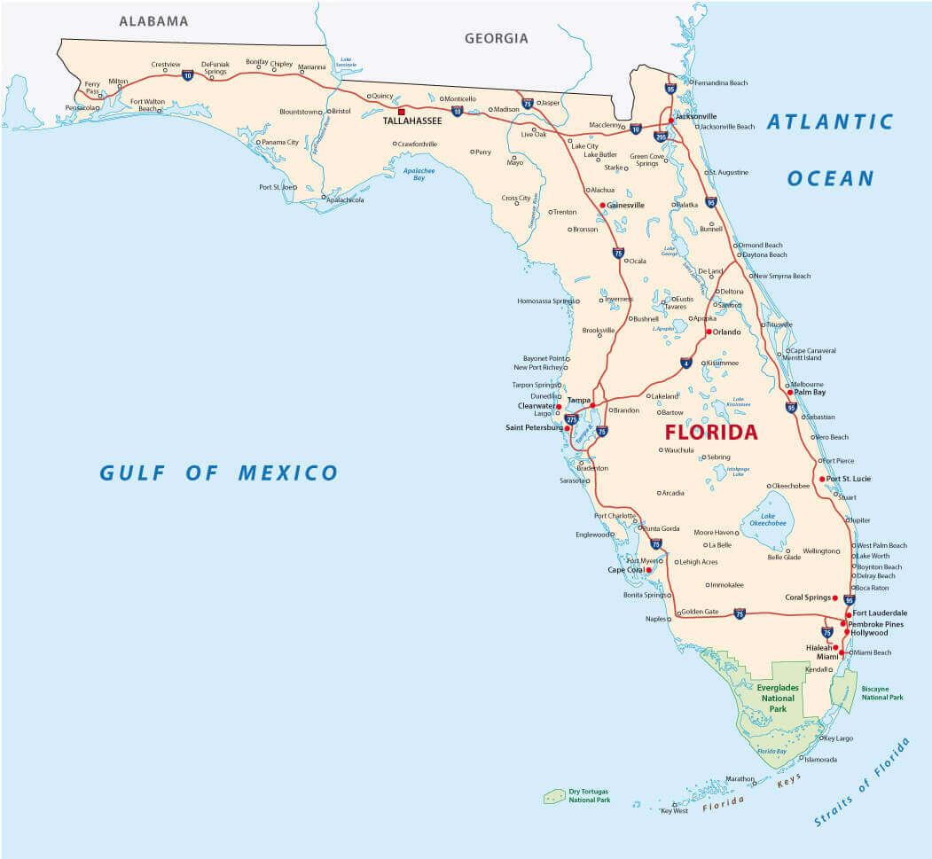
Florida cities map with national parks

Florida counties map US location map
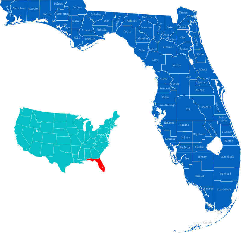
Florida counties map US location map

Florida counties road map
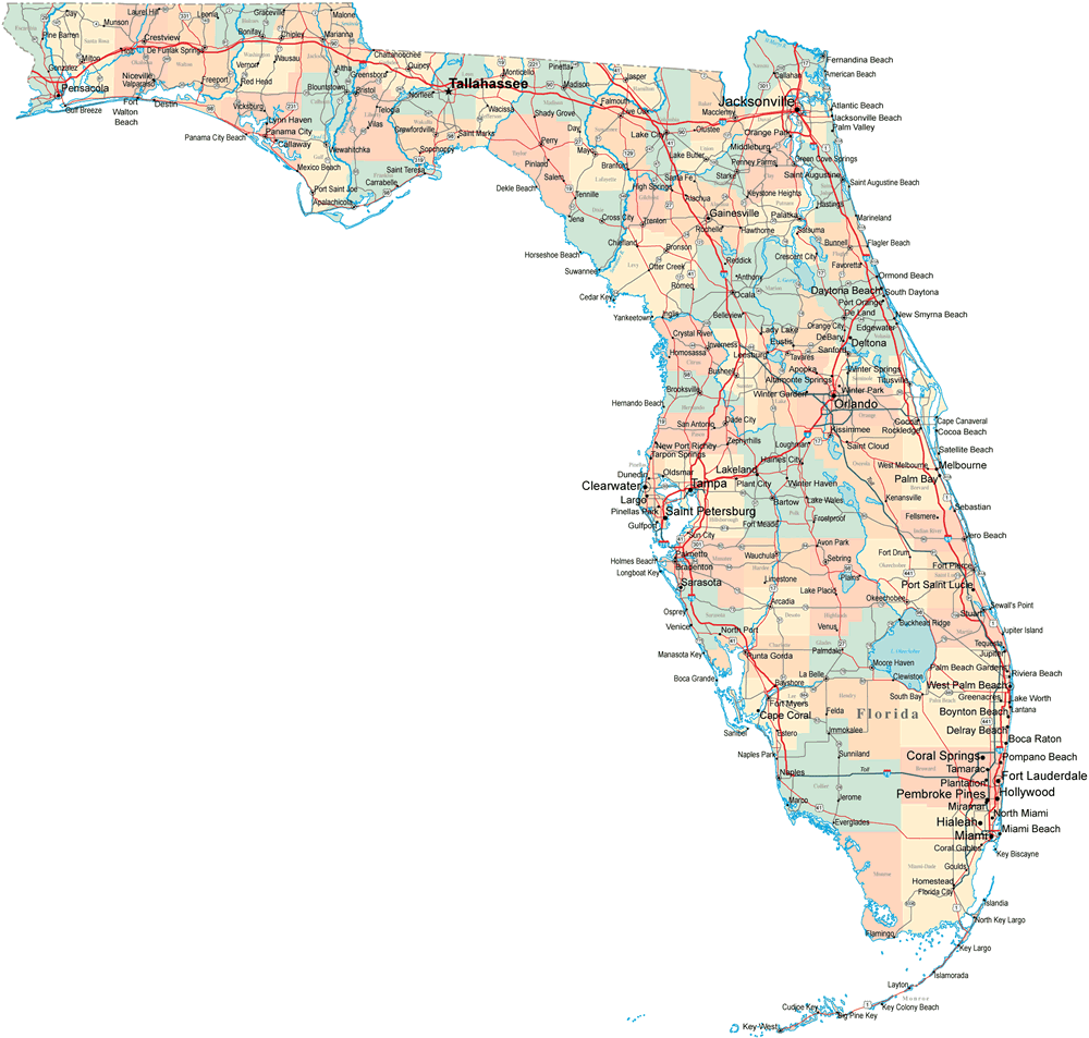
Florida counties road map

Florida county map with cities
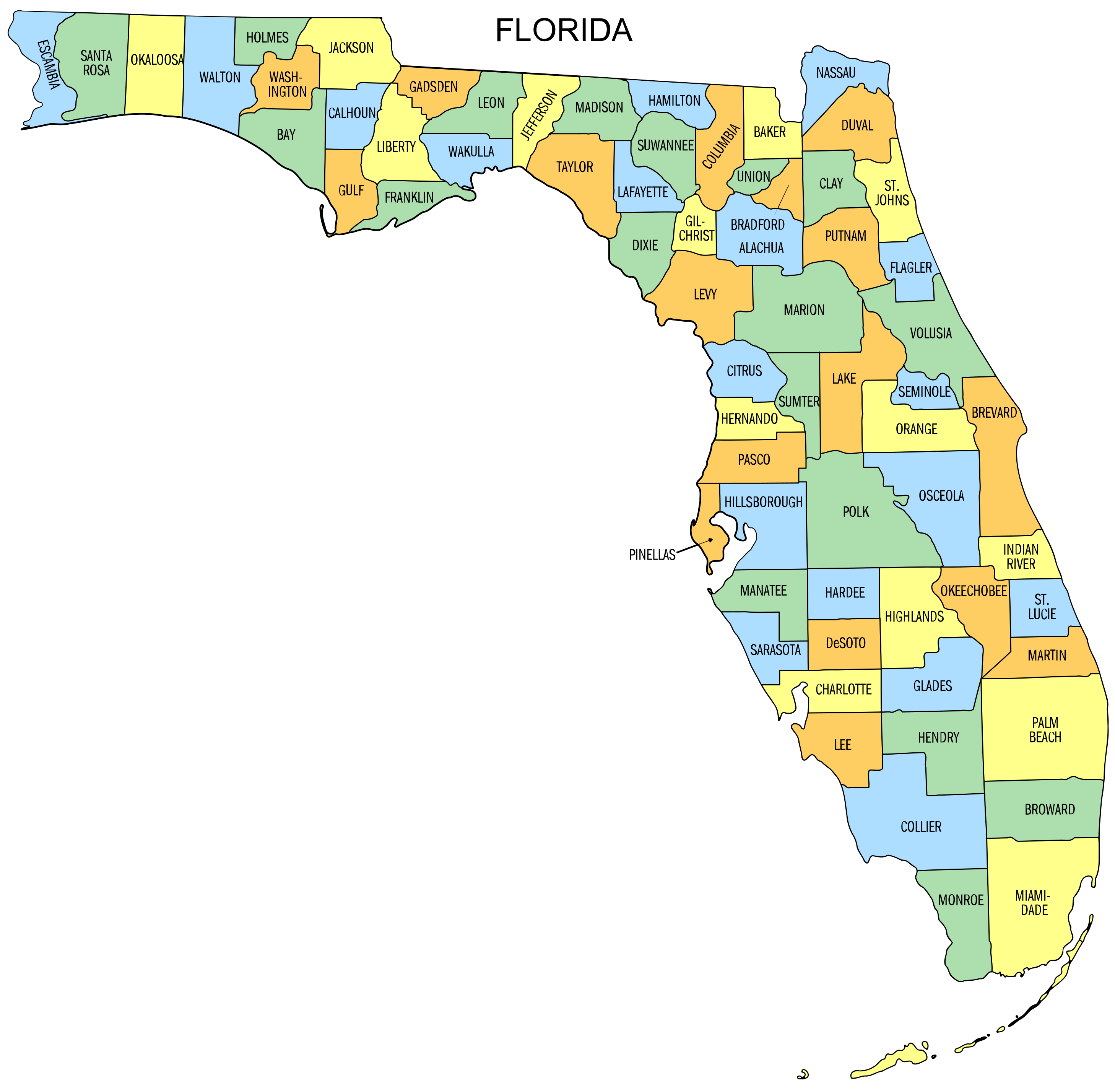
Florida county map with cities

Florida county map

Florida county map

Florida highways cities roads map
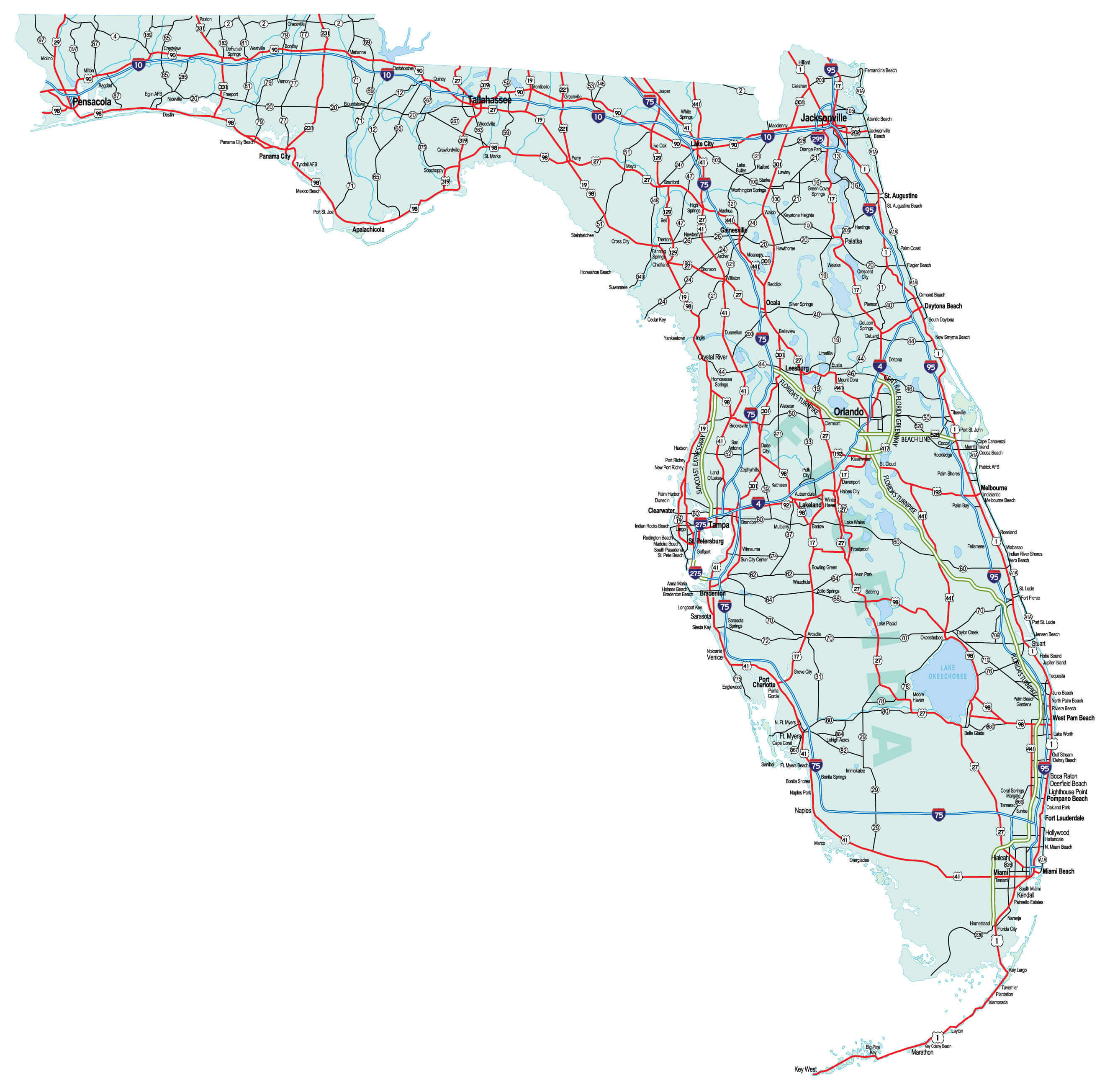
Florida highways cities roads map

Florida interstate map
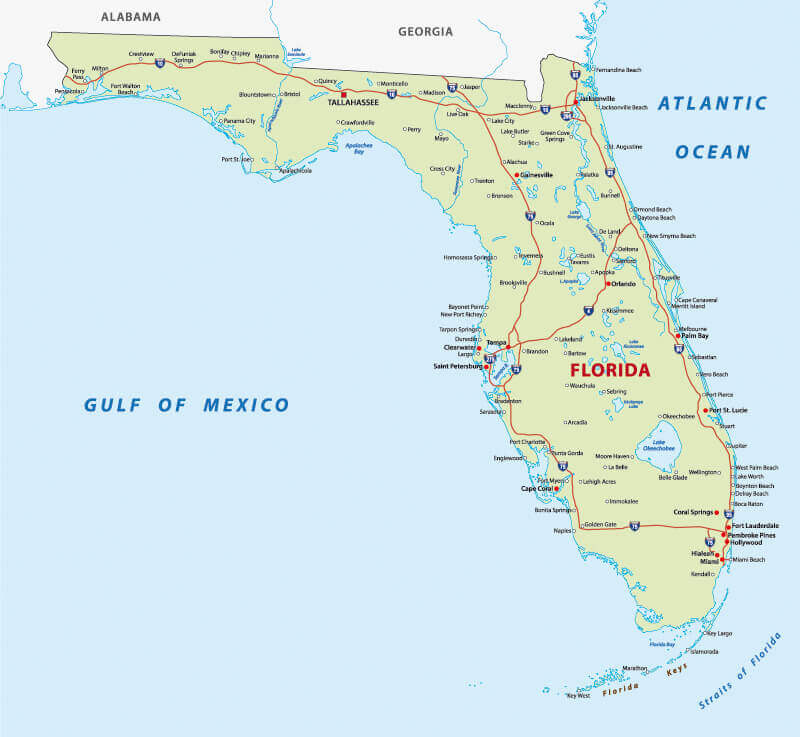
Florida interstate map

Florida main cities map
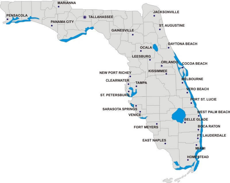
Florida main cities map

Florida major cities colorful map
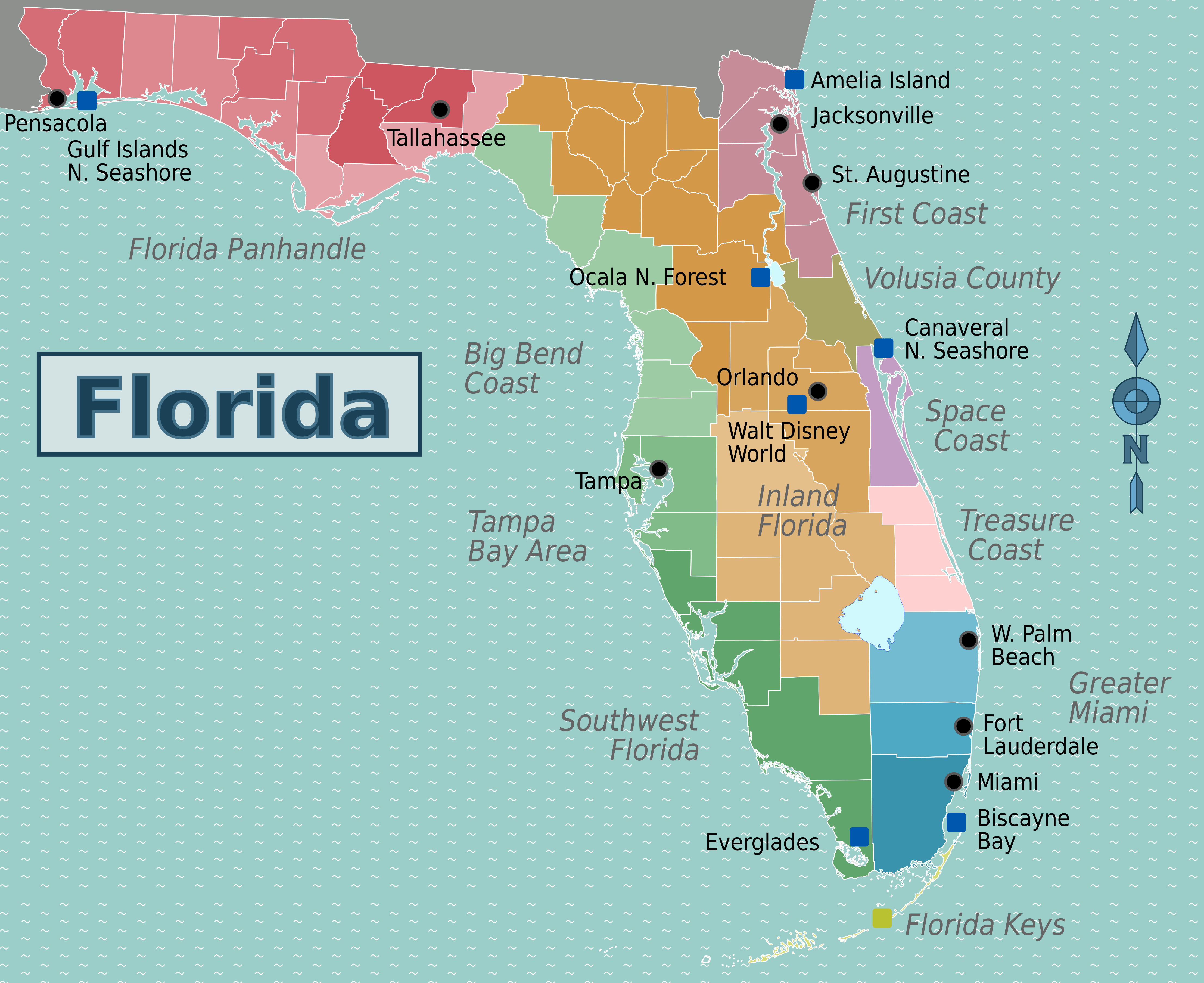
Florida major cities colorful map

Florida map cities
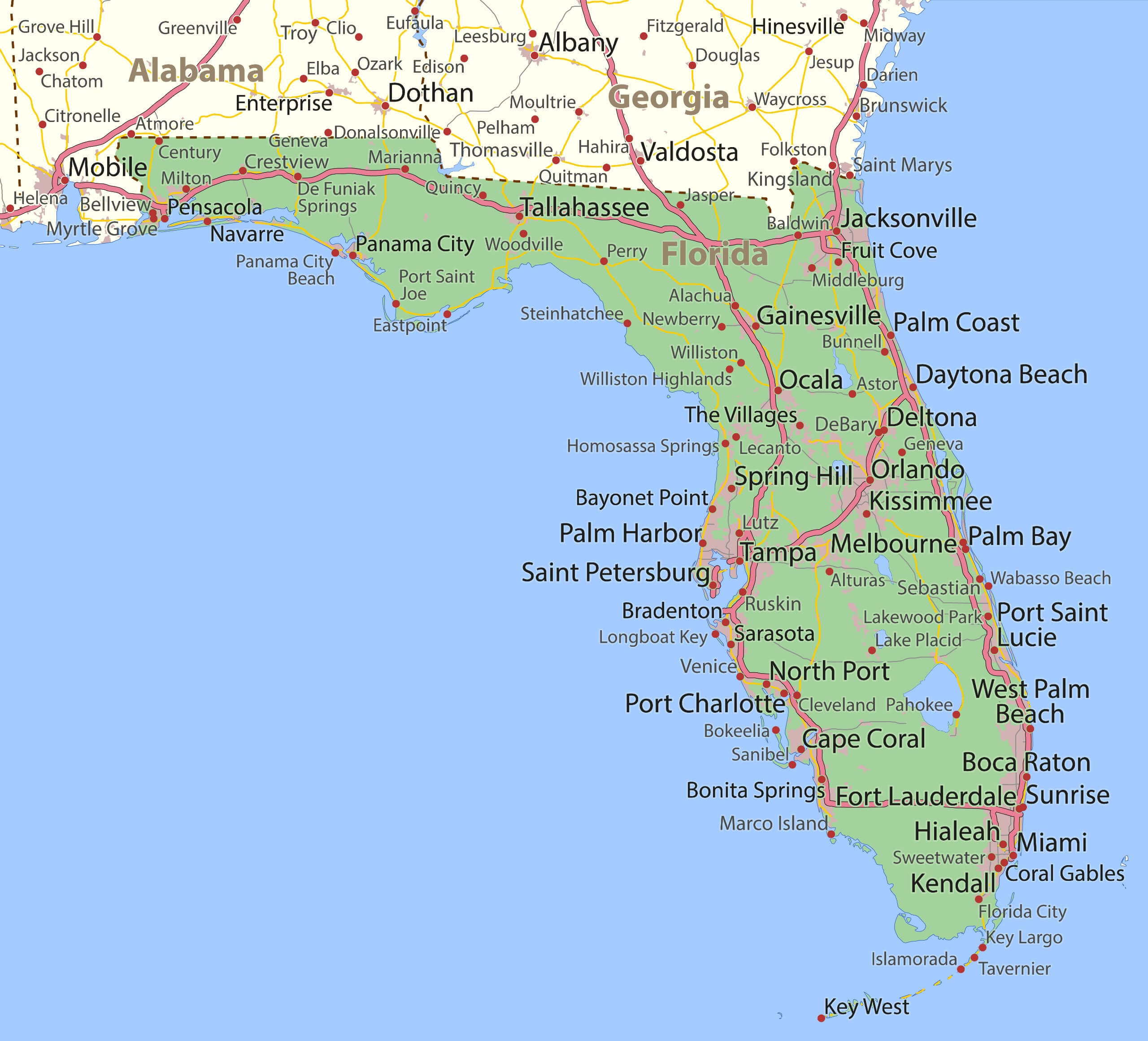
Florida map cities

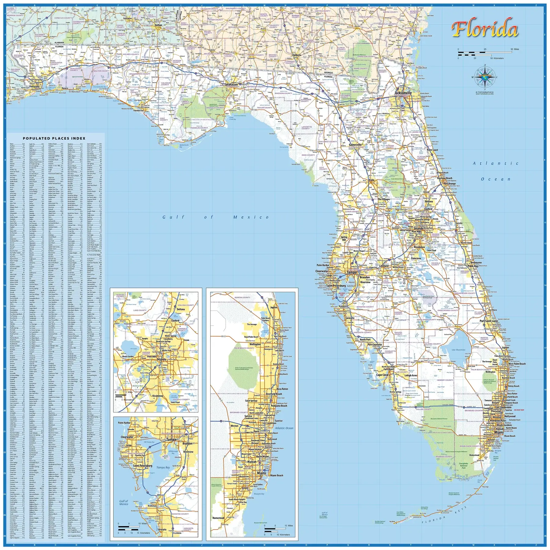
Florida populated places map
Florida populated places map

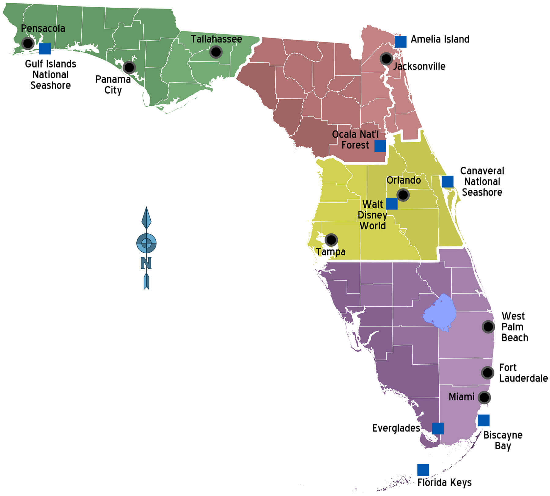
Florida regions and cities map
Florida regions and cities map

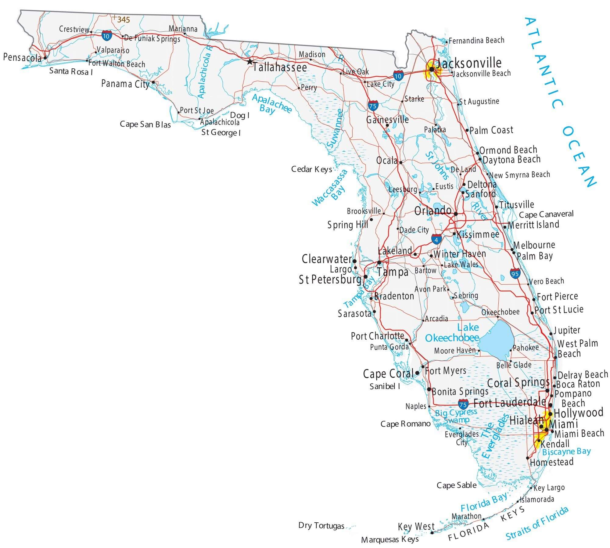
Florida road map with cities
Florida road map with cities

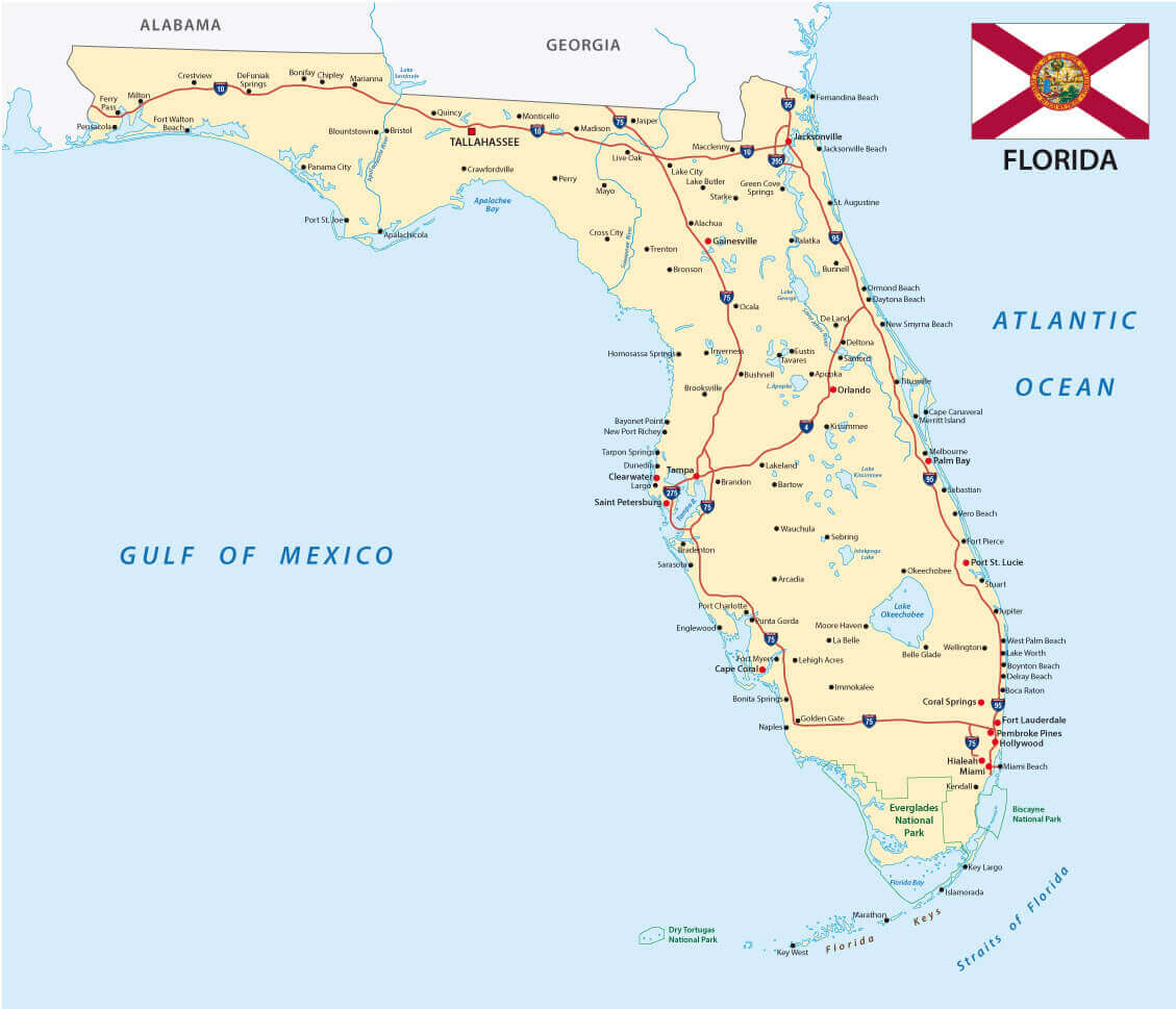
Florida state city road map
Florida state city road map

Florida state map with counties and cities
Florida state map with counties and cities

Florida topographic map with cities
Florida topographic map with cities

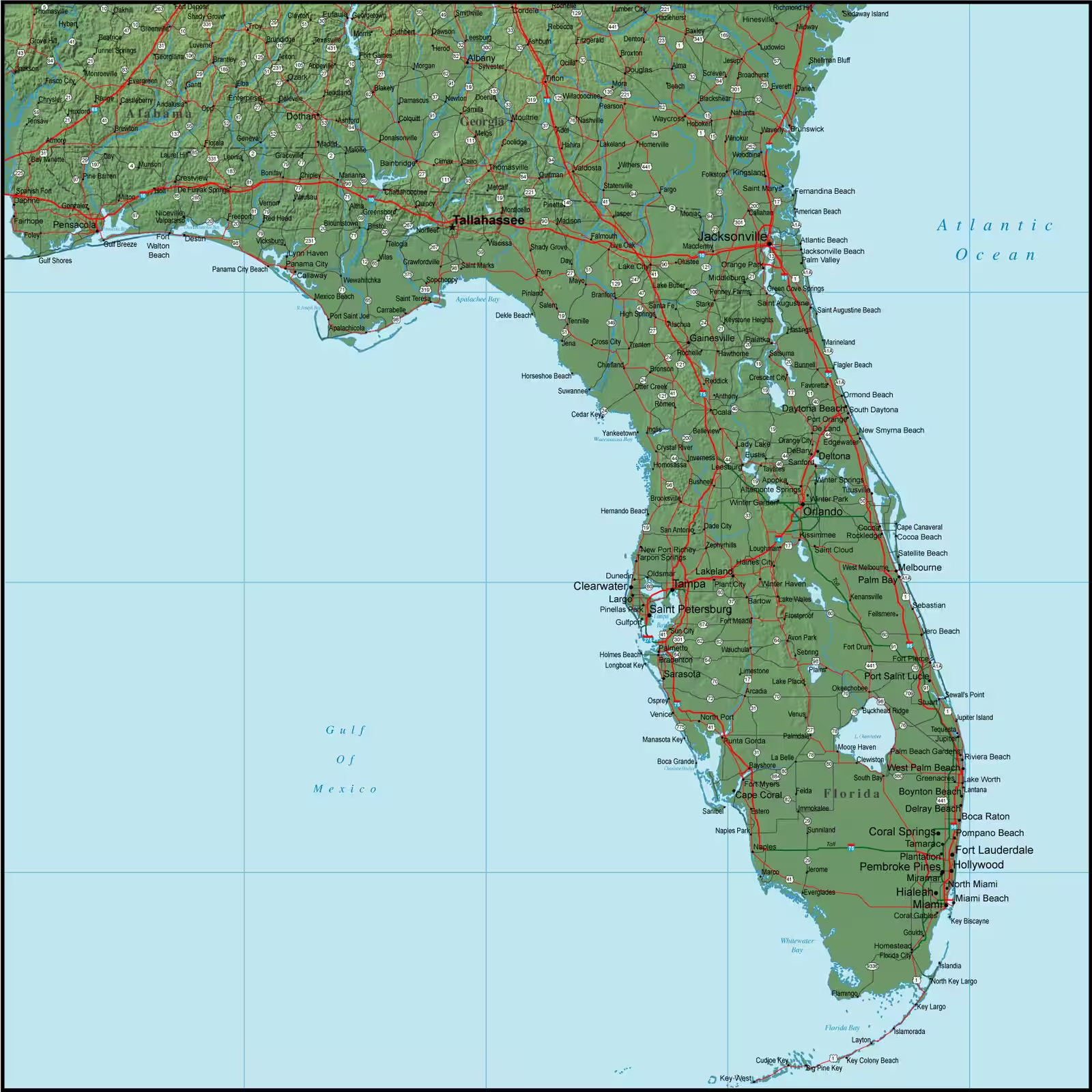
Map of Florida with cities
Map of Florida with cities

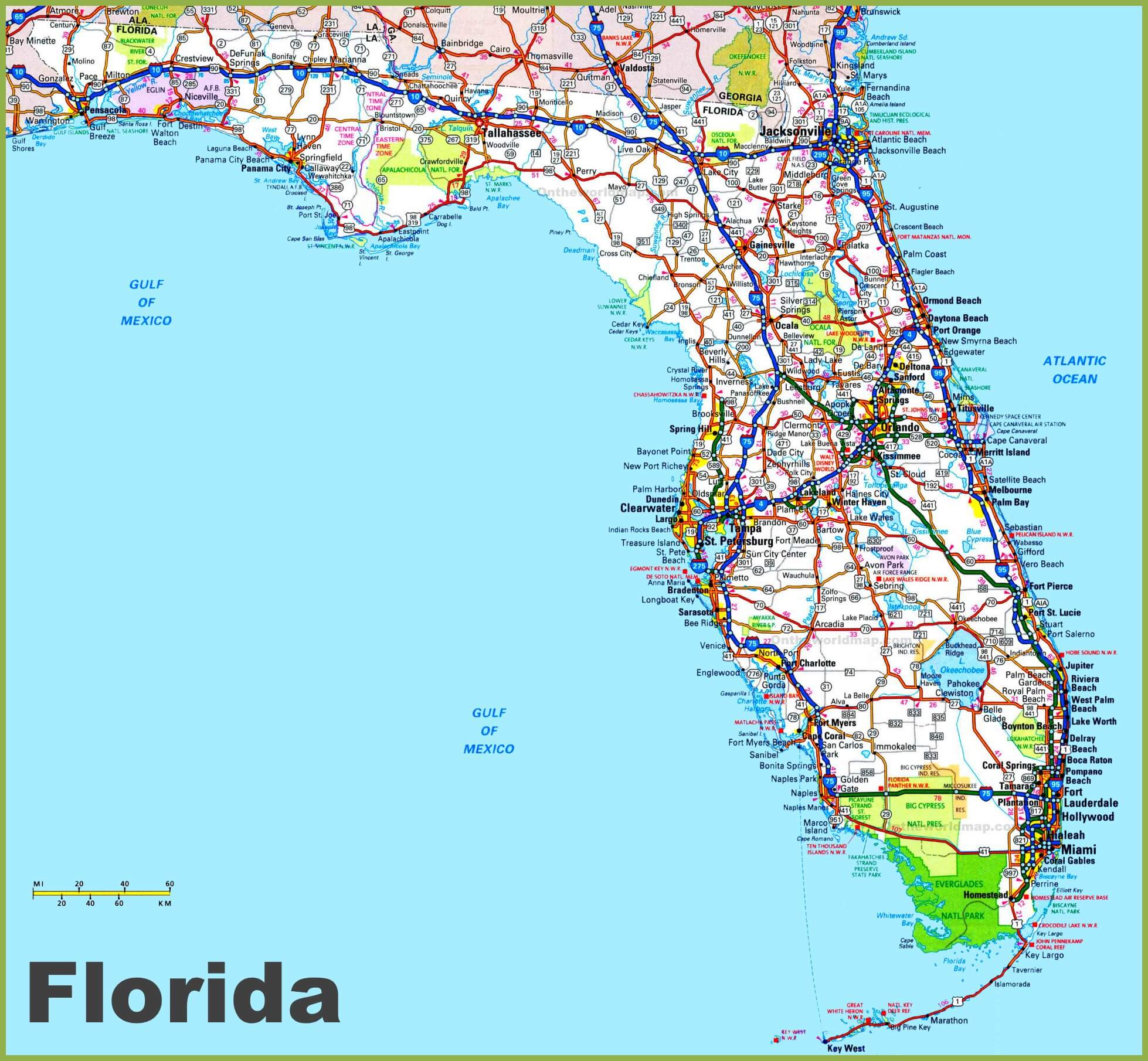
Road map of Florida with cities
Road map of Florida with cities

Where is Florida on the United States Map?

Show Google map, satellite map, where is the country located.

Get directions by driving, walking, bicycling, public transportation and travel with street view.

Feel free to explore these pages as well:

- Advertisement -
Previous article

Discover

Sponsor

Latest Posts

Cairo Unveiled: A Tapestry of Time and Tradition

Welcome to the enchanting city of Cairo, where history and modernity dance along the Nile's banks. This bustling metropolis, the heart of Egypt, is...

Sri Lanka Map

Explore Sri Lanka's diverse geography with political, physical and satellite maps. Explore its cities, terrain and regions, including its proximity to India. Learn about...

Burundi Map

Where is located Burundi on the World and Africa Map? Burundi is a small, landlocked country in East Africa, in the heart of the...

Portugal Map

A collection of Portugal Maps; View a variety of Portugal physical, political, administrative, relief map, Portugal satellite image, higly detalied maps, blank map, Portugal...

Discover Caracas: A Traveler’s Guide to Venezuela’s Captivating Capital

Welcome to Caracas, the pulsating capital of Venezuela, a city where the energy of urban life meets a rich tapestry of history, culture, and...