
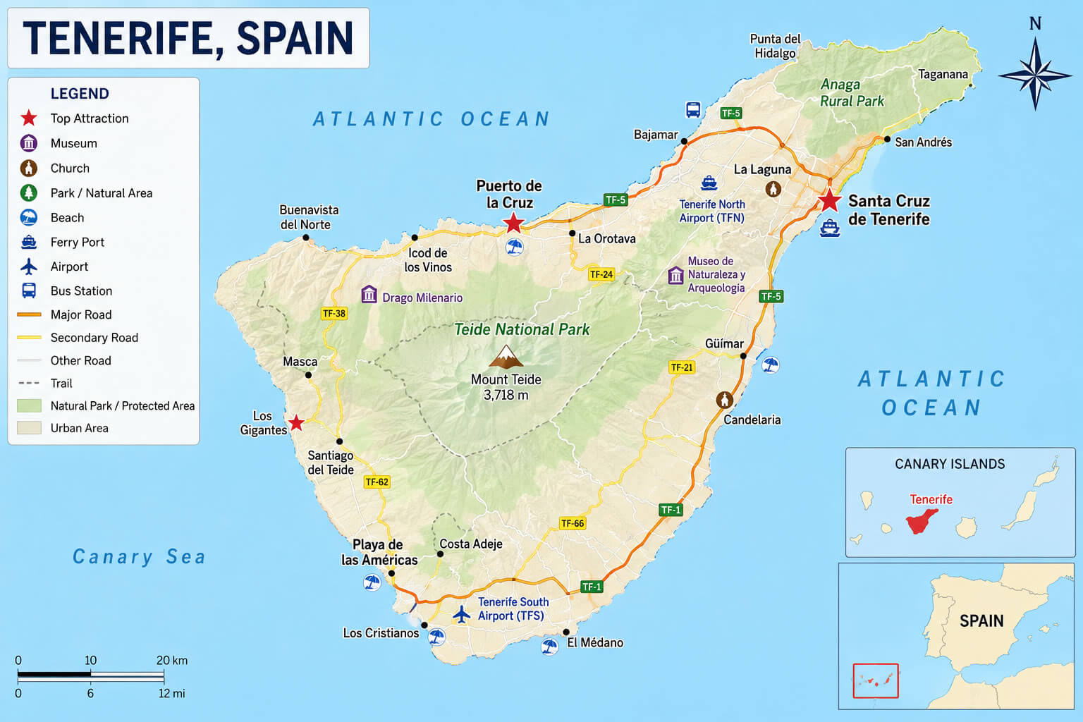
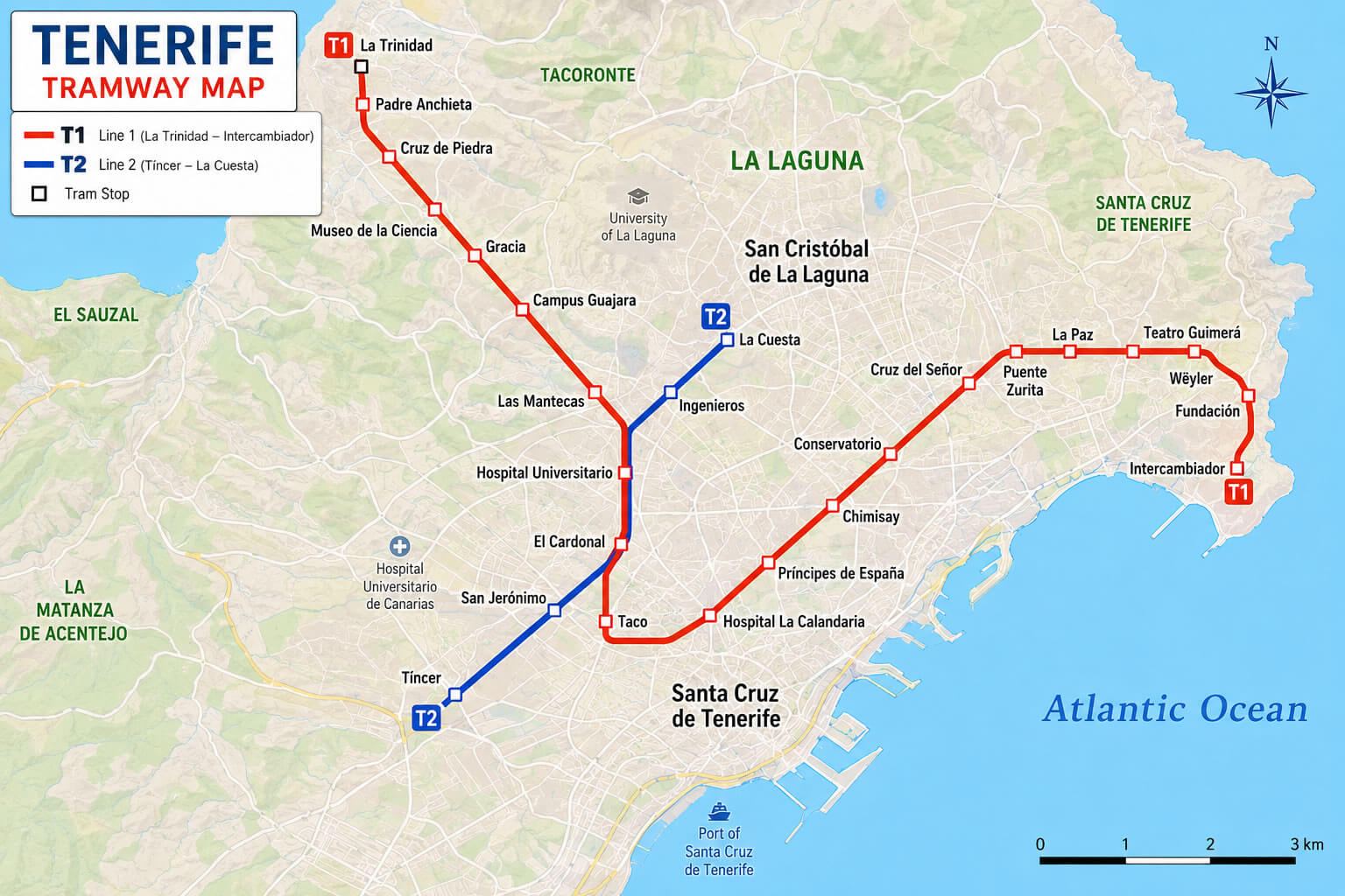
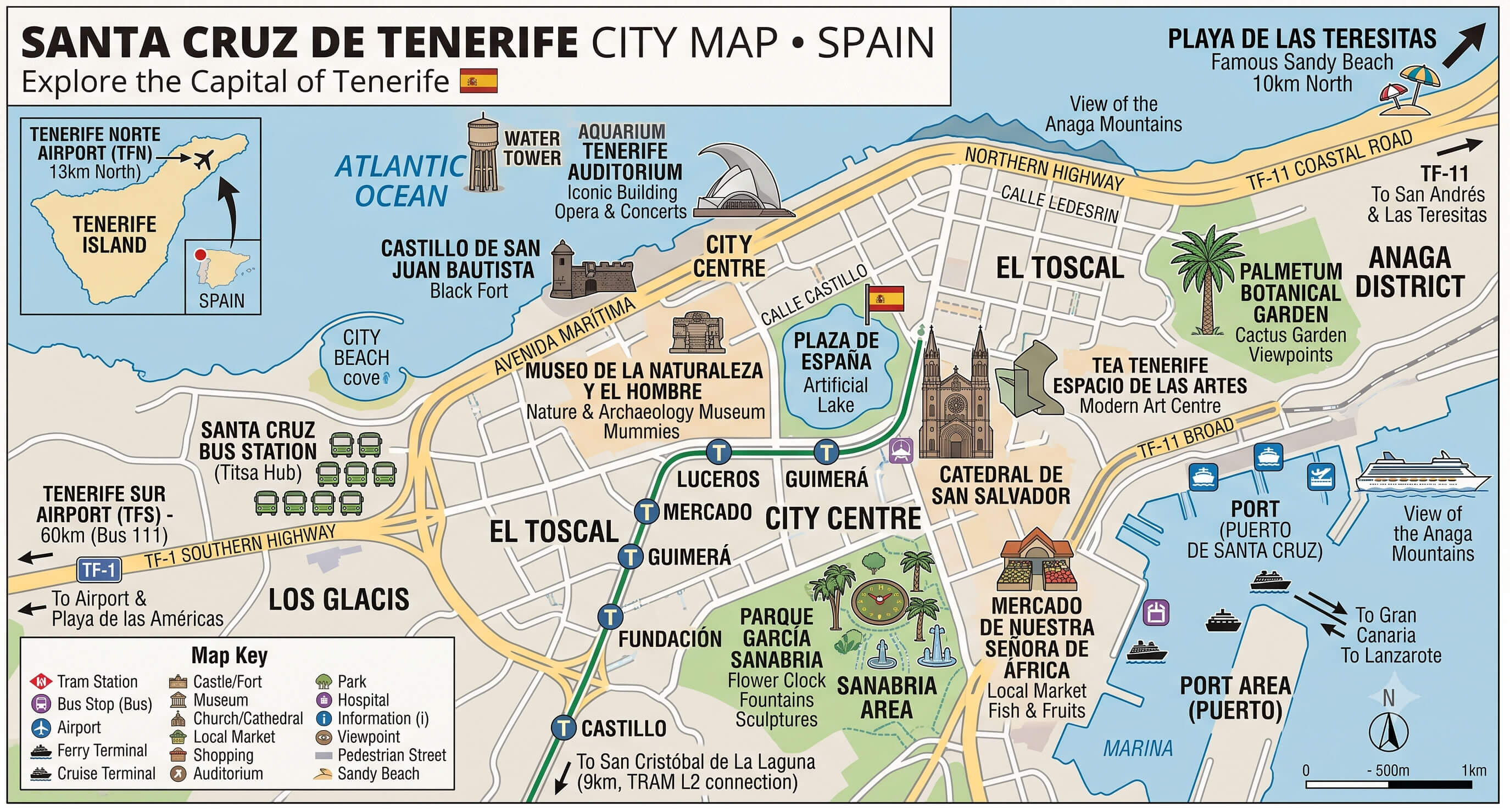
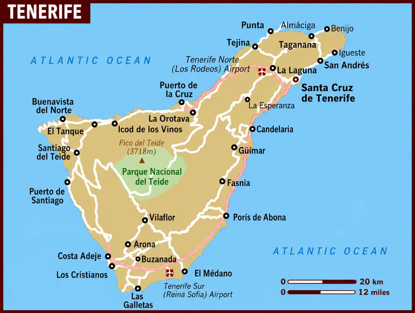
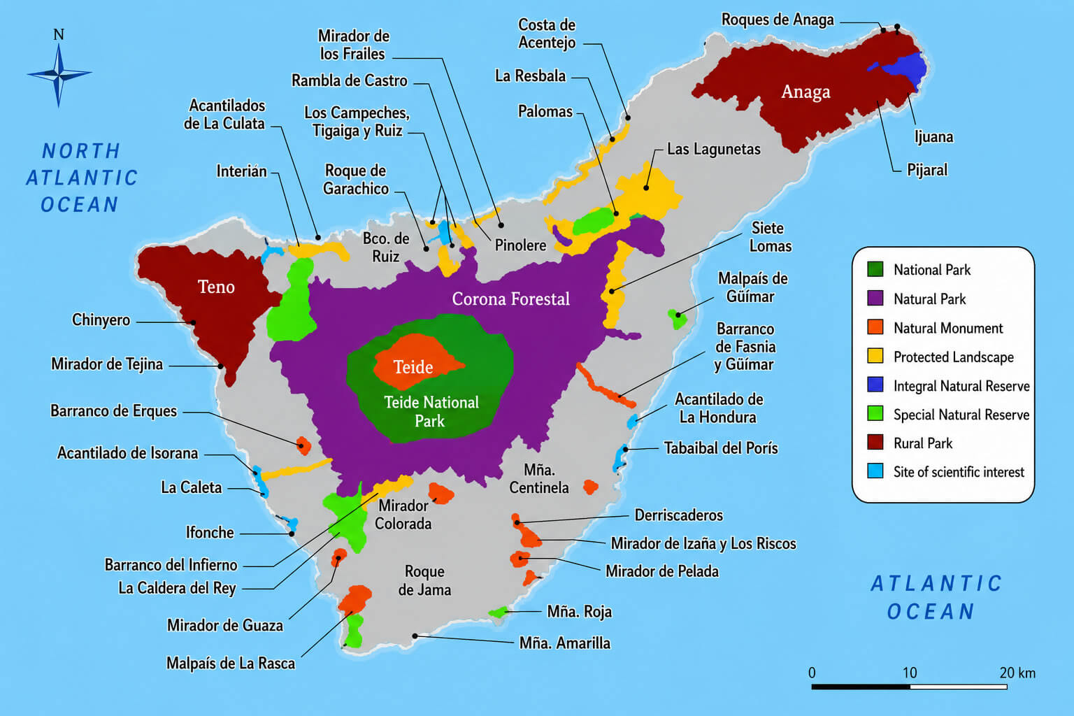
A detailed Tenerife map is an essential resource for exploring the largest island in Spain’s Canary Islands archipelago. Whether you are using a Tenerife island map, a Tenerife tourist map, or a Tenerife travel map, these maps help visitors navigate the island’s beaches, volcanic landscapes, national parks, and coastal towns. A comprehensive Tenerife city guide map highlights major attractions such as Mount Teide, Los Cristianos, Puerto de la Cruz, and Costa Adeje, while a Santa Cruz de Tenerife city center map provides useful information for exploring the island’s capital. Travelers moving around the metropolitan area often rely on a Santa Cruz de Tenerife road map and a Tenerife tram map to navigate the island’s transportation network efficiently.
Tenerife travel map
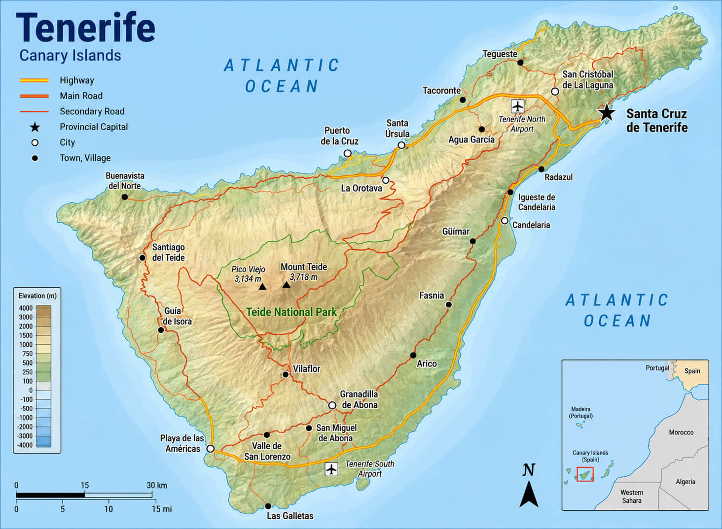
Tenerife physical map with roads
Tenerife tram map
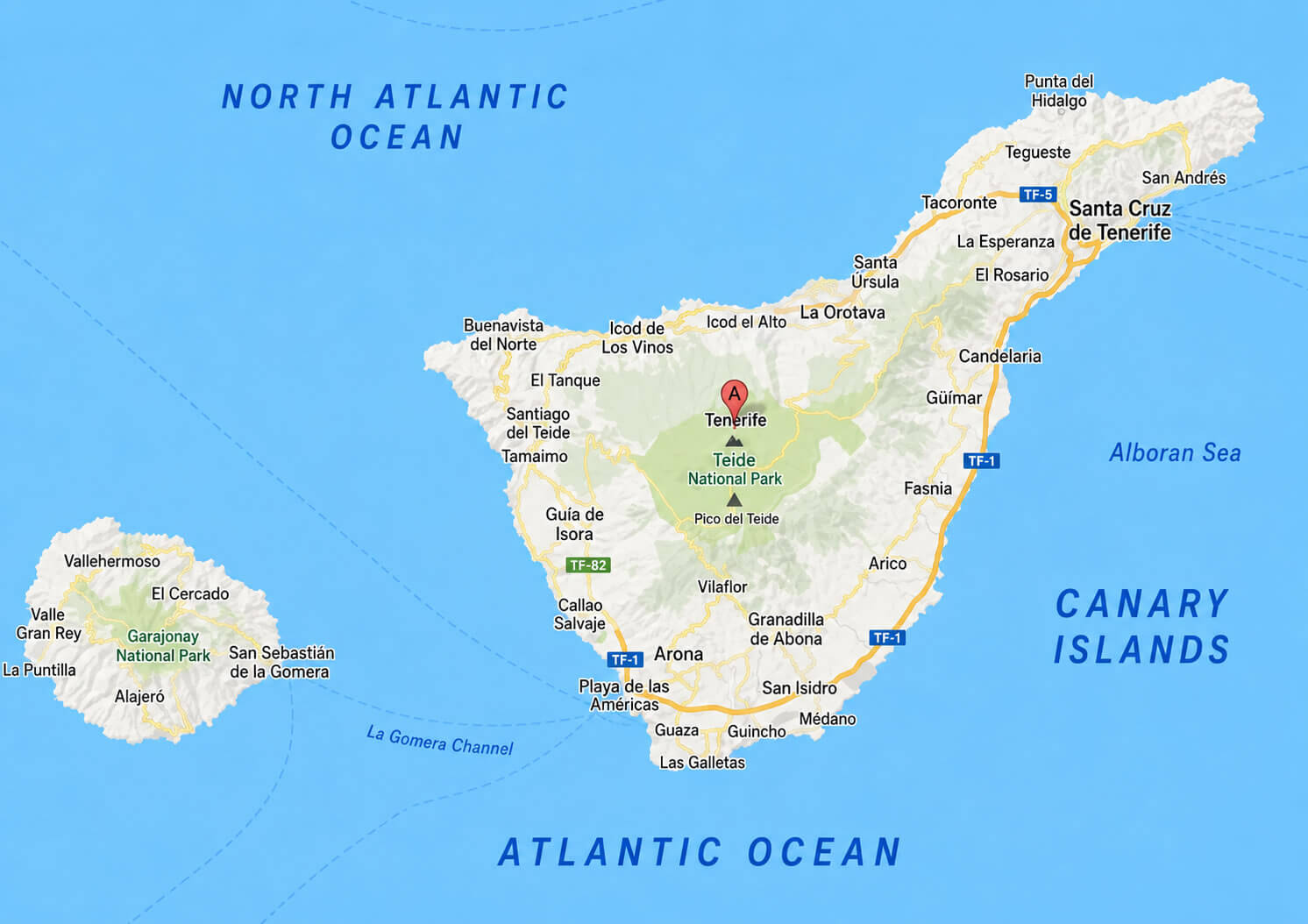
For geographical context, a Tenerife location in Europe map and a Tenerife location in Europe political map help visitors understand the island’s unique position as part of Spain and the European Union despite its location off the northwest coast of Africa. A Canary Islands map with Tenerife illustrates the island’s relationship with neighboring islands such as Gran Canaria, La Palma, and Lanzarote. Visitors interested in the island’s terrain frequently use a Tenerife topographic map, a Tenerife relief map, or a Tenerife Canary Islands elevation map to explore the dramatic volcanic landscape dominated by Mount Teide, Spain’s highest peak. Meanwhile, a Tenerife physical map with roads and a Tenerife regions map provide valuable information about the island’s municipalities and transportation routes. Many travelers also search “Where is Tenerife on Spain map?” to better understand the location of Tenerife Spain within the Atlantic Ocean and the wider Canary Islands region.
Tenerife city guide map
Tenerife regions map
Canary Islands map with Tenerife
Geography of Tenerife
where is Tenerife on Spain map
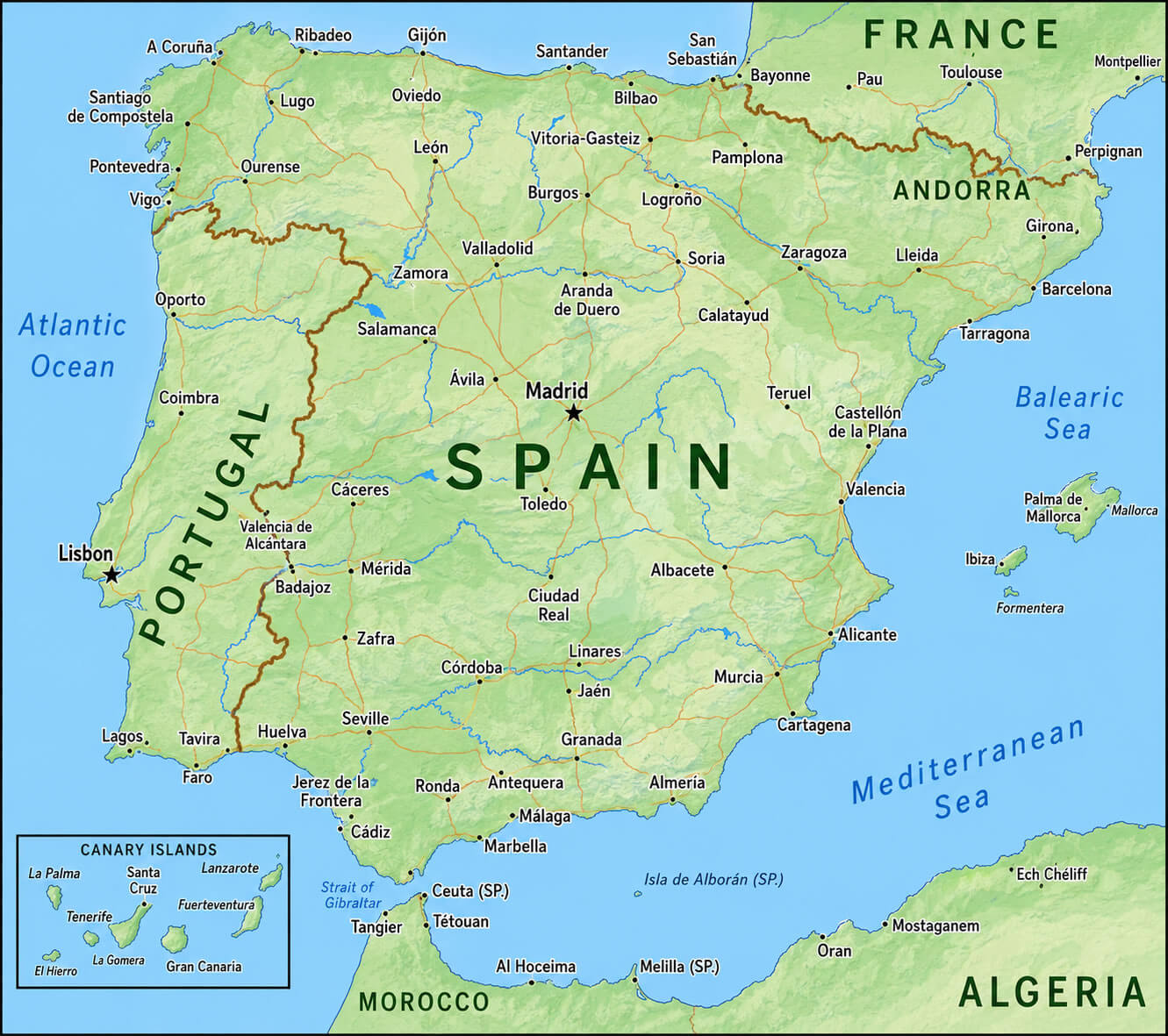
Tenerife is the largest of Spain’s Canary Islands and is located in the Atlantic Ocean, approximately 300 kilometers west of the northwest coast of Africa. Although geographically closer to Morocco and Western Sahara than mainland Spain, Tenerife is politically part of Spain and the European Union. The island covers an area of approximately 2,034 square kilometers and is dominated by Mount Teide, a volcano that rises to 3,715 meters above sea level, making it the highest peak in Spain. Tenerife’s diverse landscape includes volcanic terrain, forests, cliffs, beaches, and subtropical valleys, while its mild climate throughout the year has earned it the nickname “The Island of Eternal Spring.”
History of Tenerife
Tenerife Spain
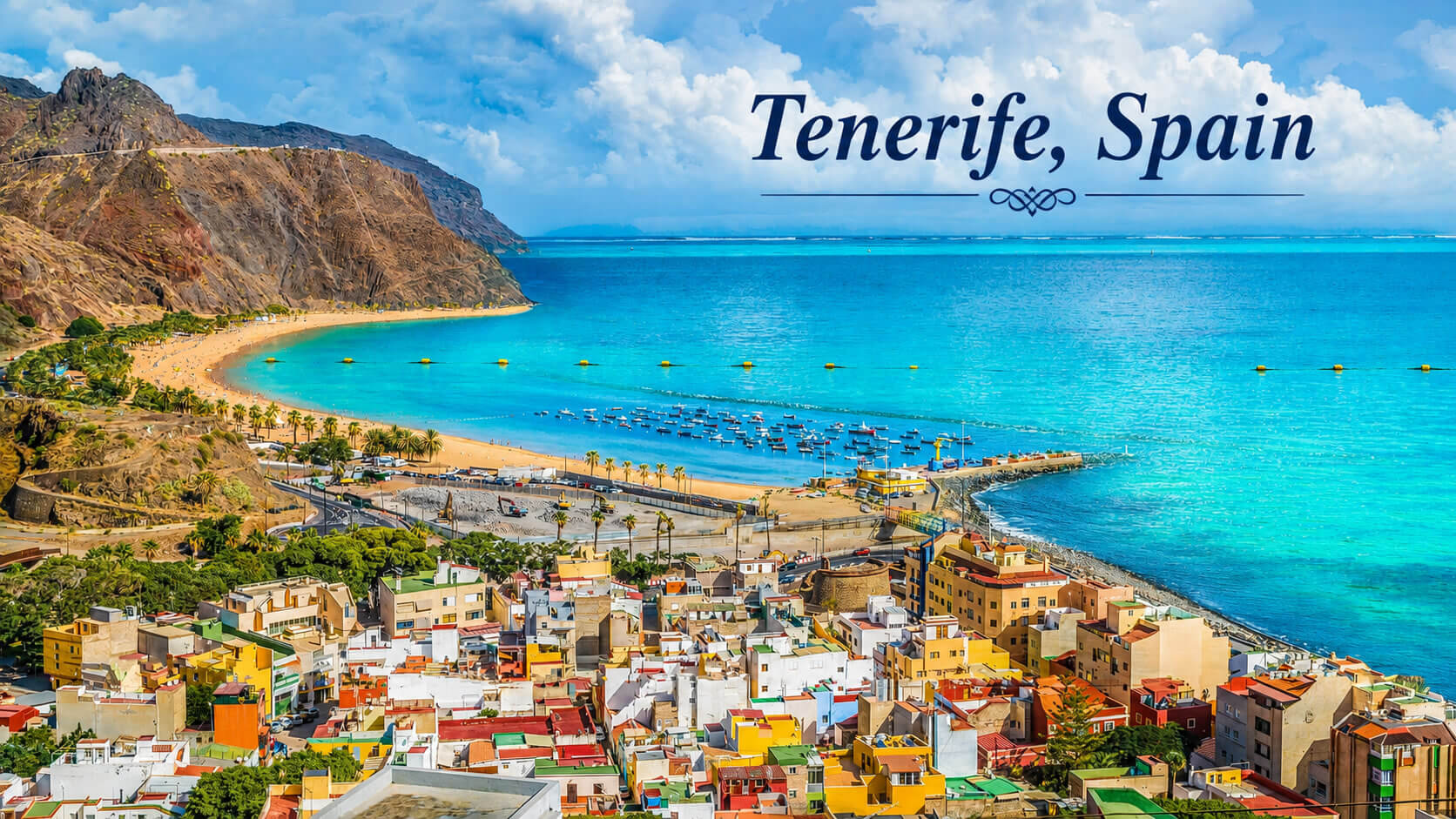
The history of Tenerife dates back to the indigenous Guanche civilization, which inhabited the island long before European contact. In the late 15th century, Tenerife became the last Canary Island to be incorporated into the Crown of Castile following the conquest completed in 1496. During the following centuries, the island developed into an important stopover point for ships traveling between Europe, Africa, and the Americas. Tenerife’s strategic location contributed to the growth of trade, agriculture, and maritime commerce, particularly through exports such as sugar cane, wine, and bananas. Today, historical sites in cities such as Santa Cruz de Tenerife and San Cristóbal de La Laguna reflect the island’s rich cultural heritage.
Demographics of Tenerife
Tenerife is the most populous island in the Canary Islands and one of Spain’s most important tourism destinations. The island has a population of approximately 970,000 residents, accounting for nearly half of the total population of the Canary Islands. Tenerife has a highly international and multicultural population, with significant communities from mainland Spain, the United Kingdom, Germany, Italy, Latin America, and other European countries. Tourism plays a central role in the local economy, attracting millions of visitors each year and supporting sectors such as hospitality, transportation, retail, and international business. This combination of cultural diversity, economic opportunity, and high quality of life makes Tenerife one of the most dynamic regions in Spain.
Santa Cruz de Tenerife city center map
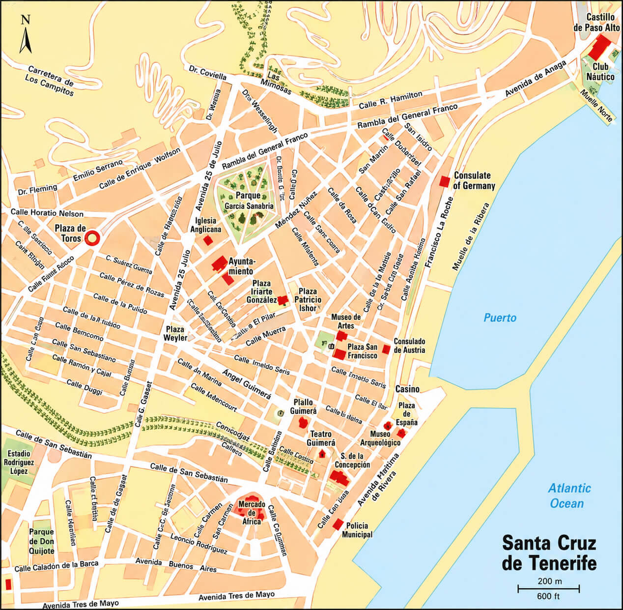
Santa Cruz de Tenerife road map
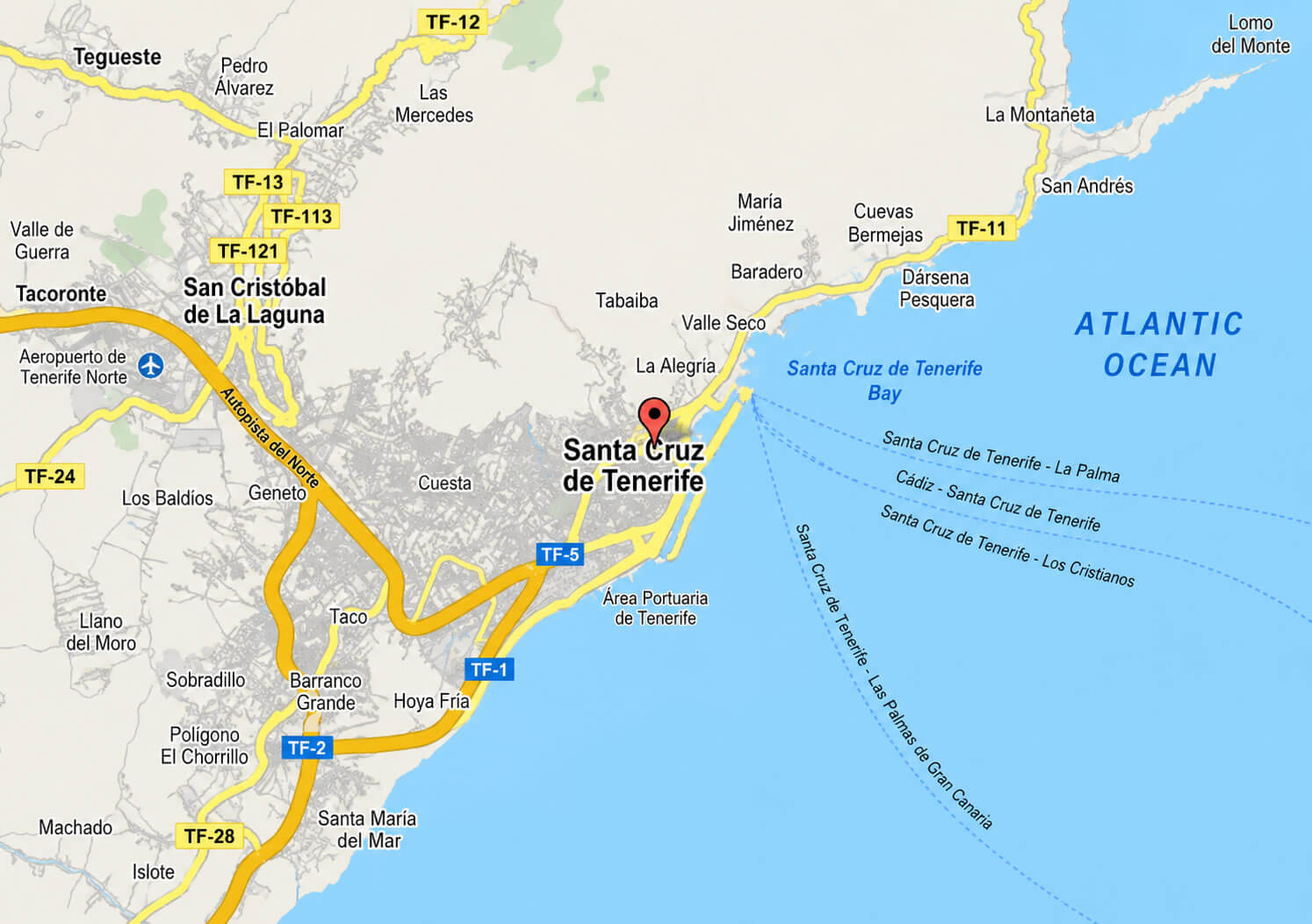
Tenerife Canary Islands elevation map
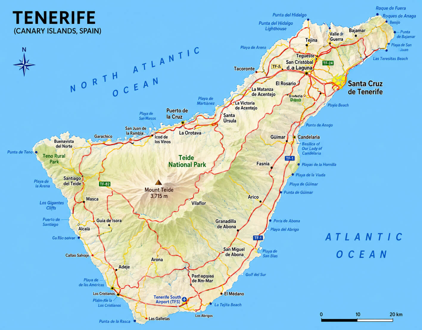
Tenerife Island map
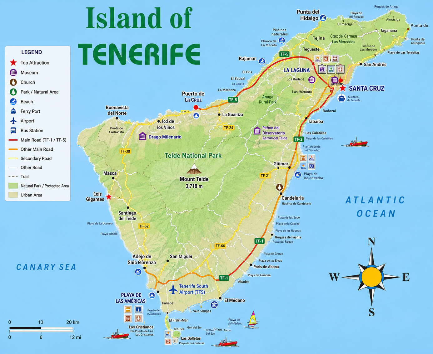
Tenerife location in Europe map
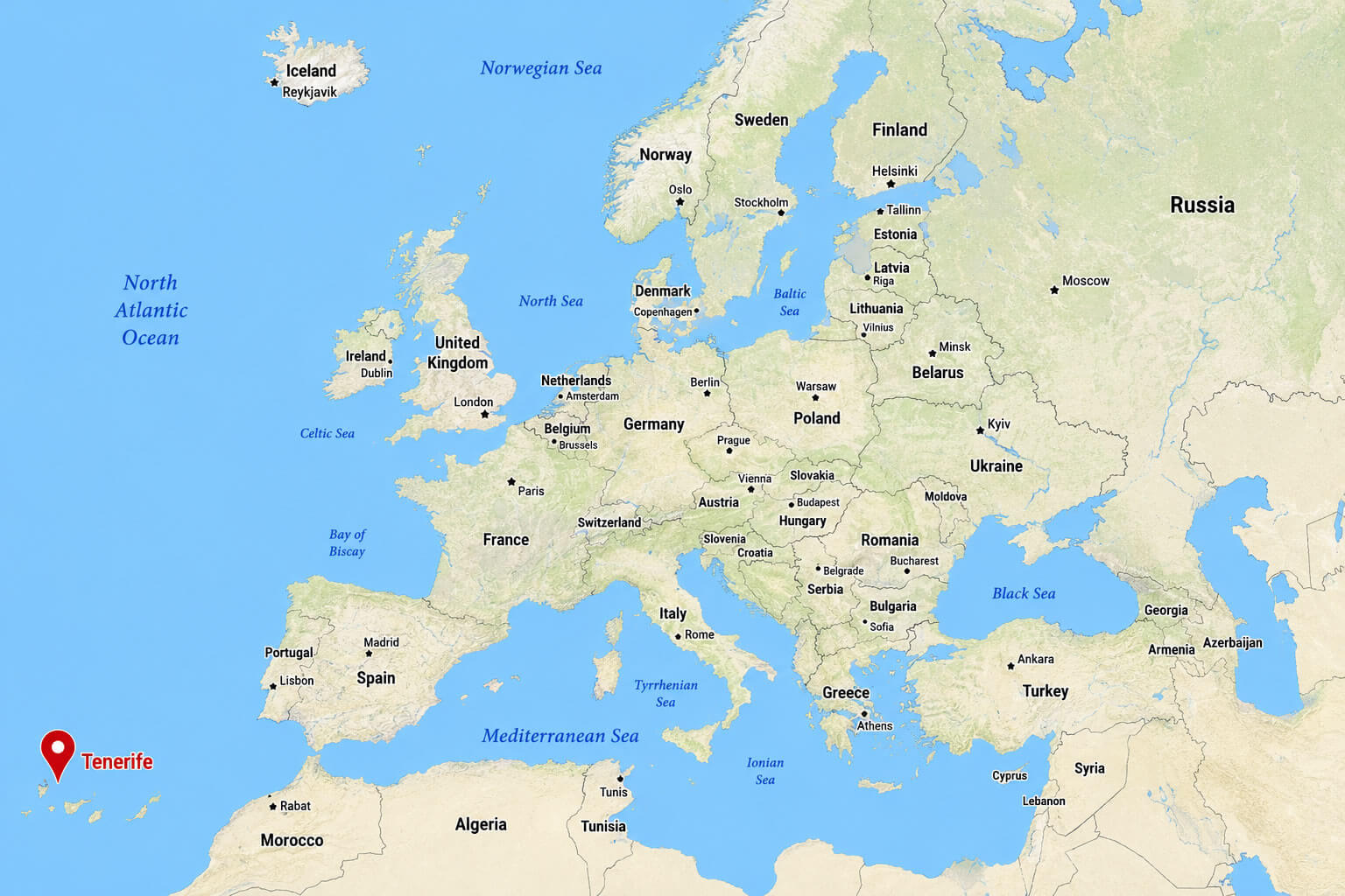
Tenerife location in Europe political map
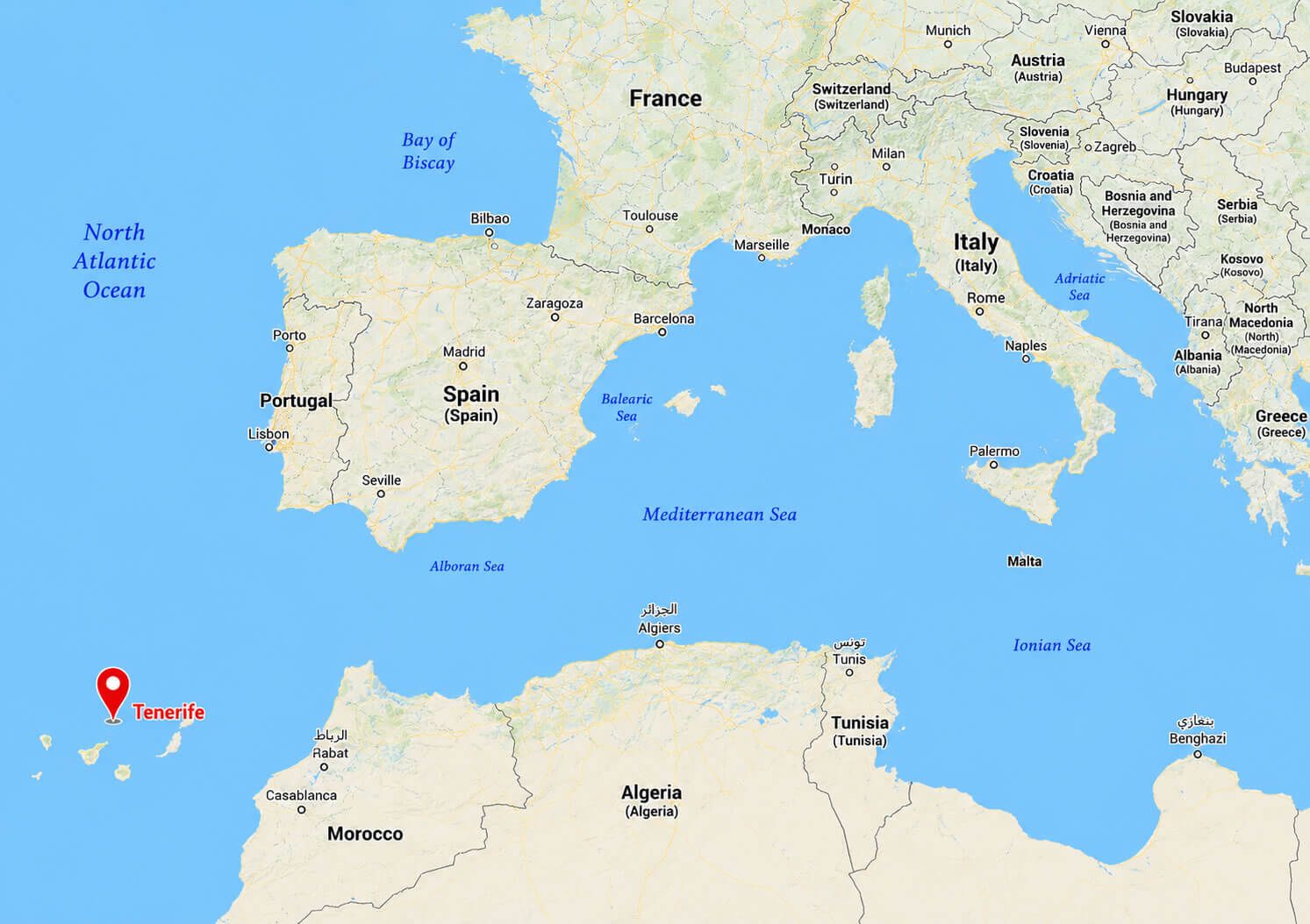
Tenerife relief map
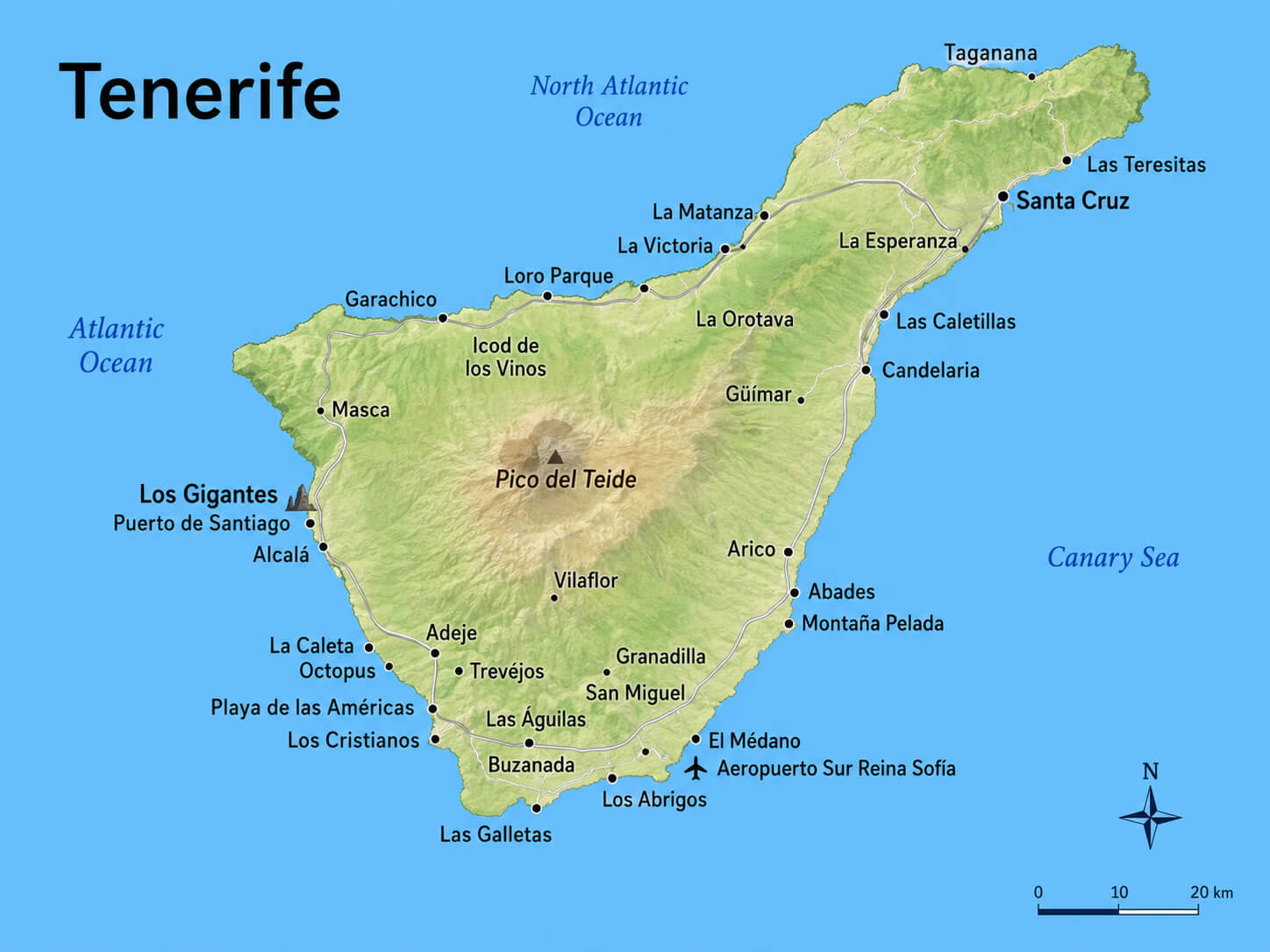
Tenerife topographic map
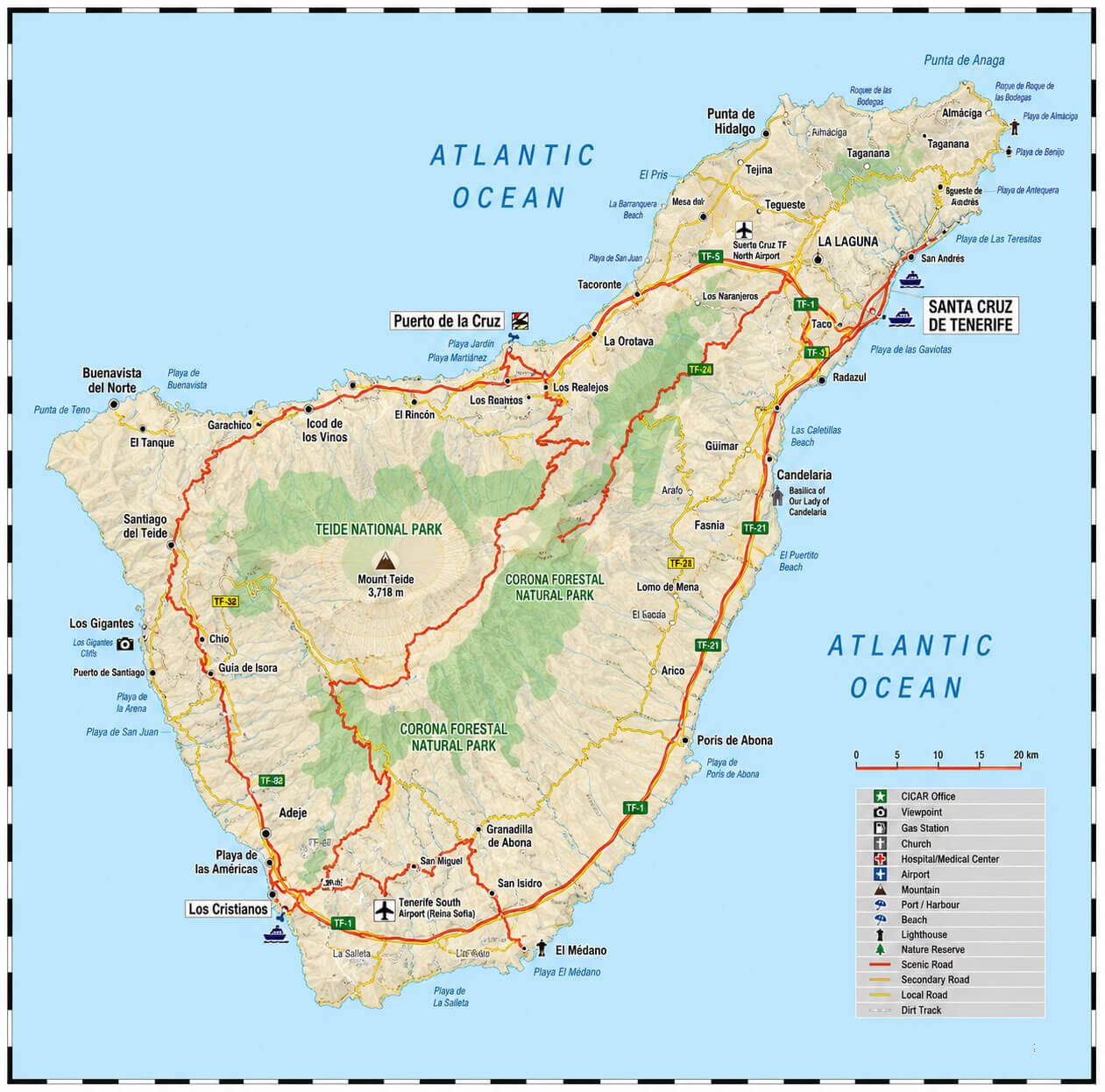
Tenerife tourist map
Where is Tenerife on Spain Map?
Show Google interactive map, satellite map, where is the country located.
Get direction by driving, walking, bicycling, public transportation and travel with street view.
Feel free to explore these pages as well:
- Spain Map ↗️
- Map of Spain ↗️
- Spain Physical Map ↗️
- Spain Regions Map ↗️
- Spain Cities Map ↗️
- Spain Road Map ↗️
- Spain Political Map ↗️
- Spain Population Map ↗️
- Spain Historical Map ↗️
- Madrid Map ↗️
- Barcelona Map ↗️
- Valencia Map ↗️
- Seville Map ↗️
- Bilbao Map ↗️
- Malaga Map ↗️
- Alicante Map ↗️
- Las Palmas Map ↗️
- Zaragoza Map ↗️
- Tenerife Map ↗️
- Murcia Map ↗️
- Exploring the Vibrant Corners of Cartagena, Spain ↗️
- Discovering Alicante: The Gem of Spain’s Costa Blanca ↗️
- A Collection of Spain Maps ↗️
- Discover Moorish Andalucia, Spain 1 ↗️
- Discover Moorish Andalucia, Spain 2 ↗️

