
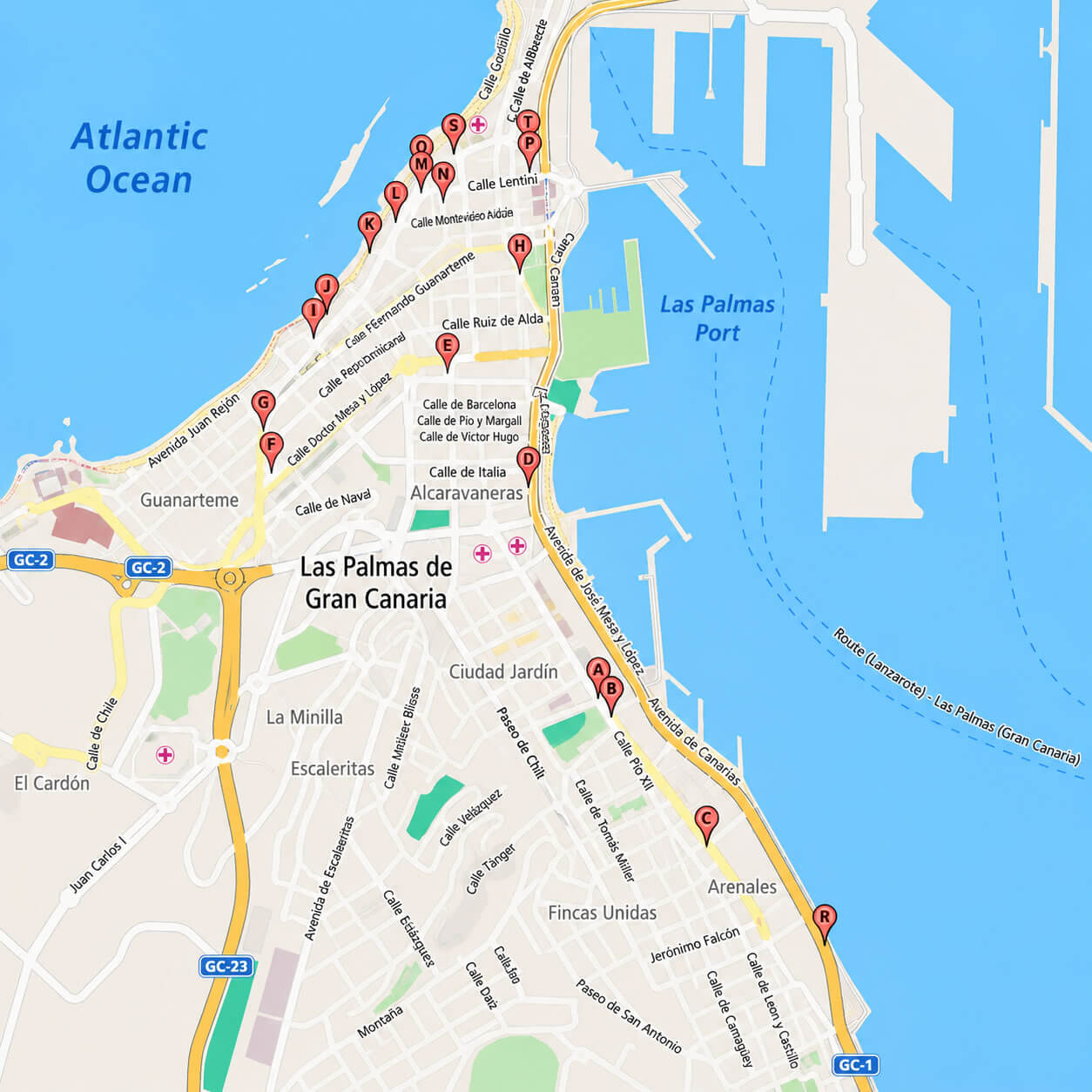
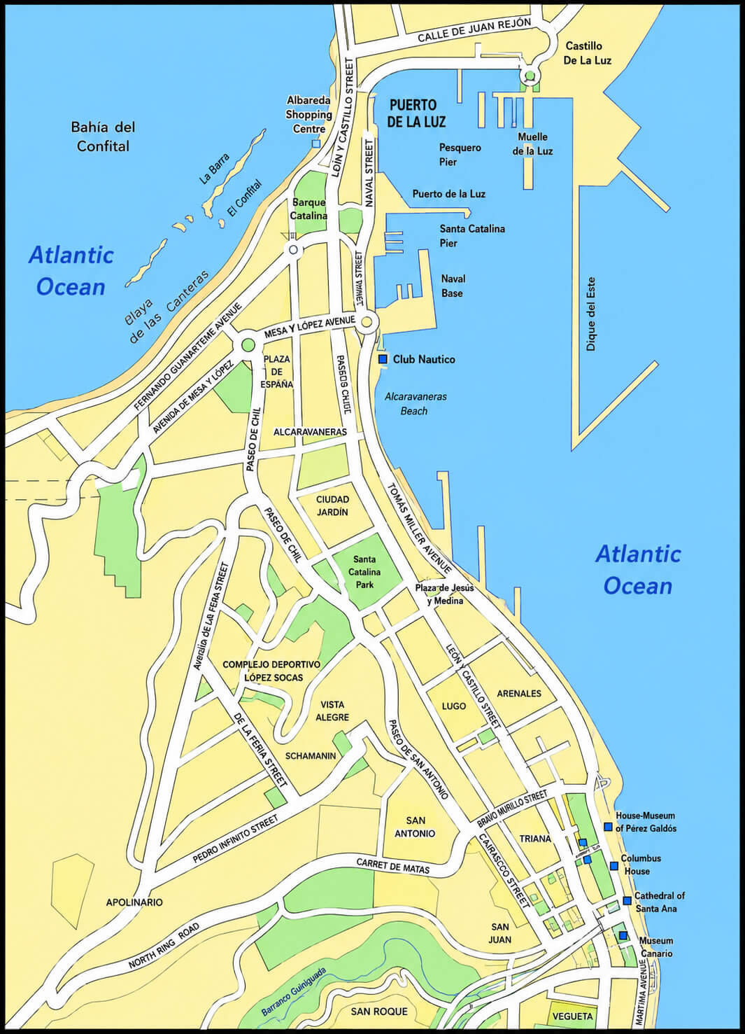
A detailed Las Palmas map is an essential resource for exploring the capital of Gran Canaria and one of the most important cities in the Canary Islands. Whether you are using a Las Palmas city map Spain, a Las Palmas city center map, or a Las Palmas downtown map, these maps help visitors navigate the city’s beaches, historic districts, shopping areas, and cultural attractions. Travelers exploring the historic center often rely on a Las Palmas old town map to discover landmarks such as Santa Ana Cathedral Las Palmas, Vegueta, and Triana. A comprehensive Las Palmas tourist map also highlights major attractions including Las Canteras Beach, the port area, museums, and waterfront promenades, making it easier for visitors to plan their stay.
Las Palmas city map Spain
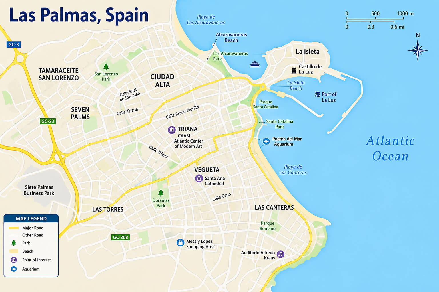
Las Palmas old town map
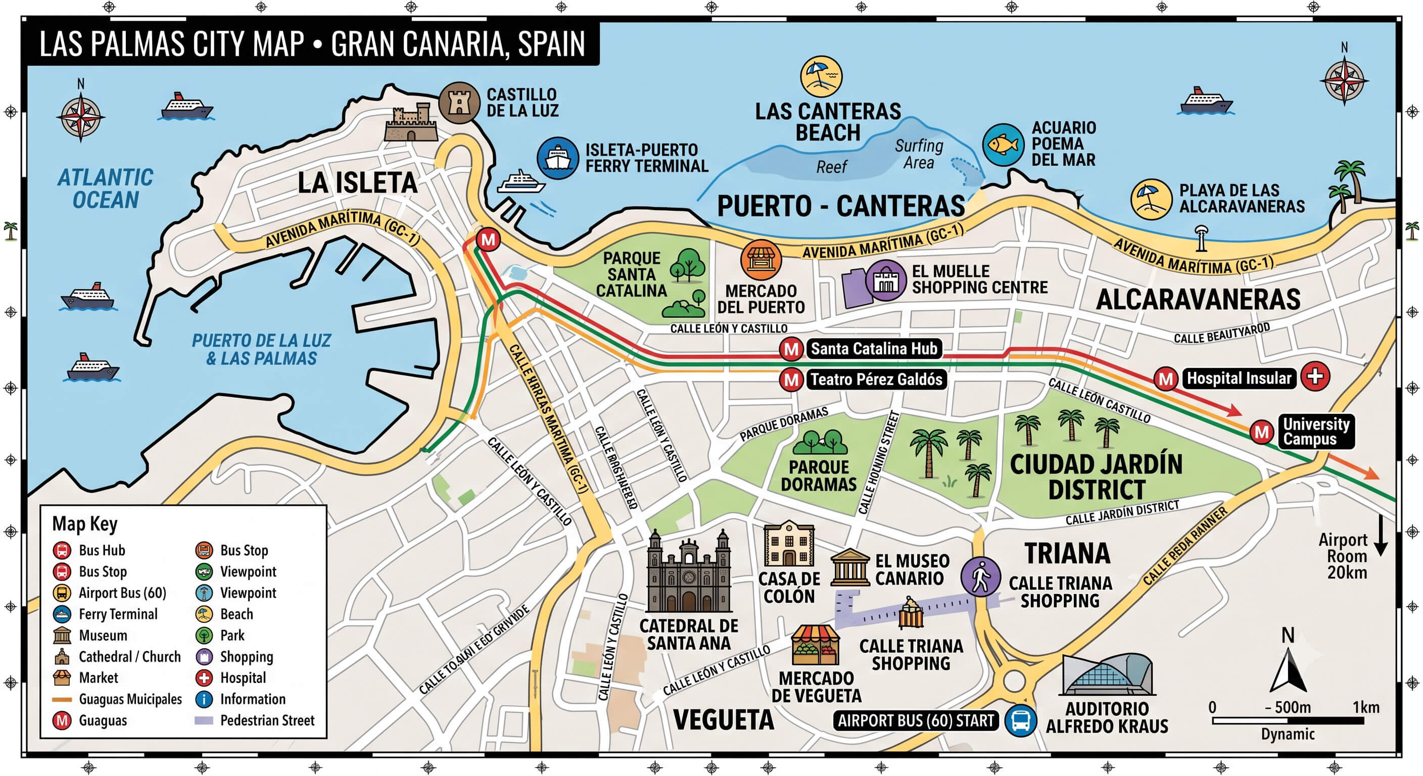
Las Palmas tourist map
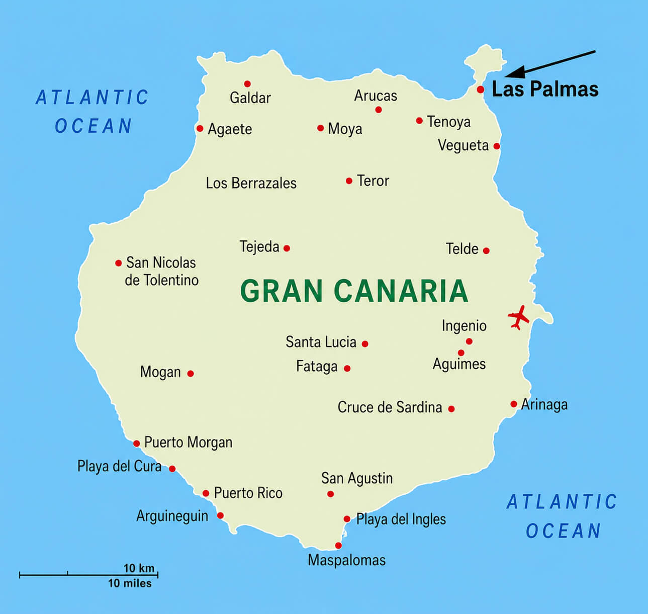
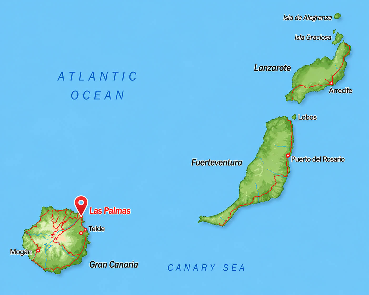
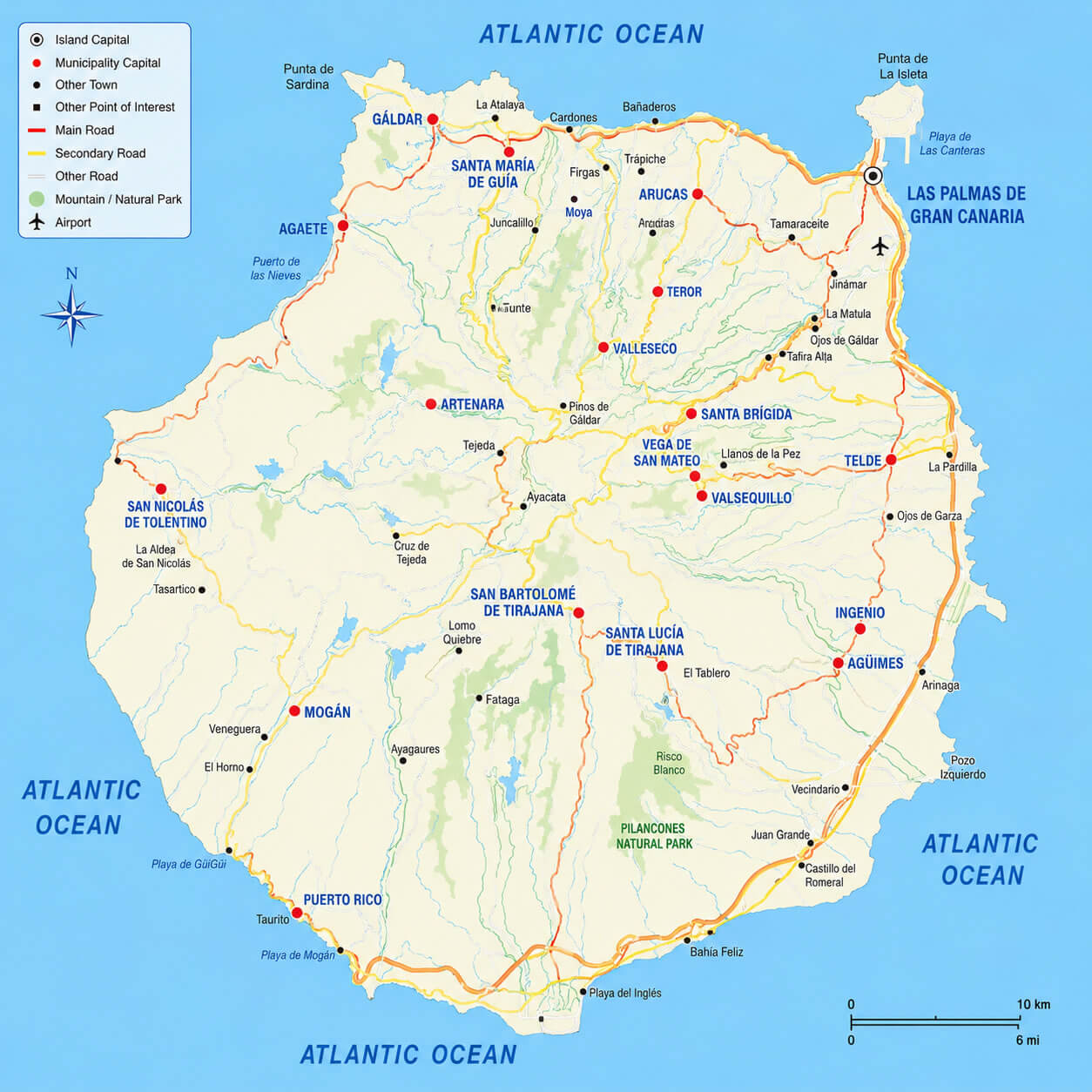
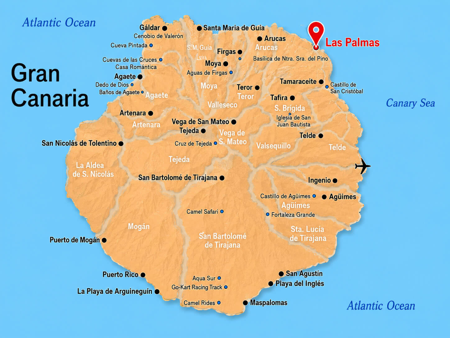
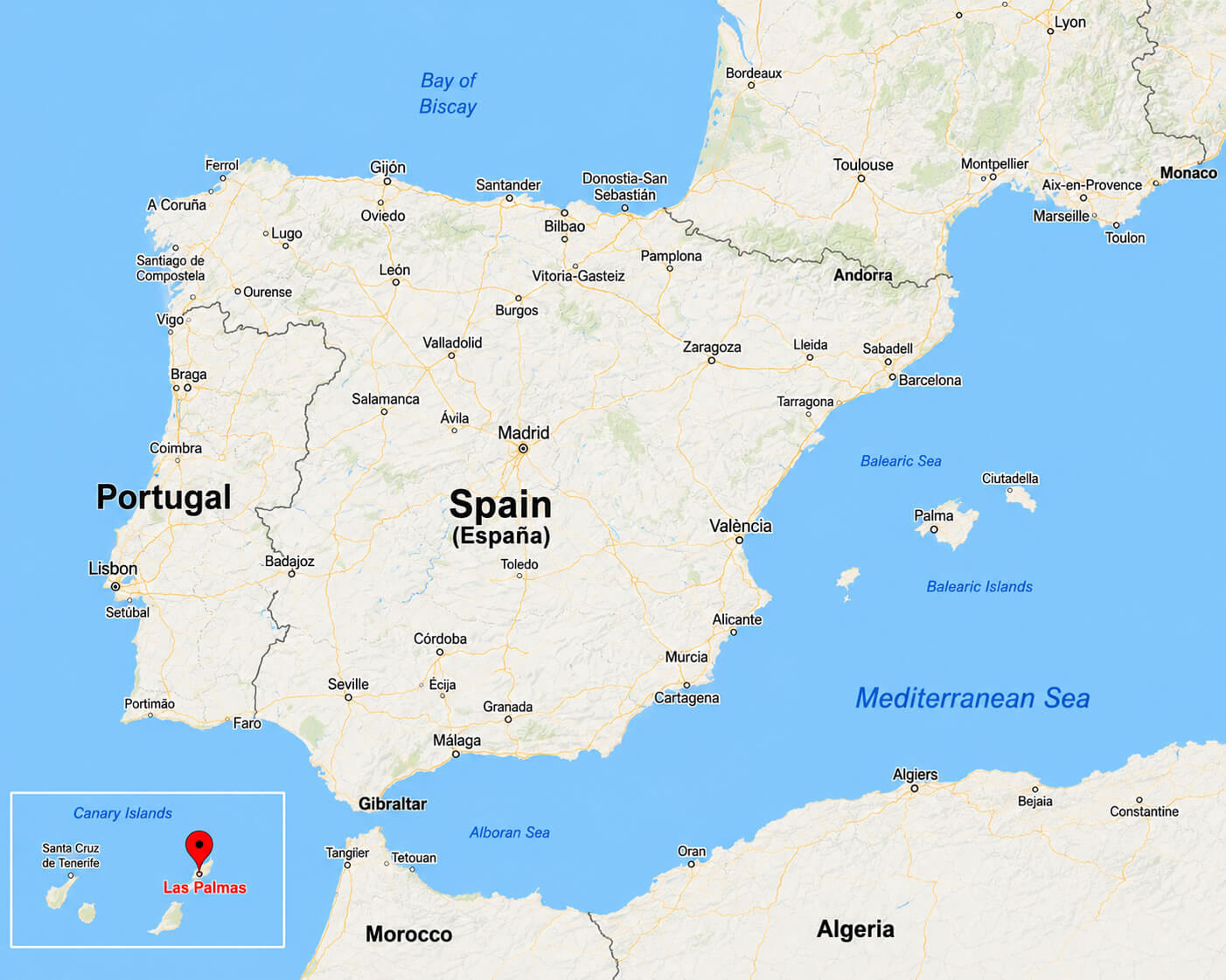
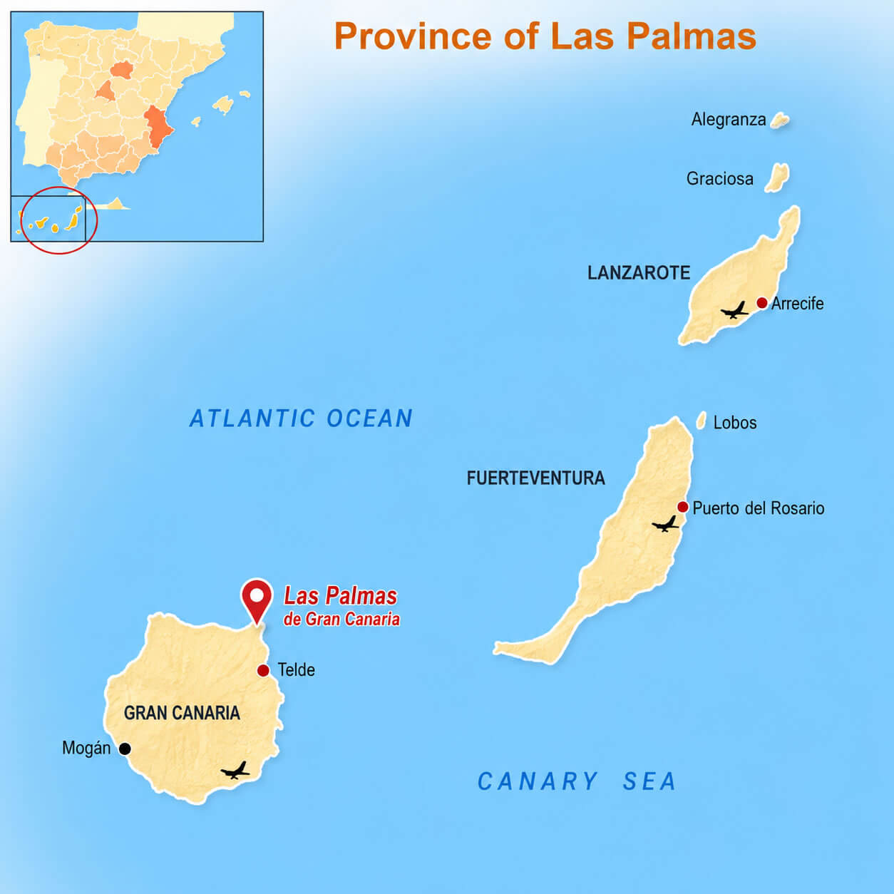
For regional and international context, a Las Palmas location in Spain map, a Las Palmas location in Europe map, and a Las Palmas location in Europe political map help travelers understand the city’s unique position in the Atlantic Ocean. Since the Canary Islands are geographically close to Africa while politically part of Spain and Europe, a Las Palmas location in Africa and Europe map provides valuable perspective. Visitors planning wider trips often use a Canary Islands map with Las Palmas, a Gran Canaria Island map, or a Gran Canaria tourism map to explore nearby destinations across the island. Transportation planning is simplified with a Las Palmas road map Spain, while many travelers also search “Where is located Las Palmas in Spain?” to better understand its location within the Las Palmas location in Canary Islands map and its strategic role as one of Spain’s most important Atlantic cities.
Las Palmas location in Spain map
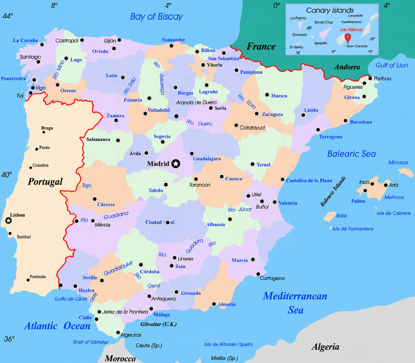
Canary Islands map with Las Palmas
Gran Canaria Island map
Gran Canaria tourism map
Geography of Las Palmas
Las Palmas, officially known as Las Palmas de Gran Canaria, is located on the northeastern coast of Gran Canaria, one of Spain’s Canary Islands in the Atlantic Ocean. Although geographically closer to Africa than mainland Europe, the city is politically part of Spain and the European Union. Las Palmas lies approximately 210 kilometers west of Morocco and about 1,350 kilometers southwest of Madrid. Its strategic location between Europe, Africa, and the Americas has made it an important maritime, commercial, and transportation hub for centuries. The city enjoys a subtropical climate with mild temperatures year-round, often earning recognition as one of the locations with the best climates in the world.
History of Las Palmas
Santa Ana Cathedral Las Palmas
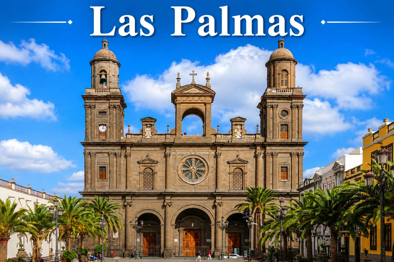
The history of Las Palmas began in 1478 when the city was founded by the Crown of Castile during the conquest of the Canary Islands. It quickly developed into a major port connecting Europe with Africa and the Americas during the Age of Exploration. Christopher Columbus visited the city several times during his voyages to the New World, further increasing its historical significance. Throughout the following centuries, Las Palmas became an important center for trade, shipping, and military operations in the Atlantic. Today, historical landmarks such as the Cathedral of Santa Ana, Casa de Colón, and the Vegueta district reflect the city’s rich cultural and colonial heritage.
Demographics of Las Palmas
Las Palmas is the largest city in the Canary Islands and one of Spain’s largest Atlantic urban centers. The municipality has a population of approximately 380,000 residents, while the wider metropolitan area exceeds 650,000 inhabitants. Due to its international port, tourism industry, and strategic location, Las Palmas has a diverse and multicultural population that includes residents from mainland Spain, Latin America, Africa, and other European countries. The city is known for its high quality of life, strong service-based economy, and growing importance in sectors such as tourism, logistics, maritime trade, and international business.
Las Palmas city center map
Las Palmas downtown map
Las Palmas location in Africa and Europe map
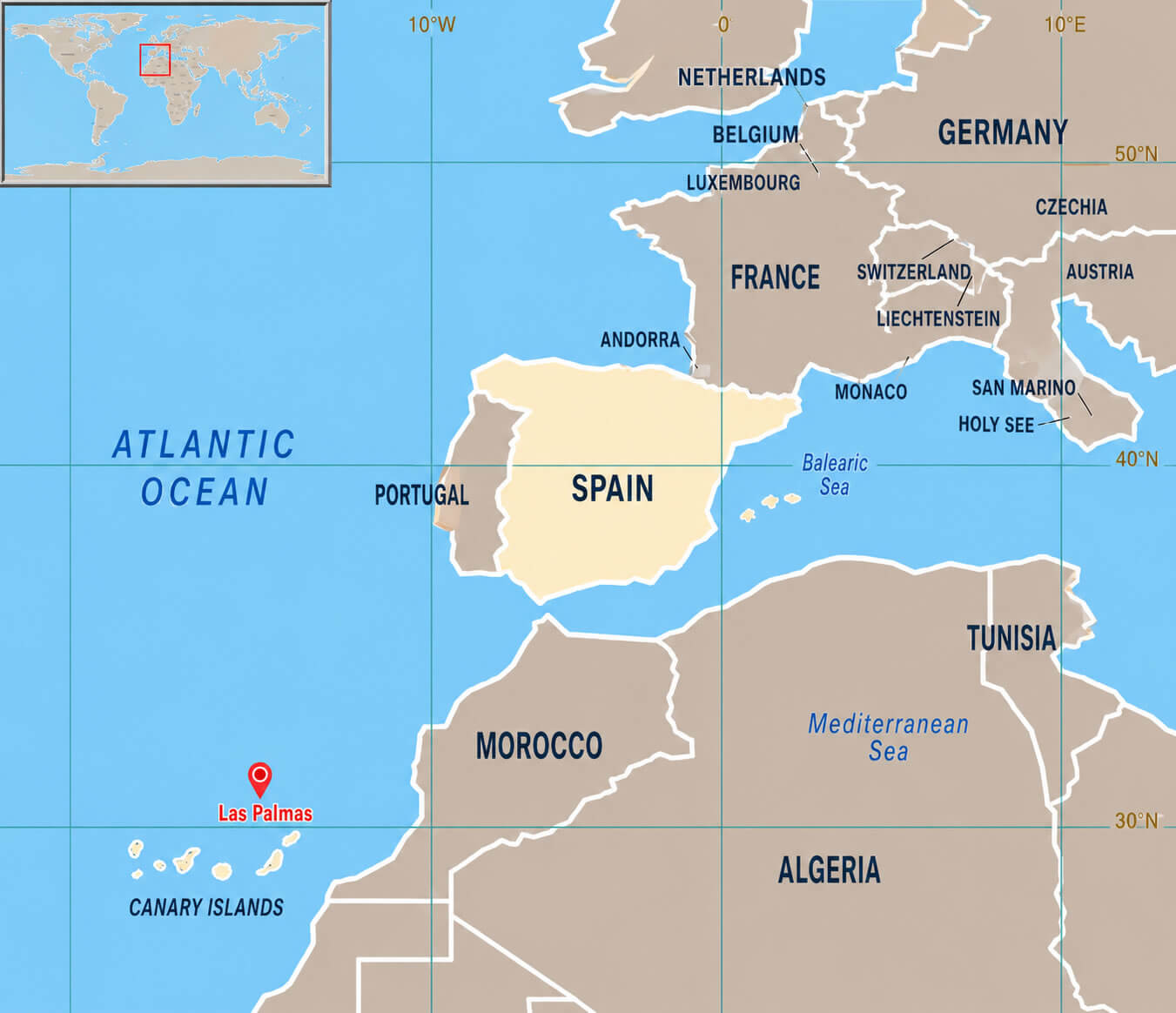
Las Palmas location in Canary Islands map
Las Palmas location in Europe map
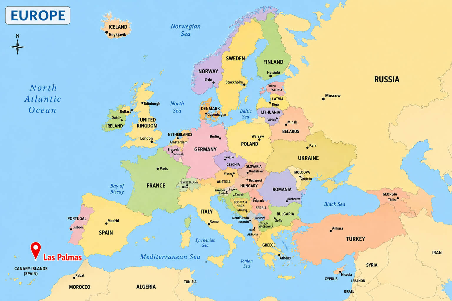
Las Palmas location in Europe political map
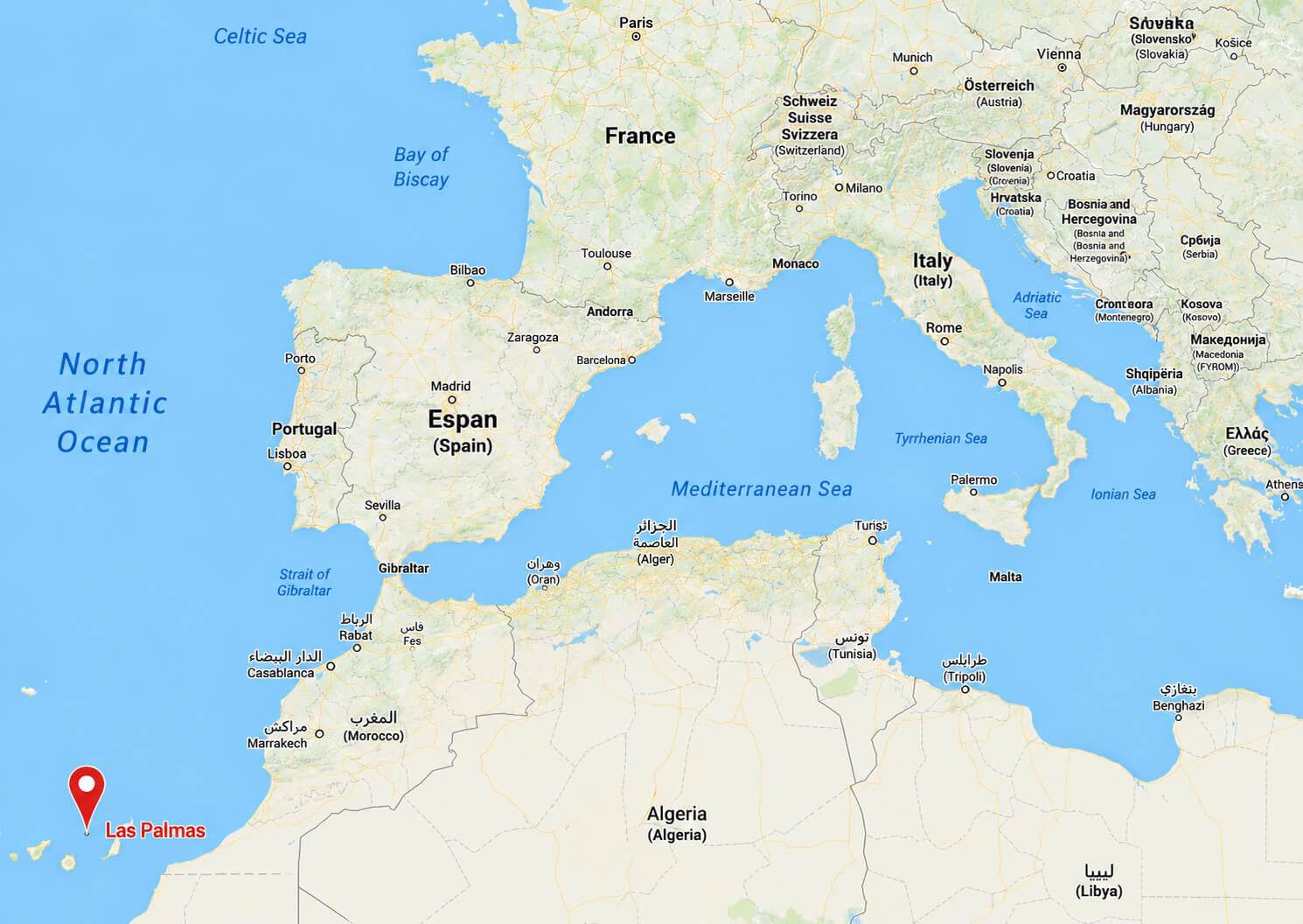
Las Palmas road map Spain
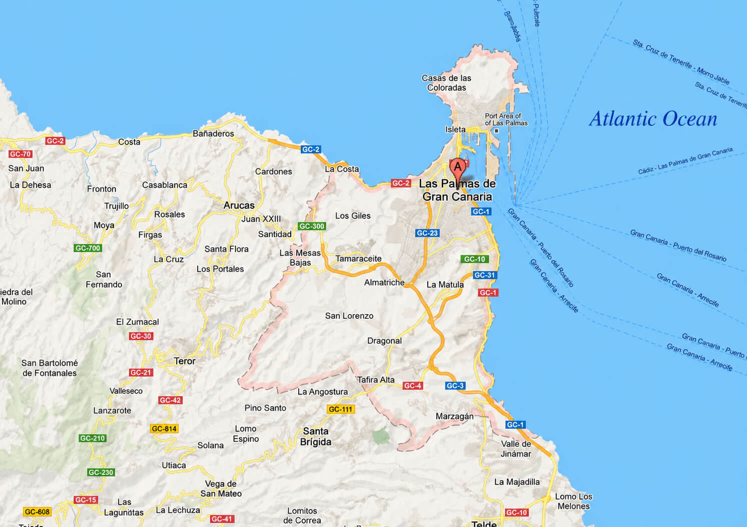
Where is Las Palmas on Spain Map?
Show Google interactive map, satellite map, where is the country located.
Get direction by driving, walking, bicycling, public transportation and travel with street view.
Feel free to explore these pages as well:
- Spain Map ↗️
- Map of Spain ↗️
- Spain Physical Map ↗️
- Spain Regions Map ↗️
- Spain Cities Map ↗️
- Spain Road Map ↗️
- Spain Political Map ↗️
- Spain Population Map ↗️
- Spain Historical Map ↗️
- Madrid Map ↗️
- Barcelona Map ↗️
- Valencia Map ↗️
- Seville Map ↗️
- Bilbao Map ↗️
- Malaga Map ↗️
- Alicante Map ↗️
- Las Palmas Map ↗️
- Murcia Map ↗️
- Exploring the Vibrant Corners of Cartagena, Spain ↗️
- Discovering Alicante: The Gem of Spain’s Costa Blanca ↗️
- A Collection of Spain Maps ↗️
- Discover Moorish Andalucia, Spain 1 ↗️
- Discover Moorish Andalucia, Spain 2 ↗️

