From the intricate patterns of winding rivers and vast deserts to the delineations of countries and cities, maps serve as a testament to the breathtaking complexity and beauty of our Earth. They not only guide travelers and scholars but also inspire dreamers and adventurers. Welcome to our grand assemblage of world maps, each telling a unique story, each offering a different perspective. Dive in, and allow yourself to be transported across continents and through time, understanding our beautiful planet like never before.
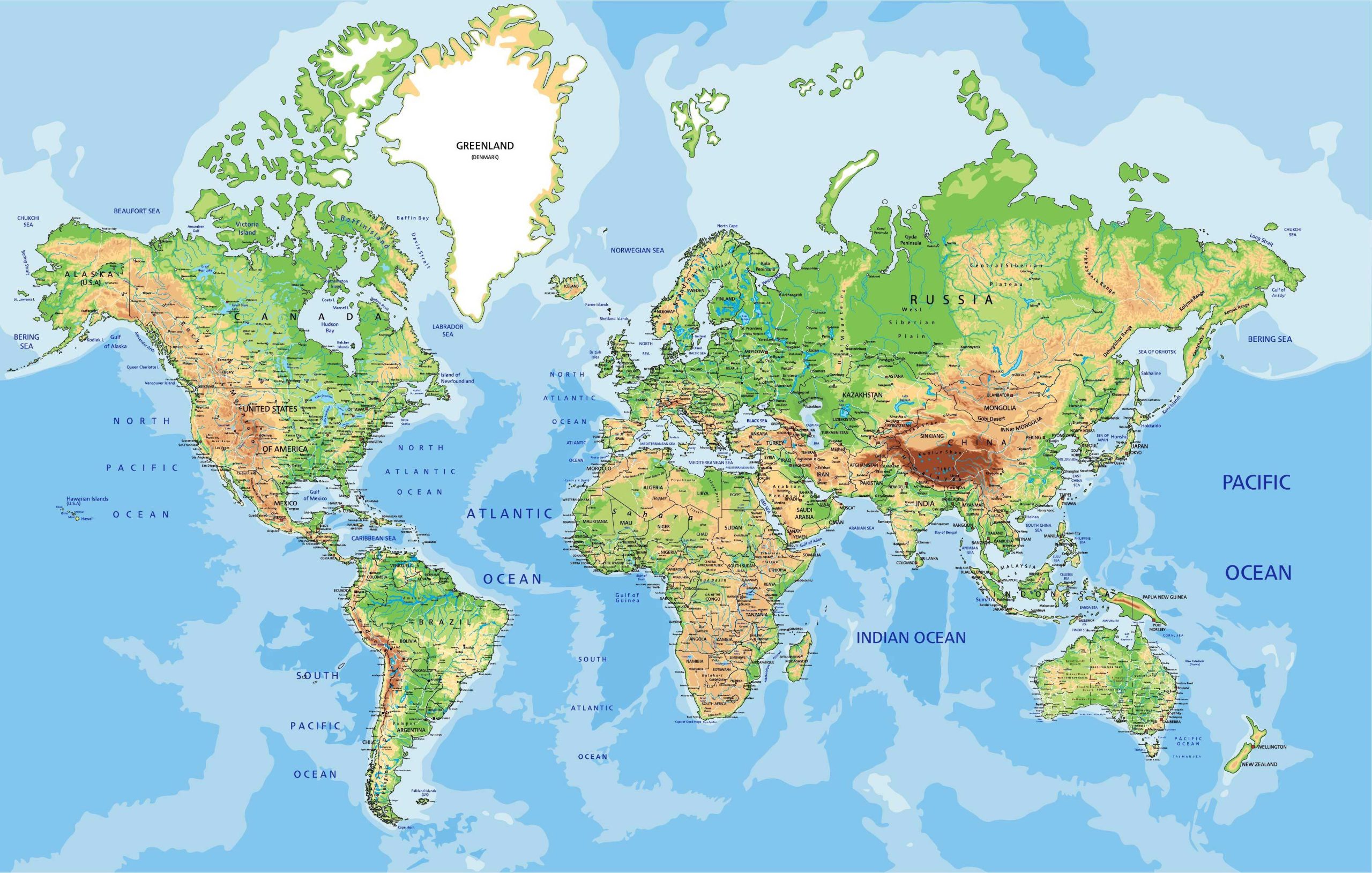
1. World Physical Map
A physical map showcases the physical features of an area, such as mountains, rivers, and lakes. Ideal for understanding terrain and natural landscapes.
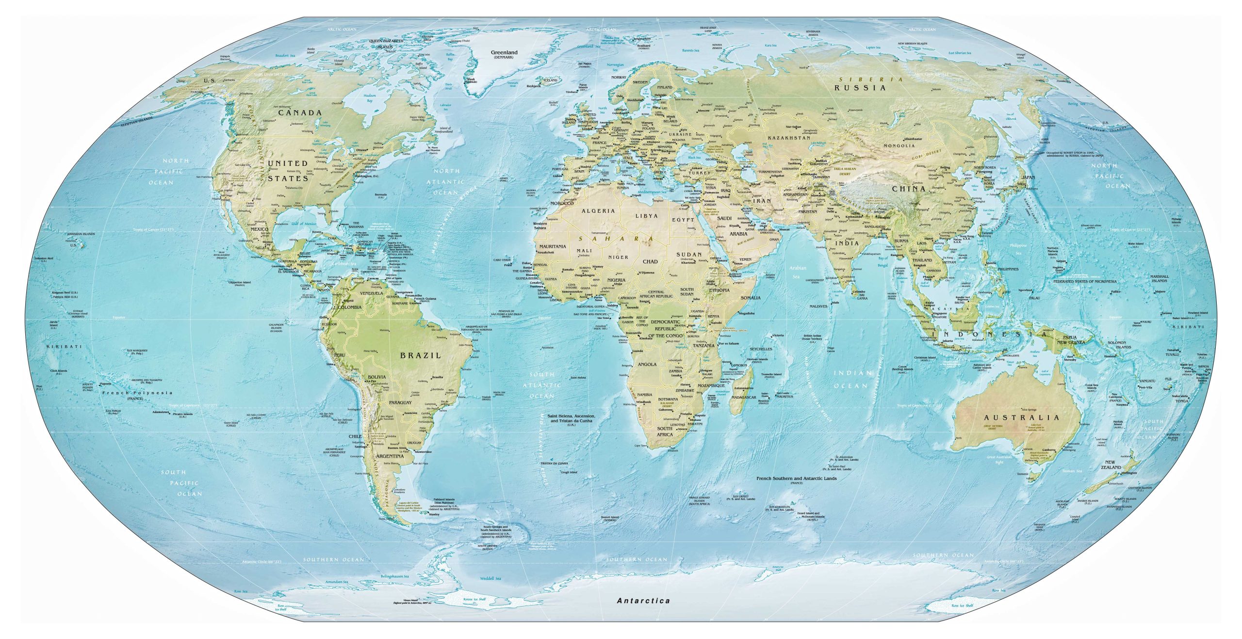
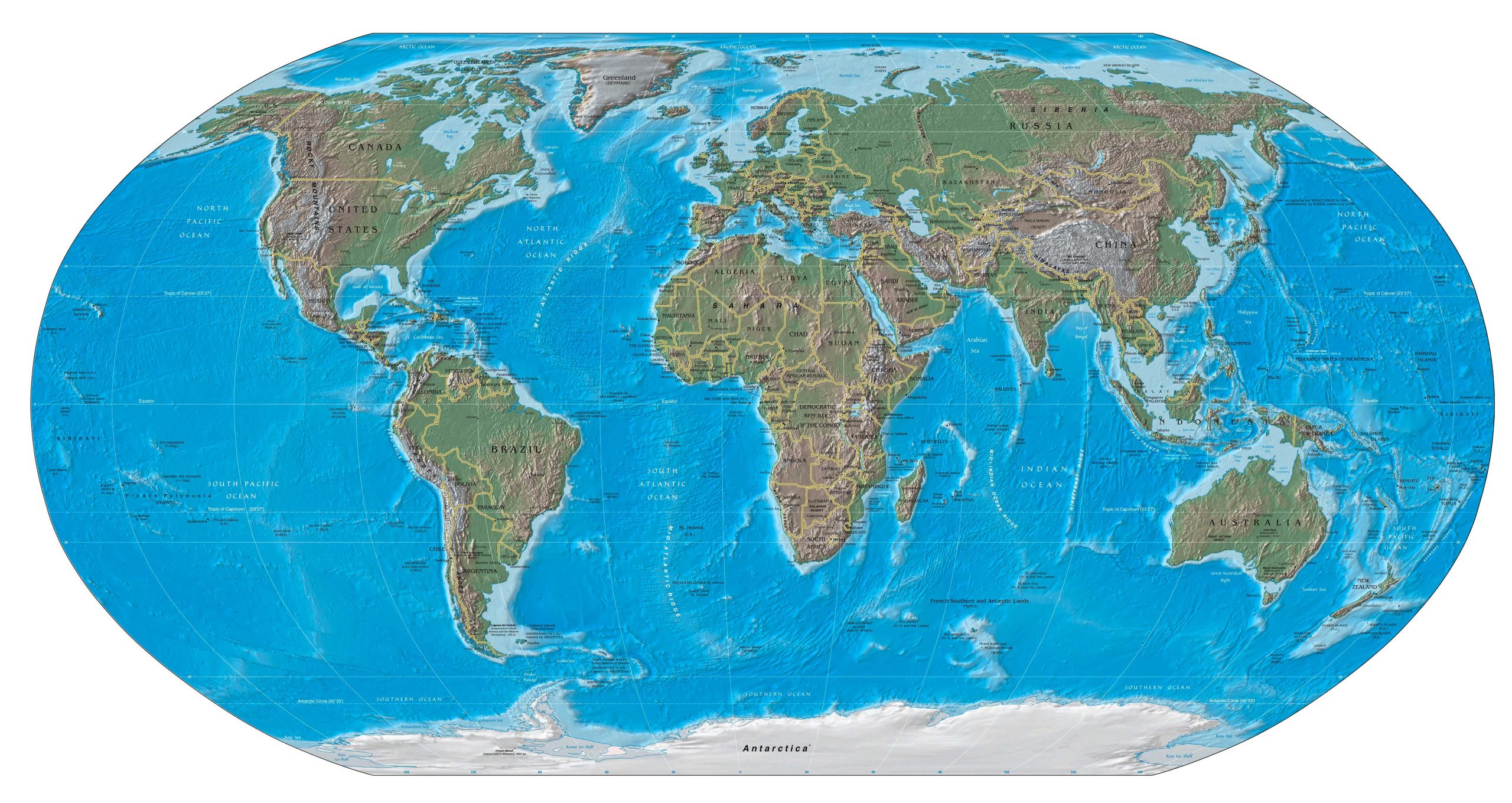
2. CIA-US Goverment Physical Map of the World
A physical map showcases the physical features of an area, such as mountains, rivers, and lakes. Ideal for understanding terrain and natural landscapes.
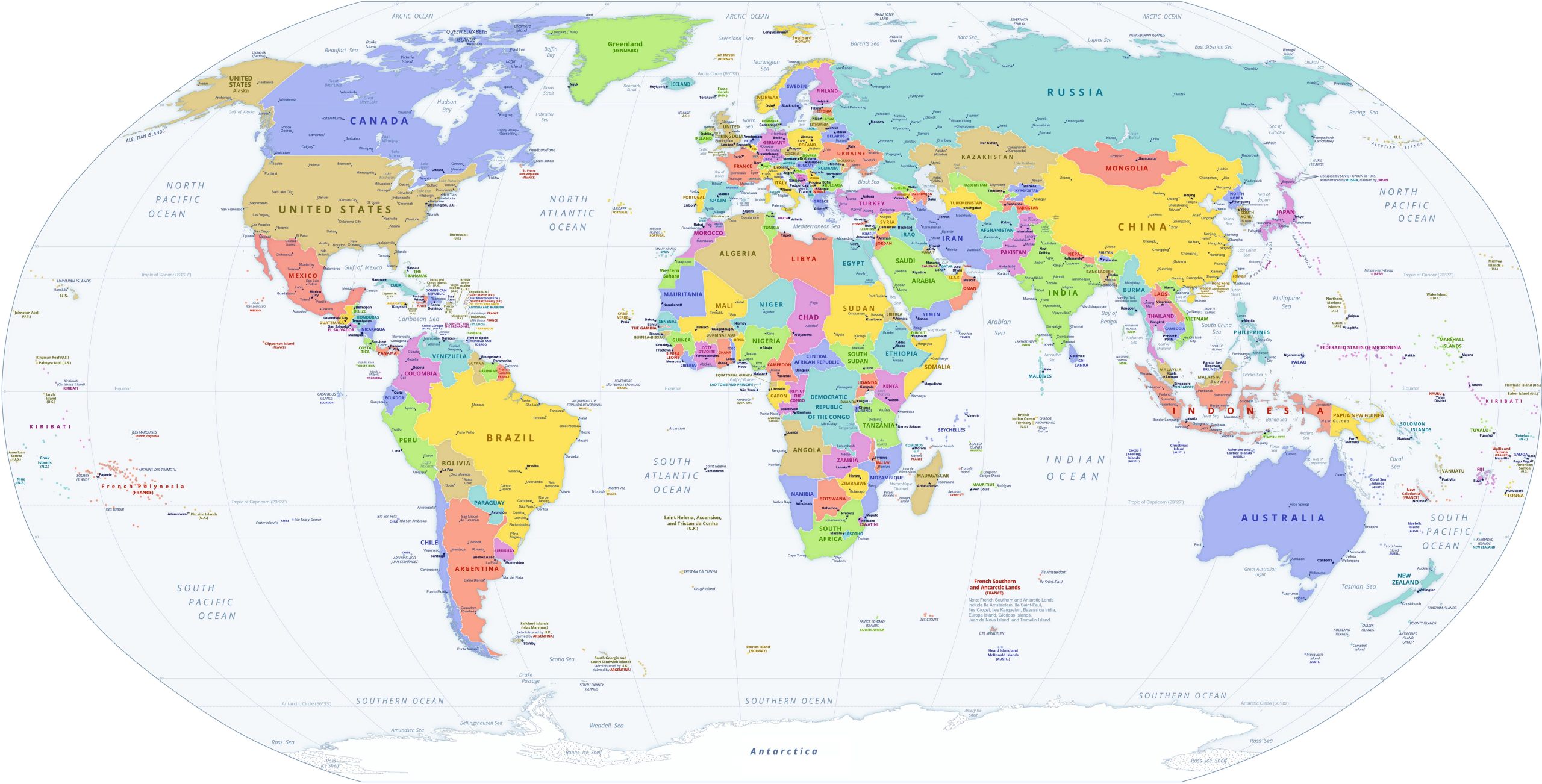
2. World Political Map
Political maps represent territorial boundaries, countries, states, and provinces. They’re perfect for getting a grip on global politics and borders.
3. World Topographic Map
With contour lines representing elevation changes, topographic maps are a dream for hikers, planners, and construction teams alike.
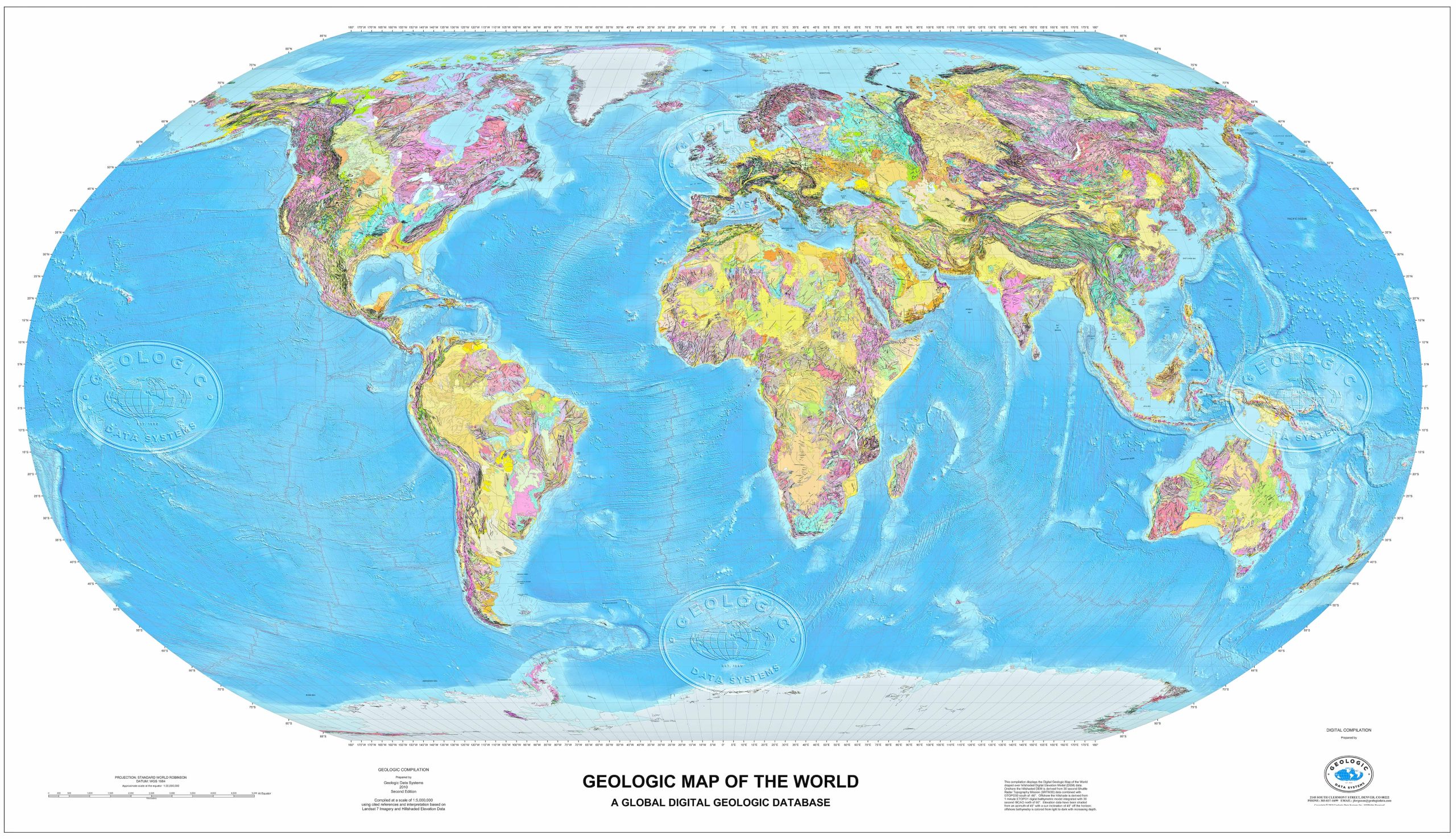
4. World Geological Map
Understand the rock distribution of an area! Geological maps are crucial for geologists and those in the mining sector.
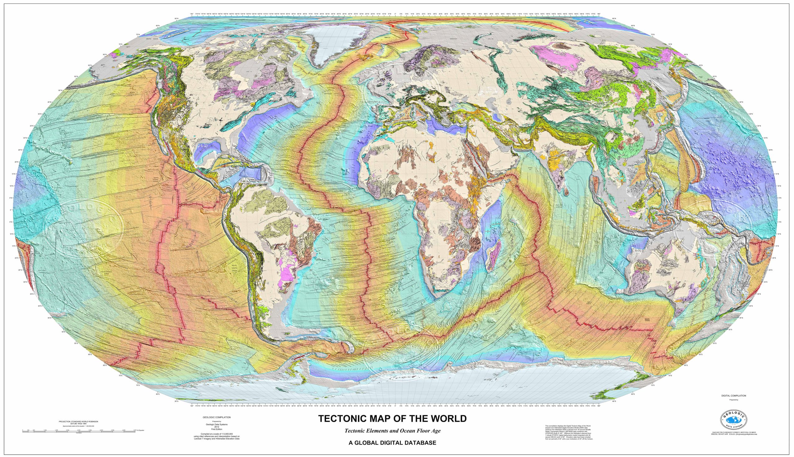
5. World Tectonic Map
Drawing inspiration from the Exxon 1985 Tectonic Map, this updated digital map incorporates modern tectonic data and GIS advancements, covering features from basin polygons to seafloor ages. Using Landsat imagery and global geophysical data, it delivers a holistic view of tectonic structures.
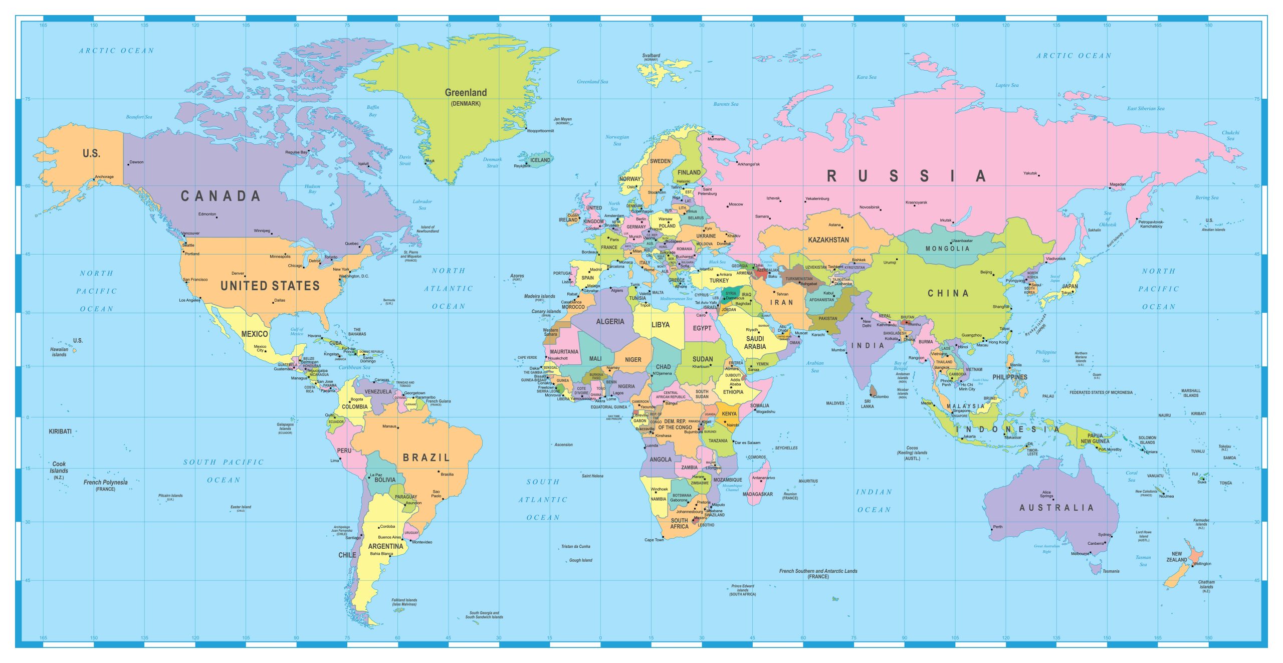
5. Countries, Capitals and Major Cities of the World Map
The ‘Countries, Capitals and Major Cities of the World Map’ provides a comprehensive overview of global geography, pinpointing nations and their respective capitals, while also highlighting major urban centers. It’s an essential tool for both learners and travelers seeking a detailed snapshot of the world’s key locations.
5. World Continents Map with Countries
Perhaps you’re expanding your geographical knowledge. This map offers a straightforward overview of countries and their main cities.
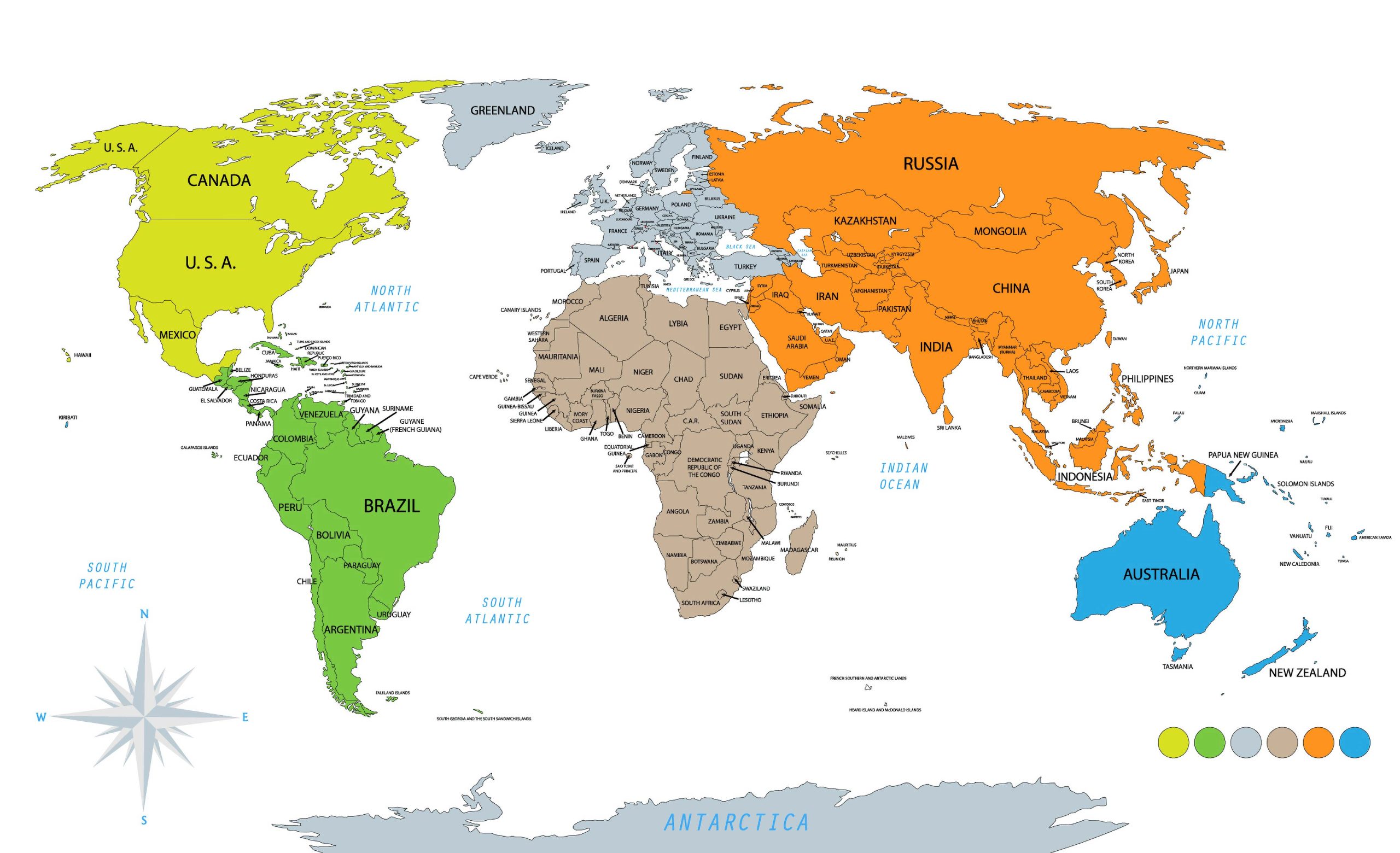
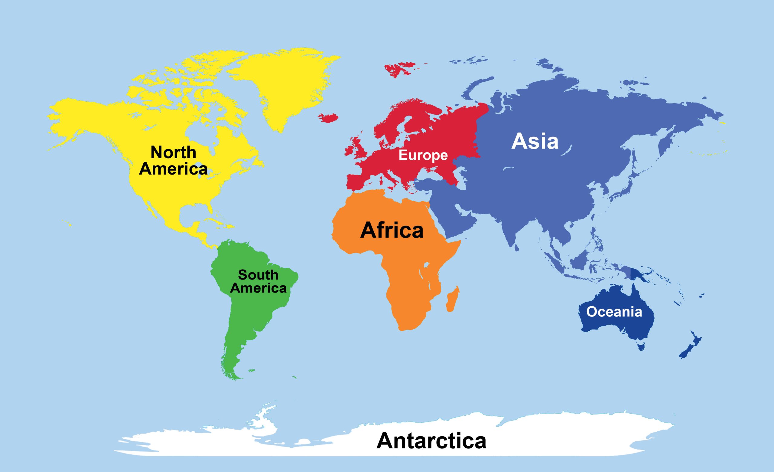
5. World Continents Map
The ‘World Continents Map’ offers a clear depiction of the Earth’s primary landmasses, categorizing and differentiating each major continent. It’s a foundational reference for understanding the broad divisions of our planet’s geography.
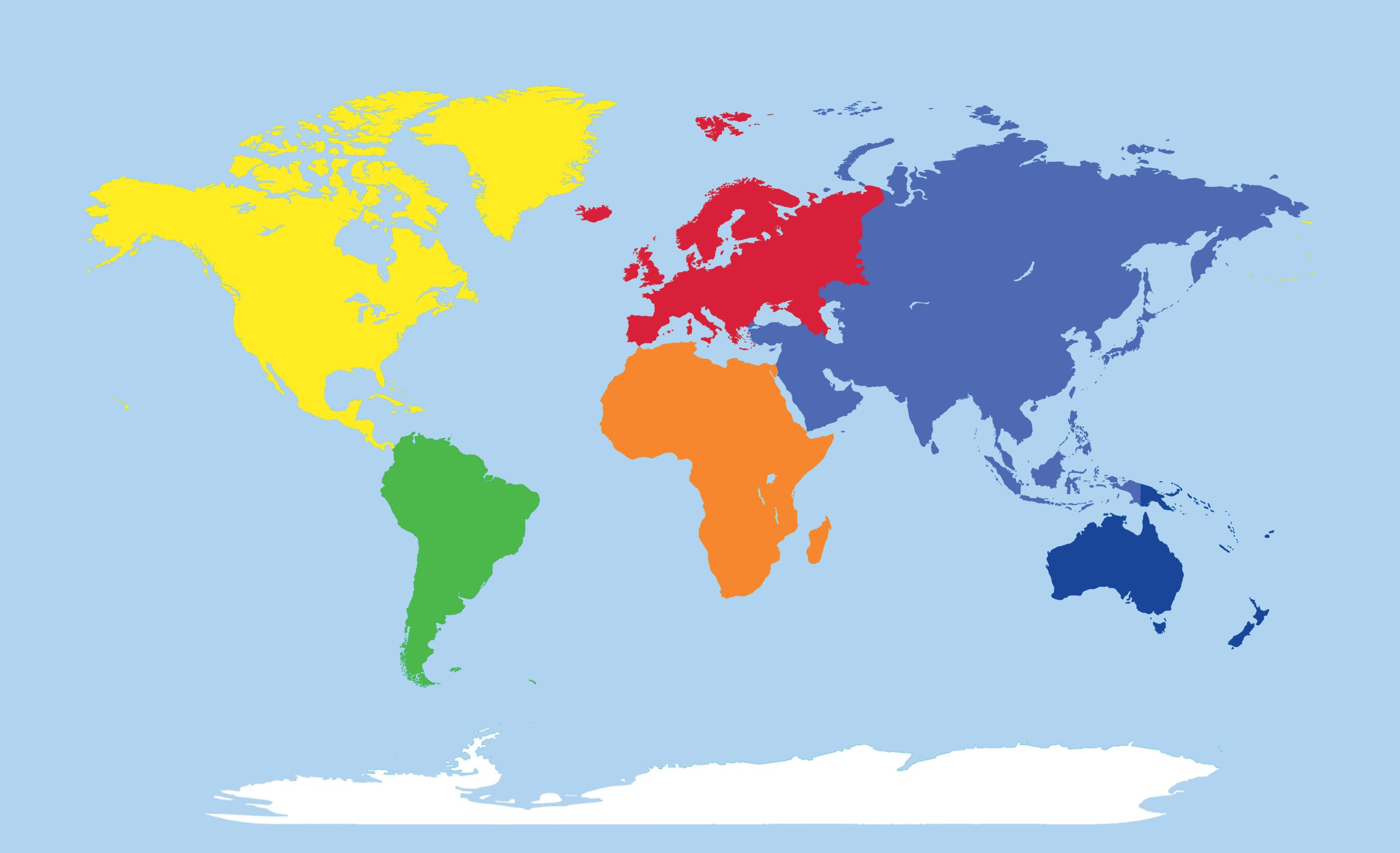
5. World Continents Blank Map
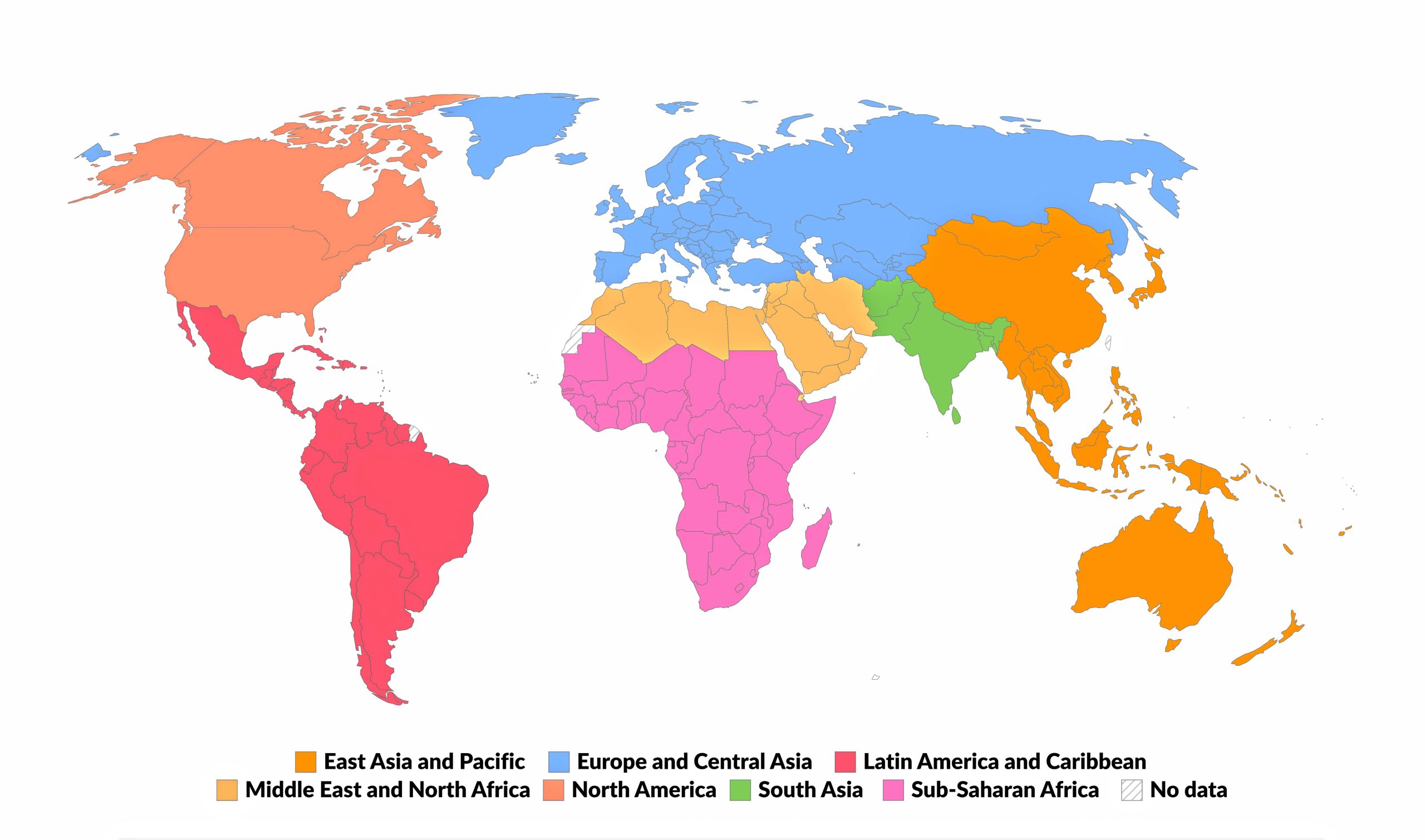
7. World Regions Map
The ‘World Regions Map’ delineates global subdivisions, showcasing the blend of geographical and cultural zones. It’s a concise guide to the planet’s diverse sectors.
8. World Blank Map
Test your geographical prowess or use it for teaching. Blank maps challenge you to recall country locations, borders, and other geographical features.
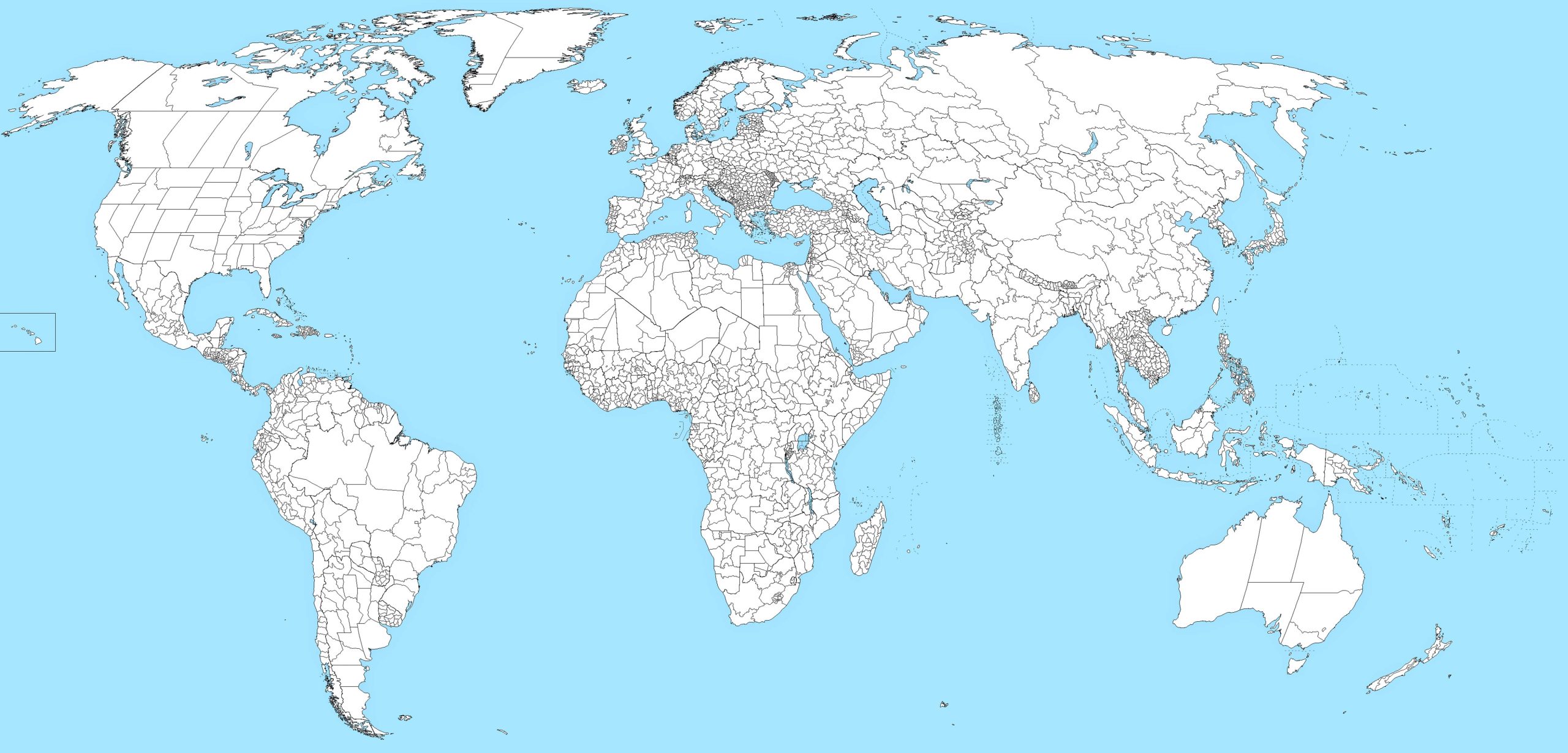
9. World Blank Map With States
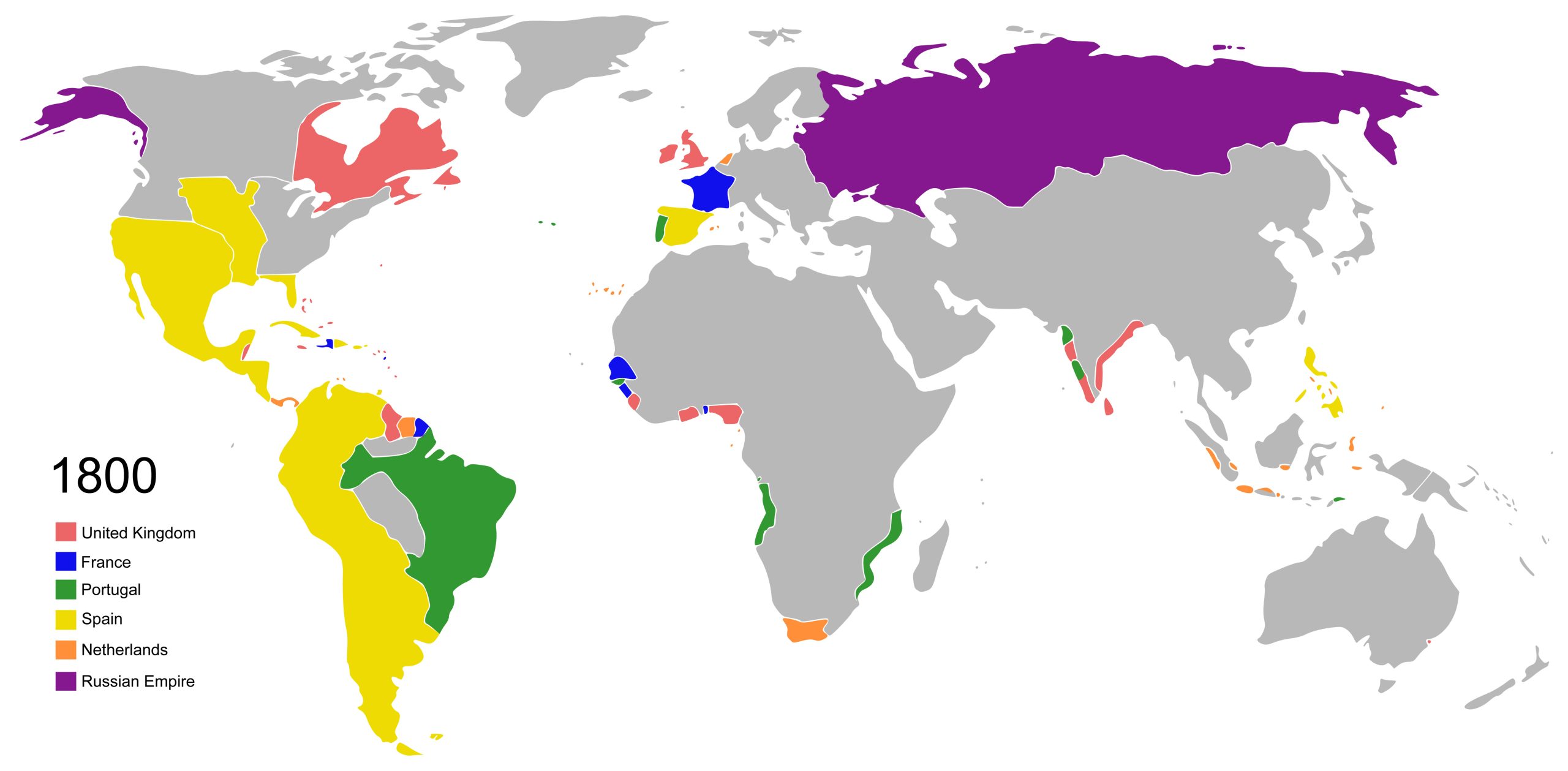
10. World Colonial Map (1800 – Vector)
This map vividly depicts the global spread of colonial empires in the 19th century, utilizing precise vector graphics to showcase territories and dominions of that epoch.
12. World Relief Map
Visualize elevation and landforms using shaded relief. An engaging way to grasp the world’s terrains.
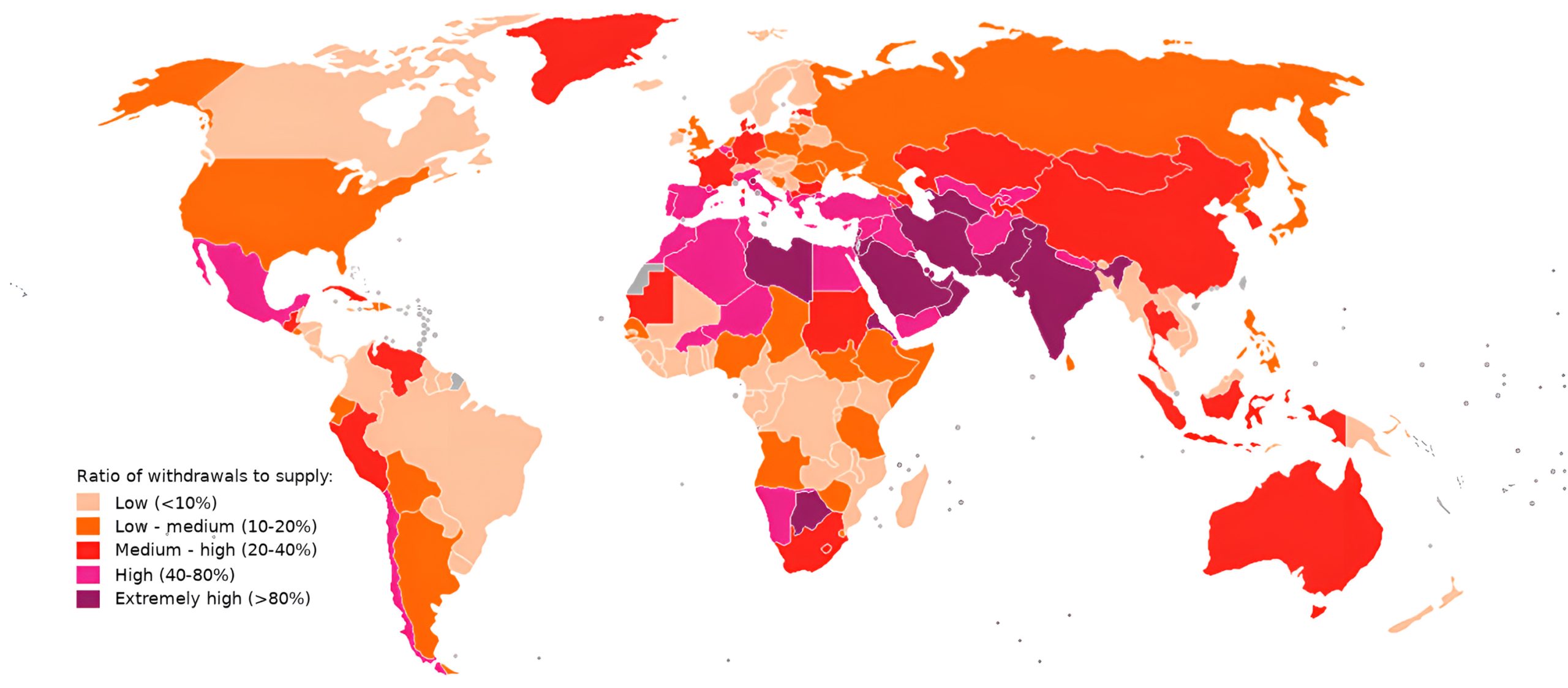
13. World Water Scarcity Map
In 2019’s map detailing worldwide water stress, the emphasis is on the imbalance between water usage and its availability. Water stress is defined as the proportion of water consumption in relation to its accessible supply, making it a reflection of demand-induced scarcity.
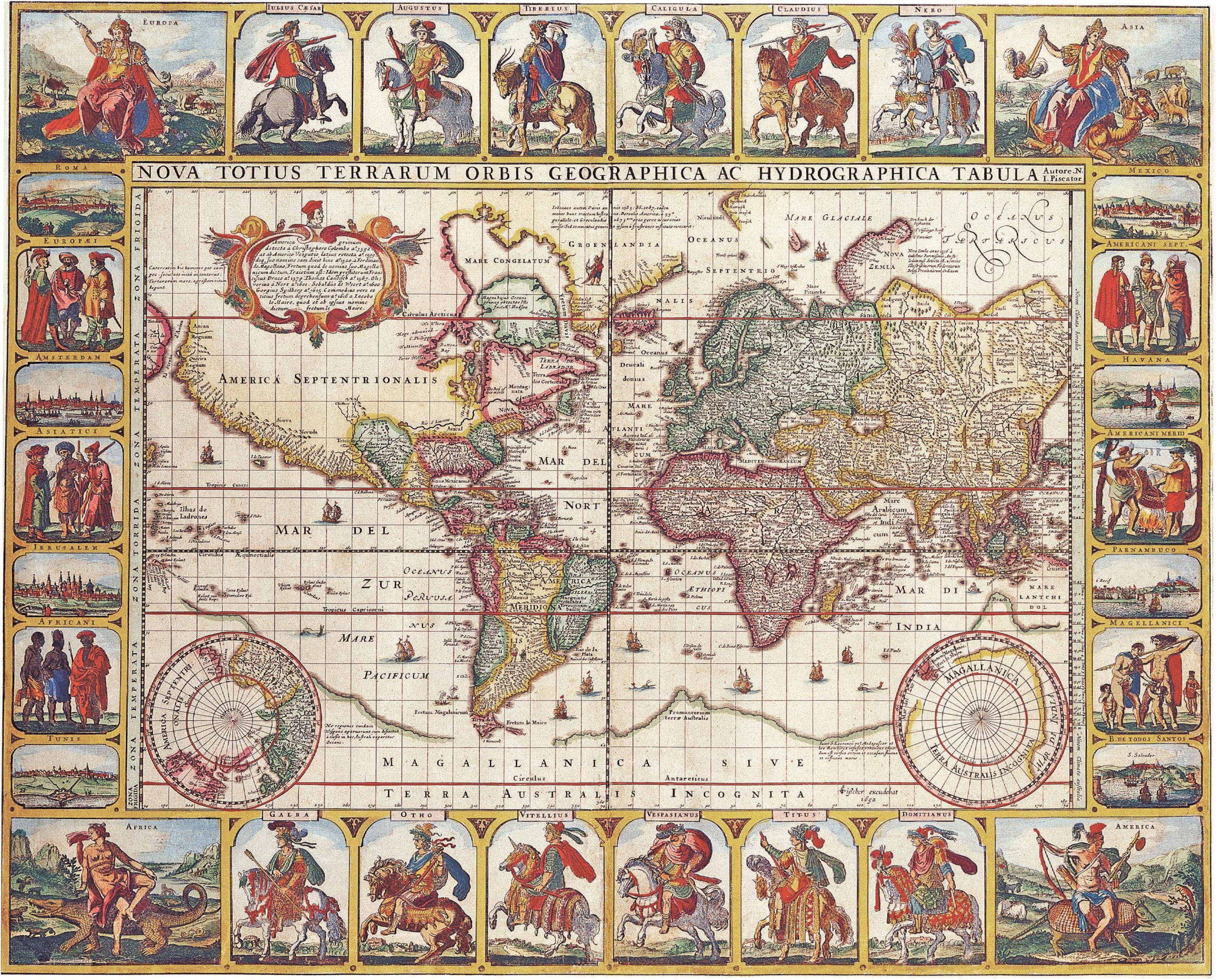
14. World Historical Map (1652)
The 1652 world map by Claes Janszoon Visscher is a remarkable representation from the 17th century, blending Dutch cartographic precision with artistic nuances. It offers a glimpse into the era’s geographical knowledge, enriched with cultural and maritime references. Source Wikipedia.
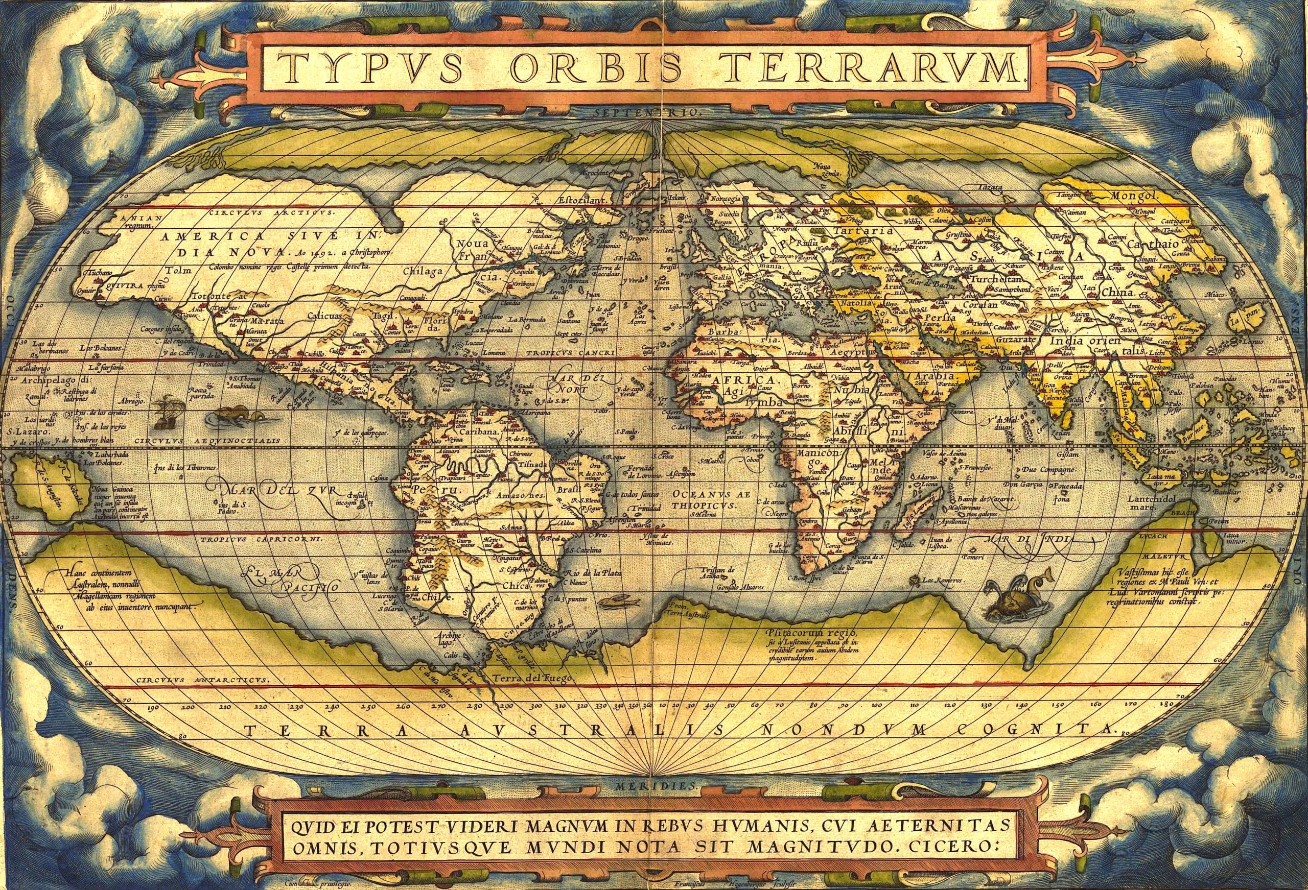
15. World Historical Map (1570)
The World Historical Map of 1570 offers a captivating snapshot of global understanding during the Renaissance era, capturing the geographical knowledge and artistic sensibilities of the time.
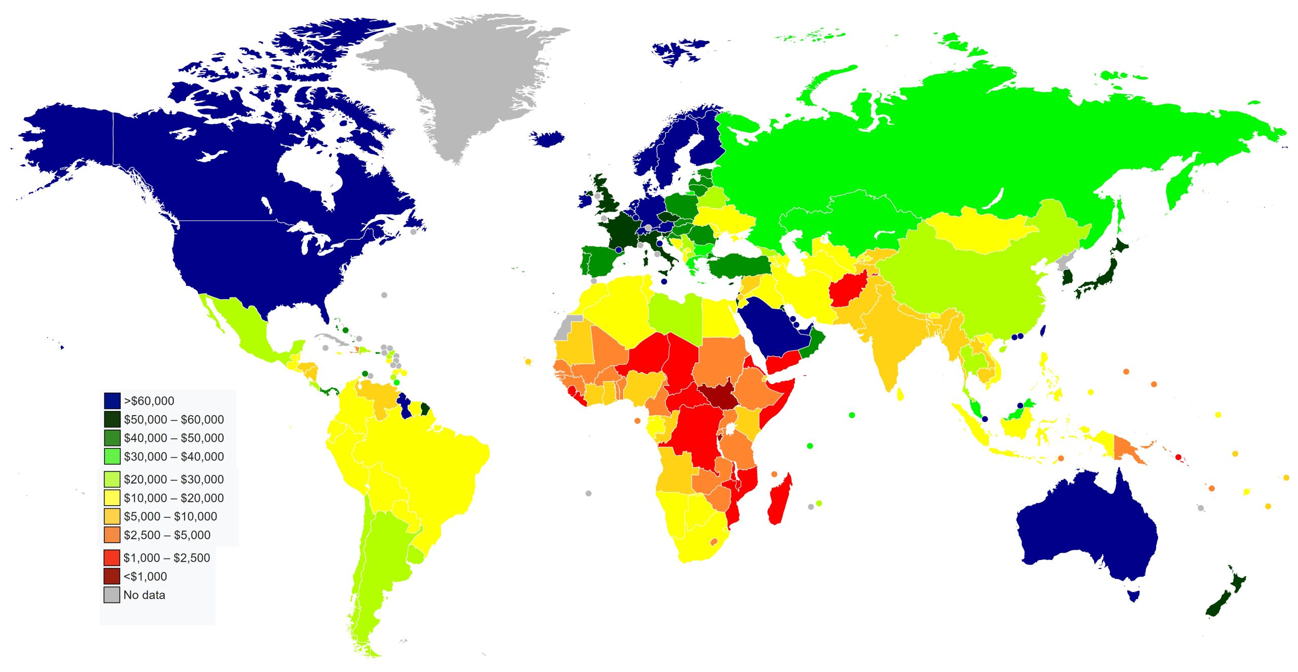
16. World Countries by GDP (PPP) Per Capita Map (2023)
An insightful map detailing countries’ GDP based on Purchasing Power Parity. Understand global economic standings at a glance.
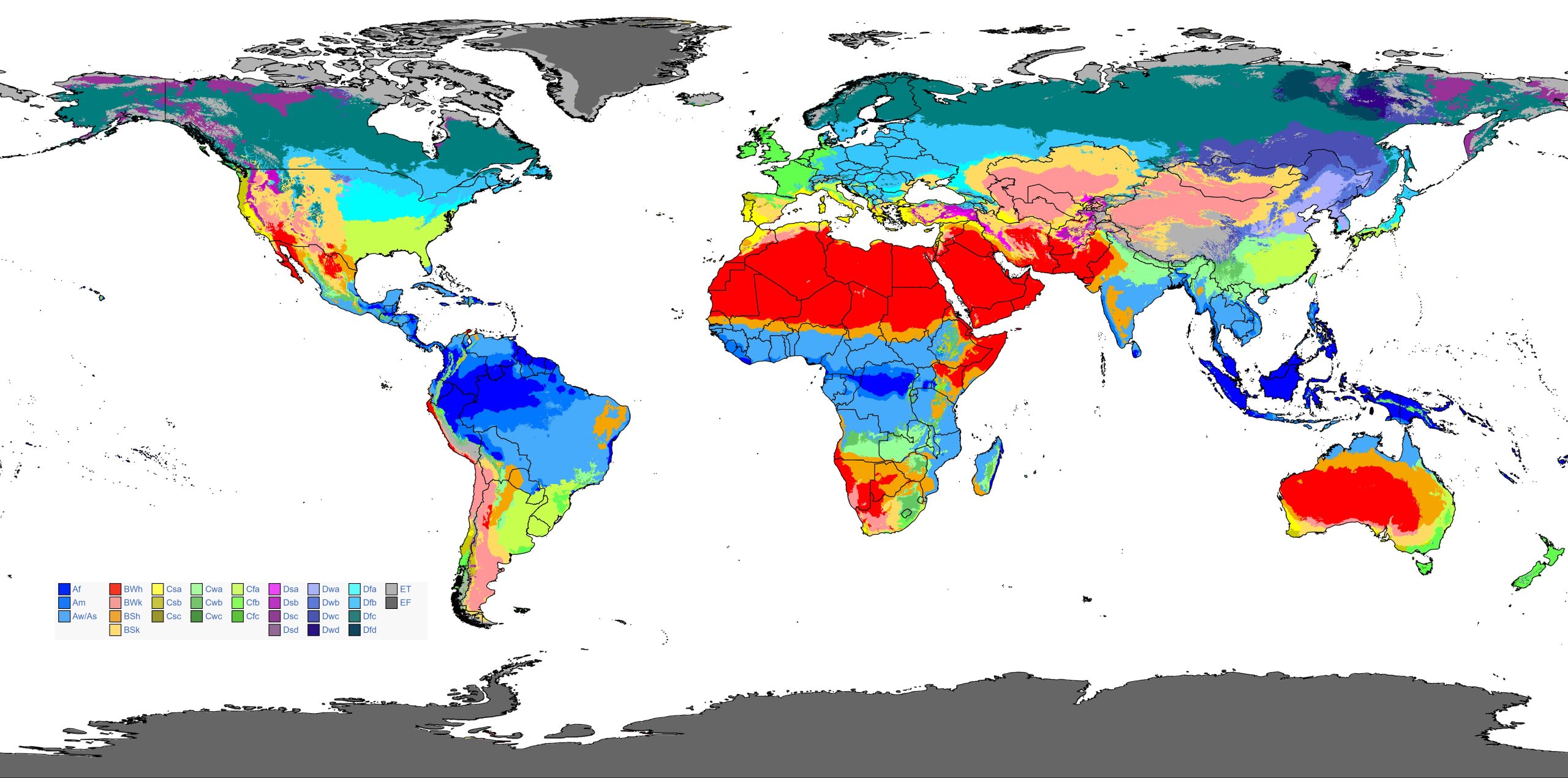
17. World Climate Map
The World Köppen-Geiger Climate Classification Map provides a visual representation of the planet’s diverse climate zones, categorizing regions based on temperature and precipitation patterns.
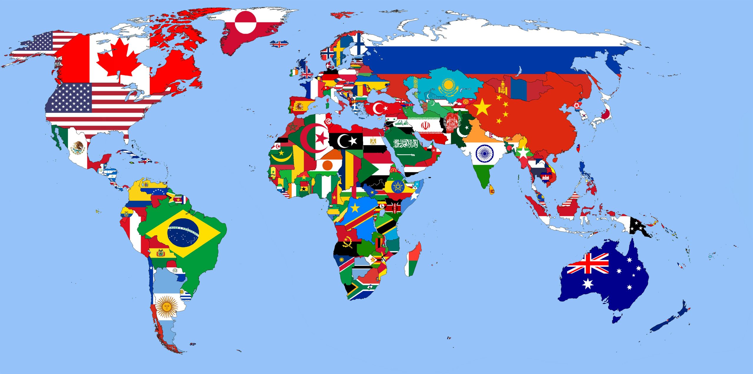
18. World Flag Map
A vibrant representation, flag maps overlay countries with their respective flags. A treat for visual learners!
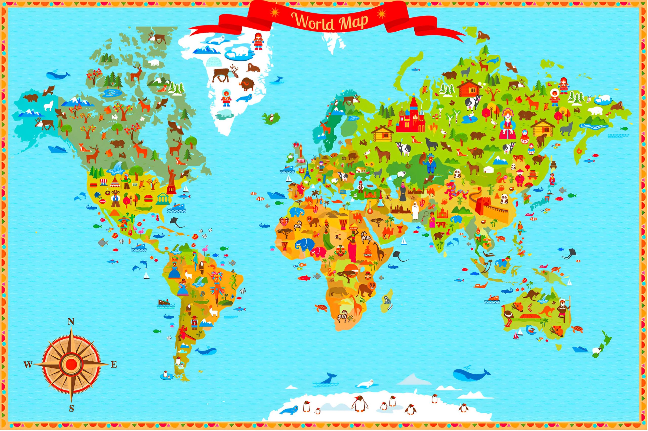
19. World Travel (Tourist) Map
Highlighting tourist attractions, scenic routes, and travel hubs, this map is the ultimate companion for globe-trotters.
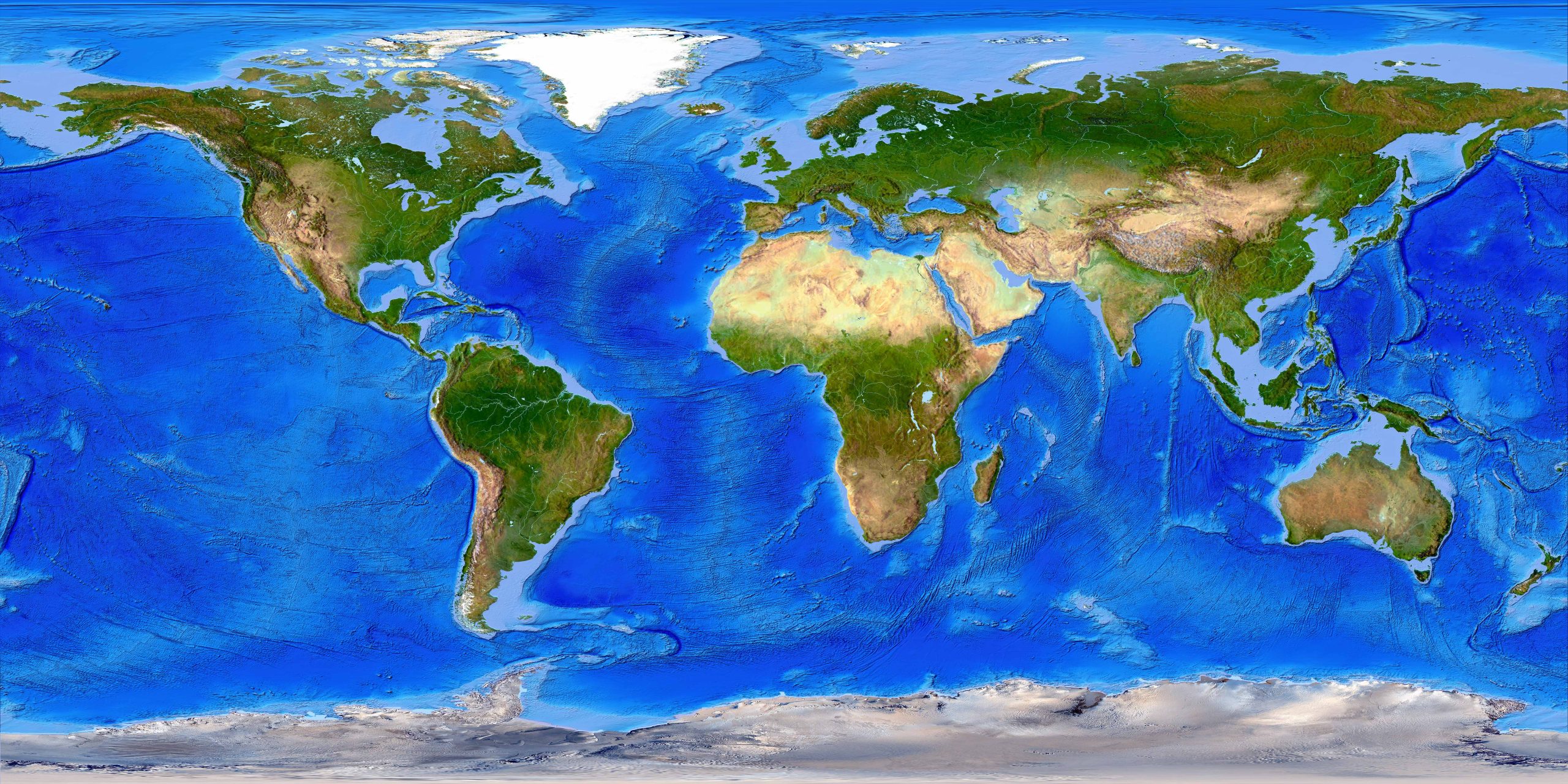
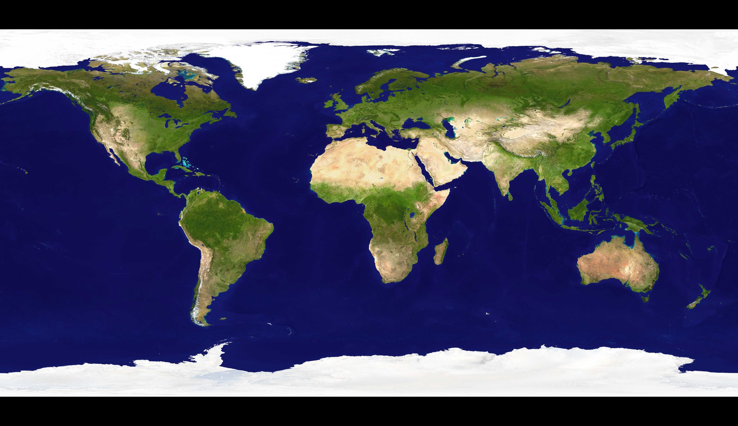
20. World Earth Satellite Map
Satellite maps offer real images of Earth from space, perfect for analyzing natural and human-made patterns.
From the cascading valleys of the Andes to the intricate networks of metropolitan train systems, every map captures a fragment of our planet’s vast tapestry. Whether you’re charting a journey, revisiting history, or simply indulging in the artistry of cartography, our collection aims to enlighten, educate, and inspire. So, as you scroll through each map, let it be a reminder of the endless wonders the world has to offer, beckoning you to explore, learn, and appreciate its diverse landscapes and cultures. Journey on, dear explorer, for every map is a new adventure waiting to unfold.
Where is North America in the World?
Show Google map, satellite map, where is the country located.
Get direction by driving, walking, bicycling, public transportaion and travel with street view.
Feel free to explore these pages as well:
- Political Map of North America ↗️
- World Political Map German ↗️
- World Political Maps ↗️
- World Political Map English ↗️
- A Collection of World Maps: Navigating Our Beautiful Planet ↗️
- World Map Continents ↗️
- World Maps with Countries ↗️
- World Time Zone Map ↗️
- More World Maps ↗️
- World Map ↗️
- A collection of World Maps ↗️
- Map of World Countries ↗️
- Map of World ↗️
- Map of the World ↗️
- Maps of the World ↗️
- Political Map of the World ↗️
- Physical Map of the World ↗️
- World Climate Map ↗️
- World Elevation Map ↗️
- World Literacy Rate Map ↗️
- World Temperature Distribution Map ↗️
- World Political Map English ↗️
- World Topographic Map ↗️
- World Satellite Map ↗️
- World Historical Maps ↗️
- World Physical Maps ↗️
- World Maps in Different Languages 1 ↗️
- World Maps in Different Languages 2 ↗️
- World Maps in Different Languages 3 ↗️
- World Maps in Different Languages 4 ↗️

