- Advertisement -
Explore detailed maps of U.S. time zones including Pacific, Mountain, Central, and Eastern regions. View standard time zone maps of the USA, US states, and the world with accurate boundaries and local time references.
United States of America time zones map with states
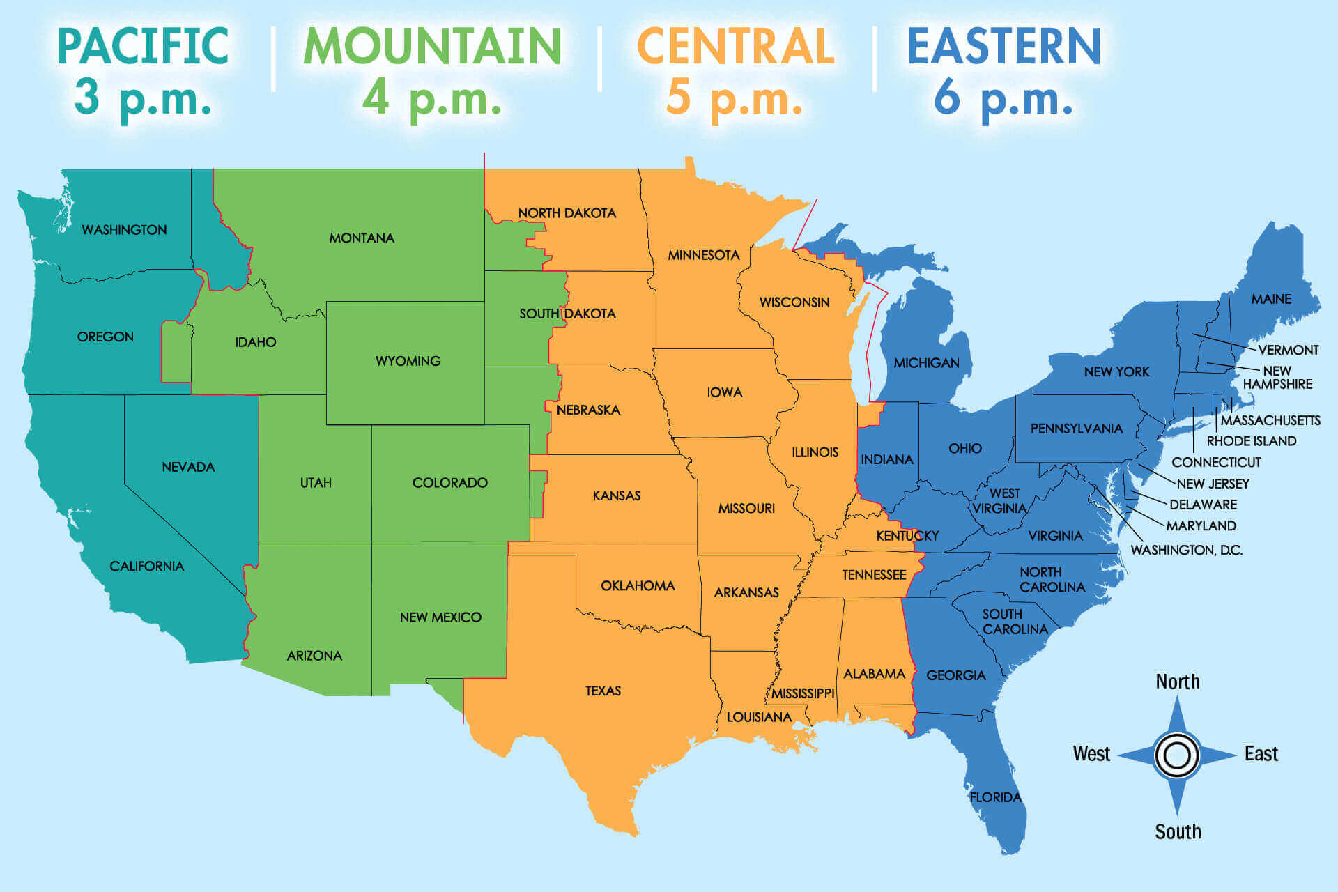 USA map showing time zones and state borders in different colors.
Pacific mountain central eastern time zones map in the US
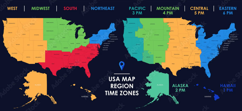 Color-coded USA map with Pacific, Mountain, Central, and Eastern time zones.
US time zone map with universal time

Standard time zones in the USA
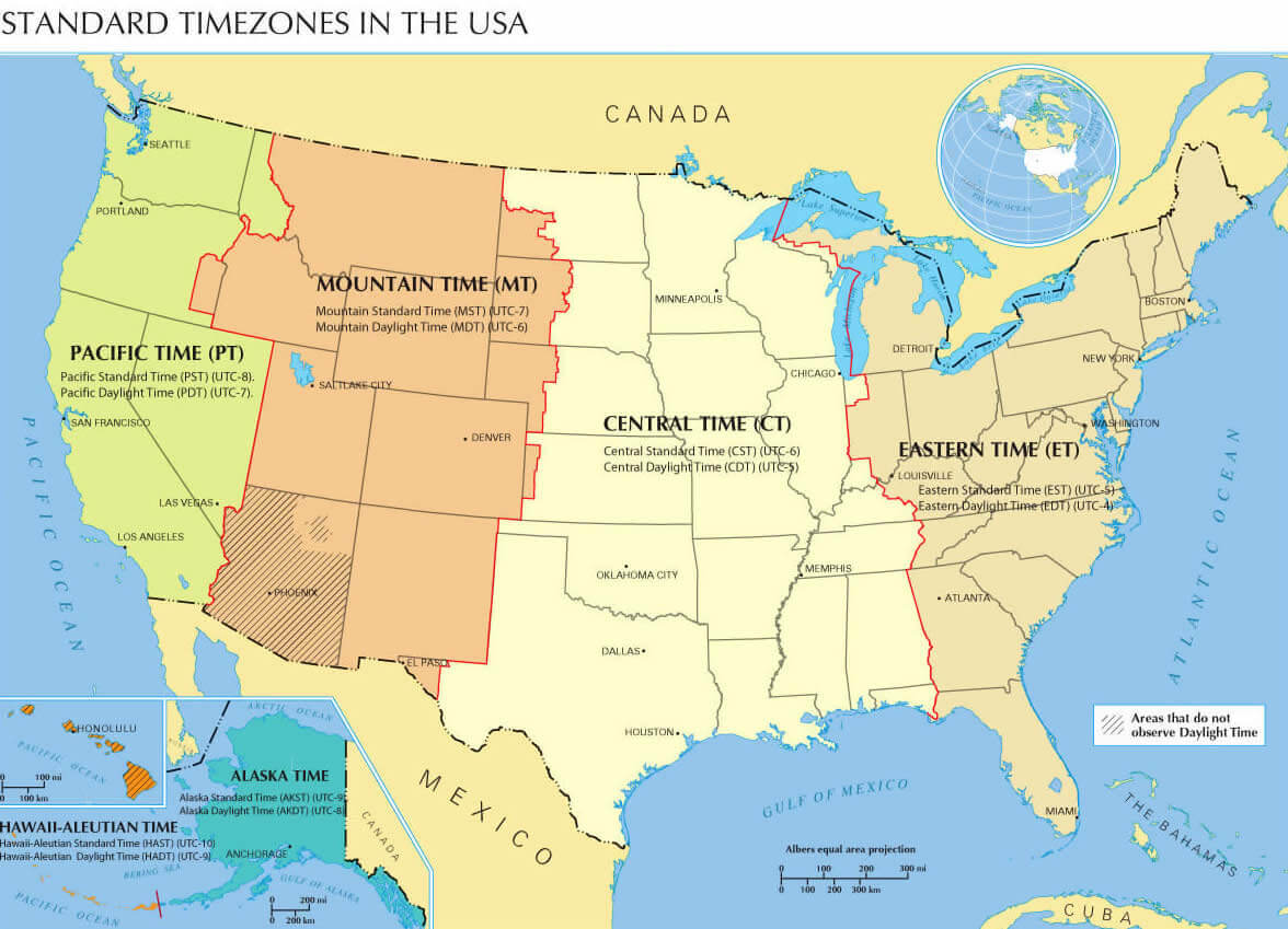
Standard time zones map of the United States
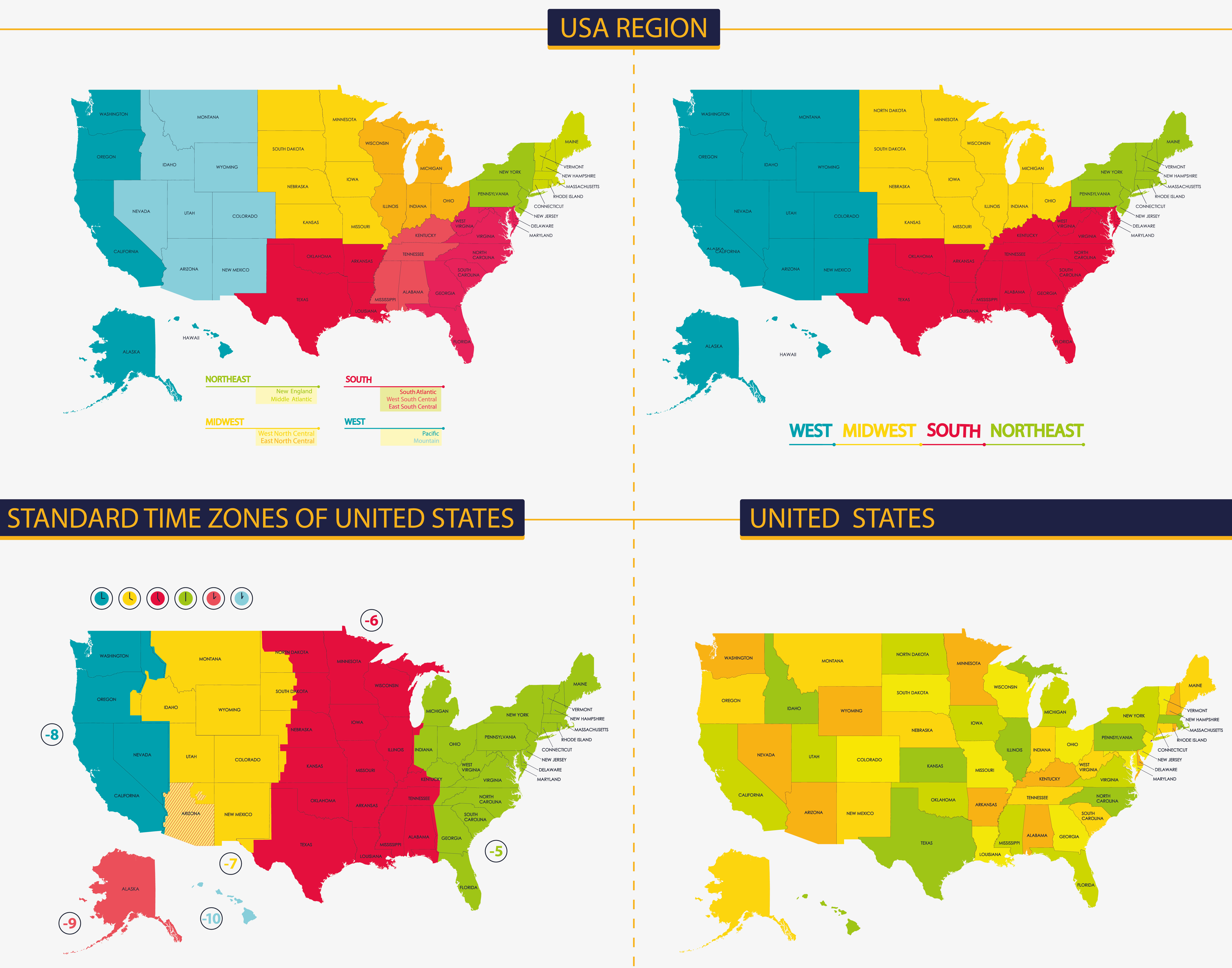
US Time Zone Map: Tracking Time Across America
The United States Time Zone Map reflects the country’s vast geographic spread, encompassing six main time zones across the 50 states: Eastern Time (ET, UTC−5), Central Time (CT, UTC−6), Mountain Time (MT, UTC−7), Pacific Time (PT, UTC−8), Alaska Time (AKT, UTC−9), and Hawaii-Aleutian Time (HAT, UTC−10). Most states observe Daylight Saving Time (DST), advancing clocks by one hour from March to November, although states like Hawaii and most of Arizona do not.Standard time zones map of the World and the United States
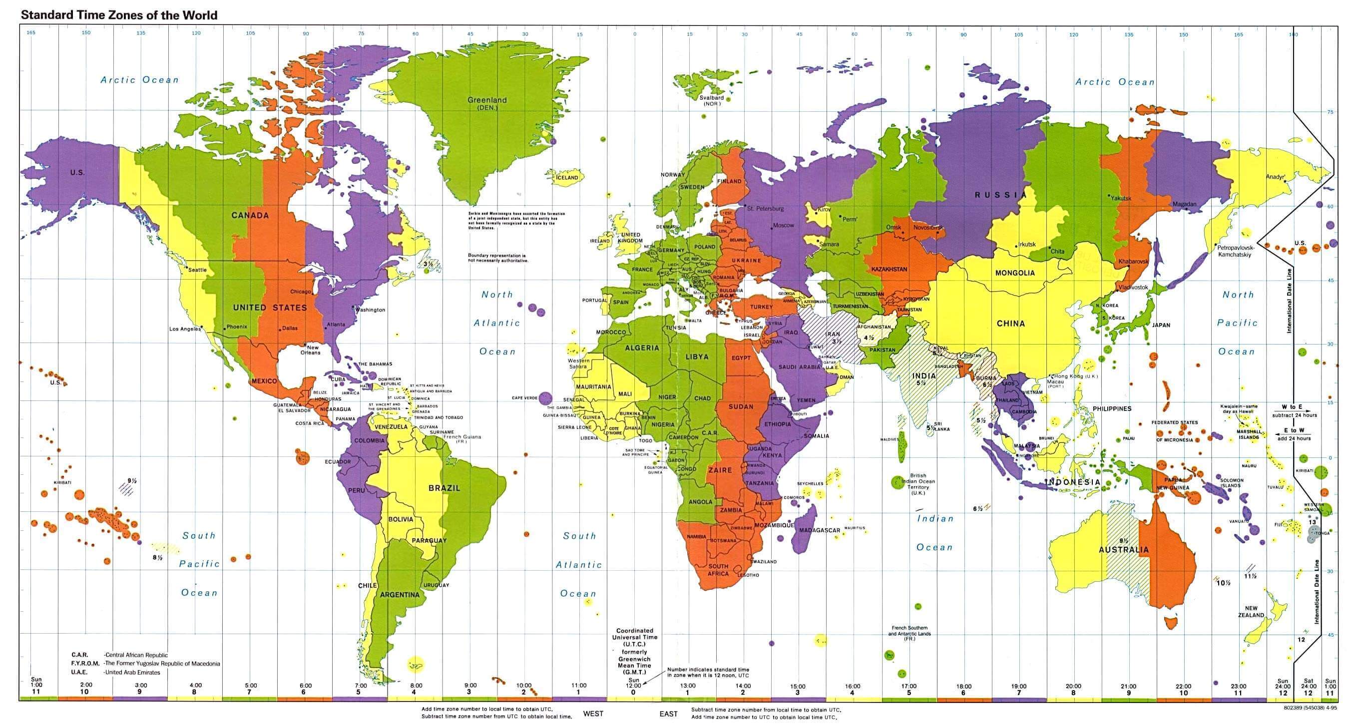
The USA and states time zone map
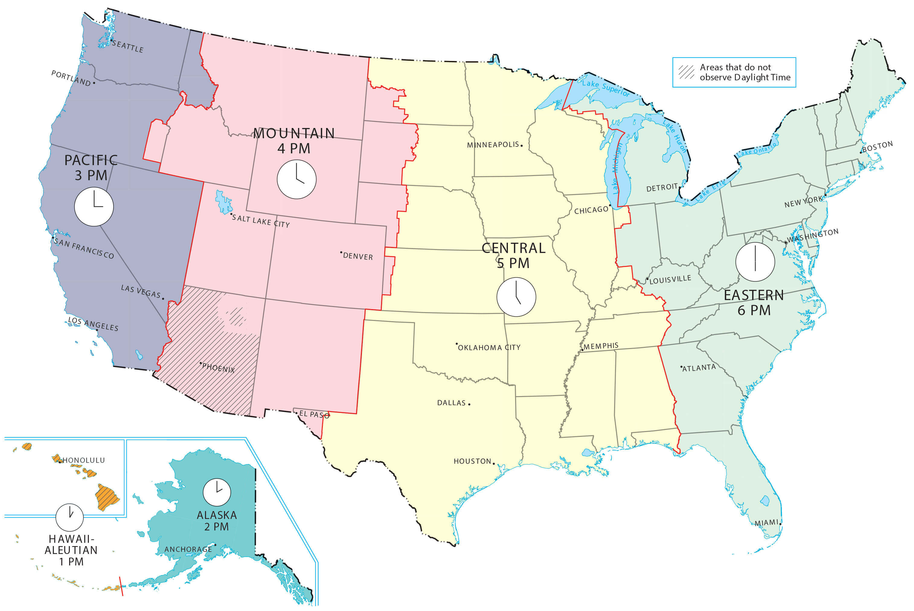
Time zone boundary map in the United States
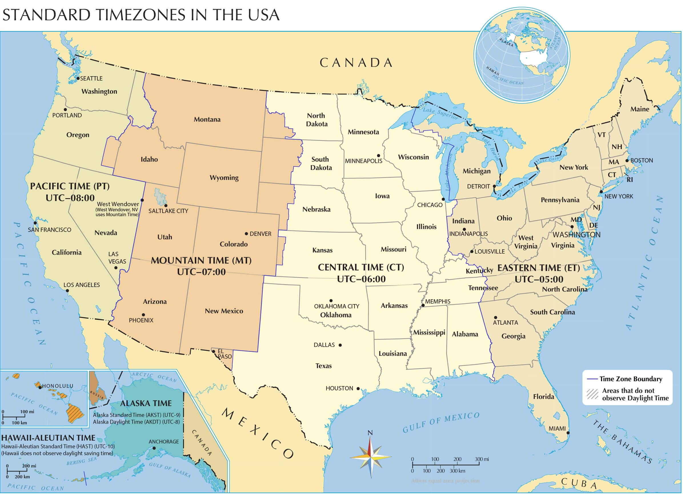
Time zones map of the United States
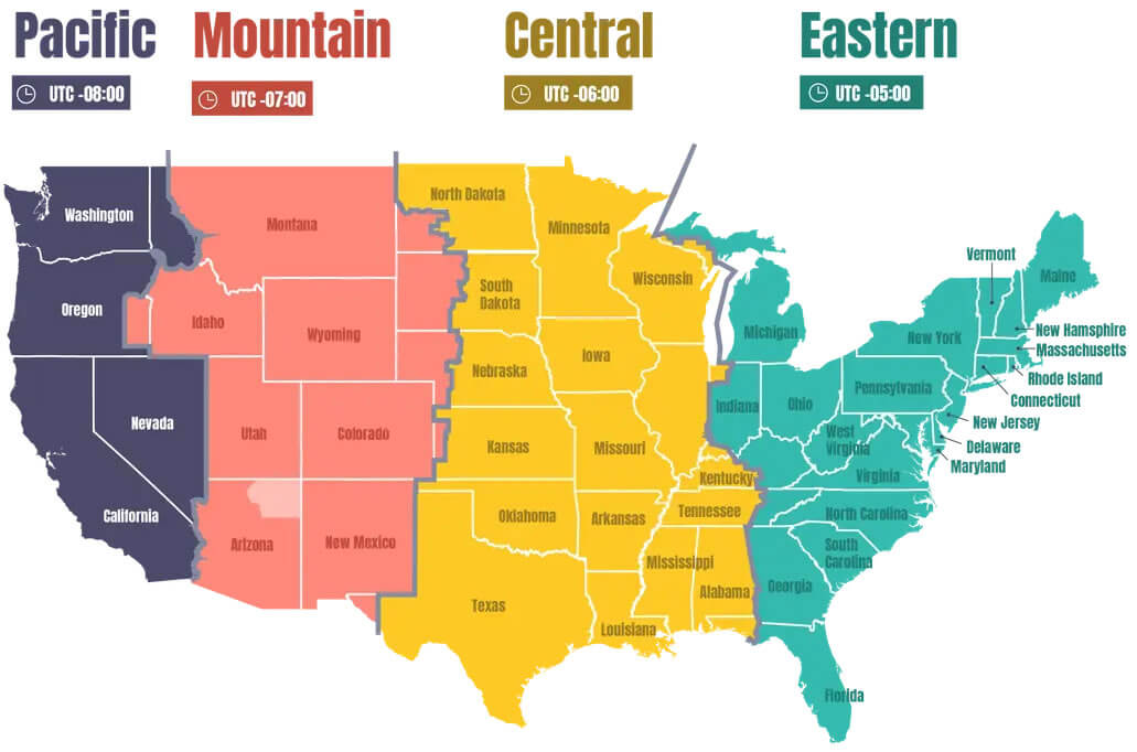
Time zones map of the USA
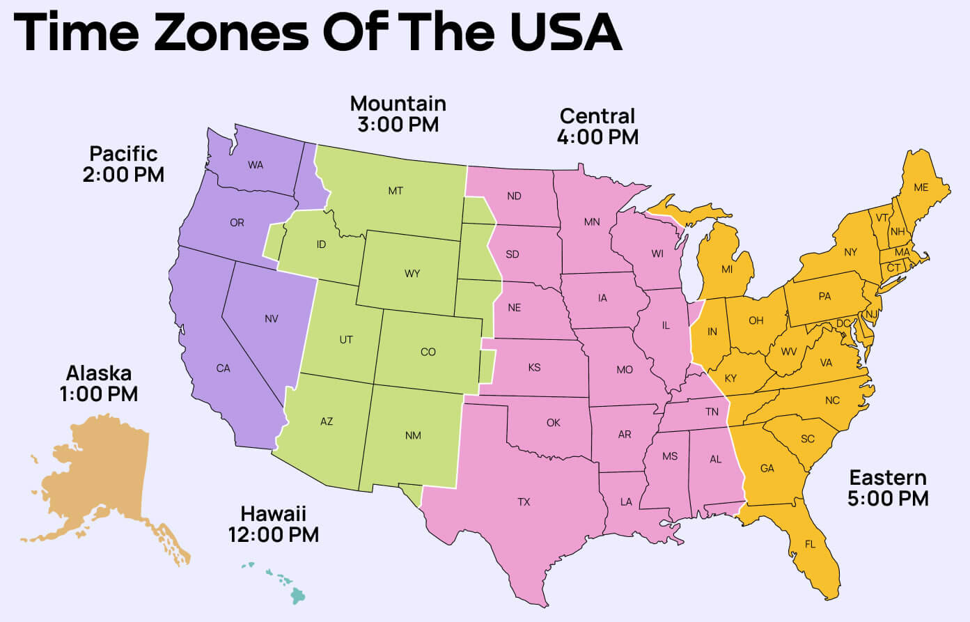
United States and US states time zone map
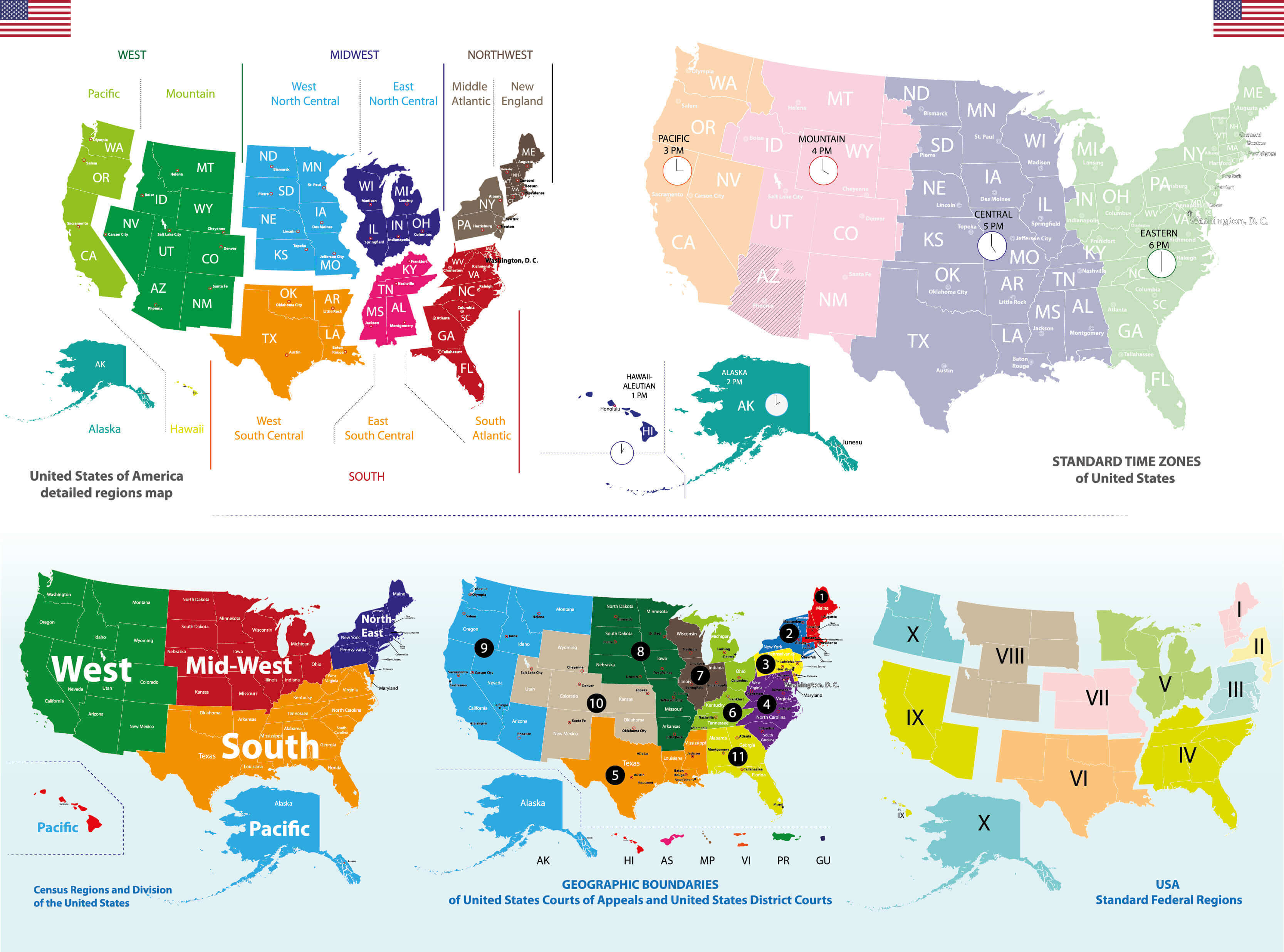
United States time zone map
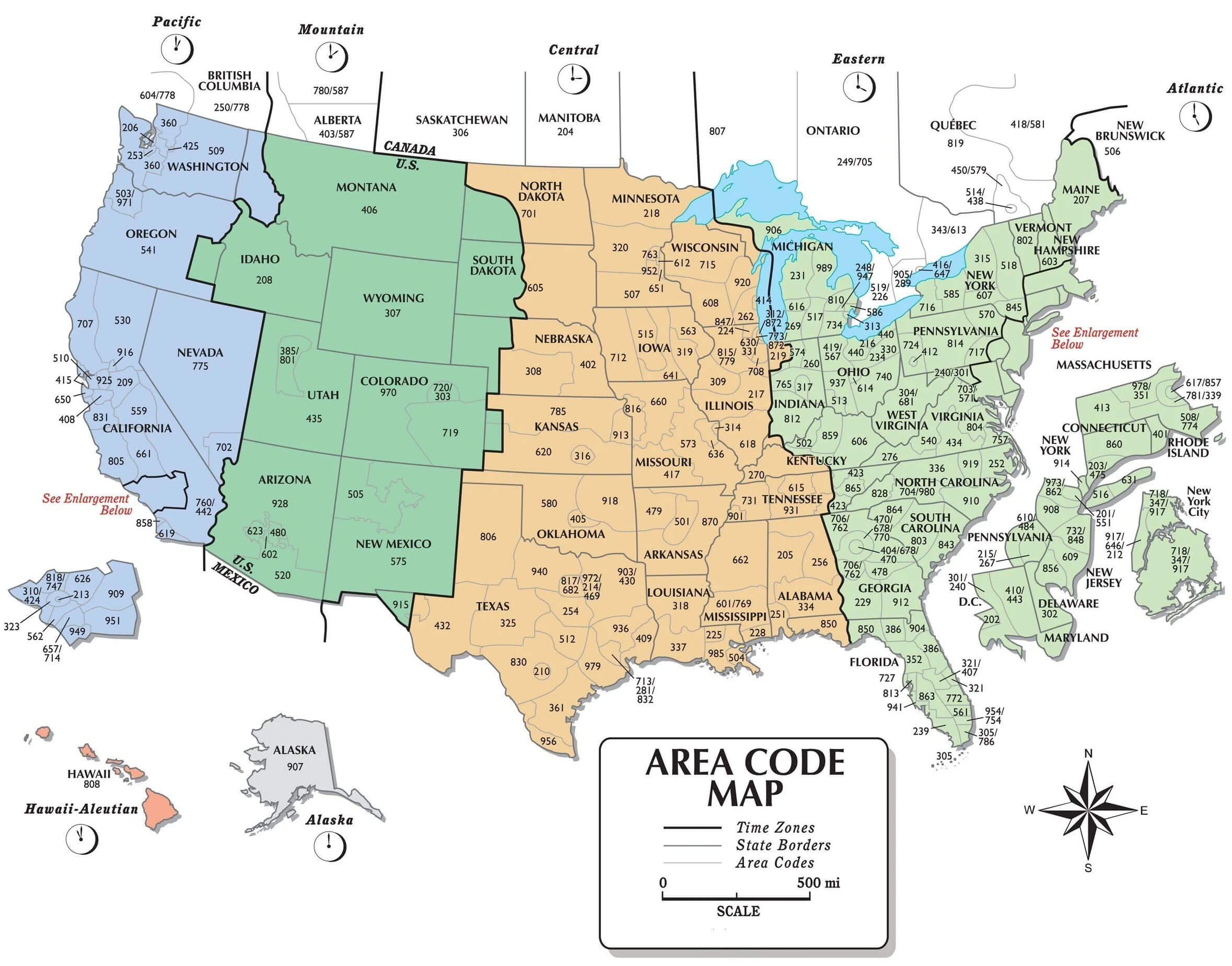
United States time zones map
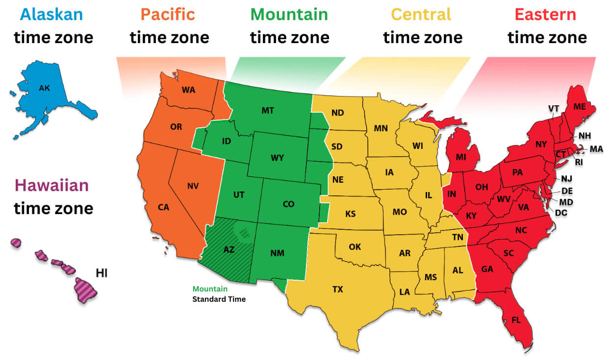
US time zone map
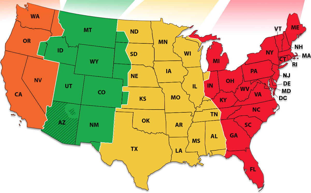
USA time zone map
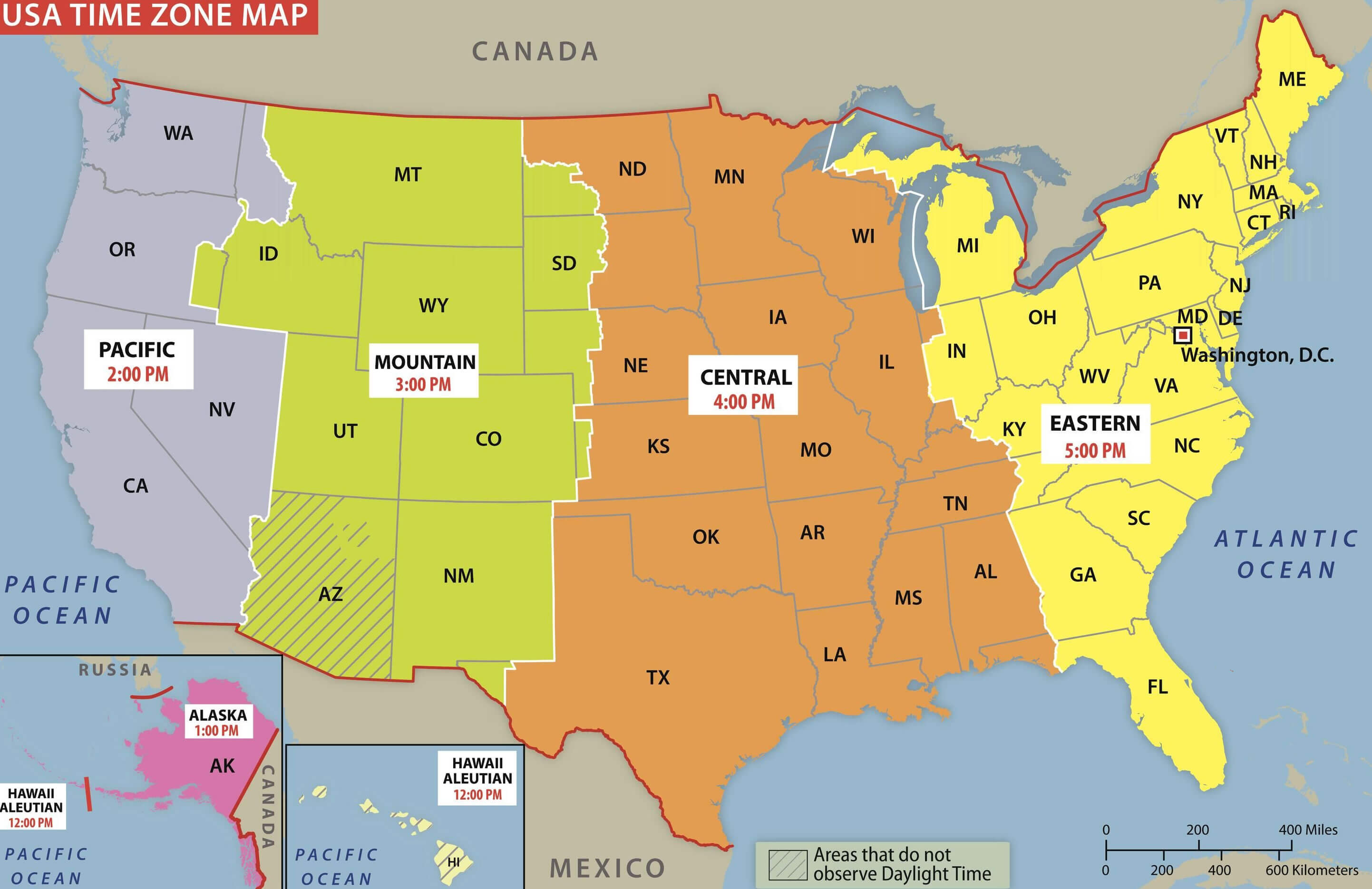
World time zone map with US
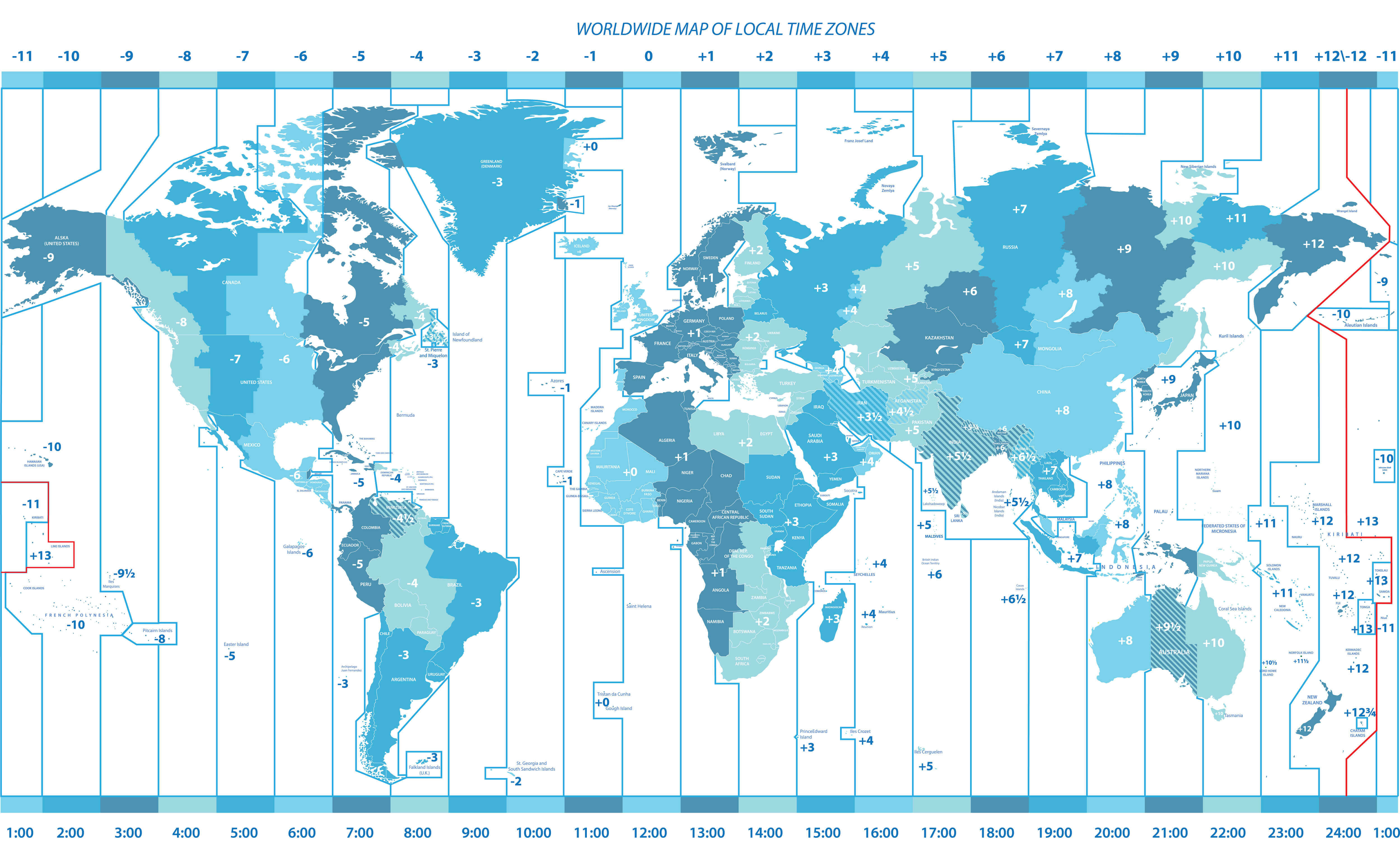
World US time zones map
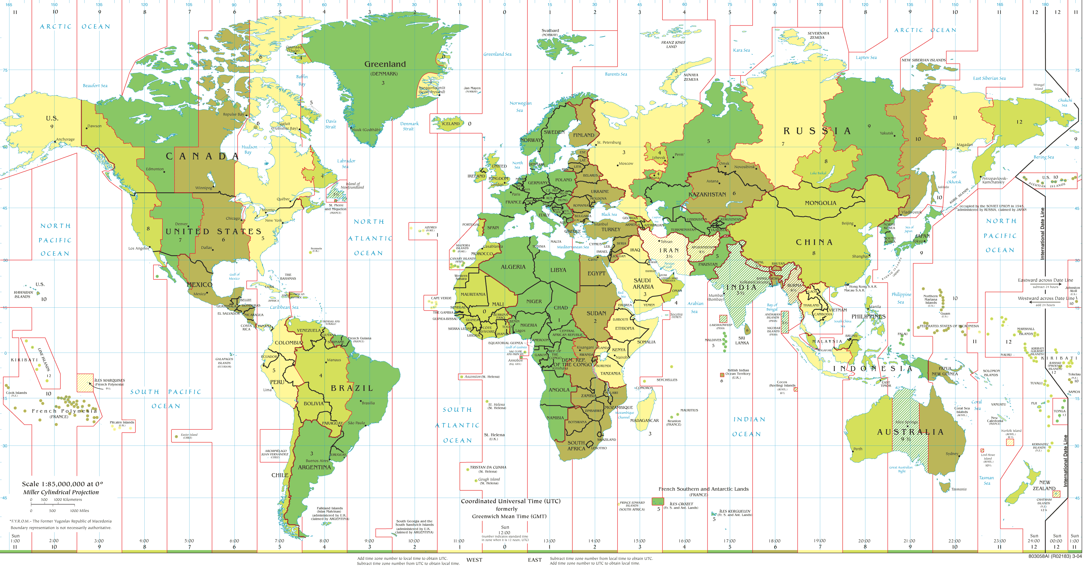
Where is United States on the World Map?
Show Google map, satellite map, where is the country located.
Get directions by driving, walking, bicycling, public transportation and travel with street view.
Feel free to explore US states maps:
- United States Map ↗️
- Map of United States ↗️
- US States Map ↗️
- United States States Map ↗️
- Political Map of the US ↗️
- United States Political Map ↗️
- United States High-resolution Map ↗️
- US High-resolution Map ↗️
- US Population Map ↗️
- Gulf of America (The Gulf of Mexico) Map ↗️
- United States Time Zone Map ↗️
- California Time Zone Map ↗️
- Texas Time Zone Map ↗️
- New York Time Zone Map ↗️
- Florida Time Zone Map ↗️
- California Map ↗️
- Texas Map ↗️
- New York Map ↗️
- Florida Map ↗️
- Illinois Map ↗️
- Pennsylvania Map ↗️
- Ohio Map ↗️
- Michigan Map ↗️
- Georgia Map ↗️
- New Jersey Map ↗️
- North Carolina Map ↗️
- Virginia Map ↗️
- Massachusetts Map ↗️
- North America Map ↗️
- Map of North America ↗️
- Mexico Time Zone Map ↗️
- Canada Time Zone Map ↗️
- UK Time Zone Map ↗️
- Mexico Time Zone Map ↗️
- Spain Time Zone Map ↗️
- China Time Zone Map ↗️
- Russia Time Zone Map ↗️
- France Time Zone Map ↗️
- Italy Time Zone Map ↗️
- Germany Time Zone Map ↗️
- Turkey Time Zone Map ↗️
- Advertisement -
