- Advertisement -
Explore detailed time zone maps of Canada and the US, including winter and summer time zones, standard UTC offsets, and global comparisons. View regional differences and daylight saving transitions across North America.
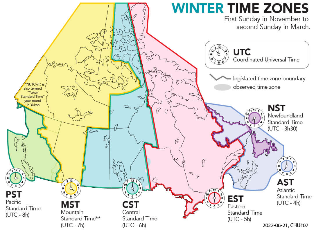
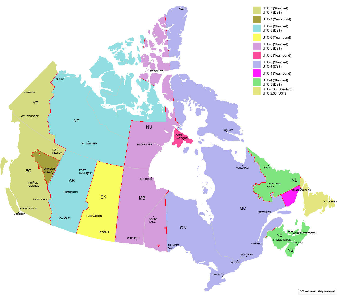
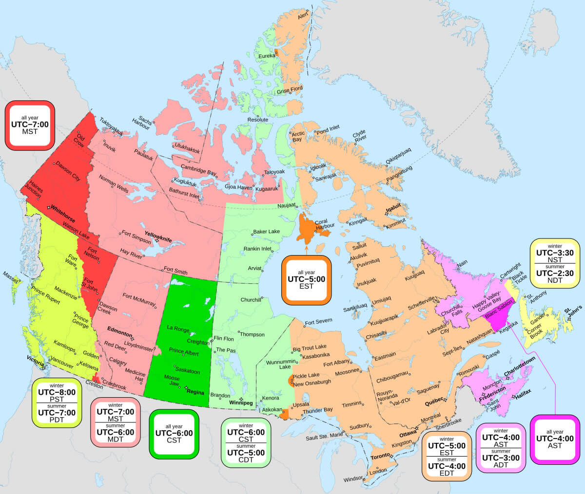
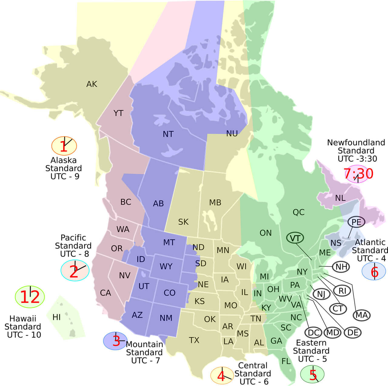
Canada spans six primary time zones: Pacific, Mountain, Central, Eastern, Atlantic, and Newfoundland Time, with the majority of its provinces and territories observing standard time from the first Sunday in November until the second Sunday in March and switching to daylight saving time for the remainder of the year.
Canada Time Zone Map with Standard and Daylight Saving Offsets
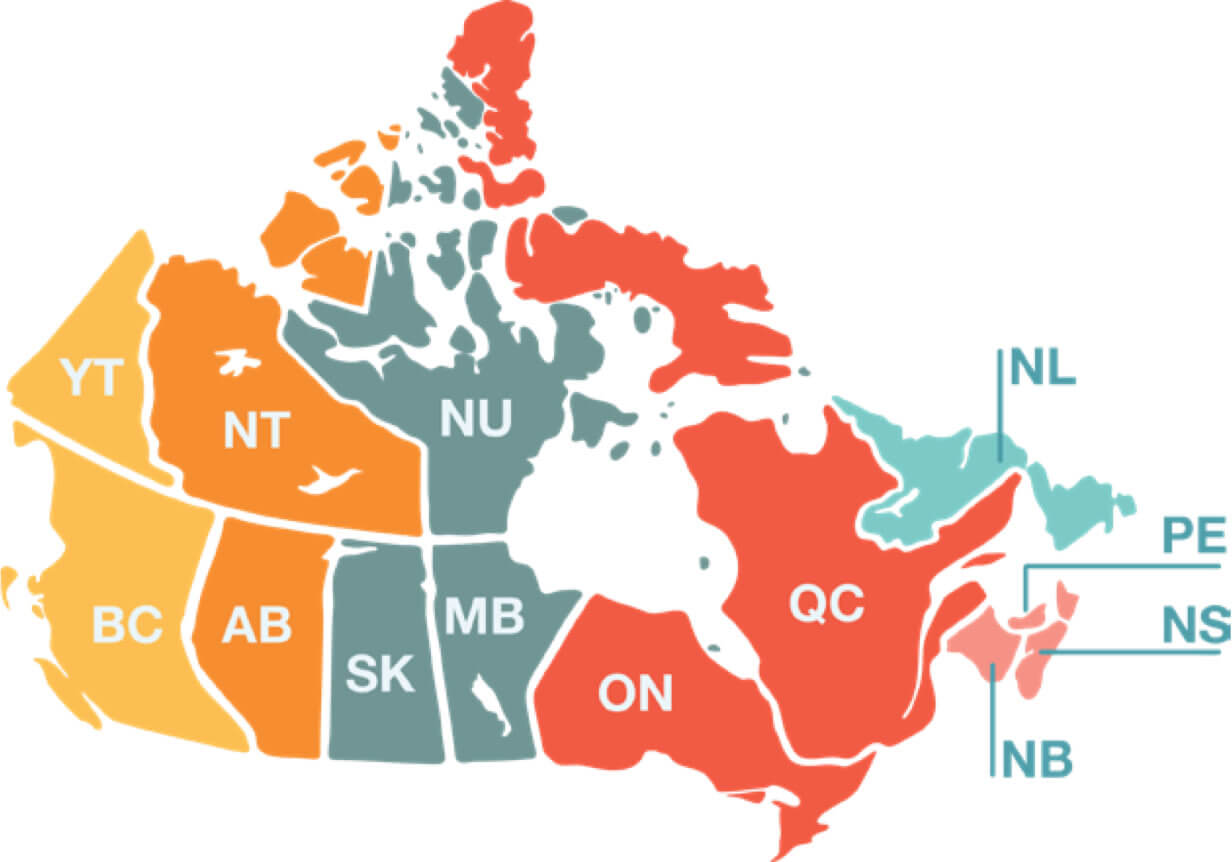
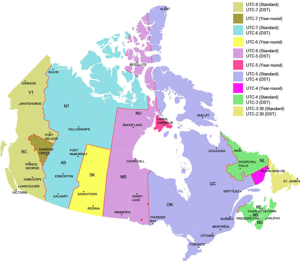 Color-coded map of Canada showing provinces and their time zones with UTC offsets.
Canada and us time zones map
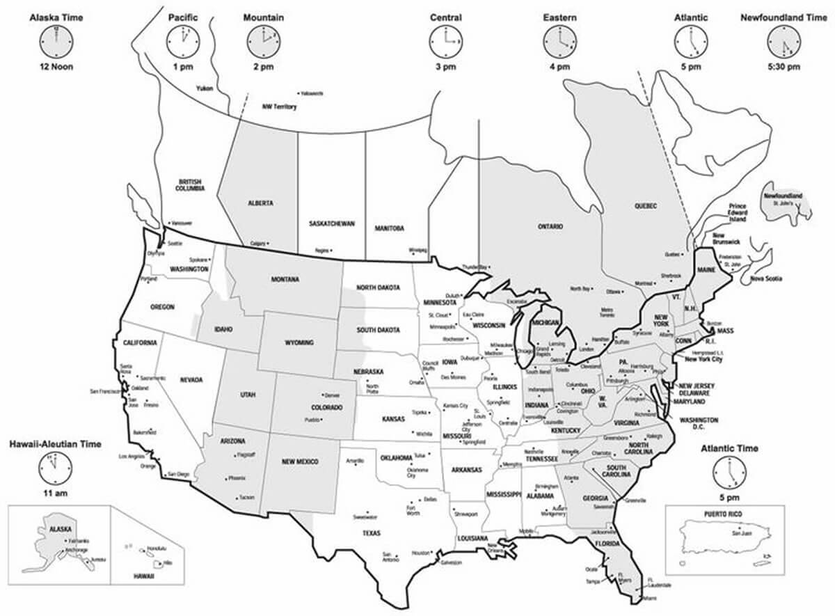
Canada time zone map with universal time
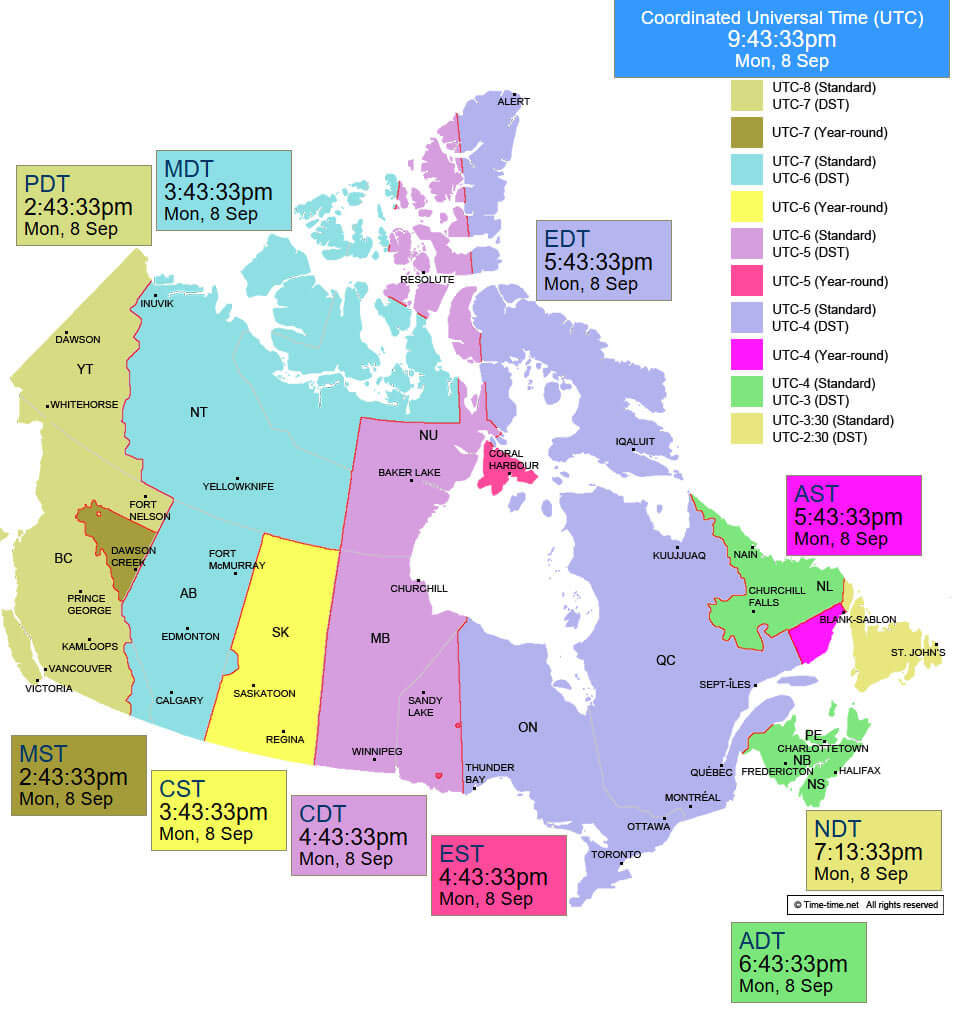
Canada time zone map between utc -2 and -7
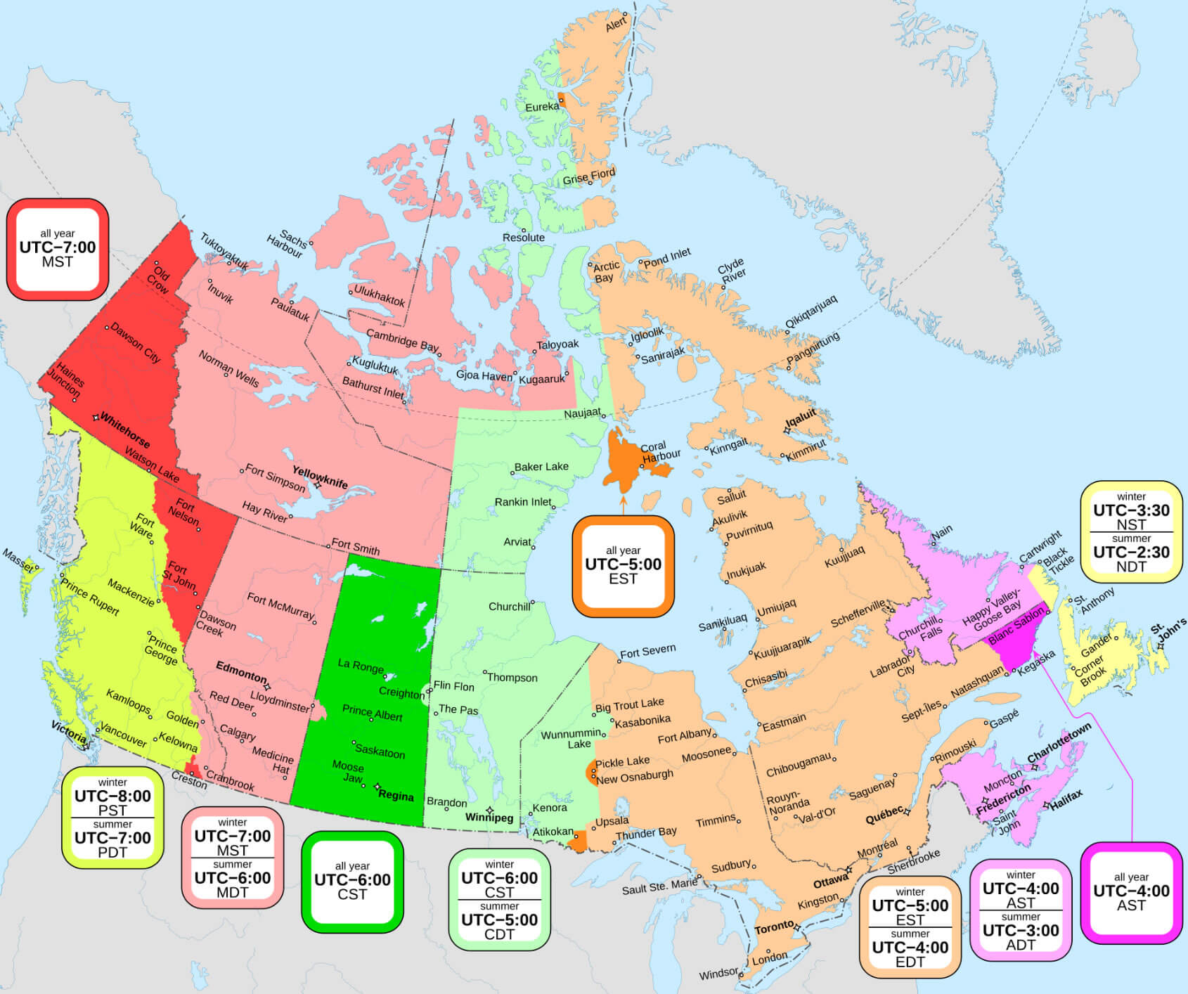
Canada winter time zone map
Canada Time Zone Map: Navigating Time Across a Vast Nation
Canada is the second-largest country in the world by land area, and its Time Zone Map reflects this vastness. Spanning six primary time zones, Canada’s regions are divided into: Pacific Time (UTC−8), Mountain Time (UTC−7), Central Time (UTC−6), Eastern Time (UTC−5), Atlantic Time (UTC−4), and Newfoundland Time (UTC−3:30). During Daylight Saving Time (DST)—which begins in March and ends in November—most provinces and territories move their clocks one hour ahead, except for a few areas such as most of Saskatchewan and parts of Quebec and British Columbia.Canadian standard winter summer time zones map
Time zone map in Canada
Time zones map of Canada
Time zones map of the united states and Canada
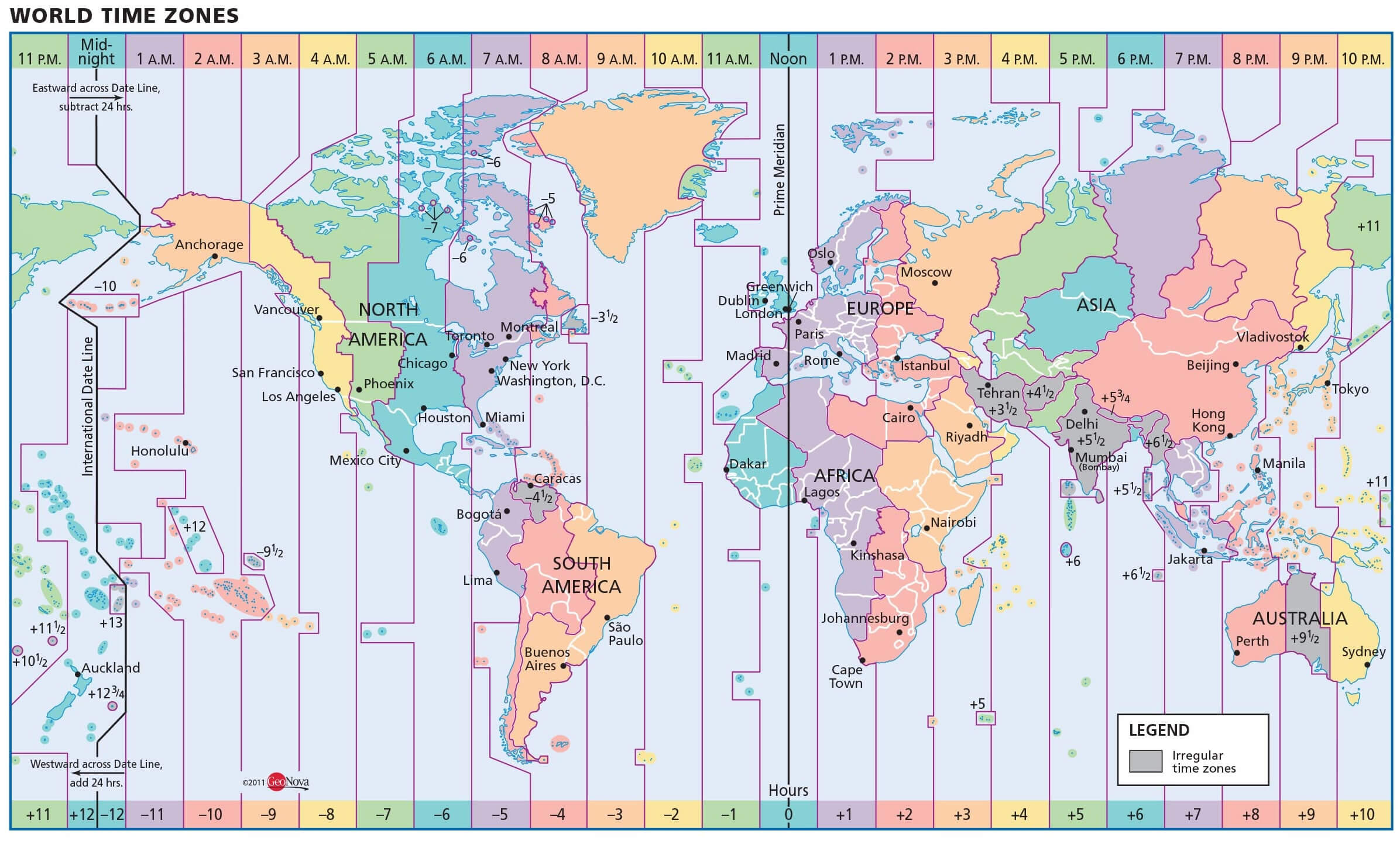
World Canada us time zone map
Where is Canada on North America Map?
Show Google interactive map, satellite map, where is the country located.
Get direction by driving, walking, bicycling, public transportation and travel with street view.
Feel free to explore these pages as well:
- Canada Map ↗️
- Map of Canada ↗️
- A Collection of Canada Maps ↗️
- Canada Political Map ↗️
- Canada Physical Map ↗️
- Canada Cities Map ↗️
- Canada Population Map ↗️
- Canada Road Map ↗️
- Canada’s Largest Maps ↗️
- Vancouvers top 10 places to visit ↗️
- Montreal’s Top 10 Best Can’t-Miss Experiences for Tourists ↗️
- 10 must visit cities from the 2023 liveability index ↗️
- United States Map ↗️
- North America Map ↗️
- Mexico Time Zone Map ↗️
- Spain Time Zone Map ↗️
- Advertisement -
