Roman Trade Routes Map
Explore the major land and maritime trade routes of the Roman Empire, connecting Europe, North Africa, and Western Asia through one of history’s greatest commercial networks.
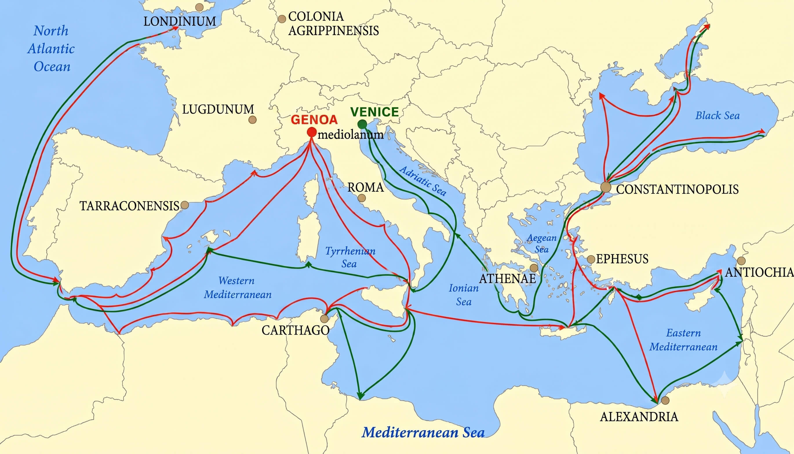
About This Roman Trade Routes Map
A concise introduction to the commercial routes that connected the Roman Empire by land and sea.
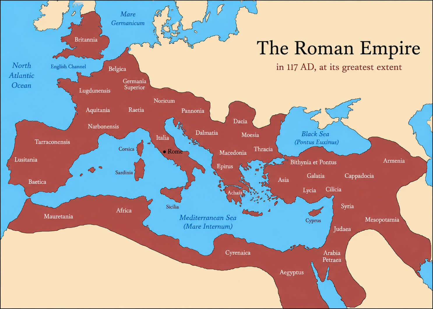
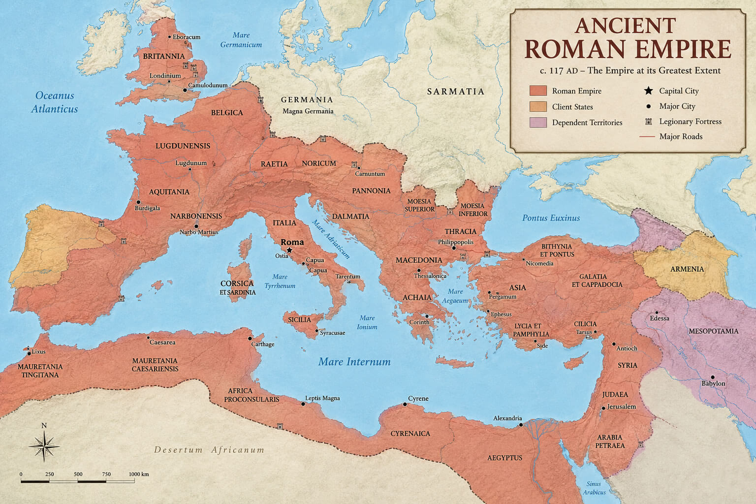
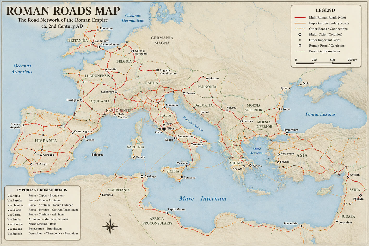
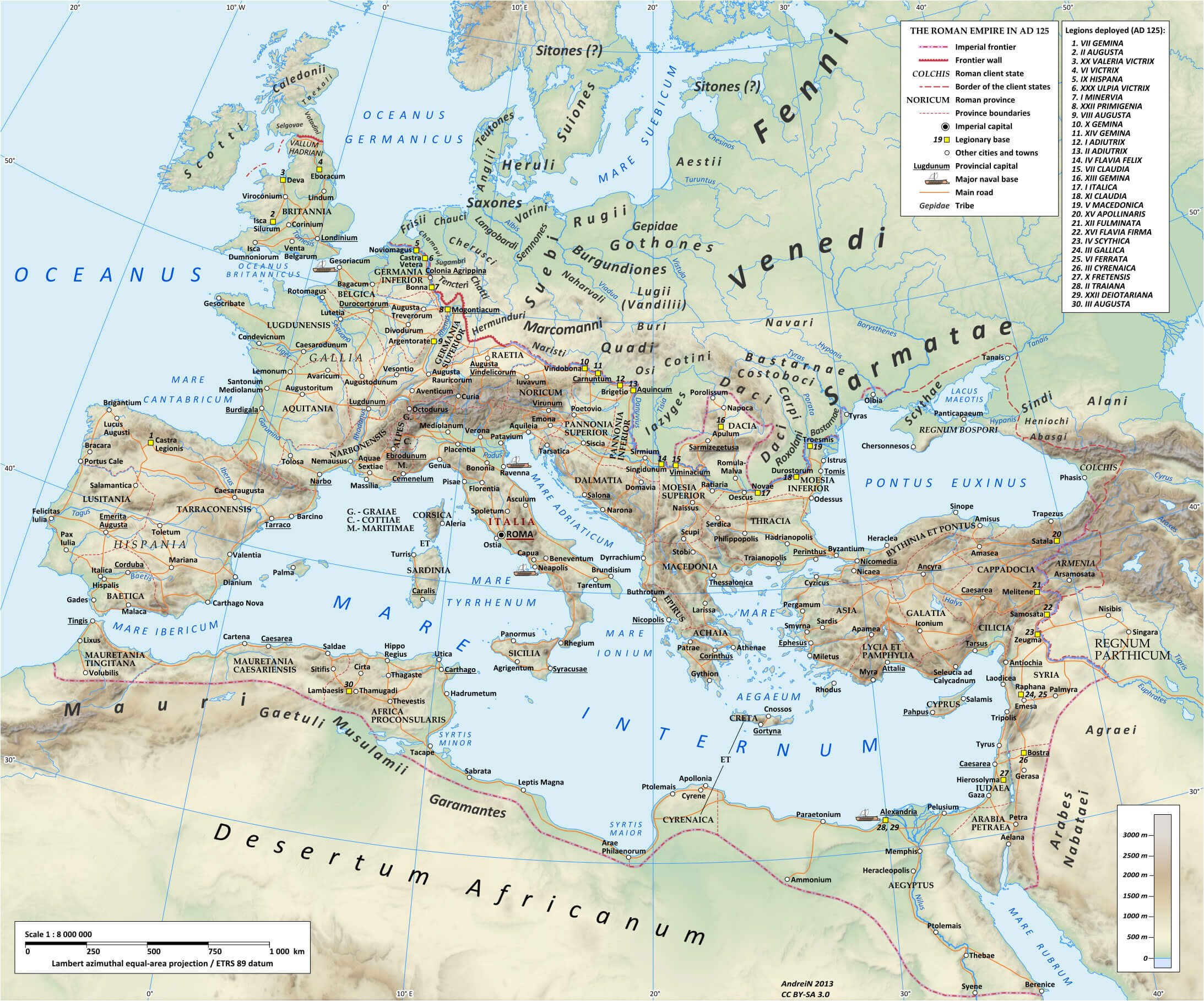
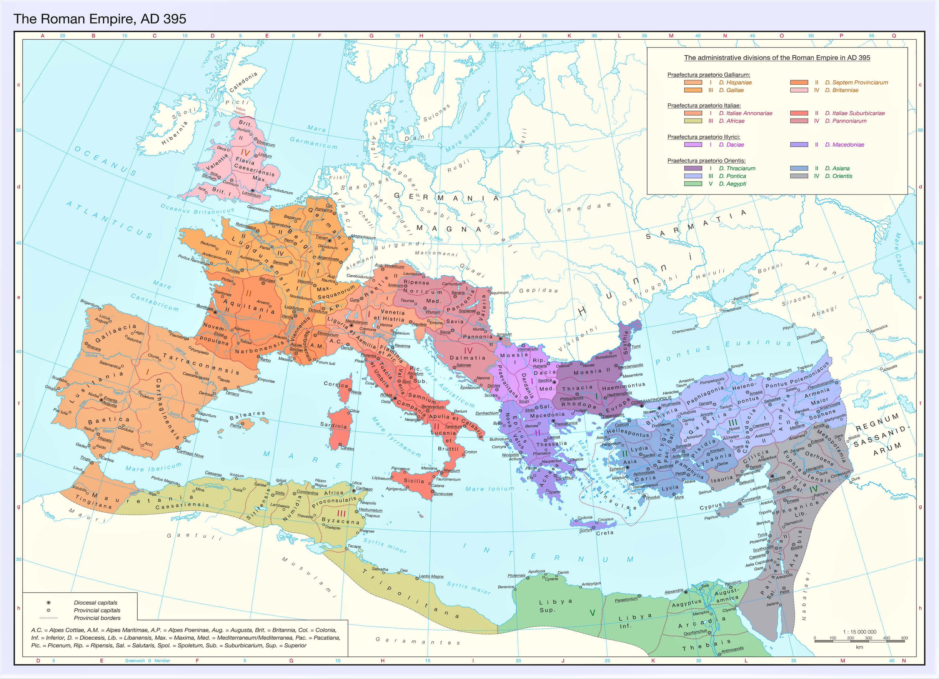
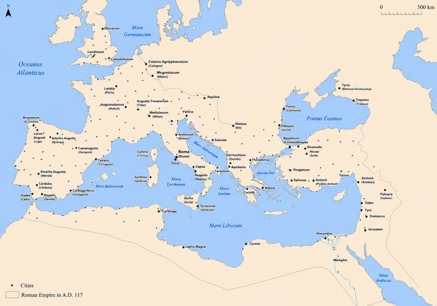
This Roman trade routes map illustrates the extensive commercial network that connected the Roman Empire across Europe, North Africa, and Western Asia. Major overland roads linked inland cities with Mediterranean ports, allowing goods, people, and information to move efficiently throughout the empire.
Maritime routes across the Mediterranean Sea connected important ports such as Ostia, Alexandria, Carthage, Antioch, Ephesus, Massilia, and Constantinople’s predecessor Byzantium, creating one of the most advanced trading systems of the ancient world.
Together, the road network and sea lanes supported the exchange of grain, olive oil, wine, ceramics, metals, marble, spices, silk, glassware, textiles, and luxury goods while also strengthening Roman military logistics and imperial administration.
How to Read the Map
The map distinguishes the principal commercial routes that connected the Roman Empire’s cities, ports, and provinces.
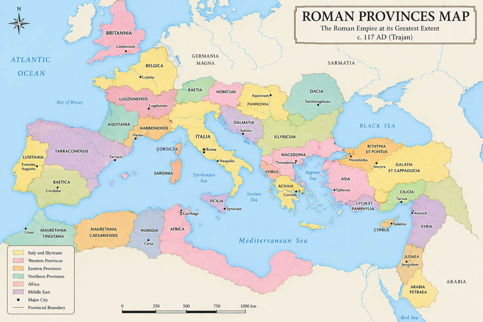
Major Roman Provinces by Region
Open each region to view the principal Roman provinces shown on the map.
Western Europe
Iberian Peninsula
Central and Eastern Europe
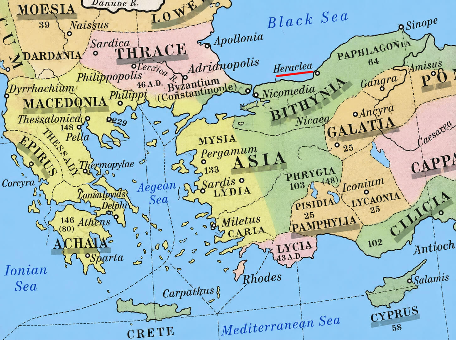
Asia Minor and the Middle East
North Africa
Which Modern Countries Were Part of the Roman Empire?
The empire included all or part of many present-day countries across three continents.
The Roman Empire included all or part of present-day Italy, Spain, Portugal, France, the United Kingdom, Belgium, the Netherlands, Germany, Switzerland, Austria, Croatia, Greece, Türkiye, Syria, Israel, Egypt, Libya, Tunisia, Algeria, and several neighboring countries.
Roman Empire Timeline
Key milestones from the beginning of the empire to the fall of the Western Roman Empire.
Related Historical Maps
Continue exploring Rome, Italy, and the ancient Mediterranean world.