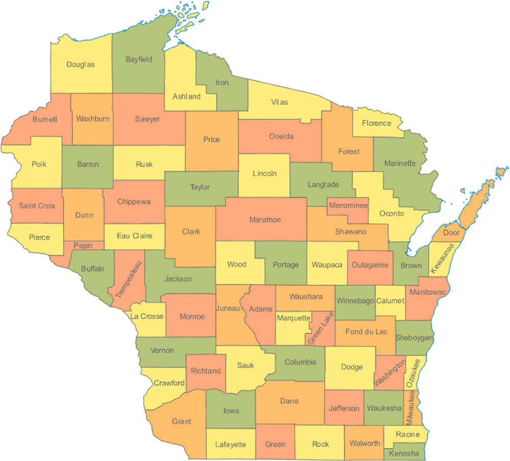
Exploring Wisconsin becomes easier with our detailed Wisconsin Cities Map, designed to bring together the state’s most essential geographic information in one place. This page features a wide range of map types, including cities and counties map of Wisconsin, Wisconsin county map, Wisconsin municipalities map, physical map of Wisconsin with cities, and road maps of Wisconsin with major highways.
Wisconsin County Map with Cities and Highways
 Colorful Wisconsin county map showing cities, roads, and major geographic features.
You can also find Wisconsin cities map with rivers, historical Wisconsin atlas maps from 1895 and 1900, and modern Wisconsin administrative maps that highlight counties, towns, and major transportation routes. Whether you’re planning a trip, studying geography, or exploring the layout of Wisconsin’s major cities, these maps provide clear, accurate visuals to help you understand the state’s landscape, roads, rivers, and county divisions.
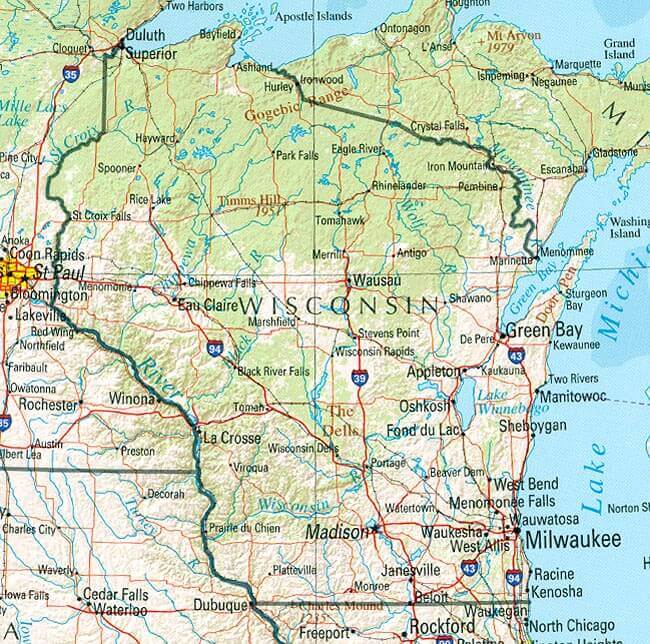
Physical map of Wisconsin with cities
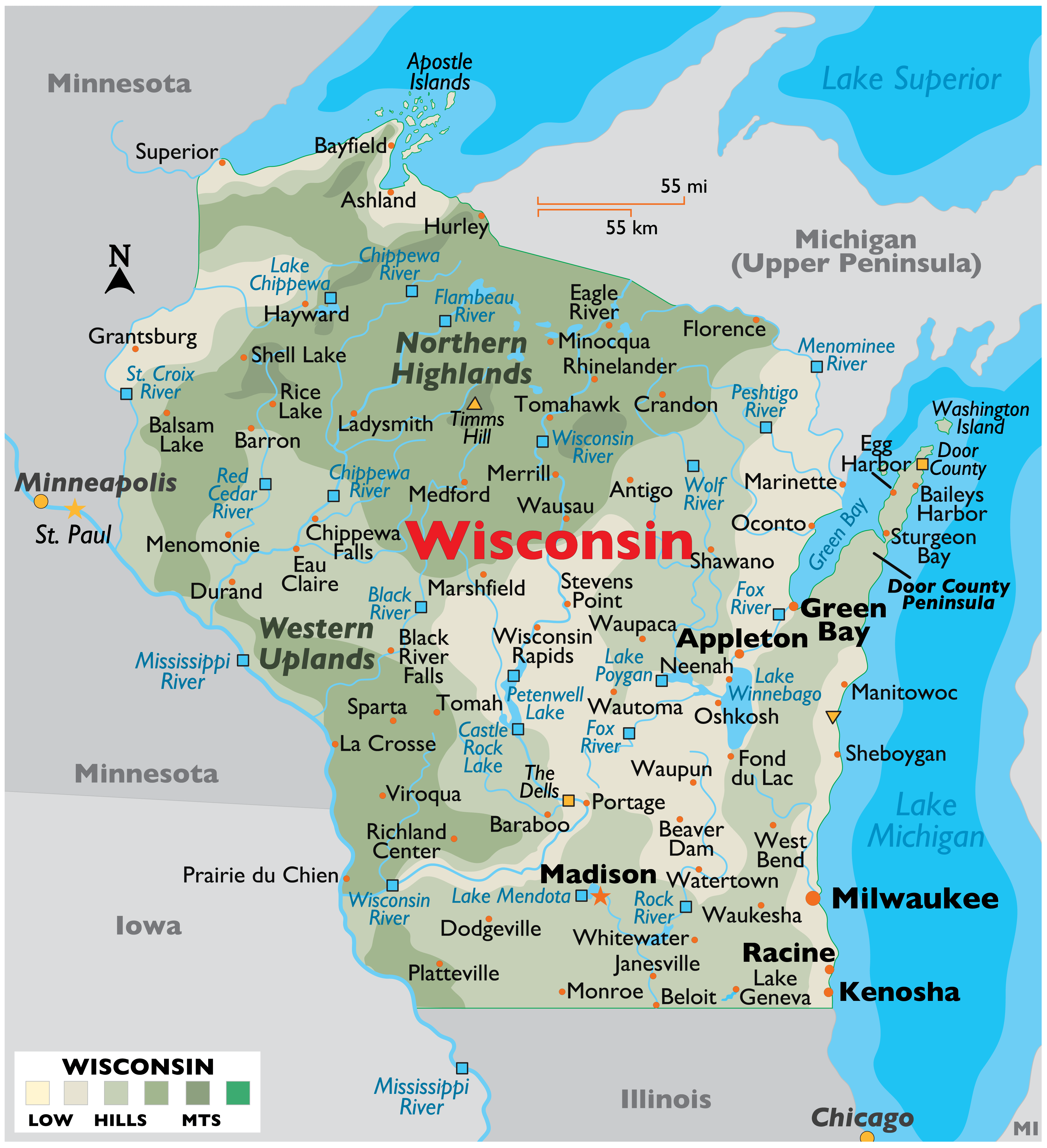
Wisconsin cities map
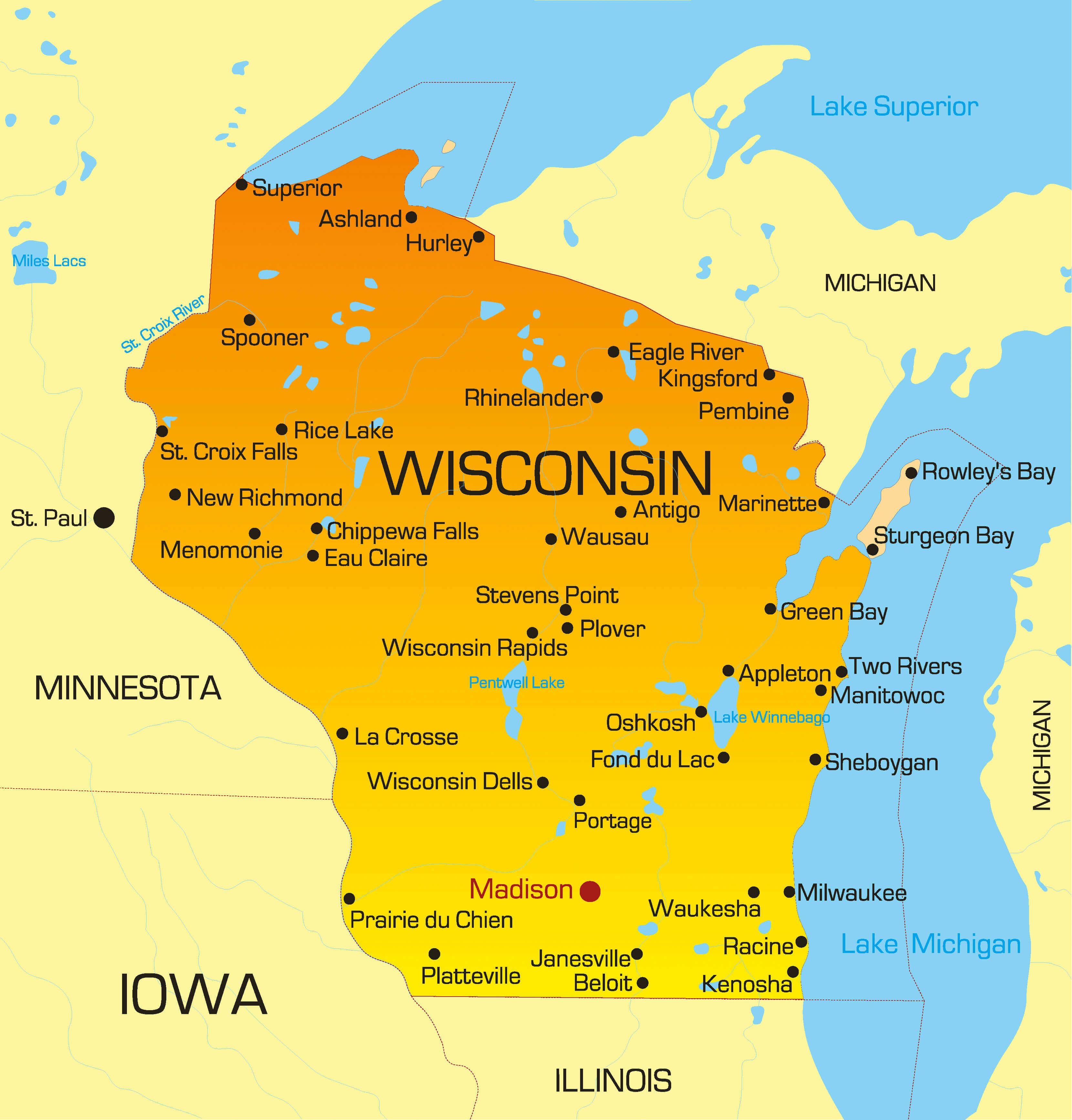
Cities and counties map of Wisconsin US
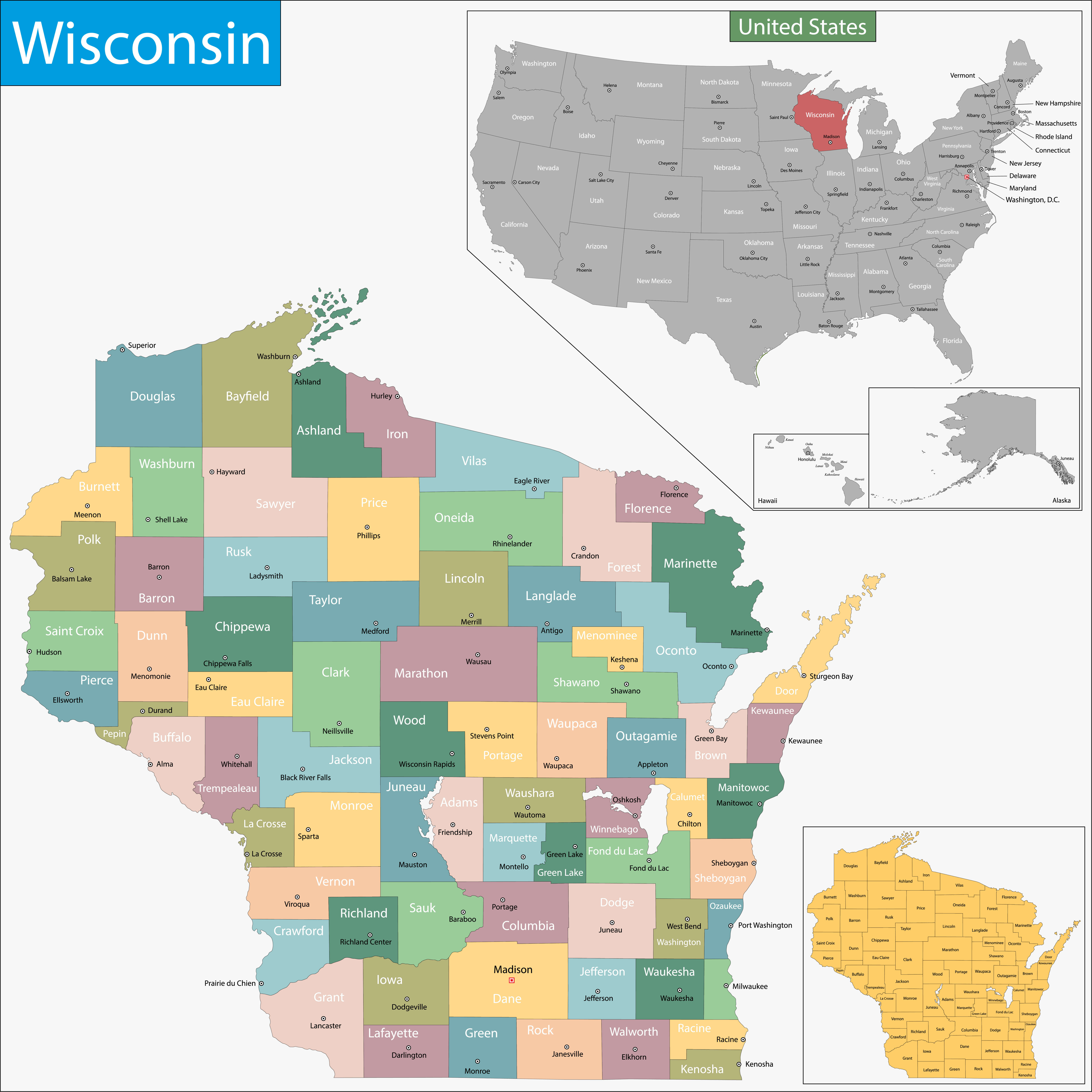
Cities map of Wisconsin with counties
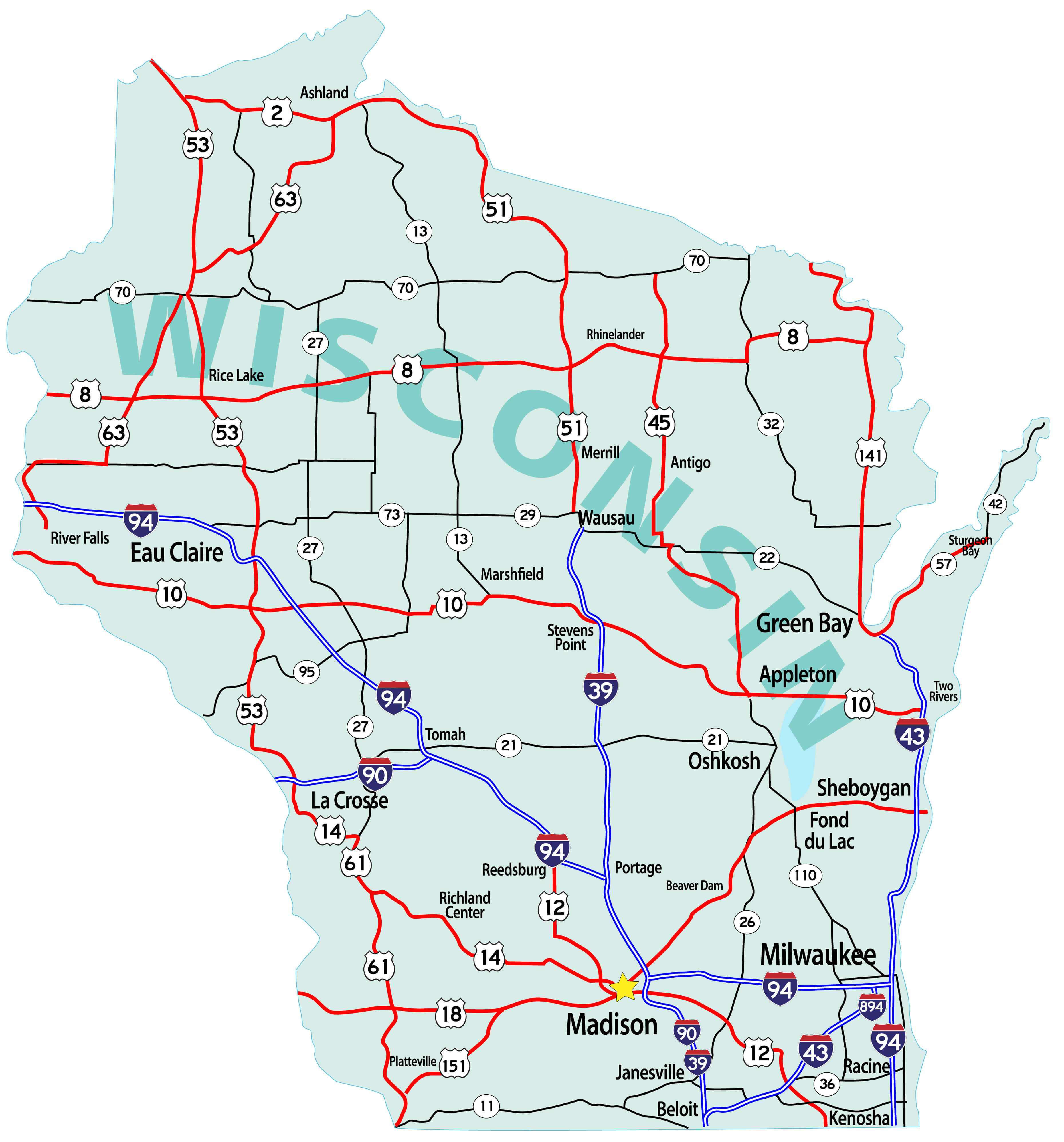
Large roads and highways map of Wisconsin with cities
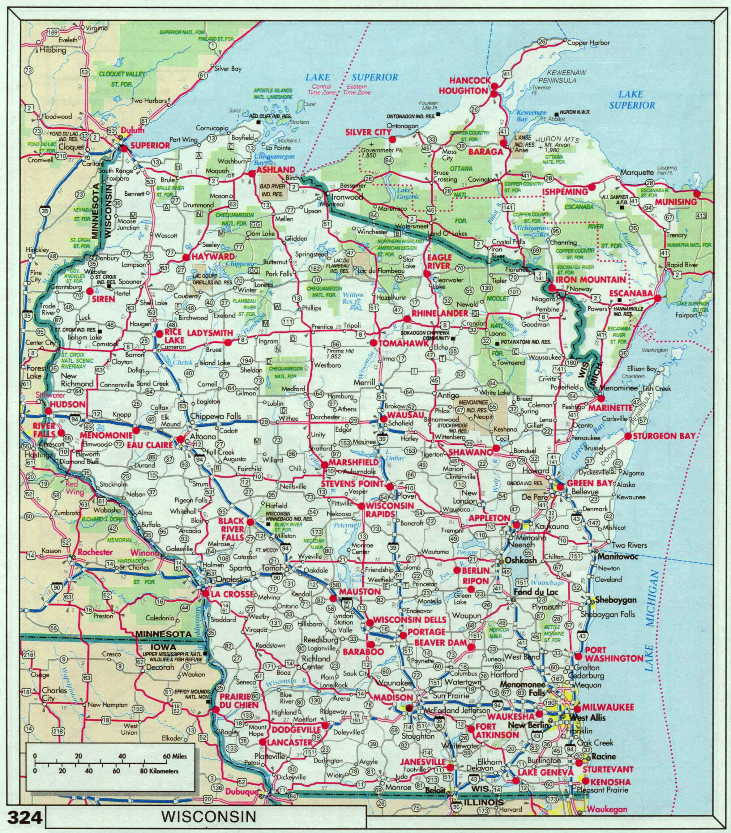
Map of Wisconsin cities and roads
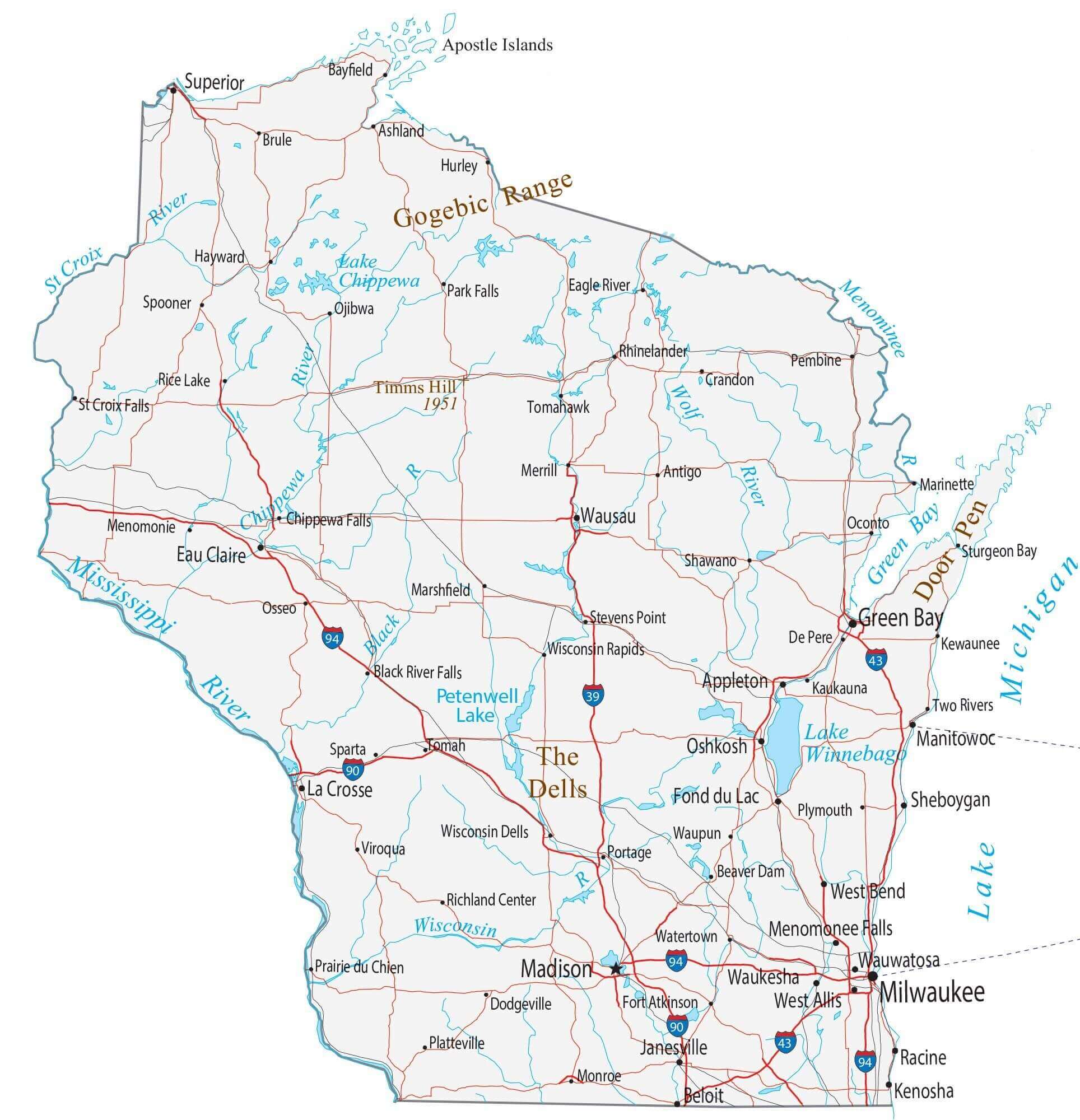
Physical map of Wisconsin
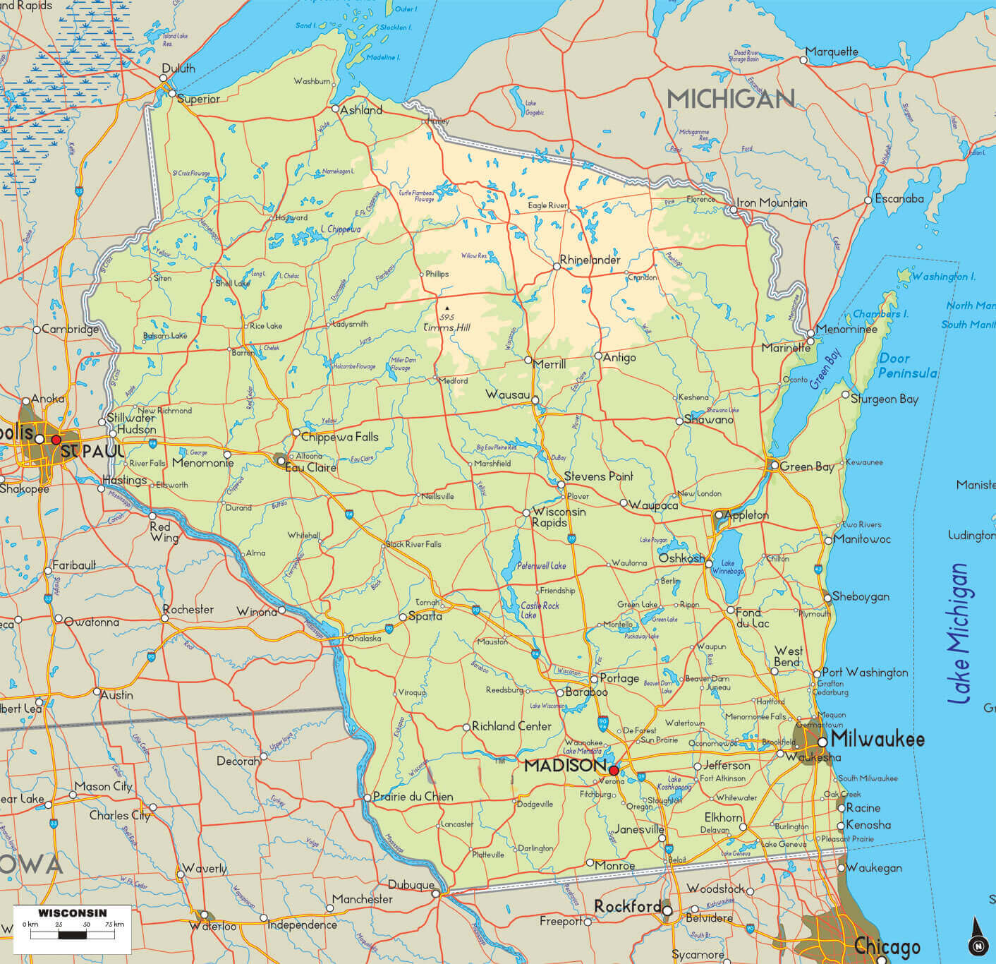
Road map of Wisconsin with cities
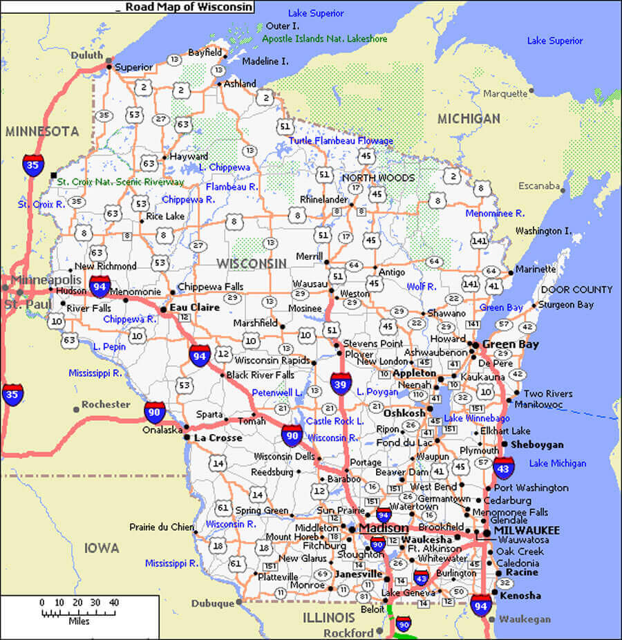
Wisconsin rivers and cities map
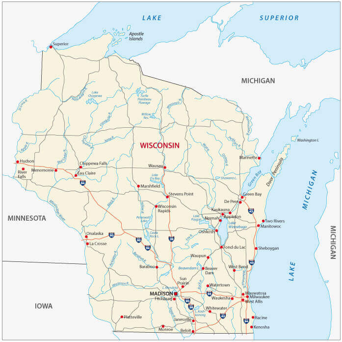
Wisconsin administrative map
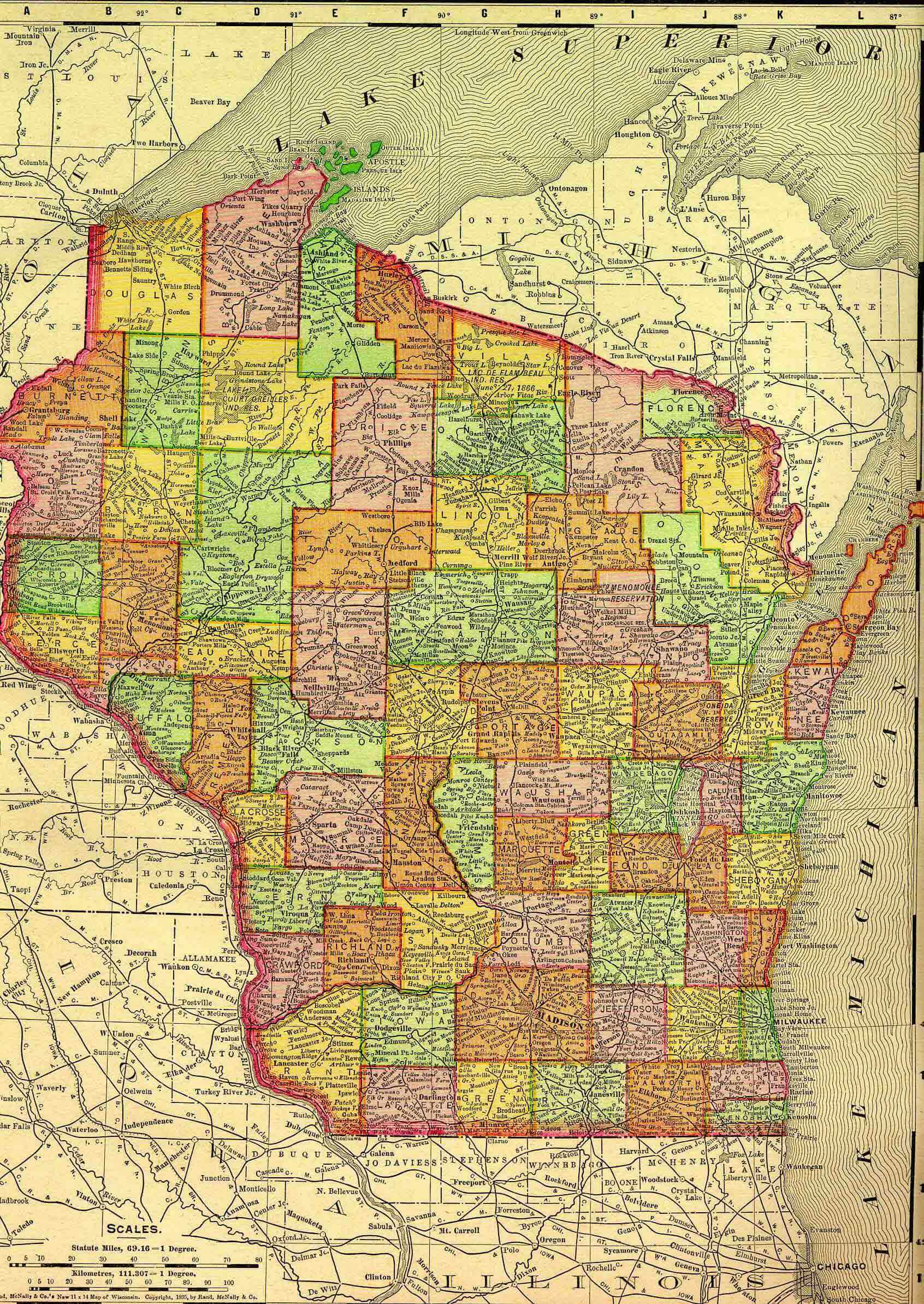
Wisconsin atlas in 1895
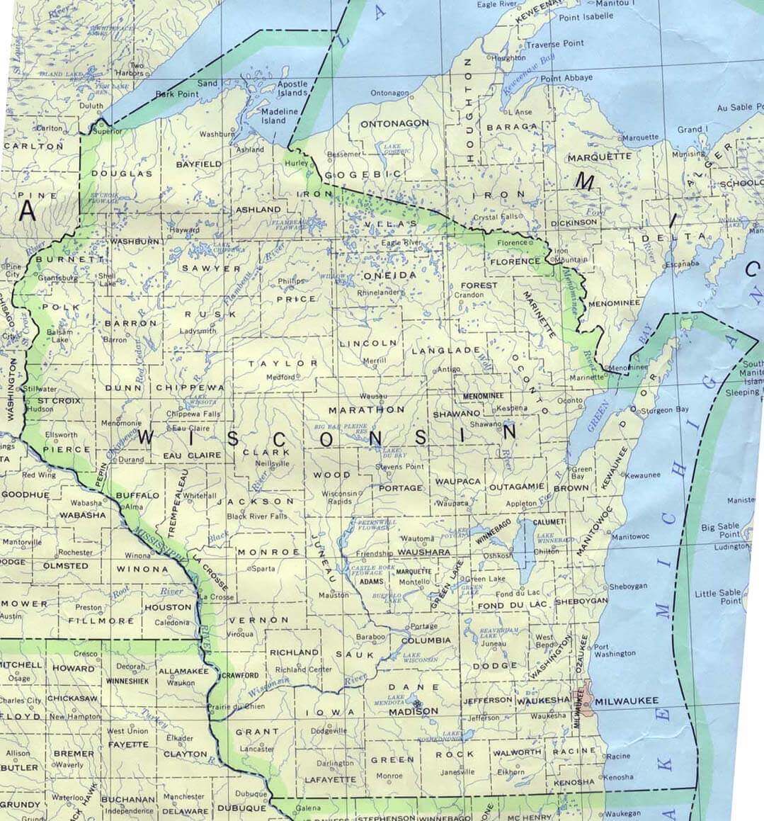
Wisconsin atlas map
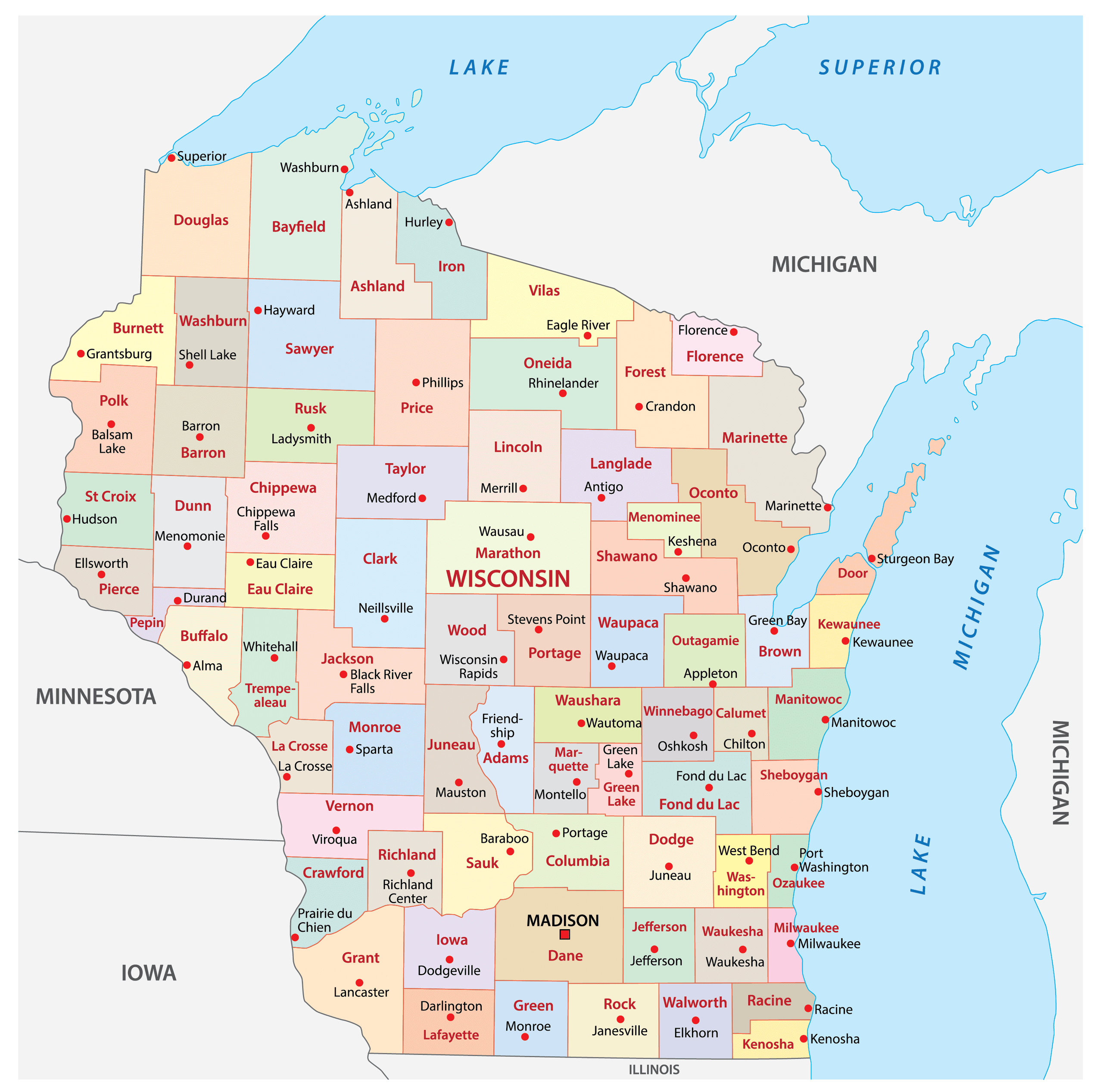
Wisconsin cities and counties map
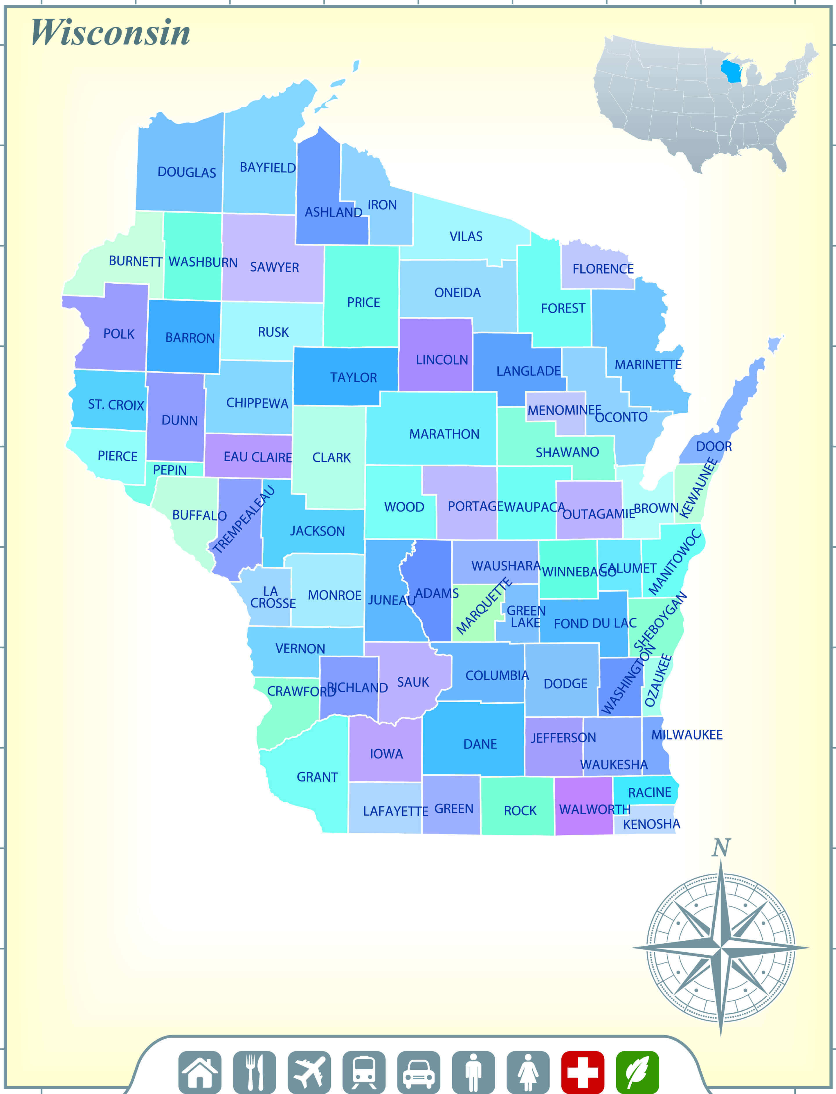
Wisconsin cities map with rivers
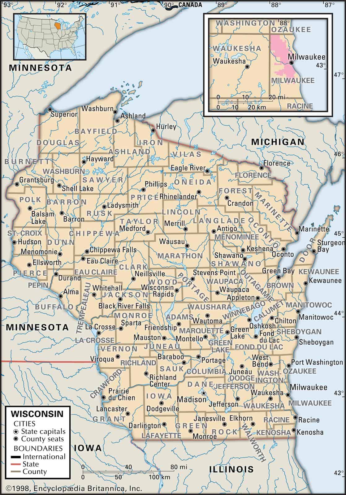
Wisconsin cities map with roads
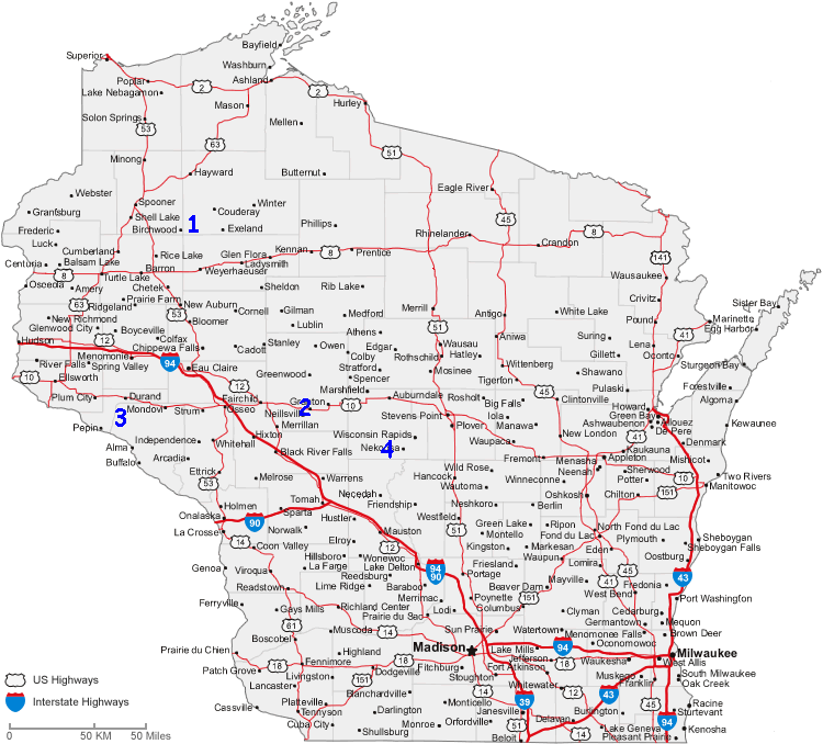
Wisconsin counties map
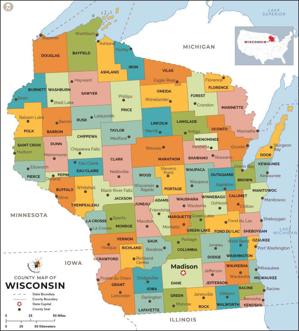
Wisconsin county map with largest cities
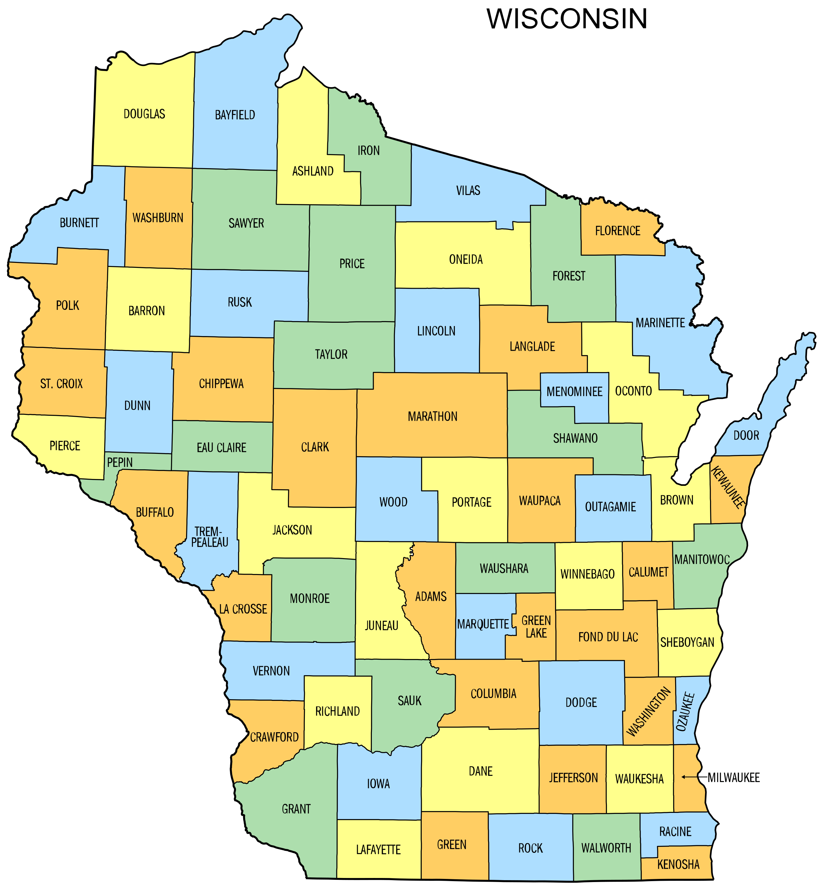
Wisconsin historical map 1900
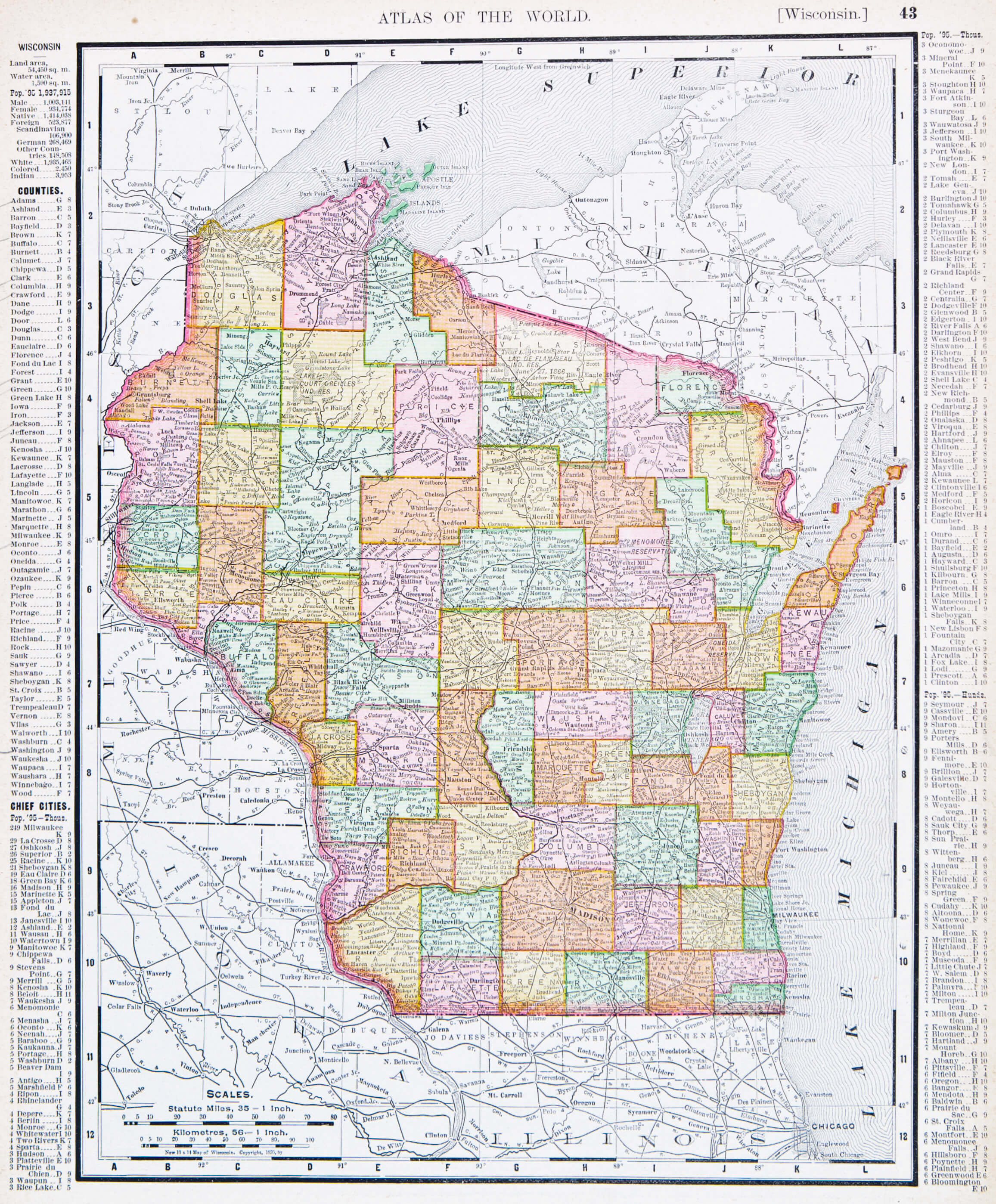
Wisconsin historical map with cities
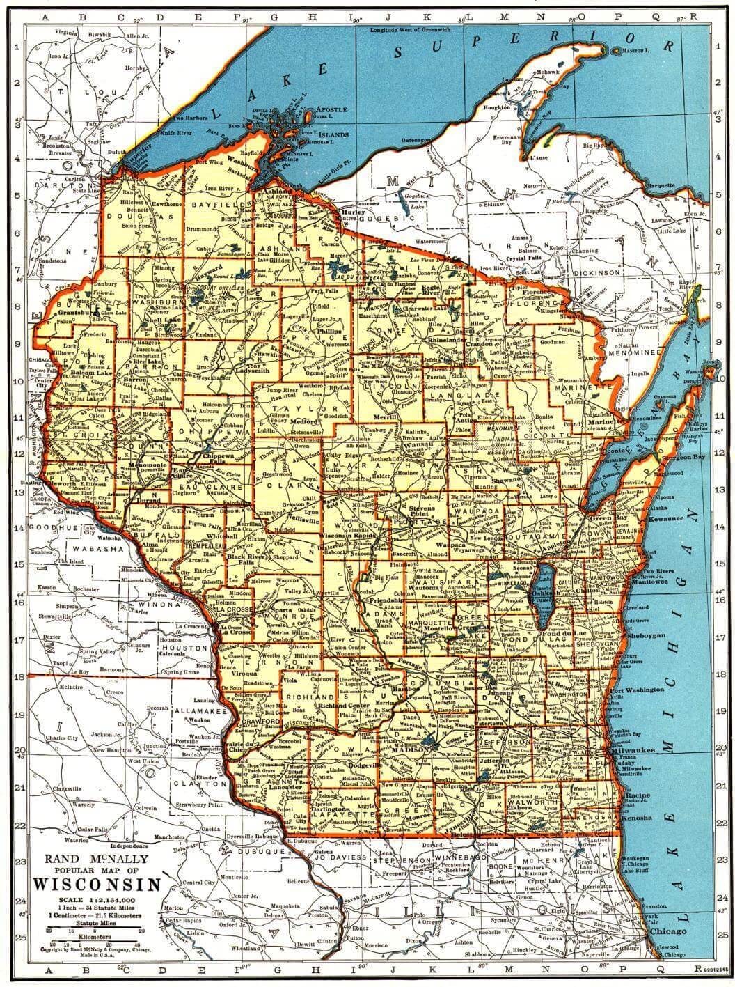
Wisconsin main cities map
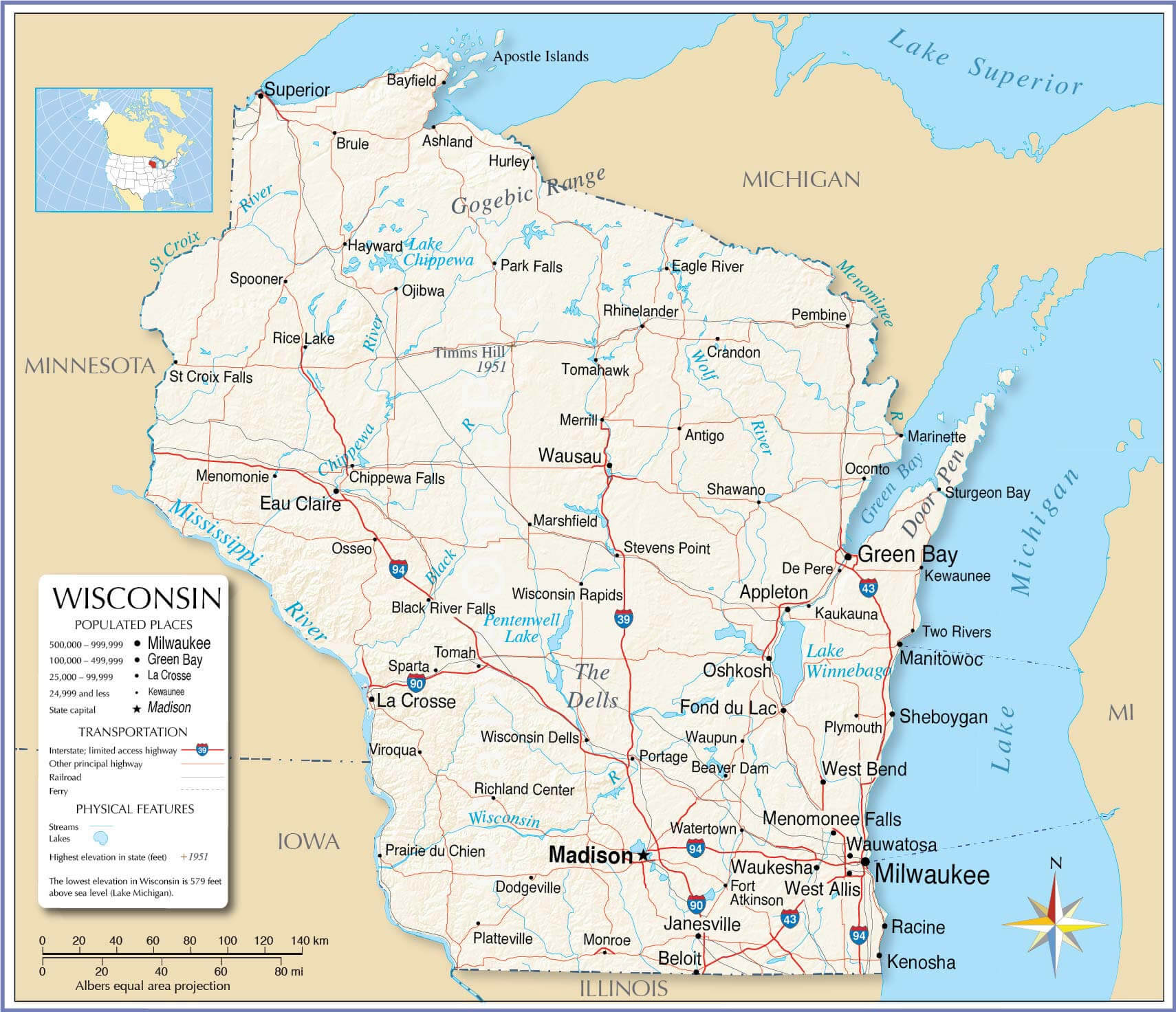
Wisconsin major cities map with US
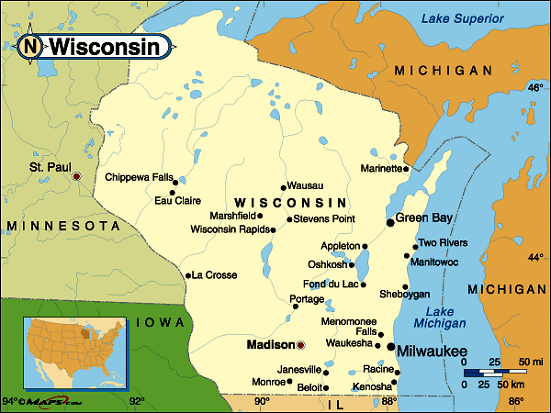
Wisconsin map with cities and counties
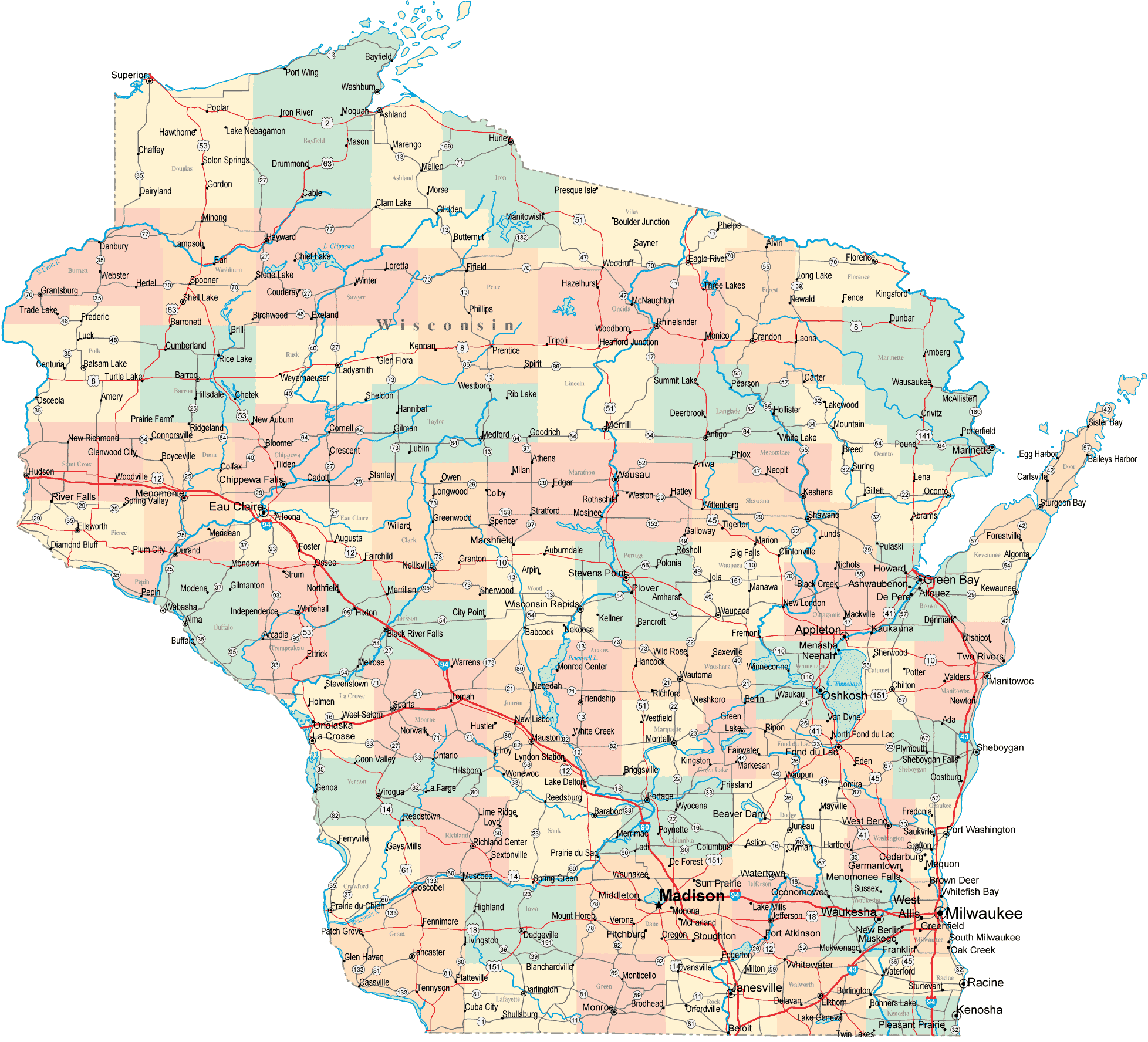
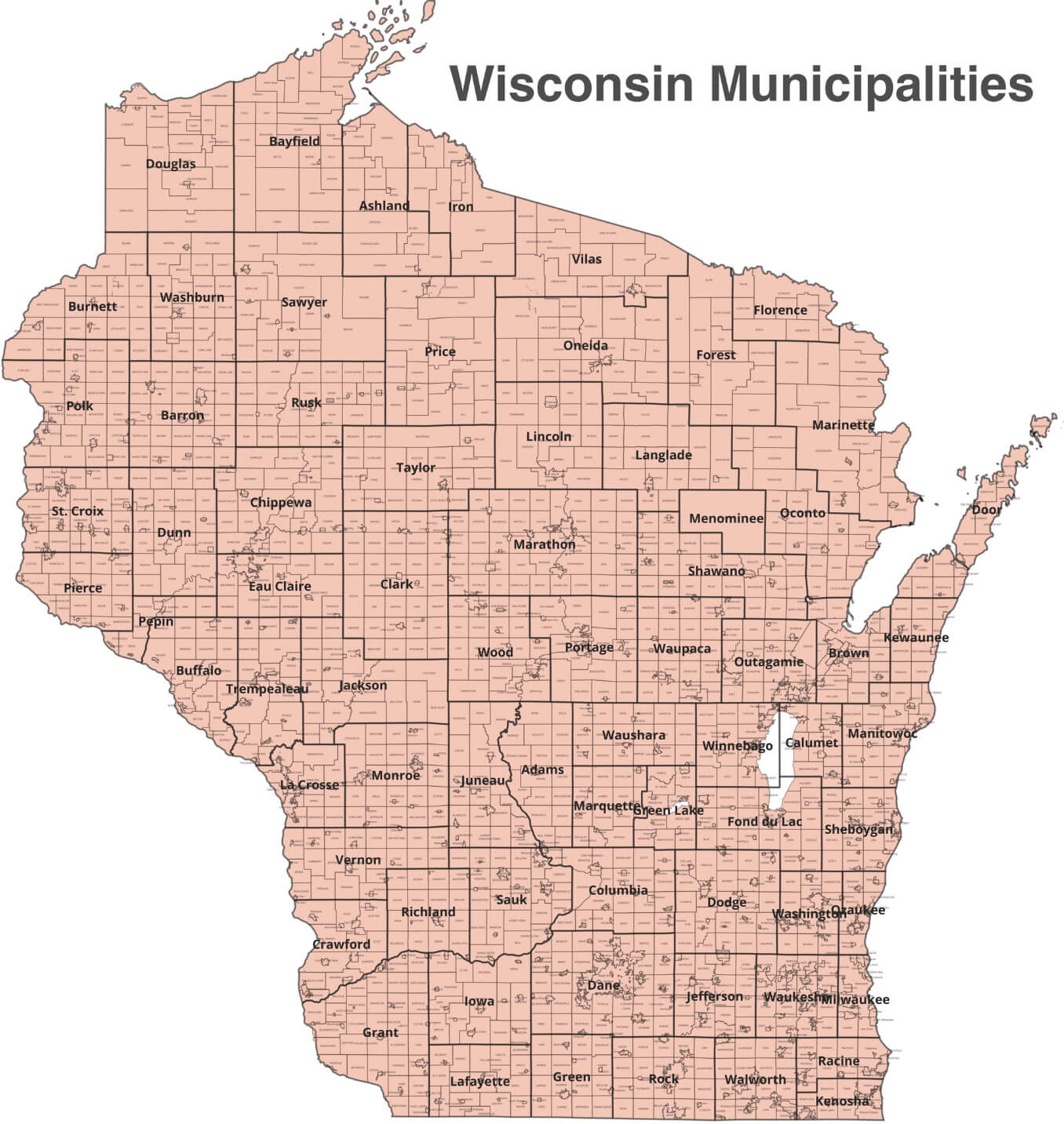
Wisconsin municipalities map
Wisconsin physical map with cities
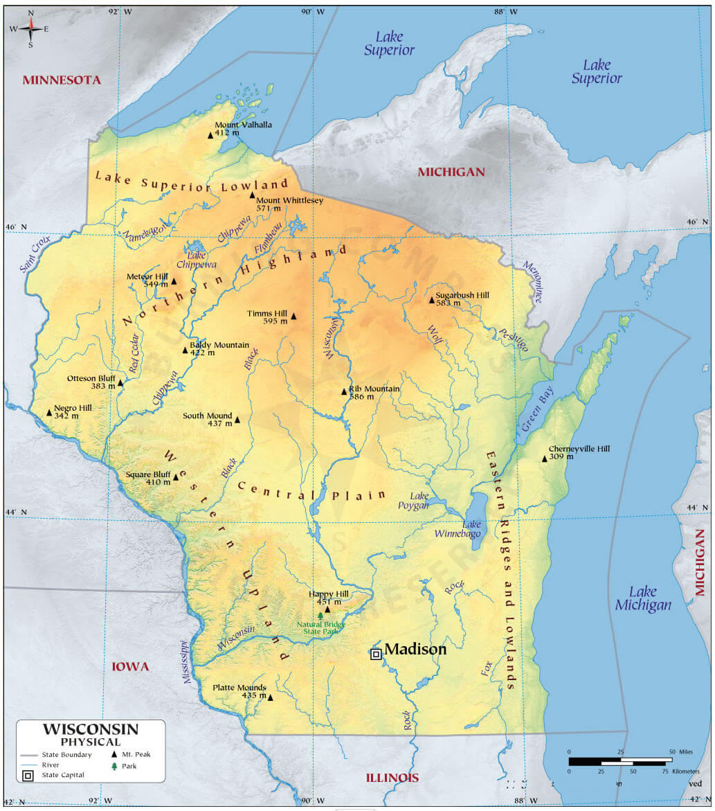
Wisconsin physical map with major cities
Wisconsin state road map with cities
Where is Wisconsin on the United States Map?
Show Google map, satellite map, where is the country located.
Get directions by driving, walking, bicycling, public transportation and travel with street view.
<Feel free to explore these pages as well:
- Wisconsin Map ↗️
- Map of Wisconsin ↗️
- US Cities Map ↗️
- United States Cities Map ↗️
- California Cities Map ↗️
- Texas Cities Map ↗️
- New York Cities Map ↗️
- Florida Cities Map ↗️
- Pennsylvania Cities Map ↗️
- Illinois Cities Map ↗️
- Ohio Cities Map ↗️
- Georgia Cities Map ↗️
- North Carolina Cities Map ↗️
- Michigan Cities Map ↗️
- New Jersey Cities Map ↗️
- Virginia Cities Map ↗️
- Arizona Cities Map ↗️
- Washington Cities Map ↗️
- Tennessee Cities Map ↗️
- Massachusetts Cities Map ↗️
- Indiana Cities Map ↗️
- Maryland Cities Map ↗️
- Missouri Cities Map ↗️
- United States Map ↗️
- Map of United States ↗️
- North America Map ↗️
