Roman Empire Map at Its Greatest Extent in 117 AD
Explore the Roman Empire during the reign of Emperor Trajan, when Roman territory stretched across Europe, North Africa, and Western Asia.
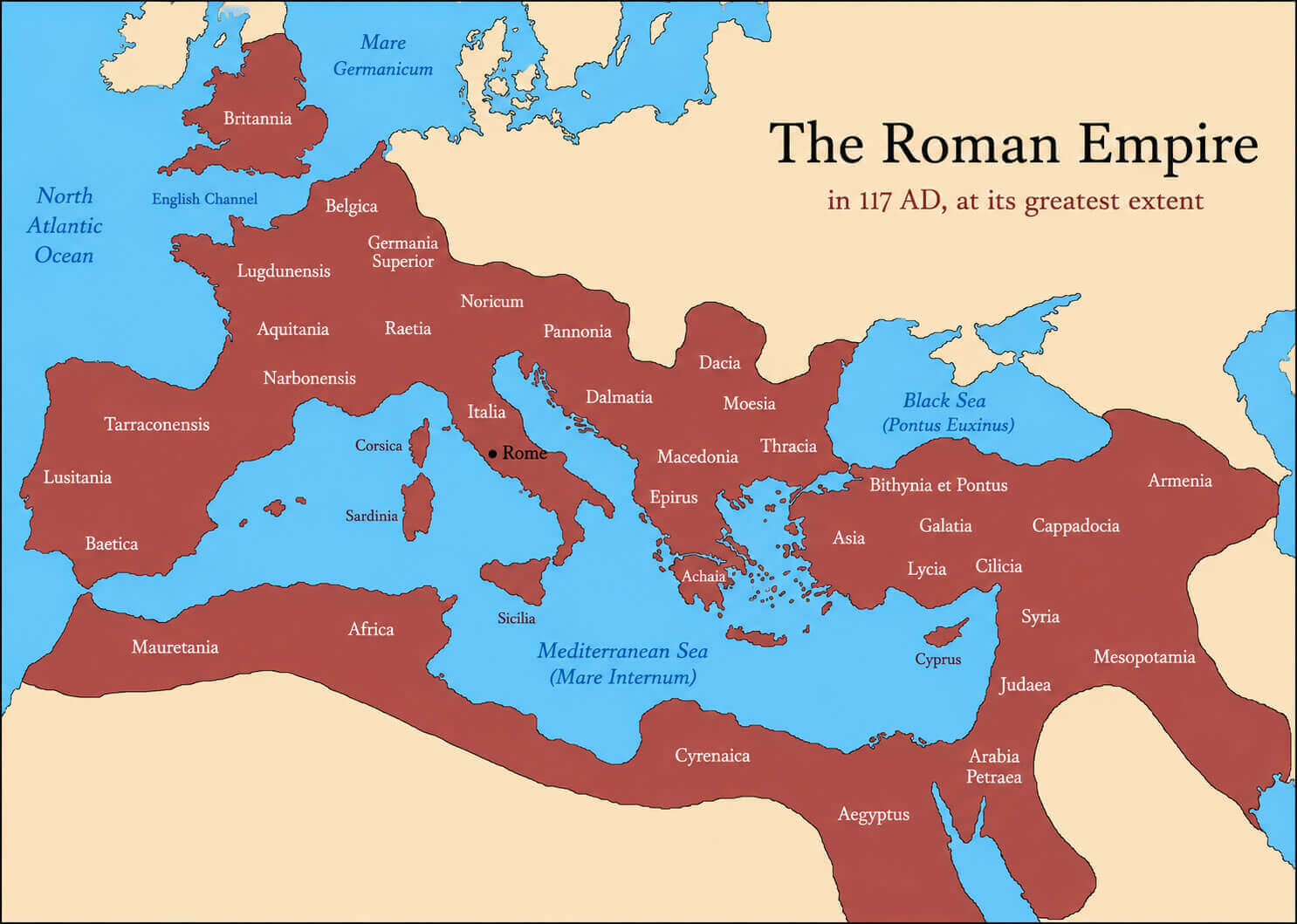
About This Roman Empire Map
A concise introduction to the empire’s maximum territorial reach and the regions shown on the map.
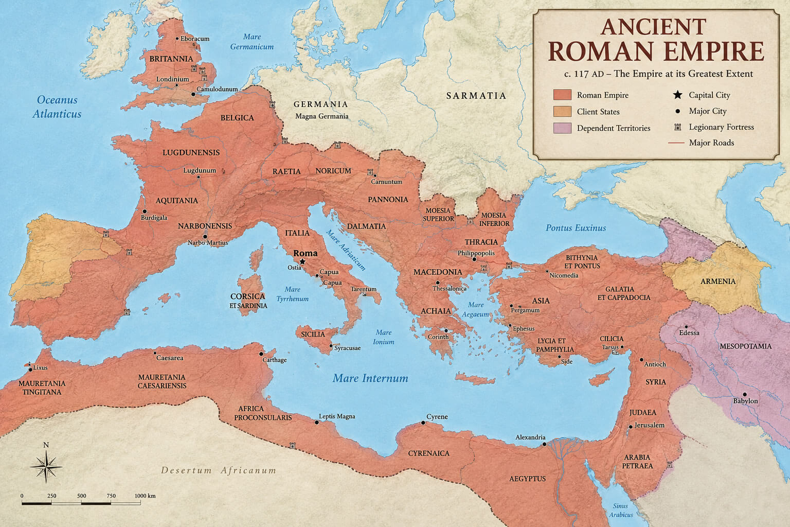
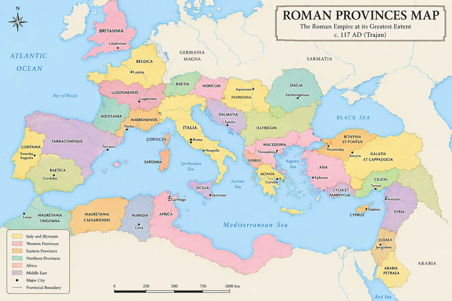
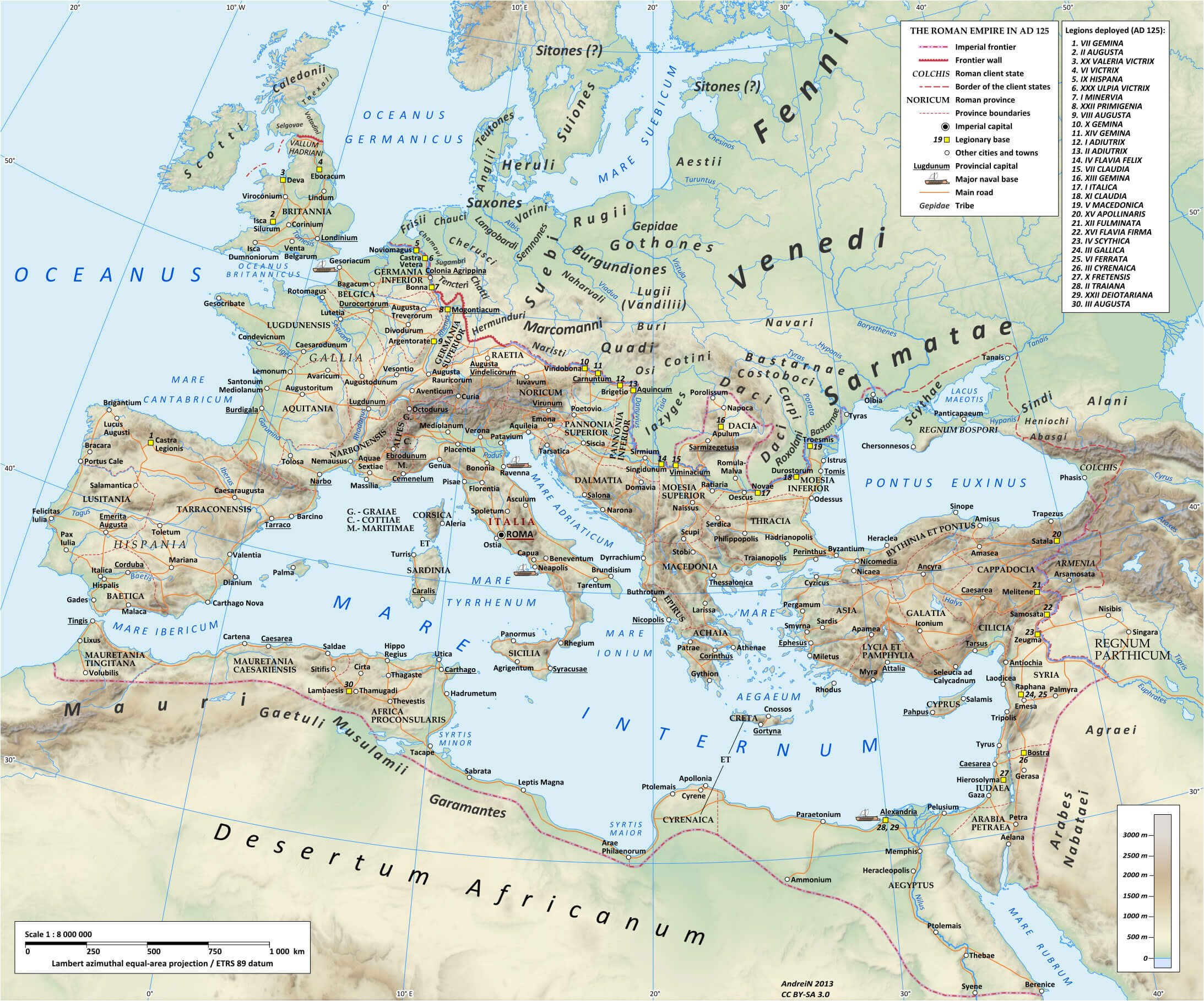
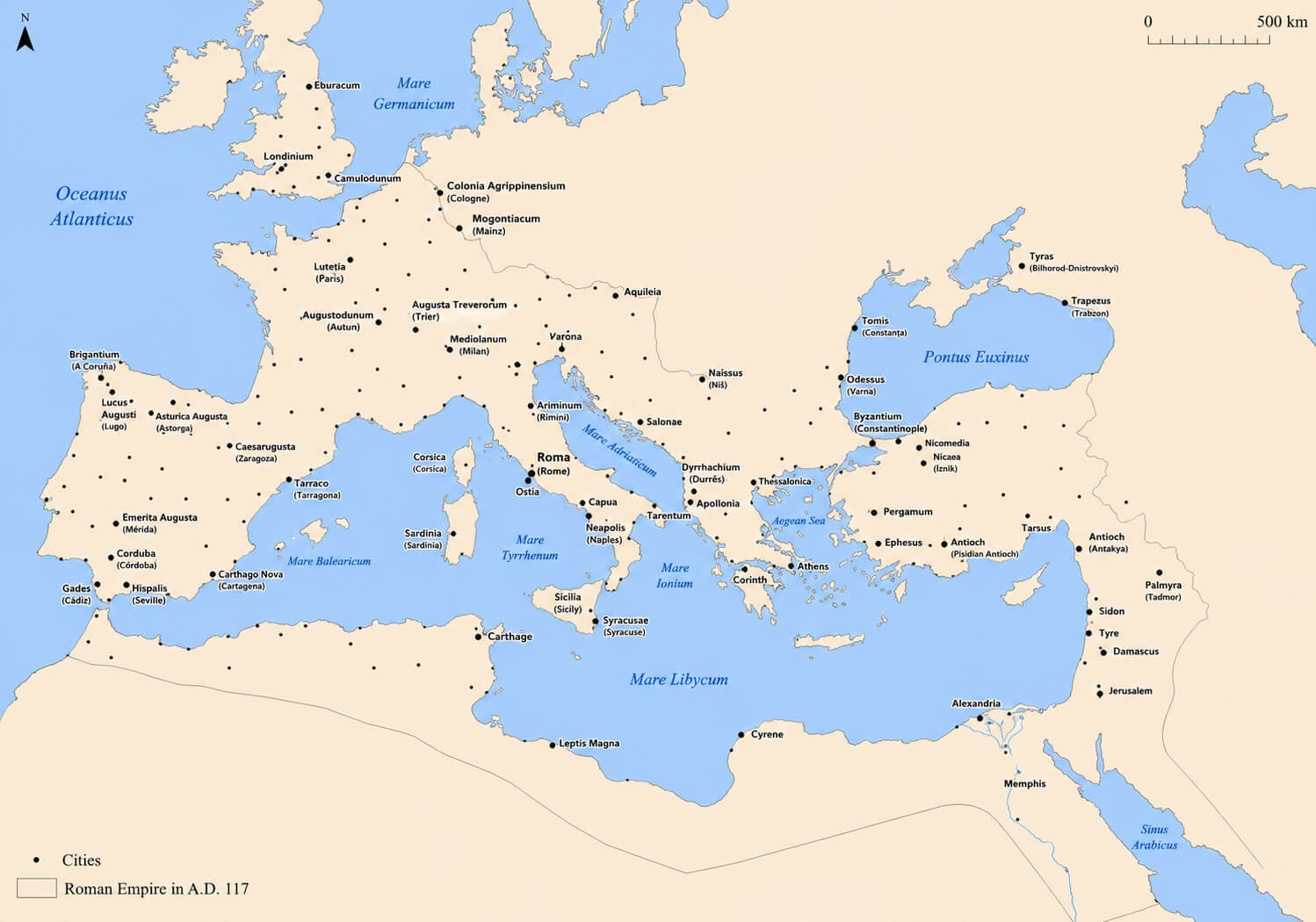
This map illustrates the Roman Empire in 117 AD, during the reign of Emperor Trajan. At this point, Roman territory extended from Britannia and the Iberian Peninsula in the west to Mesopotamia and Armenia in the east.
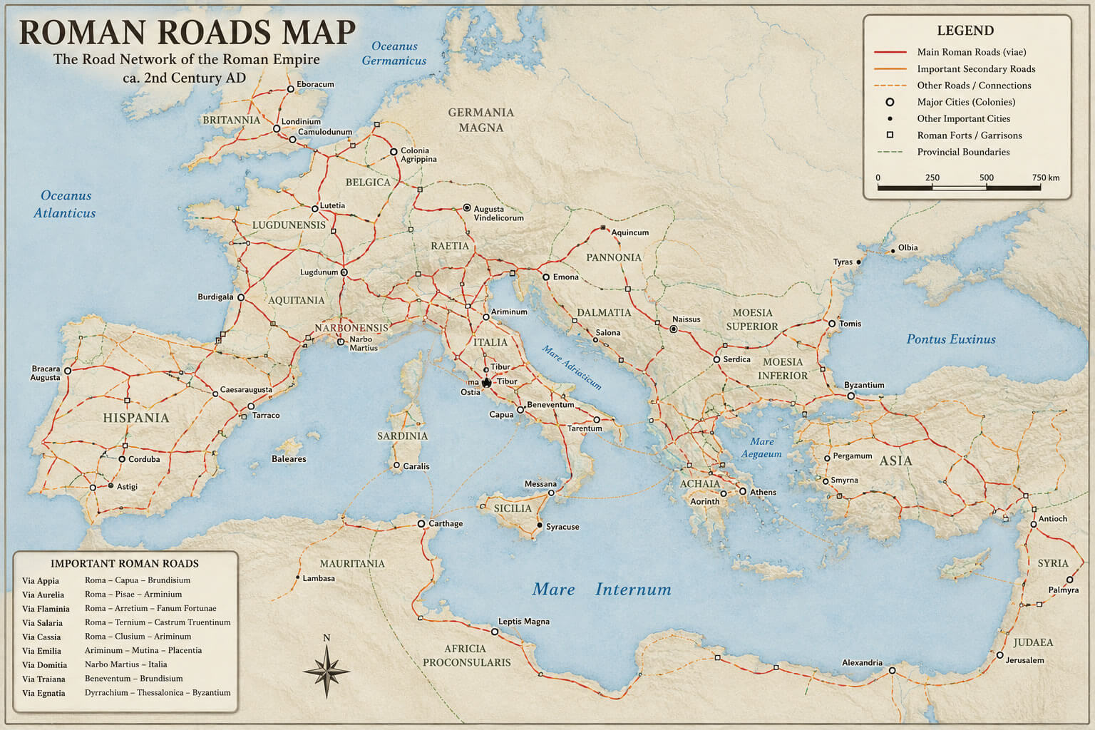
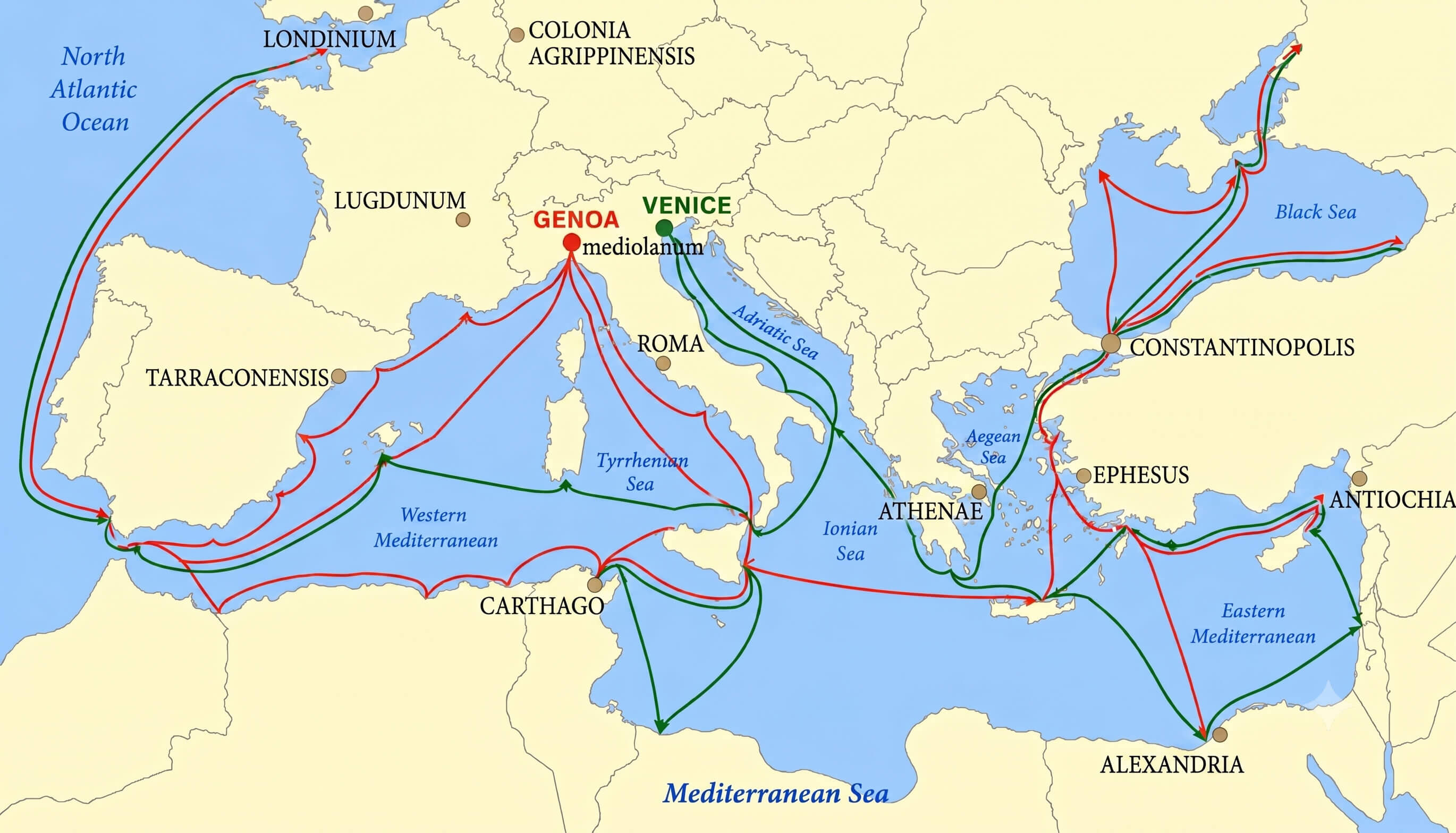
The empire surrounded much of the Mediterranean Sea, which the Romans called Mare Internum. Its provinces covered large parts of modern-day Europe, North Africa, and the Middle East.
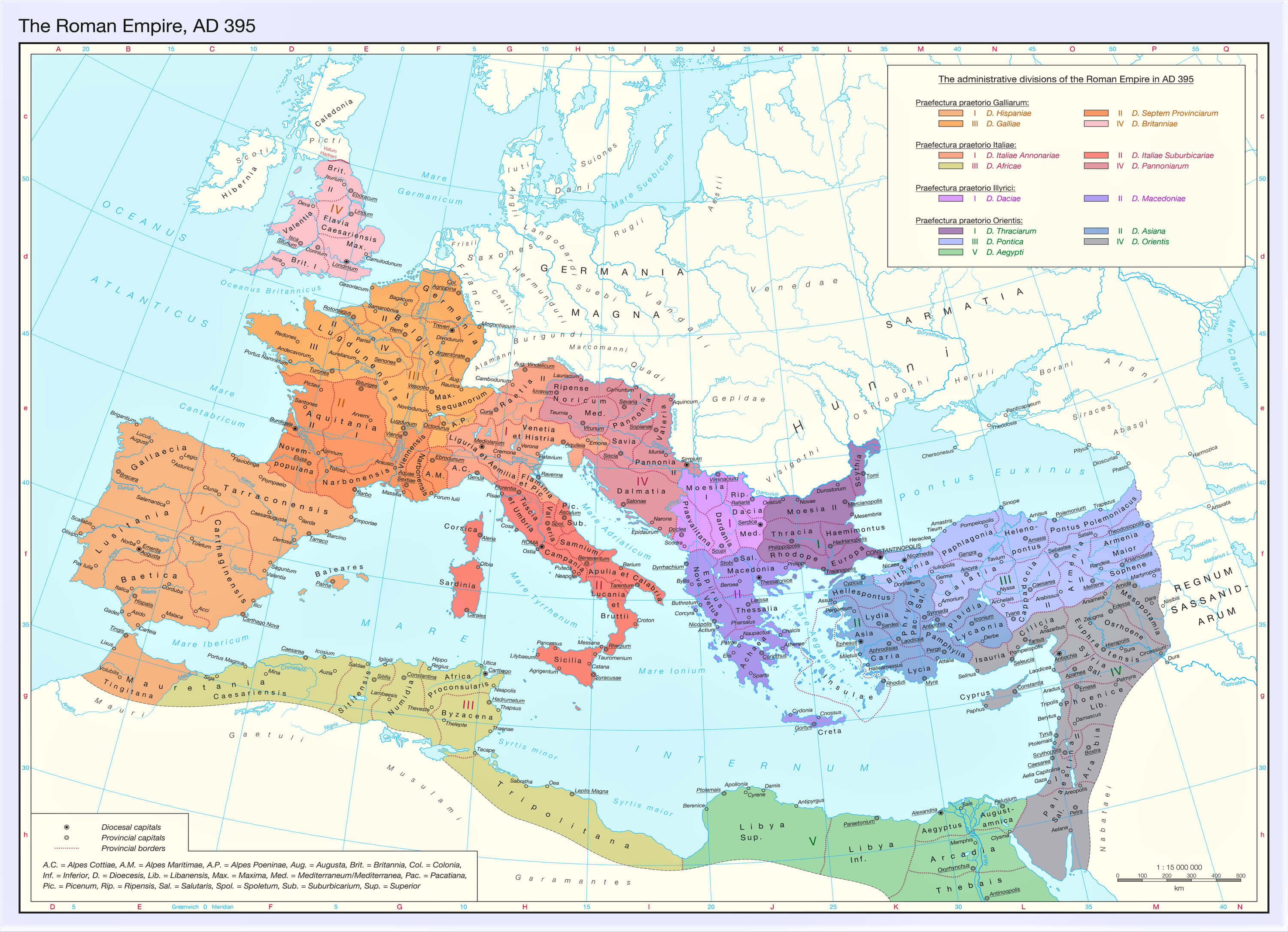
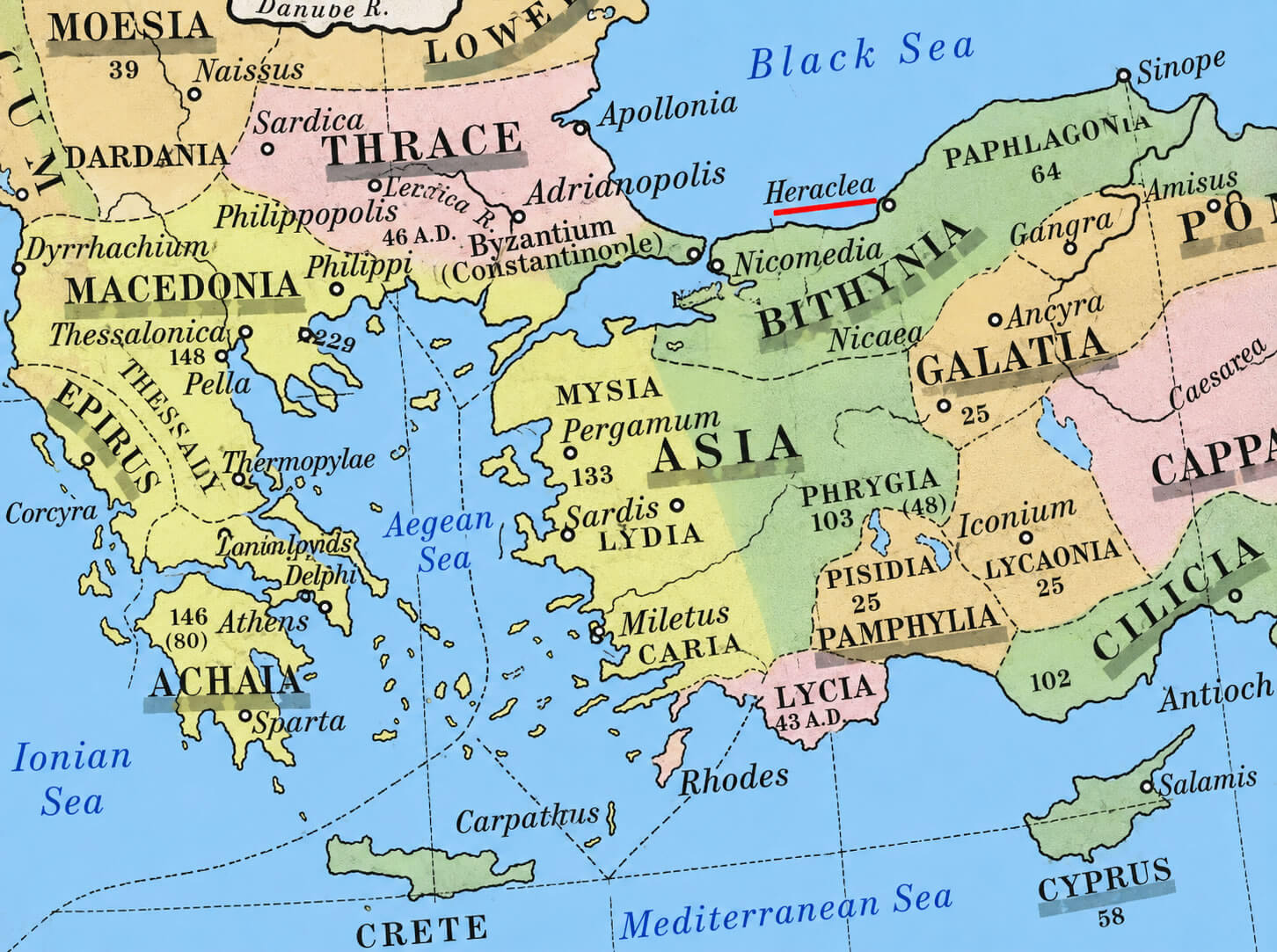
Province labels such as Britannia, Gallia, Hispania, Italia, Dacia, Asia, Syria, Judaea, and Aegyptus help visitors connect the ancient world with present-day geography.
How to Read the Map
The map uses a simple color system to separate Roman territory, surrounding lands, and bodies of water.
Major Provinces of the Roman Empire
Open each region to view the major Roman provinces visible on the map.
Western Europe
Iberian Peninsula
Central and Eastern Europe
Asia Minor and the Middle East
North Africa
Which Modern Countries Were Part of the Roman Empire?
The empire included all or part of many present-day countries across three continents.
The Roman Empire included all or part of present-day Italy, Spain, Portugal, France, the United Kingdom, Belgium, the Netherlands, Germany, Switzerland, Austria, Croatia, Greece, Türkiye, Syria, Israel, Egypt, Libya, Tunisia, Algeria, and several neighboring countries.
Roman Empire Timeline
Key milestones from the beginning of the empire to the fall of the Western Roman Empire.
Related Historical Maps
Continue exploring Rome, Italy, and the ancient Mediterranean world.