Explore the United States cities map and discover how geography, culture, and history come together across the nation. From colorful city layouts and detailed physical maps to interactive maps showing highways, elevation, and state borders, these visuals help you understand the structure and diversity of America’s urban landscape.
Whether you’re studying topography, planning a trip, or simply curious about how U.S. cities connect through major roads, airports, and railways, this collection offers a clear and comprehensive view of the country—featuring political, metropolitan, and physical city maps for every state.
United States Cities Map by States
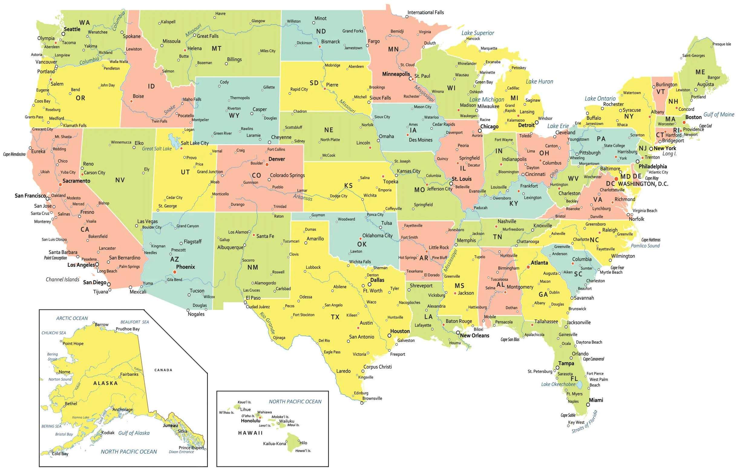
Colored United States cities map
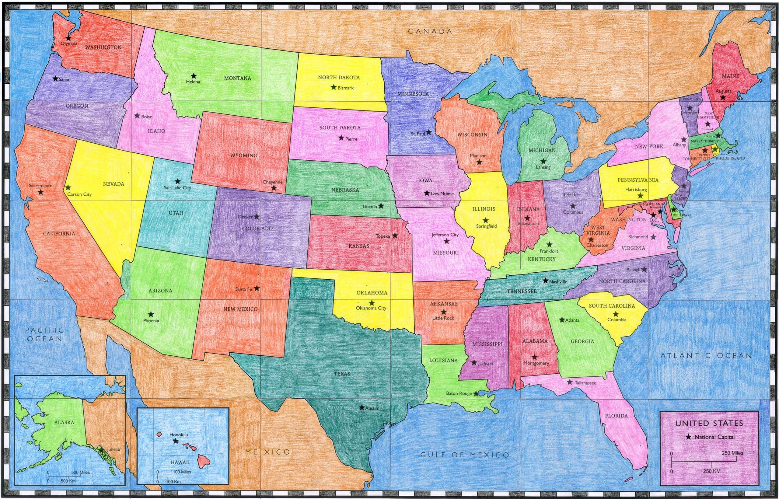
Colorful United States map with major cities
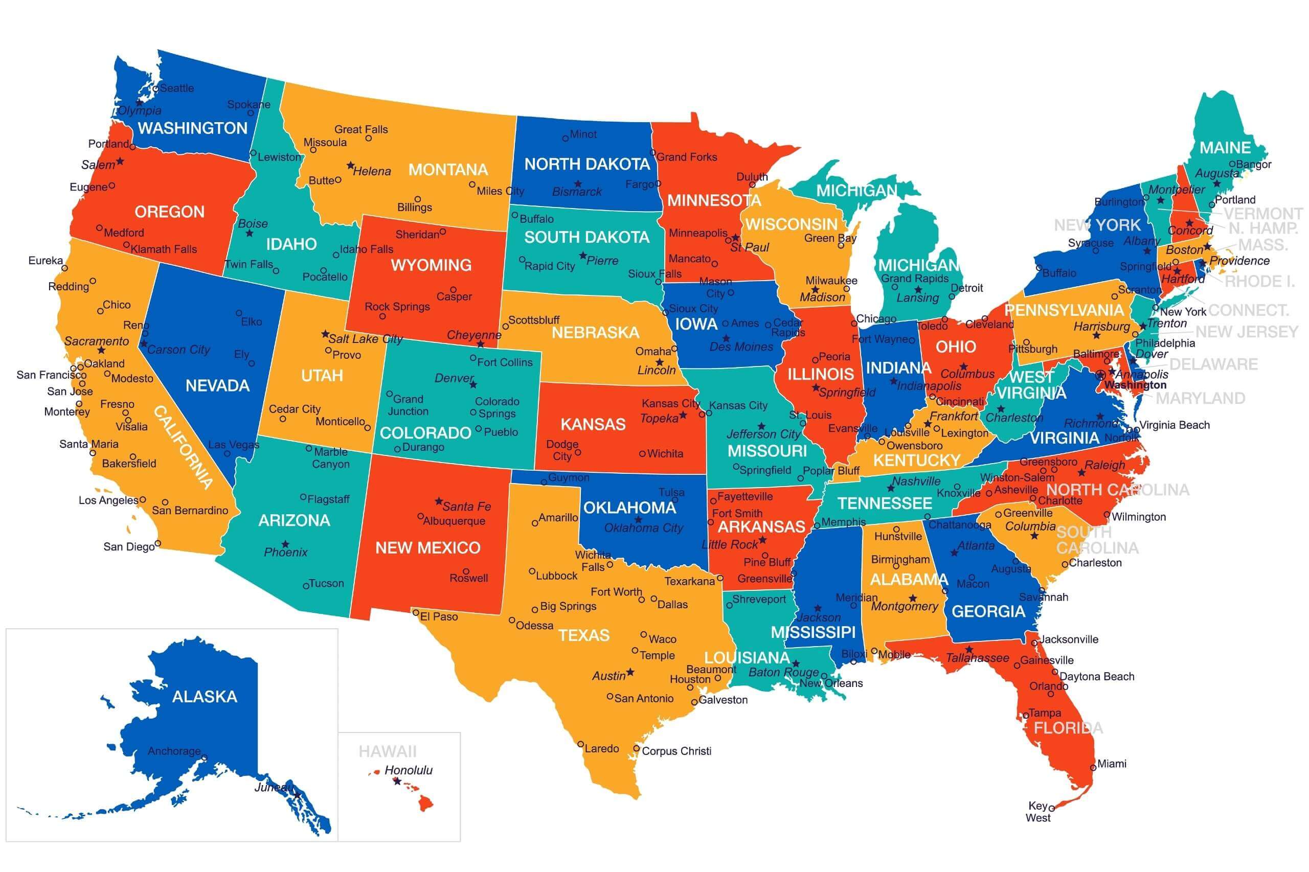
Detailed map of united state of america with states and capital cities
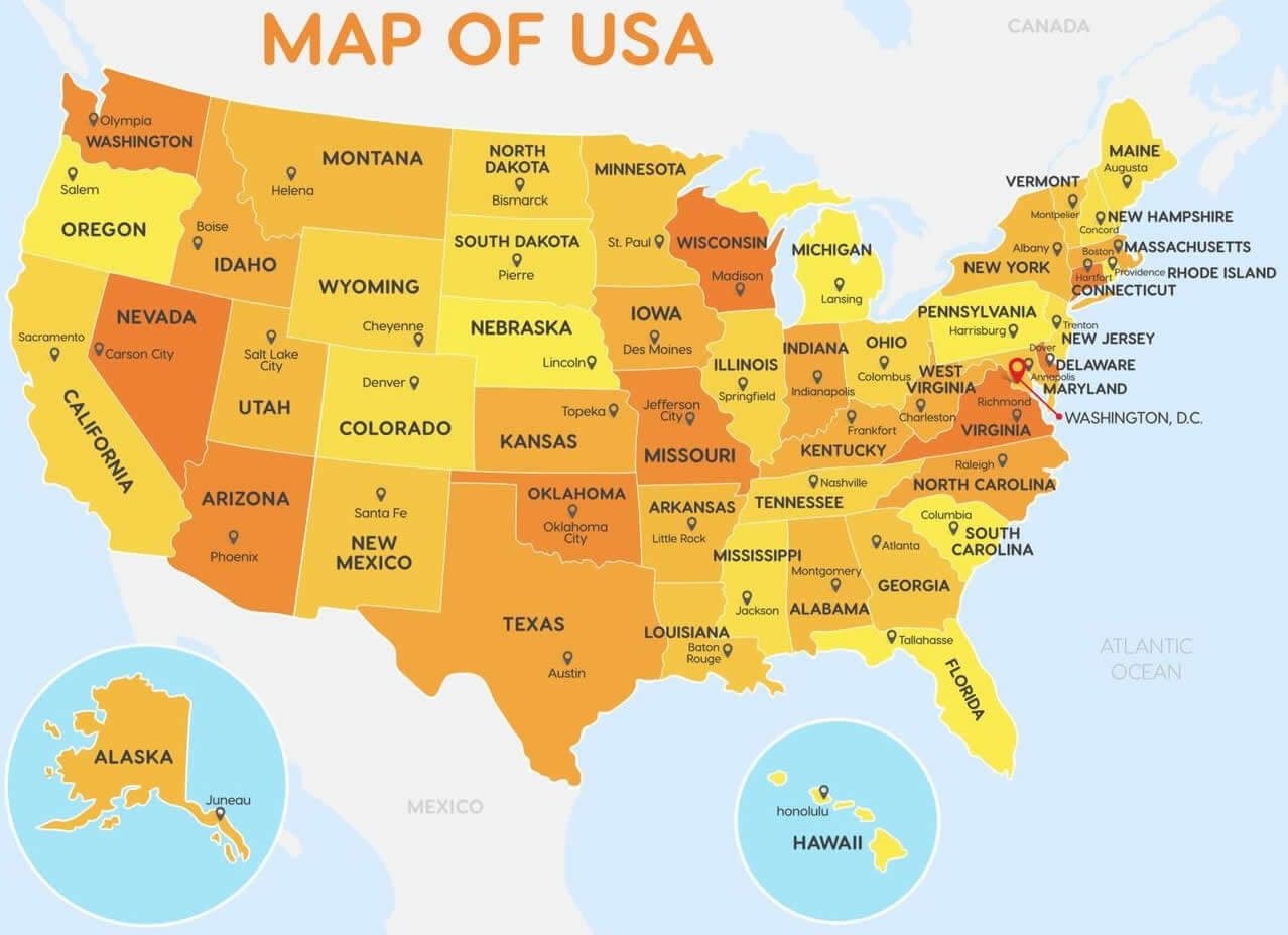
Physical map of the United States by cities
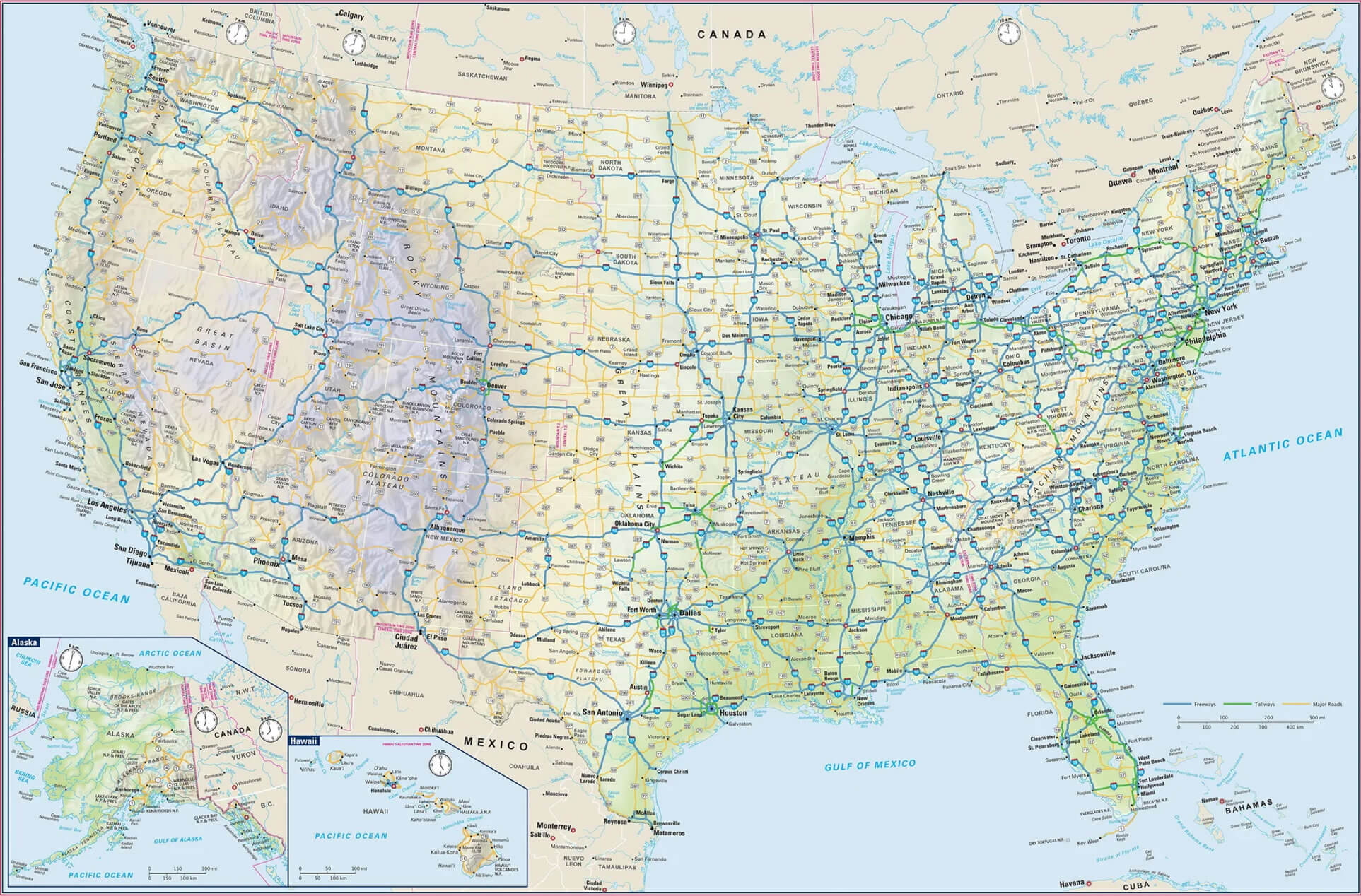
United States cities and highways map
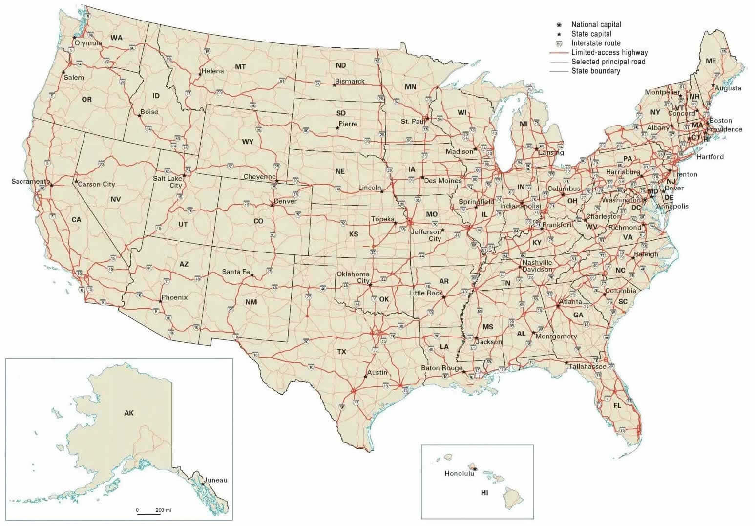
United States cities and physical map with Canada and Mexico
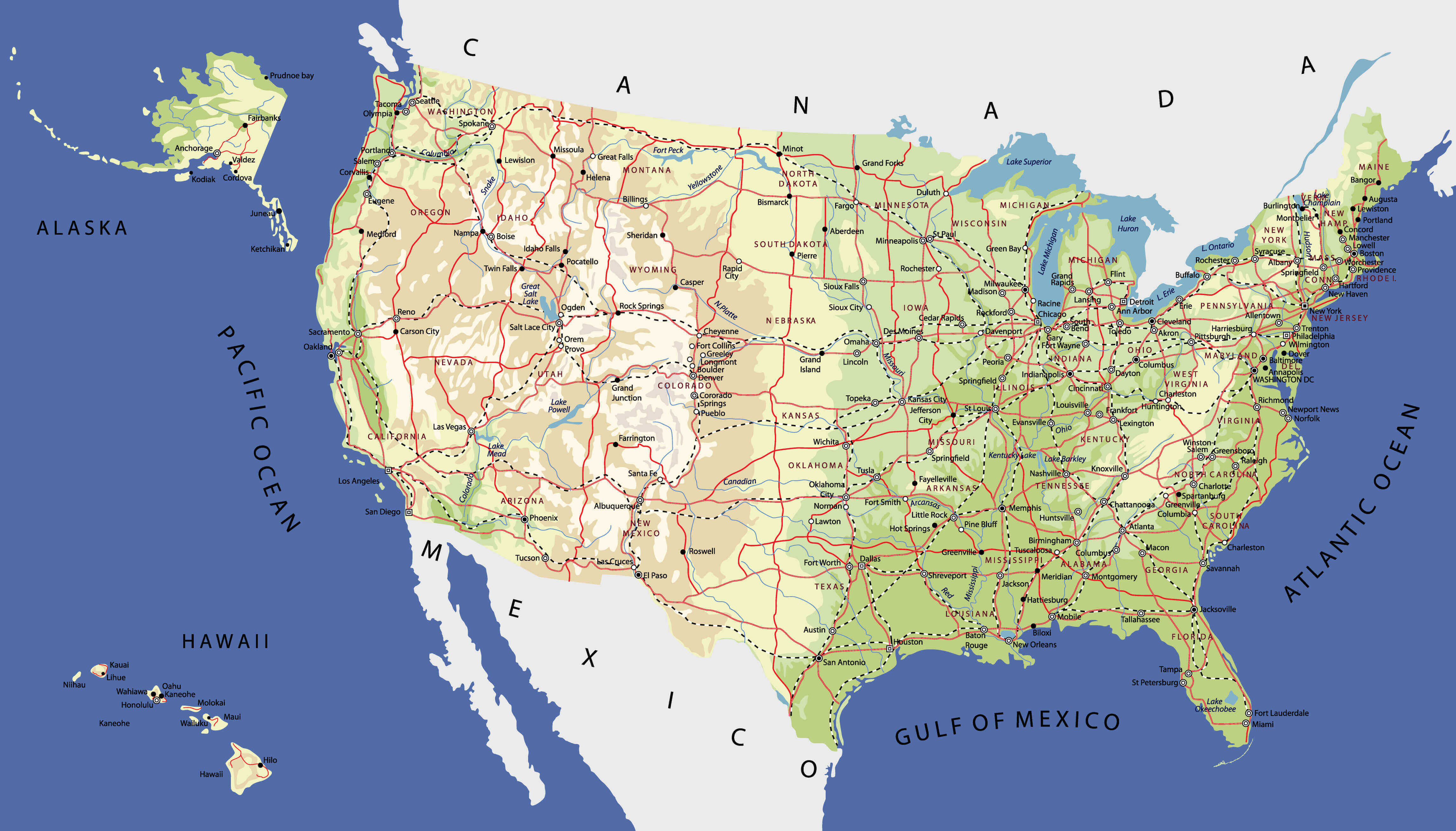
United States cities and physical map with US flag
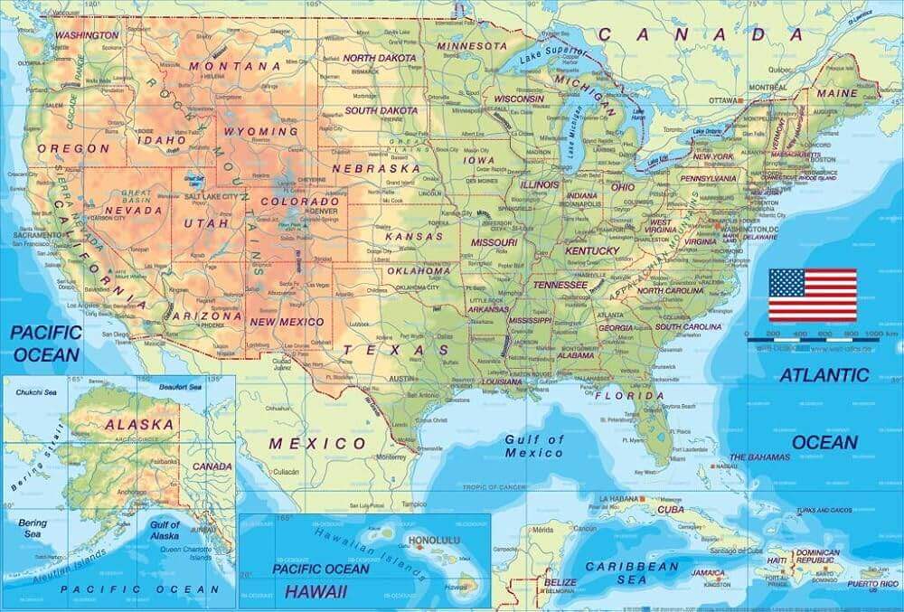
United States cities and physical map
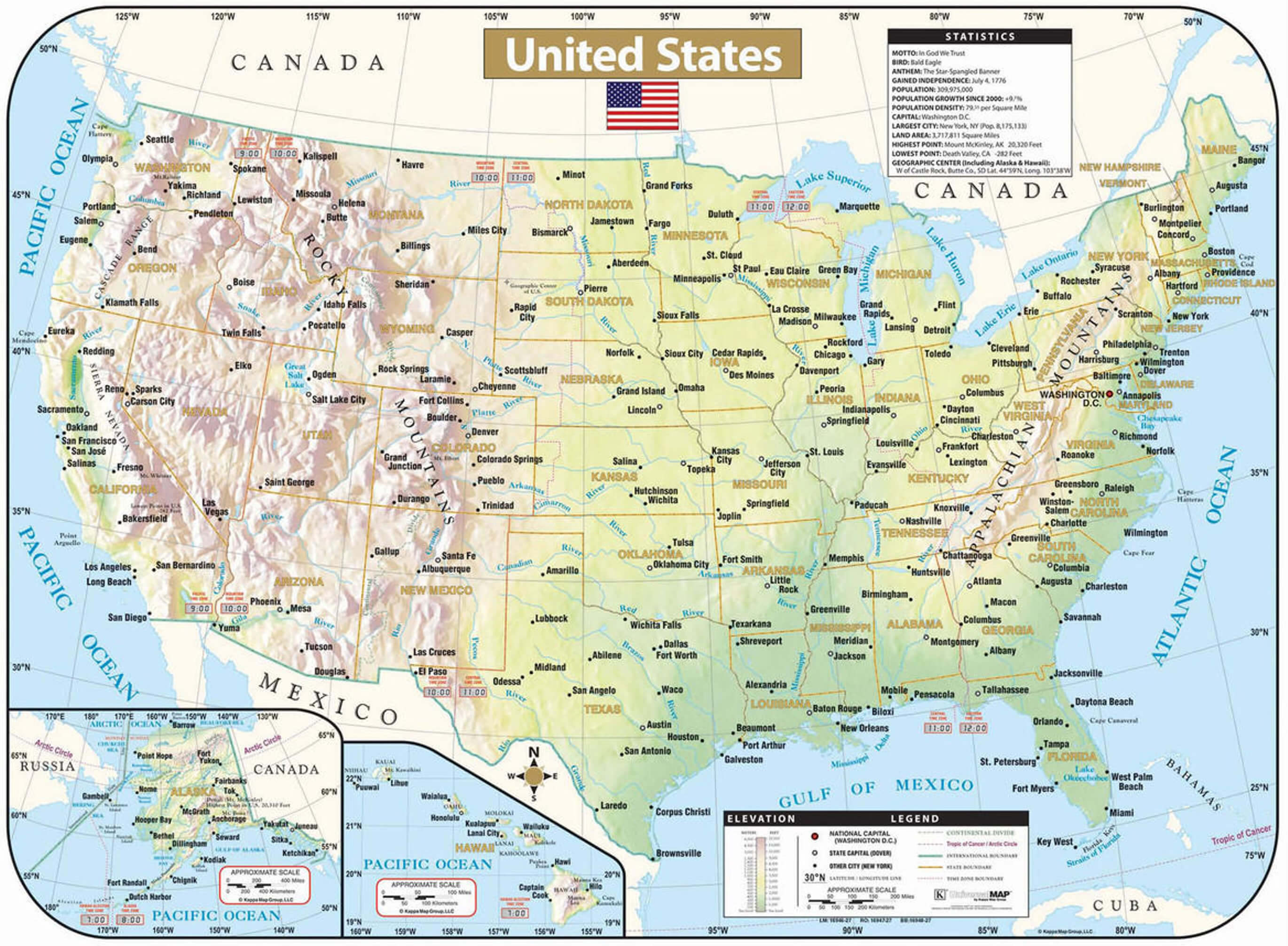
United States cities elevation map
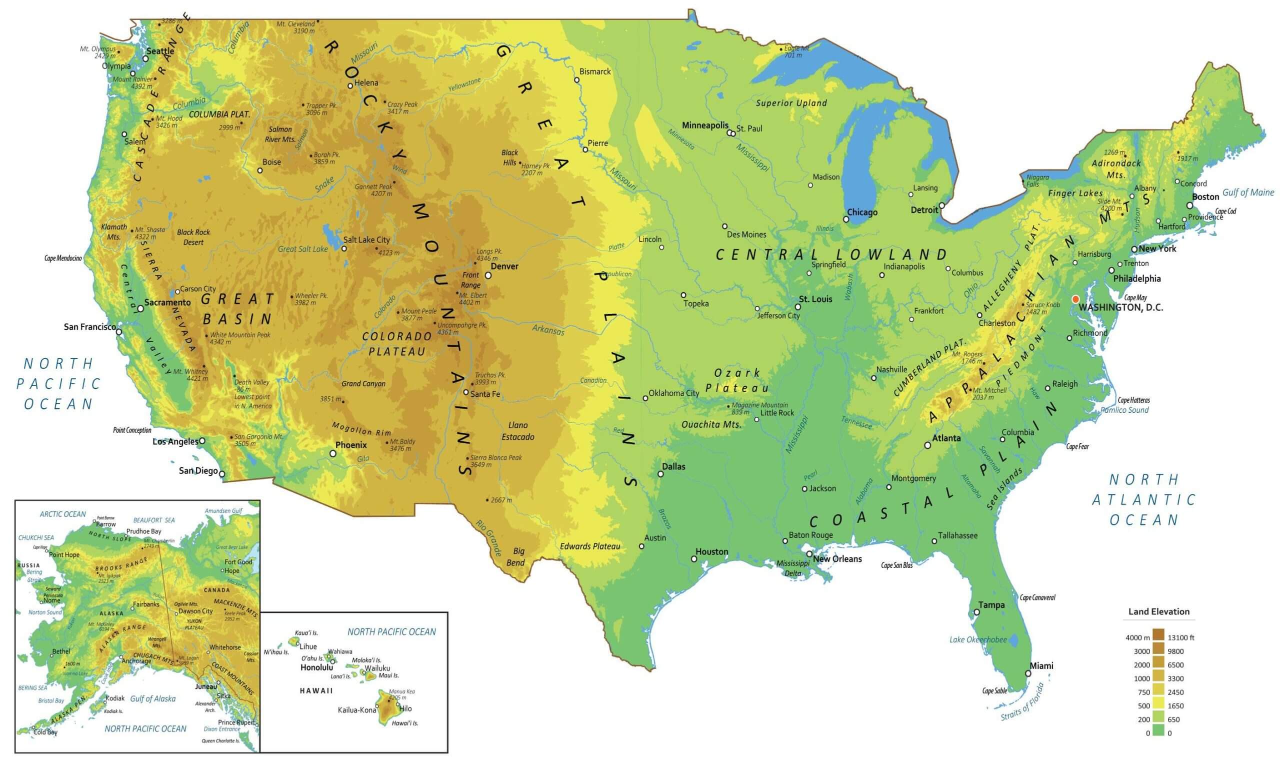
United States cities map with states on the world map
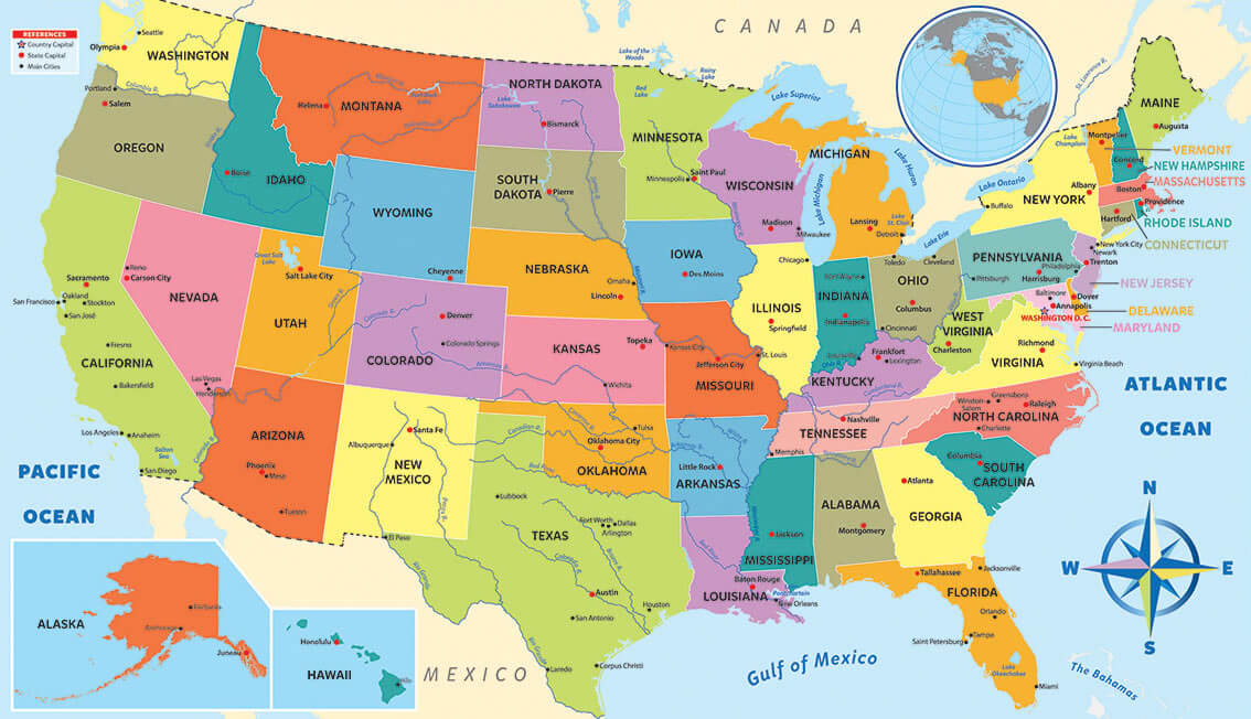
United States cities map with states
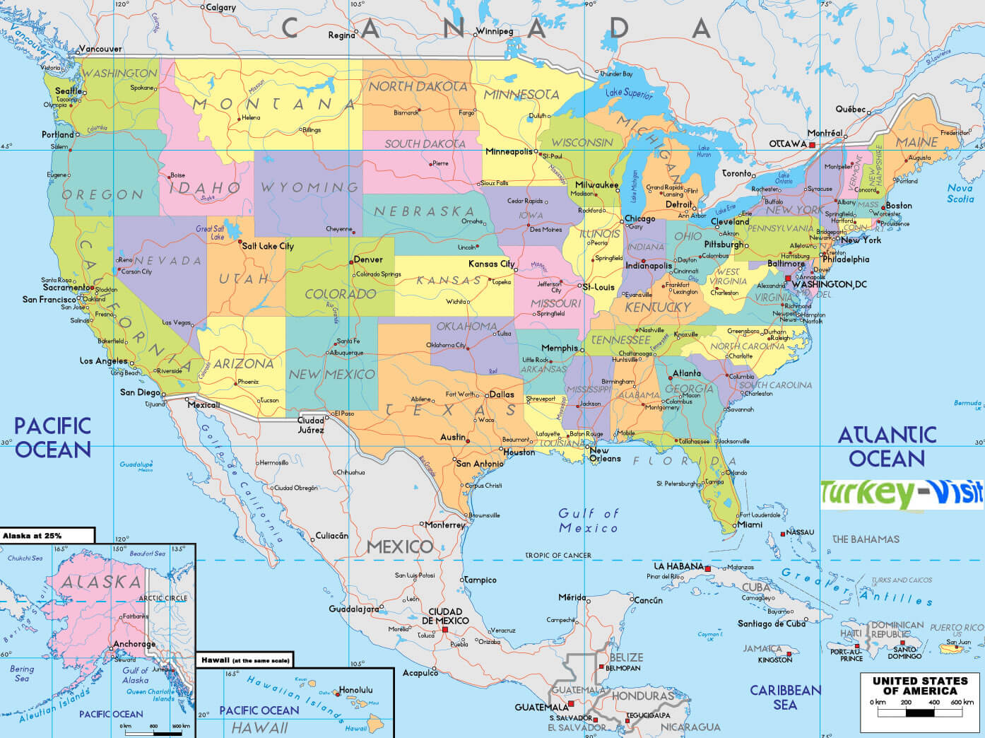
United States cities physical map in english
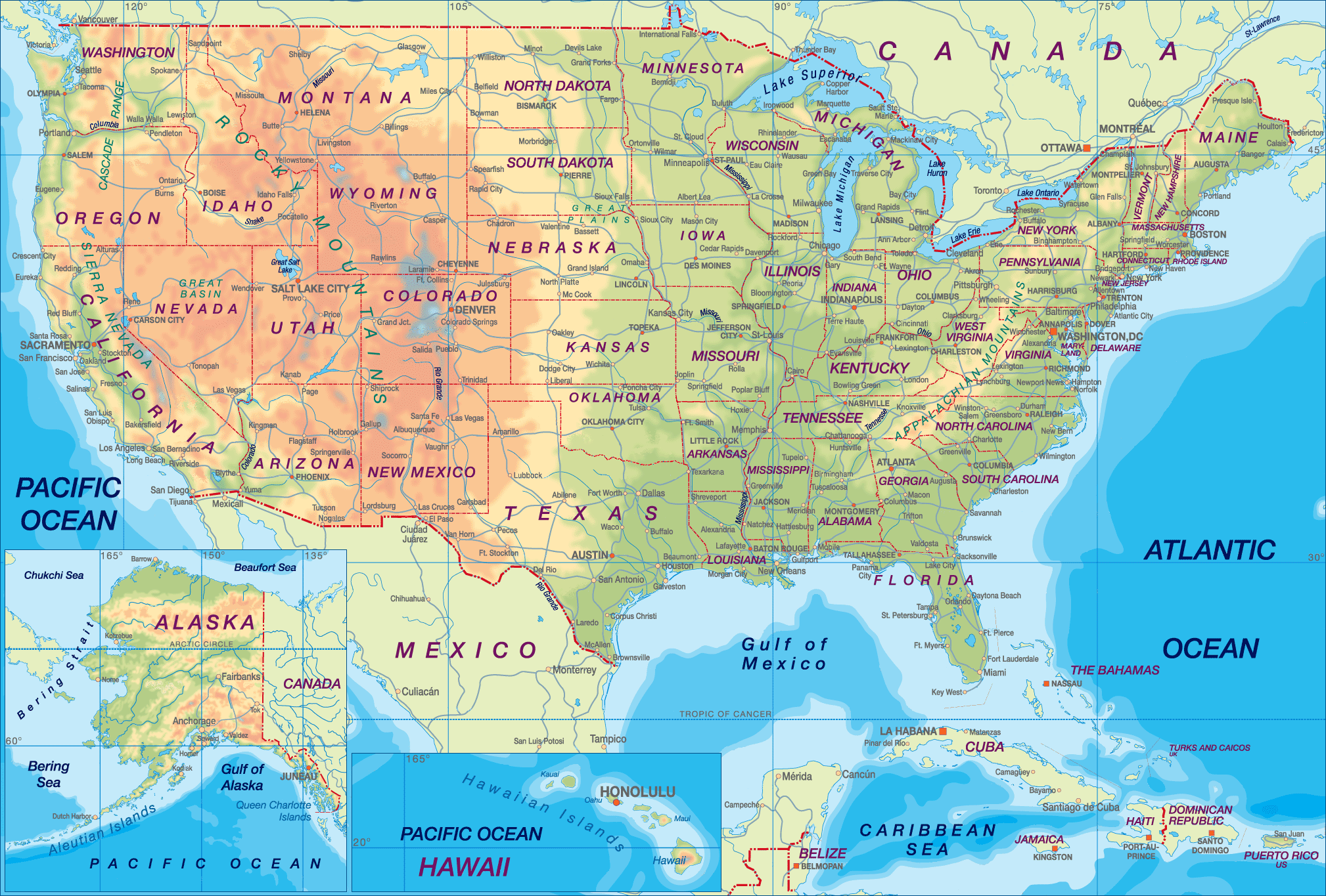
United States cities topography map
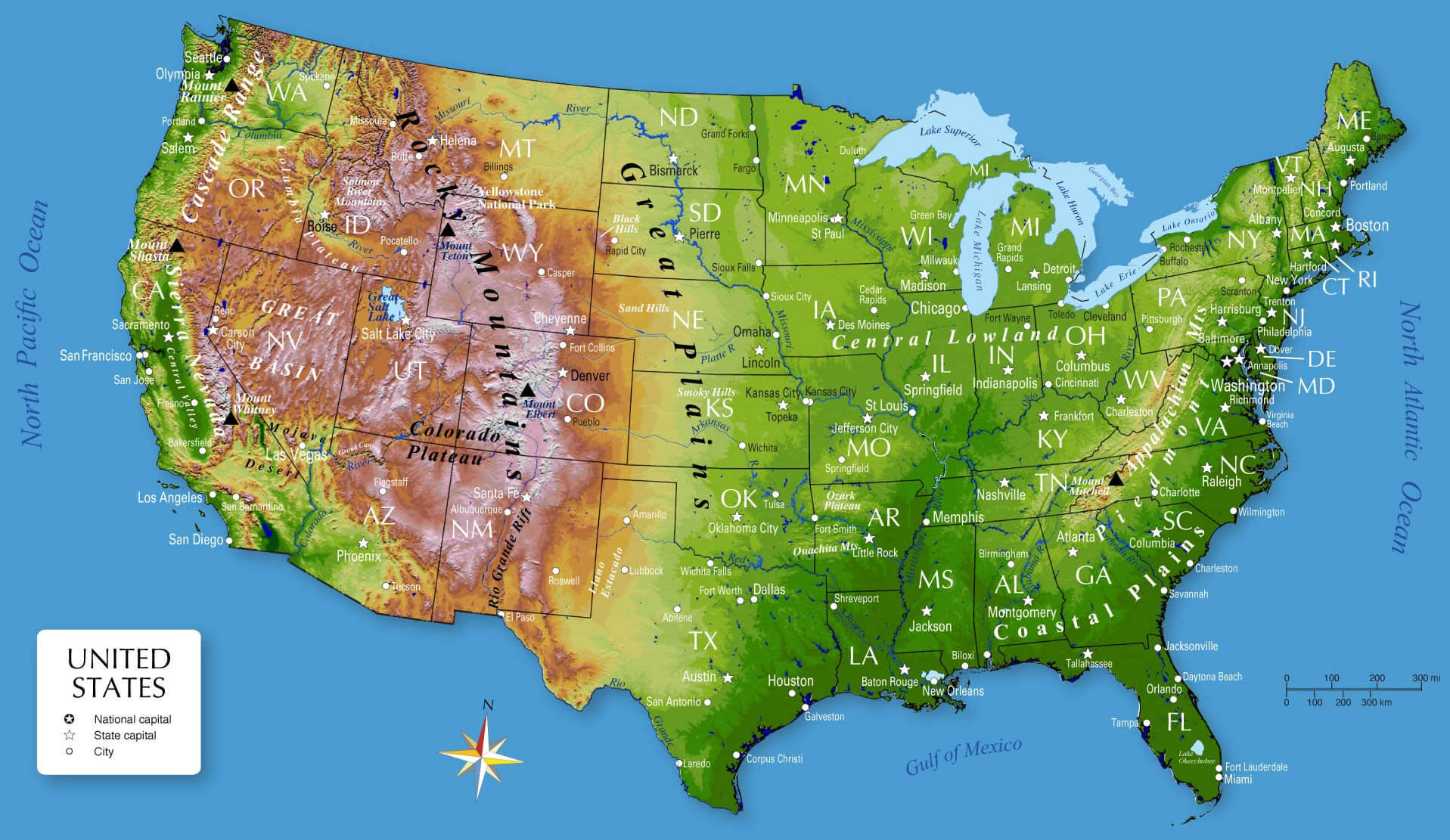
United States high speed rail map
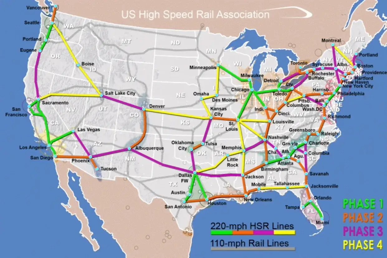
United States highways map with cities
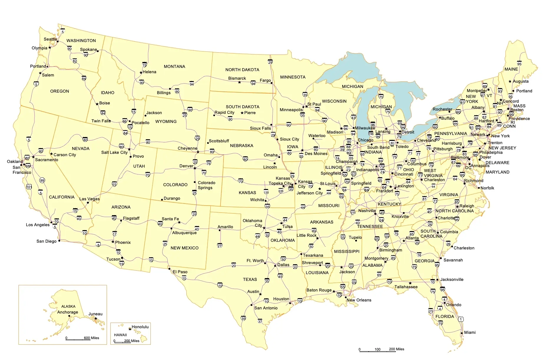
United States historical map with states and cities
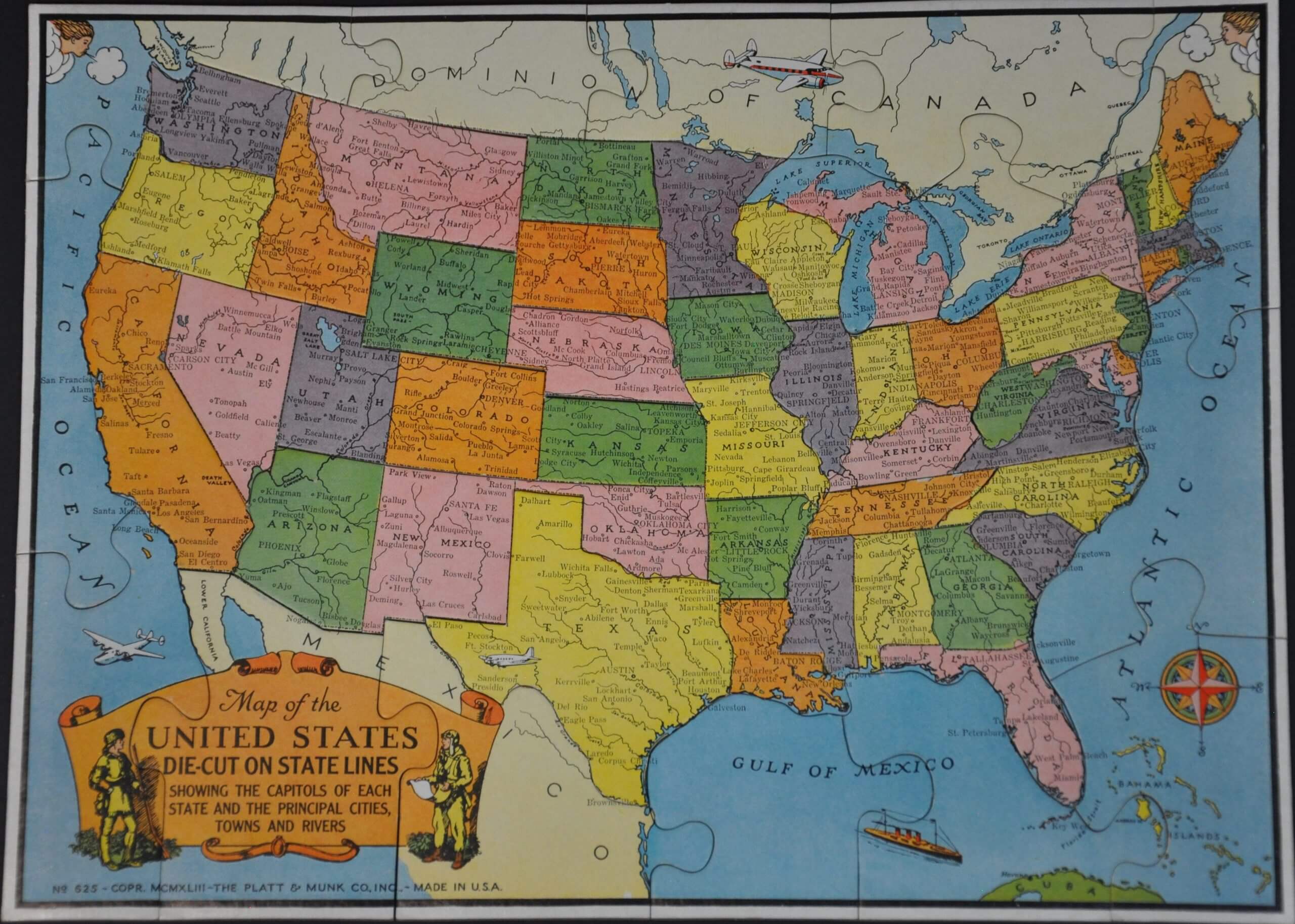
United States main cities map
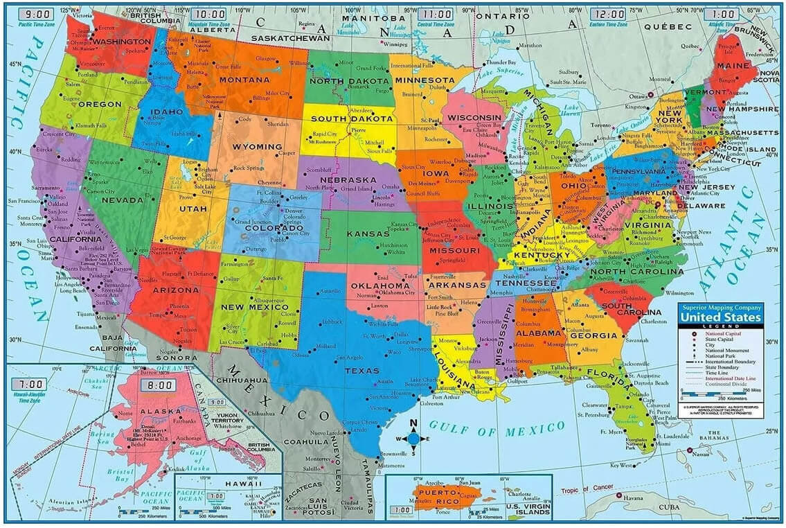
United States major cities and airports map
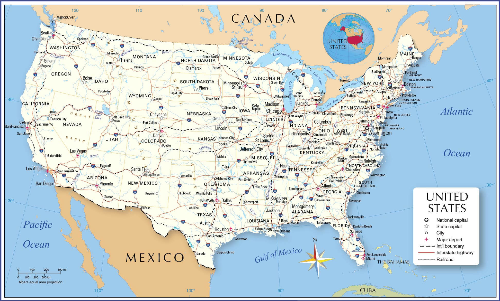
United States major cities map by states
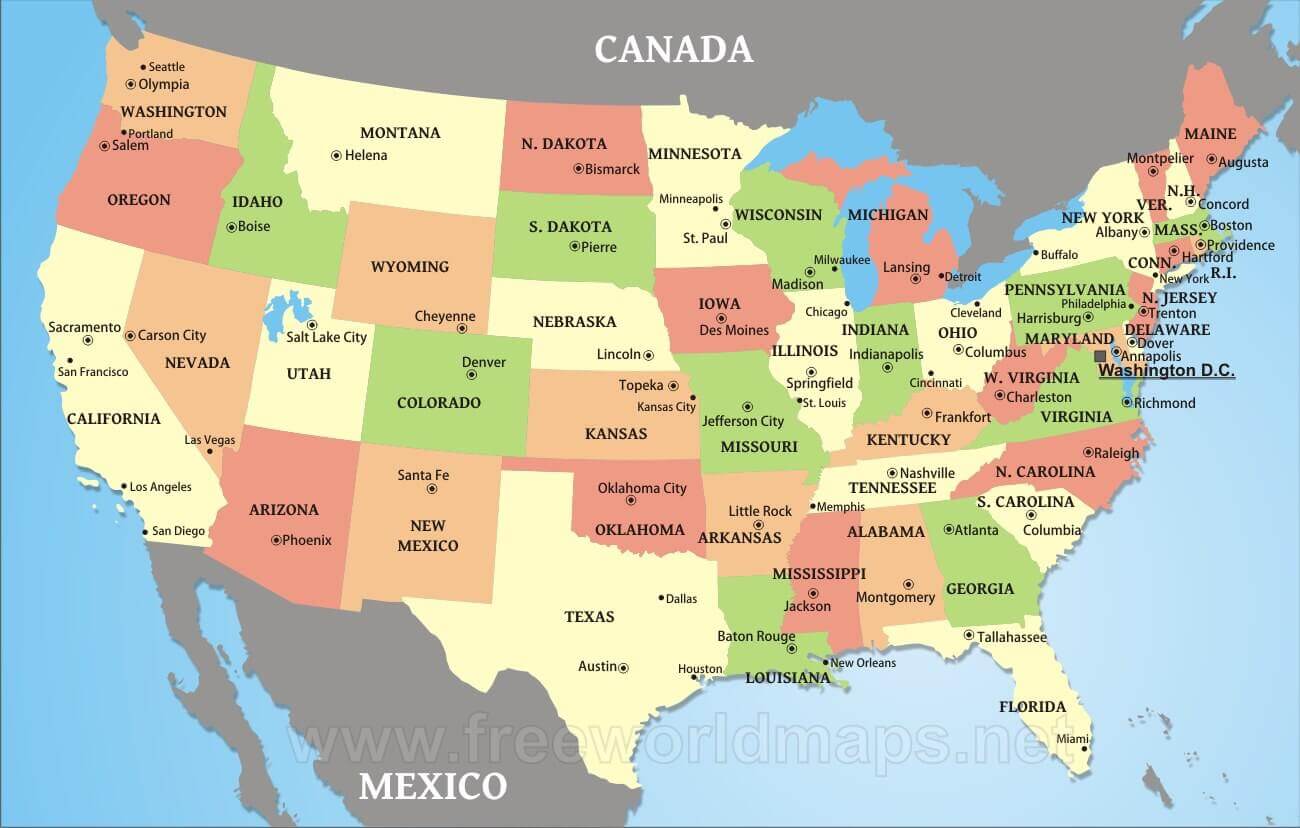
United States map with capitals
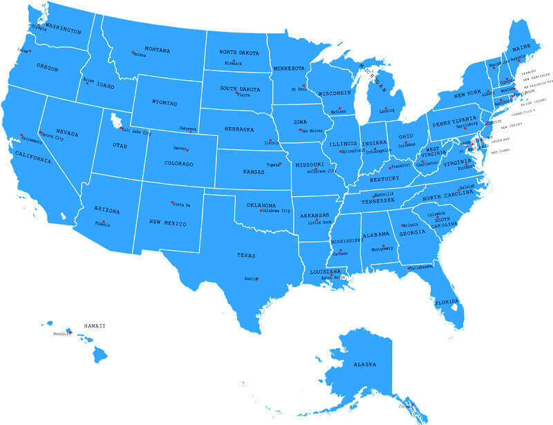
United States metro cities map
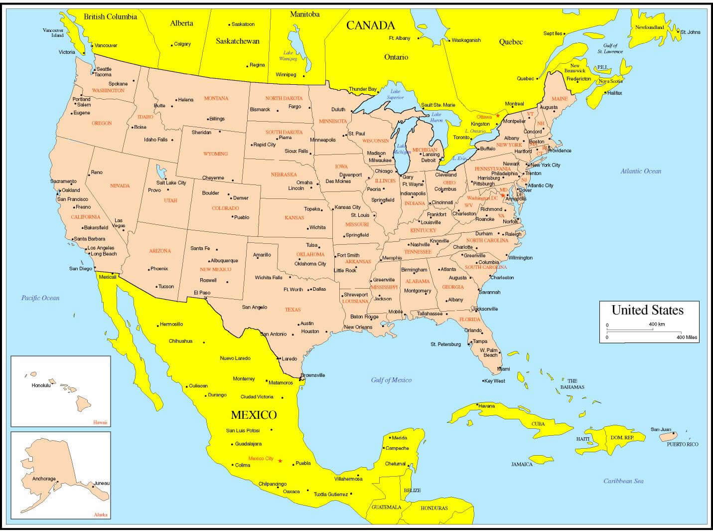
United States metropolitan cities map
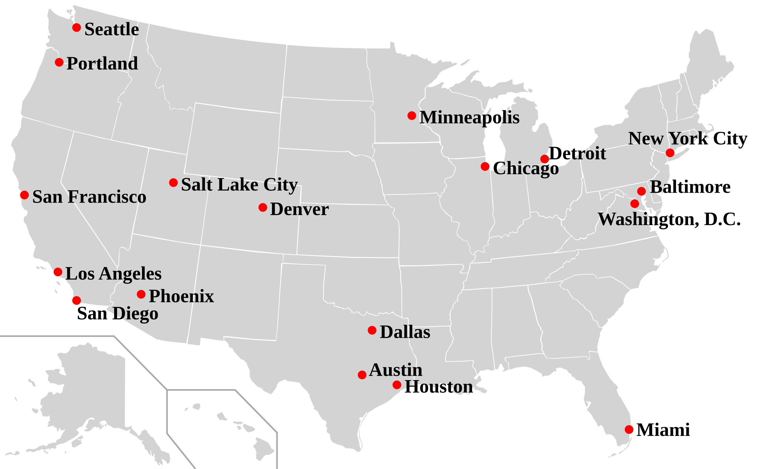
United States of america political map with main cities
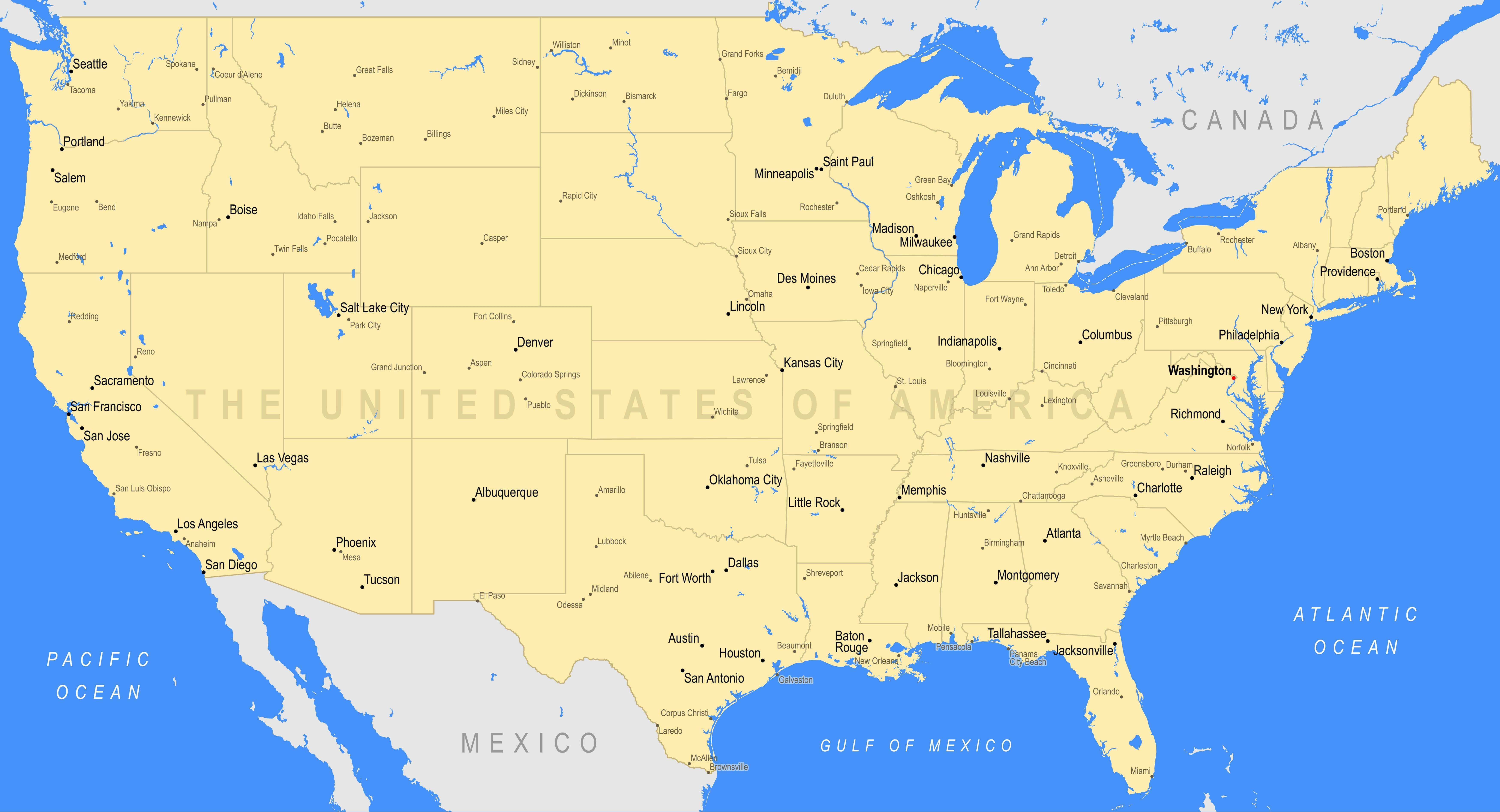
United States physical cities map
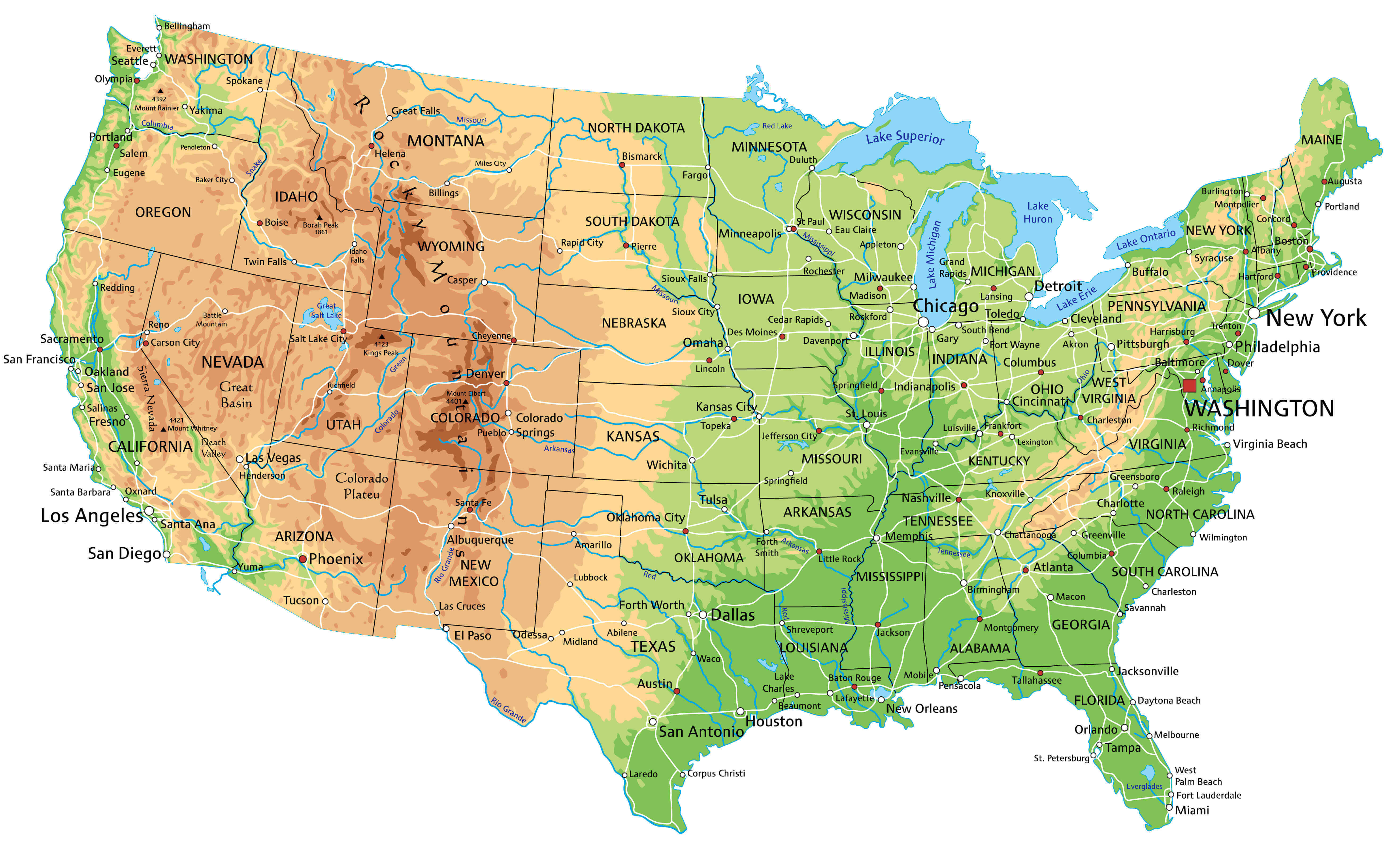
United States physical map by major cities
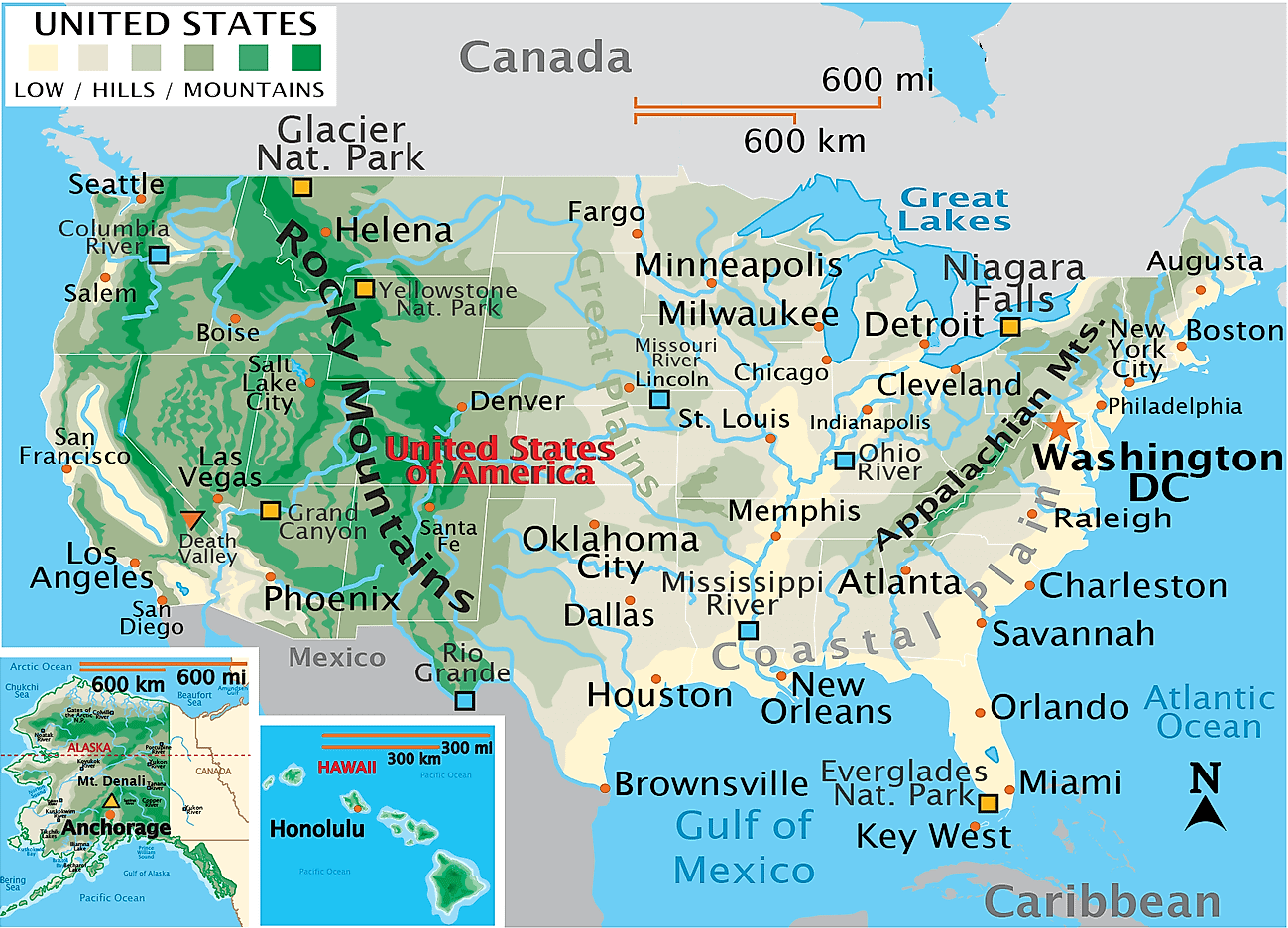
United States political map by states and cities
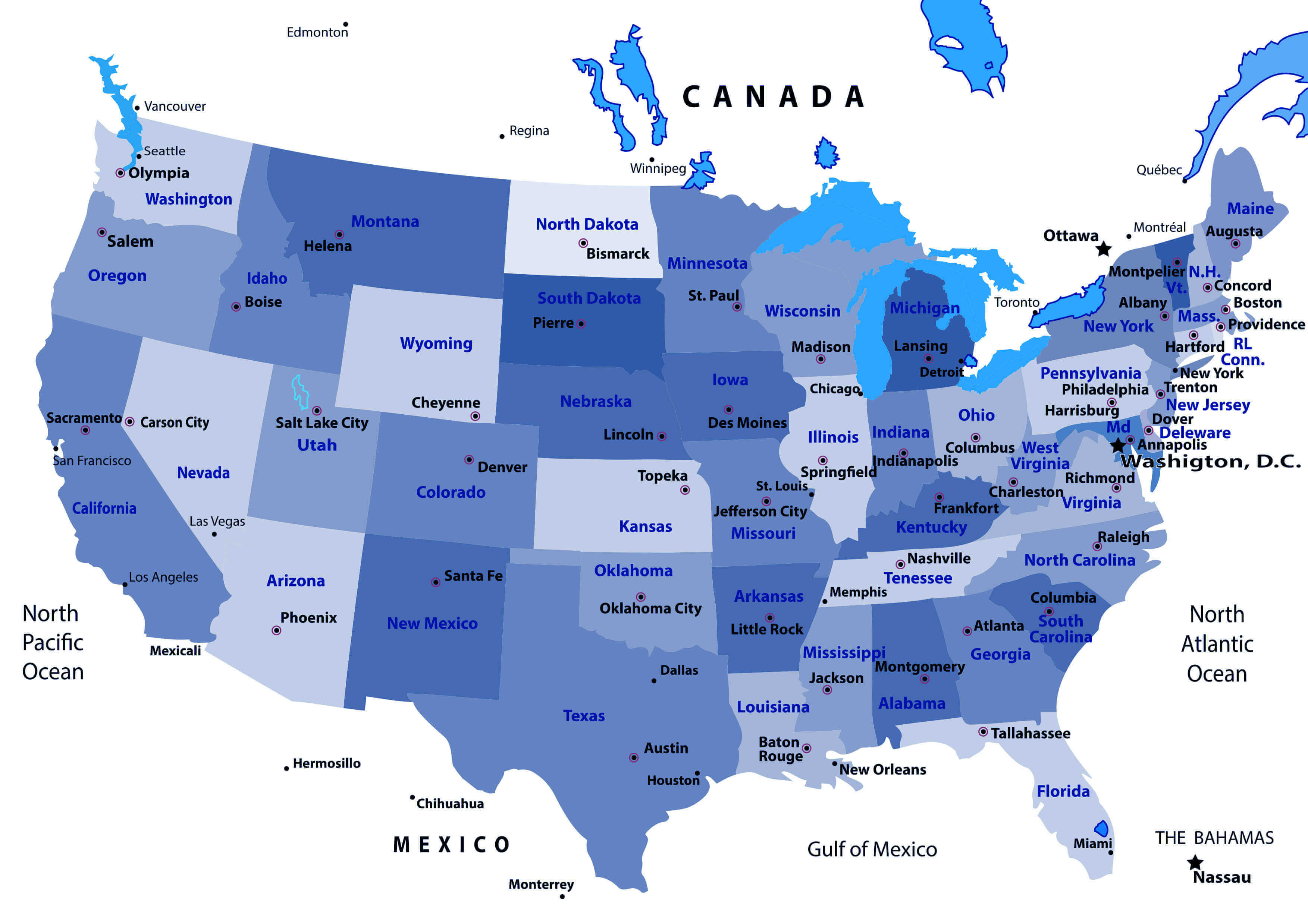
United States states capitals map
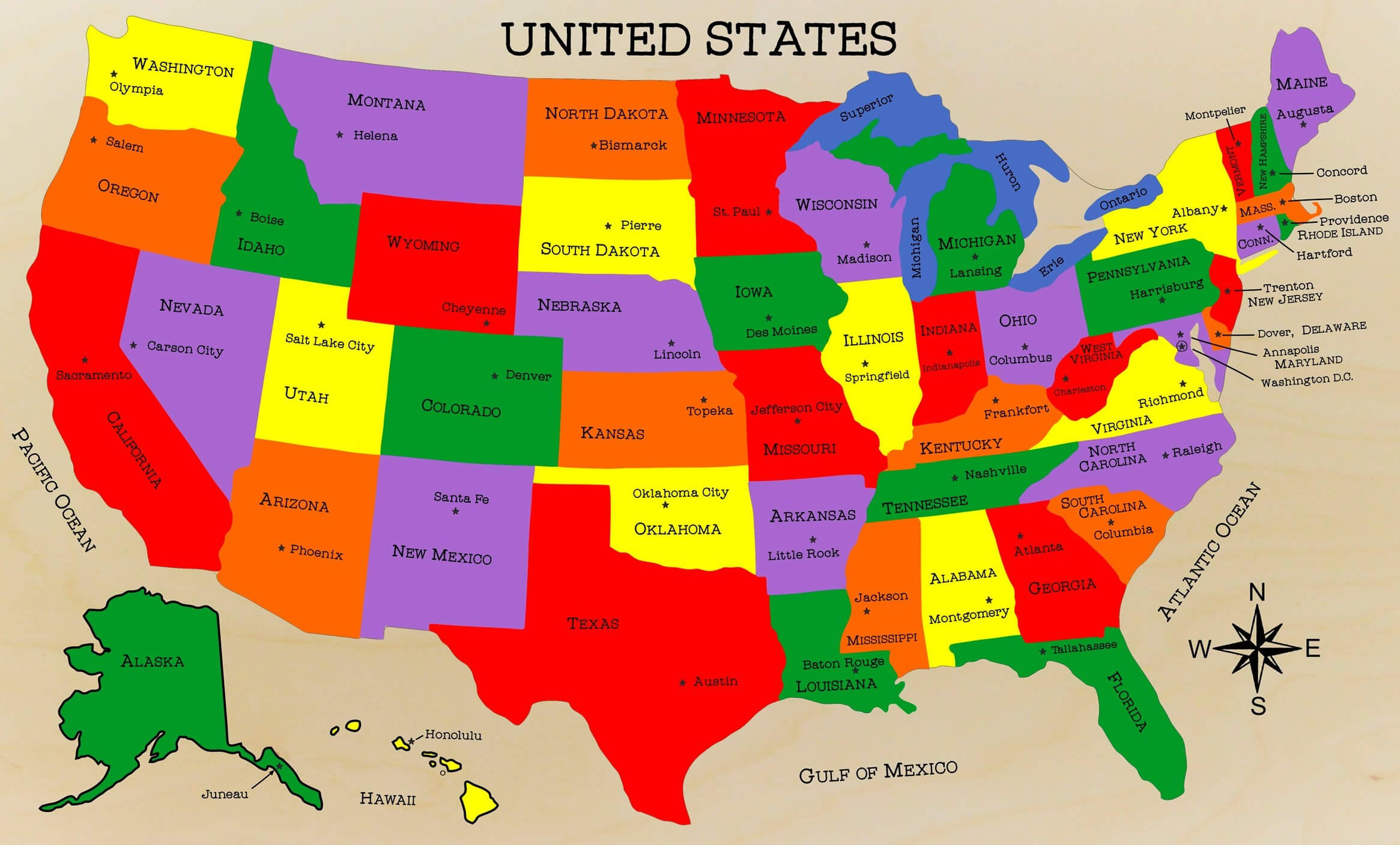
Where is the United States on the World Map?
Show Google map, satellite map, where is the country located.
Get directions by driving, walking, bicycling, public transportation and travel with street view.
Feel free to explore US states maps:
- US Cities Map ↗️
- California Cities Map ↗️
- Texas Cities Map ↗️
- New York Cities Map ↗️
- Florida Cities Map ↗️
- Illinois Cities Map ↗️
- Pennsylvania Cities Map ↗️
- Ohio Cities Map ↗️
- Georgia Cities Map ↗️
- North Carolina Cities Map ↗️
- Michigan Cities Map ↗️
- New Jersey Cities Map ↗️
- Virginia Cities Map ↗️
- Washington Cities Map ↗️
- United States Map ↗️
- US Maps ↗️
- United States Maps ↗️
- Map of United States ↗️
- US States Map ↗️
- Political Map of the US ↗️
- United States Political Map ↗️
- United States Capitals Map ↗️
- United States Physical Map ↗️
- US High-resolution Map ↗️
- United States High-resolution Map ↗️
- US States Capitals Map ↗️
- US Physical Map ↗️
- US Population Map ↗️
- United States Population Map ↗️
- US Time Zone Map ↗️
- US Blank Map ↗️
- United States Blank Map ↗️
- Gulf of America (The Gulf of Mexico) Map ↗️
- United States Time Zone Map ↗️
- California Time Zone Map ↗️
- Texas Time Zone Map ↗️
- New York Time Zone Map ↗️
- Florida Time Zone Map ↗️
- California Map ↗️
- Texas Map ↗️
- New York Map ↗️
