Explore the rich history, diverse landscapes, political, physical, civil war, religion, satellite, road, topography, rainfall, travel and cultural heritage of Syria with our comprehensive collection of Syria maps.
Brief information about Syria
Syria, officially known as the Syrian Arab Republic, is a country in the Middle East with a history dating back thousands of years. Situated at the crossroads of civilisations, Syria is home to some of the world’s oldest cities, such as Damascus and Aleppo, which have been continuously inhabited for thousands of years. The country boasts a rich cultural and historical heritage, with landmarks such as the ancient city of Palmyra, a UNESCO World Heritage Site, and the Citadel of Aleppo, reflecting its importance as a centre of trade and culture in the ancient and medieval world. Historically, Syria has been influenced by a variety of empires, including the Assyrians, Romans, Byzantines and Ottomans, each leaving their mark on the region’s architecture, culture and traditions.
Syria provinces map
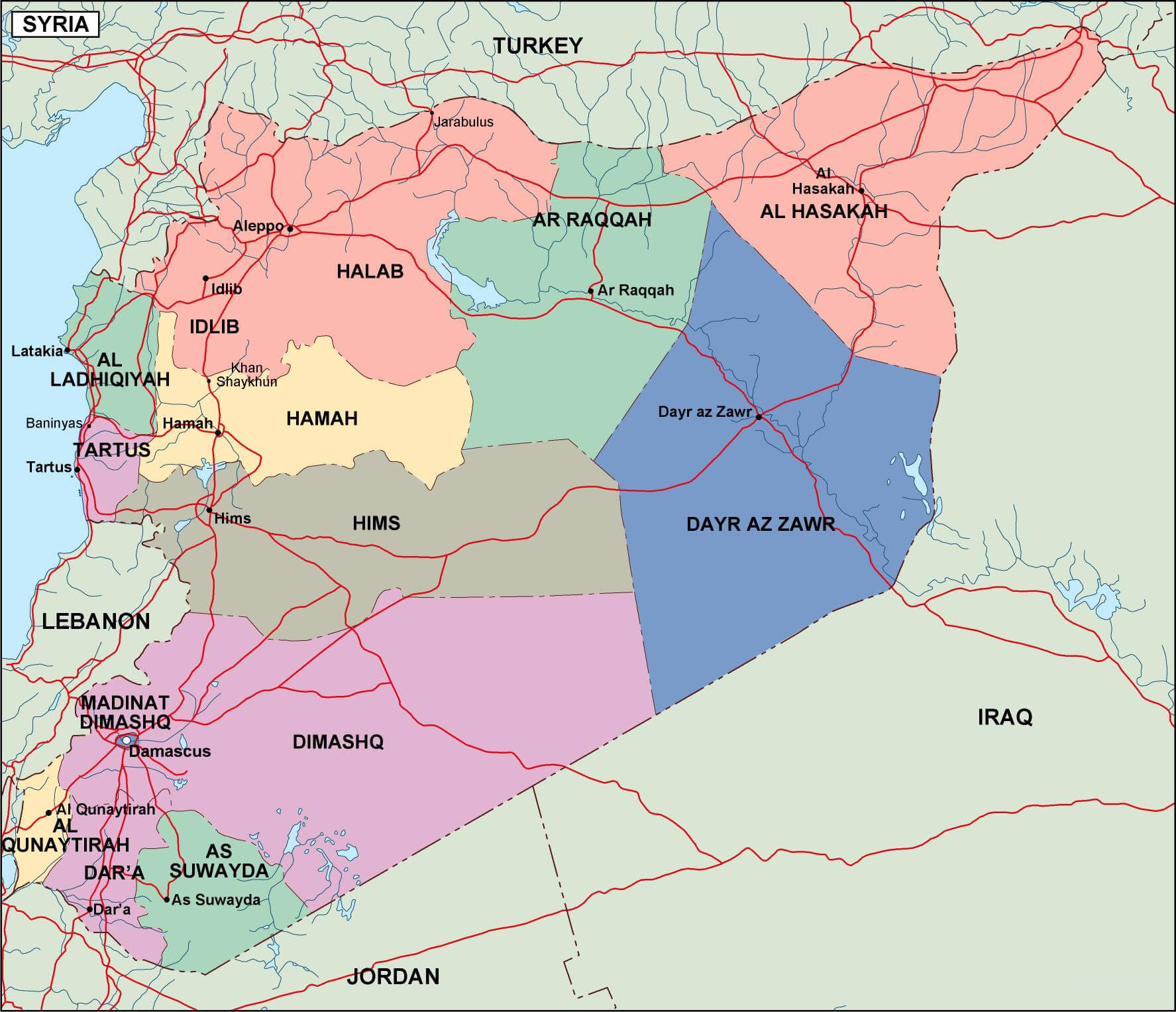 Syria provinces map
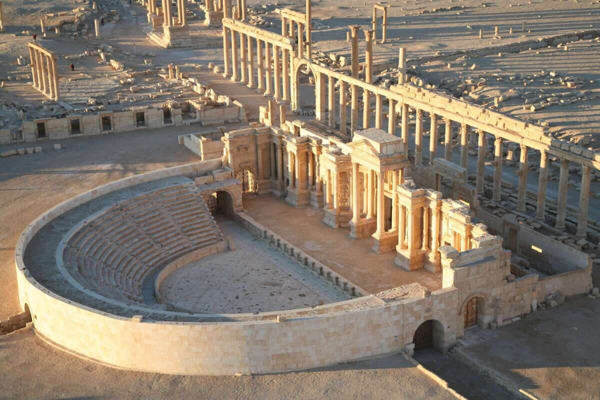 Area: 207,595 km2 (80,153 sq mi)
In modern times, Syria is known for its diverse population, consisting of various ethnic and religious groups, including Arabs, Kurds, Assyrians, Christians and Druze. Arabic is the official language and Islam is the predominant religion, with Sunni Muslims making up the majority. Since 2011, Syria has been embroiled in a complex civil war that has had a significant impact on the country’s infrastructure, economy, and population. Despite these challenges, Syria remains a country of immense historical and cultural significance, offering a glimpse into the rich tapestry of human civilisation.
Where is located Syria on the World Map
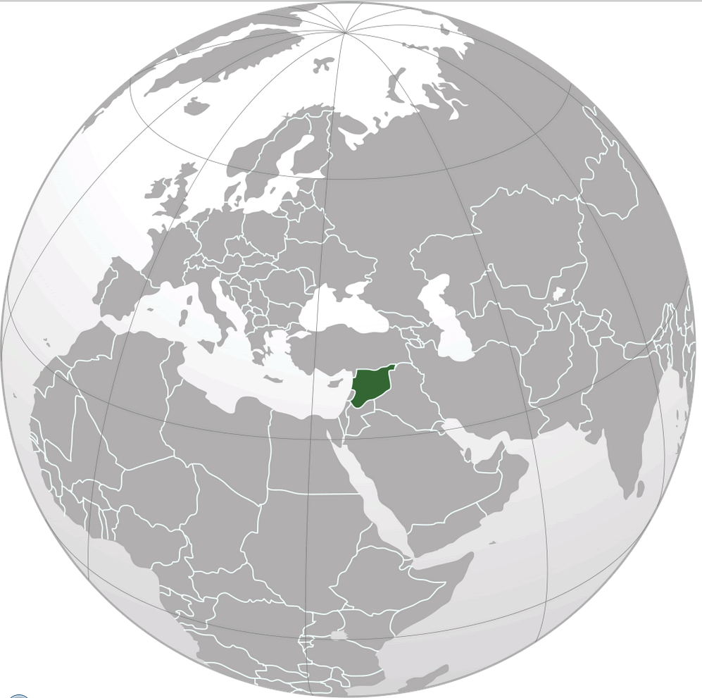 Where is Syria on the World Map
Syria is located in the Middle East, a region that serves as a bridge between Asia, Europe and Africa. It lies on the eastern shore of the Mediterranean Sea, giving it a strategic geographical position. Syria borders Turkey to the north and Iraq to the east and southeast. Jordan is its southern neighbour, and to the west Syria borders Lebanon and Israel. This central location has made Syria an important crossroads for trade, culture and politics throughout history.
Syria Physical Map: Cities and Geographic Regions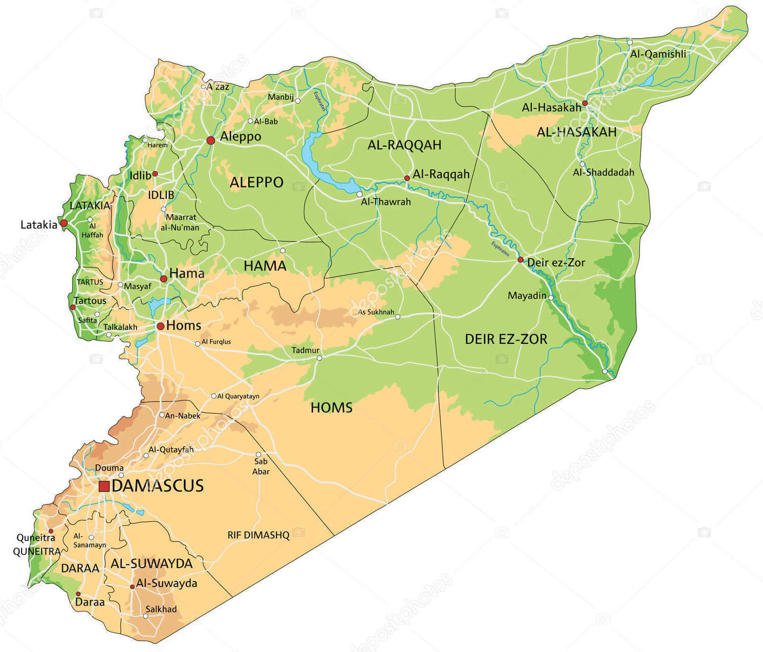 Syria physical map showing cities, regions, rivers, and terrain features.
On the world map, Syria is located in the northern hemisphere and is part of western Asia. Its latitude ranges from 32° to 37° north, while its longitude stretches from 35° to 42° east. Its Mediterranean coastline gives it access to maritime trade routes, while its proximity to the Arabian Peninsula and Mesopotamia places it at the heart of ancient civilisations. This prime location has contributed to its rich and turbulent history as a crossroads of empires, religions and cultures.
Here are some statistical information about Syria: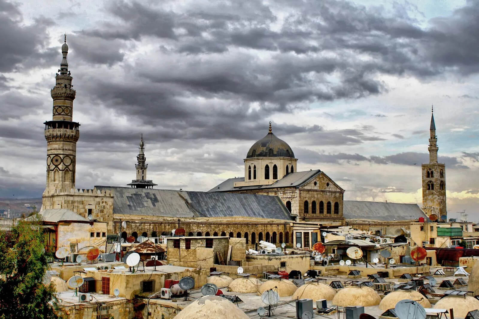 Area: 185,180 km2 (71,500 sq mi)
 Syria Ethnic Demographic Composition in 2024
- 90% Arabs
- 9% Kurds
- 1% others
Syria Religious Composition in 2024
- 87% Islam
- 74% Sunni Islam
- 13% Alawism and other Shia Islam
- 10% Christianity
- 3% Druze
Map of Syria’s Regions: Provinces and Key Cities
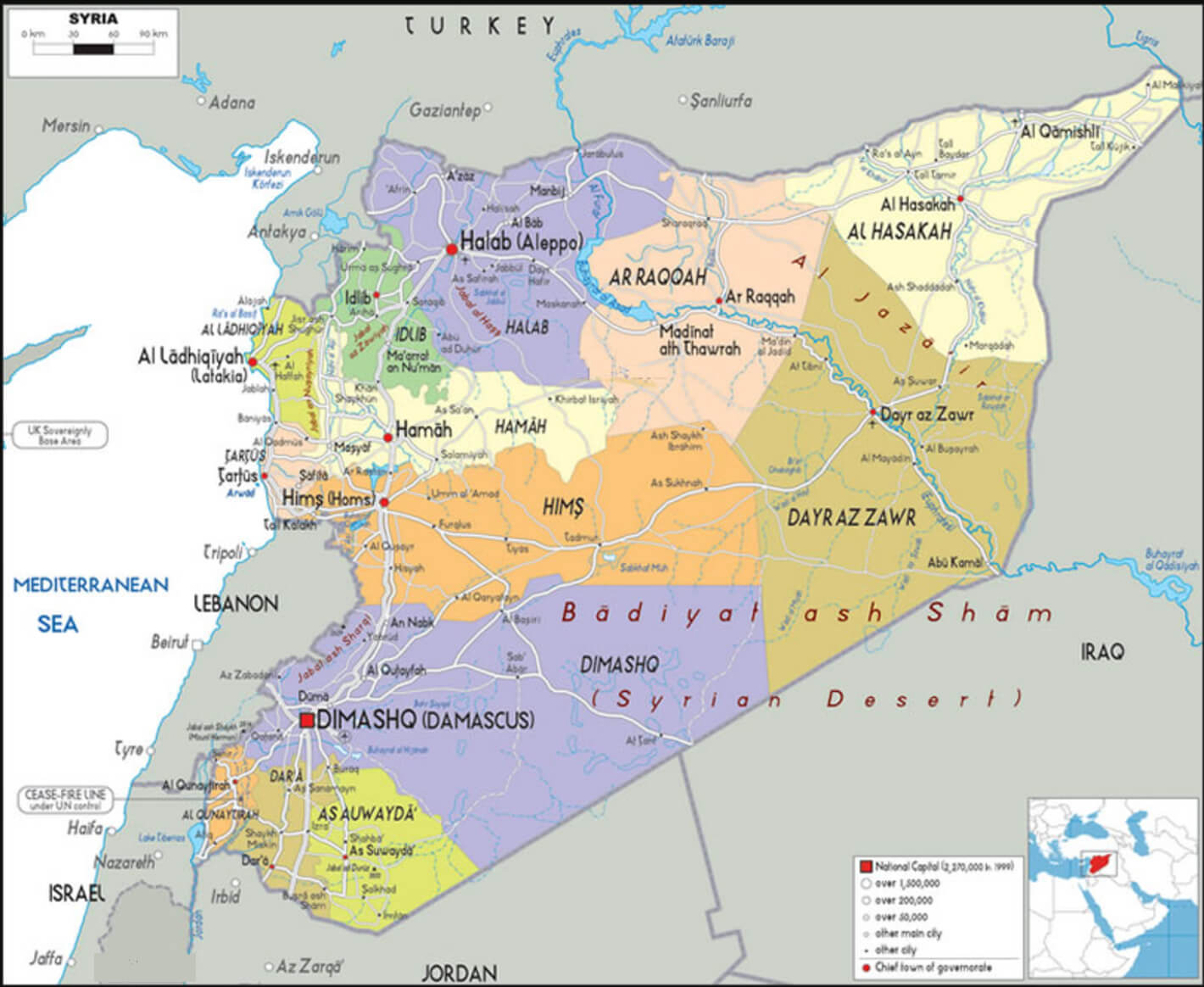 Syria regions map showing provinces, major cities, and geographic divisions.
Syria Main Road and Railroad Map: Connectivity Across the Country
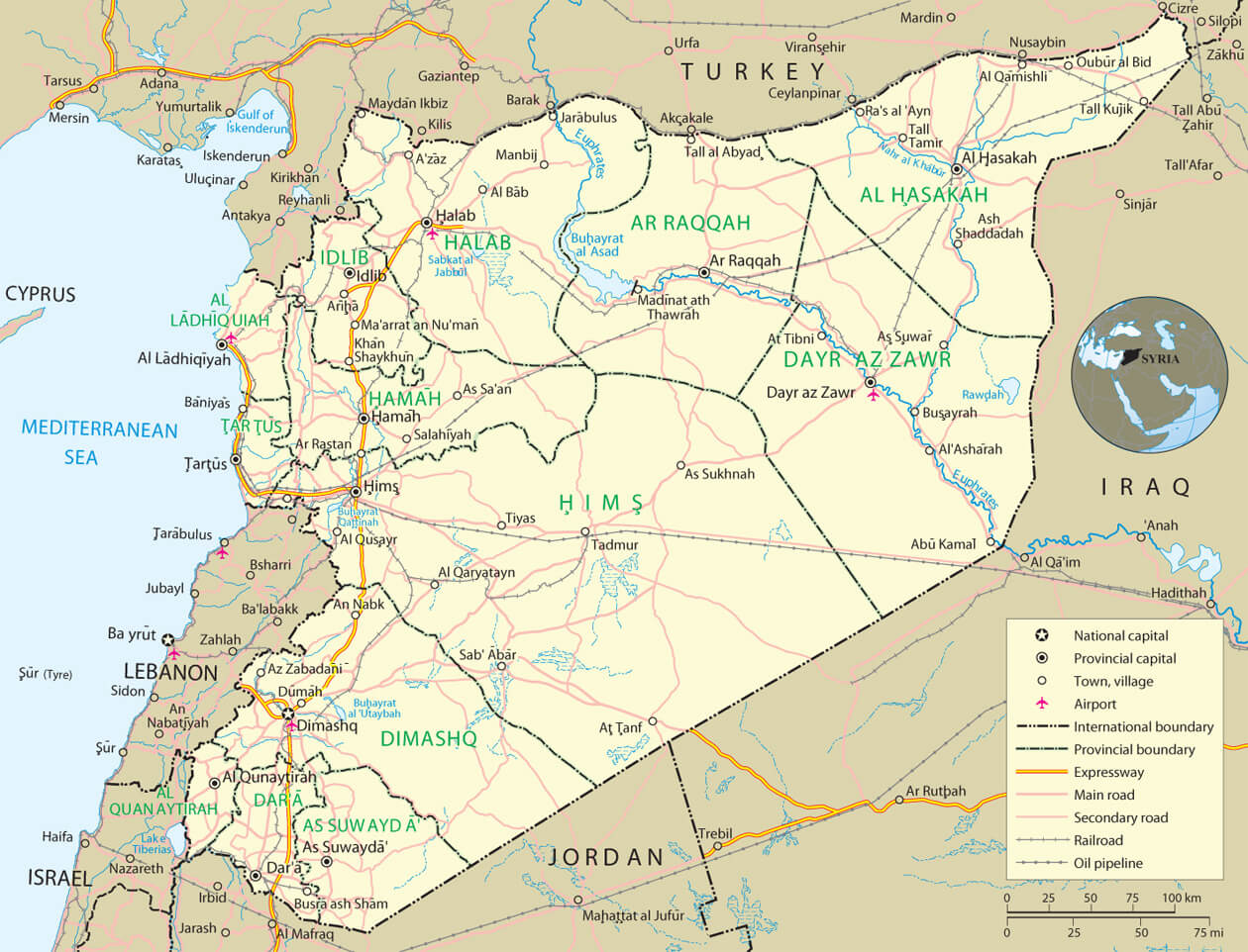 Map of Syria showing main roads, expressways, railroads, and key cities.
Map of Syria with Major Cities and Neighboring Countries
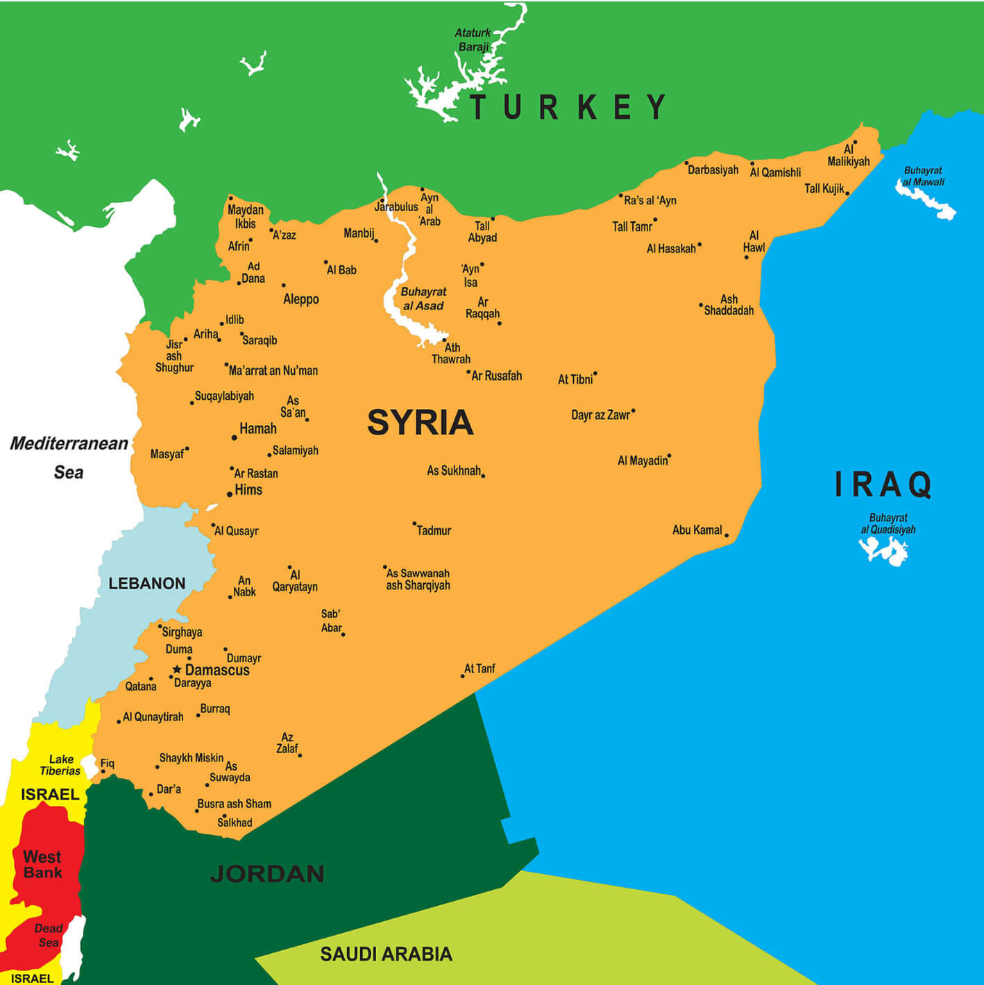 Map of Syria showing major cities and surrounding countries in the Middle East
Ethno religious composition map of Syria
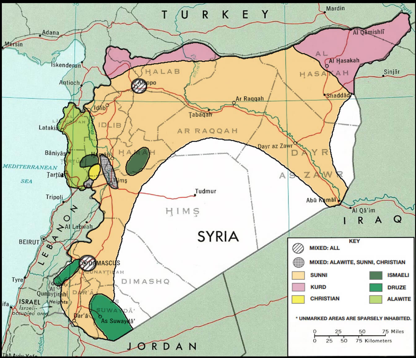 Ethno religious composition map of Syria
Physical Map of Syria and Its Geographic Features
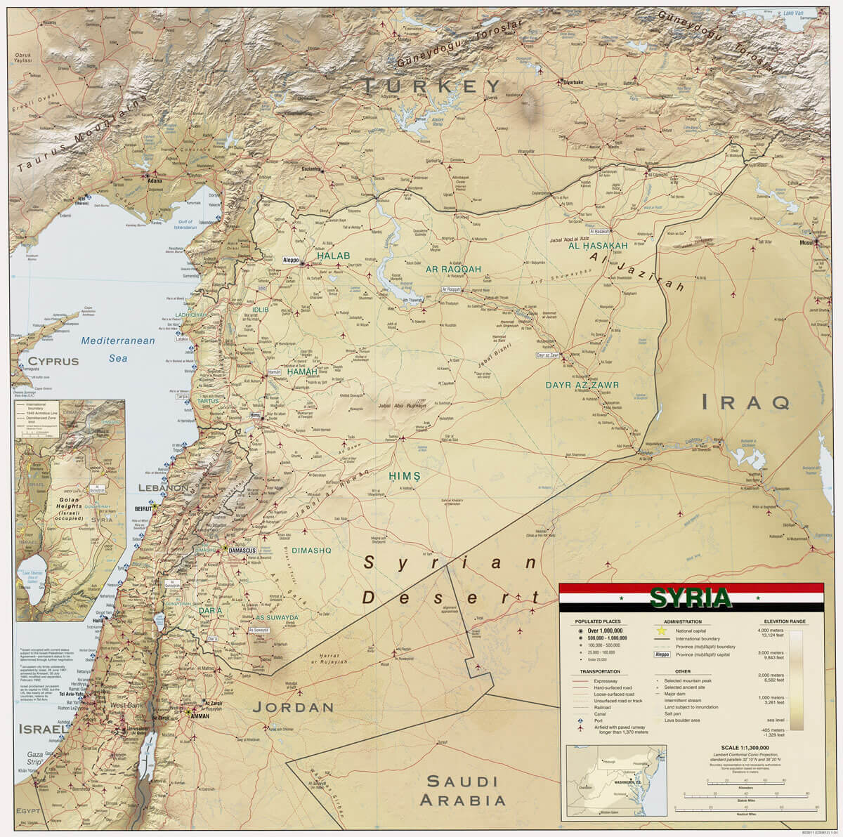 Physical map of Syria showing cities, borders, and geographic details
Political Map of Syria in November 2024: Zones of Control
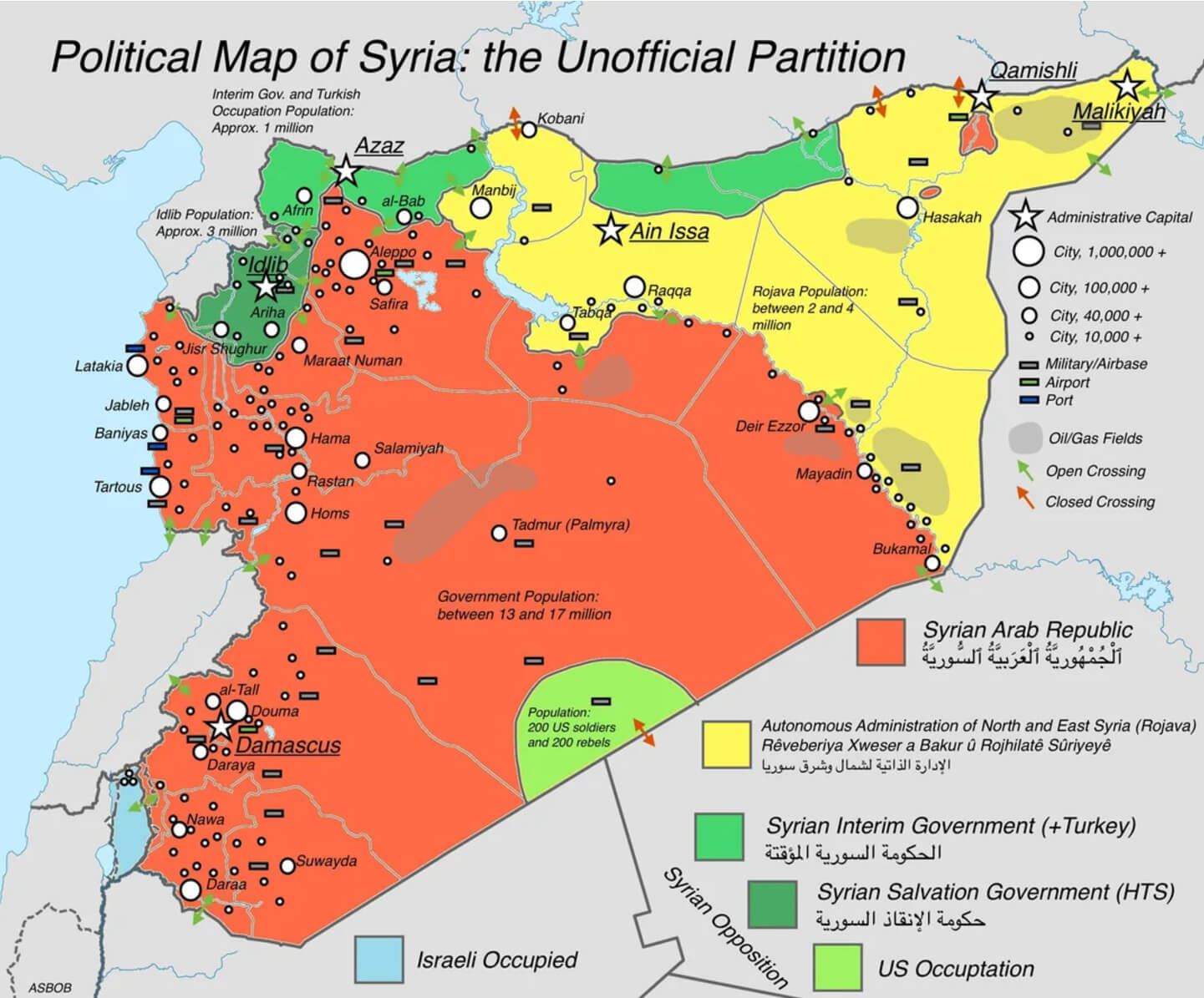 Political map of Syria showing zones of control in November 2024
Support map of Syrian opposition and Syria Government
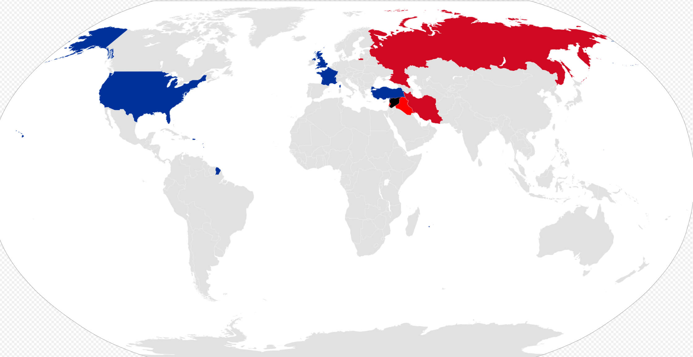 Support map of Syrian opposition blue and Syria red
Syria administrative divisions map
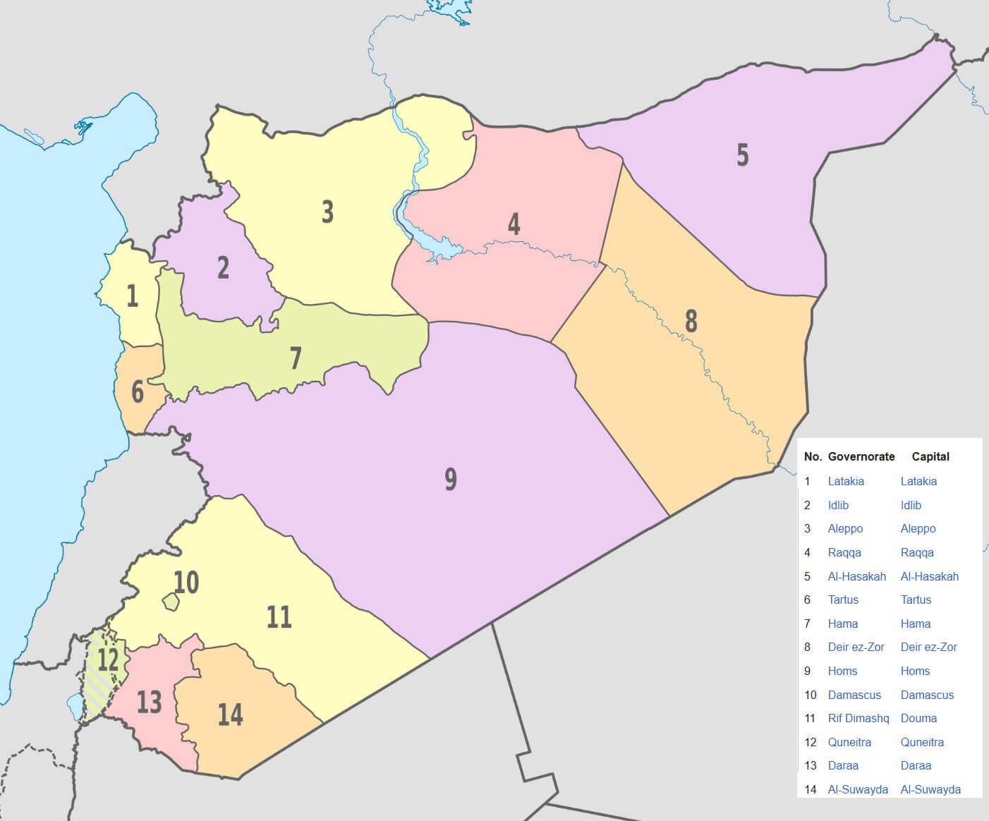 Syria administrative divisions map
Syria civil war map with territorial control map
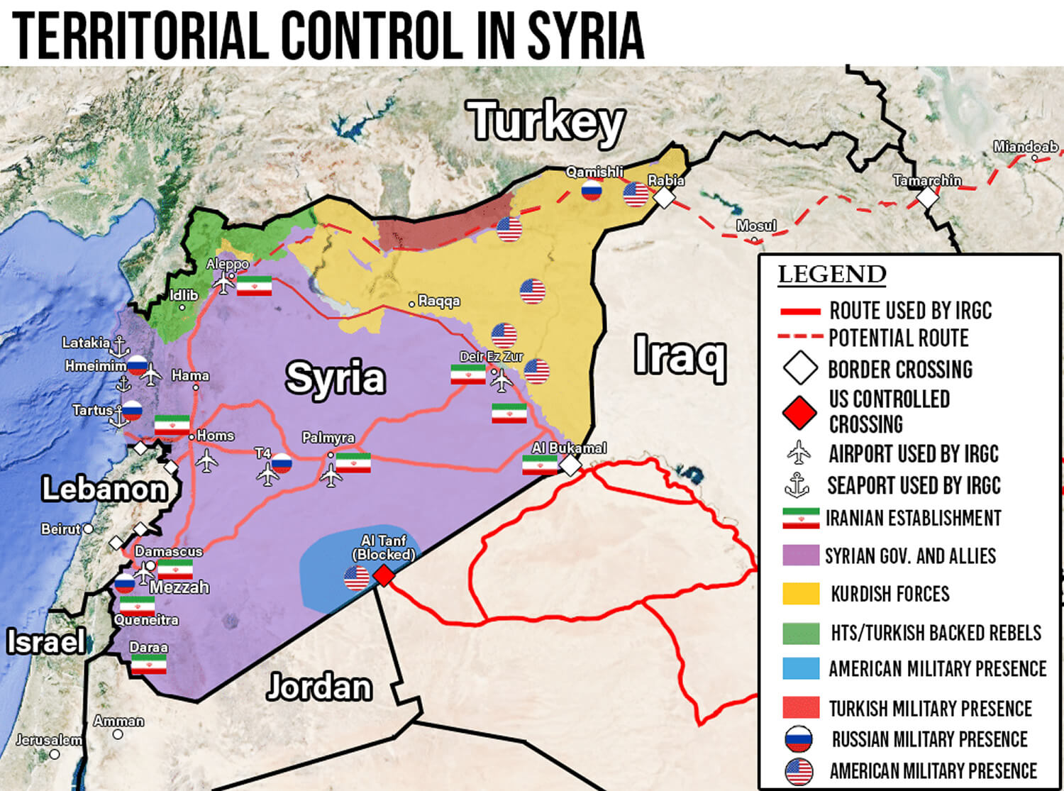 Syria civil war map with territorial control map
Syria Blank Map
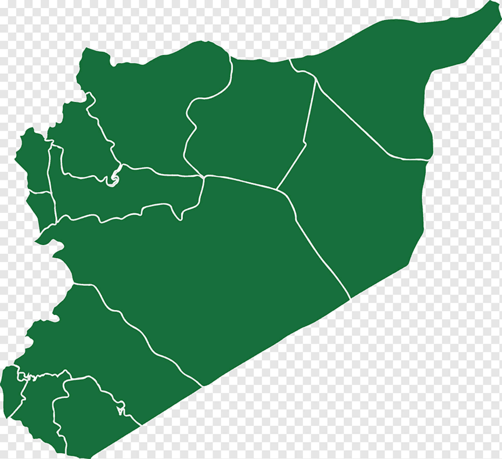 Syria Blank Map
Syria cities map with routes
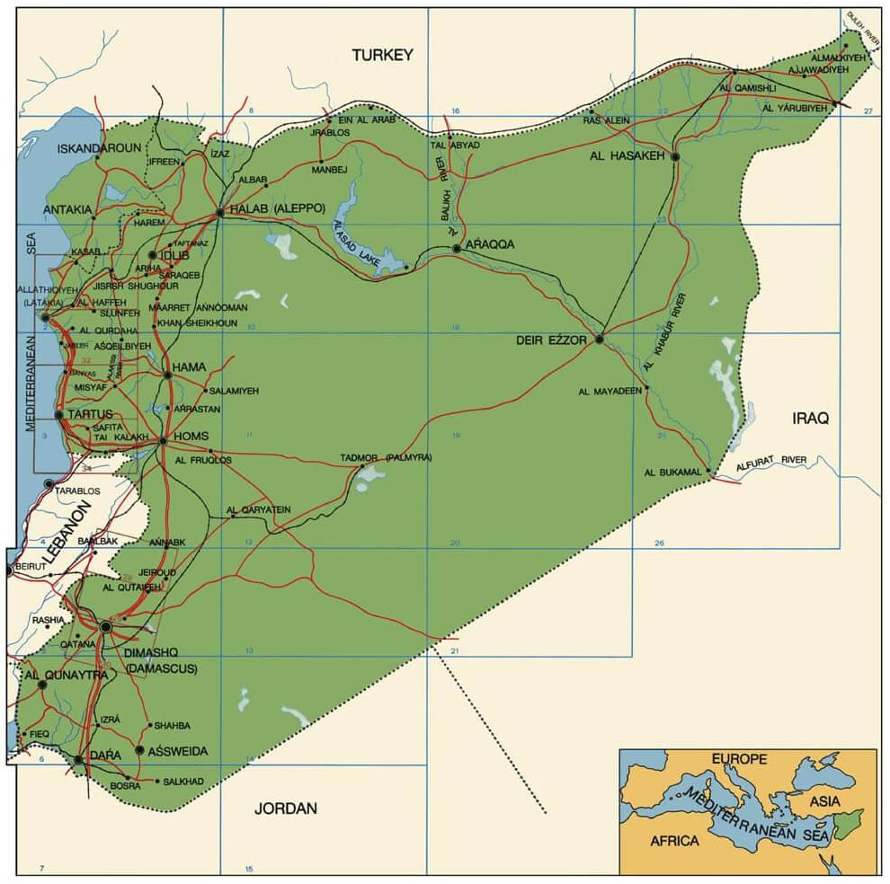 Syria cities map with routes
Map of Syria’s Civil War in 2020: Zones of Conflict and Control
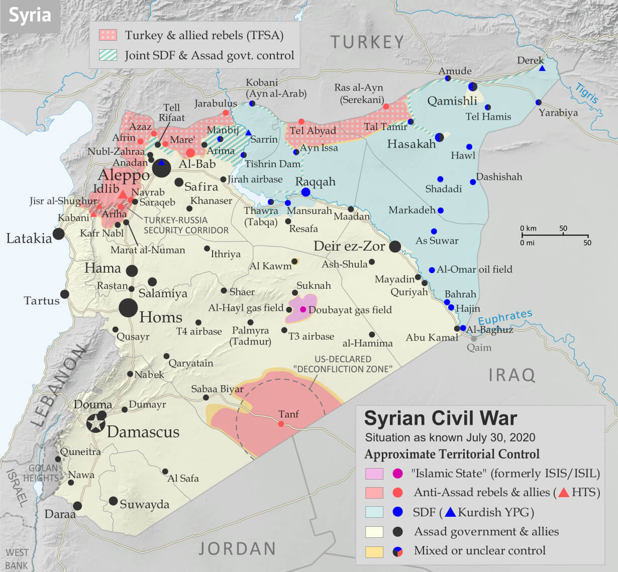 Syria civil war map showing zones of control as of 2020
Syria international border map
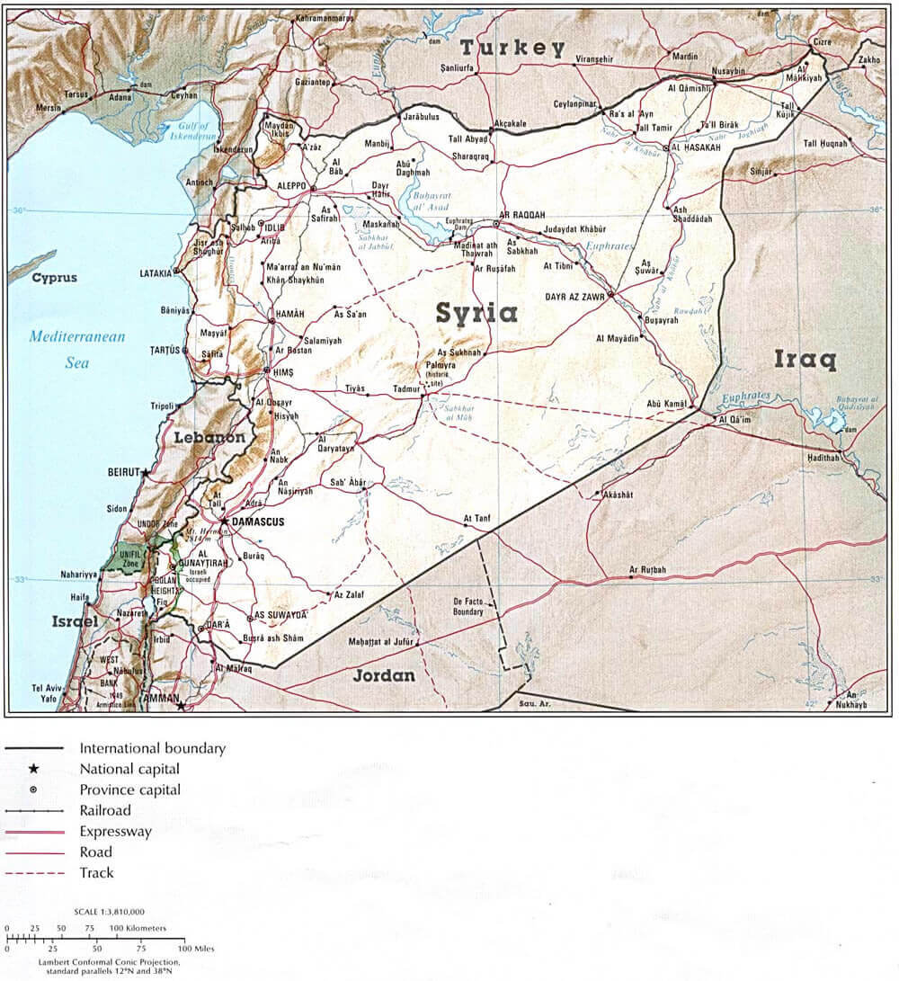 Syria international border map
Syria Land Utilization Map: Agriculture and Natural Resources
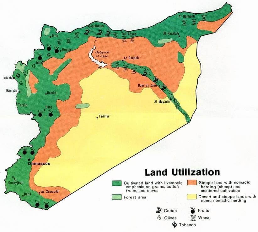 Syria land utilization map showing agriculture, forests, and desert regions.
Damascus, Syria Map
 Damascus, Syria Map
Syria Military Situation Map in 2015: Zones of Control and Conflict
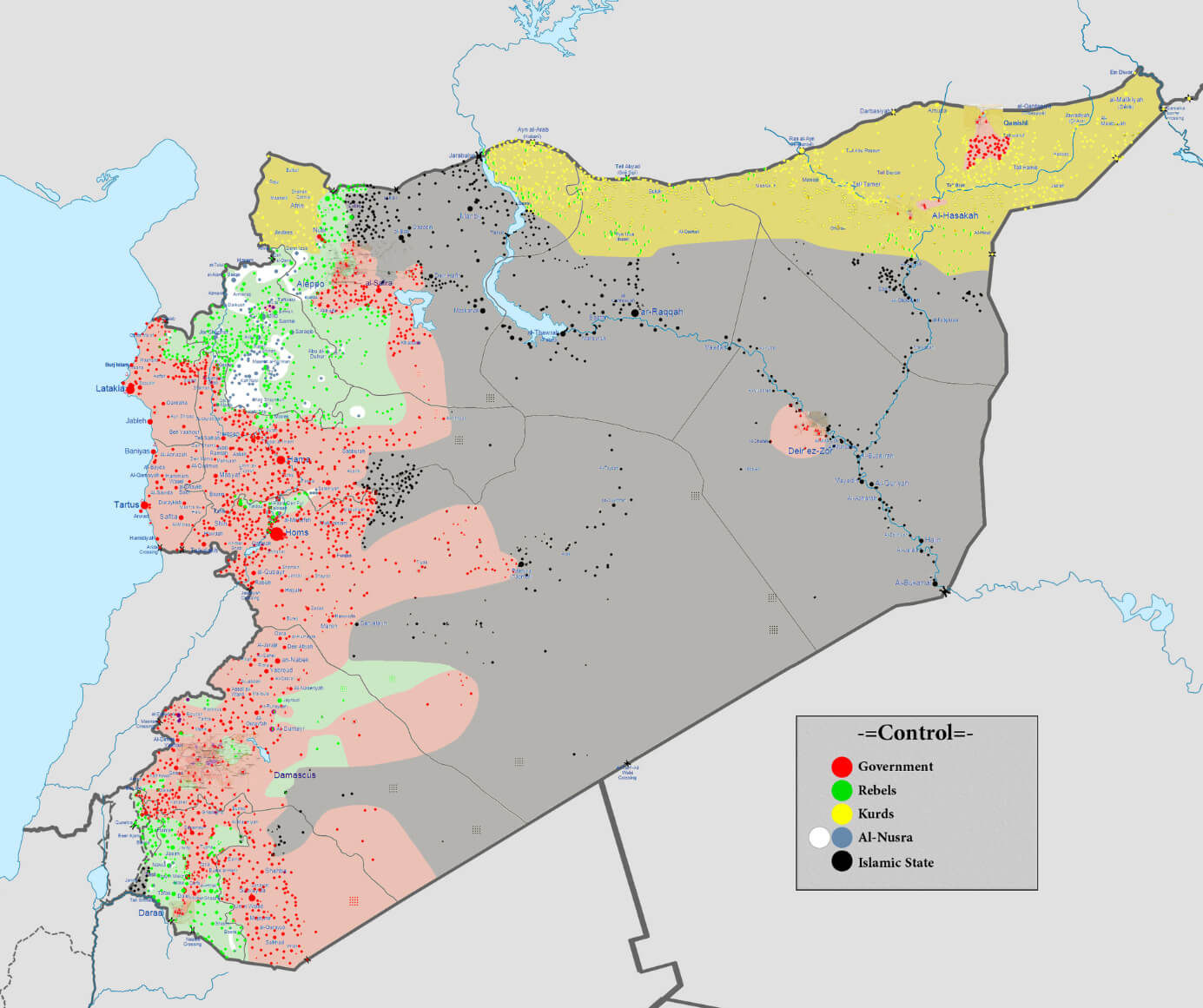 Syria map showing military control zones during the 2015 conflict.
Syria map with flag
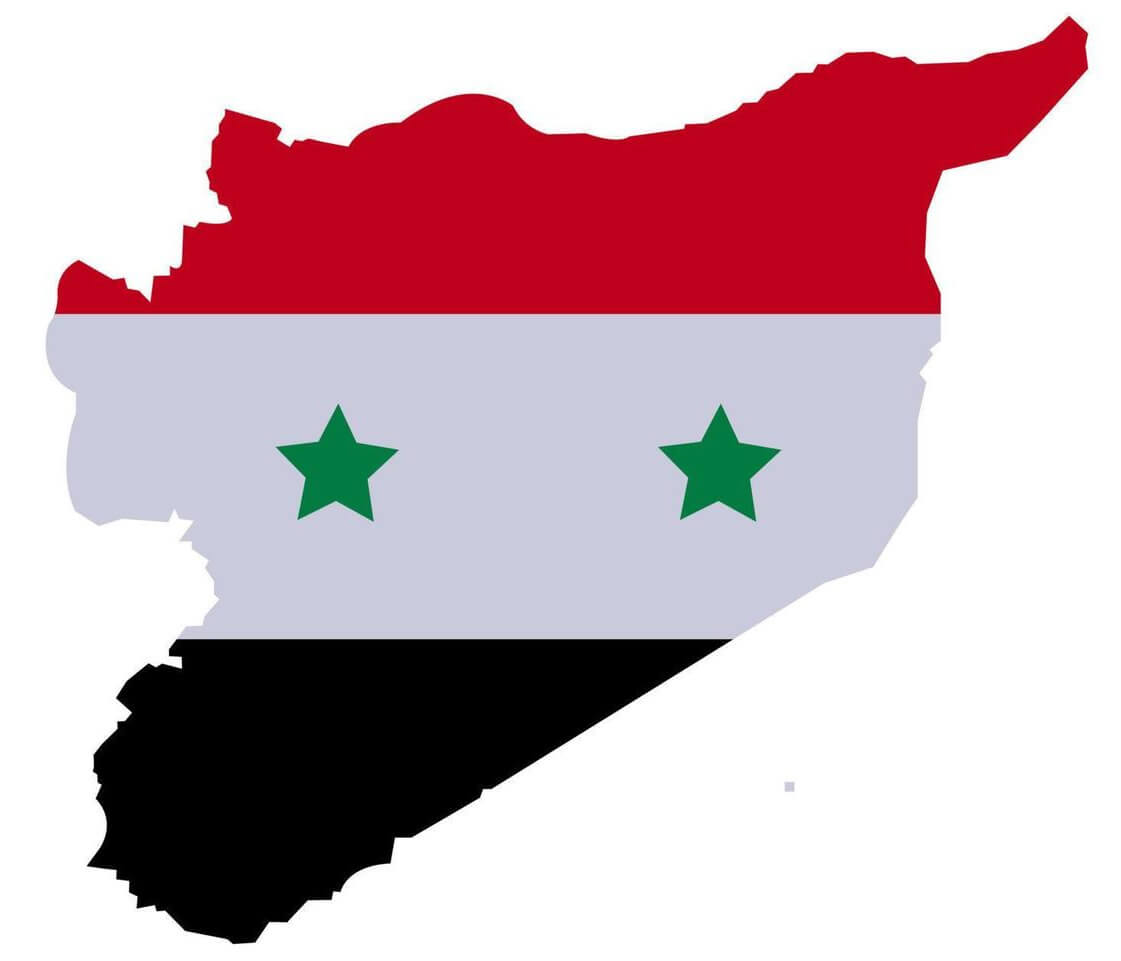 Syria map with flag
Syria map with highways and rivers
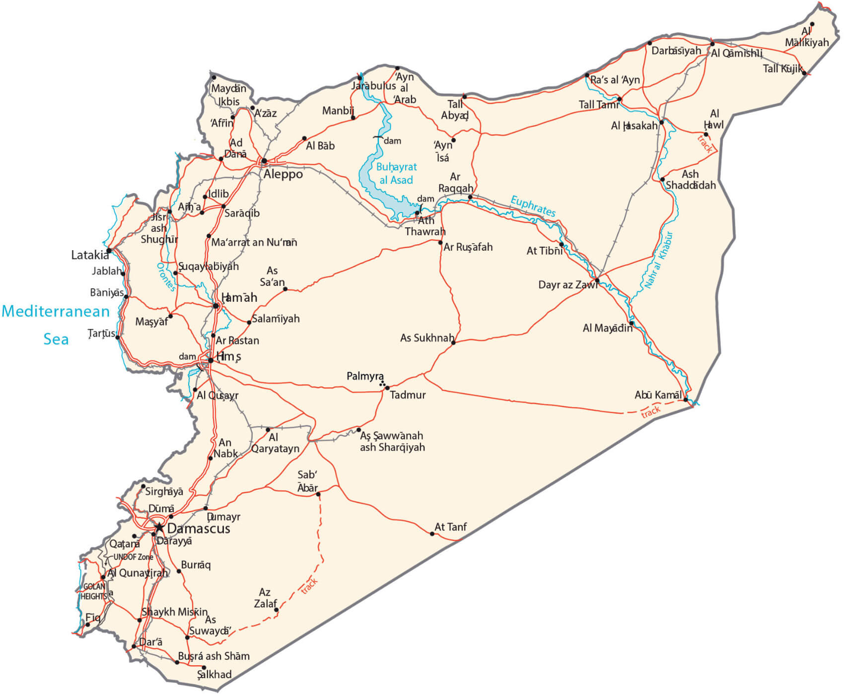 Syria map with highways and rivers
Syria Military Situation Map as of December 2024: Territorial Overview
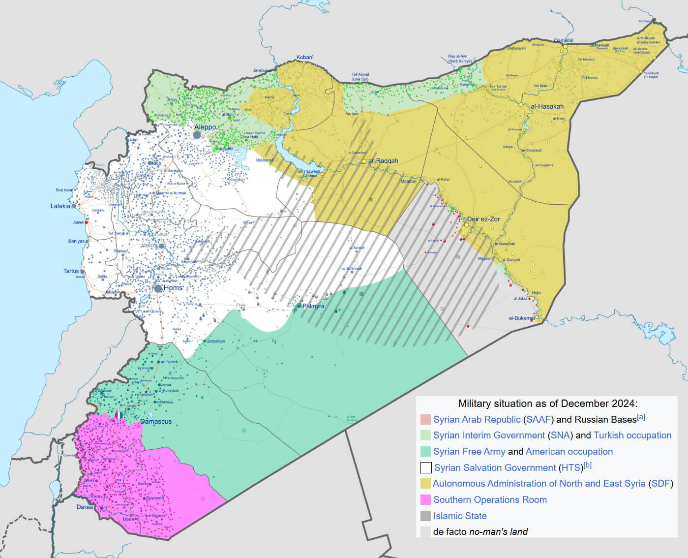 Syria map showing military control zones as of December 2024.
Syria Military Situation Map in August 2016: Conflict and Territorial Control
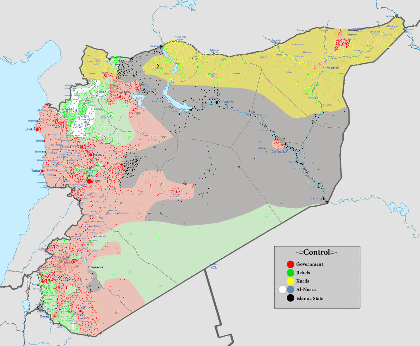 Syria map showing military control zones as of August 2016.
Syria Military Situation Map in March 2013: Early Conflict Zones
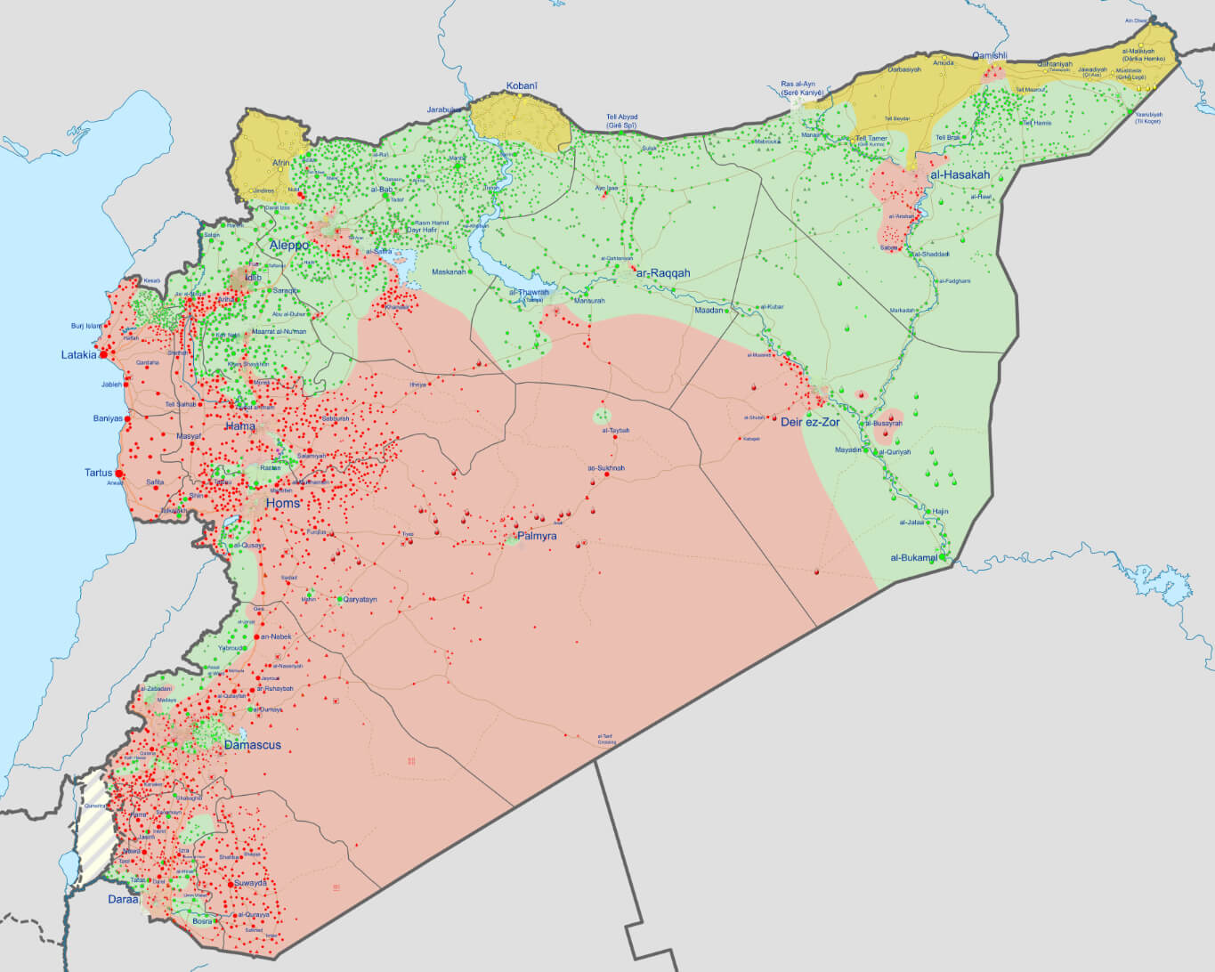 Syria map showing military control zones as of March 2013.
Syria Military Situation Map in November 2023: Updated Conflict Overview
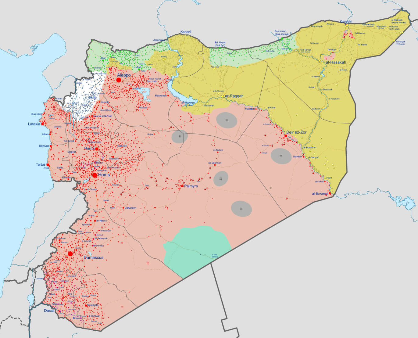 Syria map showing military control zones as of November 2023.
Syrian major cities map
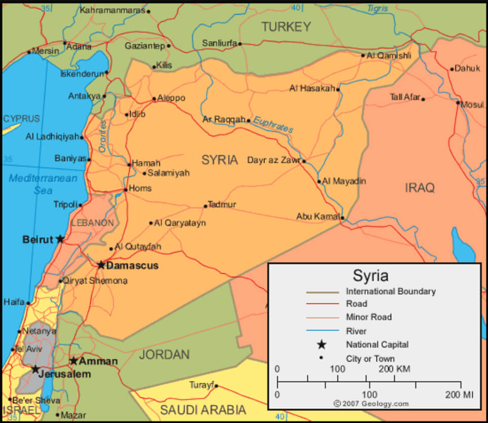 Syrian major cities map
Syria Physical Map
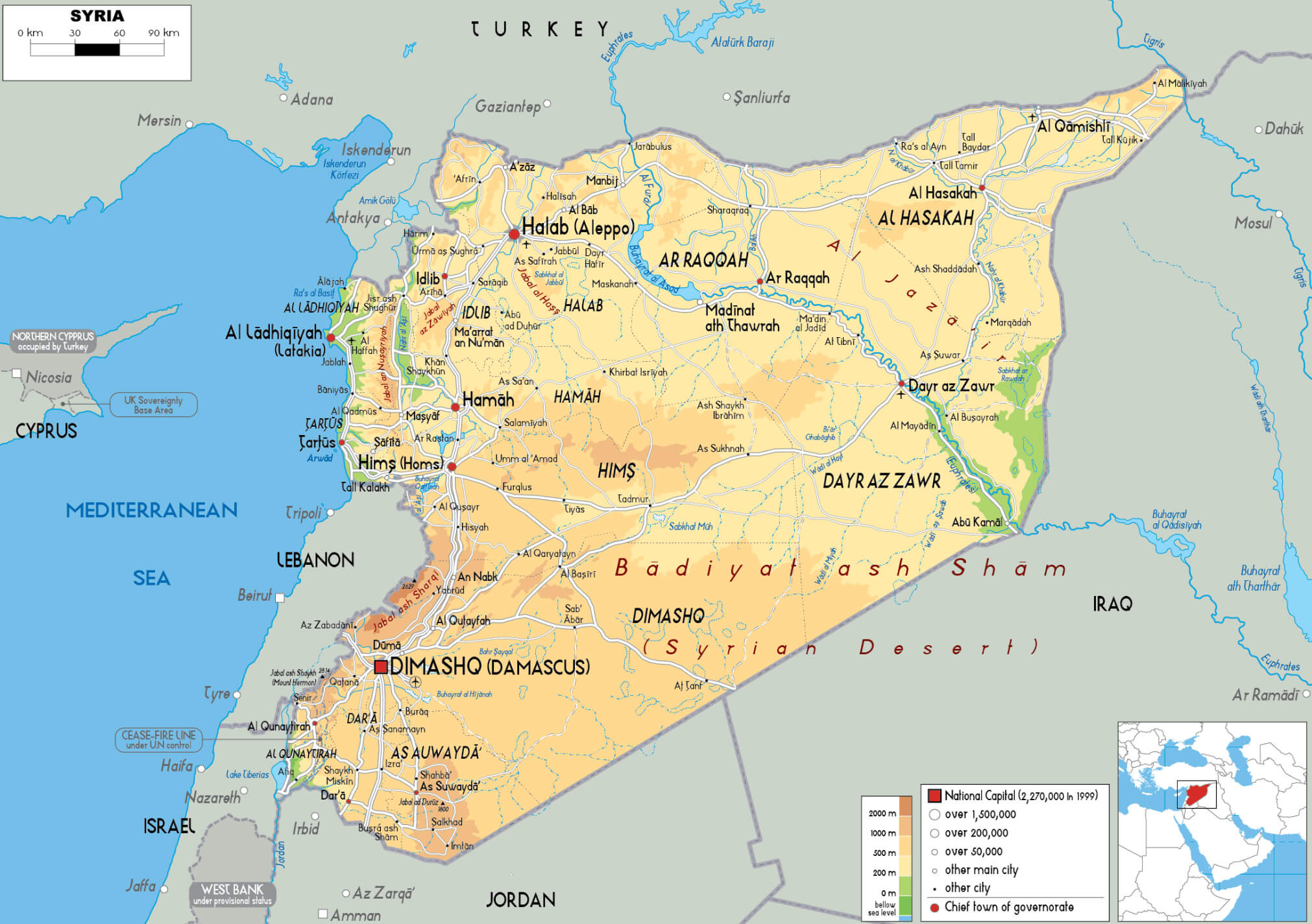 Syria Physical Map
Syria Rainfall Map: Annual Precipitation and Geographic Features
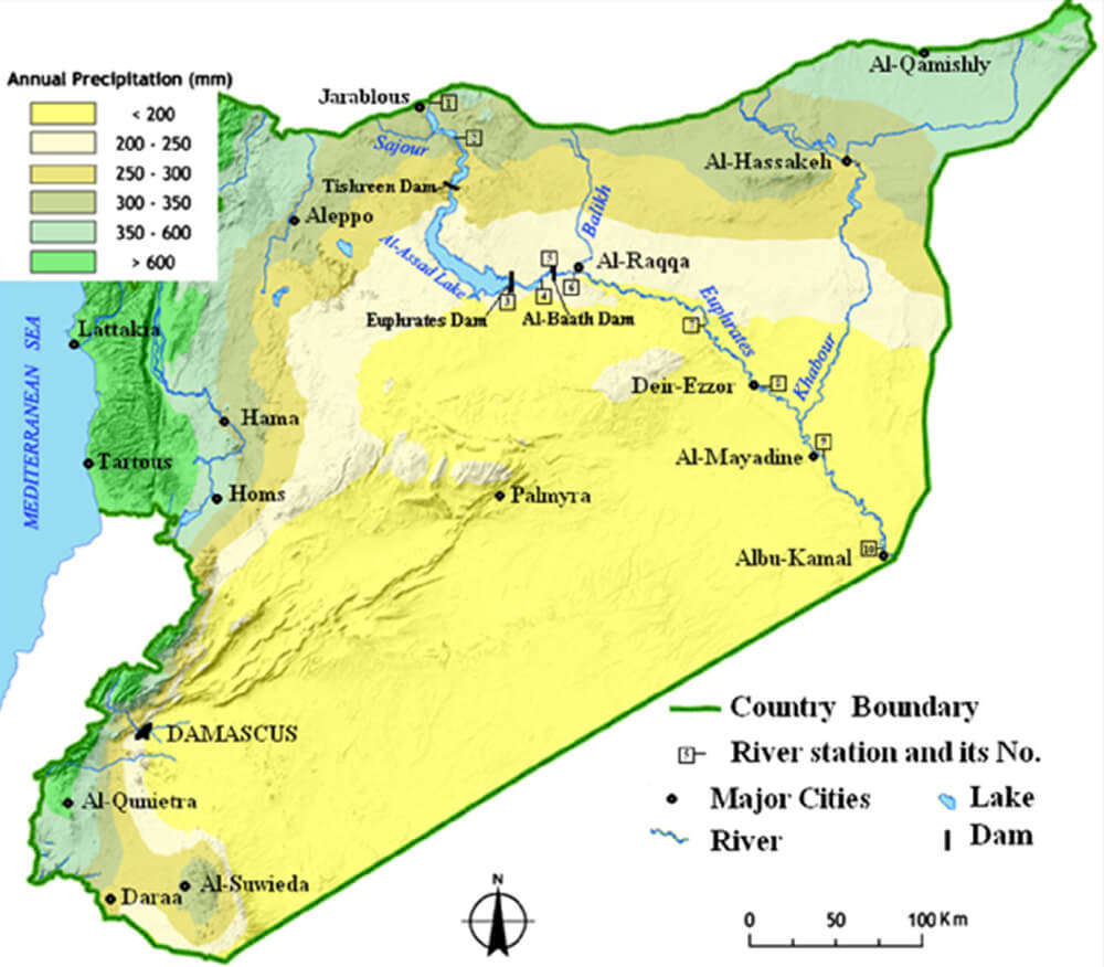 Syria rainfall map showing annual precipitation levels and major cities
Syria Religious Map: Distribution of Ethnic and Religious Communities
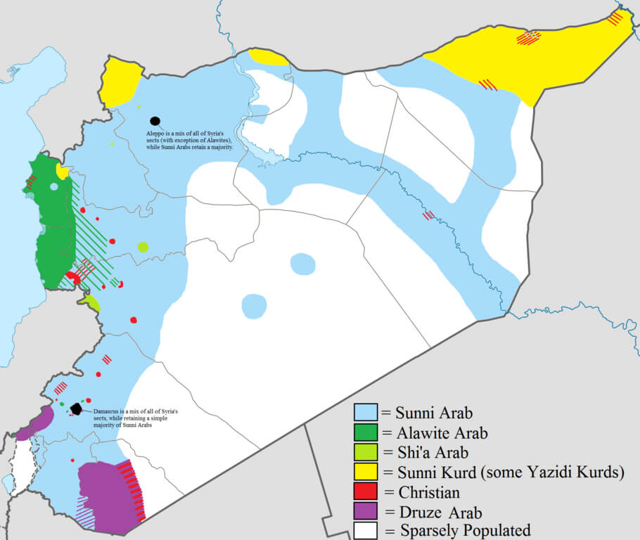 Syria map showing religious and ethnic groups’ distribution across the country.
Syria road map
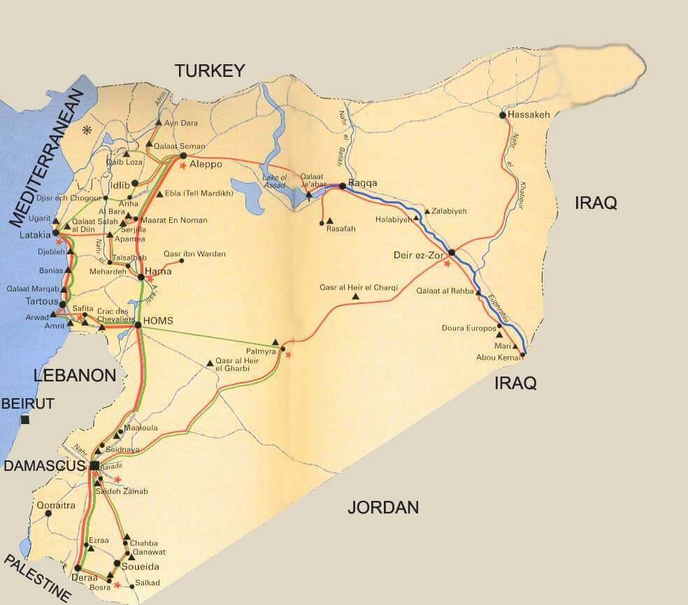 Syria road map with main cities
Syria satellite map
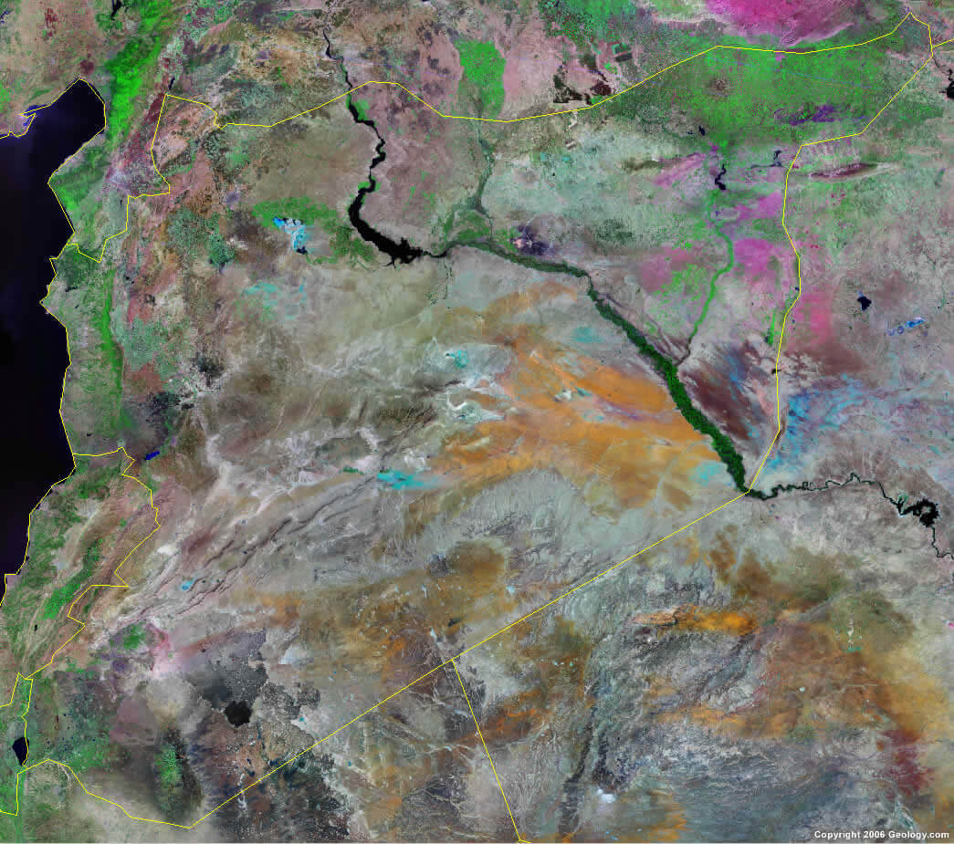 Syria satellite map
Headline: Syria Topography Map: Mountains, Plains, and Deserts
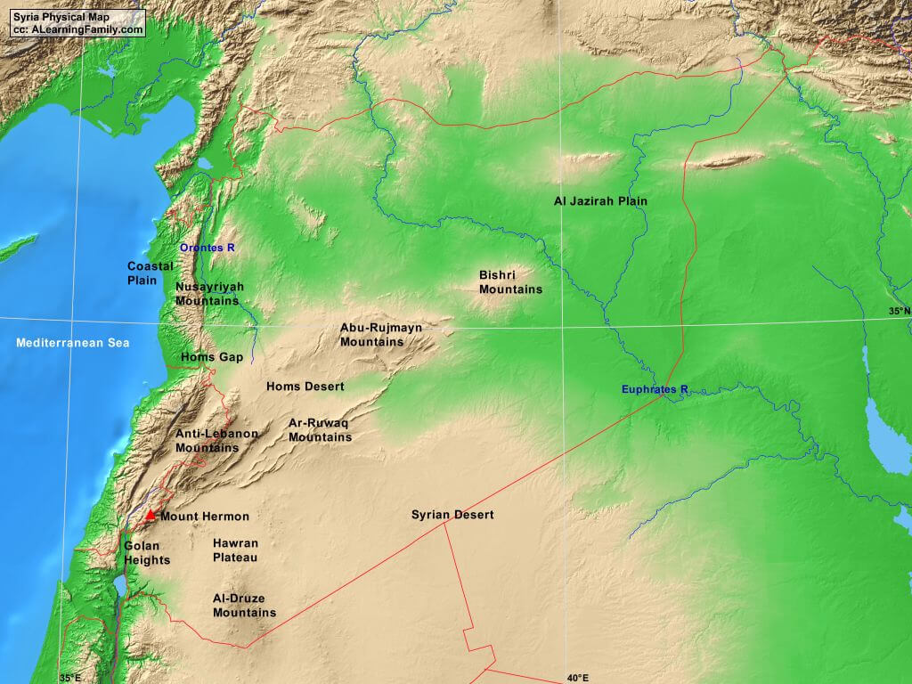 Syria topography map showing mountains, plains, and desert regions.
Syria travel map
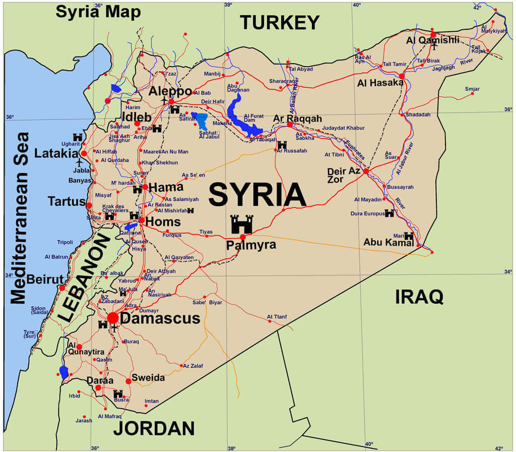 Syria travel map
World countries and diplomatic relations of Syria
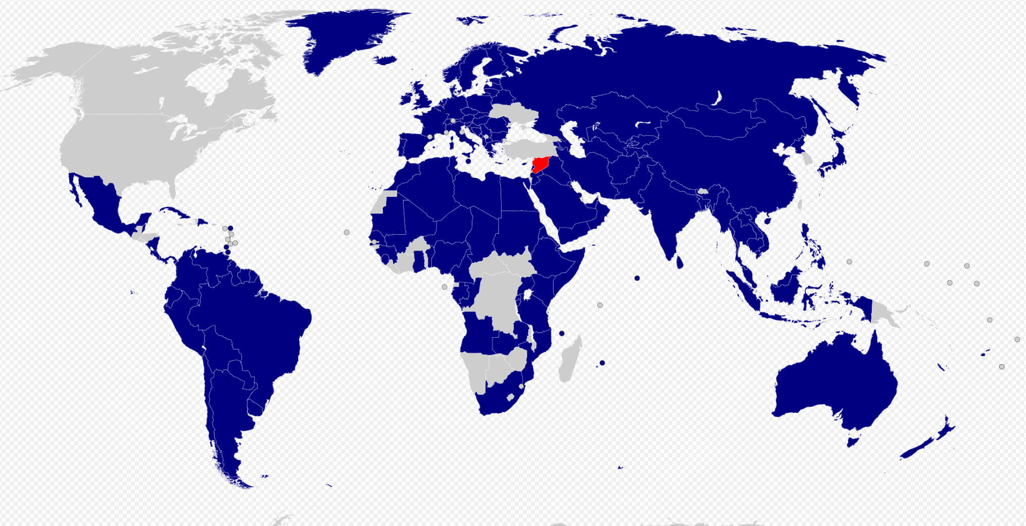 World countries and diplomatic relations of Syria
Where is Syria on the Asia Map?
Show Google interactive map, satellite map, where is the country located.
Get directions by driving, walking, bicycling, public transportation and travel with street view.
Feel free to explore these pages as well:
- Egypt Map ↗️
- A Collection of Lebanon Maps ↗️
- Iran Map ↗️
- Iraq Map ↗️
- Israel Map ↗️
- Jordan Map ↗️
- Oman Map ↗️
- Saudi Arabia Map ↗️
- Where is Located Qatar in the World? ↗️
- United States Map ↗️
- United Kingdom Map ↗️
- Türkiye Map ↗️
- Tel Aviv’s 10 Best Attractions ↗️
- Europe Map ↗️
- Asia Map ↗️
