Discover Iran’s topography, borders, and cities with this diverse map collection. These maps offer a detailed view of the country’s major regions, key infrastructure, and historical landmarks, making it a valuable resource for anyone interested in Iran.
Brief information about Iran
Iran, located in the Middle East, is bordered by countries like Iraq, Turkey, Afghanistan, and Pakistan, and has a population of over 80 million. Known for its rich history dating back to ancient Persia, Iran’s capital, Tehran, serves as a cultural and political hub. The country’s landscape is diverse, featuring deserts, mountains, and lush forests.
Iran Info Map
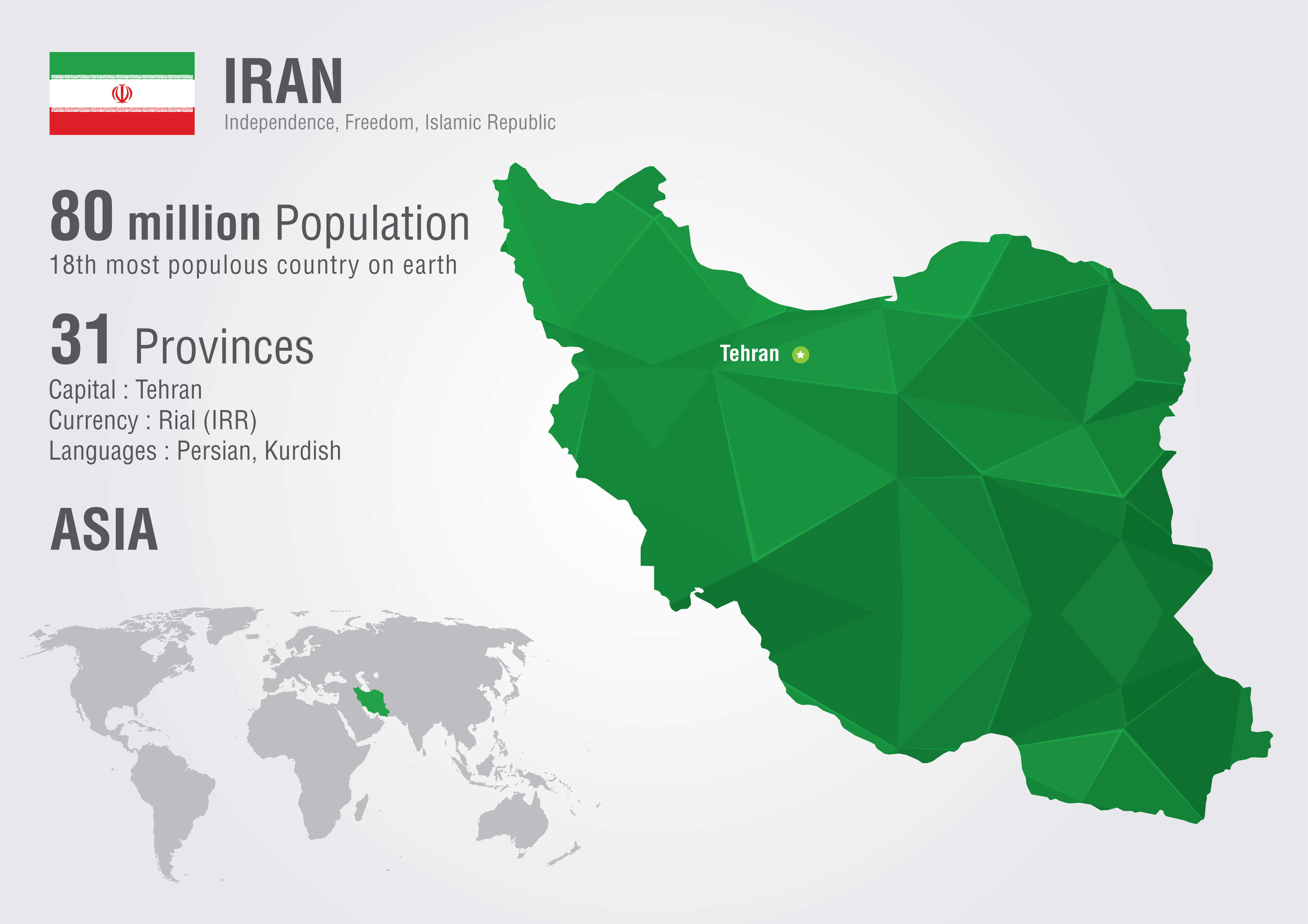
Iran, officially known as the Islamic Republic of Iran, has a population of 80 million, making it the 18th most populous country in the world. It is divided into 31 provinces, with Tehran as its capital and largest city. Iran’s official currency is the Rial (IRR), and the primary languages spoken include Persian and Kurdish. Geographically located in Asia, Iran borders several countries including Iraq, Afghanistan, and Pakistan, and has access to both the Persian Gulf and the Caspian Sea, making it a significant player in the region.
Iran’s economy is largely driven by oil and gas exports, though sanctions have impacted it in recent years. Persian is the official language, and the majority of the population practices Shia Islam. Iran is renowned for its contributions to art, literature, and science, as well as its historical landmarks, such as Persepolis and the cities of Isfahan and Shiraz.
Where is located Iran on the World Map
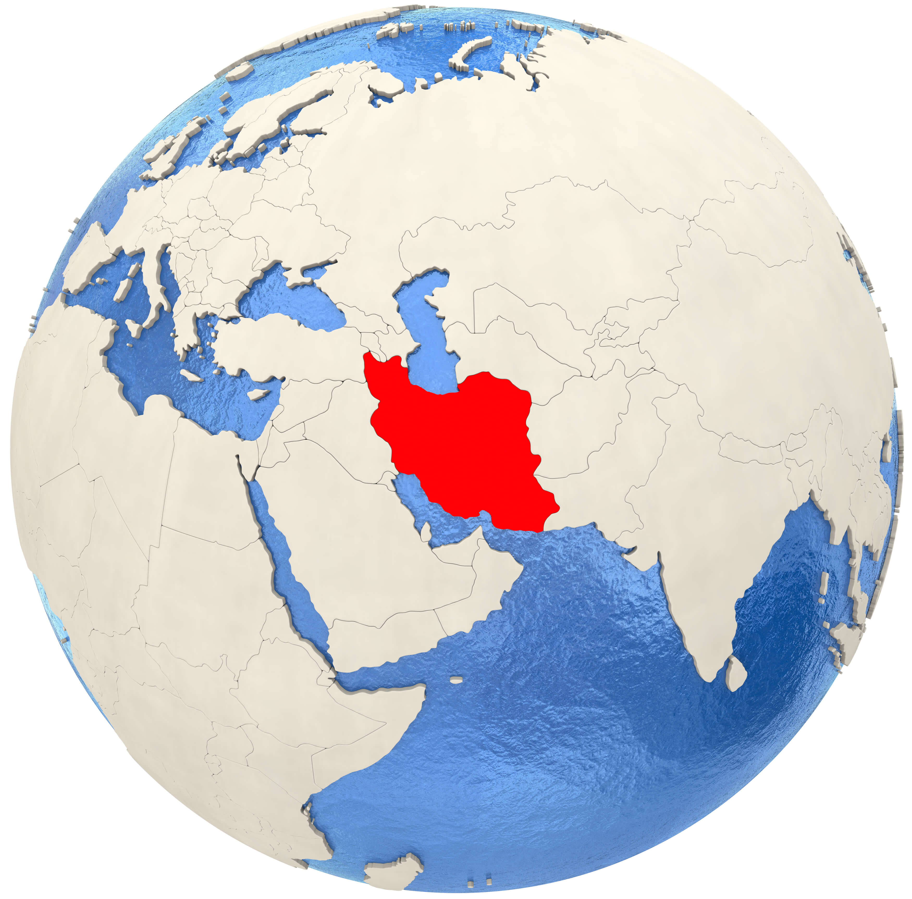
Iran is located in Western Asia, at the crossroads of the Middle East and Central Asia. It is bordered by seven countries, including Iraq to the west, Turkey to the northwest, Afghanistan and Pakistan to the east, and Turkmenistan to the northeast. To the south, it is bordered by the Persian Gulf and the Gulf of Oman, giving it access to important waterways.
On the world map, Iran occupies a strategic location, bridging the Middle East and South Asia. Its geography is diverse, with mountain ranges like the Zagros and Elburz and vast desert regions such as the Dasht-e Kavir. Iran’s central location has made it a historical hub for trade and cultural exchange throughout its long history.
Here are some statistical information about Iran:
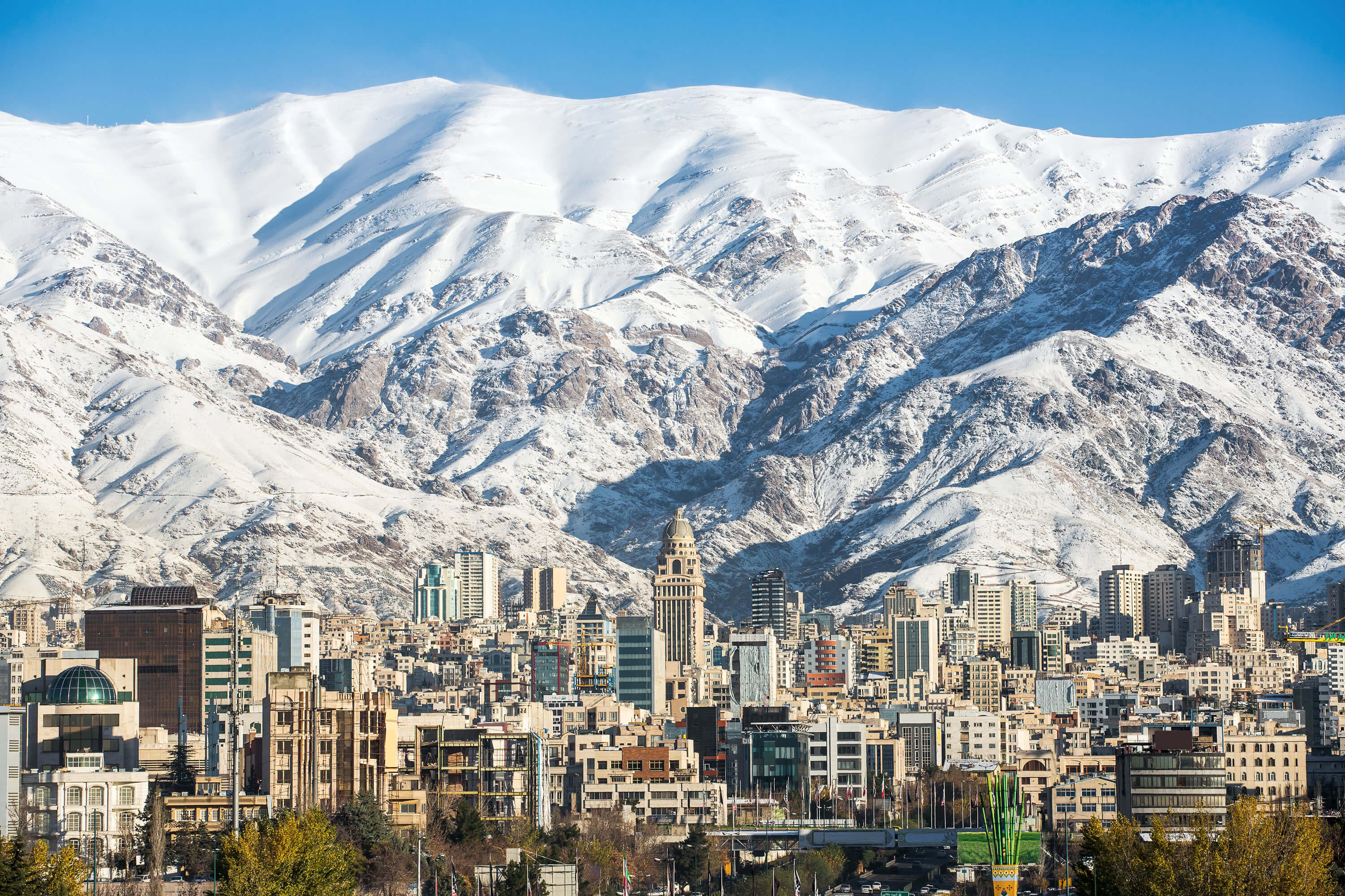
Iran Major Cities Map
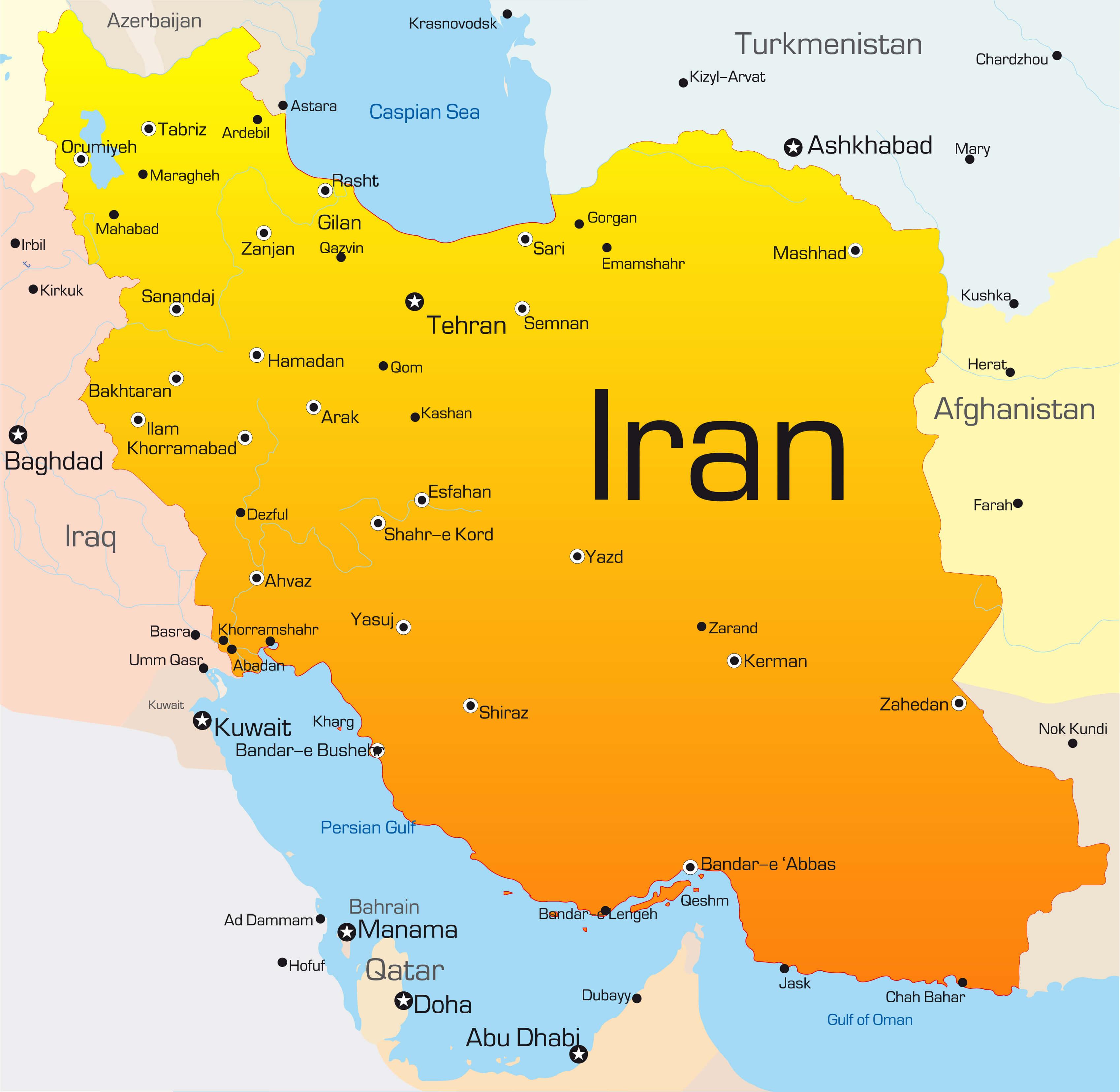
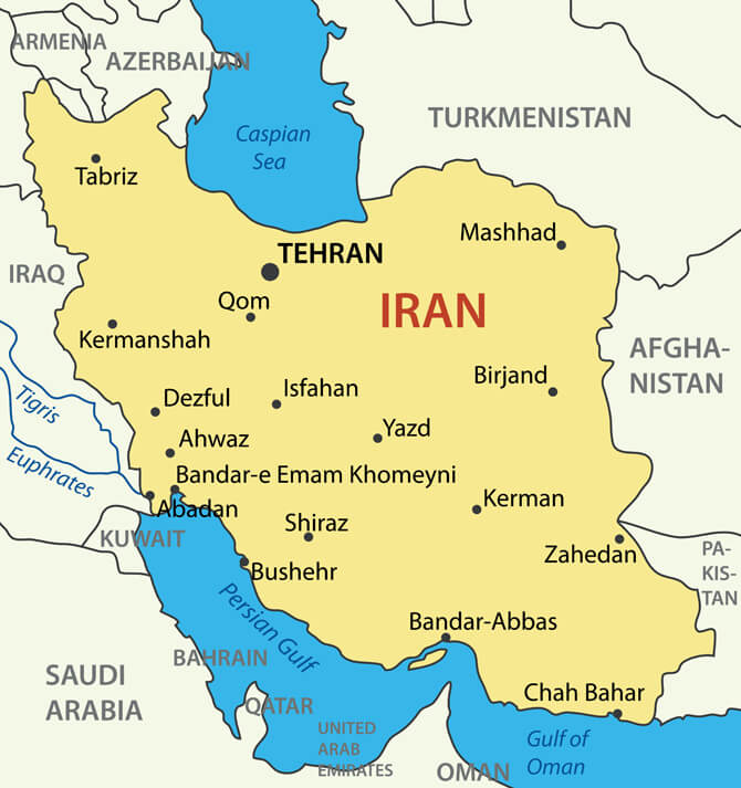
This map of Iran’s major cities highlights the key urban centers that define the country’s economic, cultural, and political landscape. Tehran, the capital, is the largest and most influential city, followed by other important cities like Mashhad, known for its religious significance, Isfahan, famous for its historical architecture, and Shiraz, celebrated for its cultural heritage. Coastal cities like Bandar-e Abbas along the Persian Gulf are crucial for trade, while Tabriz in the northwest serves as a cultural and industrial hub. These cities are vital in shaping Iran’s diverse regional identity.
Iran provinces map
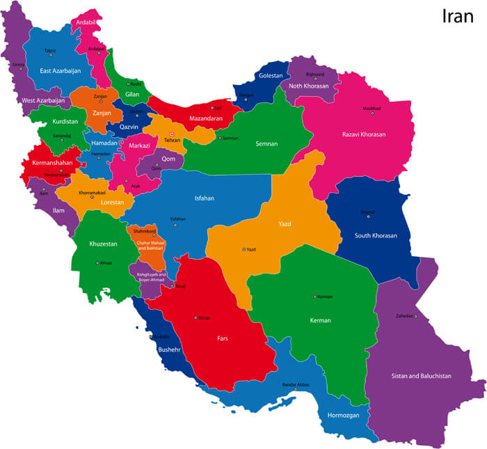
The Iran provinces map provides a colorful and detailed look at the 31 provinces that make up the country, each with its own cultural, historical, and geographic significance. From the northern Caspian Sea provinces like Mazandaran and Gilan to the arid southeastern province of Sistan and Baluchestan, this map highlights the regional diversity within Iran. Provinces like Tehran and Isfahan are major cultural and economic hubs, while others such as Khuzestan and Kerman contribute significantly to the country’s natural resources and agriculture.
Iran main cities map
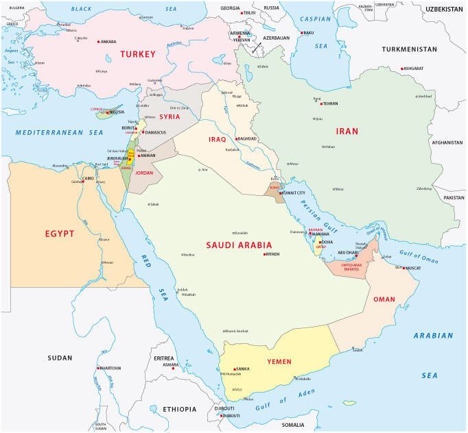
Iran Middle East Map
Iran administrative Map
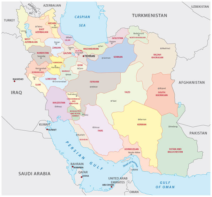
An administrative map of Iran provides a clear division of the country into its various provinces and regions. Each province is distinctly marked, making it easier to identify borders, major cities, and capitals. For example, Tehran is the capital and one of the most populous regions, while provinces like Kerman, Fars, and Khuzestan hold significant economic and cultural importance. These administrative boundaries help in governance, local administration, and showcasing Iran’s rich regional diversity across its landscape.
Iran Satellite Map
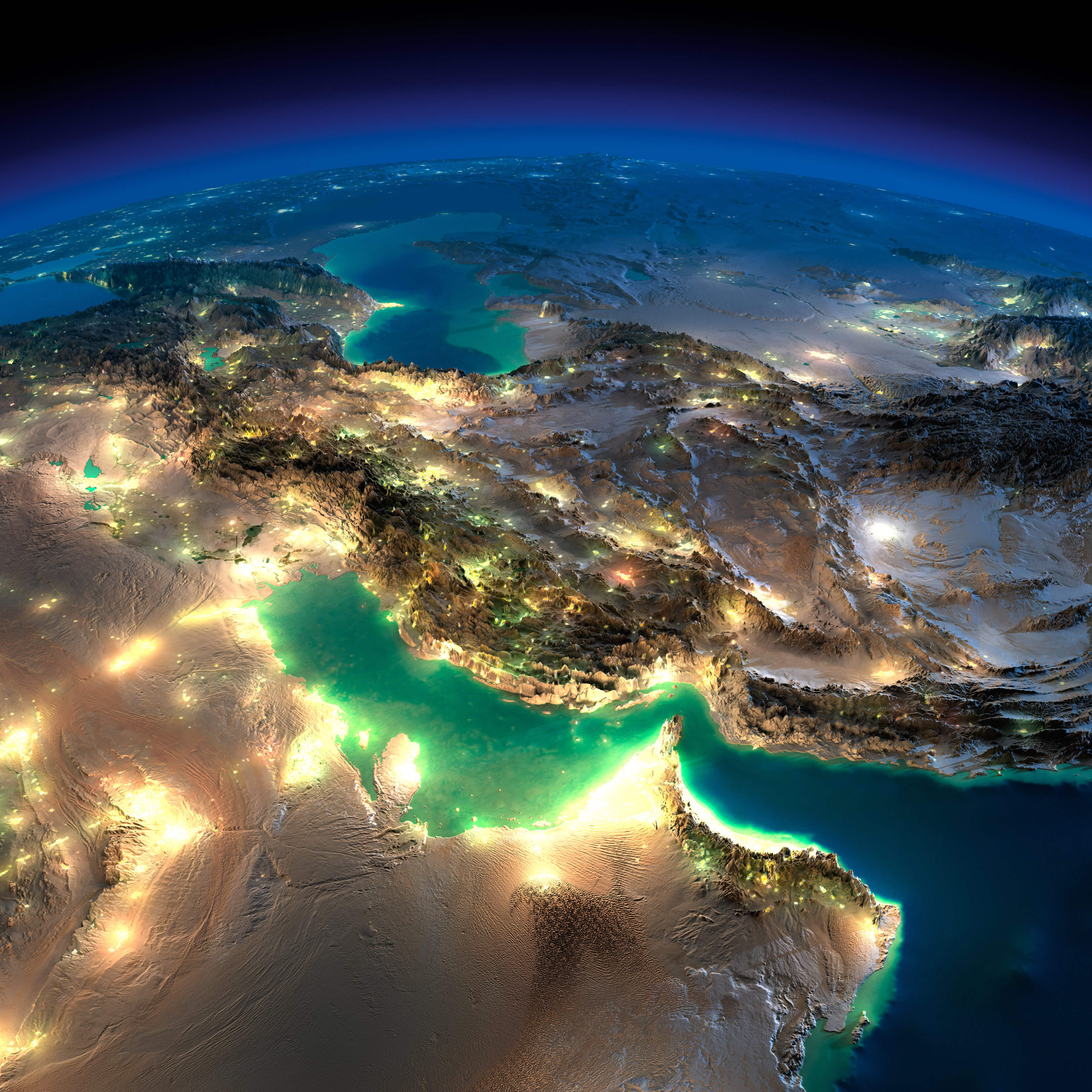
Iran’s satellite map showcases the country’s diverse landscape from space, highlighting key geographical features. From the rugged mountain ranges like the Alborz and Zagros to the vast deserts such as Dasht-e Kavir and Dasht-e Lut, the satellite view provides an expansive look at the terrain. The Caspian Sea to the north and the Persian Gulf and Gulf of Oman to the south outline Iran’s strategic coastal regions. Major cities like Tehran, Isfahan, and Mashhad are visible, illuminated at night, showcasing urban centers against natural formations.
Iran Political Map
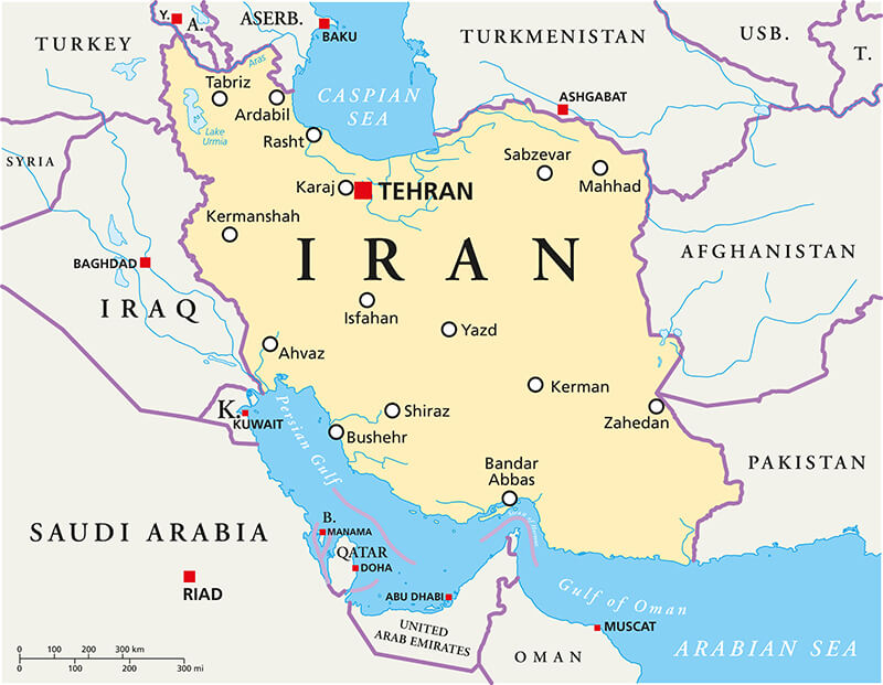
Iran Political Map with capital Tehran, national borders, most important cities, rivers and lakes. English labeling and scaling
Iran vector map with largest cities
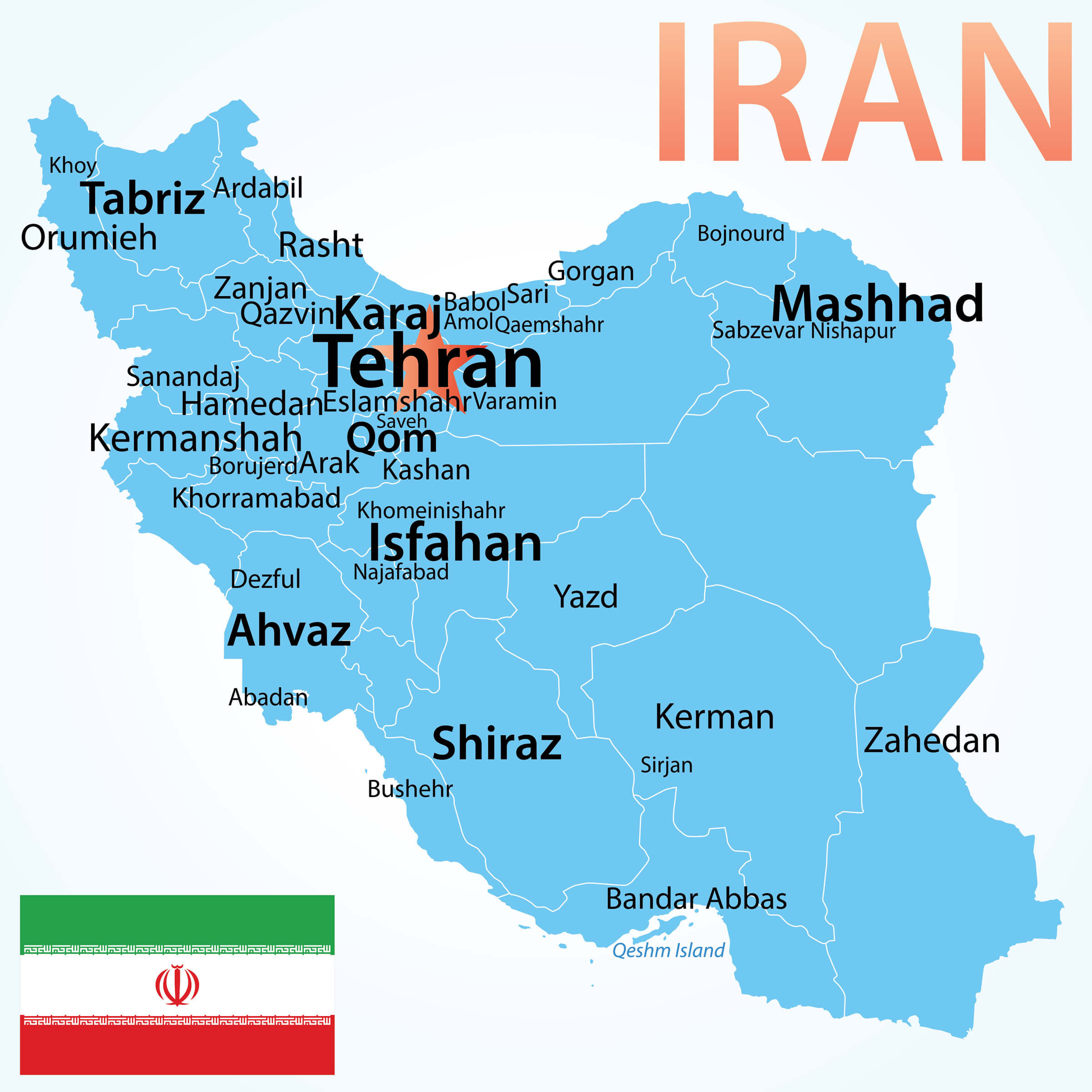
This map of Iran highlights its largest cities, including the capital, Tehran, which serves as the political, cultural, and economic hub of the country. Other prominent cities such as Tabriz, Mashhad, Isfahan, Ahvaz, Karaj, and Shiraz are also shown, representing key centers for industry, commerce, and historical significance.
Iran international boundary Map

Iran Africa Middle East Satellite Map
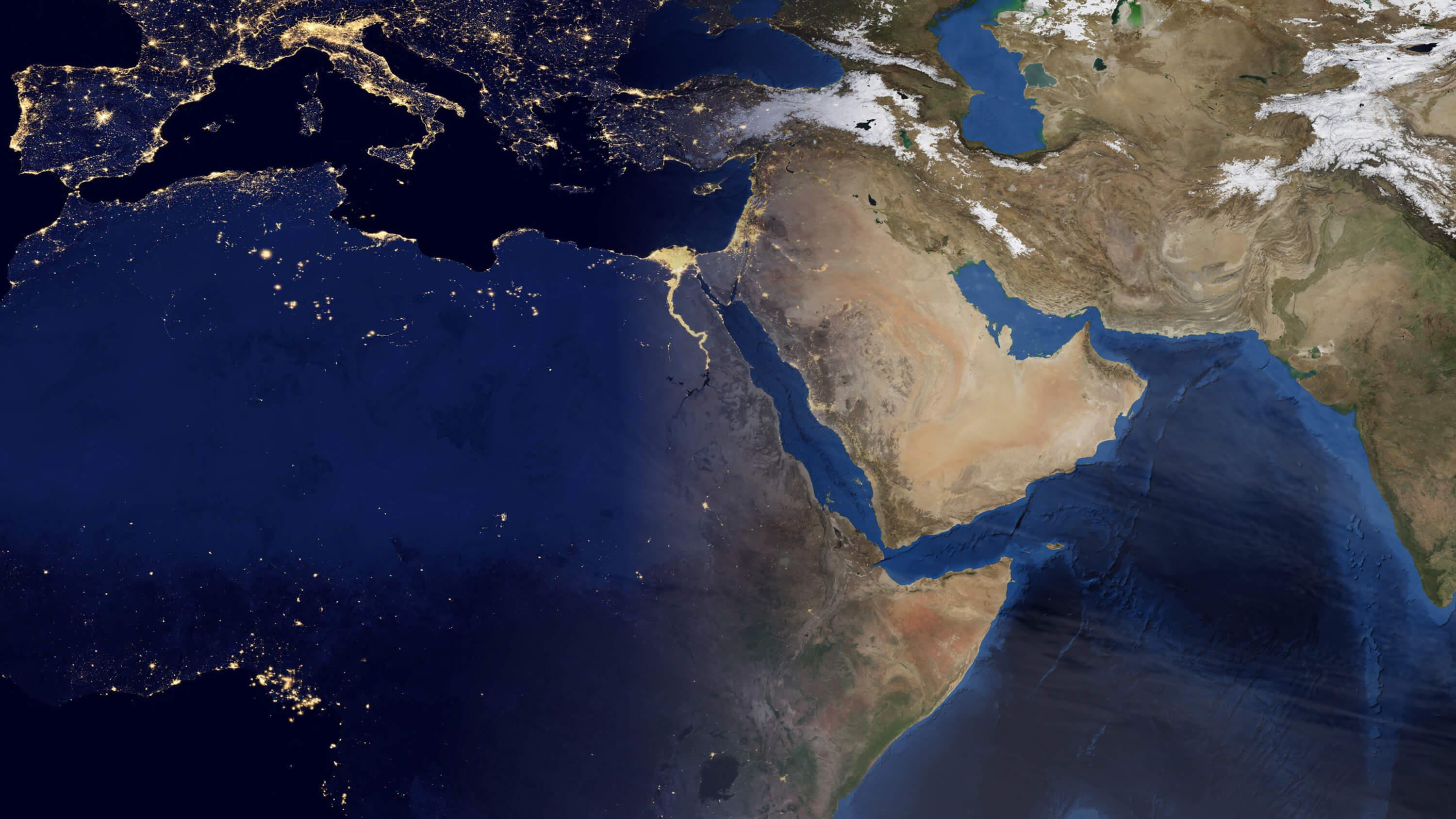
Iran from Space in the Night Map
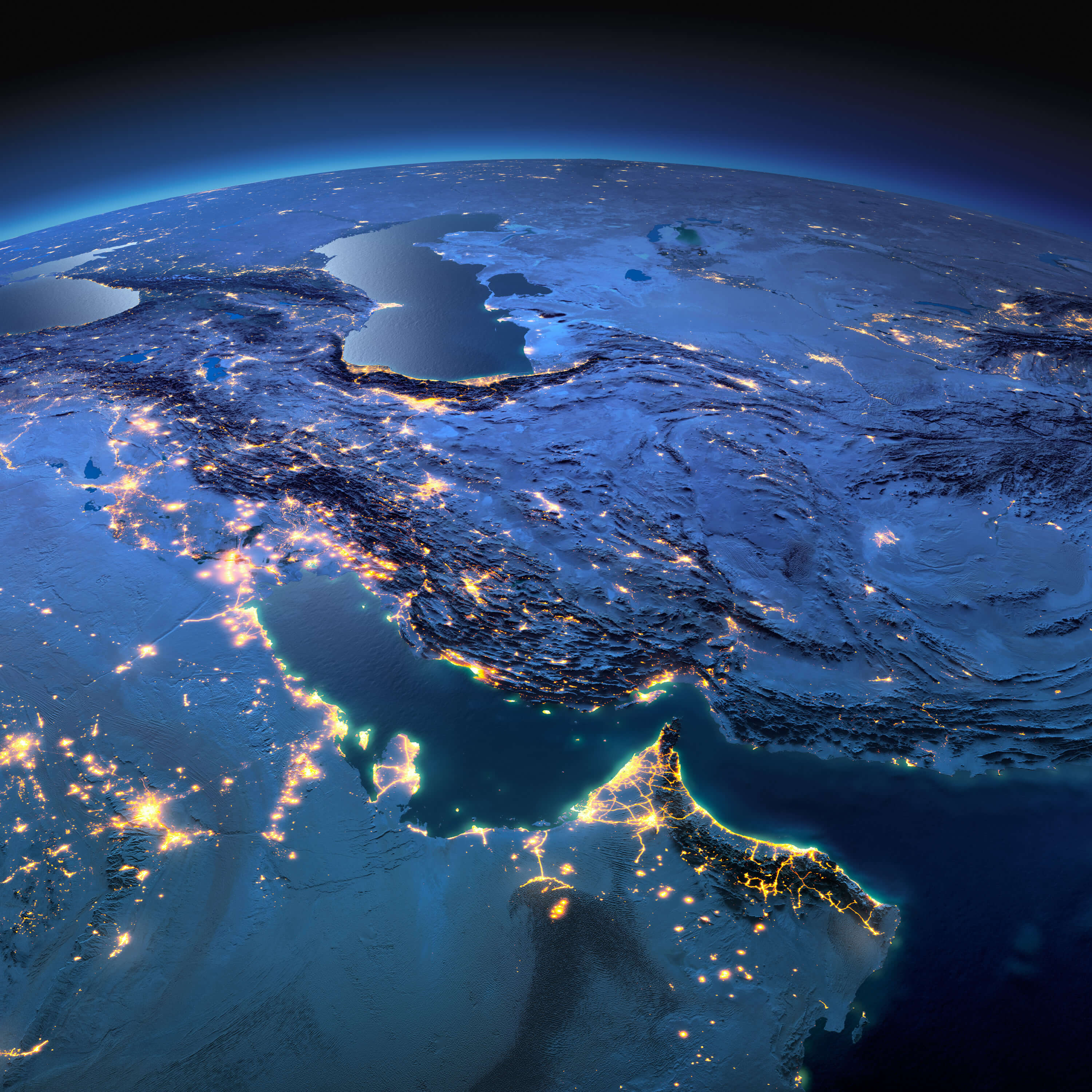
The image titled “Iran from Space in the Night Map” highlights the stunning view of Iran and its surrounding regions illuminated by city lights at night. The glowing lights in metropolitan areas such as Tehran, Shiraz, and Isfahan reveal the density of population and infrastructure. Additionally, the strategic positioning of Iran is clearly seen with its coastal areas along the Persian Gulf, neighboring countries like Iraq, Saudi Arabia, and the visible water bodies including the Caspian Sea and the Gulf of Oman. The image offers a captivating perspective of Iran’s geography from space.
Iran Map with Muslim Countries
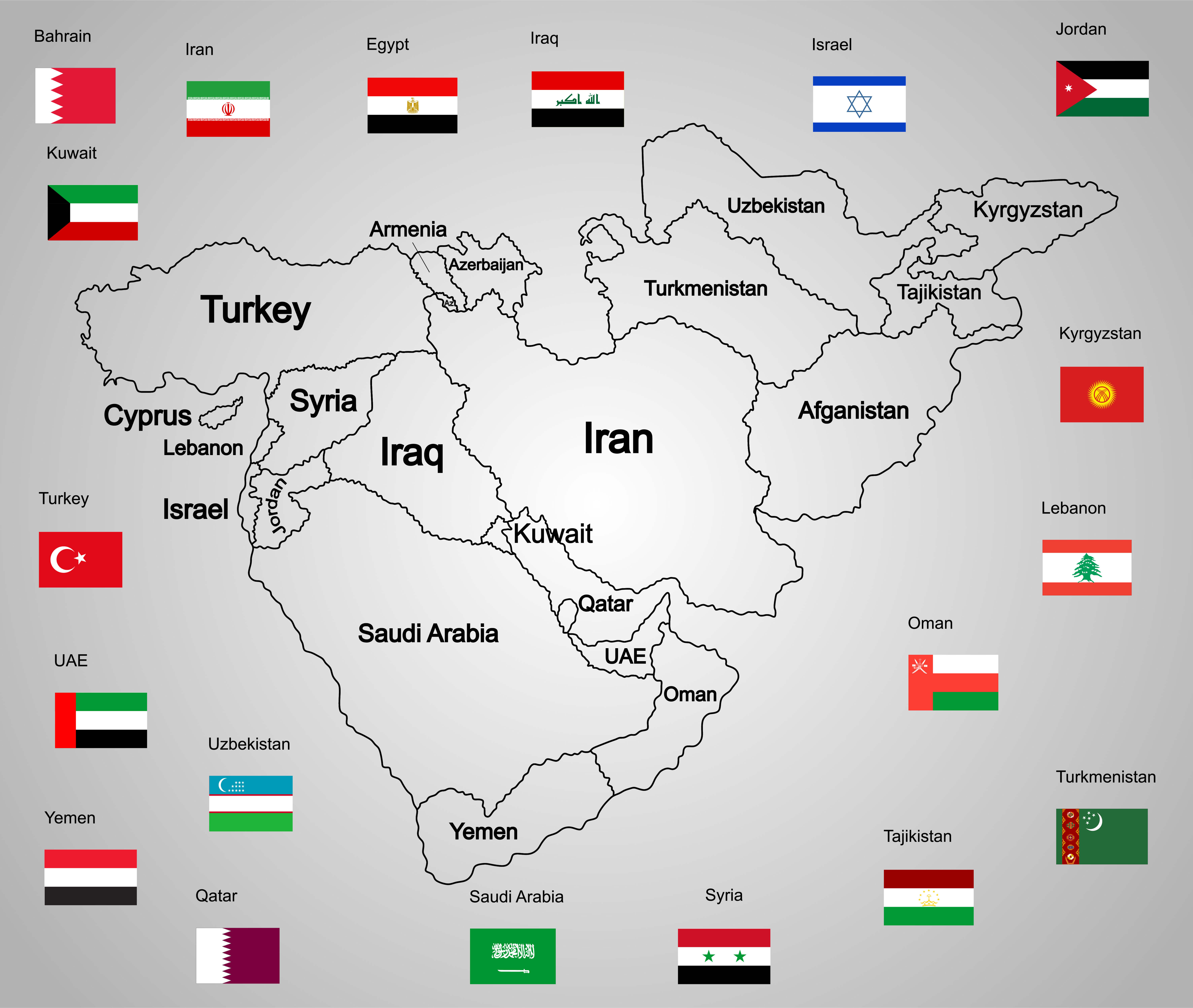
Iran is geographically located at the center of the Muslim world, bordered by several other Muslim-majority countries, including Iraq to the west, Afghanistan to the east, and the Persian Gulf states to the south. This central position places Iran in close proximity to many of the region’s key players. Its connections to the Persian Gulf and Caspian Sea further enhance its strategic importance. Iran shares deep cultural, historical, and religious ties with its Muslim neighbors, contributing to its influential role in the broader Islamic world.
Iran Map with Iraq and Gulf Countries
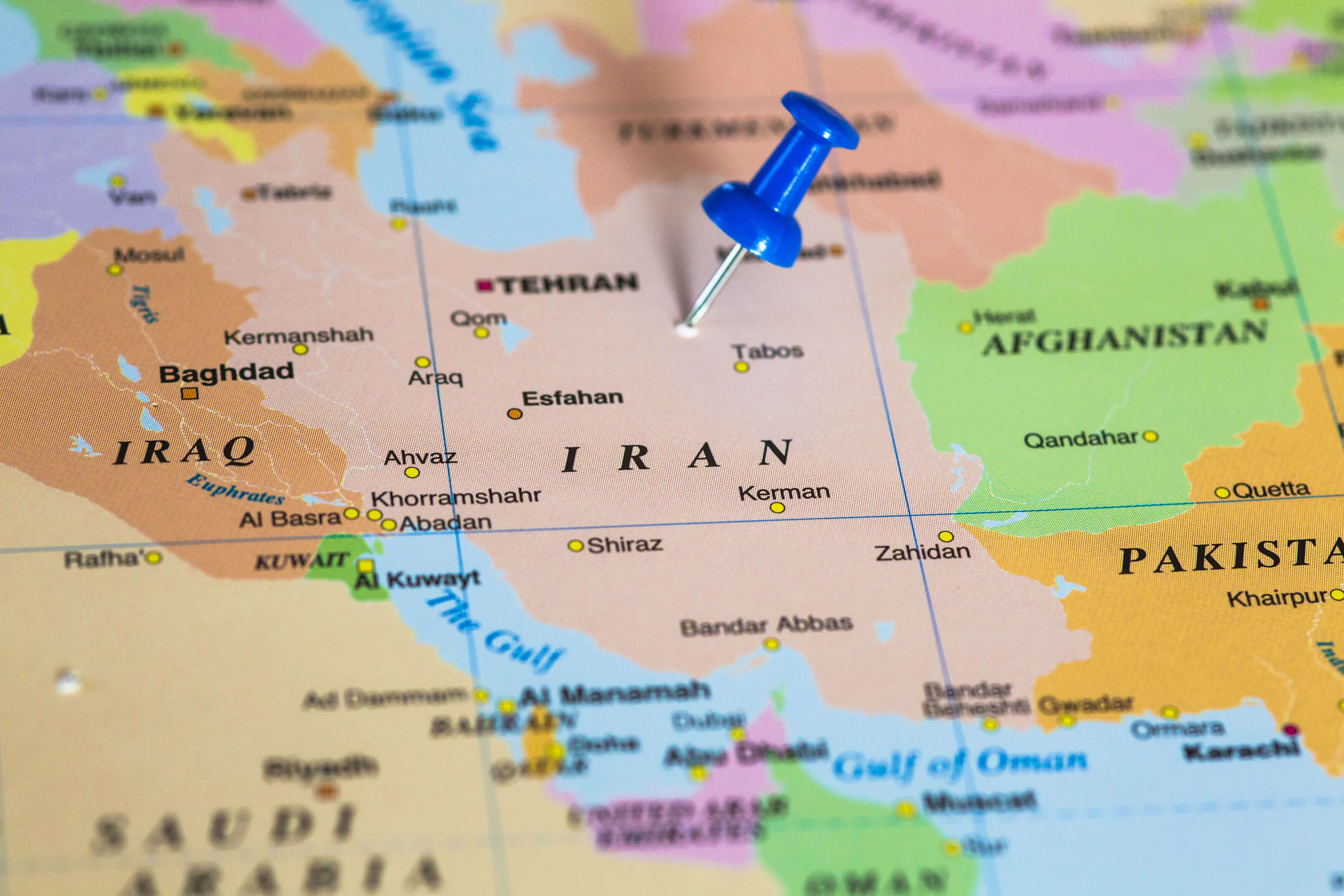
The map showcasing Iran, Iraq, and the Gulf countries highlights the strategic importance of this region. Iran, bordered by Iraq to the west and the Persian Gulf to the south, shares important cultural, historical, and political ties with its neighbors. The Gulf waters are significant for global oil trade, making the region vital in international geopolitics. Cities like Tehran, Baghdad, and Kuwait are key urban centers shown on the map, emphasizing the dense population and infrastructural importance of these areas.
Iran Highways Map
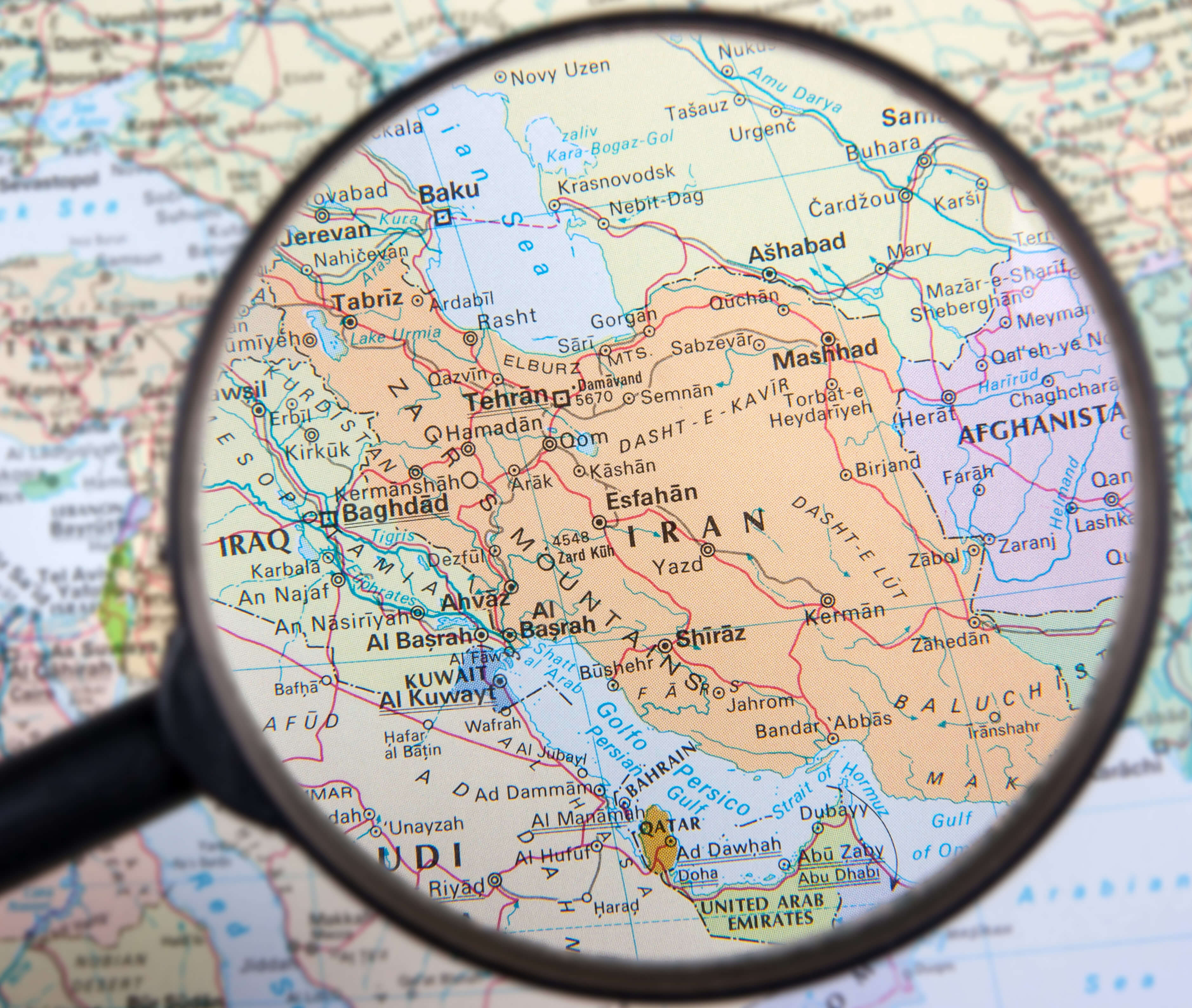
Iran Provinces Map with Largest Cities
 This map of Iran shows the provinces and highlights the largest cities within each region. Tehran, the capital, stands out as the most populous urban center, while other major cities such as Mashhad, Isfahan, Shiraz, and Tabriz are also clearly marked. The map illustrates Iran’s geographic diversity, from the Persian Gulf in the south to the Caspian Sea in the north, and the strategic location of its cities in relation to neighboring countries such as Iraq, Turkey, and Afghanistan.
Iran National Borders Map
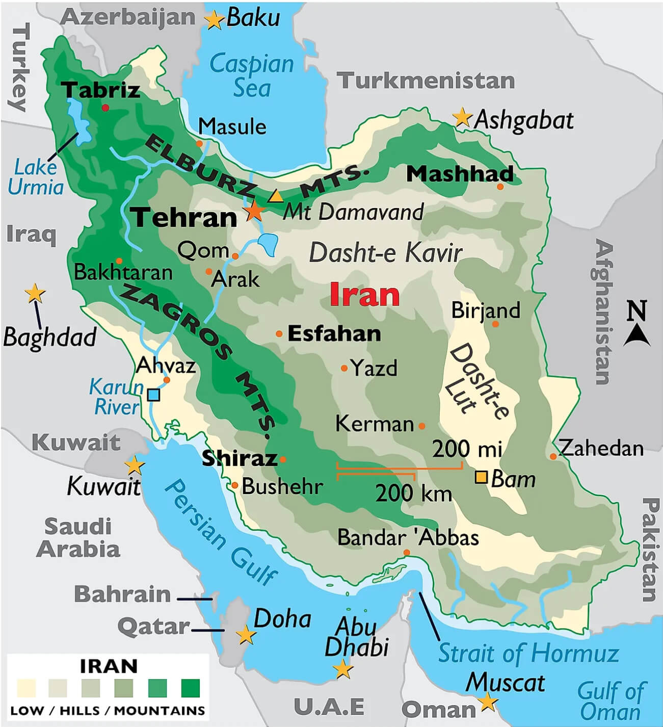 This map of Iran highlights its national boundaries, showing the country’s borders with its neighboring countries: Azerbaijan, Armenia, Turkmenistan, Afghanistan, Pakistan, Iraq, and Turkey. It also outlines key geographic features such as the Elburz and Zagros mountain ranges, as well as Iran’s access to the Caspian Sea in the north and the Persian Gulf in the south. The map highlights key cities, including the capital, Tehran, and other major cities such as Tabriz, Mashhad, Esfahan, and Shiraz, illustrating Iran’s strategic position in the Middle East.
Iran Israel Middle East Countries Map
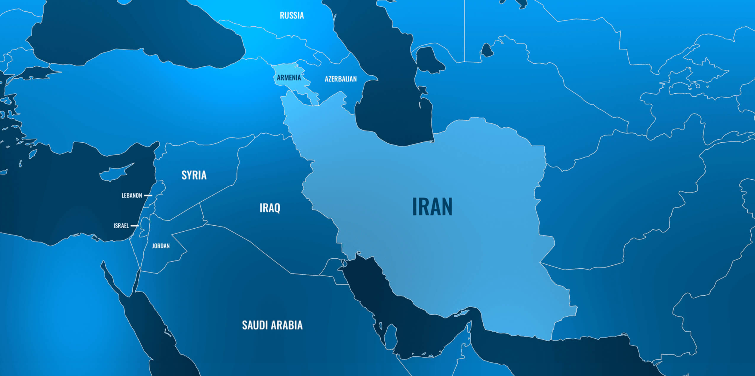 This map of the Middle East highlights Iran and its surrounding countries, including Israel, Saudi Arabia, Syria, Iraq, Jordan, and others. It provides a clear geographic perspective of Iran’s central position in the region, with significant proximity to both the Persian Gulf and the Strait of Hormuz. Additionally, the map shows Iran’s northern neighbors like Armenia and Azerbaijan, emphasizing its strategic location between the Middle East and Central Asia.
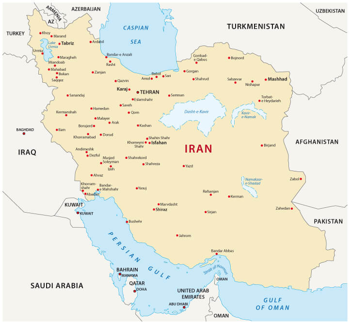
Iran Cities Map Map with Lakes
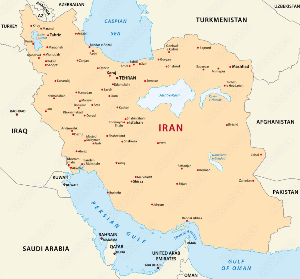 This map of Iran highlights its major cities, including the capital, Tehran, and other key locations such as Isfahan, Shiraz, and Mashhad. It also shows the major bodies of water, including Lake Urmia in the northwest and the Dasht-e Kavir (Great Salt Desert) and Dasht-e Lut (Lut Desert), which are prominent geographical features in central Iran. The Persian Gulf borders the south, providing access to maritime routes, while the Caspian Sea touches the northern part of the country. The map provides a clear overview of Iran’s urban centers and natural lakes.
Geological Map of Iran
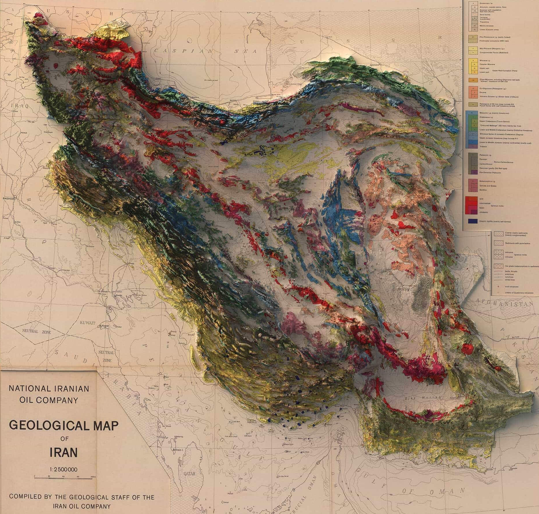 This geological map of Iran depicts the country’s complex terrain and geological features. It highlights Iran’s rich and varied geological history, with major mountain ranges such as the Zagros and Elburz Mountains prominently depicted. The map also shows major fault lines, sedimentary basins and volcanic areas, as well as the distribution of different rock types, including sedimentary, metamorphic and igneous formations. Such maps are often crucial for industries such as oil and gas exploration, as Iran is a major player in the energy sector, especially for its oil reserves.
Iran Ethnic Groups Map
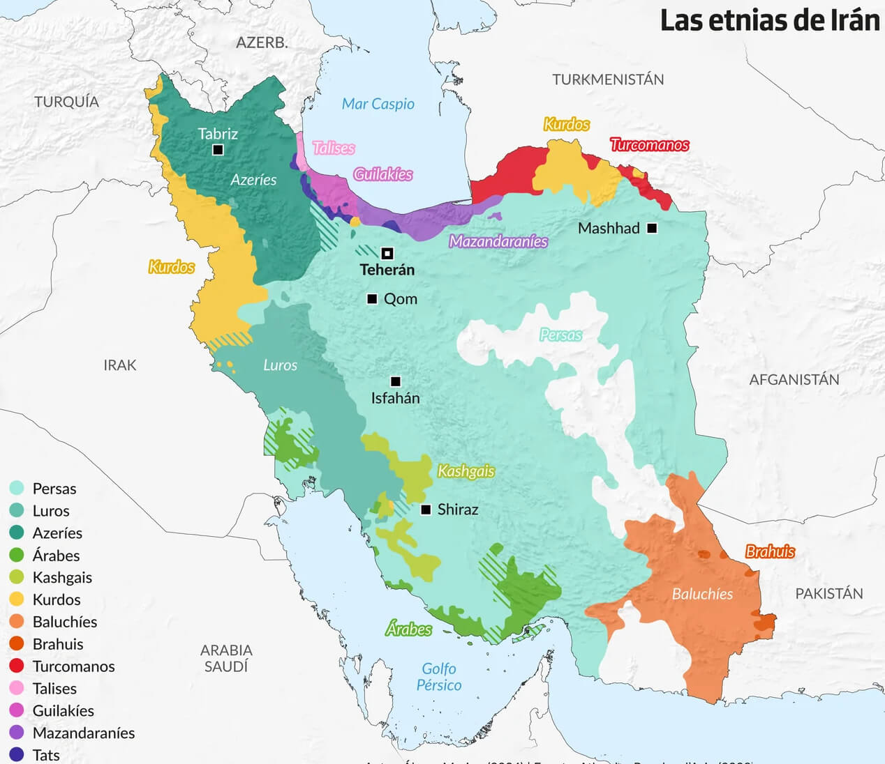 This map of Iran highlights the ethnic diversity within the country. Various ethnic groups such as Persians, Azeris, Kurds, Lurs, Arabs, Balochs, and Turkmen are spread across different regions, with Persians being the dominant group, mainly in central and southern Iran. The Azeris are concentrated in the northwest, while Kurds occupy the western regions near the Iraqi border. In the southwest and southeast, you’ll find Arab and Baloch populations, respectively. This rich ethnic mosaic reflects Iran’s long history of cultural and ethnic diversity, influenced by its geography and neighboring countries.
Iran Topographical Map
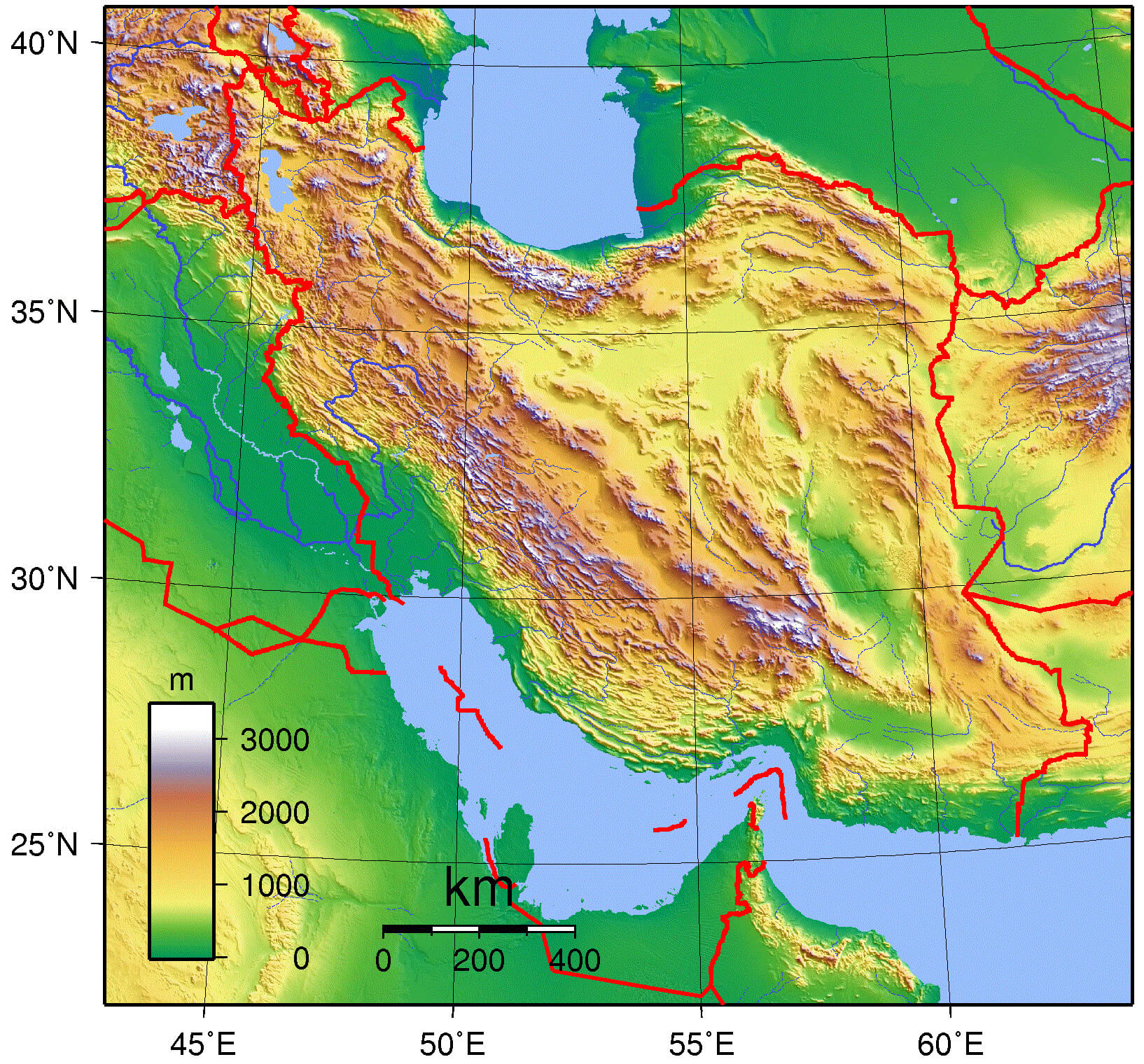 This topographical map of Iran provides a detailed view of the country’s relief and geographic features. The map highlights the Zagros and Elburz mountain ranges, which dominate the western and northern regions of Iran, respectively, while also showing the central plateau and lowland areas such as the Caspian Sea and Persian Gulf coastline. The different colors on the map represent different elevations, with the darker colors representing the highest elevations, such as the peaks of the Zagros and Elburz ranges, and the lighter colors representing the lower-lying plains and coastal regions.
Iran Religon Map with Shia Sunni Groups
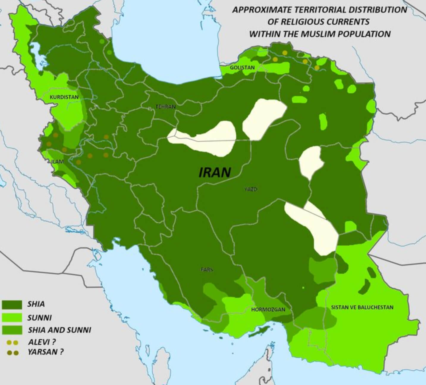 This map of Iran illustrates the approximate territorial distribution of religious currents within the Muslim population, highlighting areas dominated by Shia and Sunni communities. Most of Iran is shaded in dark green, indicating regions where the Shiite population is concentrated, making up the vast majority of Iran’s Muslim population. Sunni communities are shown in lighter green, with significant Sunni populations in areas such as Kurdistan in the west, Sistan and Baluchestan in the southeast, and parts of Golestan near the Caspian Sea. Other smaller religious groups, such as Alevis and Yazans, are also represented on this distribution map.
Iran Demography Map
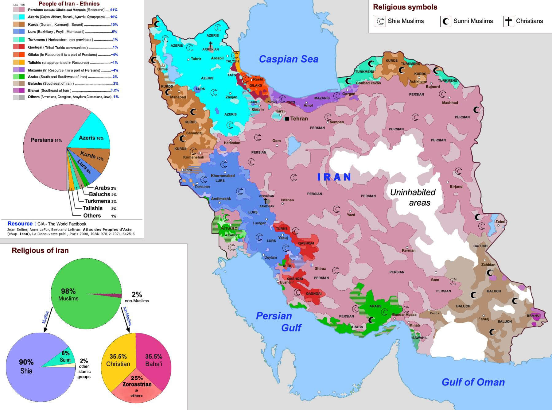 The map highlights Iran’s diverse demographics, showing different ethnic and religious groups spread throughout the country. The dominant group, Persians, make up about 61% of the population and are concentrated in the central areas, while Azeris, Kurds, Arabs, and other ethnic minorities populate specific regions such as the northwest, southwest, and border areas. The religious distribution shows that the vast majority of Iranians follow Shiite Islam, with a smaller Sunni minority, and the map also shows small pockets of Christians, Bahá’ís, and Zoroastrians scattered throughout the country. The uninhabited areas in the central deserts underscore the geographic limitations in certain regions.
Iran National Provincial Map
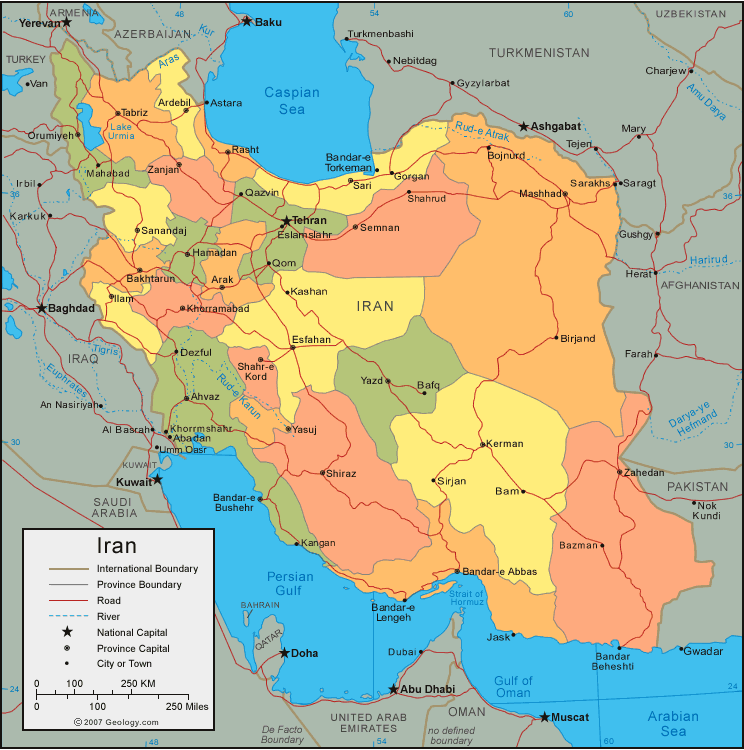
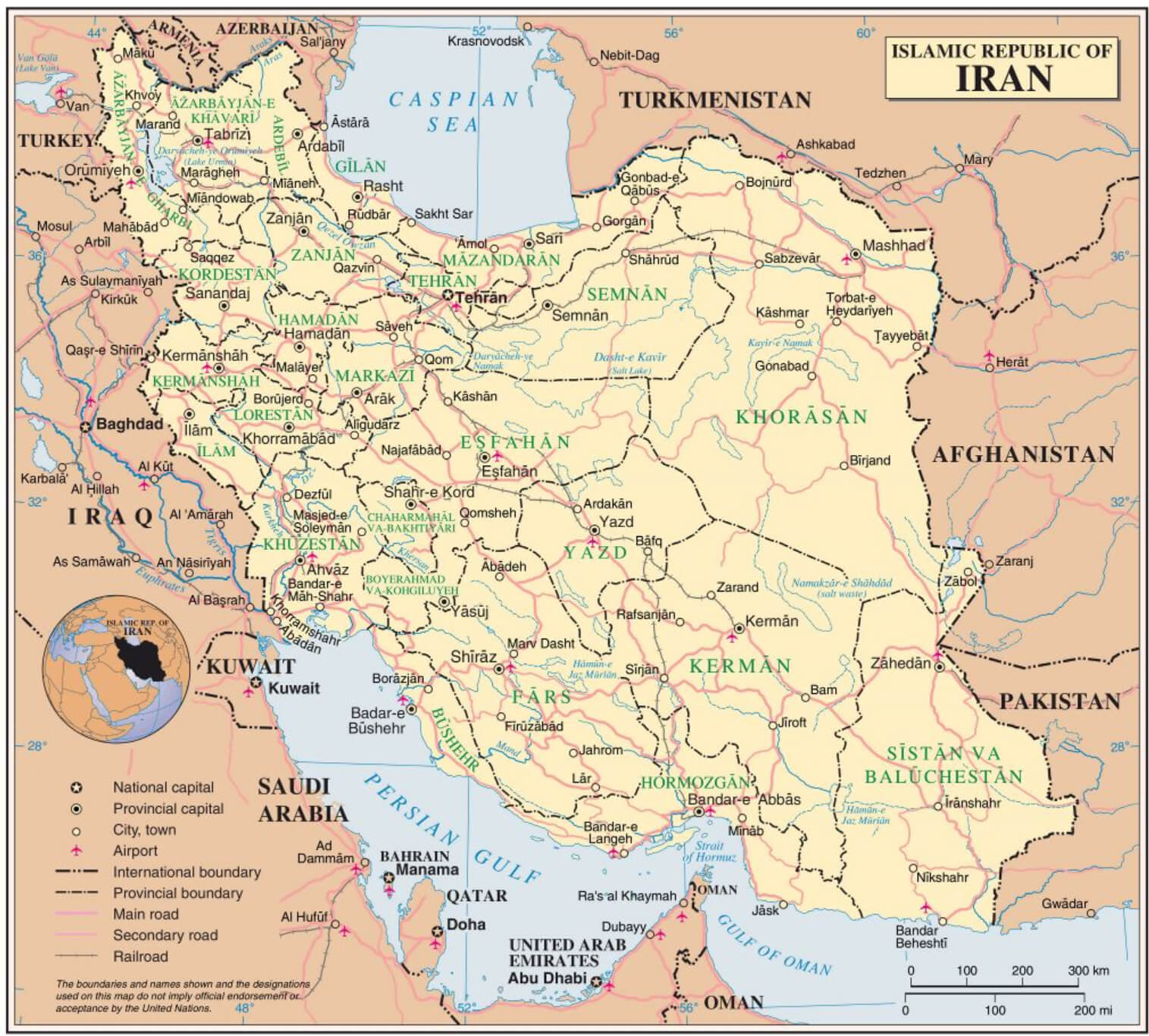 This map of Iran depicts national and provincial boundaries and highlights the country’s various provinces and their capitals. It provides a detailed view of major cities, road networks, airports, and international borders with neighboring countries such as Iraq, Afghanistan, Pakistan, and Turkmenistan. The Persian Gulf and Caspian Sea are prominently featured, emphasizing Iran’s strategic access to these important bodies of water.
Iran Climate Map
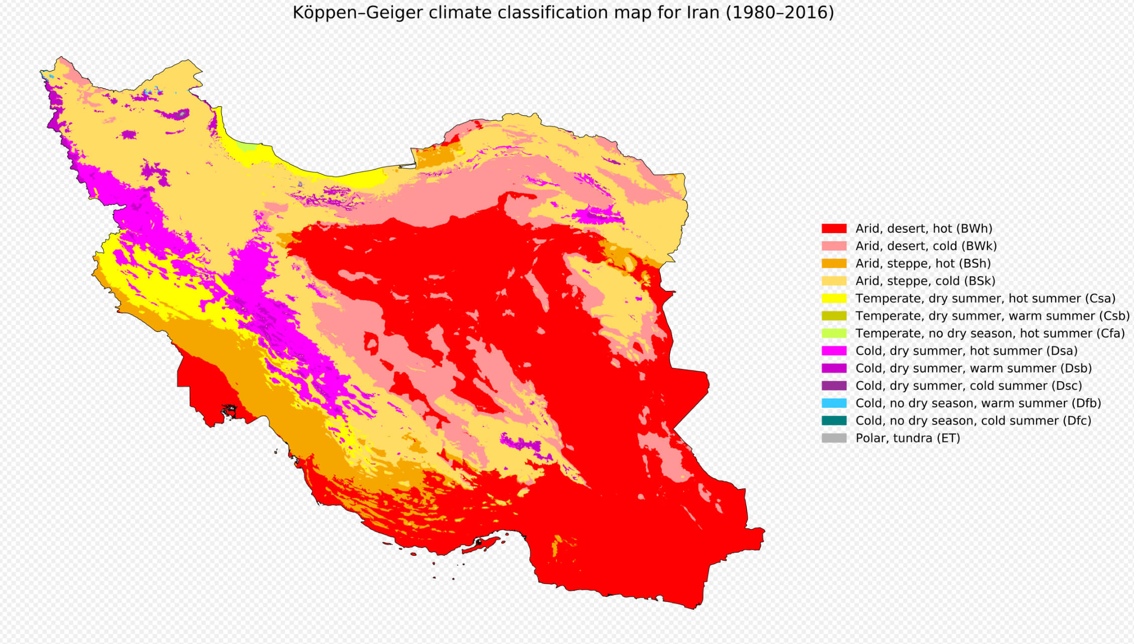 This climate map of Iran, based on the Köppen-Geiger climate classification from 1980 to 2016, shows that a significant portion of the country is classified as arid desert (BWh), particularly in the central and southern regions. Areas of hot desert climate dominate, but there are also regions of arid steppe and temperate zones. The map shows the diversity of Iran’s climate, with some areas experiencing cold, dry summers, while others have hot summers with no dry season.
Iran Physical Map
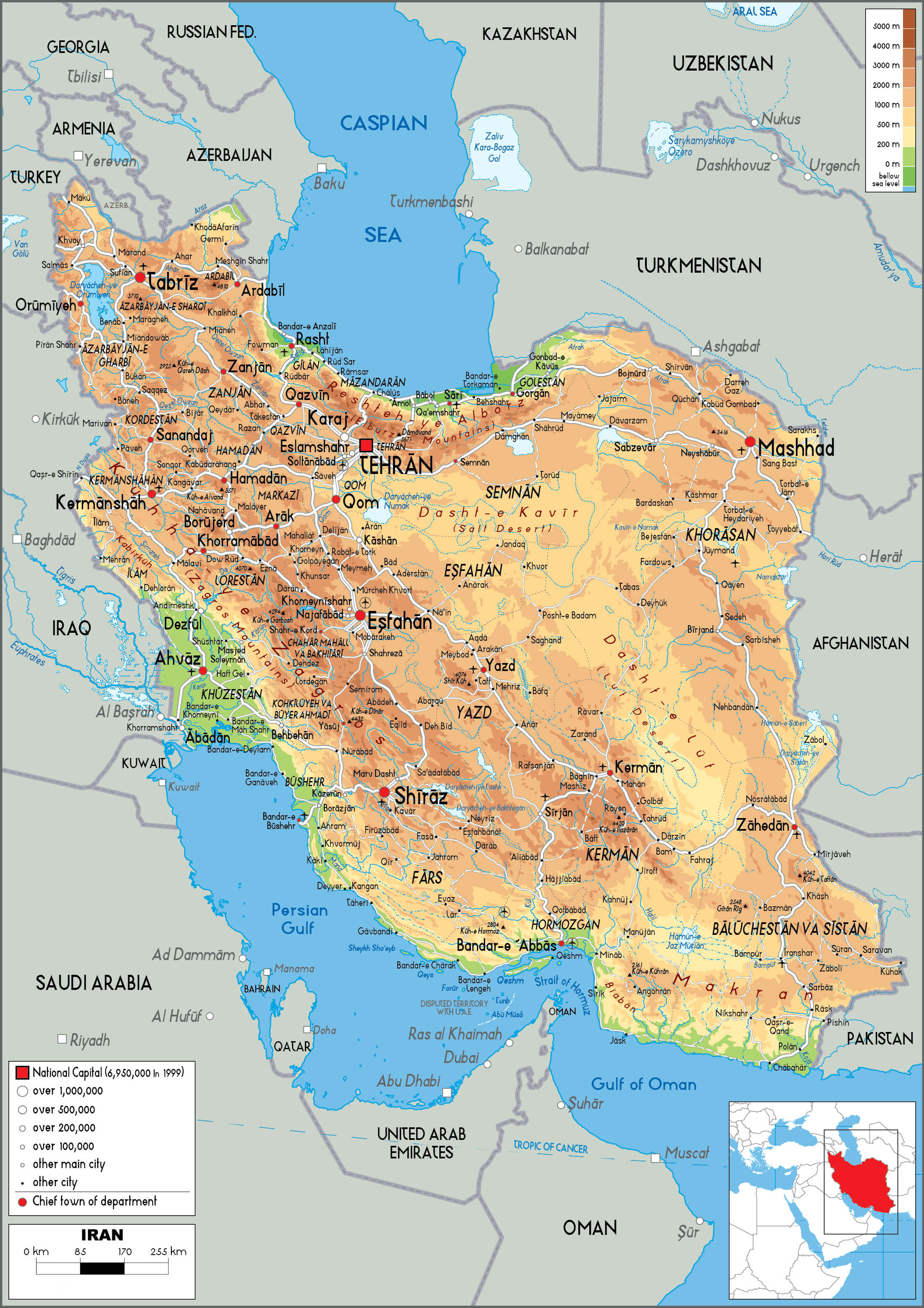 This physical map of Iran highlights the country’s diverse topography, from the towering Zagros and Elburz mountain ranges to the central deserts like Dasht-e Kavir and Dasht-e Lut. The map also shows the low-lying coastal plains along the Persian Gulf and the Caspian Sea, as well as major cities like Tehran, Shiraz, and Mashhad. Iran’s varying elevations are evident, with higher mountainous regions marked by darker shades, contrasting with the lower-lying desert and plain areas marked by lighter colors.
Iran Blank Map
Achaemenid Empire in 500 BCE and Iran Map
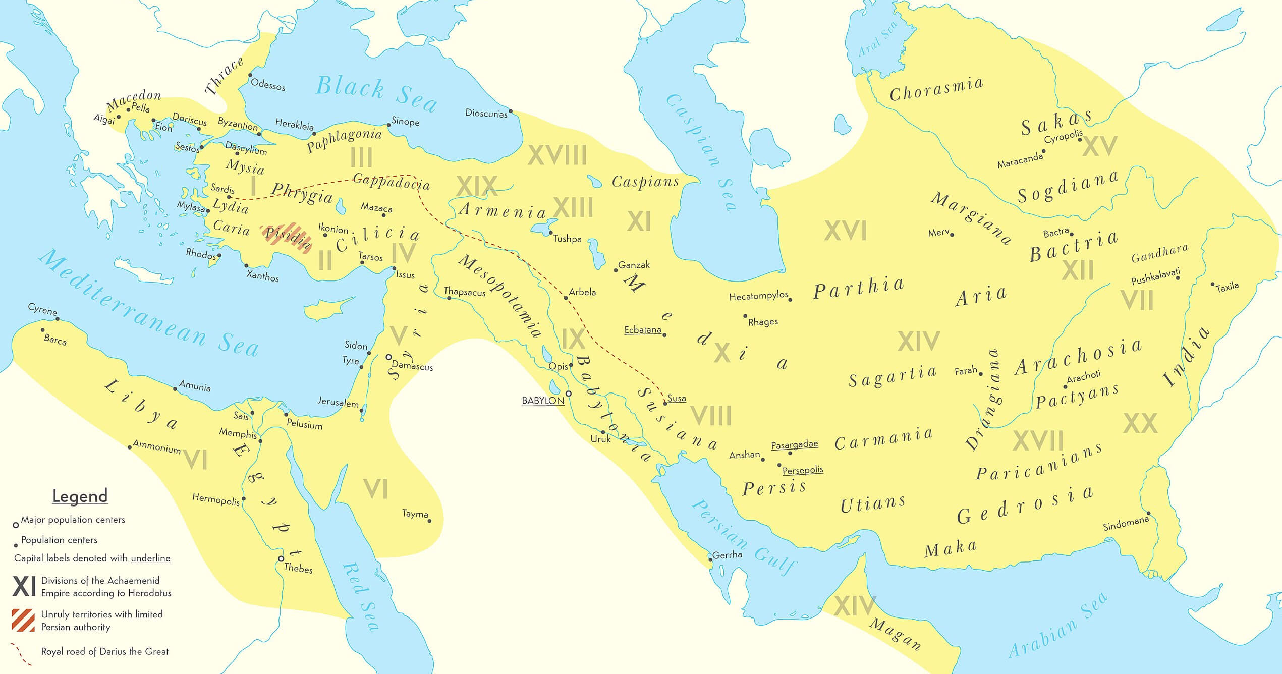 The map of the Achaemenid Empire in 500 BC, as shown here, illustrates the vast extent of one of the largest empires in the ancient world. Stretching from the Indus Valley in the east to Egypt and the Balkans in the west, it encompassed regions as diverse as Persia, Mesopotamia, Egypt, and parts of India and Central Asia. The empire was divided into several satrapies (provinces), each overseen by a satrap or governor, providing centralized control over a vast multicultural and multilingual population.
Iran and its Sphere of Influence Map
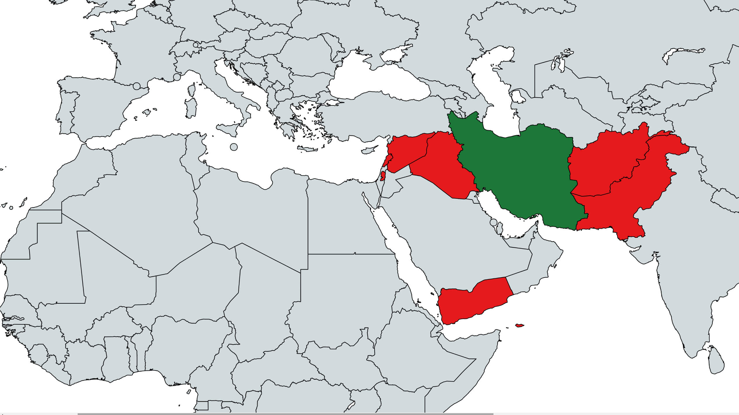 This map illustrates Iran’s sphere of influence in the Middle East and surrounding regions, highlighting countries that have significant political, economic, or military ties to Iran. The green-shaded areas represent Iran, while the red-shaded regions indicate countries where Iran exerts influence, often through alliances with political or military groups. These include Iraq, Syria, Lebanon, and Yemen, where Iranian support is often aligned with Shiite Muslim factions or groups sympathetic to Iran’s regional goals. Iran’s influence in these areas is particularly pronounced because of its strategic alliances and the geopolitical conflicts that shape the Middle East.
Iran Provinces Map by Population
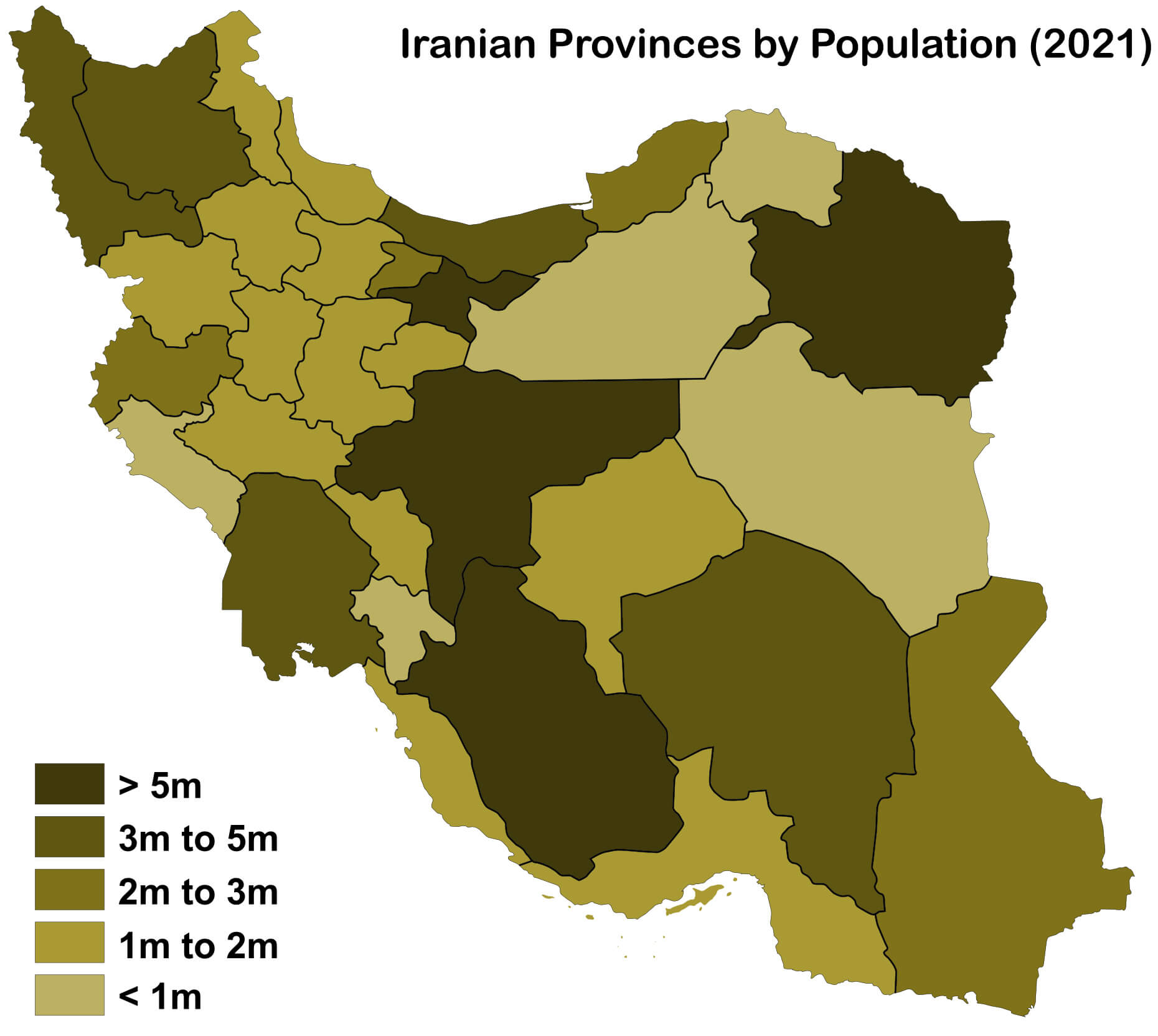 This map shows the population distribution of Iran’s provinces in 2021. It divides the provinces into five groups based on population size: those with more than 5 million inhabitants, between 3 and 5 million, 2 to 3 million, 1 to 2 million, and less than 1 million. The darker regions represent provinces with the highest population densities, while the lighter regions indicate less populated areas. This classification highlights major population centers such as Tehran, where the population exceeds 5 million, as opposed to sparsely populated provinces in the southeast.
Iran Google Map
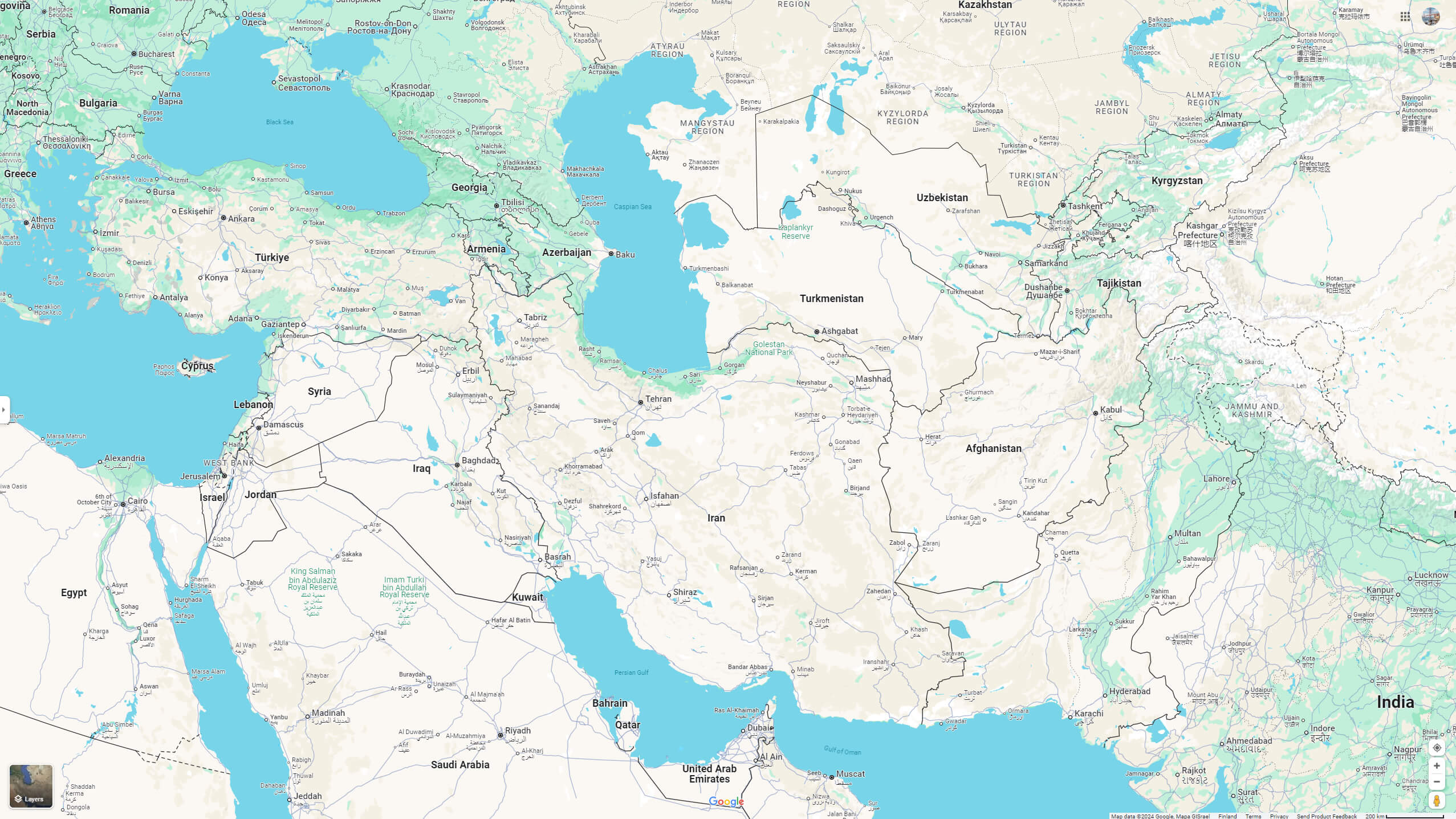
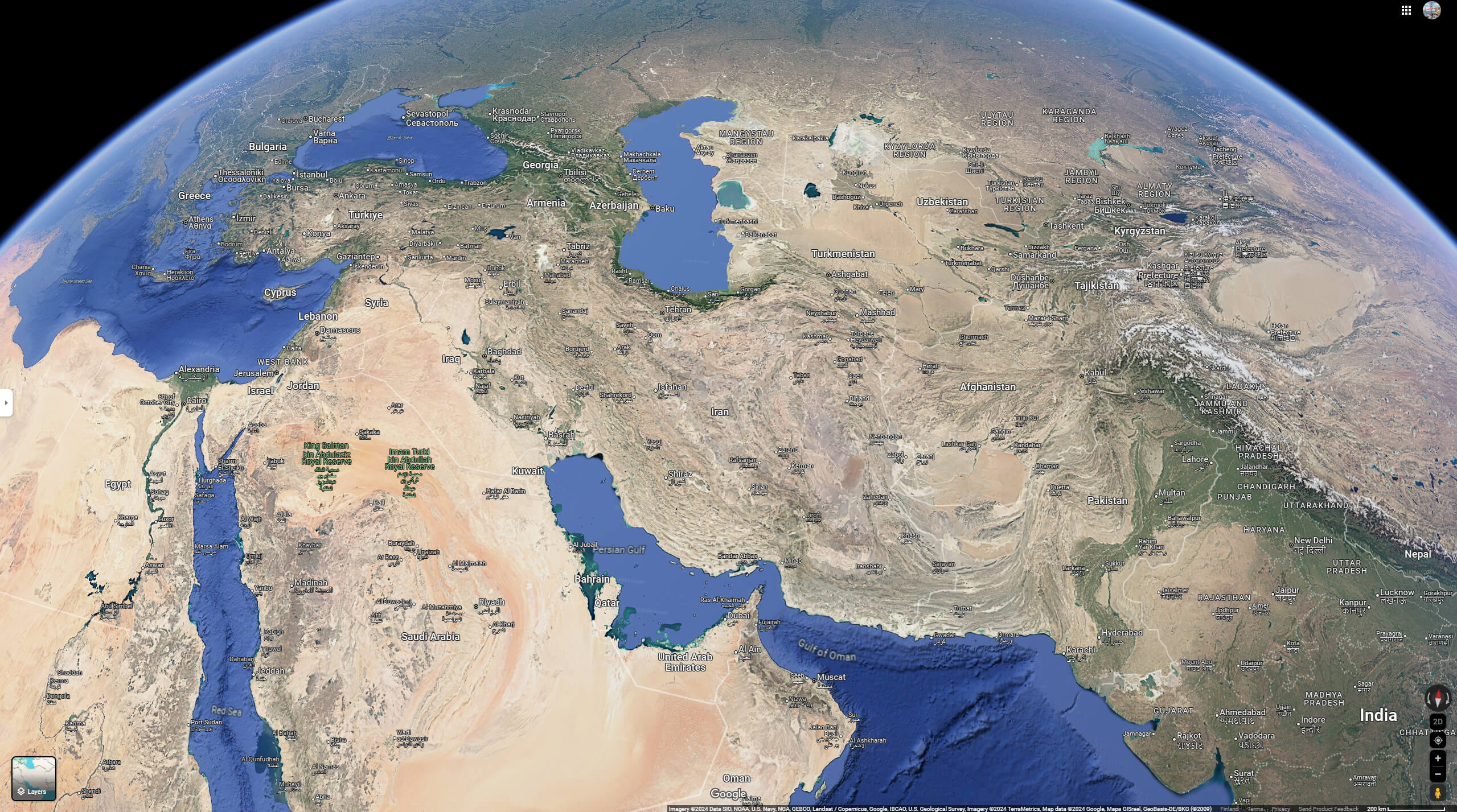
Iran Google Earth Map
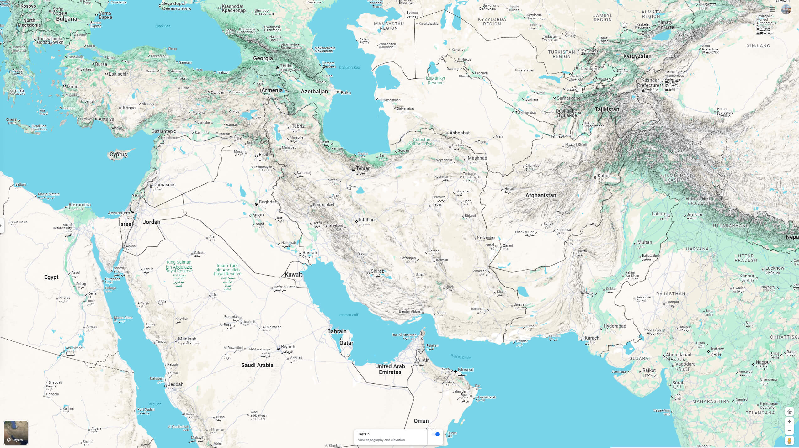
Iran Google Terrain Map
Rail Map of Iran
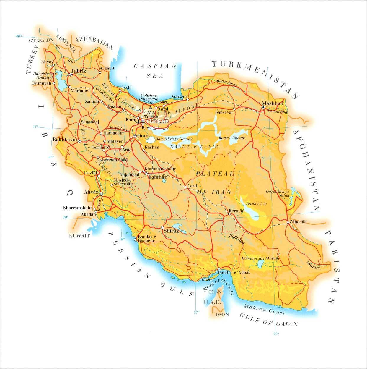 Map of Iran showing major cities, railroads, and geographic features.
This map of Iran displays its rail network connecting major cities such as Tehran, Mashhad, Isfahan, and Shiraz. Key geographical features include the Caspian Sea to the north, the Persian Gulf to the south, and mountain ranges like Alborz and Zagros. Neighboring countries such as Turkey, Azerbaijan, Turkmenistan, Afghanistan, and Pakistan are also marked.
Where is located Iran on the World Map ?
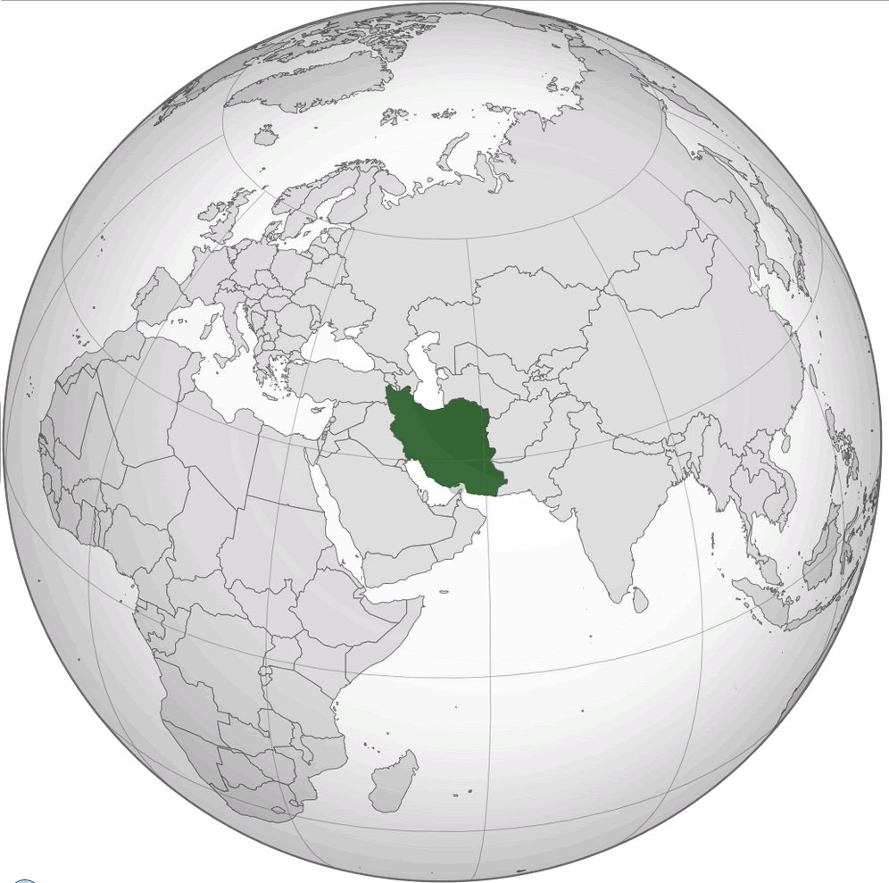 Where is located Iran on the World Map
Located in western Asia, Iran is bordered by several countries and bodies of water, making it a geographically strategic nation. It borders Armenia, Azerbaijan and the Caspian Sea to the north, and Turkey and Iraq to the west. To the east, Iran borders Turkmenistan, Afghanistan and Pakistan. Iran’s southern border touches the Persian Gulf and the Gulf of Oman, giving it access to major sea lanes that are essential for the global transport of oil.
Map of Iran
Achaemenid Empire Map Darius Iran
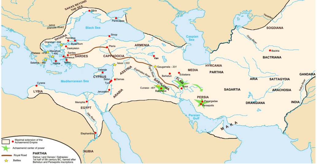 Map of the Achaemenid Empire, highlighting its maximum extent, key cities, and battles
This map depicts the Achaemenid Empire at its peak under Darius I and Xerxes I, stretching from the Mediterranean to the Indus River. Key locations, including centers of power like Persepolis and Susa, are marked, along with the Royal Road connecting Sardes to Susa. Important battles, such as Marathon and Gaugamela, are also highlighted. This map illustrates the vast reach of the Persian Empire, encompassing regions across Asia Minor, Egypt, and parts of Central Asia.
Boundaries of Iran Map
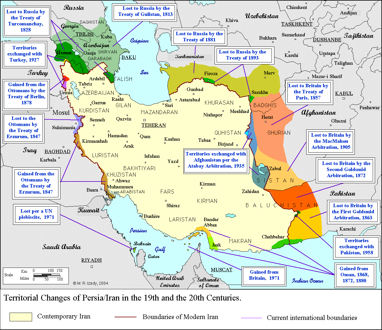 Map showing historical territorial changes of Persia/Iran with treaties
This map illustrates the territorial changes of Persia (now Iran) over the 19th and 20th centuries. Key areas lost and gained through treaties with Russia, Britain, the Ottoman Empire, and other countries are marked, along with the dates of significant events like the Treaty of Turkmenchay (1828) and Treaty of Paris (1857). It also shows exchanges with Afghanistan and Pakistan. Contemporary Iran’s borders and past boundaries provide historical context to Iran’s territorial evolution.
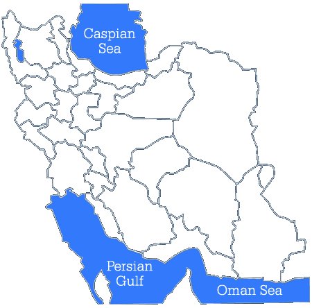
Empty Iran Map
Ethnic Groups Map of Iran
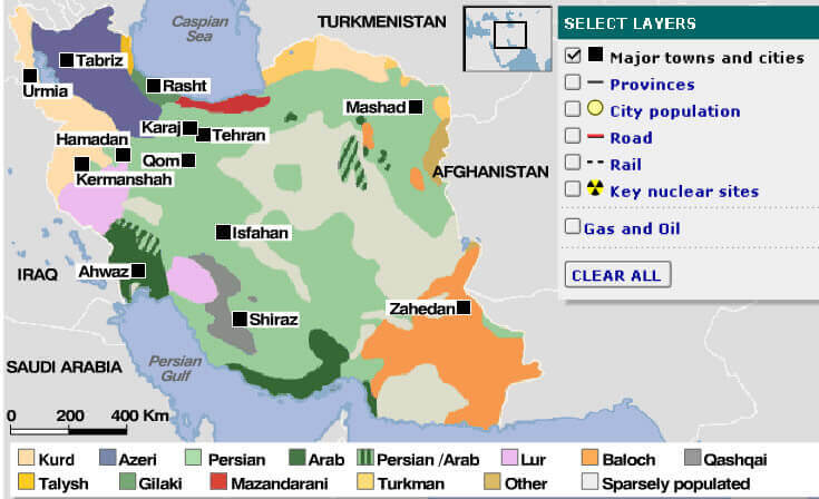 Map of Iran showing ethnic groups, cities, and key nuclear sites
This map illustrates the ethnic distribution across Iran, highlighting areas predominantly populated by Kurds, Azeris, Persians, Arabs, Lurs, Balochs, and other groups. Major cities such as Tehran, Mashhad, Isfahan, and Shiraz are marked, alongside key nuclear sites and gas and oil regions. The map provides a visual representation of Iran’s diverse ethnic landscape and key geographical and industrial locations.
Gas Oil Map of Iran
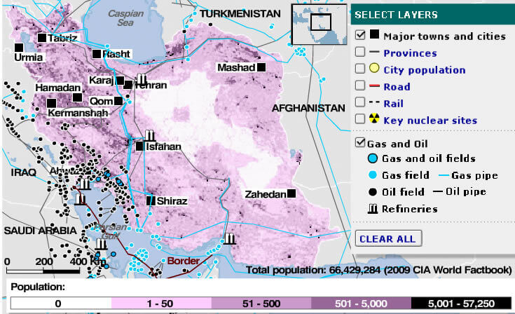 Map of Iran showing population density, gas and oil fields, pipelines, and key cities
This map illustrates Iran’s population density, with major cities such as Tehran, Mashhad, Isfahan, and Shiraz highlighted. It also marks Iran’s gas and oil fields, along with pipelines and refineries, showing the country’s energy infrastructure. Key nuclear sites and railroads are displayed, providing a comprehensive view of Iran’s industrial and population distribution. The map color-codes population density, ranging from low to high.
Iran Elevation Map
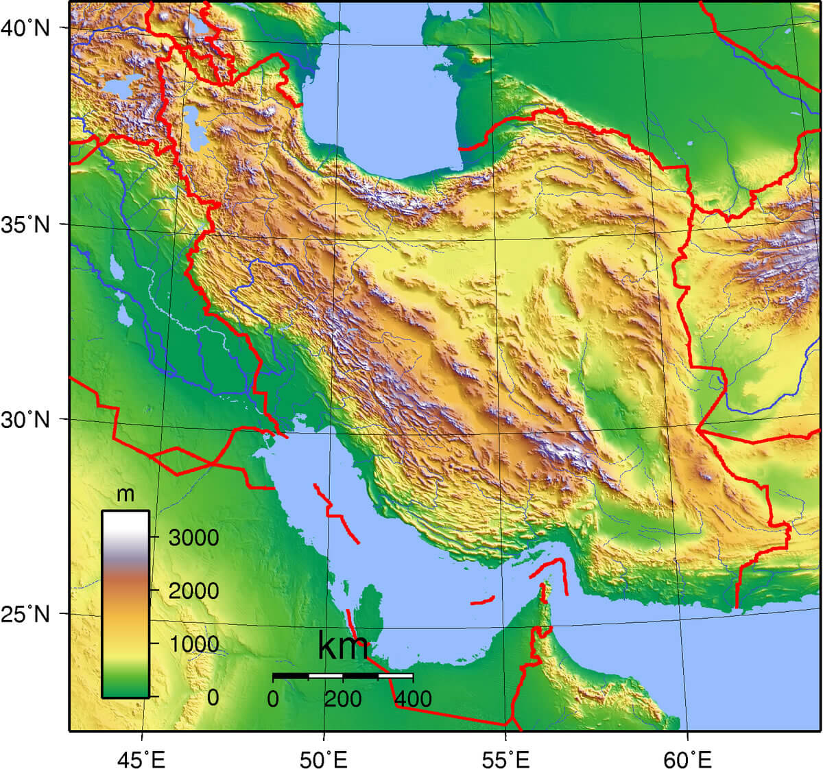
Iran Cities Map
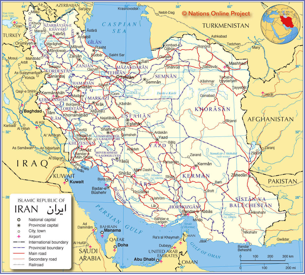
Iran Map
Rail Map of Iran
 Map of Iran showing major cities, railroads, and geographic features
This map of Iran displays its rail network connecting major cities such as Tehran, Mashhad, Isfahan, and Shiraz. Key geographical features include the Caspian Sea to the north, the Persian Gulf to the south, and mountain ranges like Alborz and Zagros. Neighboring countries such as Turkey, Azerbaijan, Turkmenistan, Afghanistan, and Pakistan are also marked.
Where is Iran on the Asia Map?
Show Google map, satellite map, where is the country located.
Get directions by driving, walking, bicycling, public transportation and travel with street view.
Feel free to explore these pages as well:
- Iran: The Rise and Fall of Empires ↗️
- Iran Israel War Map – Location Strikes Map in Iran and Israel ↗️
- A Collection of Lebanon Maps ↗️
- Iraq Map ↗️
- Syria Map ↗️
- Egypt Map ↗️
- Jordan Map ↗️
- Pakistan Map ↗️
- Bangladesh Map ↗️
- Israel Map ↗️
- Oman Map ↗️
- Saudi Arabia Map ↗️
- Kazakhstan Map ↗️
- Where is Located Qatar in the World? ↗️
- United States Map ↗️
- United Kingdom Map ↗️
- Türkiye Map ↗️
- Georgia Map ↗️
- Tel Aviv’s 10 Best Attractions ↗️
- Europe Map ↗️
- Asia Map ↗️
