Where is located Gabon on the World and Africa Map? Located on the west coast of Central Africa, Gabon’s equatorial location gives it a tropical climate with lush rainforests and diverse ecosystems. It borders Equatorial Guinea to the northwest, Cameroon to the north and the Republic of Congo to the east and south. Its western border is formed by the Atlantic Ocean, providing Gabon with a strategic coastline that facilitates trade and transport.
Gabon Physical Map
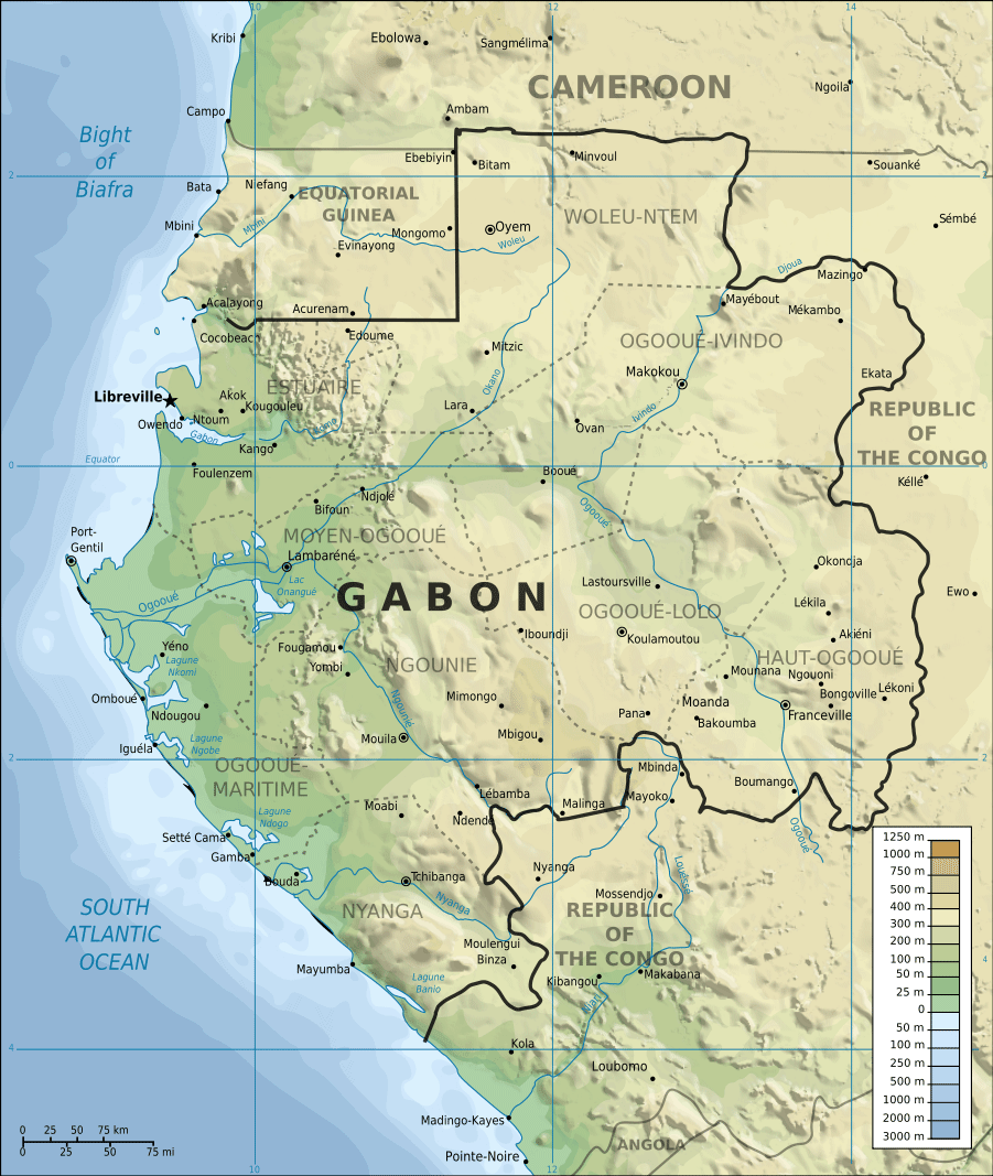
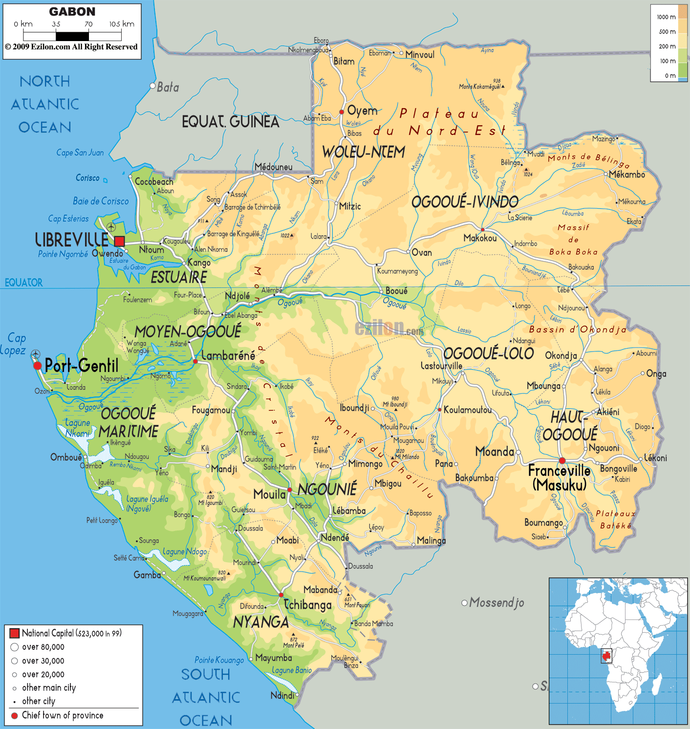 Gabon physical map showing cities, rivers, and geographical features.
This map of Gabon highlights key cities like Libreville and Port-Gentil, major rivers, and regions such as Estuaire and Ogooué-Ivindo. It also illustrates the country’s terrain, including plateaus and coastal areas, emphasizing Gabon’s natural diversity.
Gabon cities map
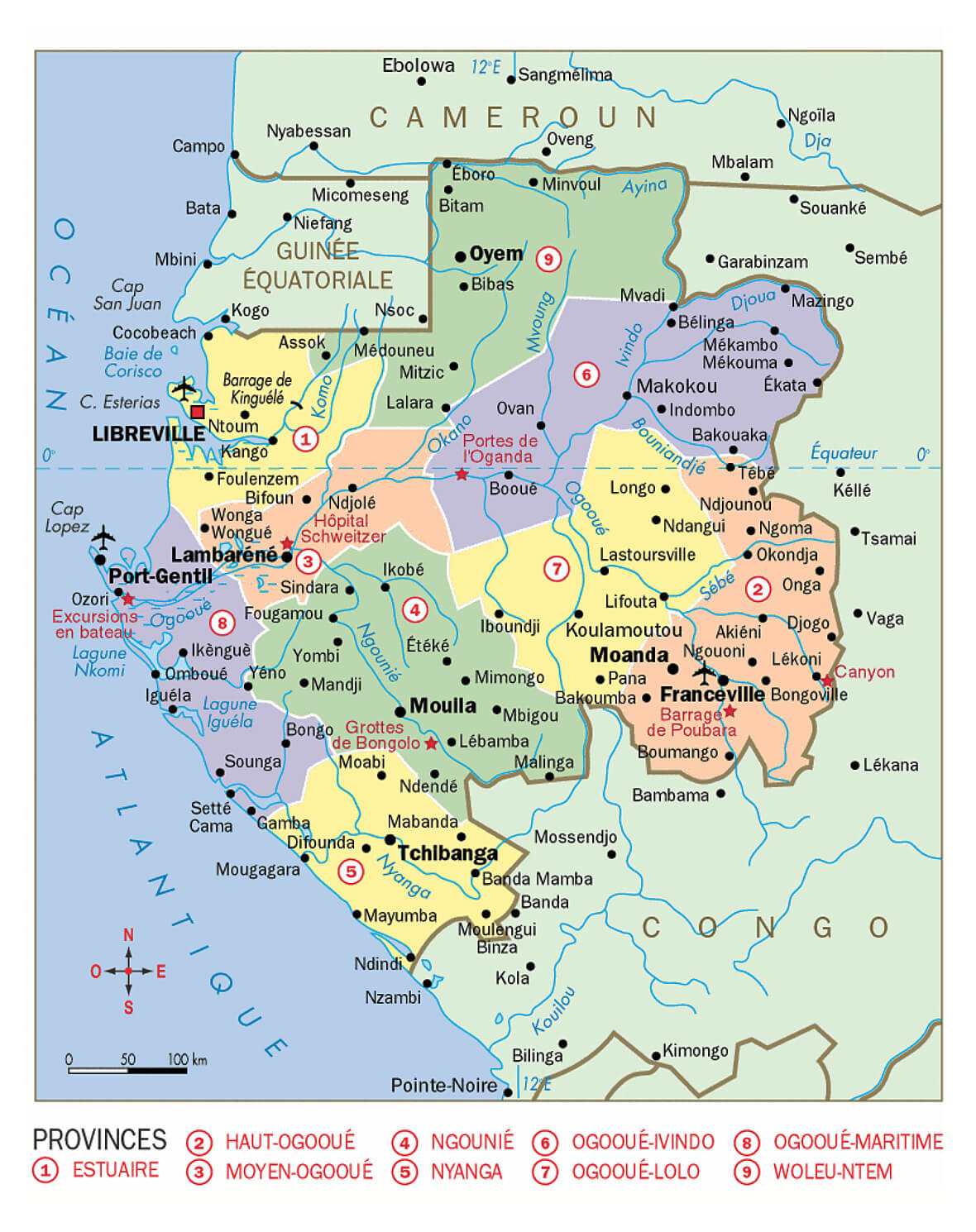
Brief information about Gabon
Located on the west coast of Central Africa, Gabon is a country known for its rich biodiversity and vast rainforests. Covering an area of approximately 267,668 square kilometres, Gabon borders Equatorial Guinea, Cameroon and the Republic of Congo, while its coastline stretches along the Atlantic Ocean. Libreville, the capital and largest city, is the political, economic and cultural centre of the country. Gabon has a relatively small population of around 2.3 million, with French as the official language due to its colonial history.
Economically, Gabon benefits from abundant natural resources, including oil, manganese and timber, making it one of the wealthier nations in sub-Saharan Africa in terms of GDP per capita. The country is also known for its conservation efforts, with approximately 11% of its land devoted to national parks, including the famous Loango National Park, often referred to as the ‘last Eden’. Gabon’s stability and focus on ecotourism has made it an attractive destination for visitors seeking unspoilt natural beauty and wildlife experiences.
Where is located Gabon on the World and Africa Map?
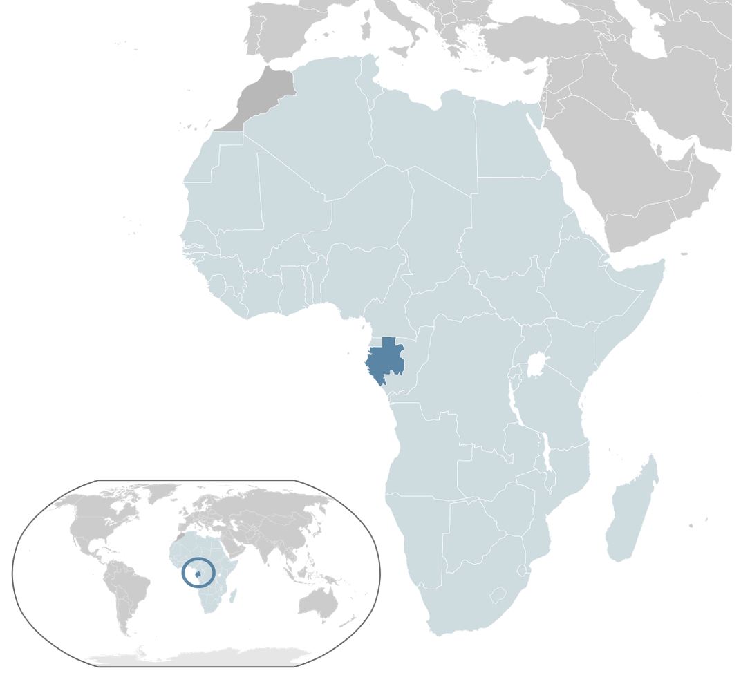
Located on the west coast of Central Africa, Gabon’s equatorial location gives it a tropical climate with lush rainforests and diverse ecosystems. It borders Equatorial Guinea to the northwest, Cameroon to the north and the Republic of Congo to the east and south. Its western border is formed by the Atlantic Ocean, providing Gabon with a strategic coastline that facilitates trade and transport.
Gabon Location Map
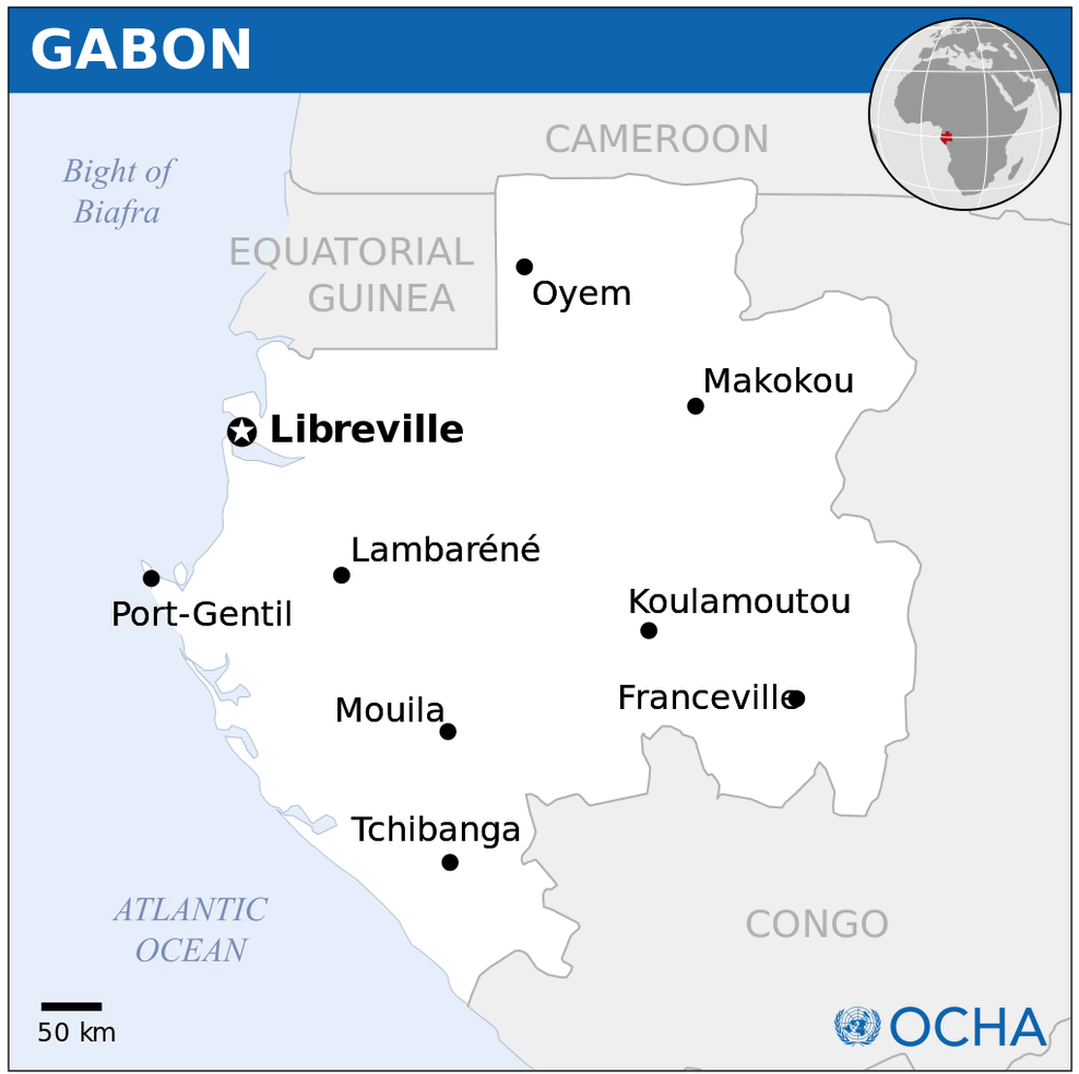
Geographically, Gabon lies between latitudes 3° and 4° south of the equator and longitudes 9° and 12° east. This equatorial location contributes to the country’s warm and humid climate throughout the year. The country’s terrain is a mixture of coastal plains, savannah and dense rainforest, with the Cristal Mountains and the Ogooué River being prominent natural features. Gabon’s location makes it part of the Congo Basin, one of the largest tropical rainforest regions in the world.
On the world map, Gabon is located in the heart of Africa, close to the Gulf of Guinea. Its proximity to other countries in Central Africa and its location on major Atlantic shipping routes underline its strategic importance. Despite its small population, Gabon’s vast natural resources and its position as a biodiversity hotspot have made it an important country in terms of environmental conservation and sustainable development.
Here are some statistical information about Gabon:
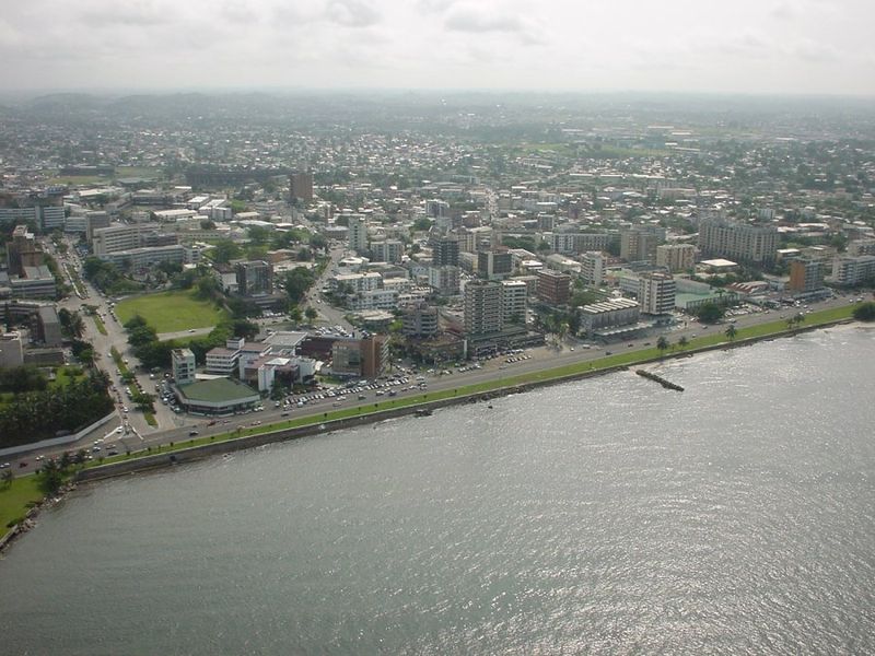 Area: 267,668 km2 (103,347 sq mi)
 Political Map of Gabon
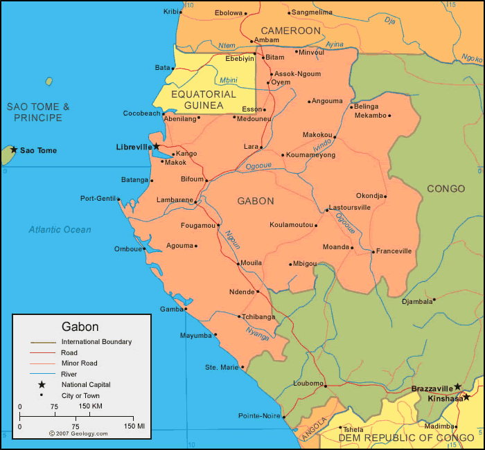
Map of Gabon
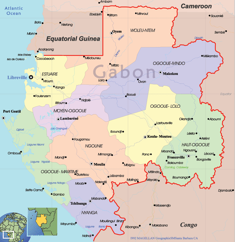 Gabon administrative map showing regions, cities, and borders.
This administrative map of Gabon showcases its provinces, including Estuaire, Ngounié, and Haut-Ogooué, along with major cities like Libreville and Franceville. It also displays neighboring countries like Cameroon and Equatorial Guinea, and the Atlantic coastline.
Cities Map Gabon
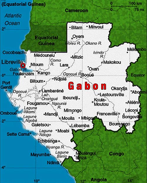 Gabon map showing major cities and regions with Libreville highlighted.
This map displays Gabon’s major cities, including the capital Libreville, and its surrounding regions. Key cities like Port-Gentil and Franceville are shown, highlighting Gabon’s coastal and inland divisions.
Gabon Ethnic Map 1968
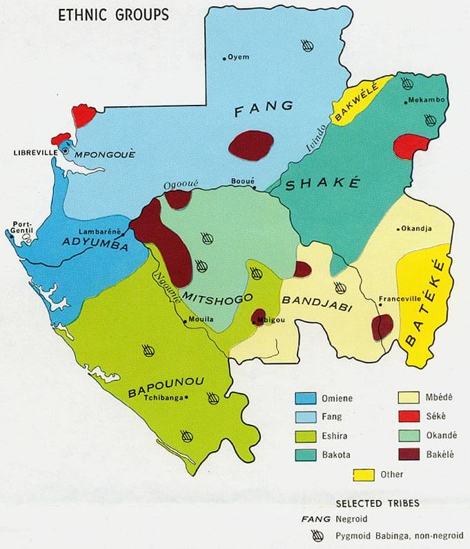 Map of Gabon illustrating the distribution of ethnic groups.
This map highlights the diverse ethnic groups in Gabon, such as the Fang, Bapounou, and Mitsogo, along with smaller communities like the Bakélé and Mbédé. It shows how these groups are distributed across Gabon’s regions, reflecting the country’s cultural diversity.
Map of Gabon Africa
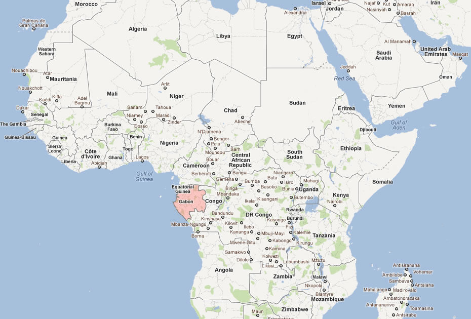
Map of Gabon World
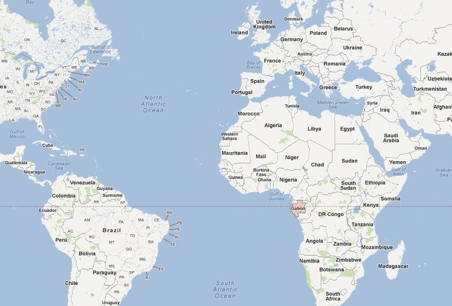
Map Gabon
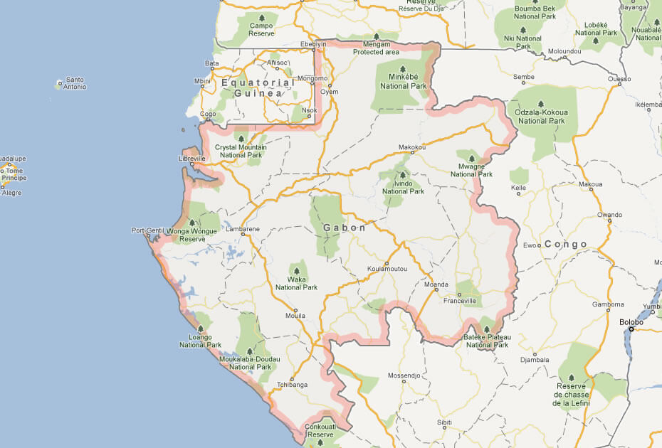
Topographic Map of Gabon
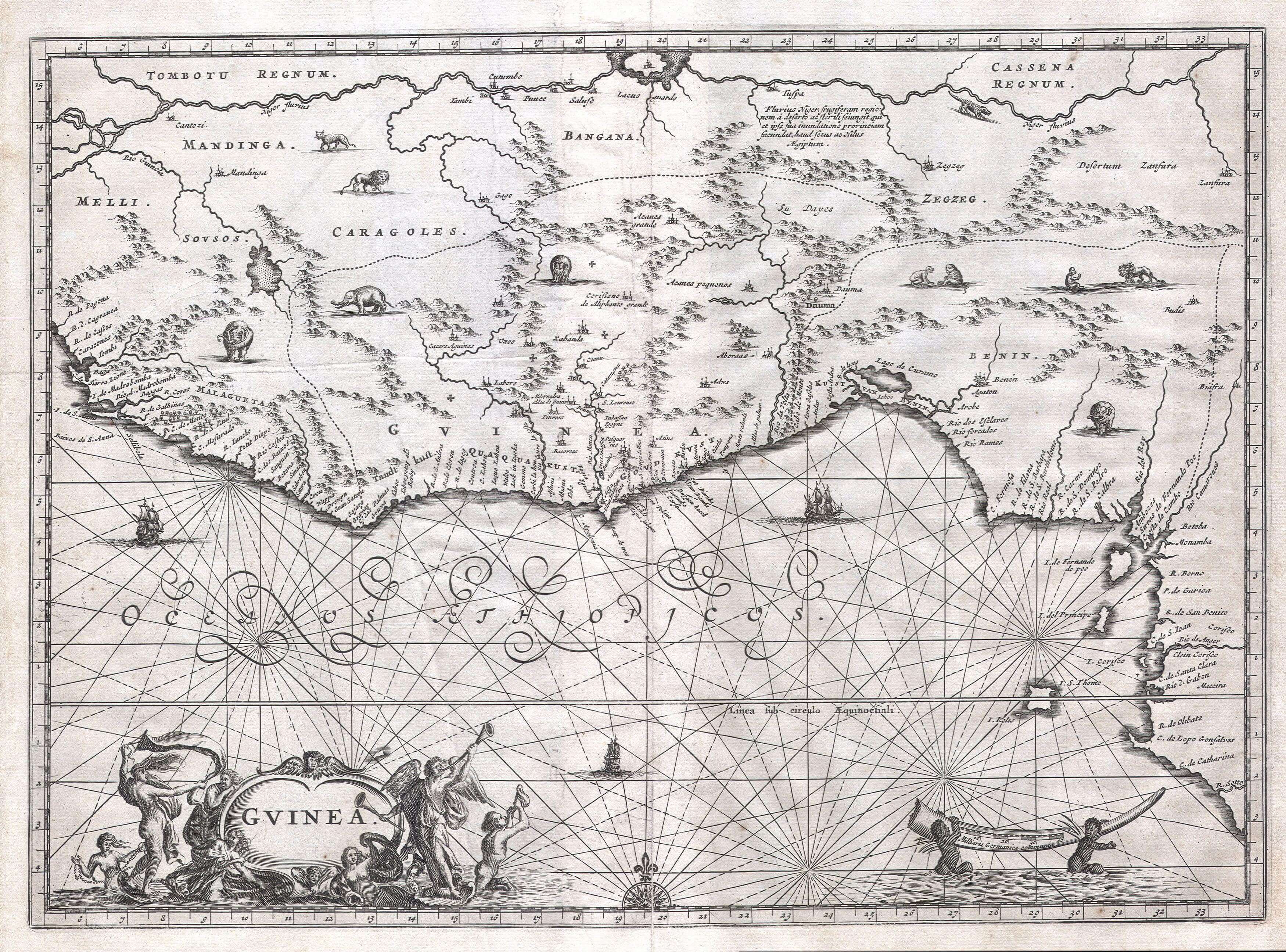
Gabon map of West Africa in 1673
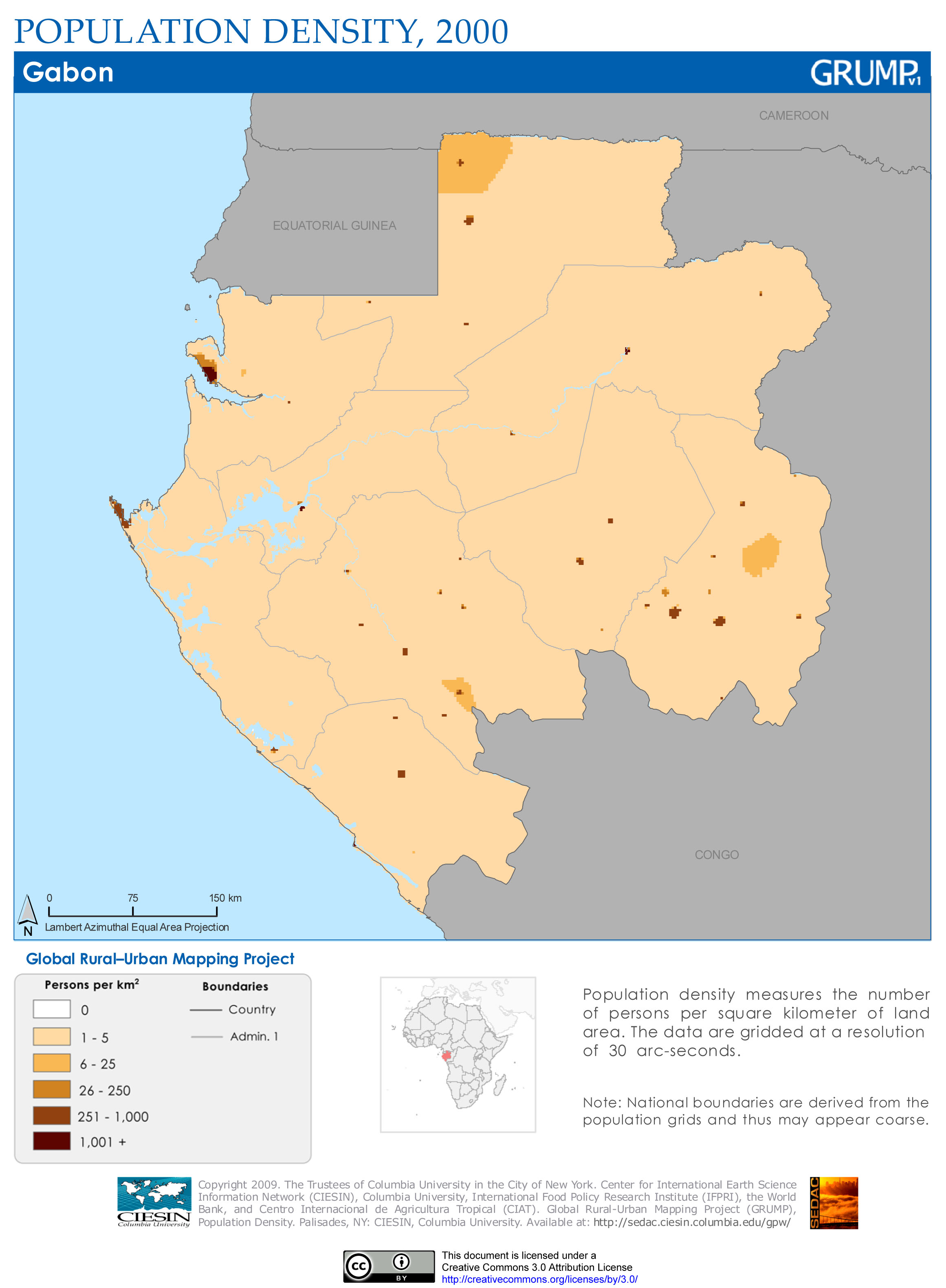
Gabon population map
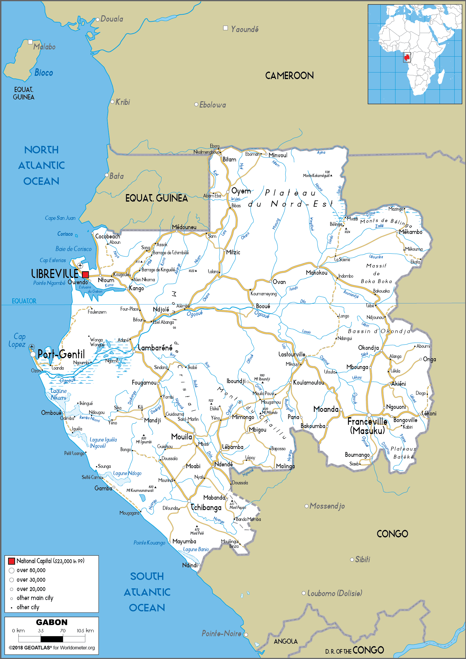
Gabon road map
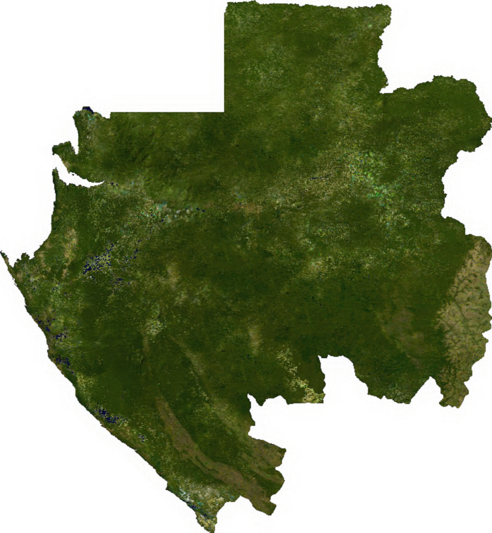
Gabon satellite map
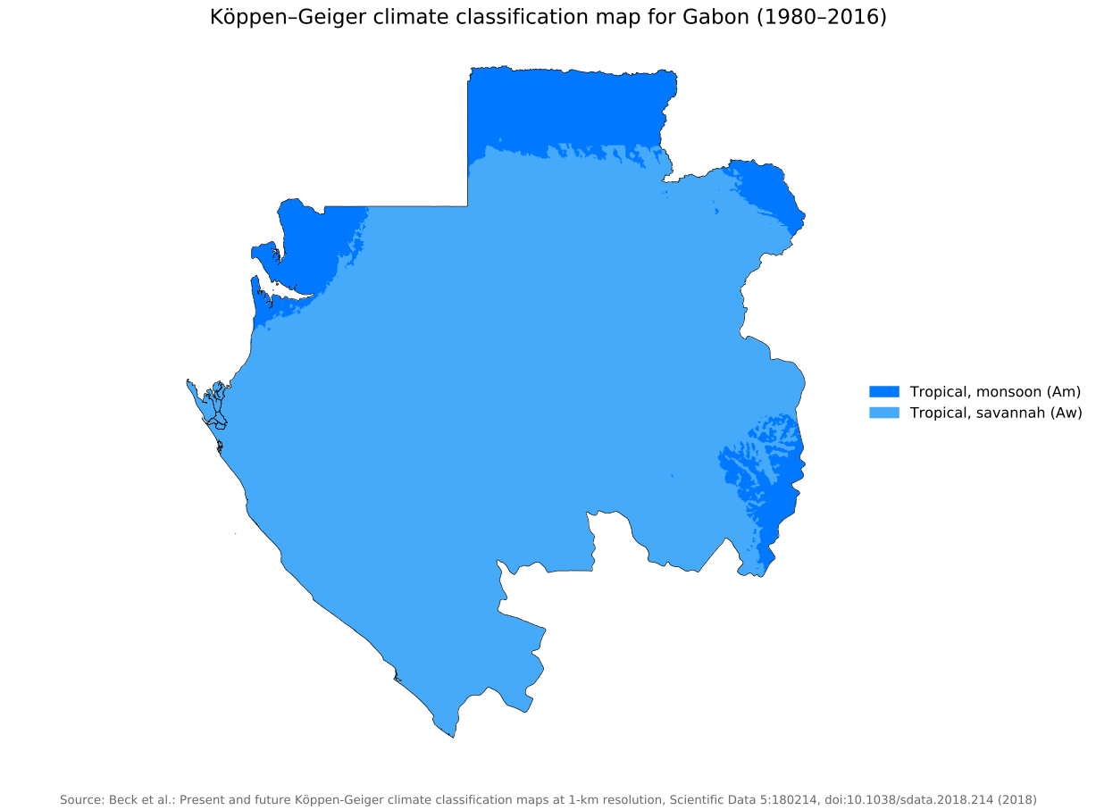
Gabon koppen geiger climate map
Where is Located Gabon on the World and Africa Map?
Show Google Interactive Maps and satellite maps of where the country is located.
Get directions by driving, walking, bicycling, public transportation and travel with street view.
Feel free to explore these pages as well:
- Africa Maps ↗️
- Africa Map ↗️
- Map of Africa ↗️
- Africa Time Zone Map ↗️
- Africa Topographic Map ↗️
- Africa Satellite Map ↗️
- Africa Religion Map ↗️
- Africa Population Map ↗️
- Africa Historical Map ↗️
- Africa Road Map ↗️
- Africa Countries Map ↗️
- Africa Political Map ↗️
- Africa Physical Map ↗️
- South Africa Map ↗️
- Benin Map ↗️
- Botswana Map ↗️
- Burkina Faso Map ↗️
- Burundi Map ↗️
- Cameroon Map ↗️
- Côte d’Ivoire Map ↗️
- Democratic Republic of the Congo Map ↗️
- Ethiopia Map ↗️
- Ghana Map ↗️
- Guinea Map ↗️
- Lesotho Map ↗️
- Madagascar Map ↗️
- Mali Map ↗️
- Mauritius Map ↗️
- Mayotte Map ↗️
- Namibia Map ↗️
