- Advertisement -
Explore historical and thematic maps of Africa, including vintage maps from 1400 to 1939, colonial and pre-colonial Africa, ancient civilizations, African royalty, religious distribution, and health-related data such as HIV/AIDS prevalence.
Antique Map of Africa: A Glimpse into the Continent’s Historical Geography
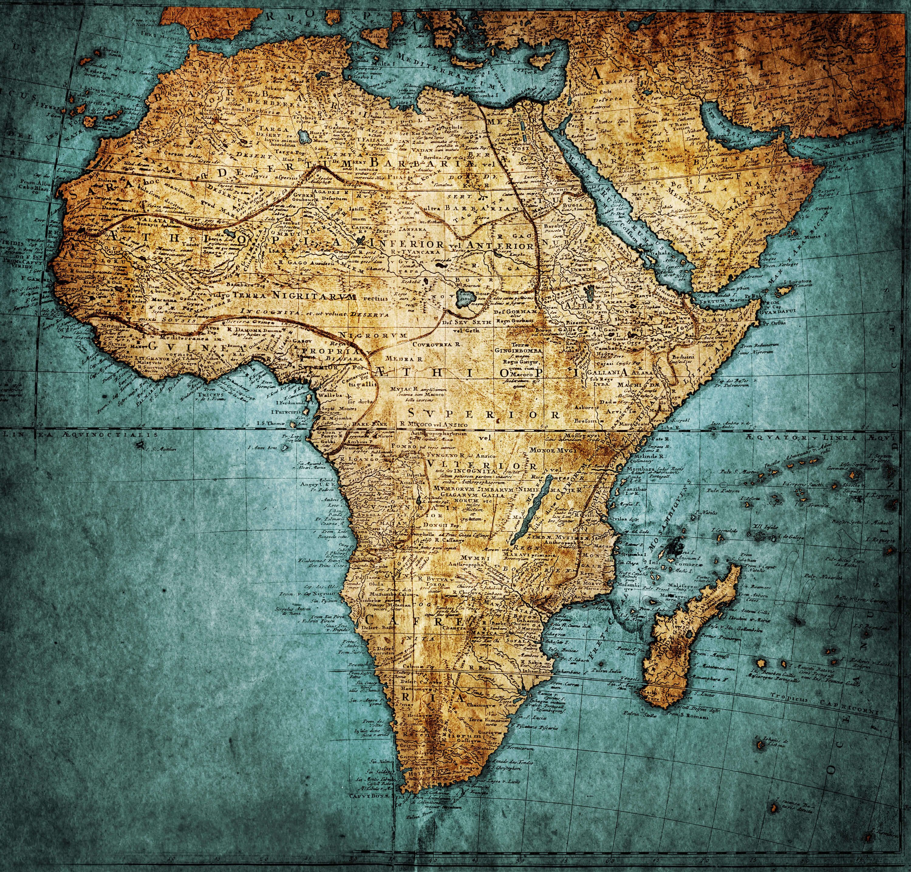
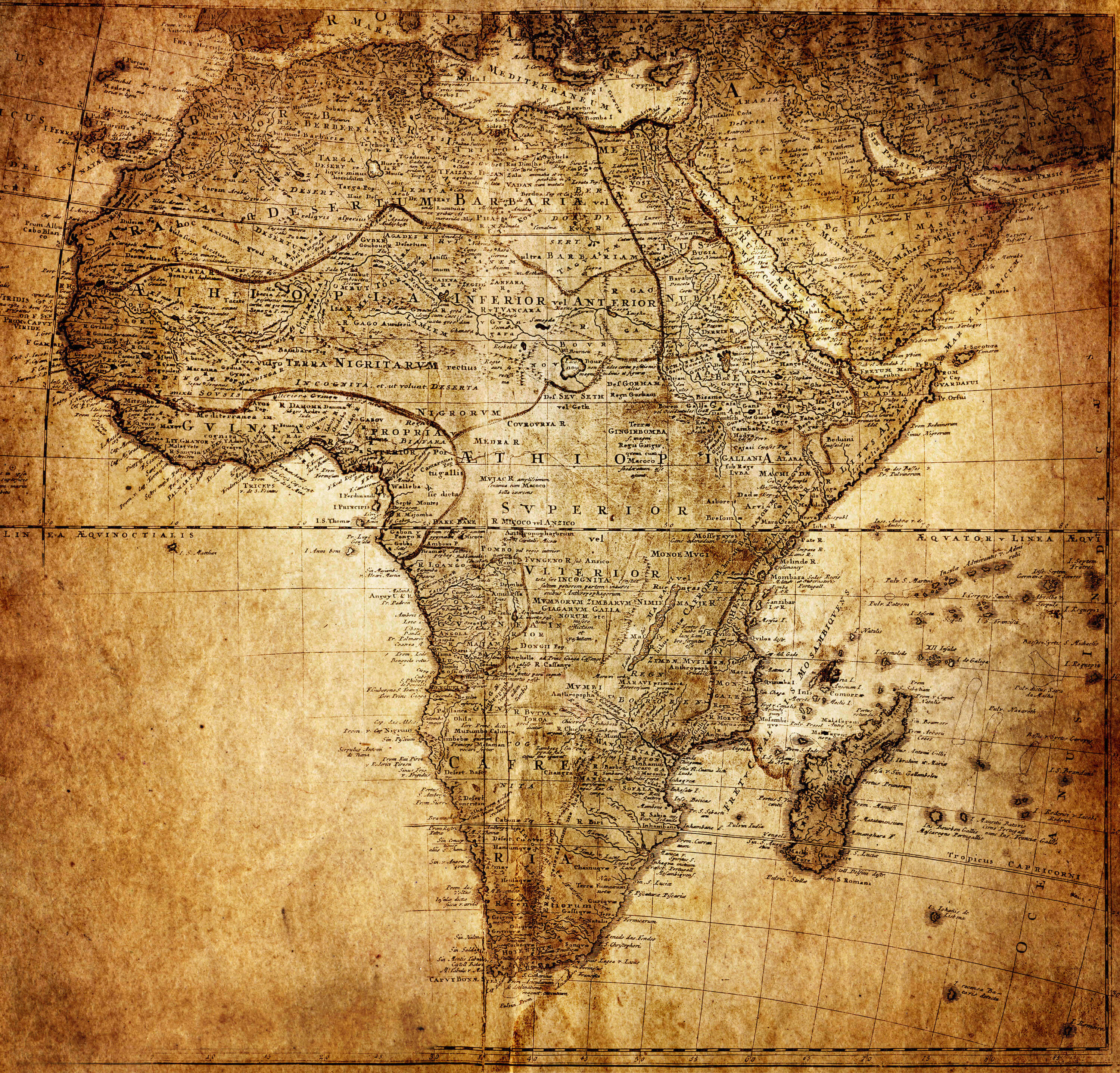 Old historical map of Africa showing ancient territories and trade routes.
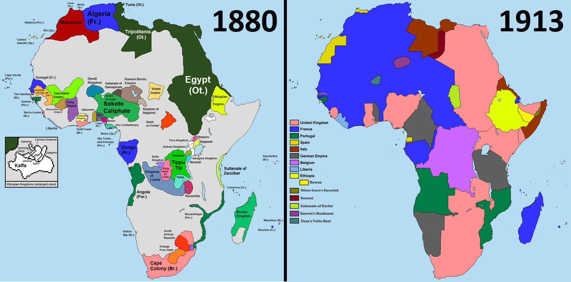
Historical Map of Africa in 1880: Pre-Colonial Boundaries and European Influence
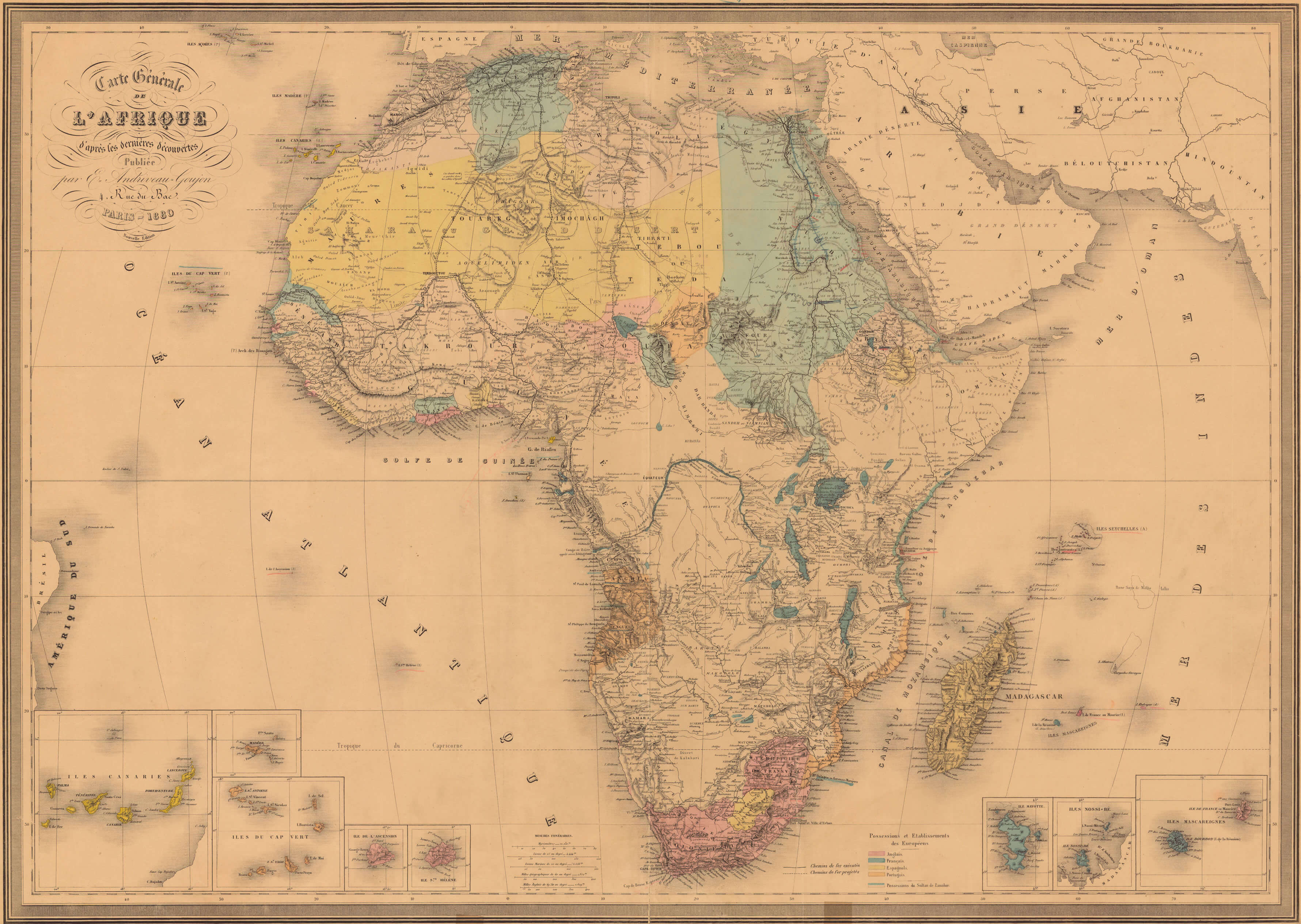 Africa 1880 historical map with pre-colonial regions and European territories.
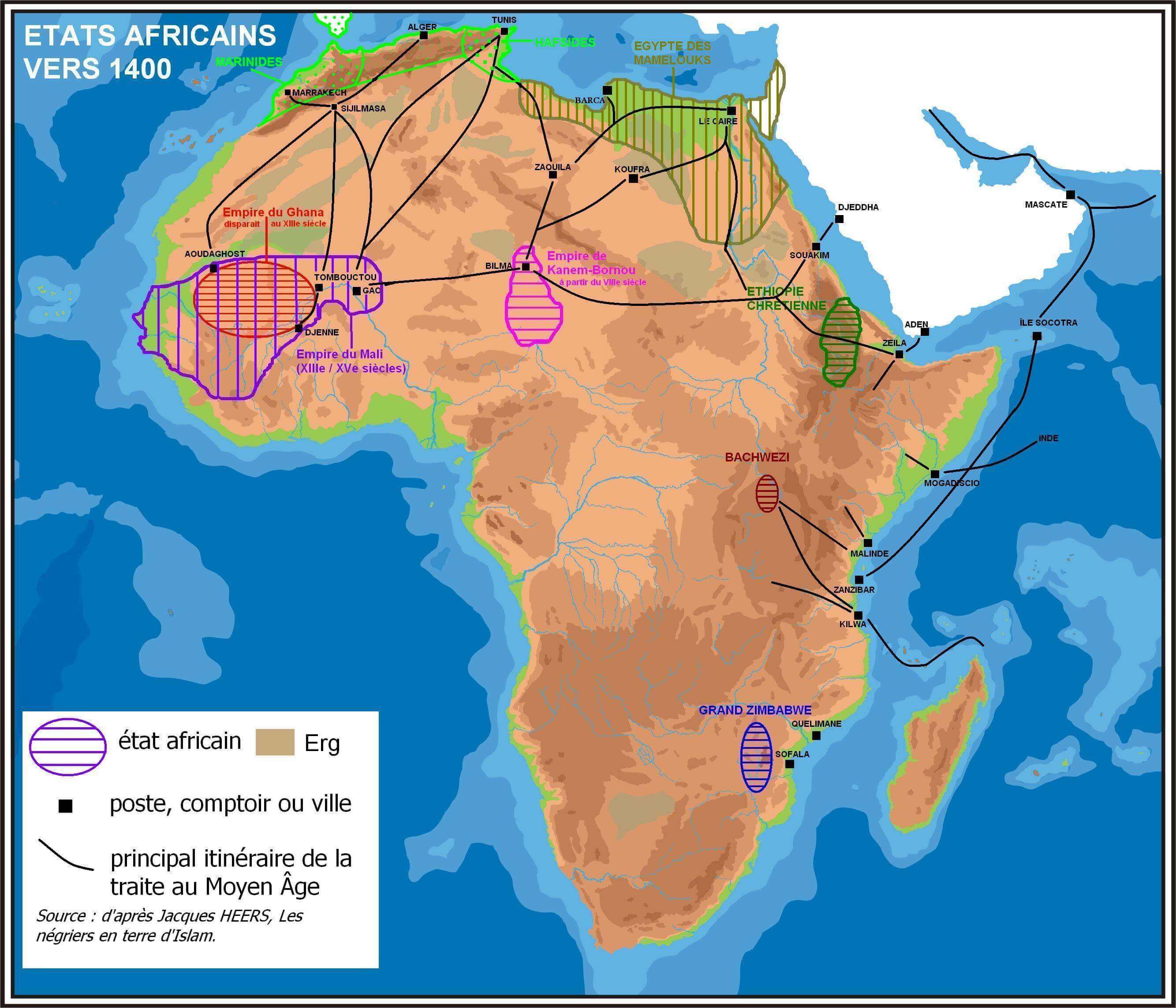
Africa historical map 1400
Africa historical map 1880 1913
African civilizations pre colonial map
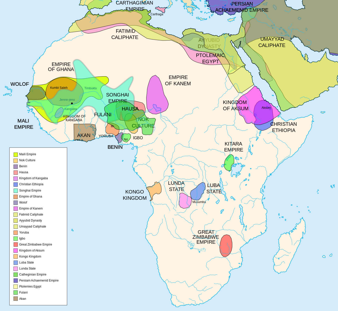
African royals map
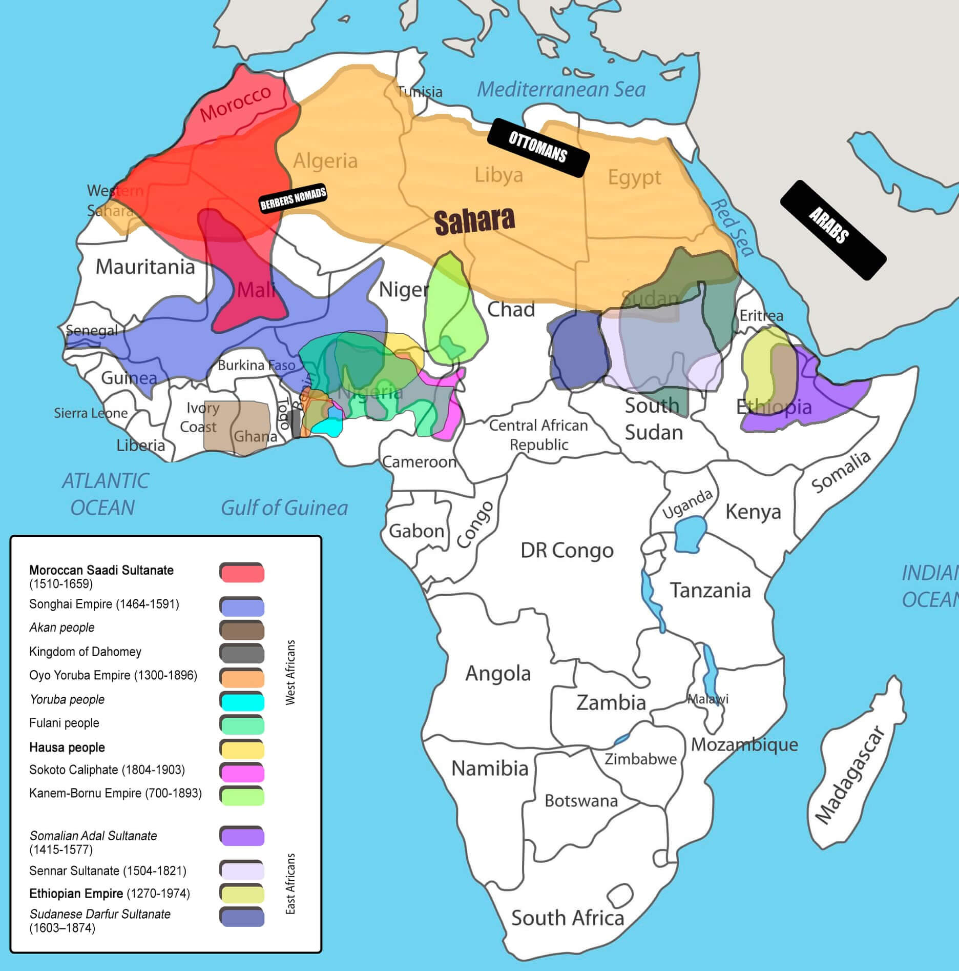
Ancient Carthage in 323 BC North Africa map
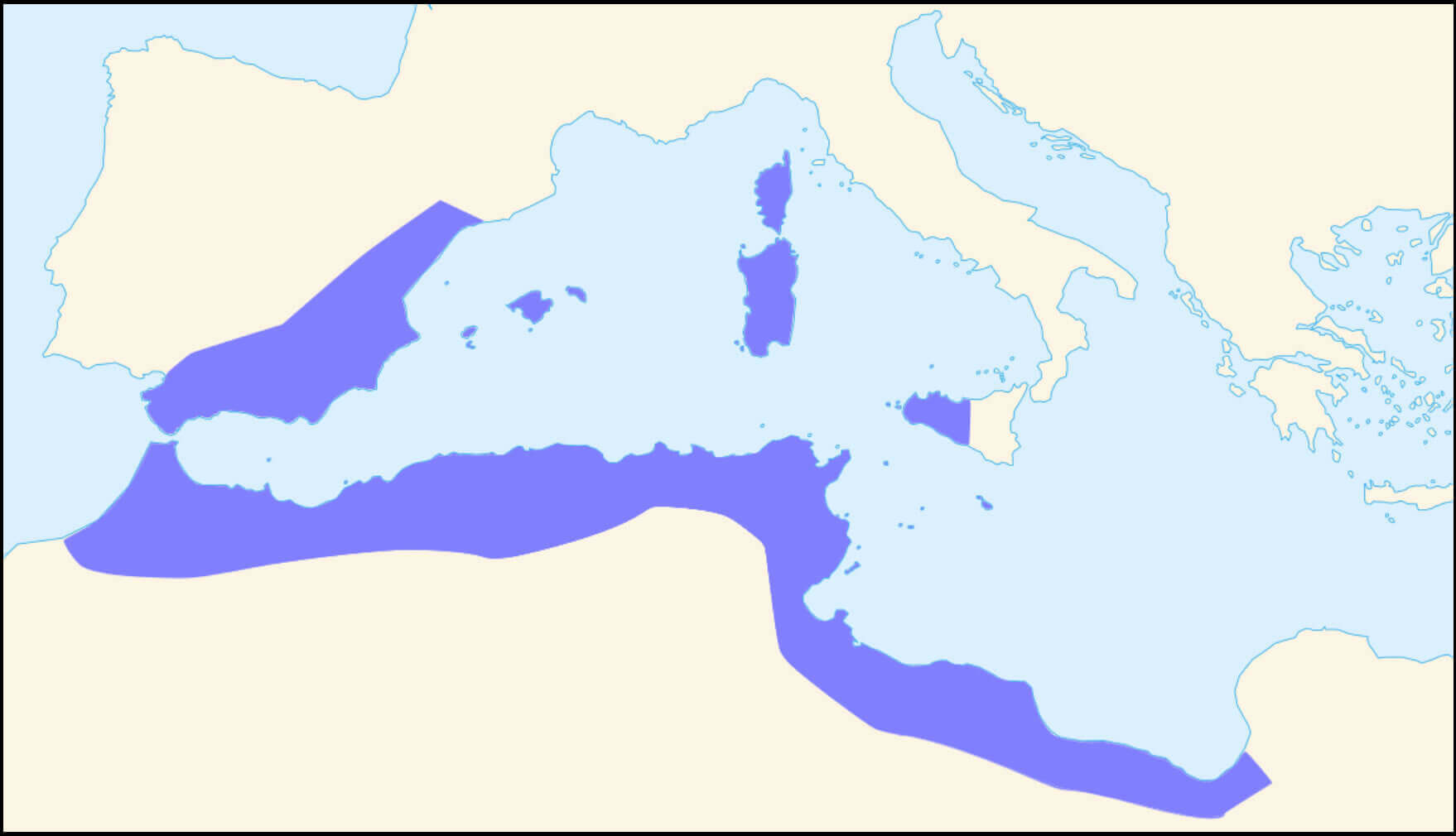
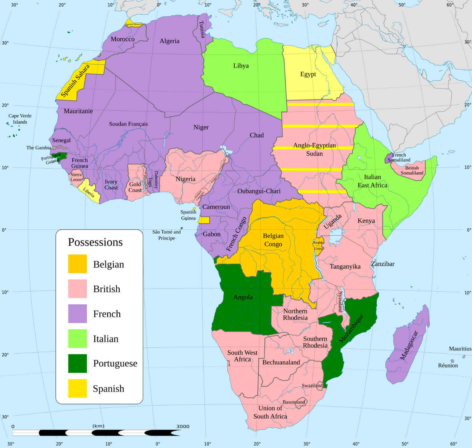
Colonial map of Africa 1913
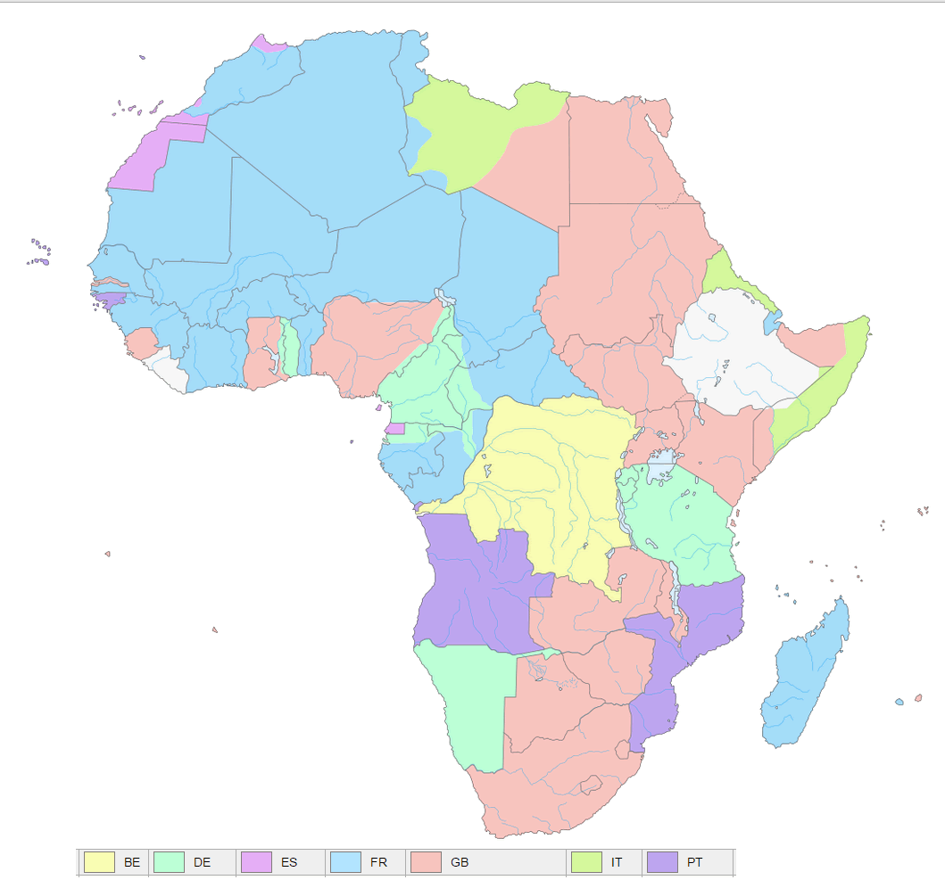
European colonial presence map in Africa 1939
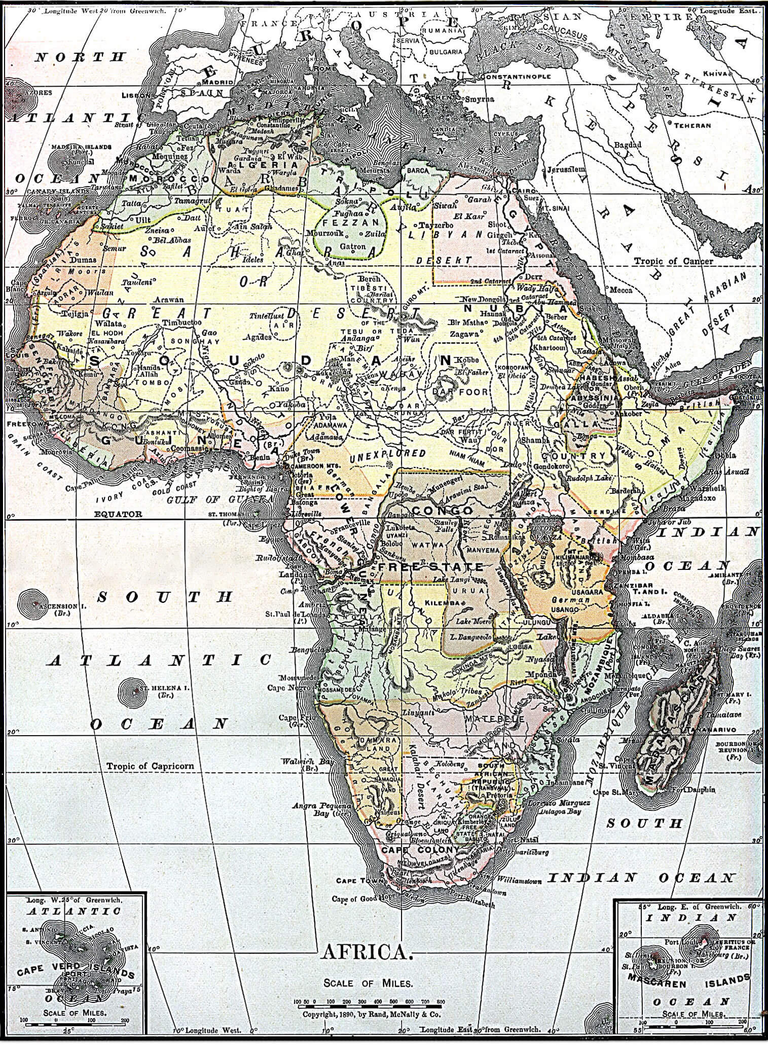
Map of Africa 1890
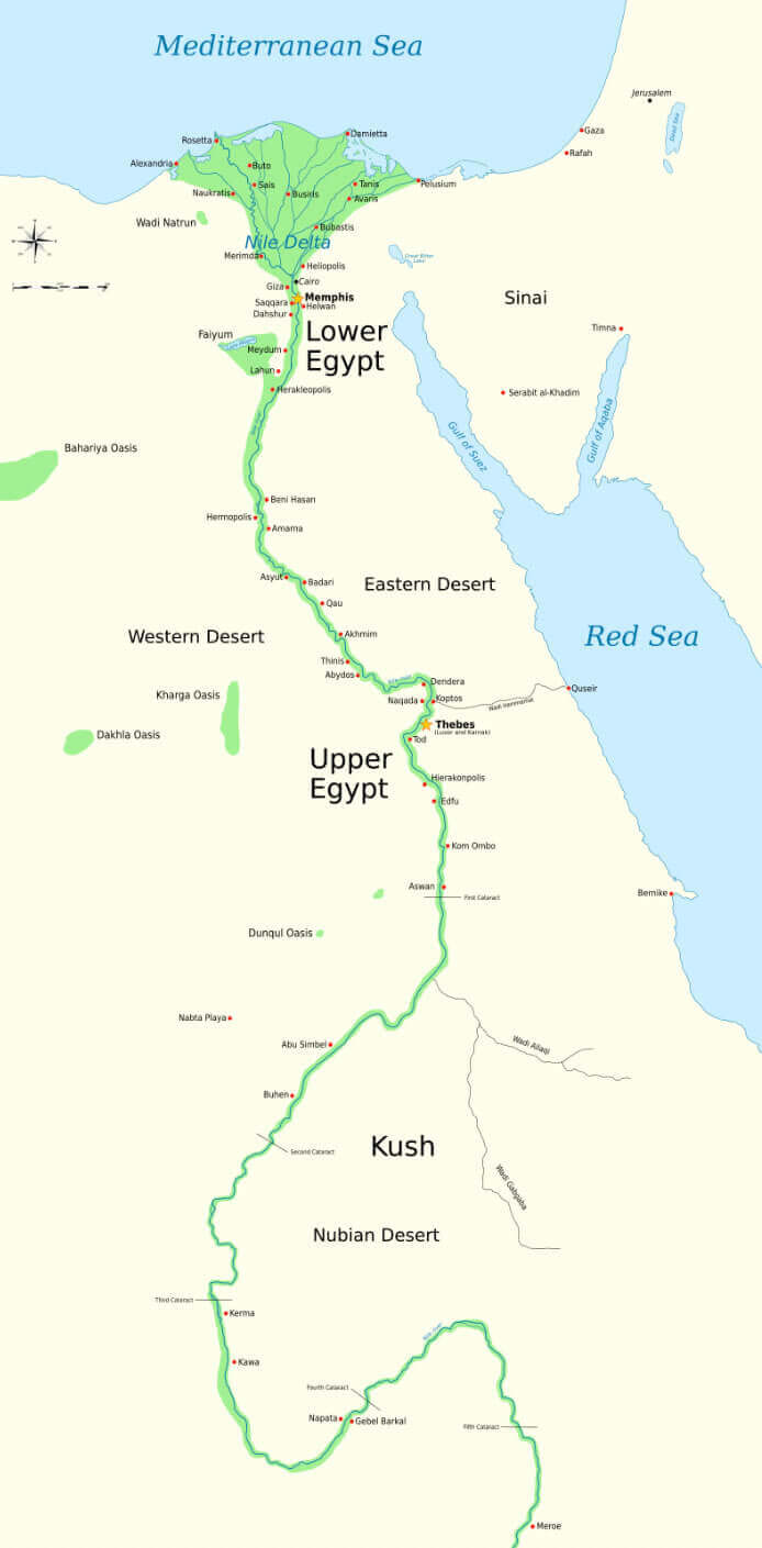
Map of ancient Egypt and Africa
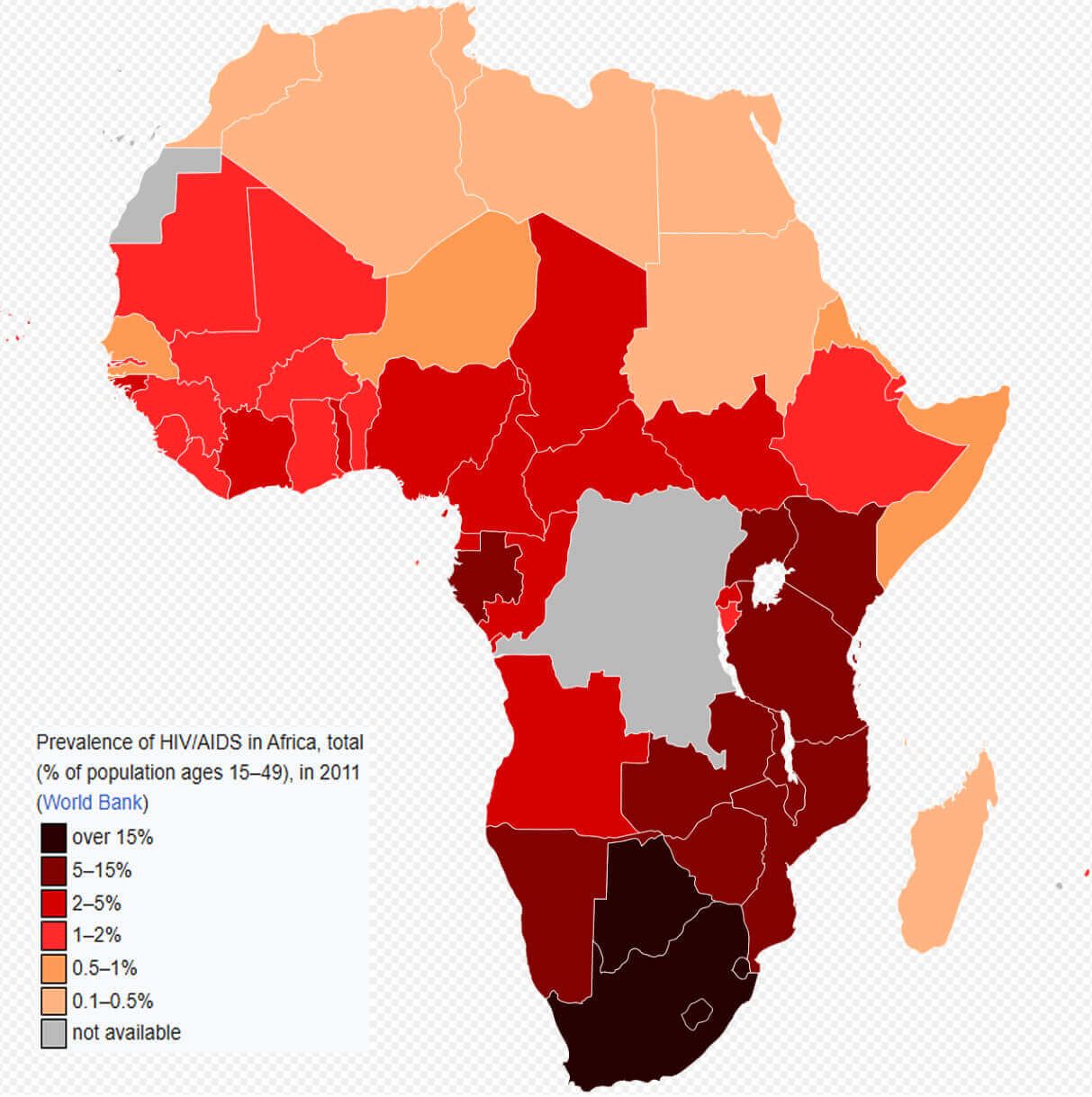
Prevalence of HIV AIDS map in Africa
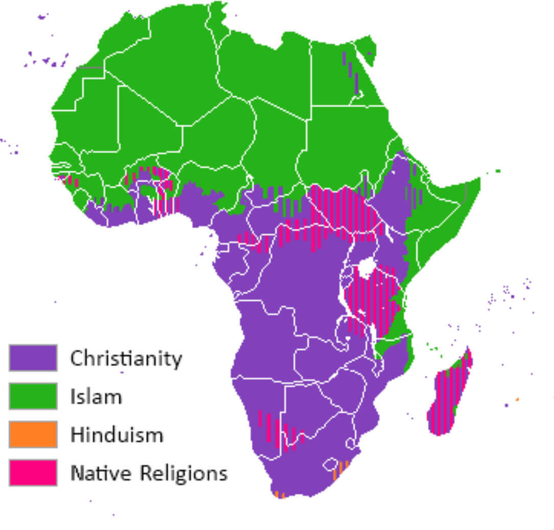
Religious distribution map in Africa
Vintage map of Africa
Where is Africa on the World Map?
Show Google Interactive Maps and satellite maps of where the country is located.
Get directions by driving, walking, bicycling, public transportation and travel with street view.
Feel free to explore these pages as well:
- Africa Map IV ↗️
- Africa Map ↗️
- Africa High-resolution Map ↗️
- Map of Africa ↗️
- Africa Physical Map ↗️
- Africa Political Map ↗️
- Africa Countries Map ↗️
- Africa Population Map ↗️
- Africa Road Map ↗️
- Africa Topographic Map ↗️
- Africa Religion Map ↗️
- Africa Cities Map ↗️
- Africa Time Zone Map ↗️
- Muslim Population Map in Africa by Country ↗️
- A Collection of Algeria Maps: Exploring a North African Gem via Maps ↗️
- Visit Africa ↗️
- Africa Map I ↗️
- Africa Map II ↗️
- Africa Map III ↗️
- Africa Map V ↗️
- Advertisement -
