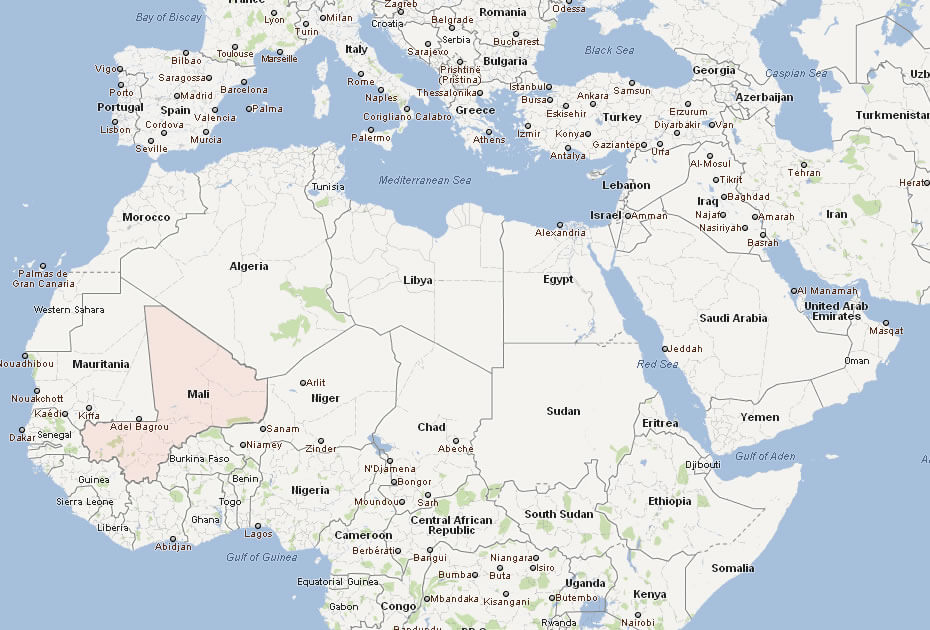
Where is located Mali on the World and Africa Map? Mali is a landlocked country in West Africa, just below the Sahara Desert. It borders Algeria to the north, Niger to the east, Burkina Faso and Côte d’Ivoire to the south, Guinea to the southwest and Senegal and Mauritania to the west. Its central location in West Africa makes it a key part of the region’s cultural and historical narrative.
Mali map
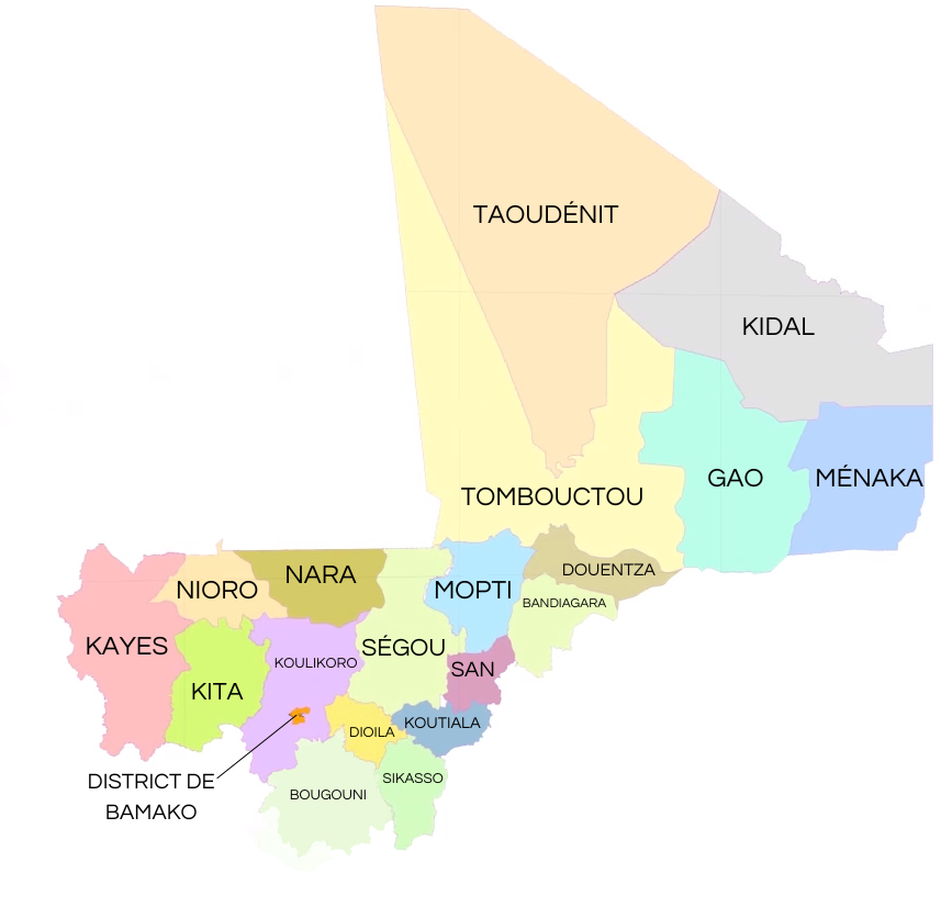
Political Map of Mali
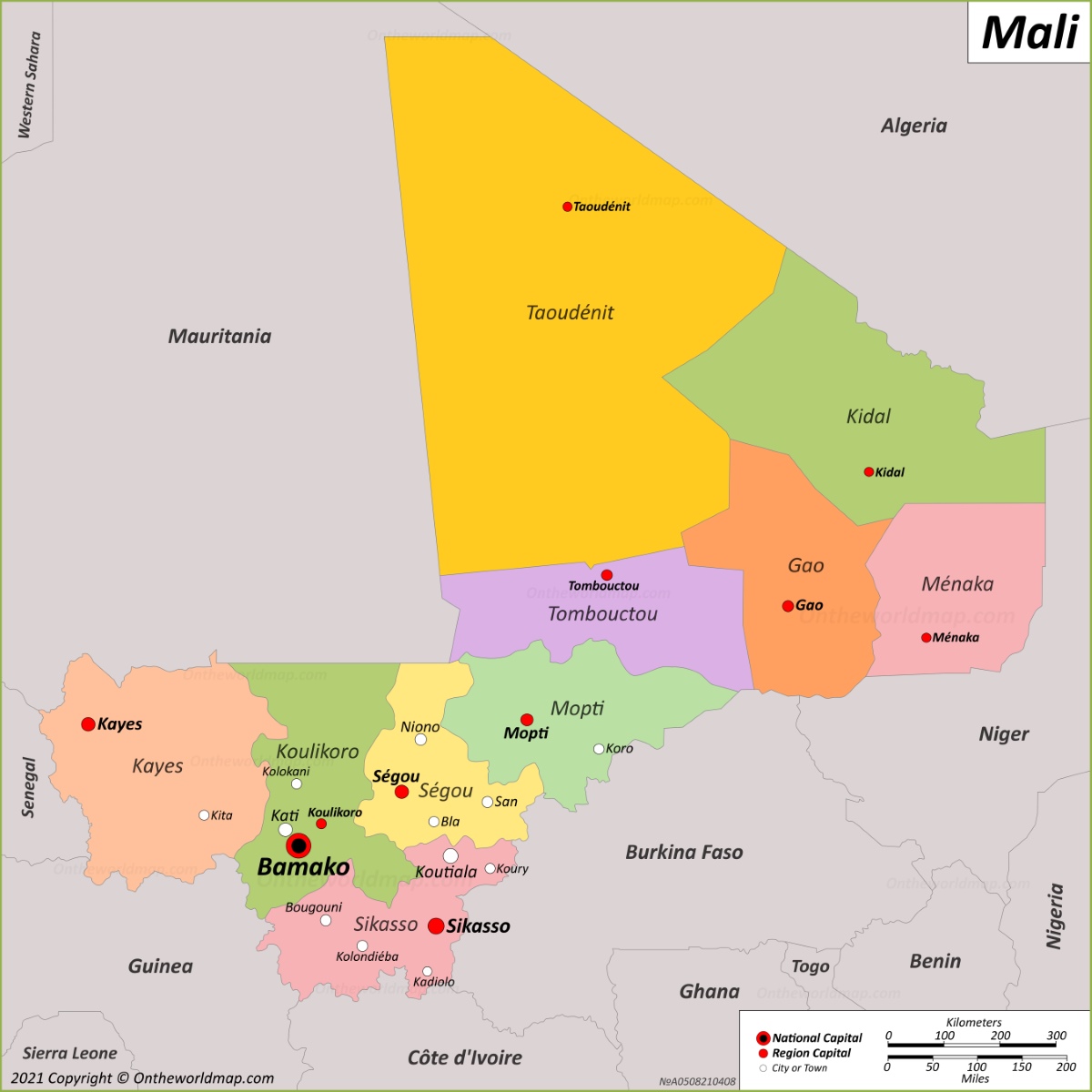
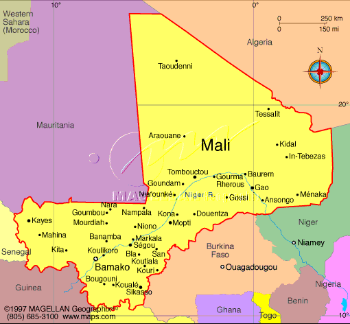 Political map of Mali showing major cities, regions, and neighboring countries.
This map highlights Mali’s political divisions, including regions like Timbuktu and Kidal, and key cities such as Bamako, the capital. It also shows borders with neighboring countries like Algeria, Mauritania, and Niger, emphasizing Mali’s central position in West Africa.
Brief information about Mali
Mali, a landlocked country in West Africa, is renowned for its rich history and cultural heritage. Once home to the powerful Mali Empire, it was a centre of trans-Saharan trade and Islamic learning. The historic city of Timbuktu, a UNESCO World Heritage Site, is a symbol of this heritage, renowned for its ancient manuscripts and its role as a hub of knowledge and trade.
Physical Map Africa Mali
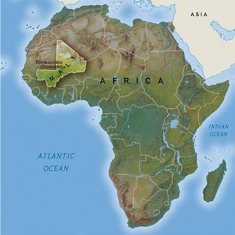
This map shows Mali’s position in West Africa, with its boundaries highlighted on the continent. It emphasizes Mali’s proximity to the Sahara Desert, the Niger River, and its iconic city of Timbuktu, a historical center of trade and culture.
The capital, Bamako, is located on the Niger River and serves as Mali’s political and economic centre. The country’s geography ranges from the arid Sahara desert in the north to fertile agricultural land in the south. While Mali faces challenges such as political instability and desertification, its vibrant music, traditional arts and historical landmarks continue to captivate the world.
Where is located Mali on the World and Africa Map?
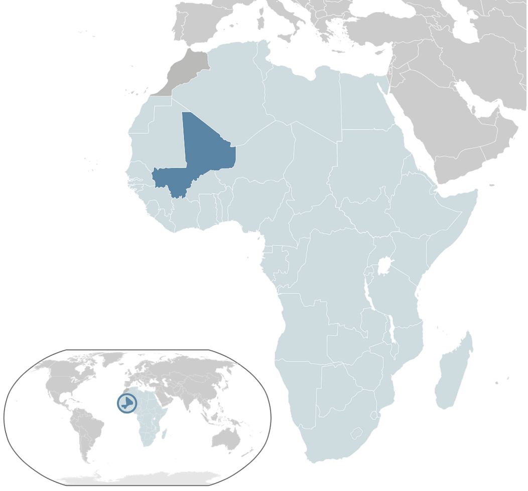 Where is located Mali on the World Map
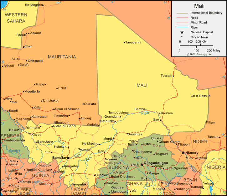
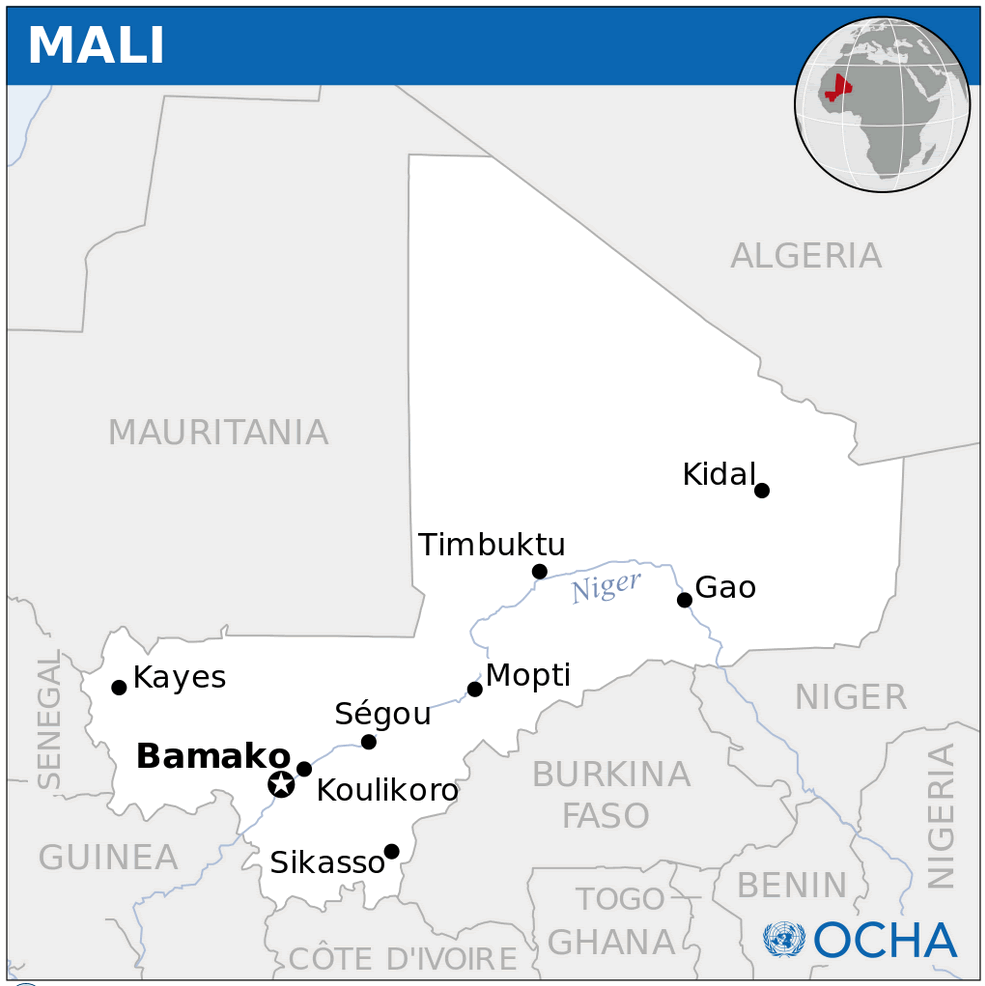
Mali is a landlocked country in West Africa, just below the Sahara Desert. It borders Algeria to the north, Niger to the east, Burkina Faso and Côte d’Ivoire to the south, Guinea to the southwest and Senegal and Mauritania to the west. Its central location in West Africa makes it a key part of the region’s cultural and historical narrative.
Mali Physical Map
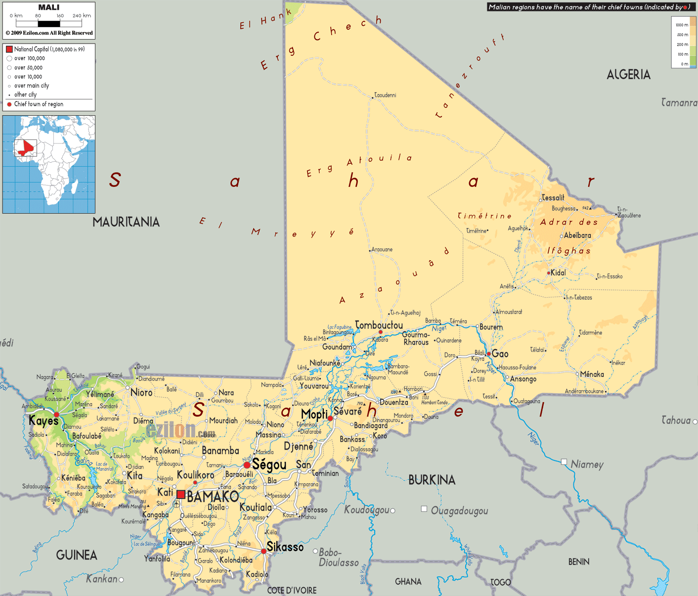
Geographically, Mali is vast, stretching from arid deserts in the north to fertile lands in the south. The Niger River, which flows through Mali, is one of its most important features, providing water for agriculture, transport and daily life. Cities such as Timbuktu and Gao lie near the river and were once vibrant centres of trade and Islamic learning.
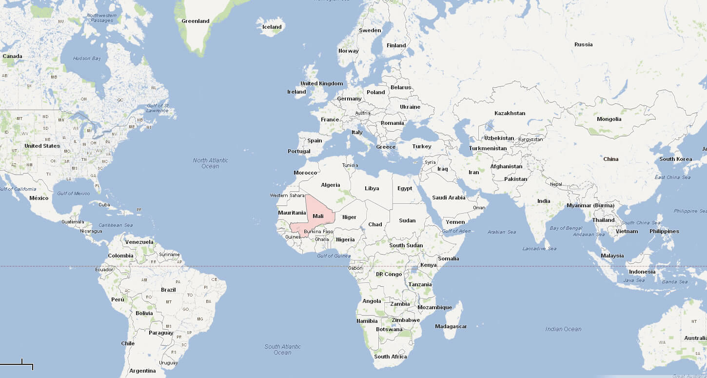
On the world map, Mali’s position highlights its connection to both the desert and tropical regions of Africa. Its mix of northern Saharan landscapes and southern savannas reflects the country’s unique role as a bridge between different ecosystems and cultures.
Here are some statistical information about Mali:

Mali cities map
 Official languages: Bambara, Bobo, Arabic, Bozo, Dogon (Toro So), Fula, Kassonke, Maninke, Minyanka, Senufo (Senara), Songhay (Koyraboro Senni), Soninke, Tamasheq.
 Map of Mali
Mali Location Map
Mali Relief Map
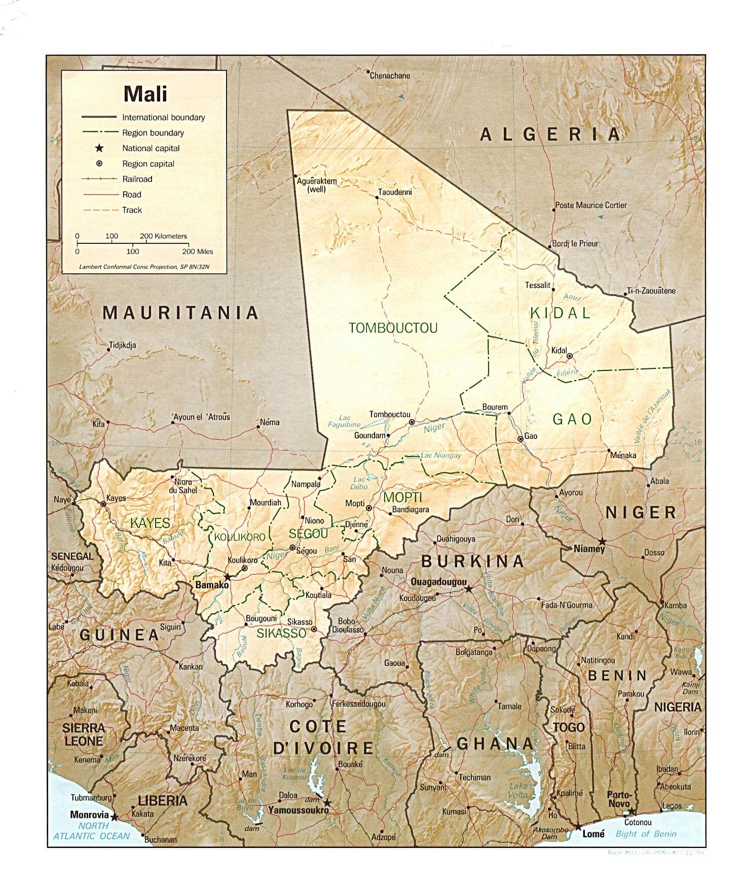
This map provides a detailed look at Mali’s topography, highlighting its regions like Timbuktu and Kidal. It showcases major cities such as Bamako, rivers like the Niger, and international borders with Algeria, Mauritania, and neighboring West African countries.
Mali Regions Map
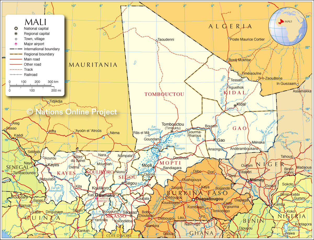 Map of Mali showing regions, major cities, roads, and neighboring countries.
This map highlights Mali’s administrative regions, including Timbuktu, Gao, and Kidal, as well as key cities like Bamako, the capital. It shows major roads, rivers like the Niger, and borders with neighboring countries such as Algeria, Mauritania, and Burkina Faso.
Map of Mali Africa Europe
Map of Mali World
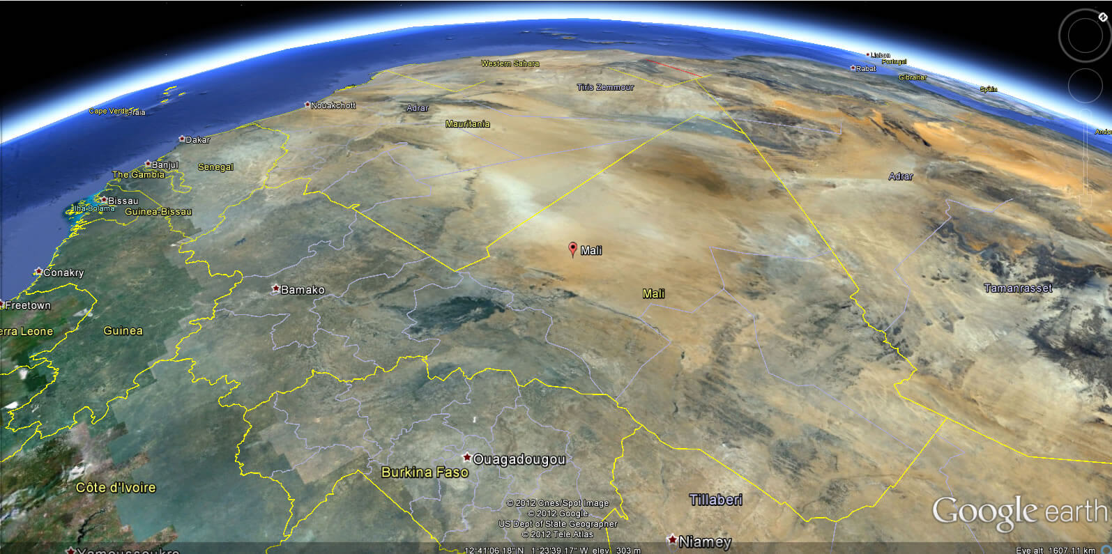
Mali Earth Map
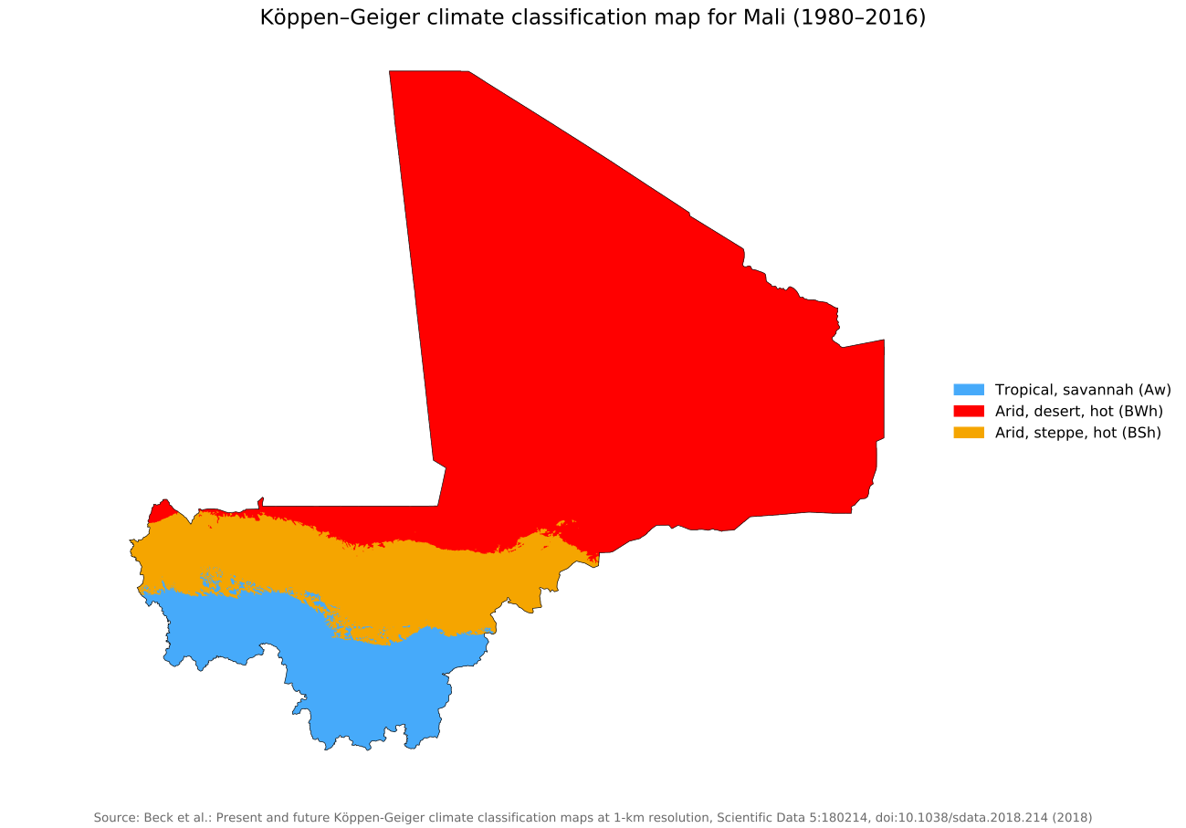
Koppen Mali climate map
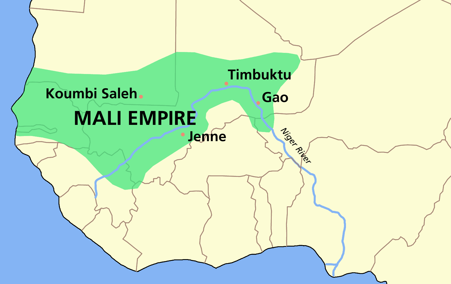
Mali empire map
Mali maps
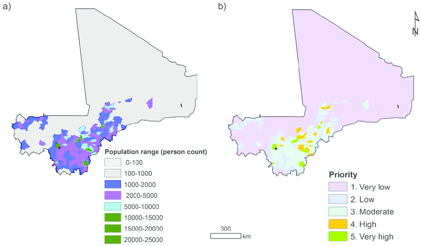
Mali population map
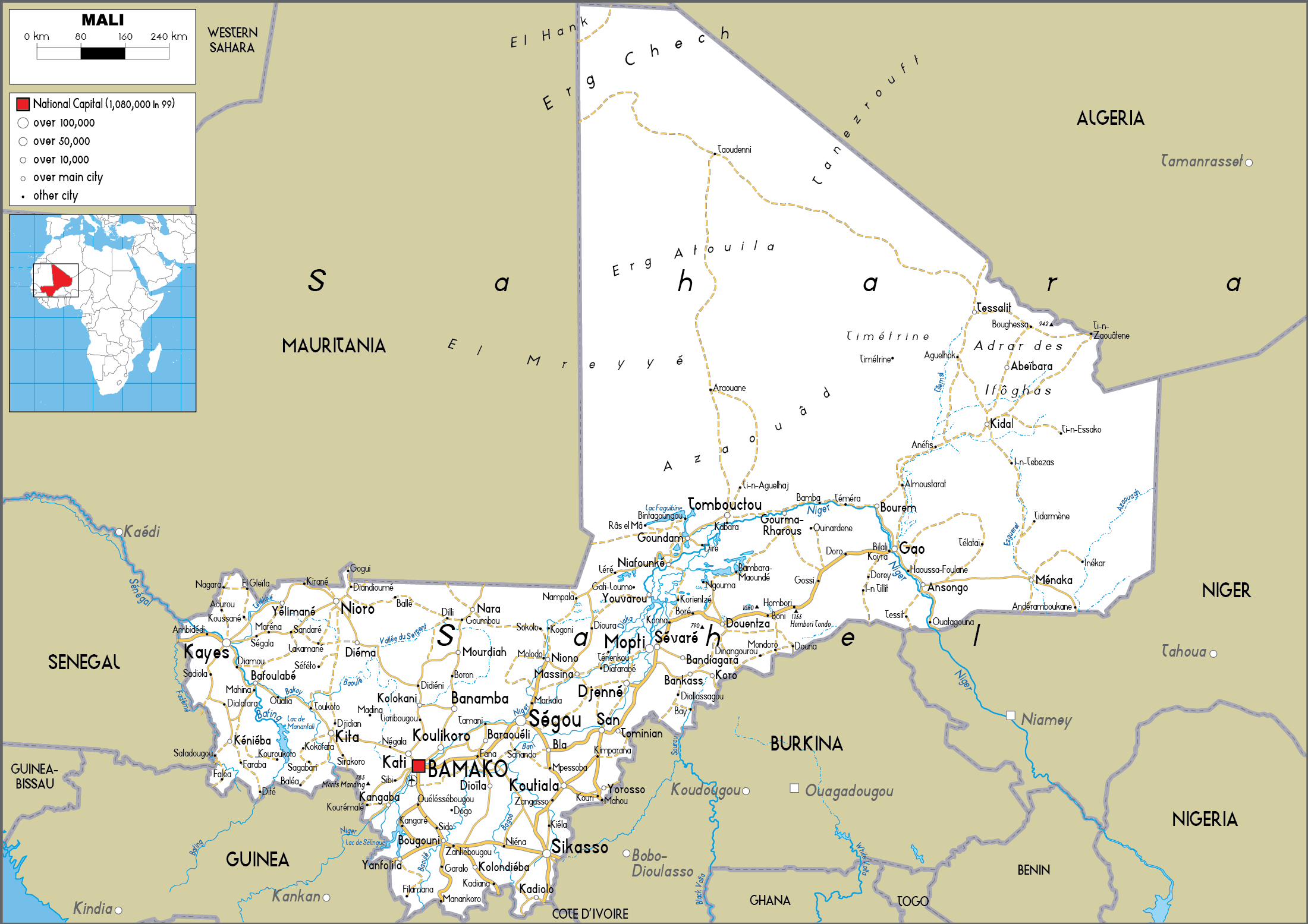
Mali road map
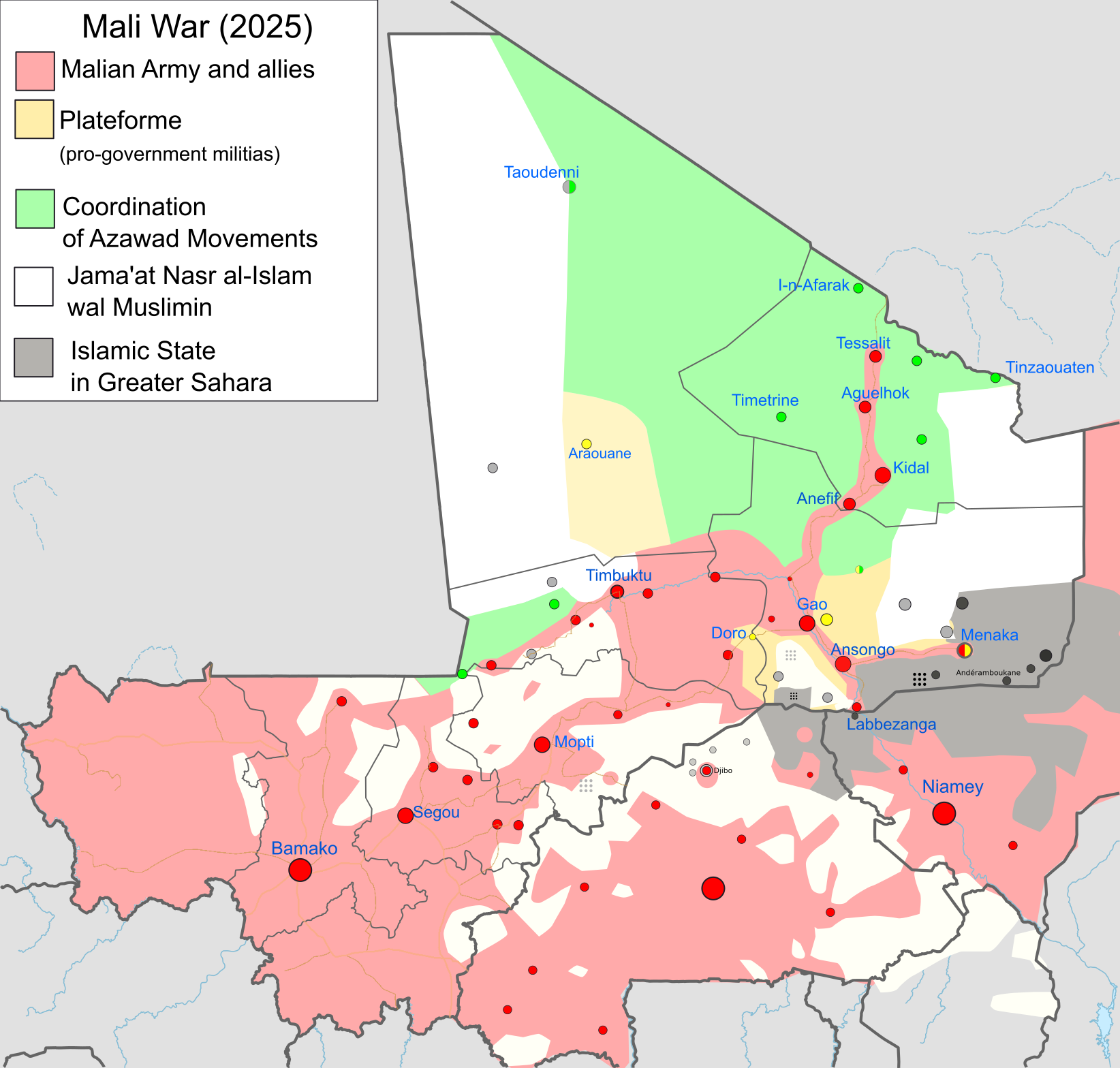
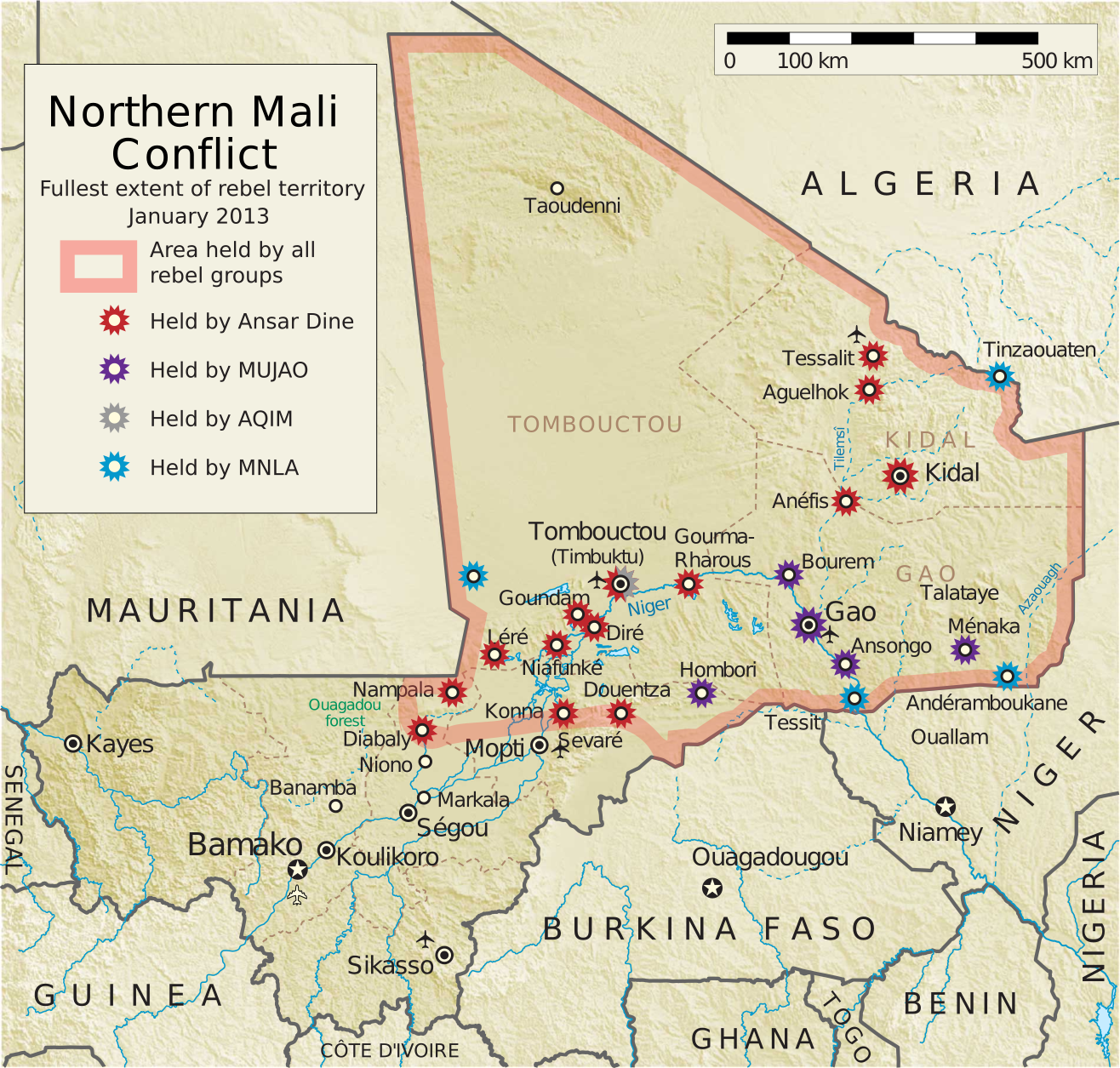
Northern Mali conflict
Where is Located Mali on the World and Africa Map?
Show Google Interactive Maps and satellite maps of where the country is located.
Get directions by driving, walking, bicycling, public transportation and travel with street view.
Feel free to explore these pages as well:
- Africa Maps ↗️
- Africa Map ↗️
- Map of Africa ↗️
- Africa Time Zone Map ↗️
- Africa Topographic Map ↗️
- Africa Satellite Map ↗️
- Africa Religion Map ↗️
- Africa Population Map ↗️
- Africa Historical Map ↗️
- Africa Road Map ↗️
- Africa Countries Map ↗️
- Africa Political Map ↗️
- Africa Physical Map ↗️
- South Africa Map ↗️
- Benin Map ↗️
- Botswana Map ↗️
- Burkina Faso Map ↗️
- Burundi Map ↗️
- Cameroon Map ↗️
- Côte d’Ivoire Map ↗️
- Democratic Republic of the Congo Map ↗️
- Ethiopia Map ↗️
- Gabon Map ↗️
- Ghana Map ↗️
- Guinea Map ↗️
- Lesotho Map ↗️
- Madagascar Map ↗️
- Mauritius Map ↗️
- Mayotte Map ↗️
- Namibia Map ↗️
