World Population Map

HomeMapsWorld Population Map
- Advertisement -

World population maps & data: distribution and density, growth 1901–2021, fertility, life expectancy, urbanization, Africa 2010–2050, Europe 2023, and more.

World Population Map: Global Density Hotspots
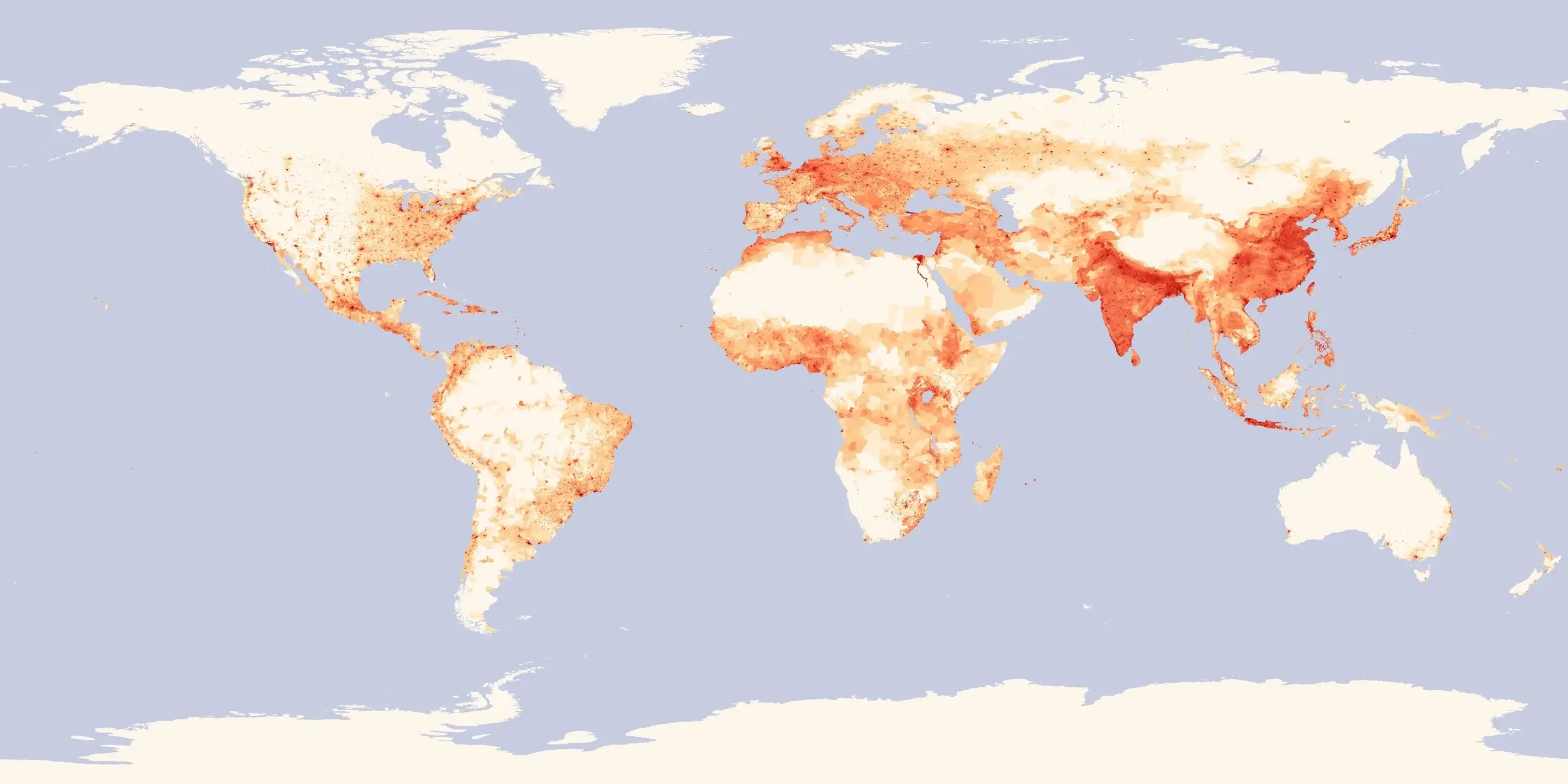
World Population map
World population density map showing global hotspots and sparse regions.

See how people are distributed around the world. Darker shades of red mark densely populated areas, such as South Asia, eastern China, Java, and Western Europe, while pale zones indicate sparsely populated regions, including the Sahara, Siberia, Australia, and the Amazon. This is a clear global view of population distribution.

World Countries Population Density Map – Global Distribution
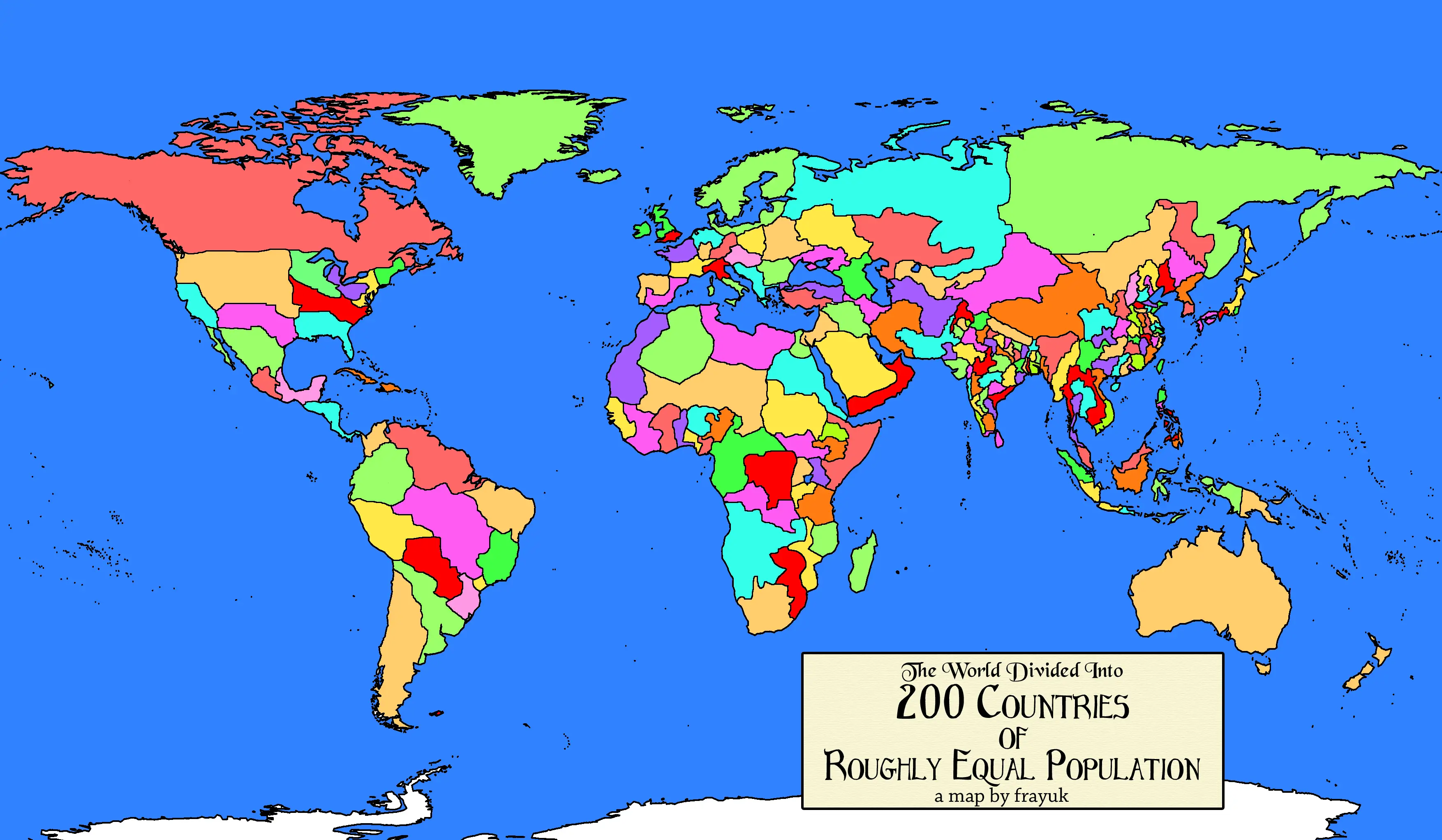
World countries Population density map
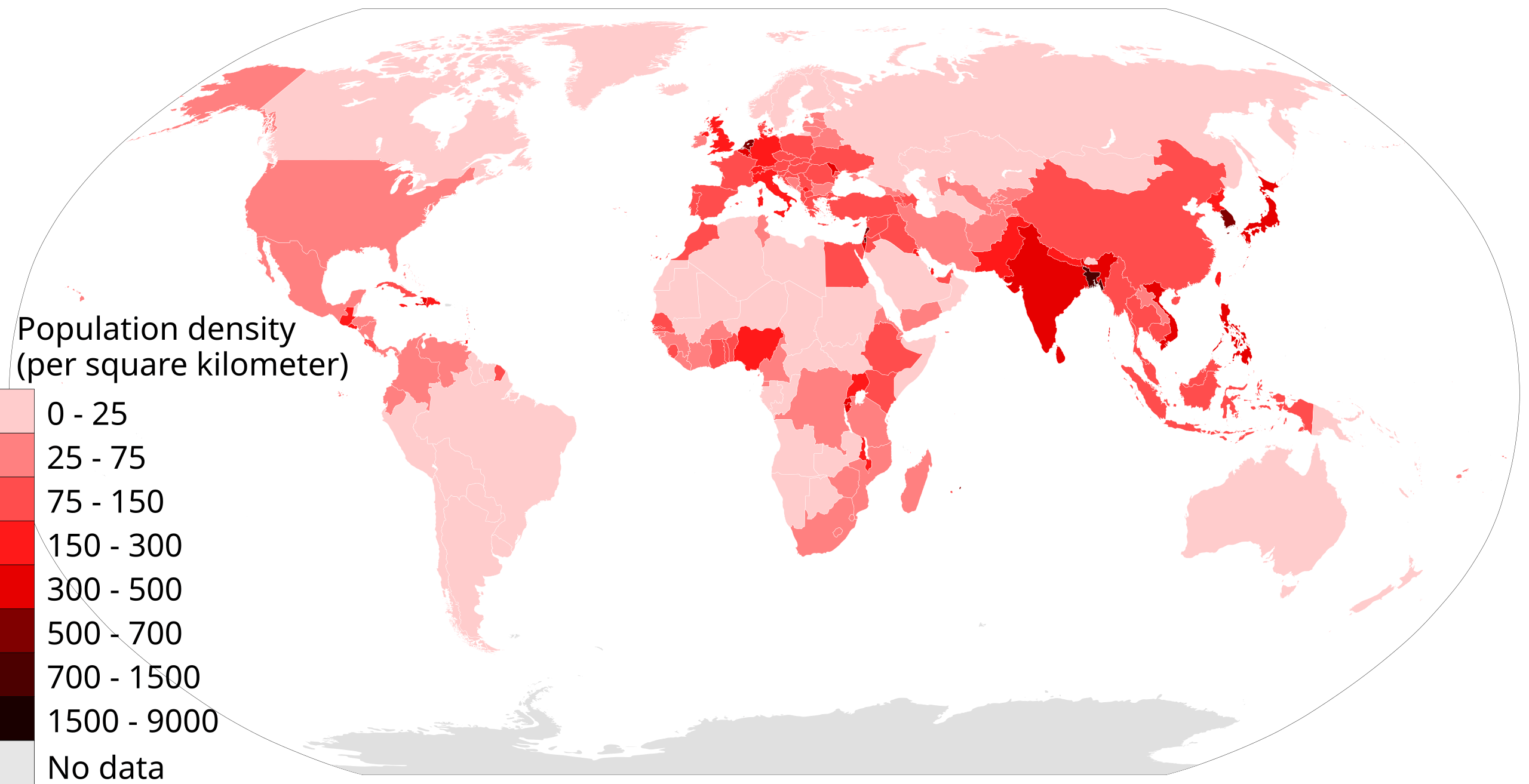
World map by country showing population density patterns worldwide.

A global map comparing population density by country. It highlights very dense regions in South and East Asia, Western Europe, and parts of Africa and the Americas, while showing sparsely populated areas like the Sahara, Siberia, Australia, and the Amazon. Ideal for demographics and geography study.

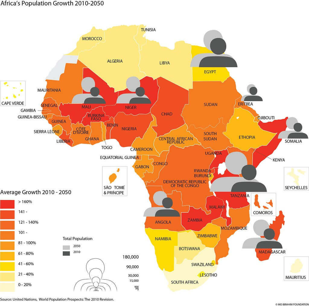
Africa Population growth map 2010 2050

Africa Population growth map 2010 2050

Distribution map of the World Population
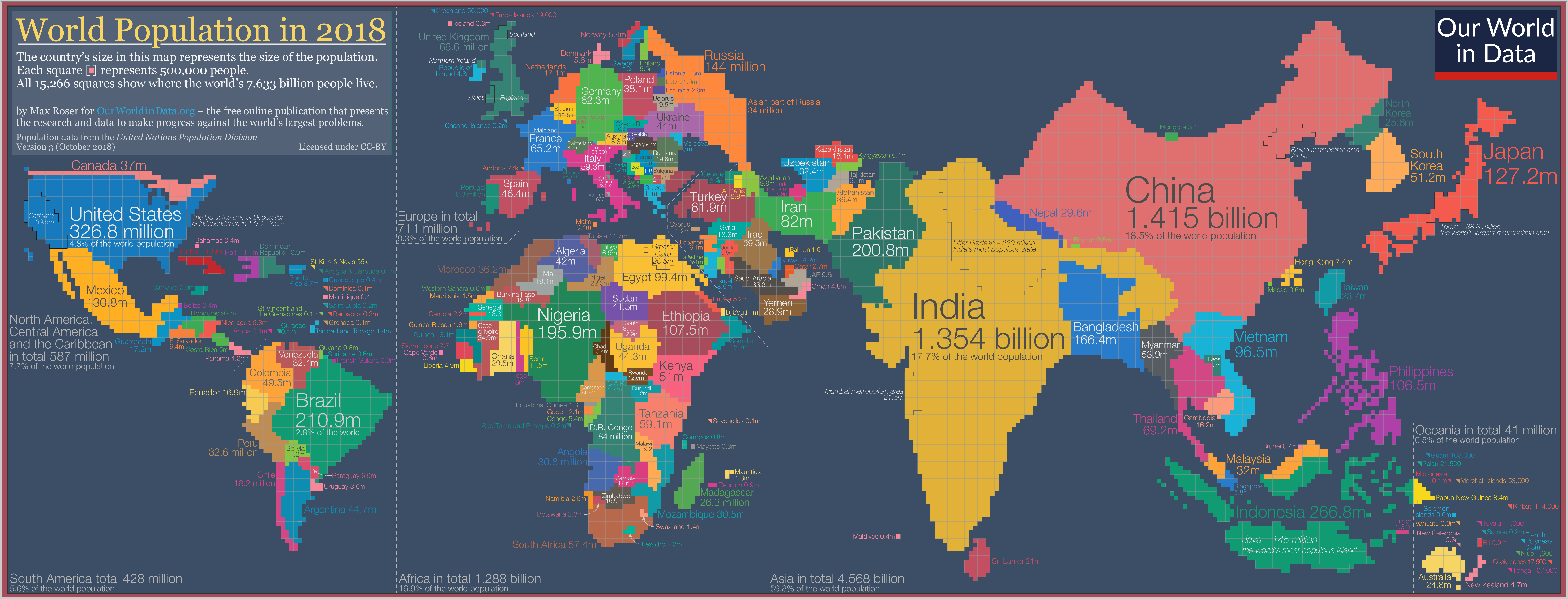
Distribution map of the World Population

European countries by Population map in 2023
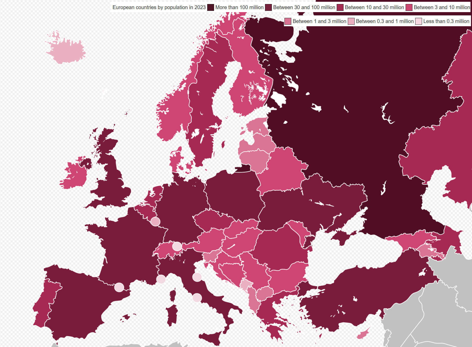
European countries by Population map in 2023

European countries muslim Population map in 2020
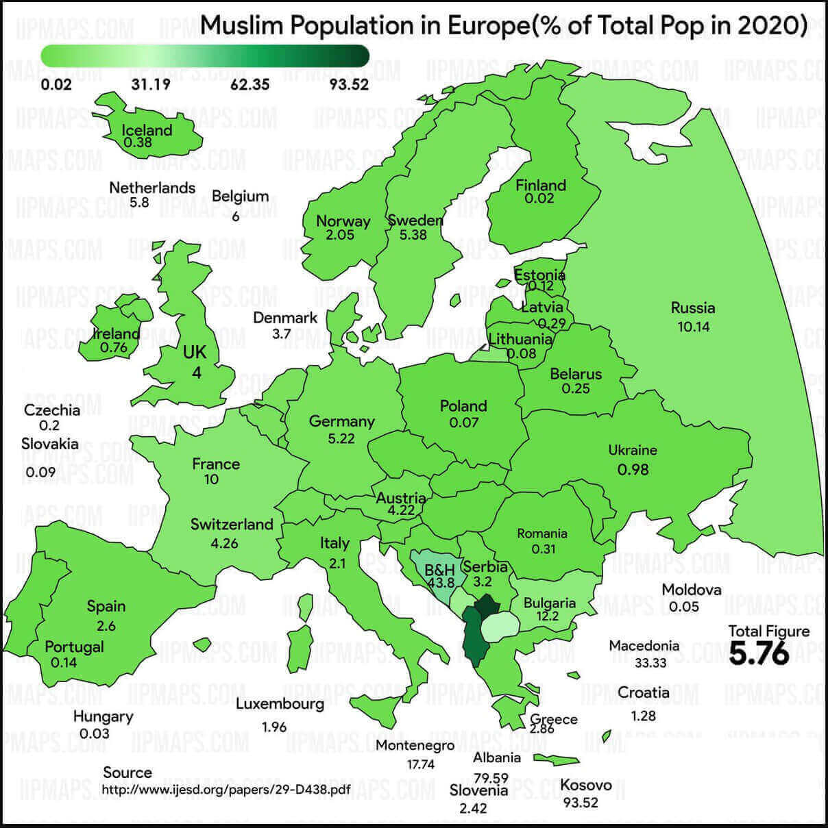
European countries muslim Population map in 2020

Map of the World by fertility rate in 202
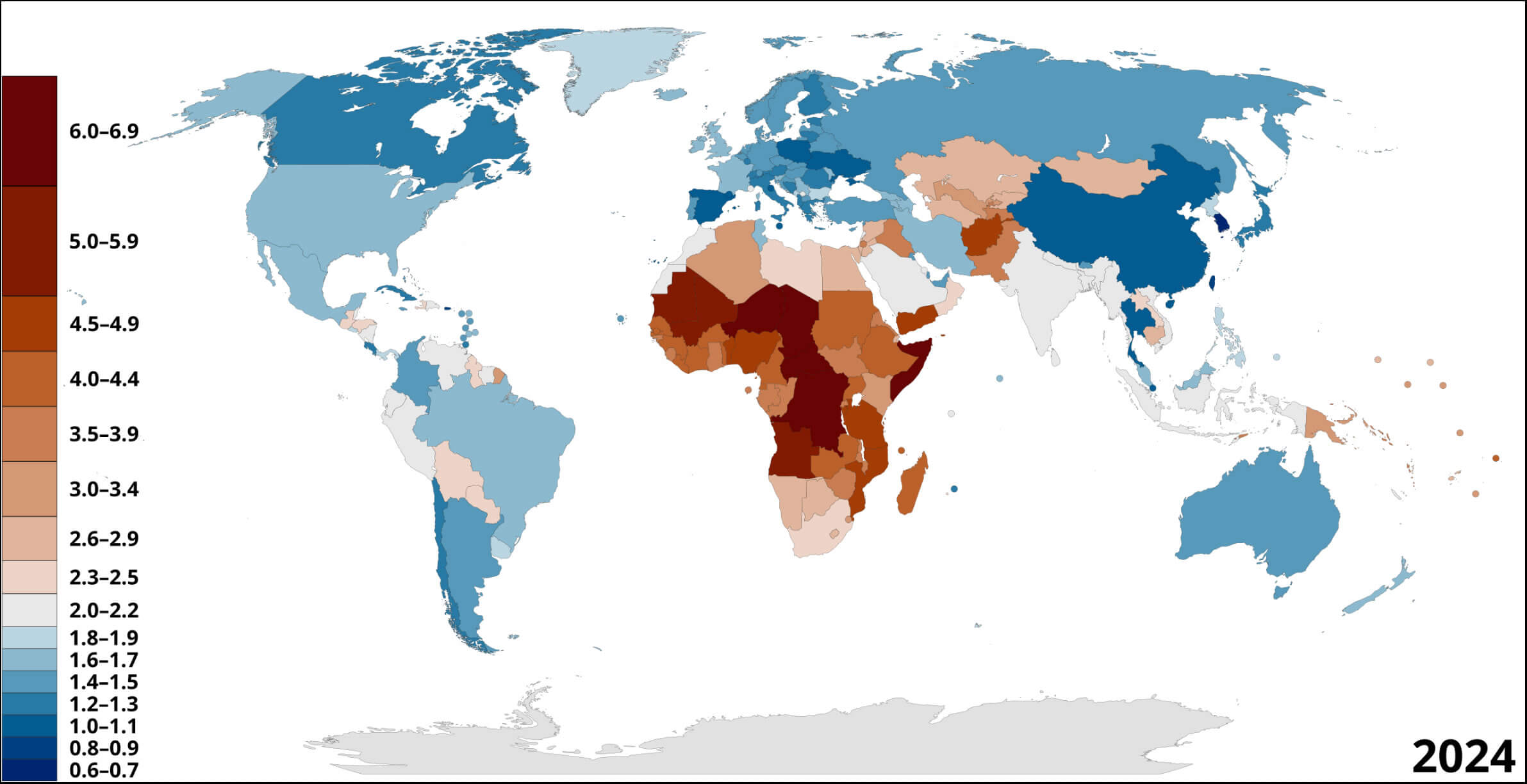
Map of the World by fertility rate in 202

Population density countries 2018 World map
Population density countries 2018 World map

Population density map in Africa
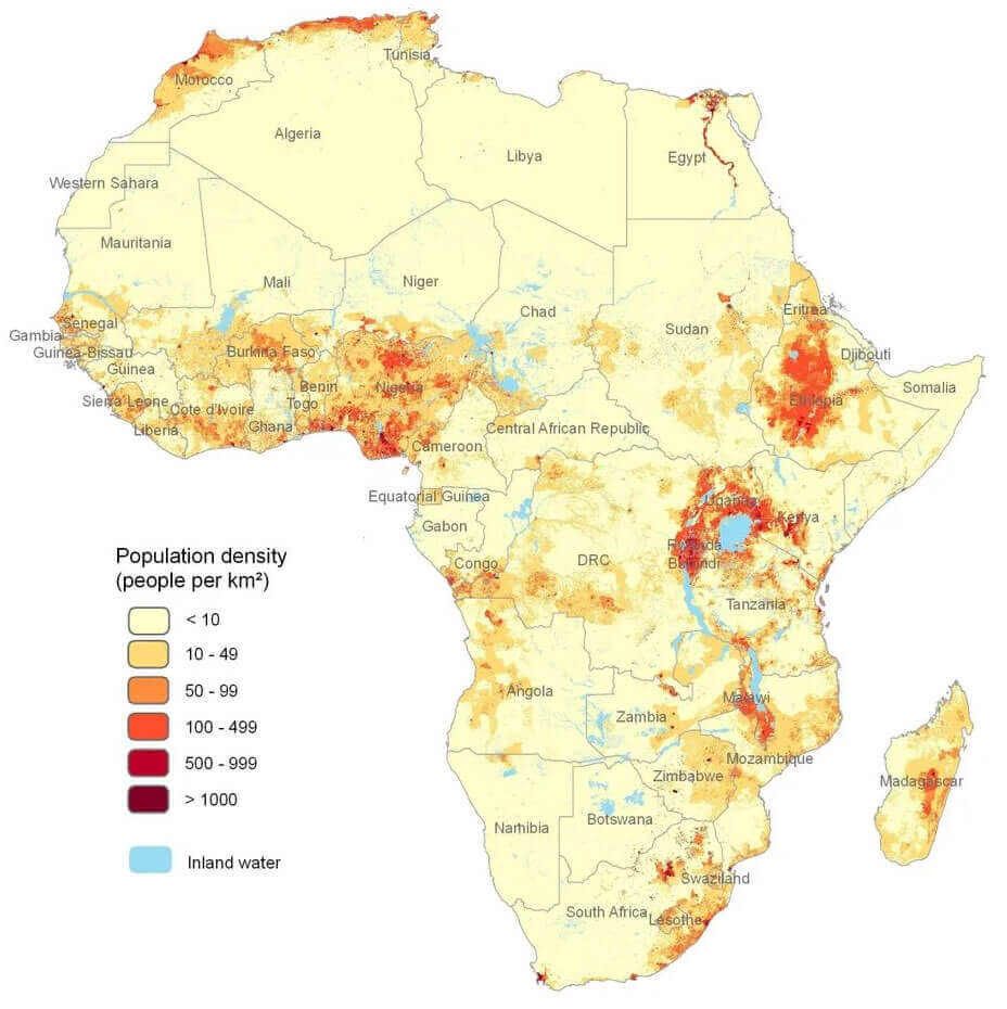
Population density map in Africa

Population density map of the World by counrtries
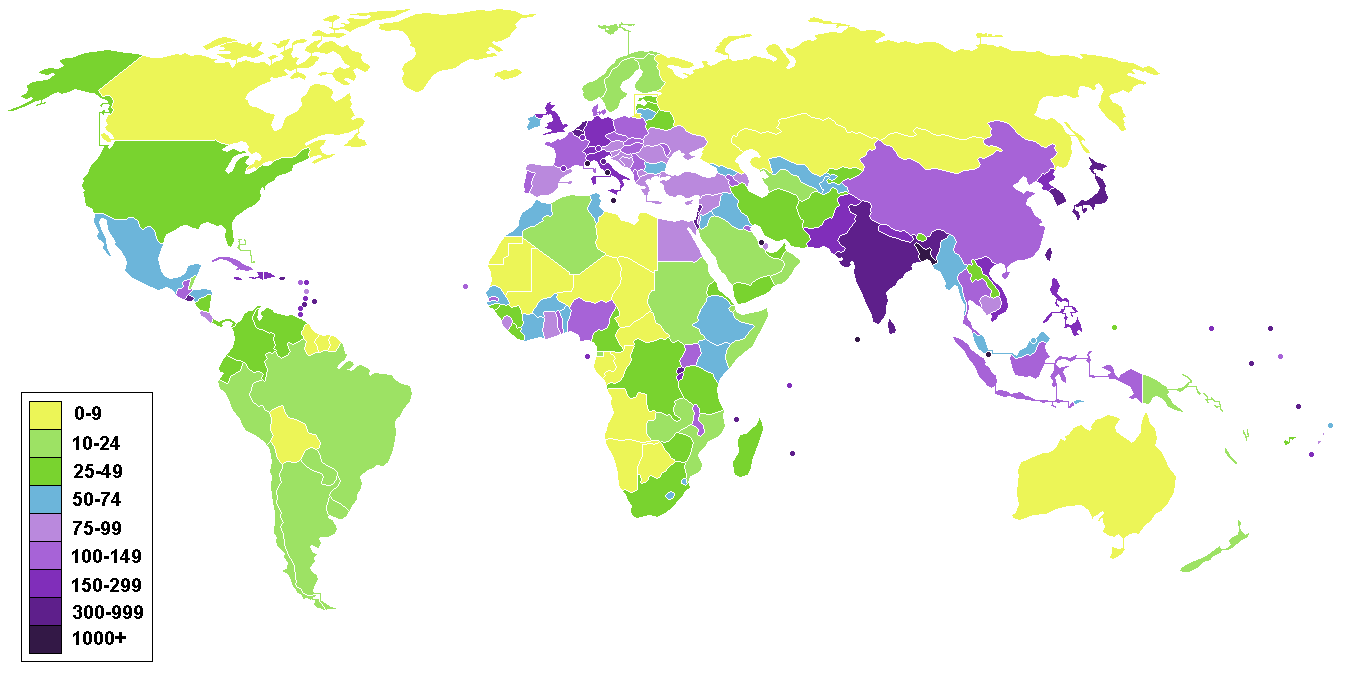
Population density map of the World by counrtries
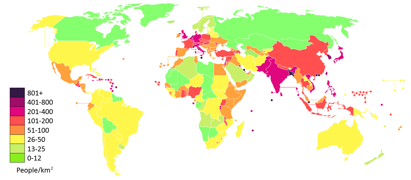
Population density map of the World

Population density map of the World

Population density per km2 map of the World in 2020
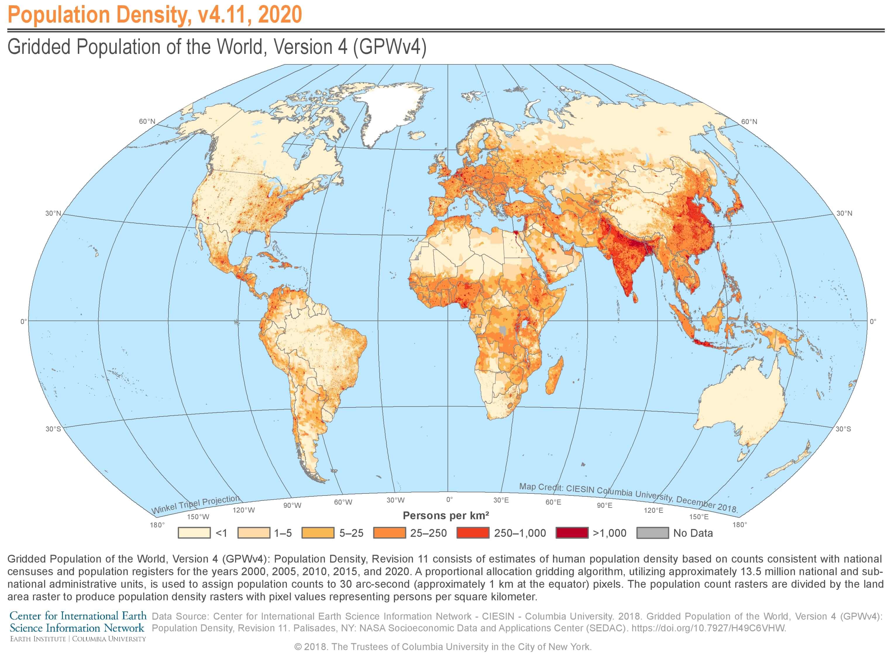
Population density per km2 map of the World in 2020

Population density per square kilometre in 2019
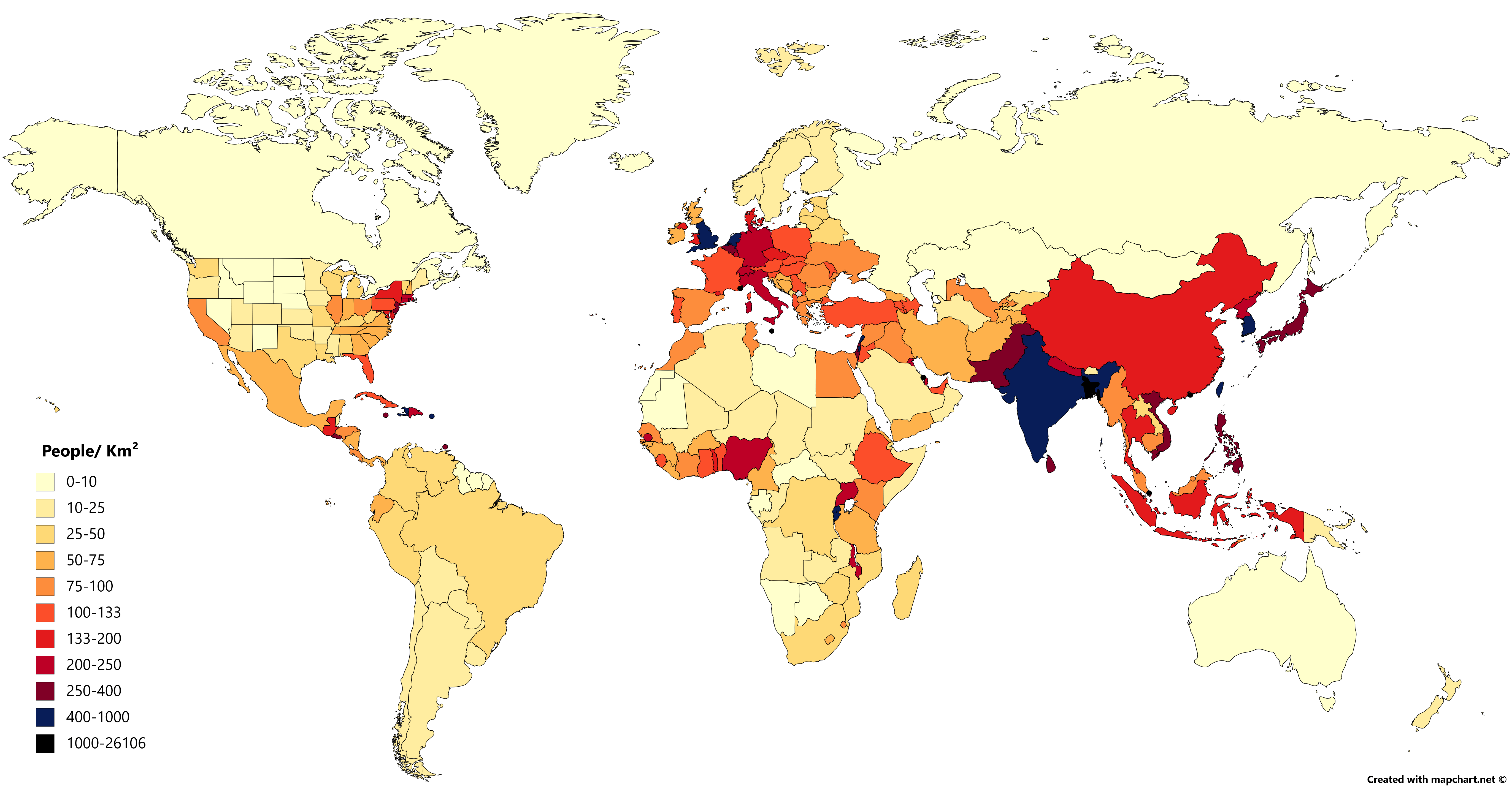
Population density per square kilometre in 2019

Population evolution World continents between 1950 and 2050
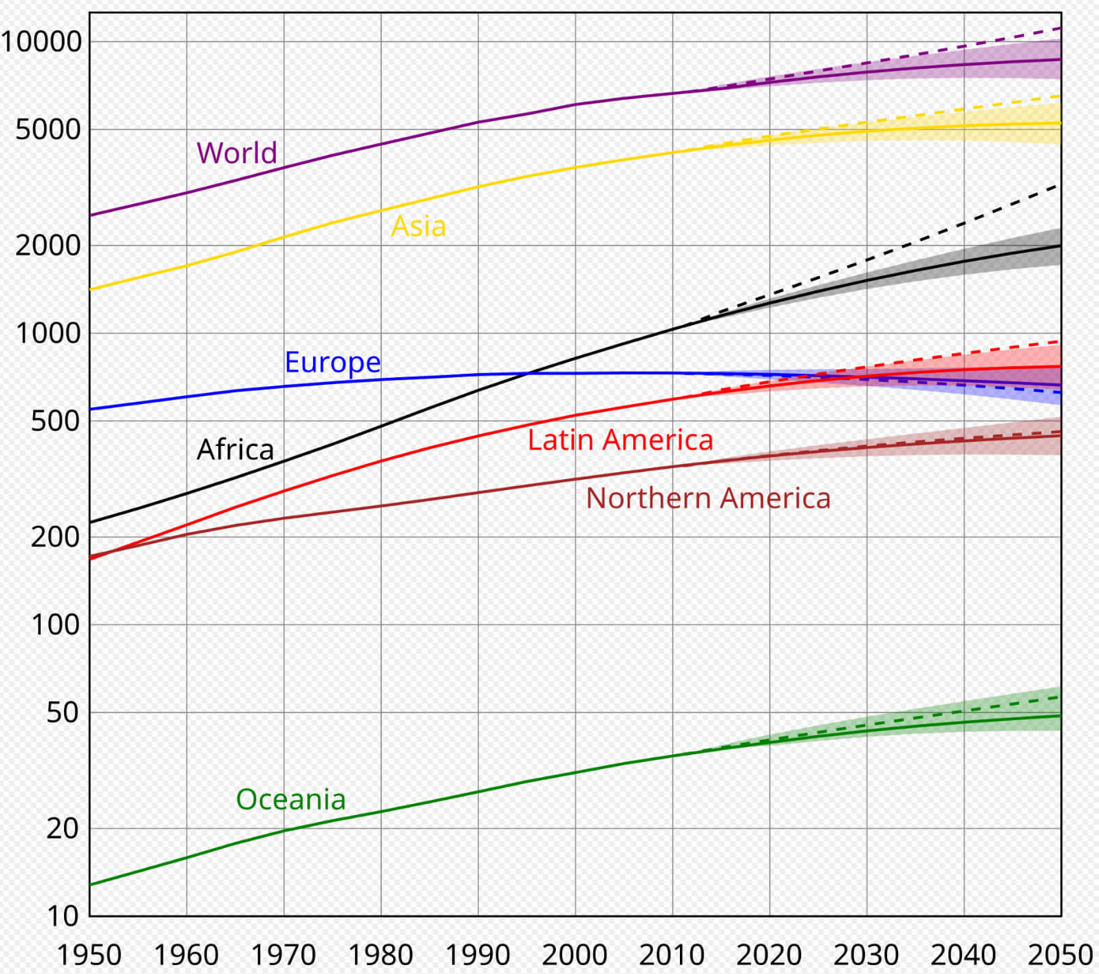
Population evolution World  continents between 1950 and 2050

Time zones map of the World with Population density
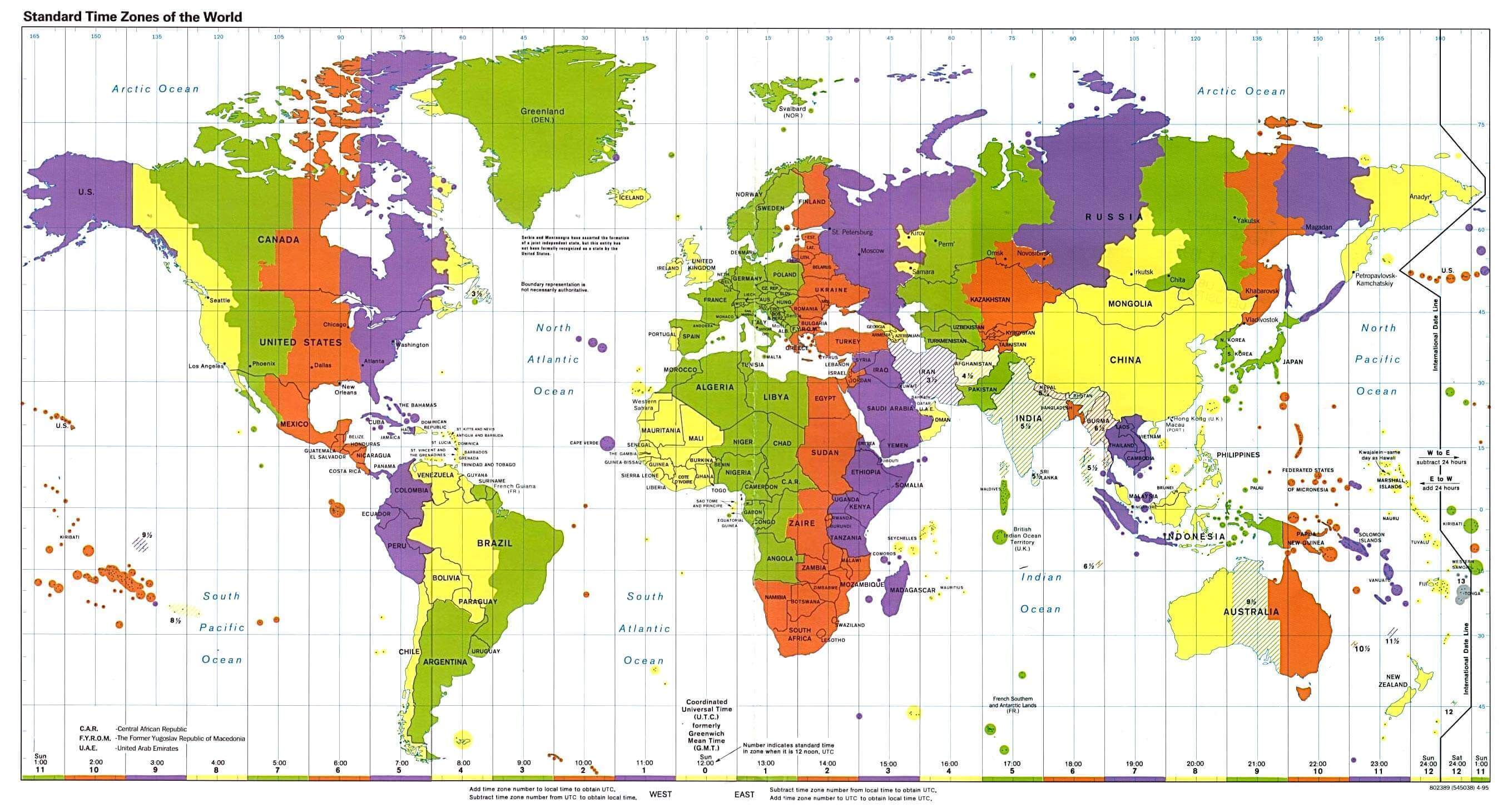
Time zones map of the World with Population density

World’s Population lived in urban areas in 1800
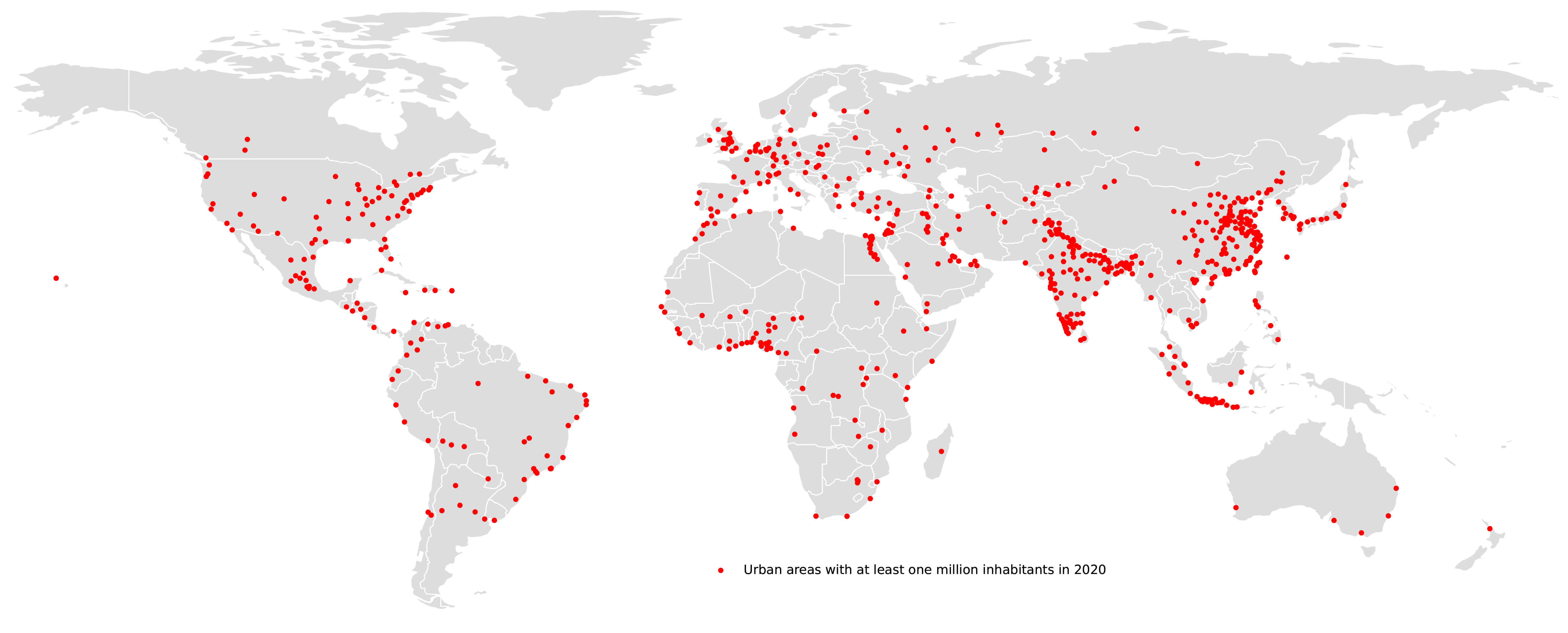
World's Population lived in urban areas in 1800

World blank map with Population density
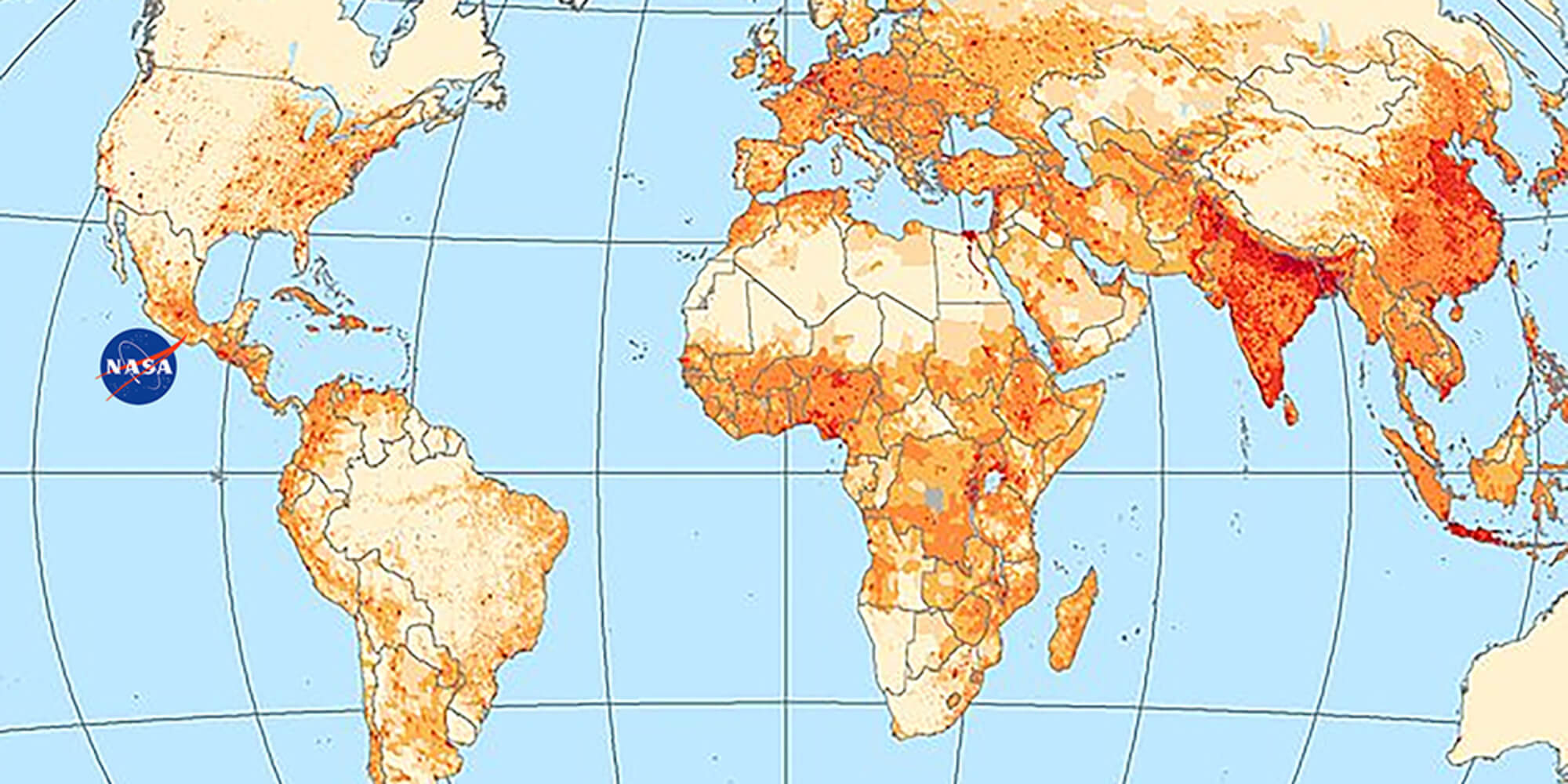
World blank map with Population density

World countries Population map
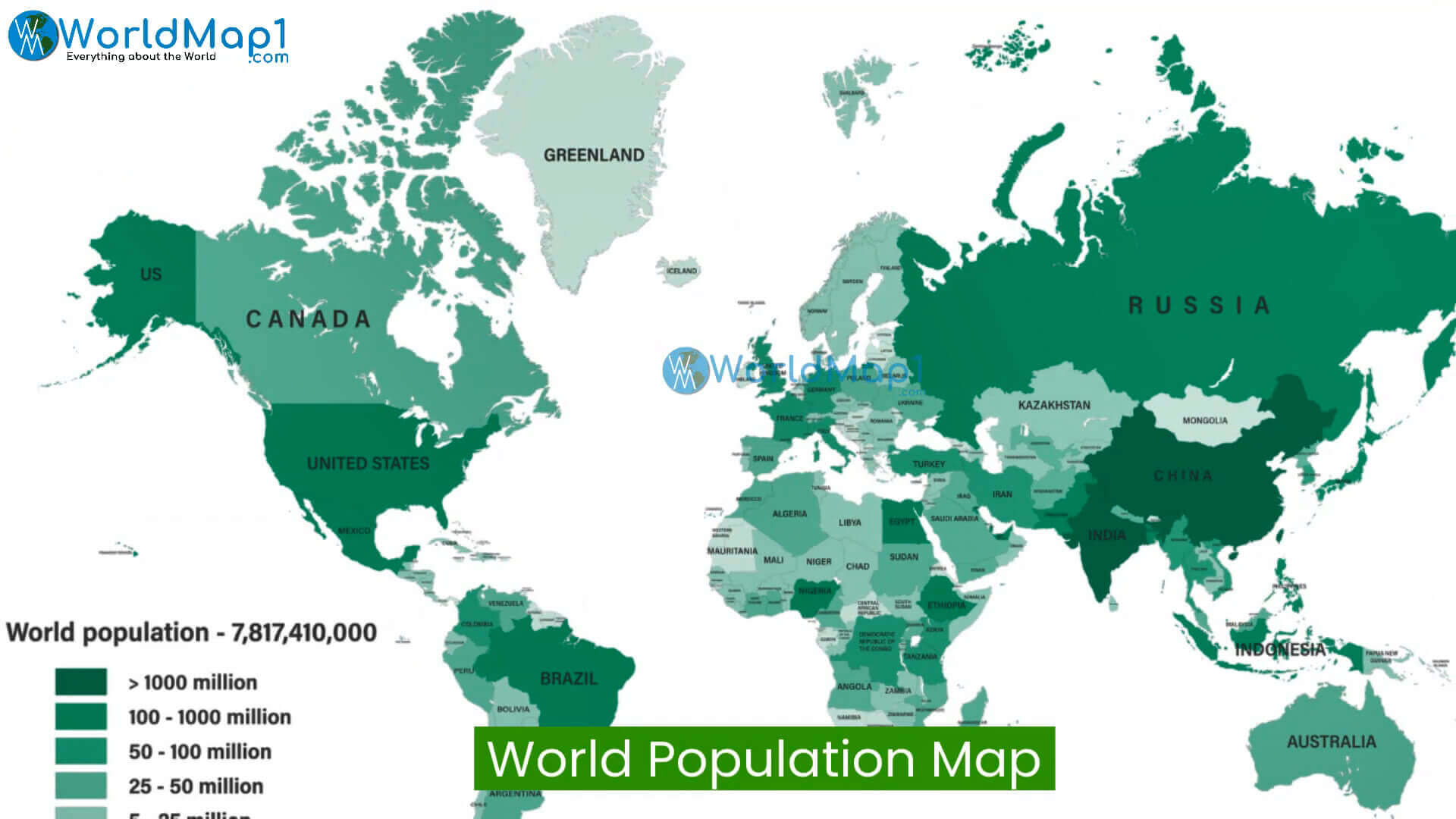
World countries Population map

World global Population density map
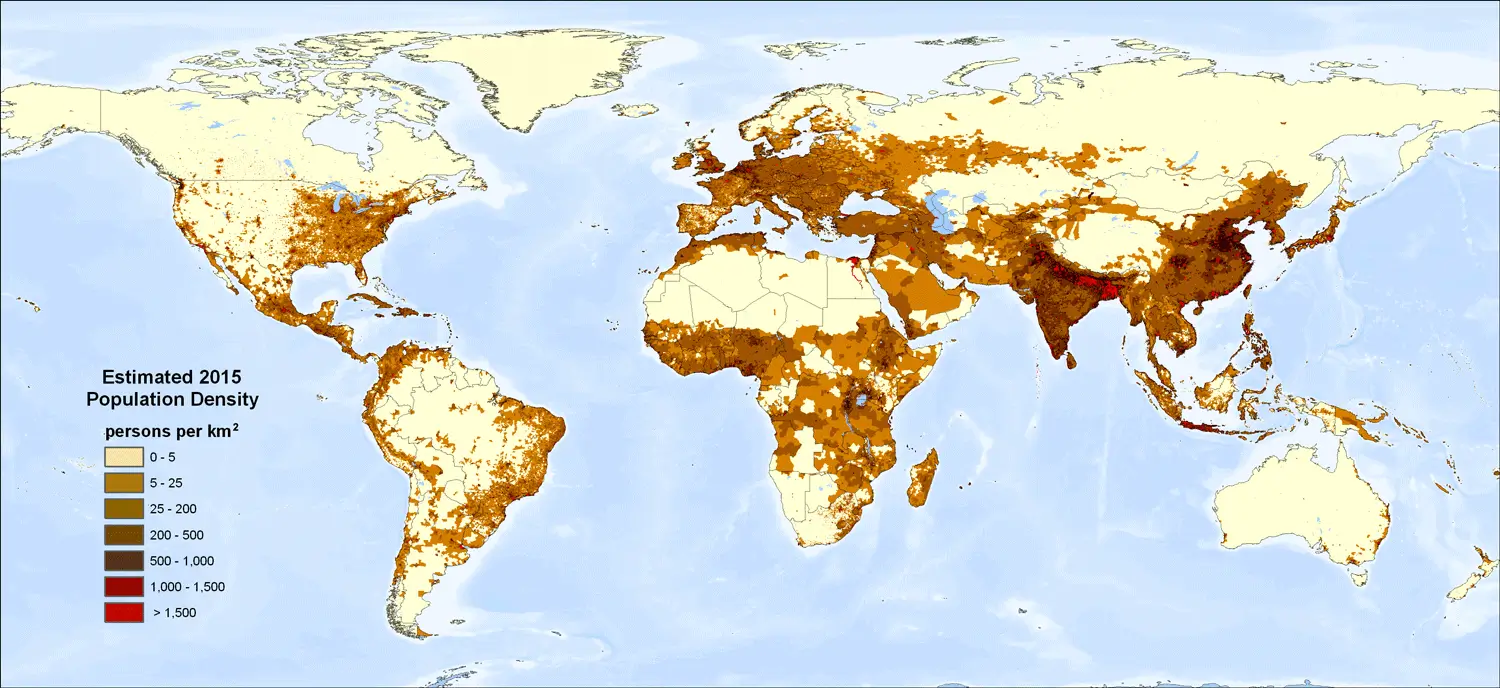
World global Population density map

World human Population density map
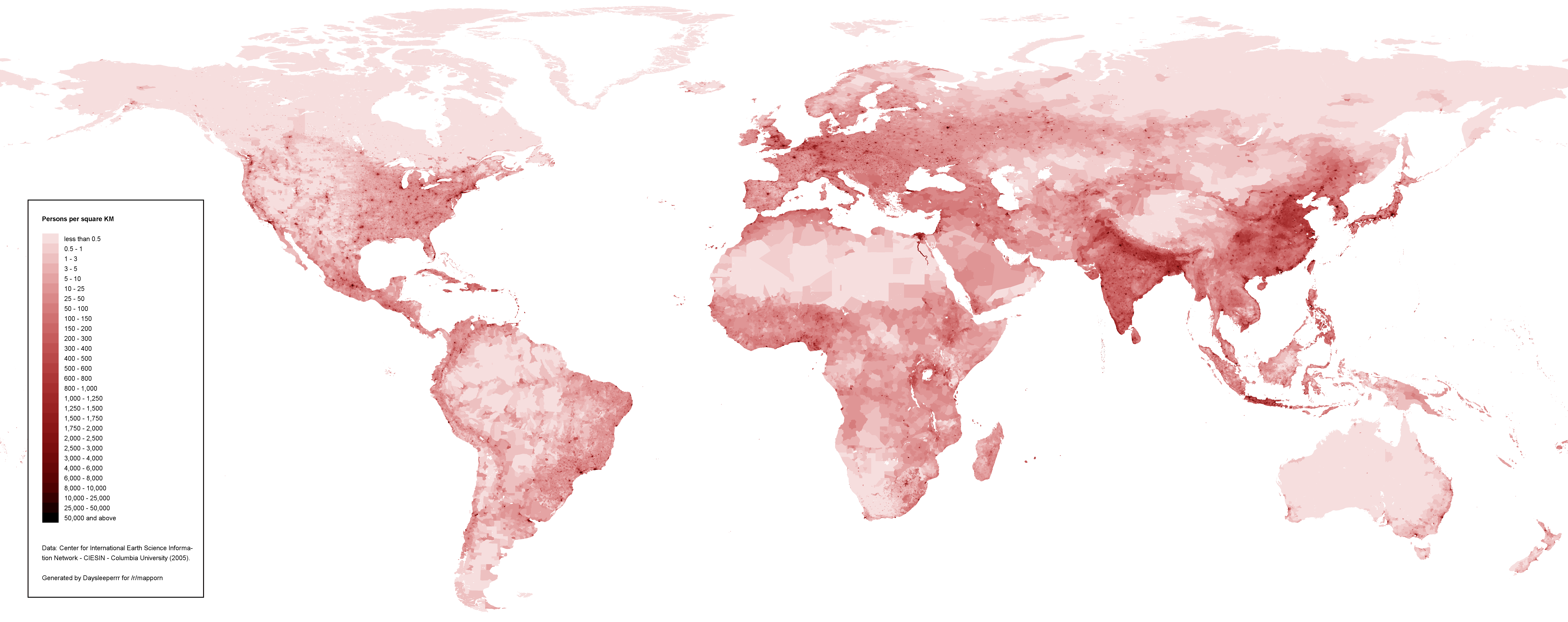
World human Population density map

World life expectancy by country in years
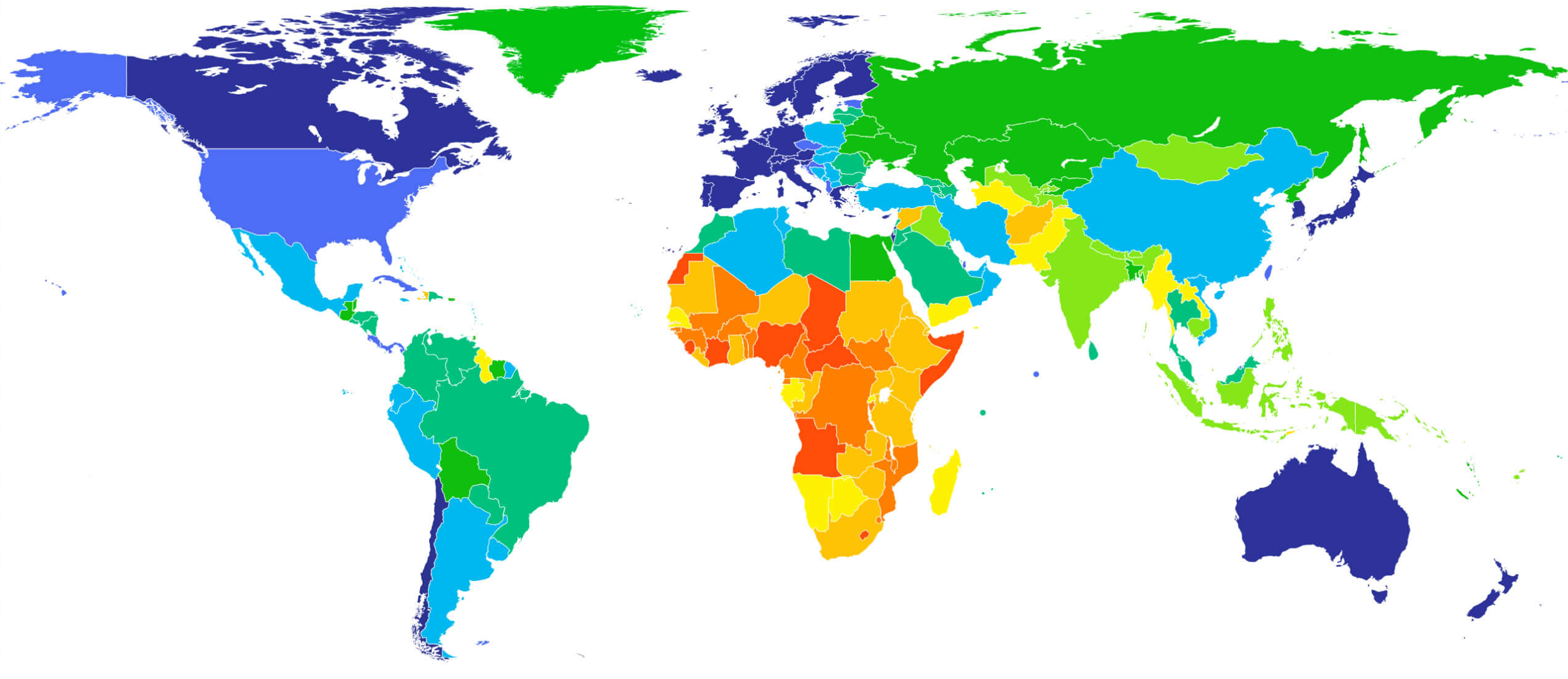
World life expectancy by country in years

World Population density map by latitude
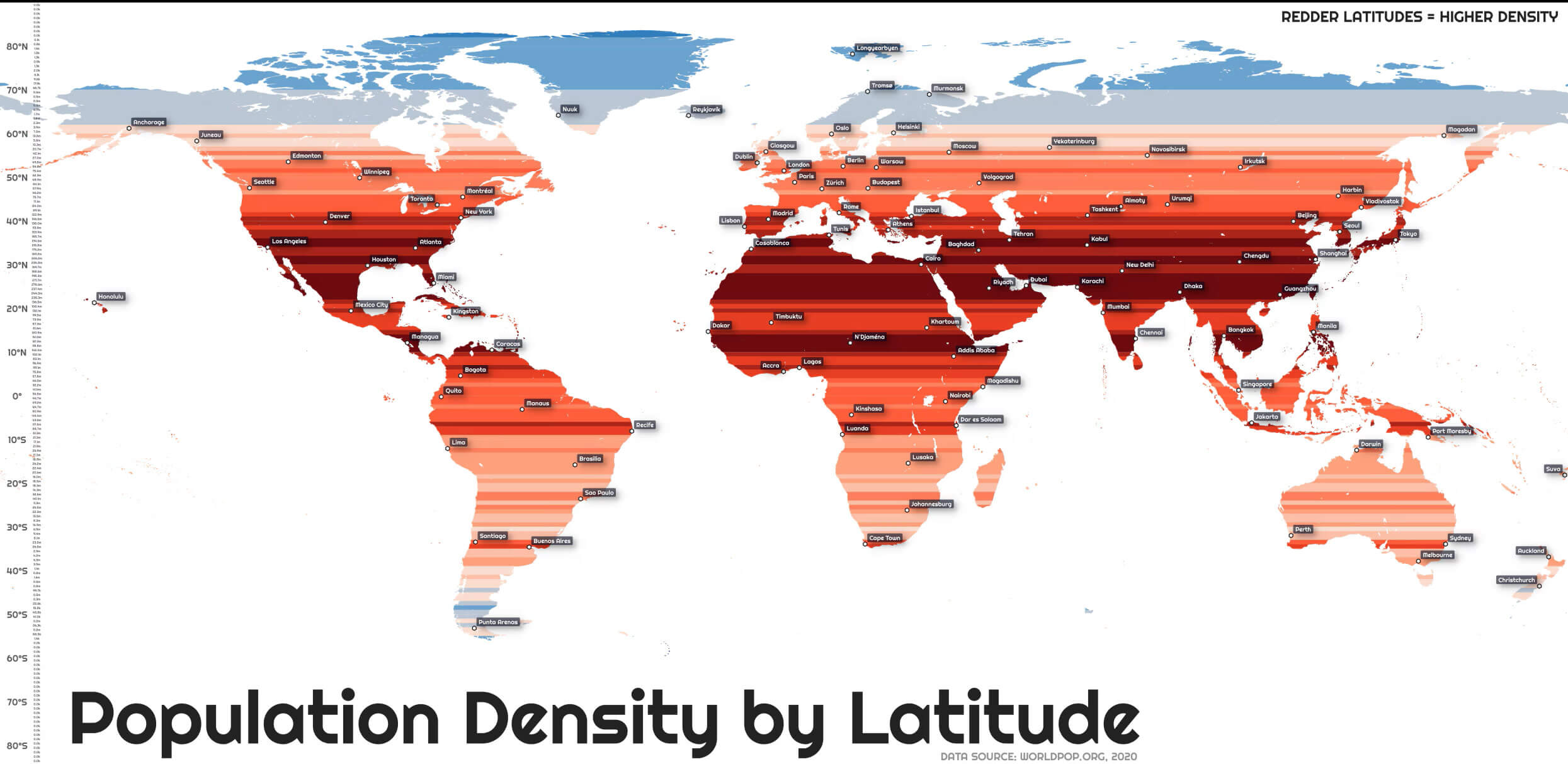
World Population density map by latitude

World Population density map per square kilometre
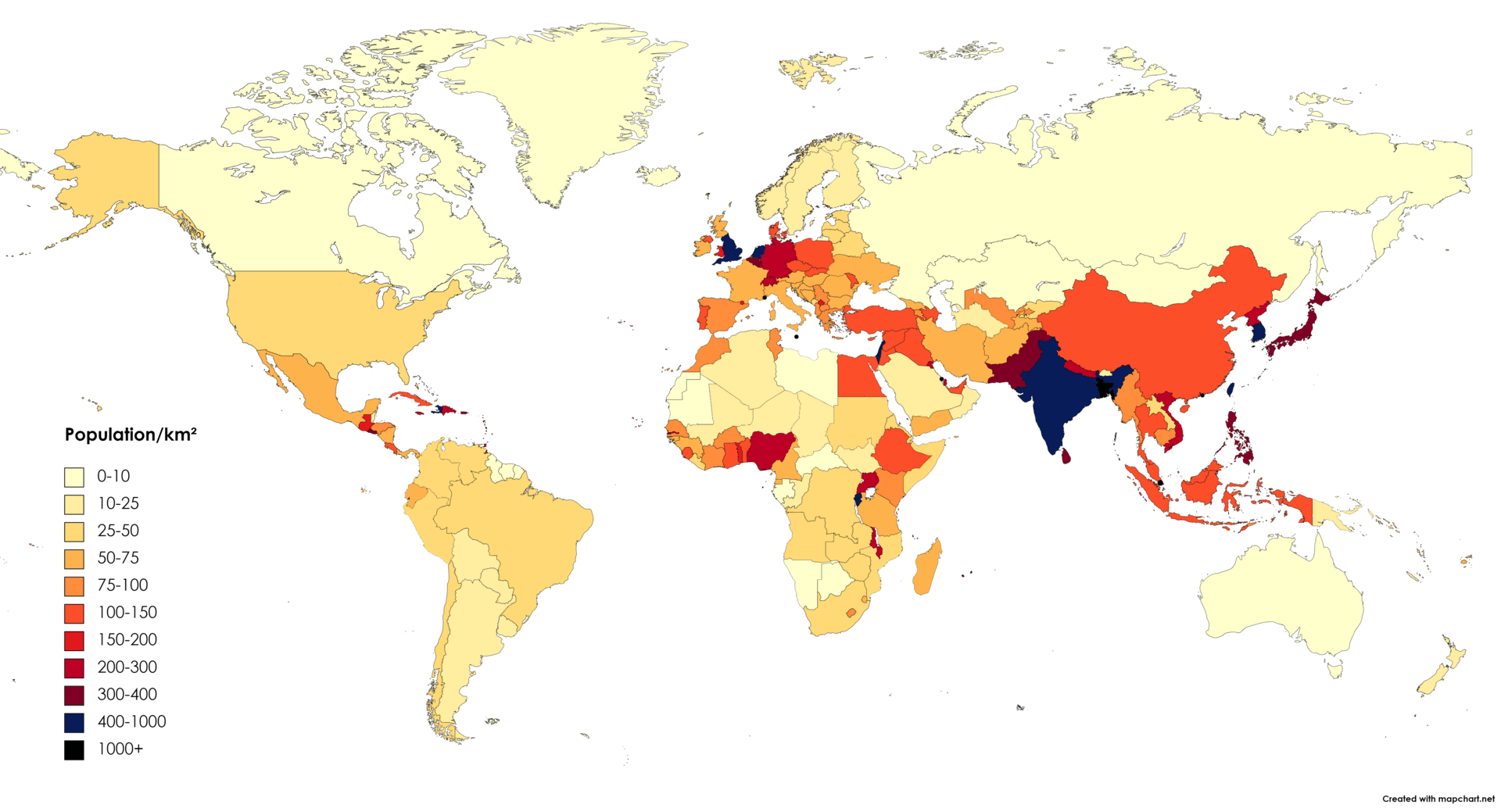
World Population density map per square kilometre
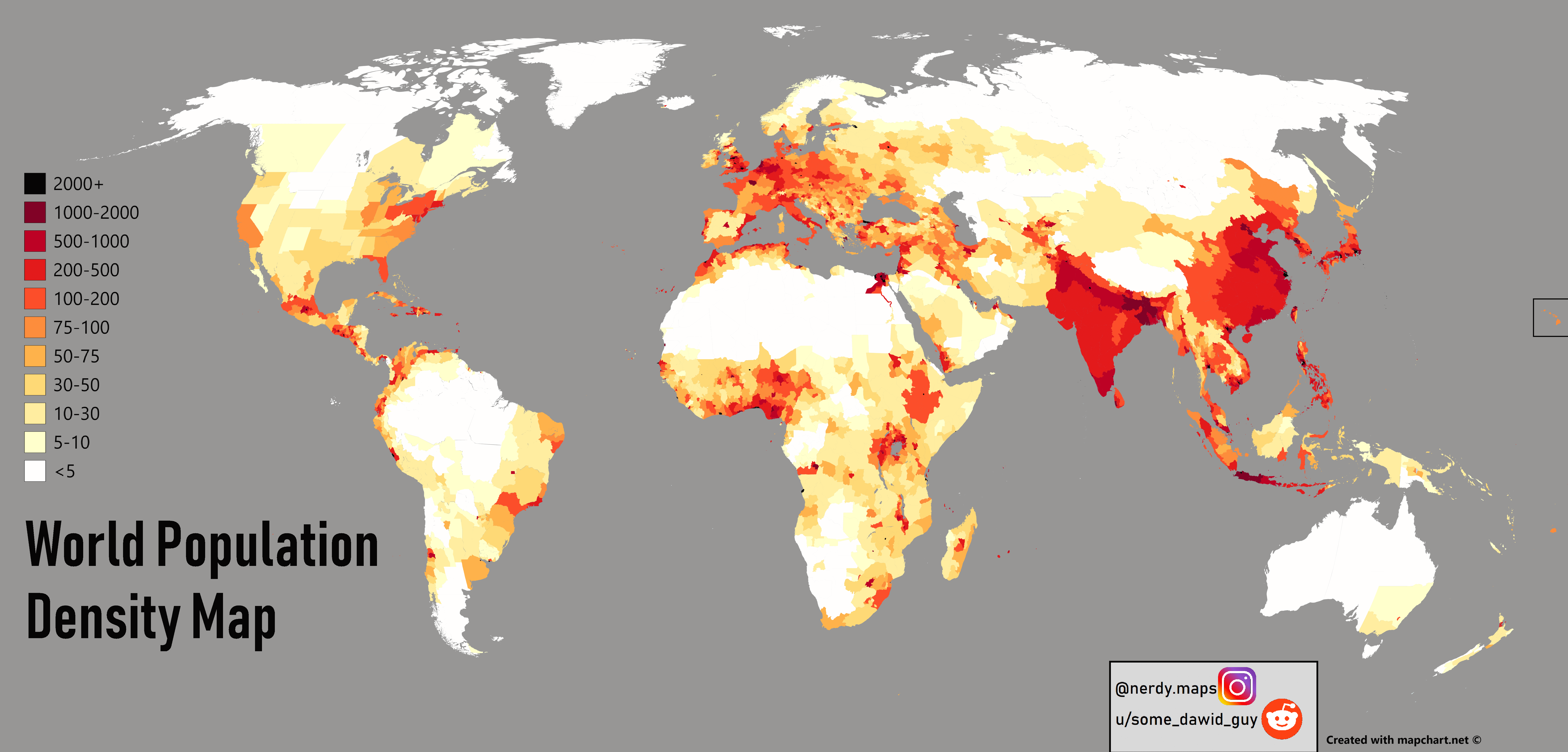
World Population density map

World Population density map

World Population growth graph 1901 to 2021
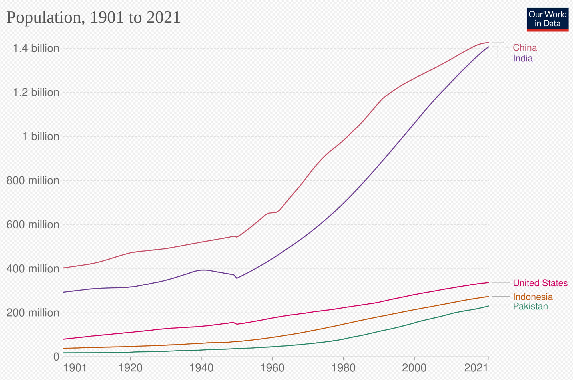
World Population growth graph 1901 to 2021

Where are countries located in the World?

Show Google Maps and satellite maps of where the country is located.

Get directions by driving, walking, bicycling, public transportation, and travel with street view.

Feel free to explore these pages as well:

- Advertisement -
Previous article
Next article

Discover

Sponsor

Latest Posts

Discover Auckland: The Jewel of the South Pacific

Imagine a city where the urban rhythm blends seamlessly with the call of the wild; where contemporary skyscrapers overlook vast, untouched natural sanctuaries; and...

Lima’s Top 10 Must-Visit Spots for Every Traveler

From Historic Sites to Modern Vibes: Lima's Top 10 Attractions for Every Wanderer Perched along the Pacific coast, where urban energy meets ancient history, Lima...

Pasadena Map in Los Angeles

Pasadena, located 11 miles (18 km) northeast of downtown Los Angeles, is a city in Los Angeles County, California. As the largest city in...

Hong Kong Map

A collection of Hong Kong Maps; View a variety of Hong Kong physical, political, administrative, relief map, Hong Kong satellite image, higly detalied maps,...

A Collection of World Maps: Navigating Our Beautiful Planet

From the intricate patterns of winding rivers and vast deserts to the delineations of countries and cities, maps serve as a testament to the...