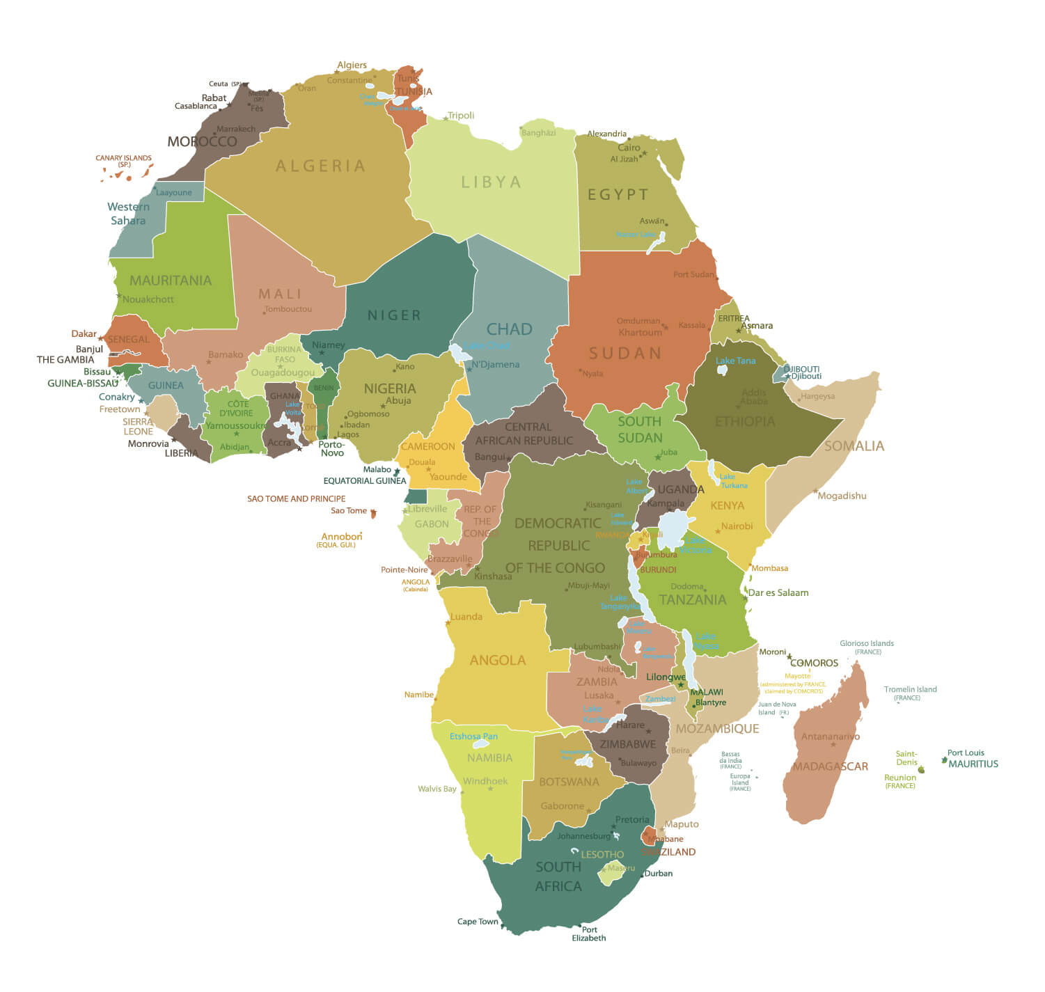
African Countries Map, Colorful Africa Map with World, Africa Physical Map with World, Highly Detailed Africa Physical Map, Africa Political World Map with Infographic, Coloured political map of Africa and a variety maps.
Africa and Earth Air Routes on Real Data
 Highly detailed planet Earth at night with embossed continents, illuminated by light of cities. Erath is surrounded by a luminous network, representing the major air lines routes based on real World countries data.
Africa Vector Map
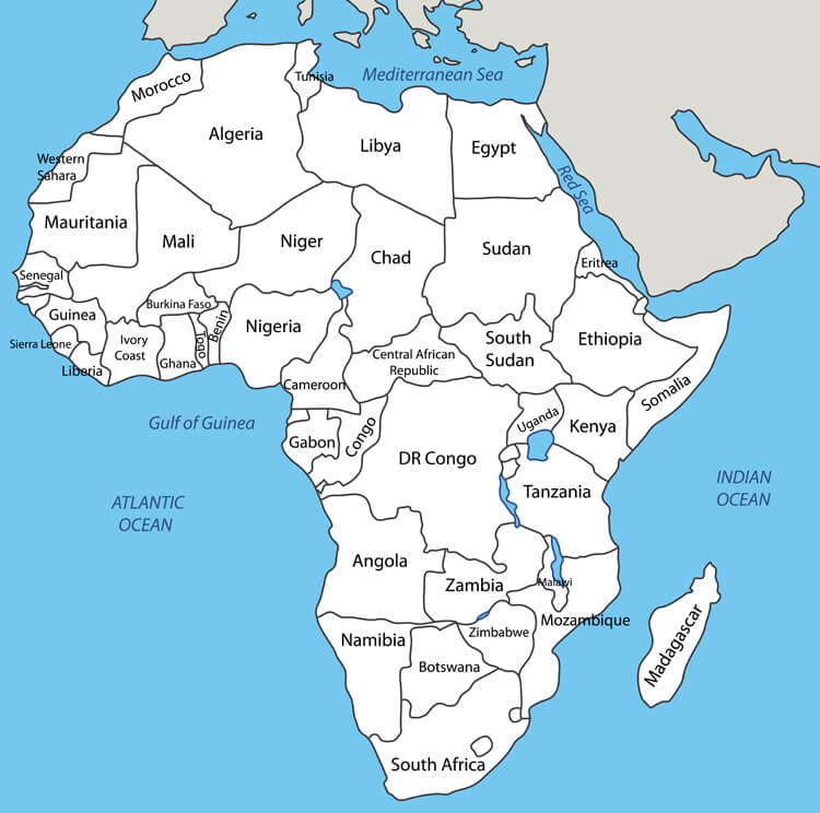
Africa Countries International Borders
Africa Countries International Borders, Egypte, Sudan, Libya, Tunisia, South Africa, Morocco, Algeria, Nigeria etc.
Coloured political map of Africa
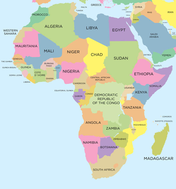 Coloured political map of Africa with international borders.
Africa Political World Map with Infographic
Africa political cities map
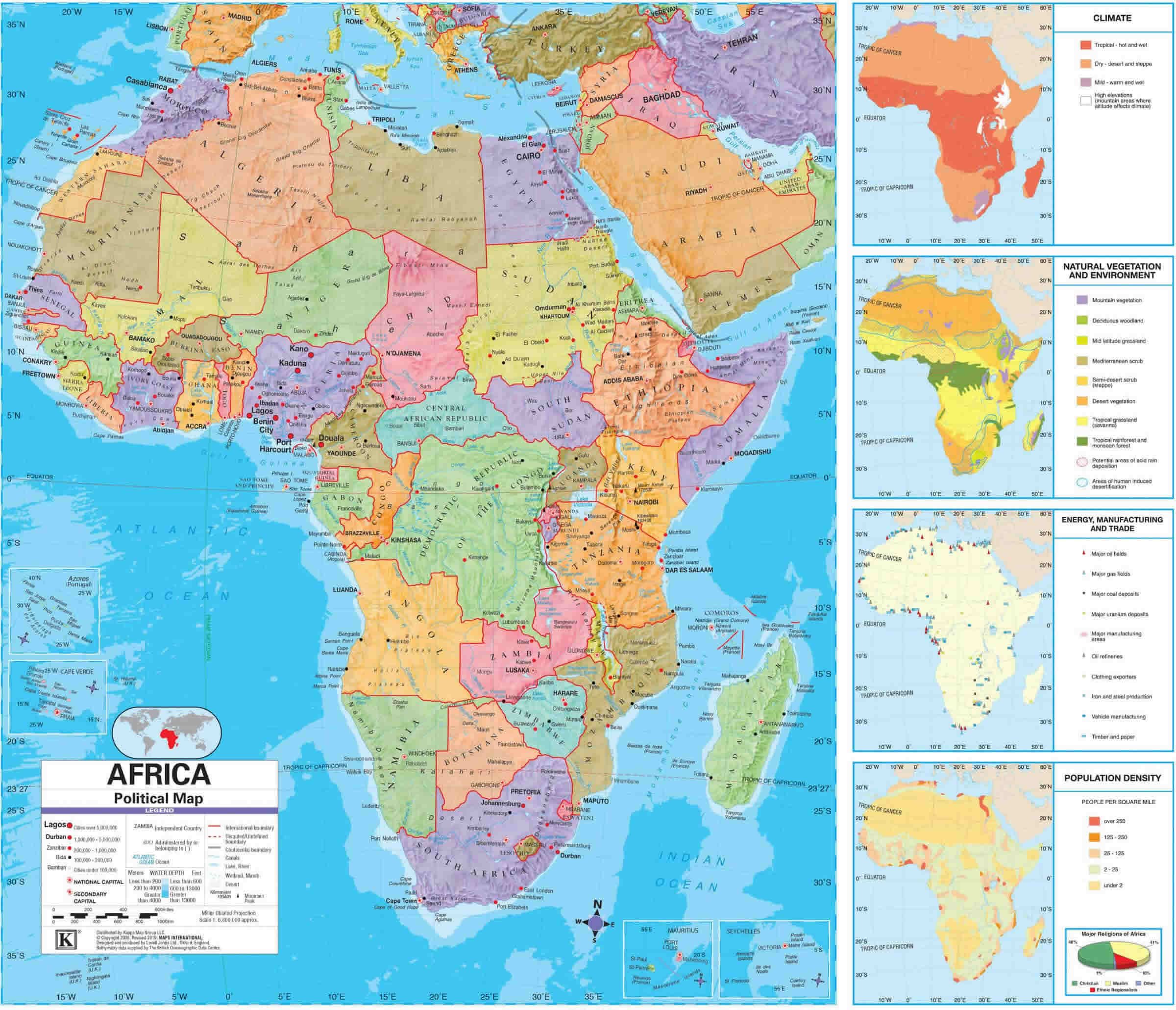
Africa physical map with cities
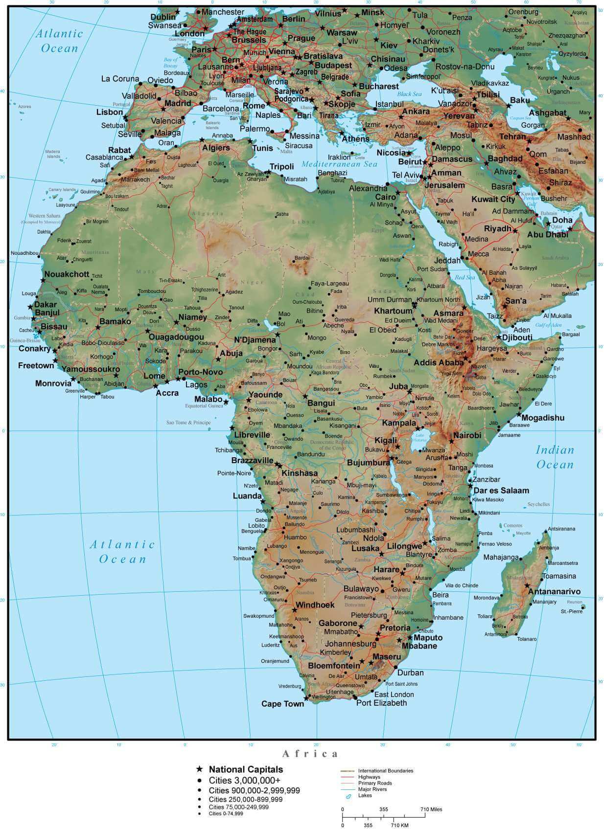
Political map of Africa with cities
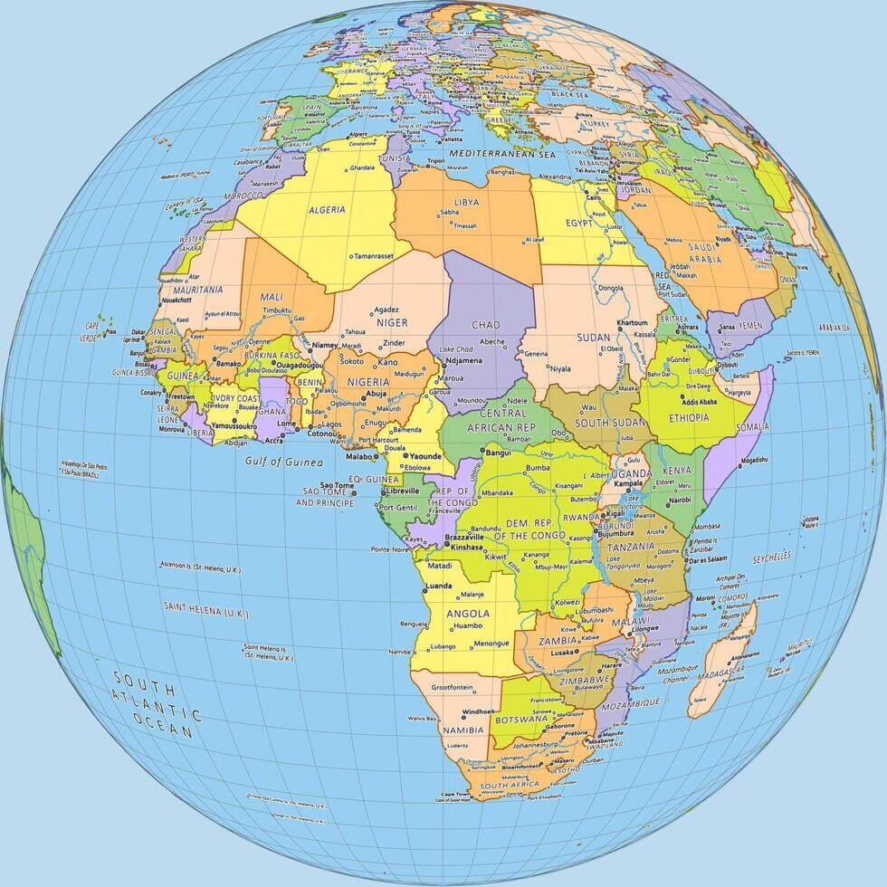
Africa Political Map with Countries, Capitals, and Major Cities
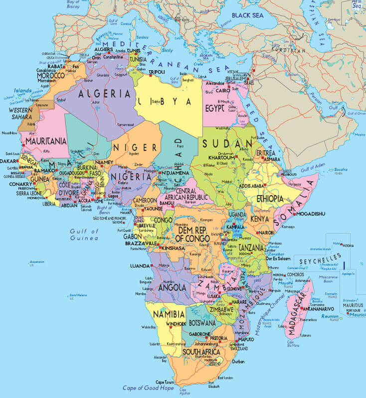
Map of Africa with cities
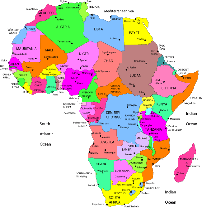
High Detailed Africa Physical Map
 High detailed Africa physical map with countries labeling
Africa Physical Map of the World
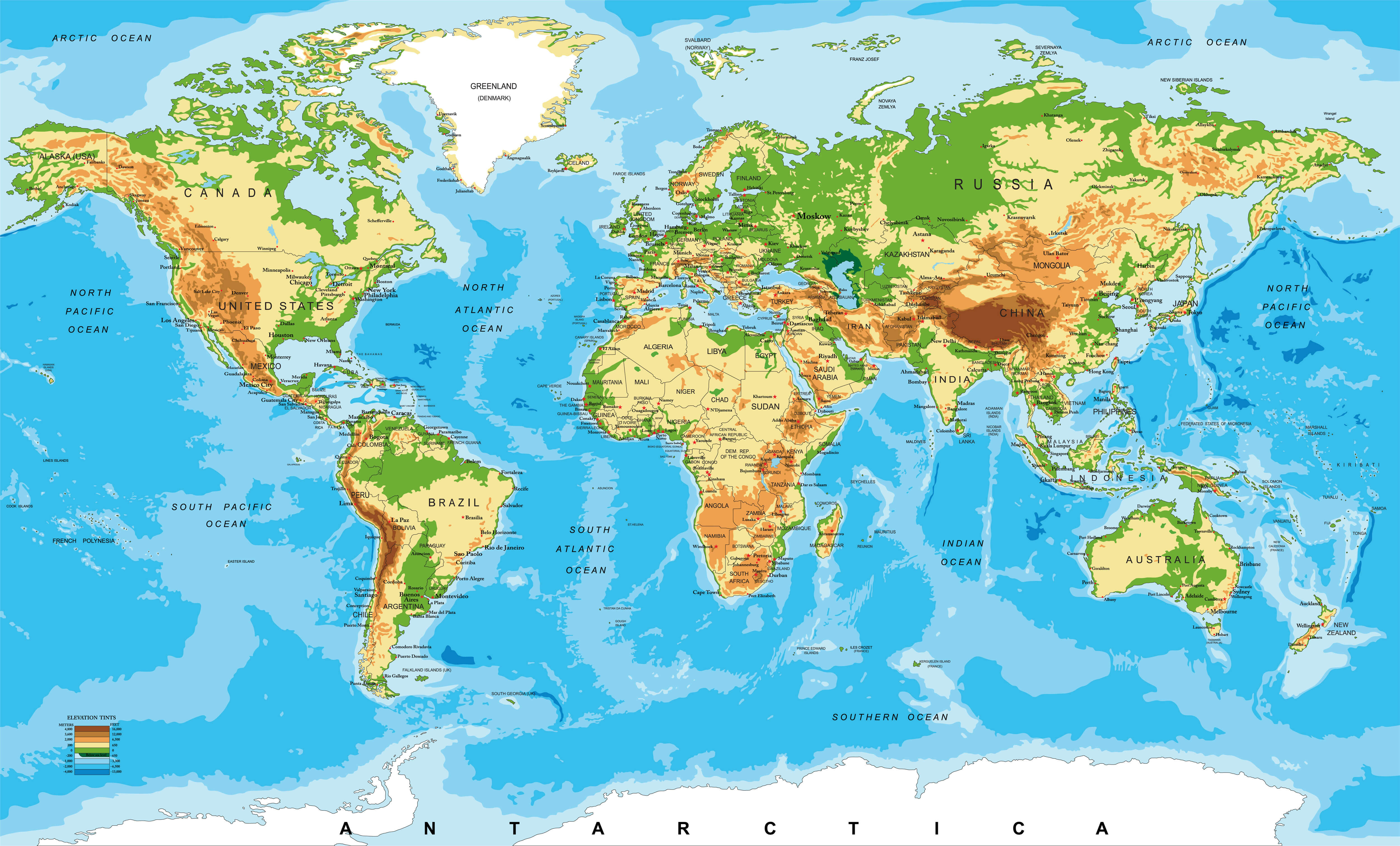 Africa Physical map of the World
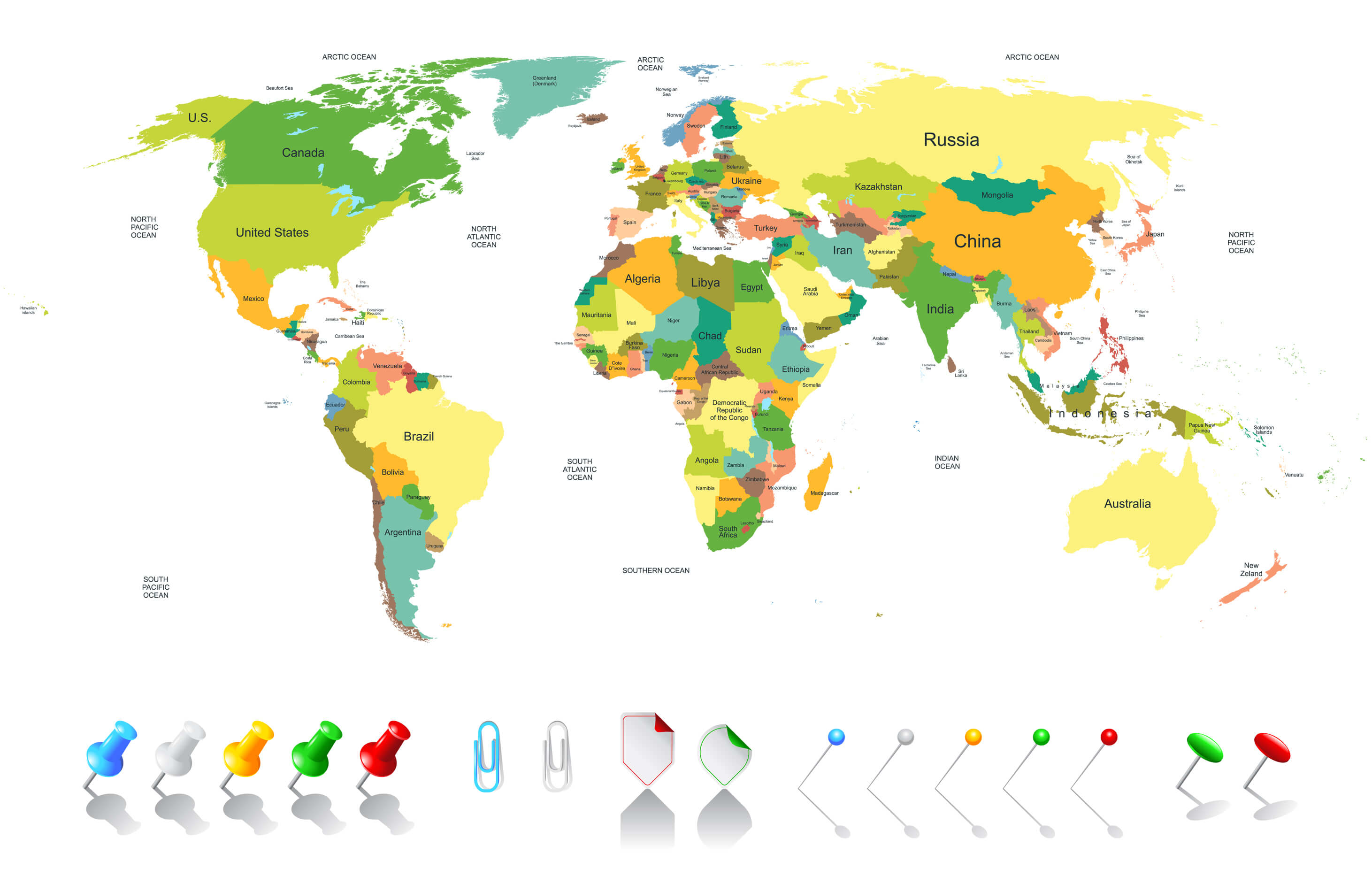
Colored World Map Africa
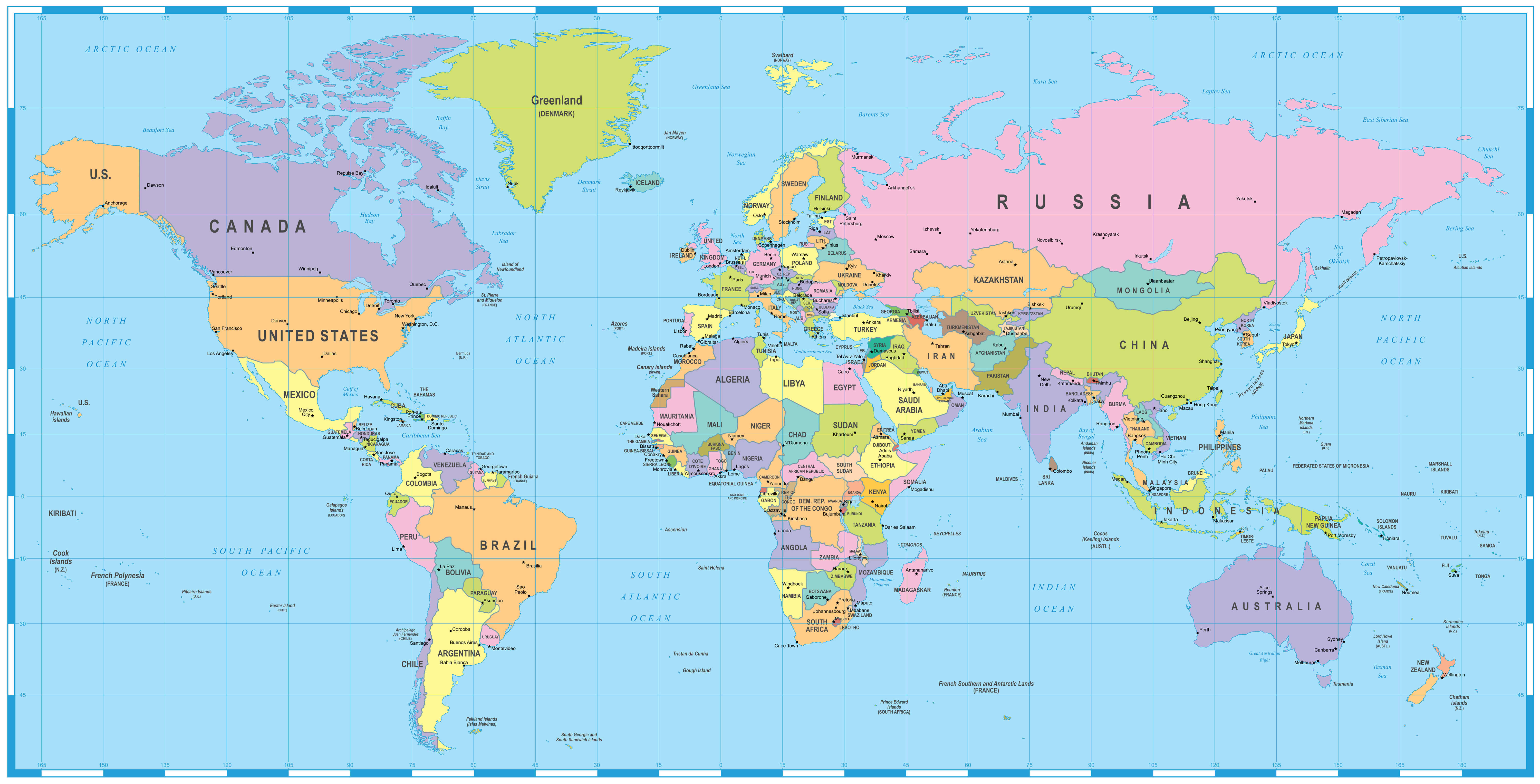 Colored World Map – borders, countries and cities – illustration Image contains next layers: – land contours – country and land names – city names – water object names.
Where is Africa in the World?
Show Google map, satellite map, where is the country located.
Get direction by driving, walking, bicycling, public transportaion and travel with street view.
Feel free to explore these pages as well:
- Africa Map IV ↗️
- Africa Map ↗️
- Map of Africa ↗️
- Africa Physical Map ↗️
- Africa Political Map ↗️
- Africa Countries Map ↗️
- Africa Population Map ↗️
- Africa Road Map ↗️
- Africa Religion Map ↗️
- Africa Satellite Map ↗️
- Africa Topographic Map ↗️
- Africa Time Zone Map ↗️
- Muslim Population Map in Africa by Country ↗️
- A Collection of Algeria Maps: Exploring a North African Gem via Maps ↗️
- Visit Africa ↗️
- Africa Map I ↗️
- Africa Map II ↗️
- Africa Map III ↗️
- Africa Map V ↗️
- About Africa and Maps ↗️
- Asia Map ↗️
- Europe Map ↗️
- The Essential Collection of South Africa Maps for Travelers and Geographers ↗️
- Cape Town: A Tapestry of Culture, Nature, and History ↗️

