
Peru Cities Map is an essential resource for exploring the country’s largest urban centers, transportation network, and regional geography. Whether you are looking for a Peru cities map, Peru major cities map, or a Peru location map, this collection makes it easy to identify important destinations such as Lima, Cusco, Arequipa, Trujillo, and Iquitos. You can also use a Peru highway map, Peru transportation map, or Peru cities and roads map to understand how cities are connected by major highways and travel routes across the country.
Peru location map

Peru cities map with roads
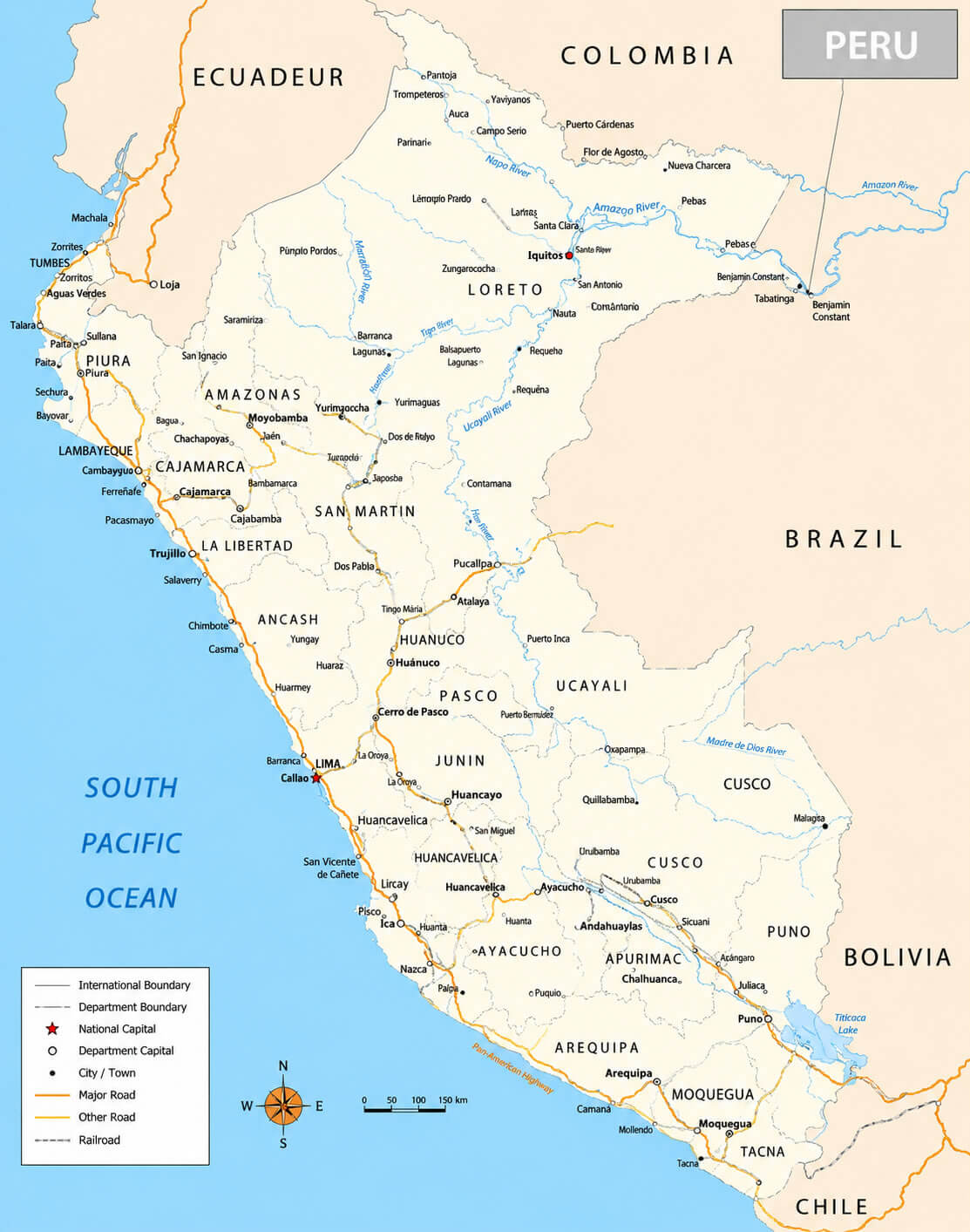
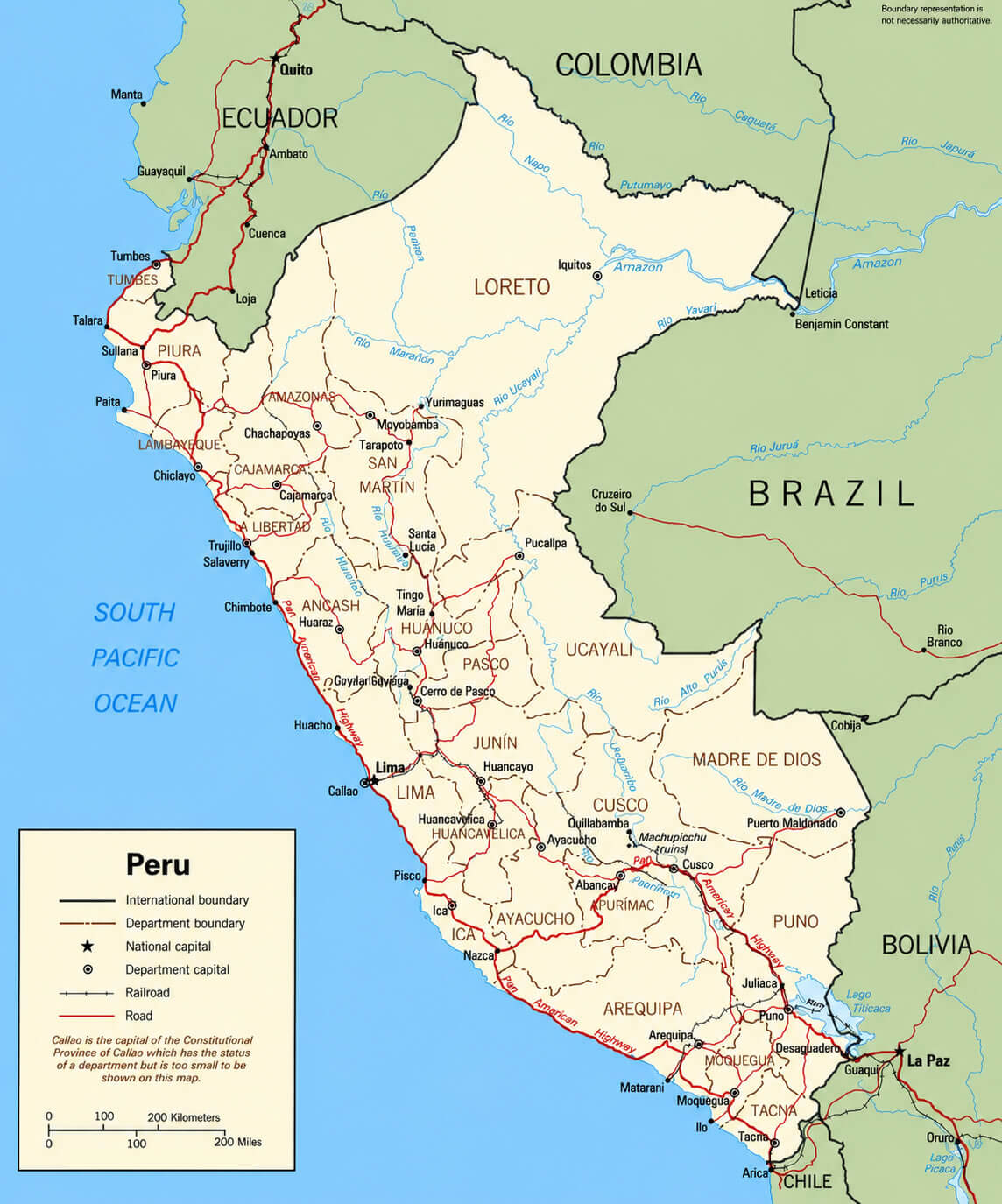
Peru political map
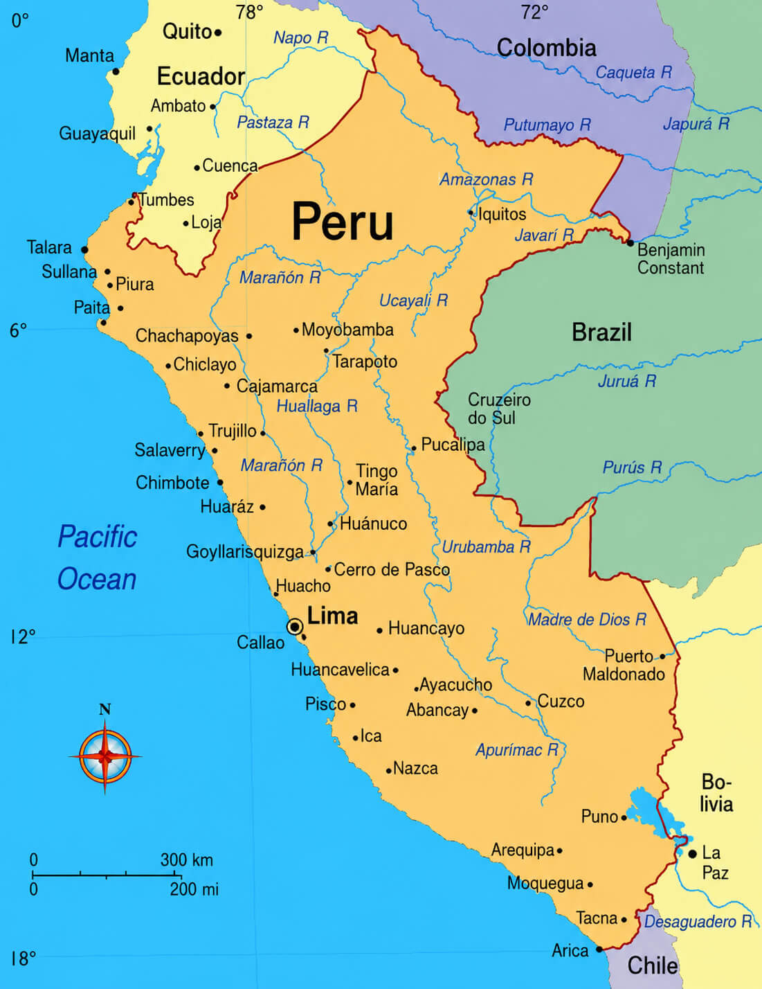
In addition to city locations, this map collection includes a Peru cities map with roads, Peru major cities map with rivers, and Peru cities and rivers map, helping users visualize the relationship between urban areas, waterways, and transportation corridors. For those interested in administrative boundaries, a Peru political map provides valuable geographic context, while a Peru tourist attractions map and Peru tourist map highlight the country’s most popular destinations, including Machu Picchu, the Sacred Valley, Lake Titicaca, and the Amazon region. Whether for travel planning, education, or geographic research, these detailed Peru city maps offer accurate and easy-to-read information.
Peru cities map
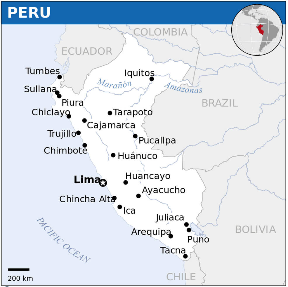
Peru cities and rivers map
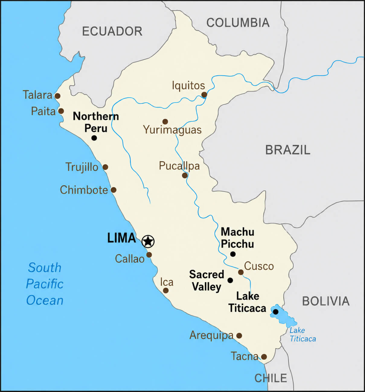
Peru cities and roads map
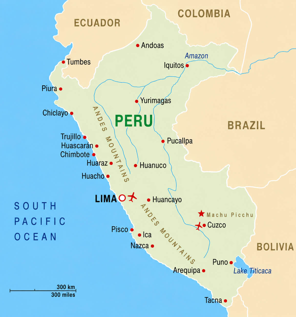
Peru highway map
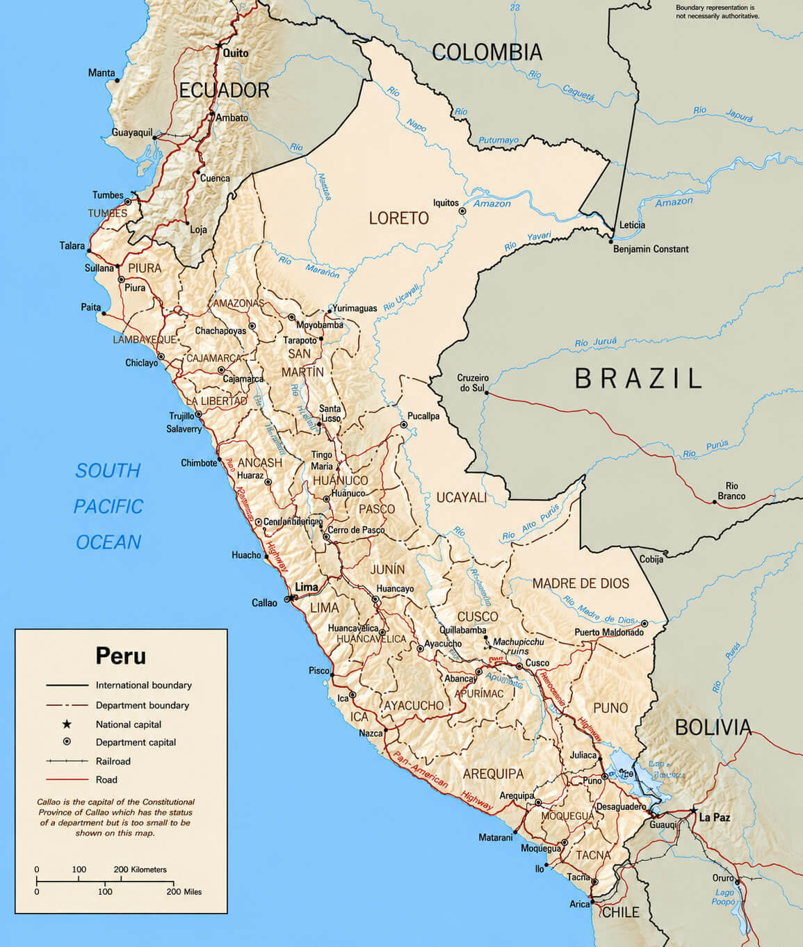
Peru major cities map with rivers
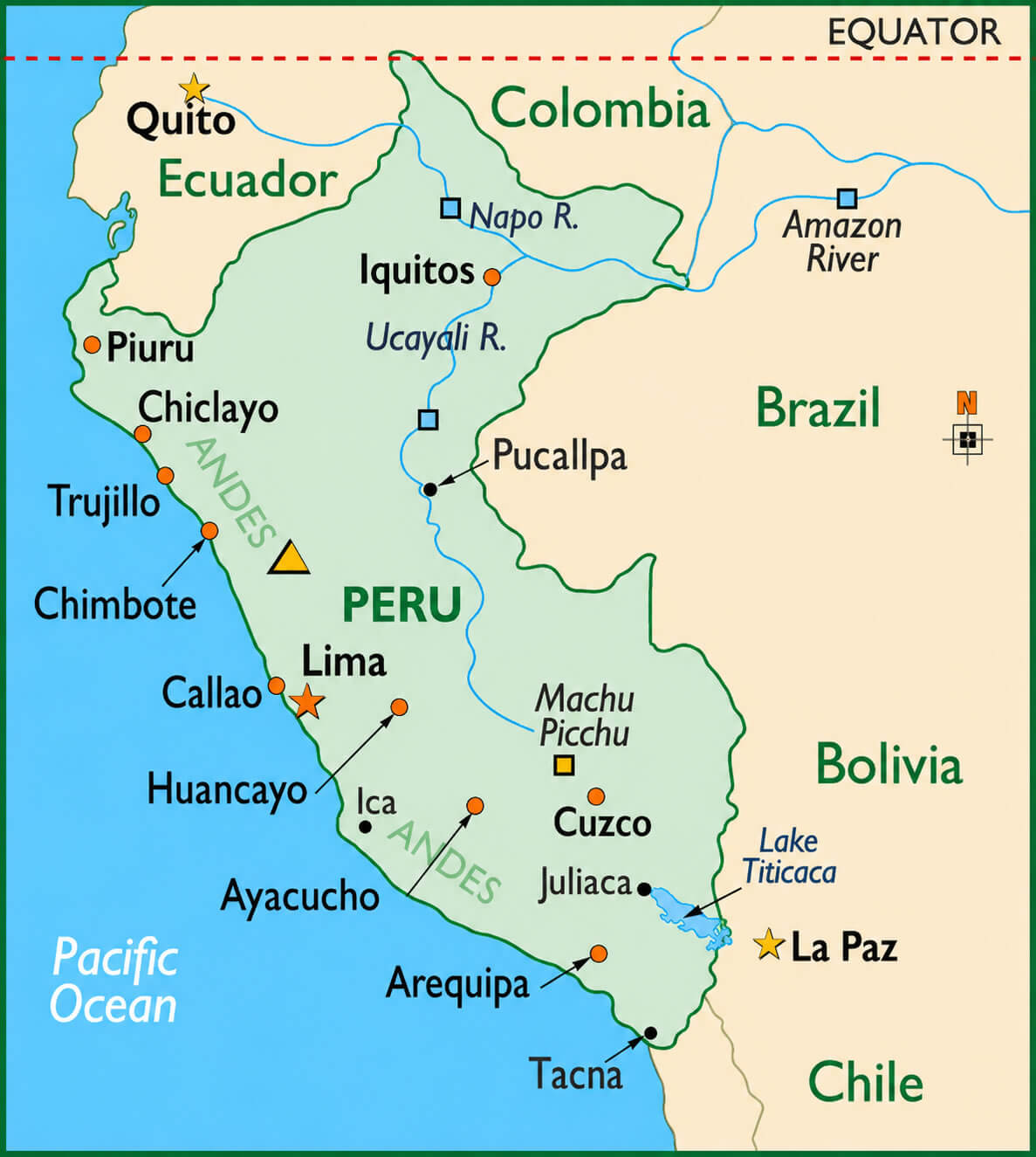
Peru major cities map
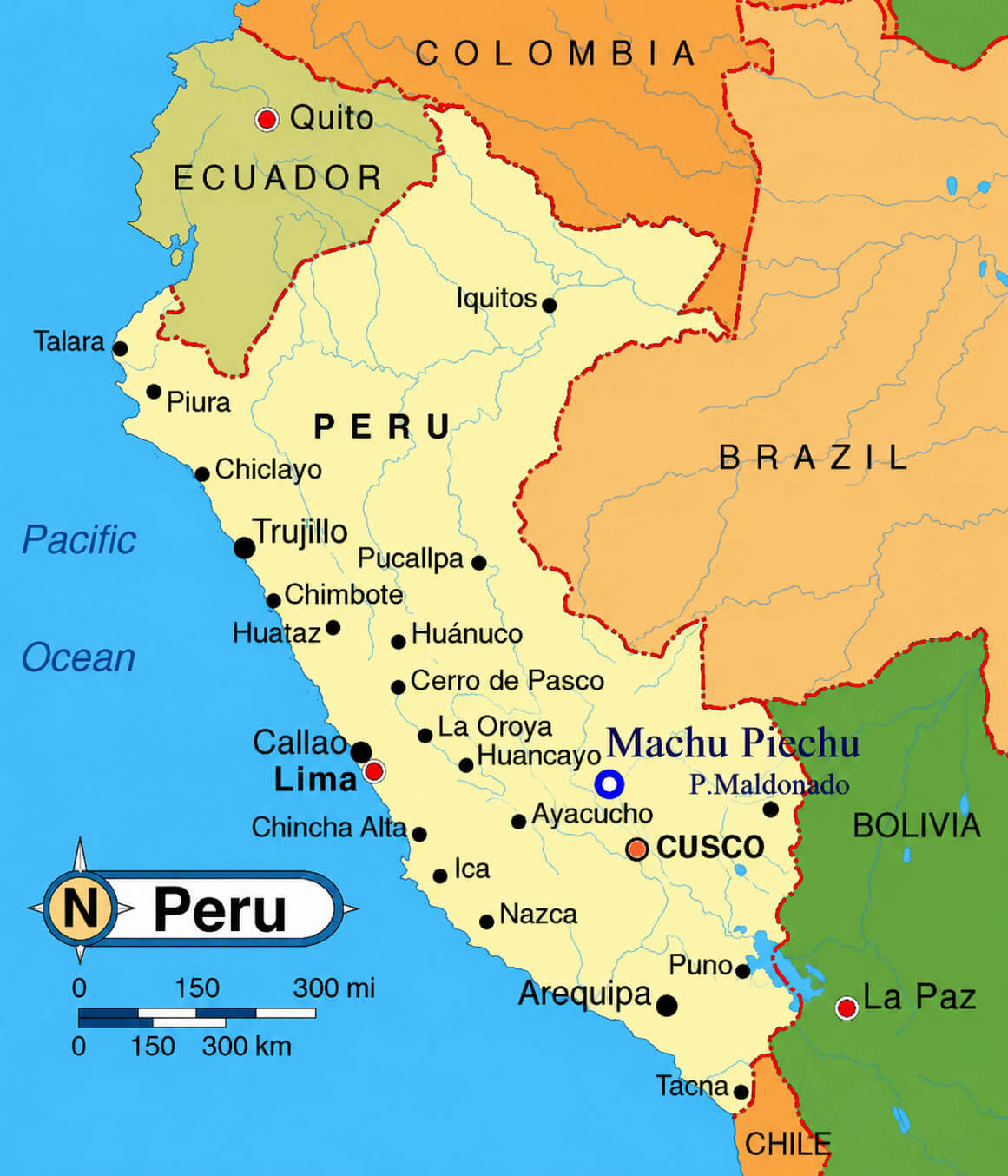
Peru tourist attractions map
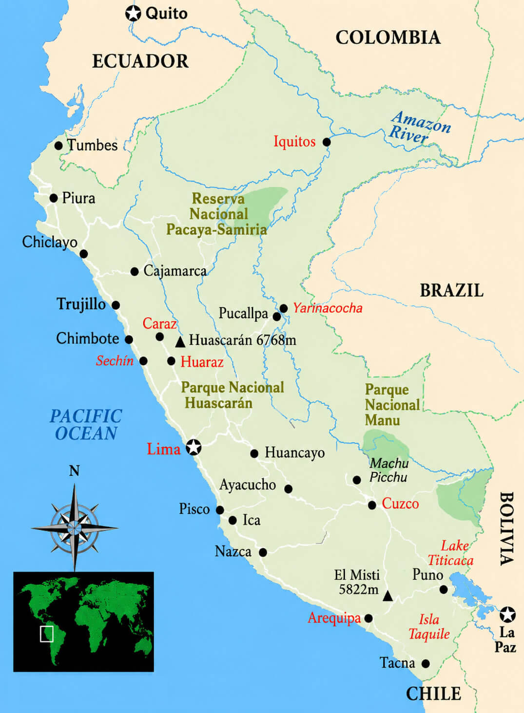
Peru tourist map
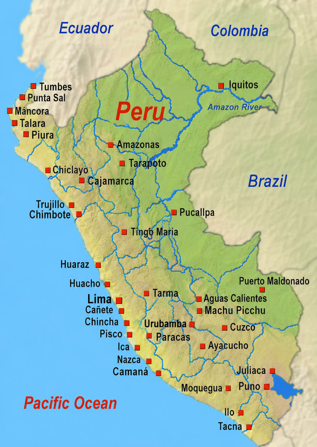
Peru transportation map
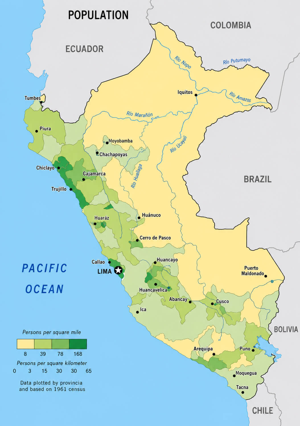
Peru population density map
Where is Peru on the South America Map?
Show Google map, satellite map, where is the country located.
Get directions by driving, walking, bicycling, public transportation and travel with street view.

