- Advertisement -
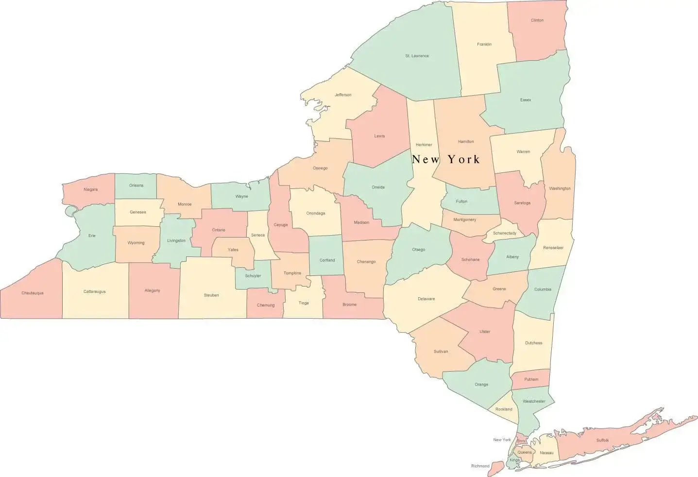
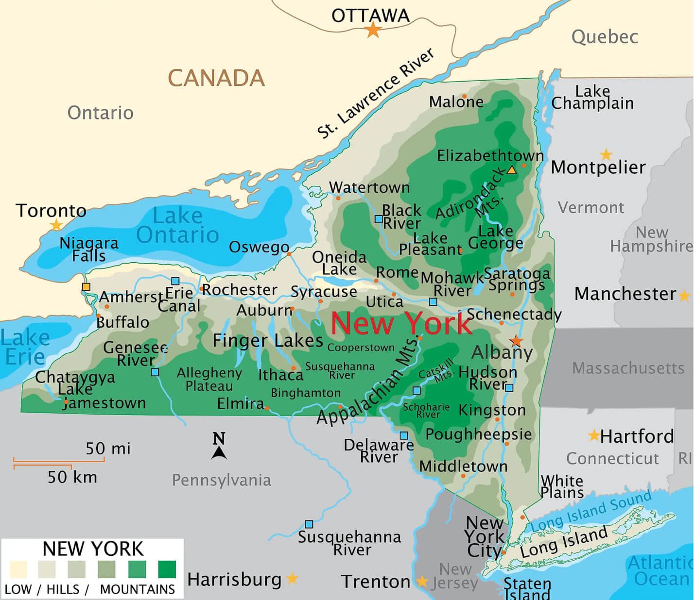
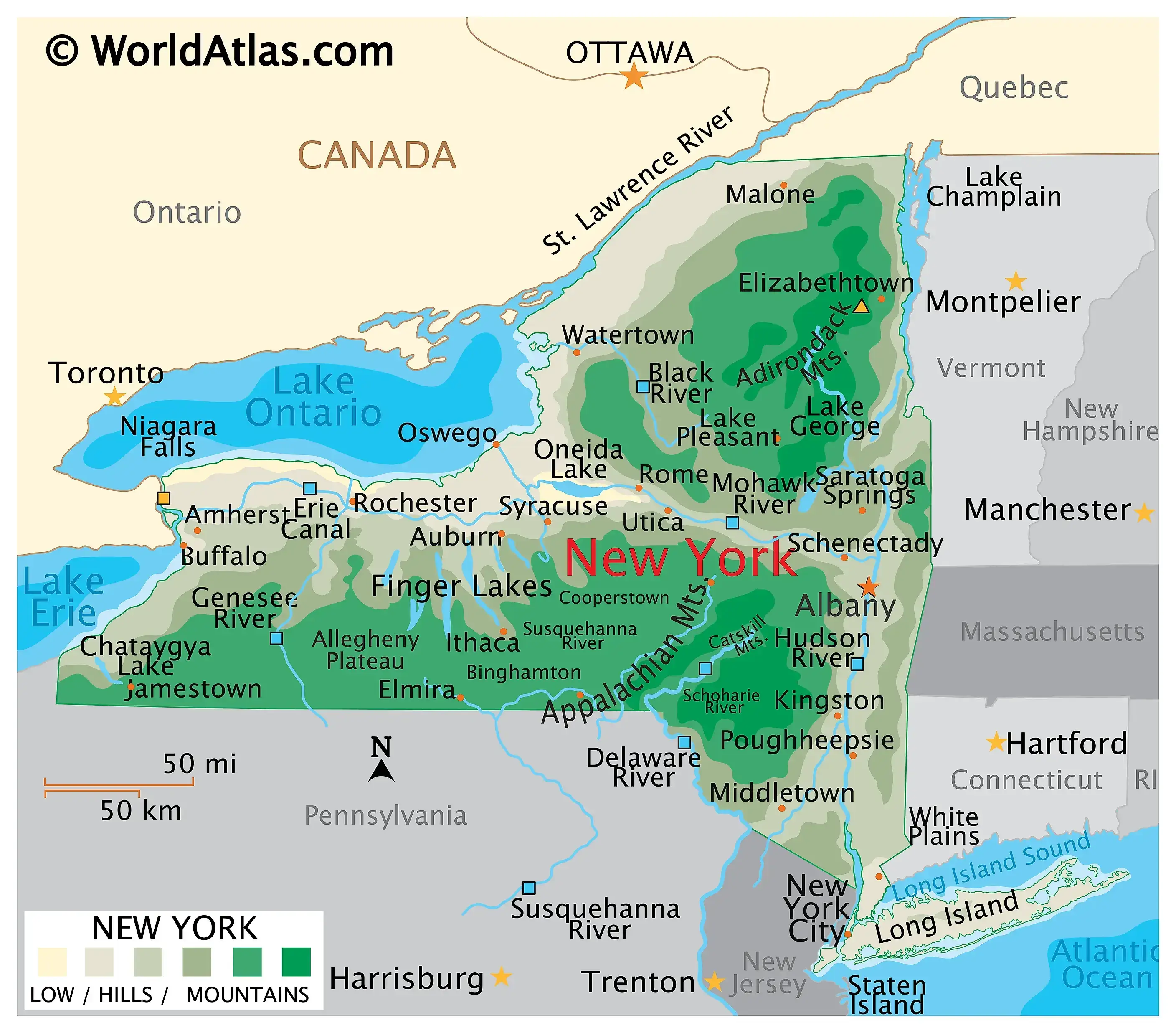
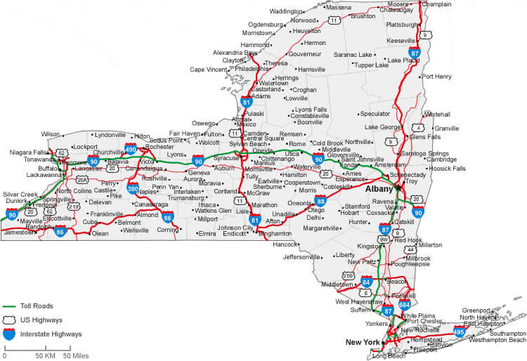
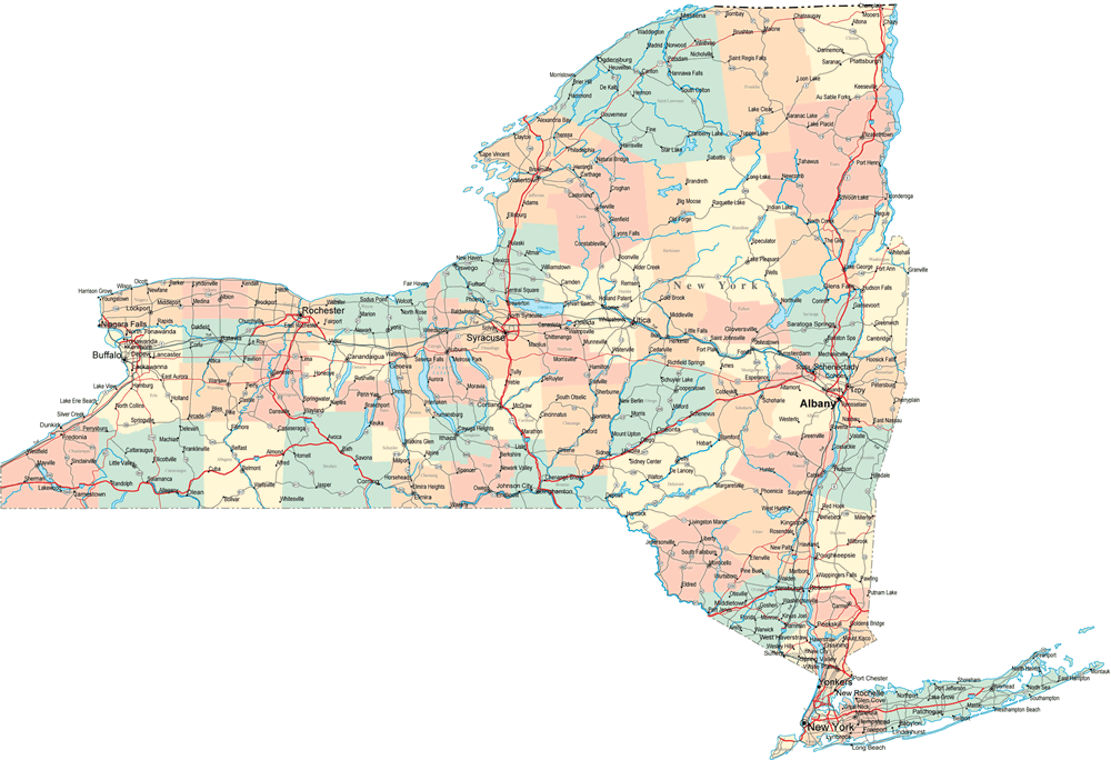
The New York Cities Map offers a detailed look at the Empire State, showing counties, major cities, roads, and waterways. Explore Long Island, New York City, and upstate regions with this administrative and physical map. It includes state borders, highways, and population data, perfect for travelers, researchers, and students.
New York Cities Map in the United States
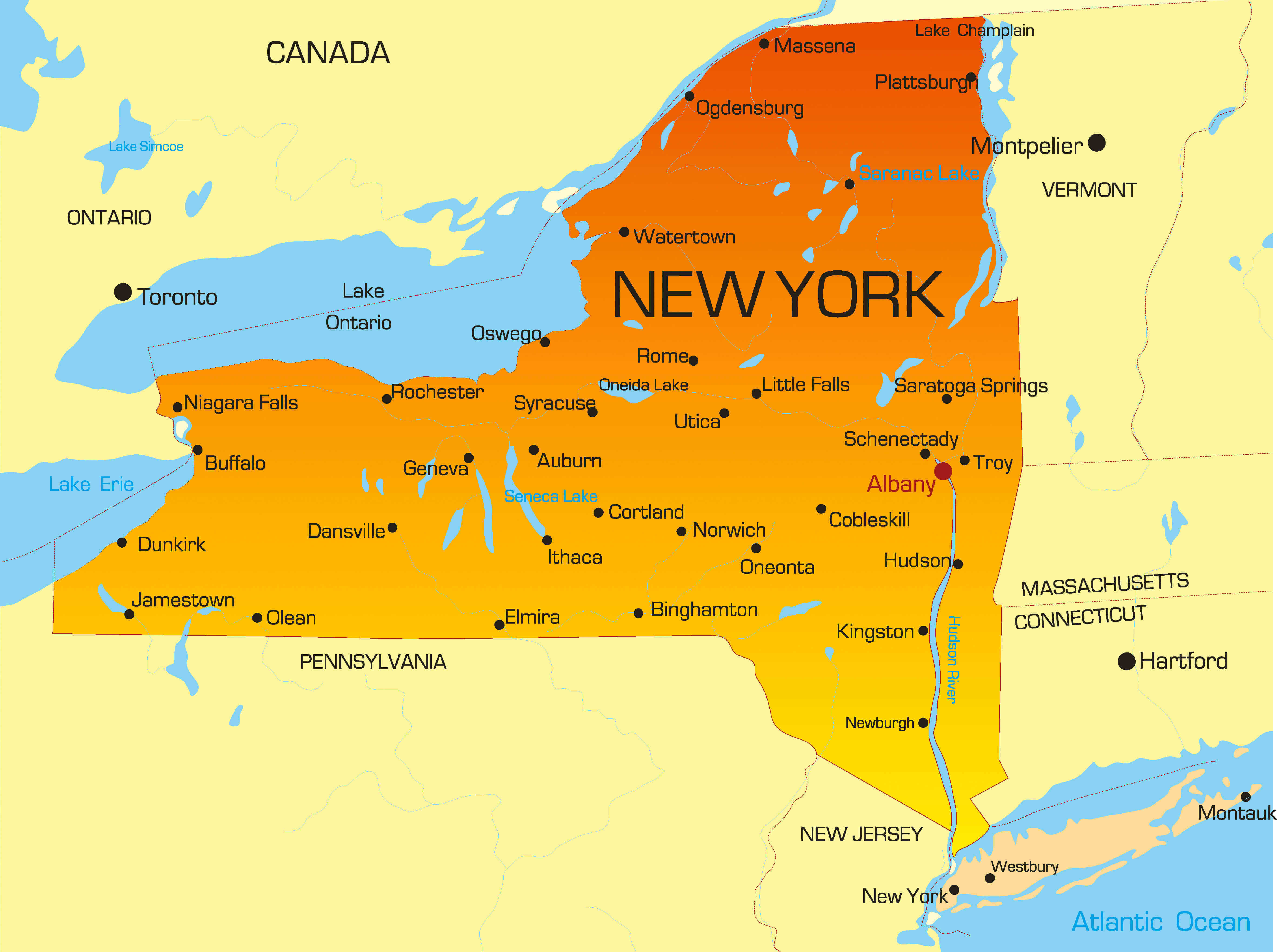
New York geography cities map
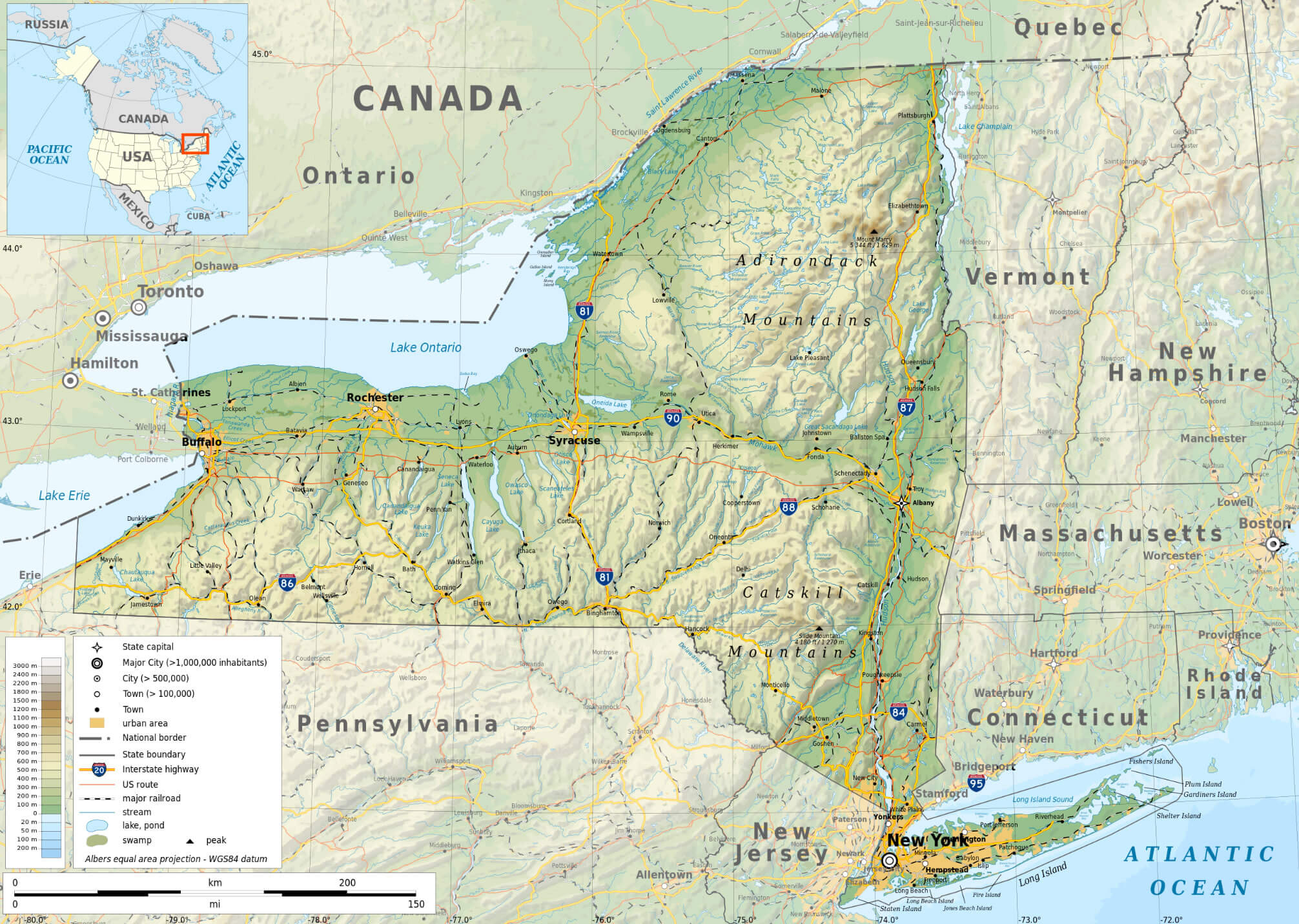
Long island map New York
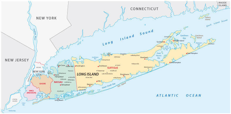
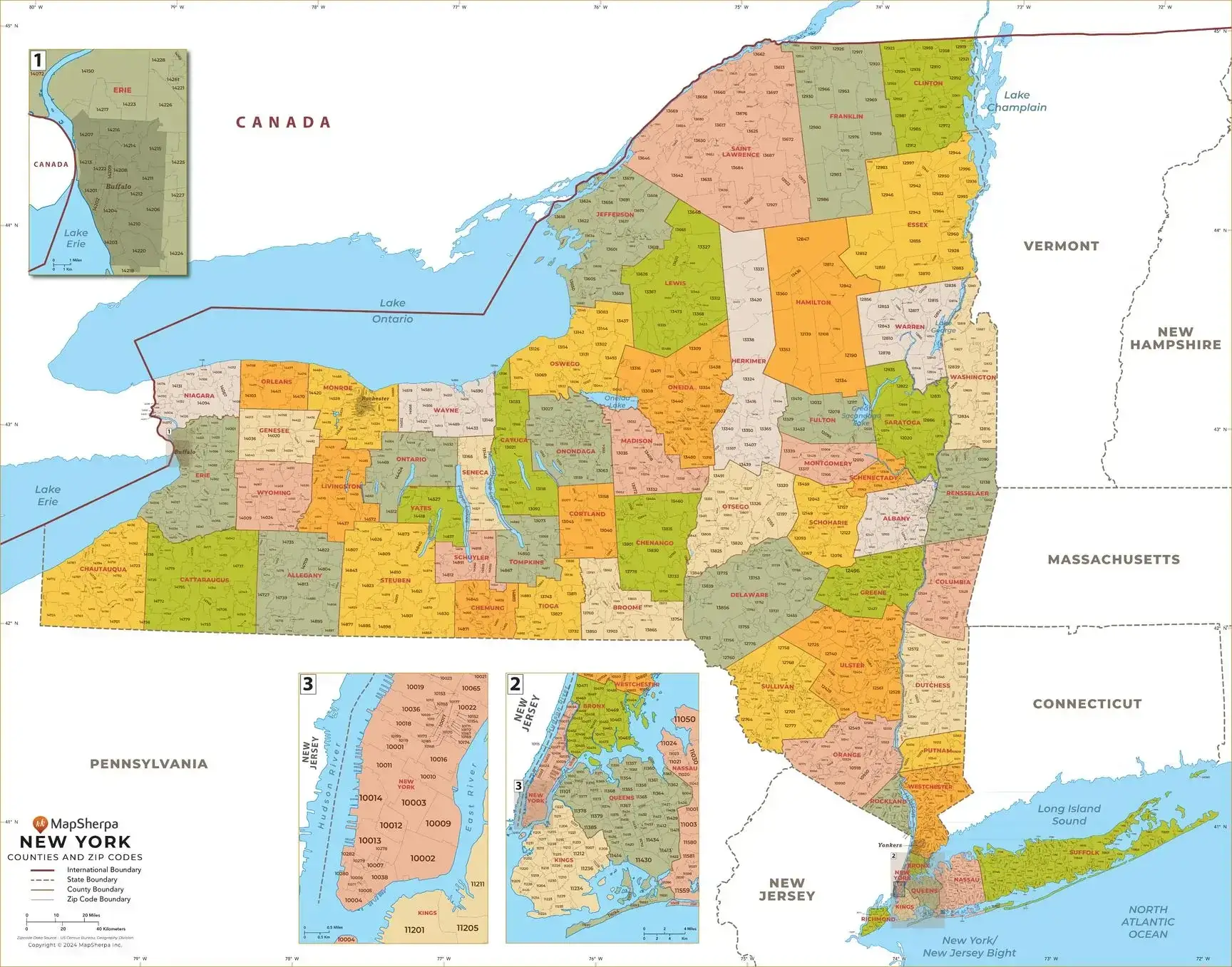
New York counties map
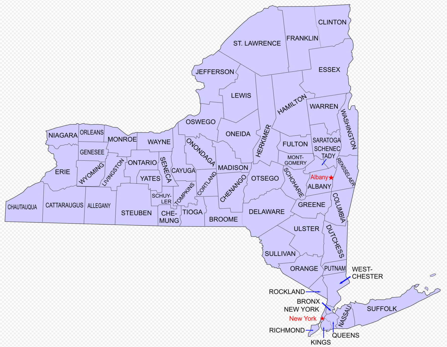
New York cities map with state borders
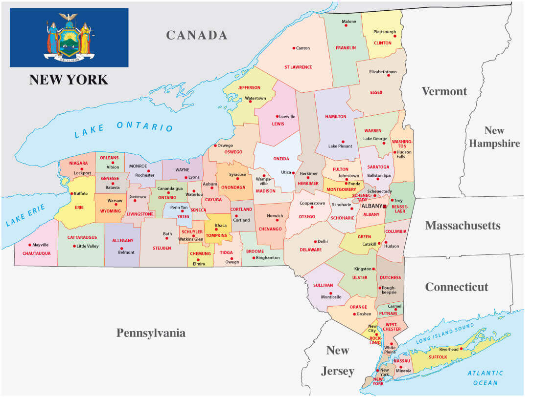
New York cities administrative map
New York cities blank map
New York cities interstate highways map
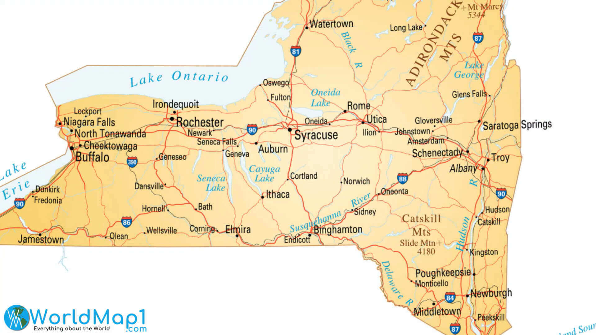
New York cities outline map
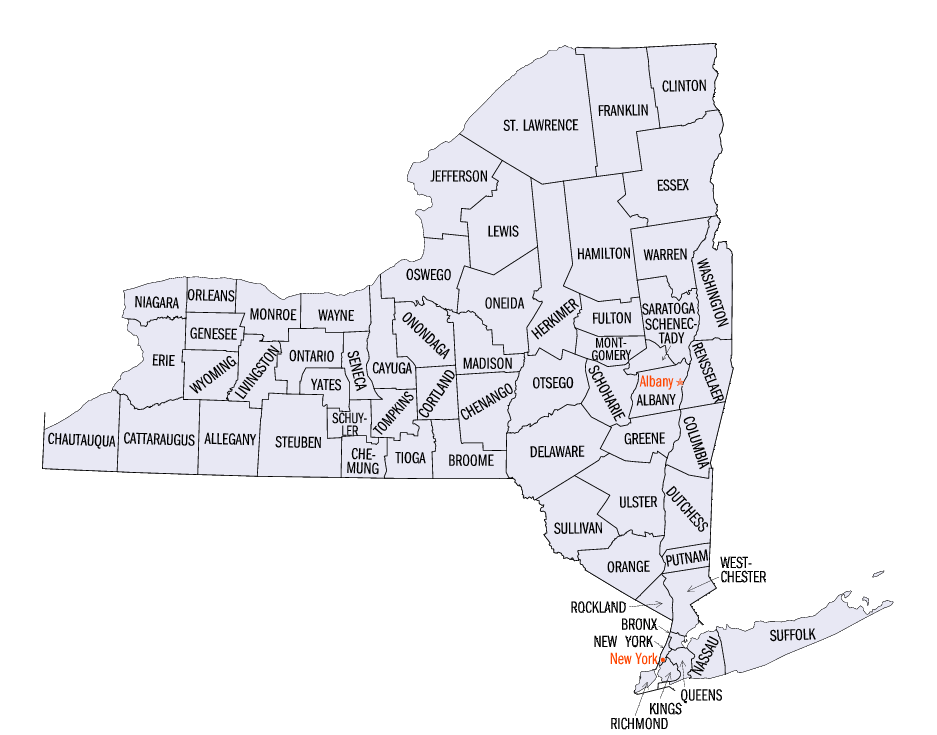
New York cities population map
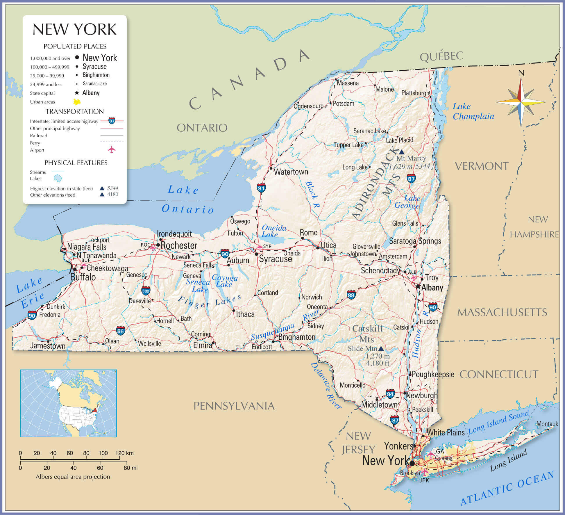
New York city map in NY
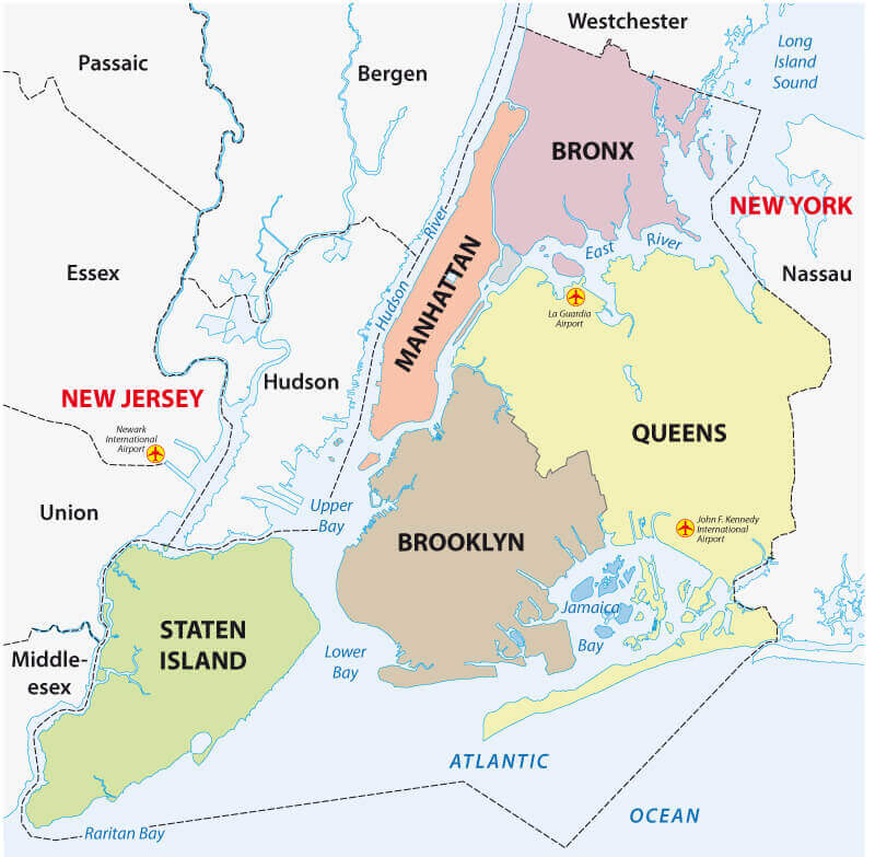
New York city on the us map
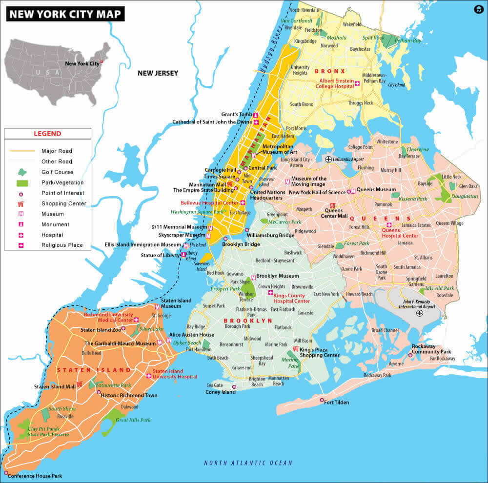
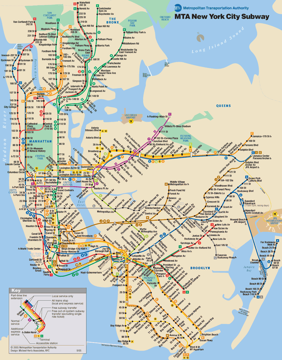
New York city subway map
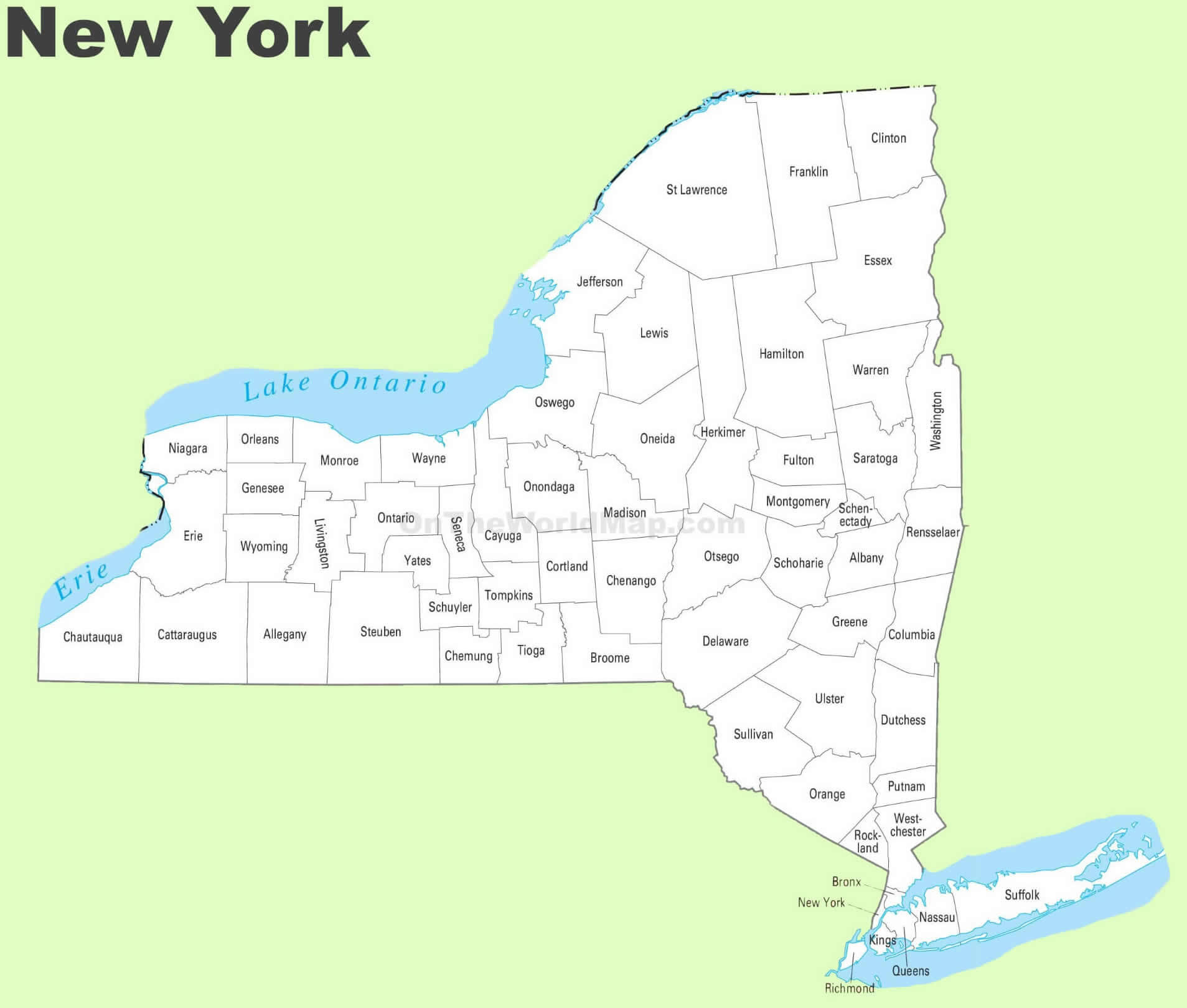
New York counties and cities map
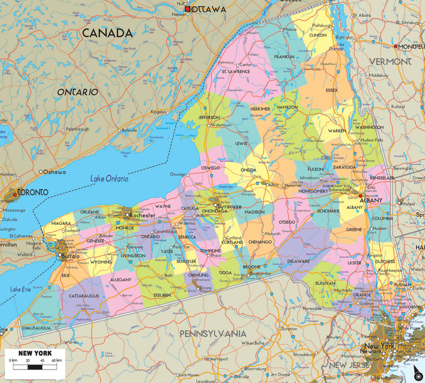
New York county map with cities
New York lakes and rivers map with cities
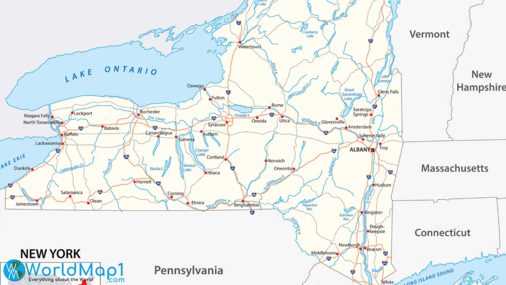
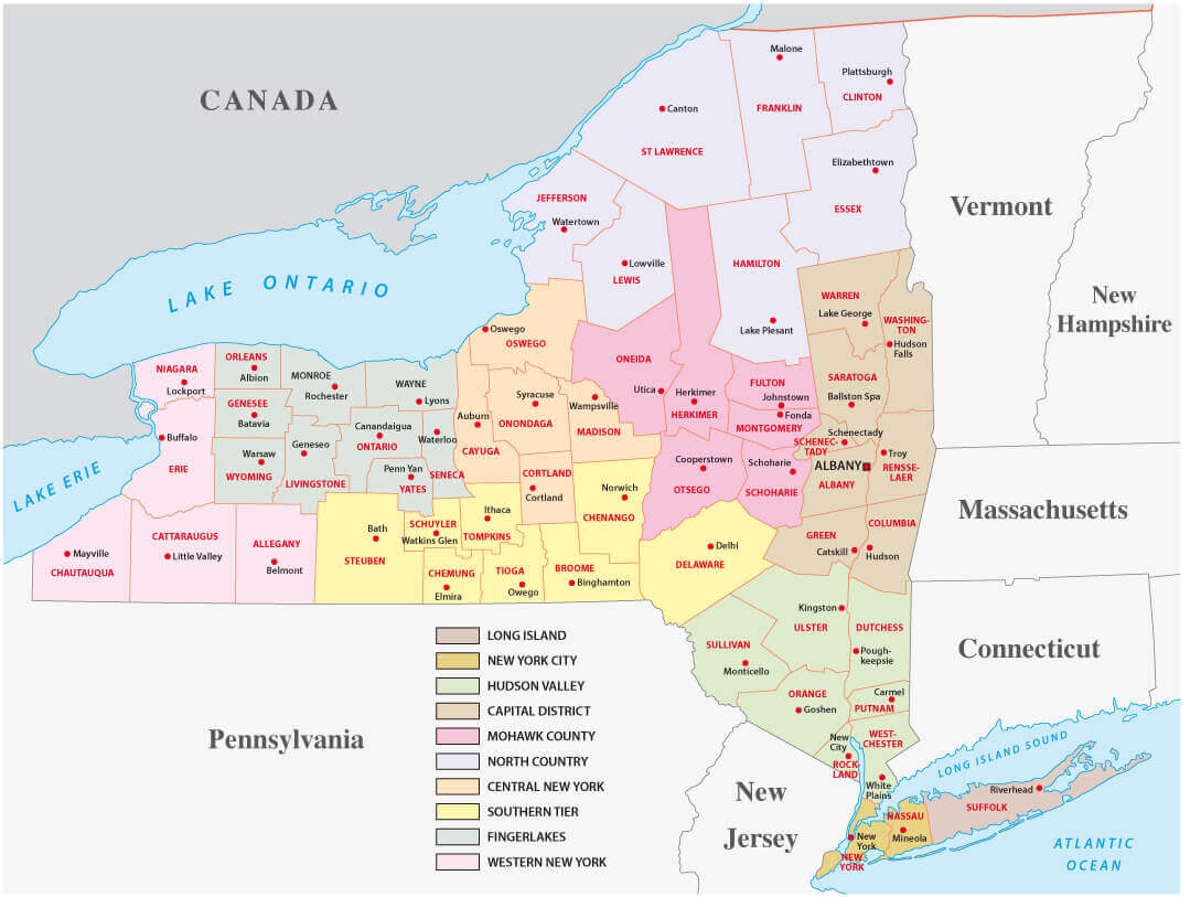
New York state cities and regions map
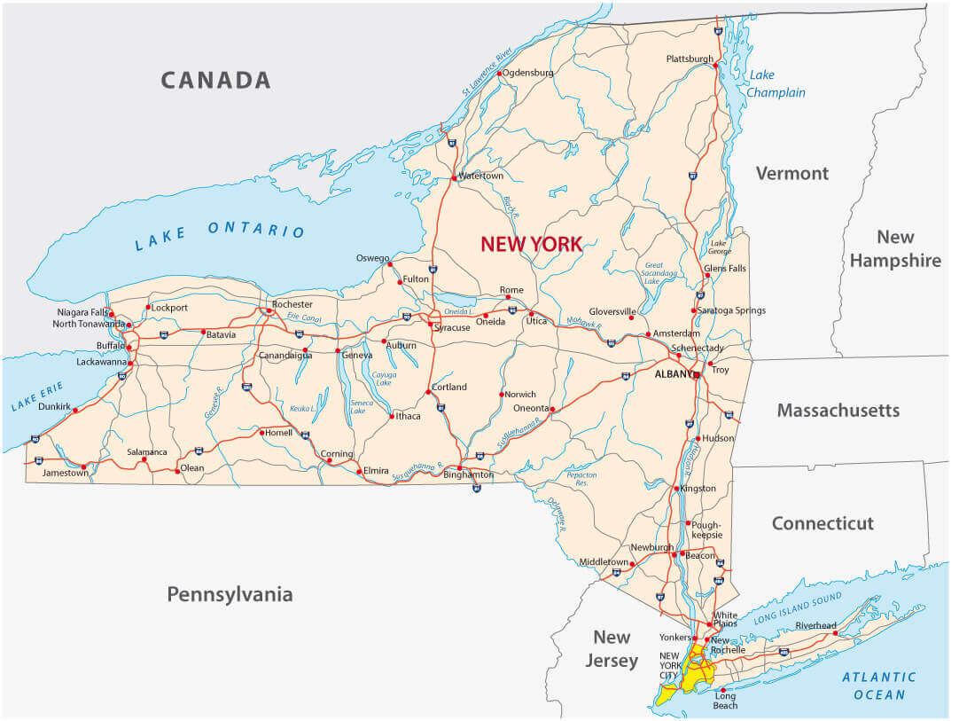
New York state cities and roads map
New York state largest cities map
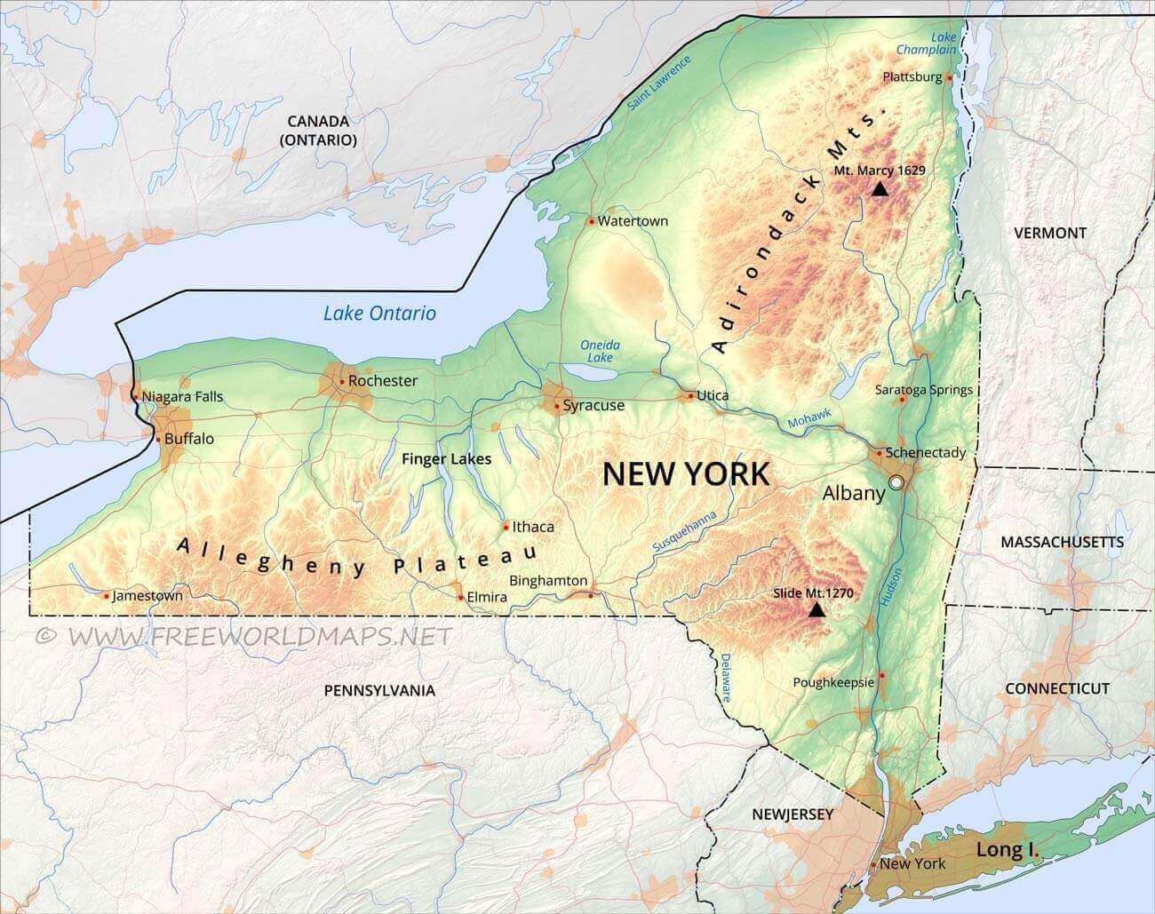
New York topo map with cities
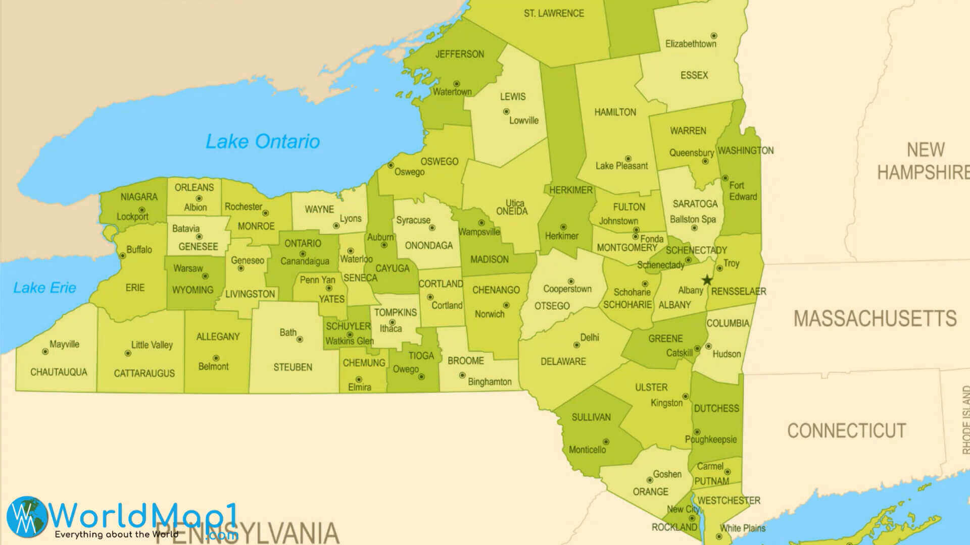
NY state counties and cities map usa
NY state physical map with cities
NY state physical map with cities
Road map of New York cities
State map of New York with cities
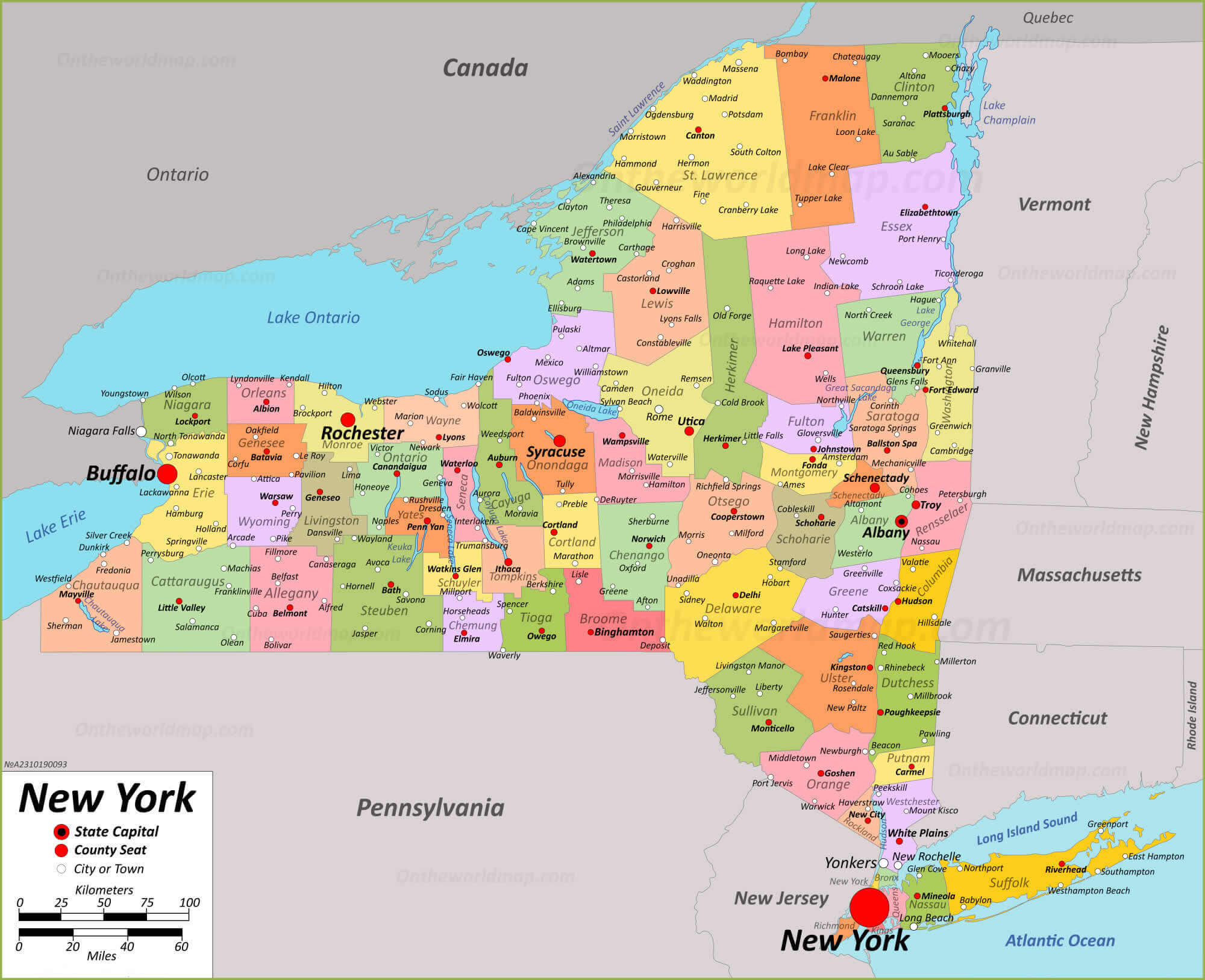
State map of New York with counties
Where is New York on the United States Map?
Show Google map, satellite map, where is the country located.
Get directions by driving, walking, bicycling, public transportation and travel with street view.
Feel free to explore these pages as well:
- New York Map ↗️
- Map of New York ↗️
- US Cities Map ↗️
- United States Cities Map ↗️
- California Cities Map ↗️
- Texas Cities Map ↗️
- Florida Cities Map ↗️
- Pennsylvania Cities Map ↗️
- Illinois Cities Map ↗️
- Ohio Cities Map ↗️
- Georgia Cities Map ↗️
- North Carolina Cities Map ↗️
- Michigan Cities Map ↗️
- New Jersey Cities Map ↗️
- Virginia Cities Map ↗️
- Washington Cities Map ↗️
- Arizona Cities Map ↗️
- Tennessee Cities Map ↗️
- Massachusetts Cities Map ↗️
- Indiana Cities Map ↗️
- Maryland Cities Map ↗️
- Missouri Cities Map ↗️
- Wisconsin Cities Map ↗️
- United States Map ↗️
- Map of United States ↗️
- North America Map ↗️
- Advertisement -
