Discover Bulgaria’s rich history and geography through this detailed map collection. From the Black Sea coastline to the majestic Balkan Mountains, these maps offer an in-depth look at Bulgaria’s diverse geography.
Brief information about Bulgaria
Bulgaria, located in Southeast Europe on the Balkan Peninsula, is a small but historically rich country. Its capital, Sofia, combines ancient ruins with modern architecture, while the country’s landscapes range from the Black Sea coast to the Balkan Mountains, offering both scenic beauty and outdoor activities.
Bulgaria Political Map
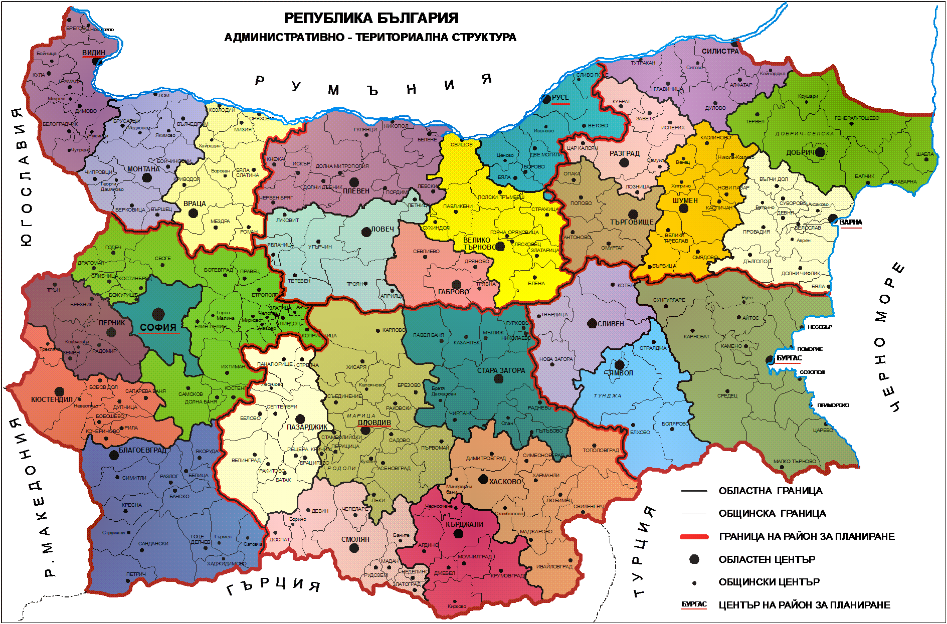
This map of Bulgaria shows the political divisions of the country, highlighting the various administrative regions and their boundaries. It includes the capital city of Sofia and other major cities such as Plovdiv, Varna and Bourgas. The regions are colour-coded to distinguish the different administrative areas, making it easier to identify the location of each province within the country. The map also outlines Bulgaria’s neighbouring countries, including Romania to the north, Serbia to the west, North Macedonia to the southwest, Greece to the south and Turkey to the southeast.
Known for its vibrant culture, Bulgaria boasts lively folk music, traditional dances, and delicious cuisine like banitsa and shopska salad. Whether exploring historic cities or relaxing in charming villages, Bulgaria offers a unique mix of history, nature, and hospitality.
Where is located Bulgaria on the World Map
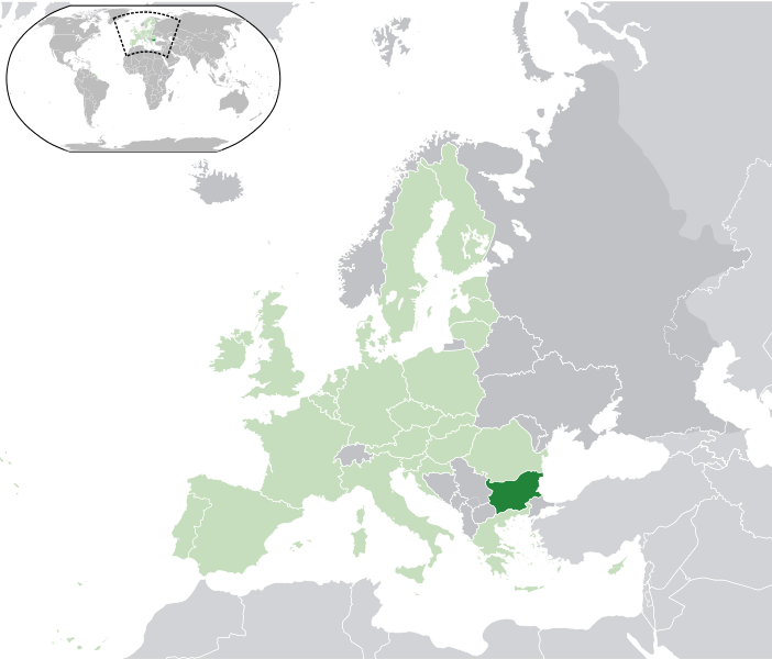
Bulgaria is located in Southeast Europe on the Balkan Peninsula, bordered by Romania to the north, Greece and Turkey to the south, Serbia and North Macedonia to the west, and the Black Sea to the east. Its position has historically made it a bridge between Europe and Asia.
On a world map, you can spot Bulgaria above Greece, with a coastline along the Black Sea. The capital, Sofia, is in the west, while other key cities like Plovdiv and Varna are spread across the country.
Bulgaria’s location has influenced its rich history and culture, blending Eastern and Western influences. Today, it stands as a member of the European Union, offering travelers a mix of history, nature, and coastal beauty.
Here are some statistical information about Bulgaria:
Bulgaria Detailed Map
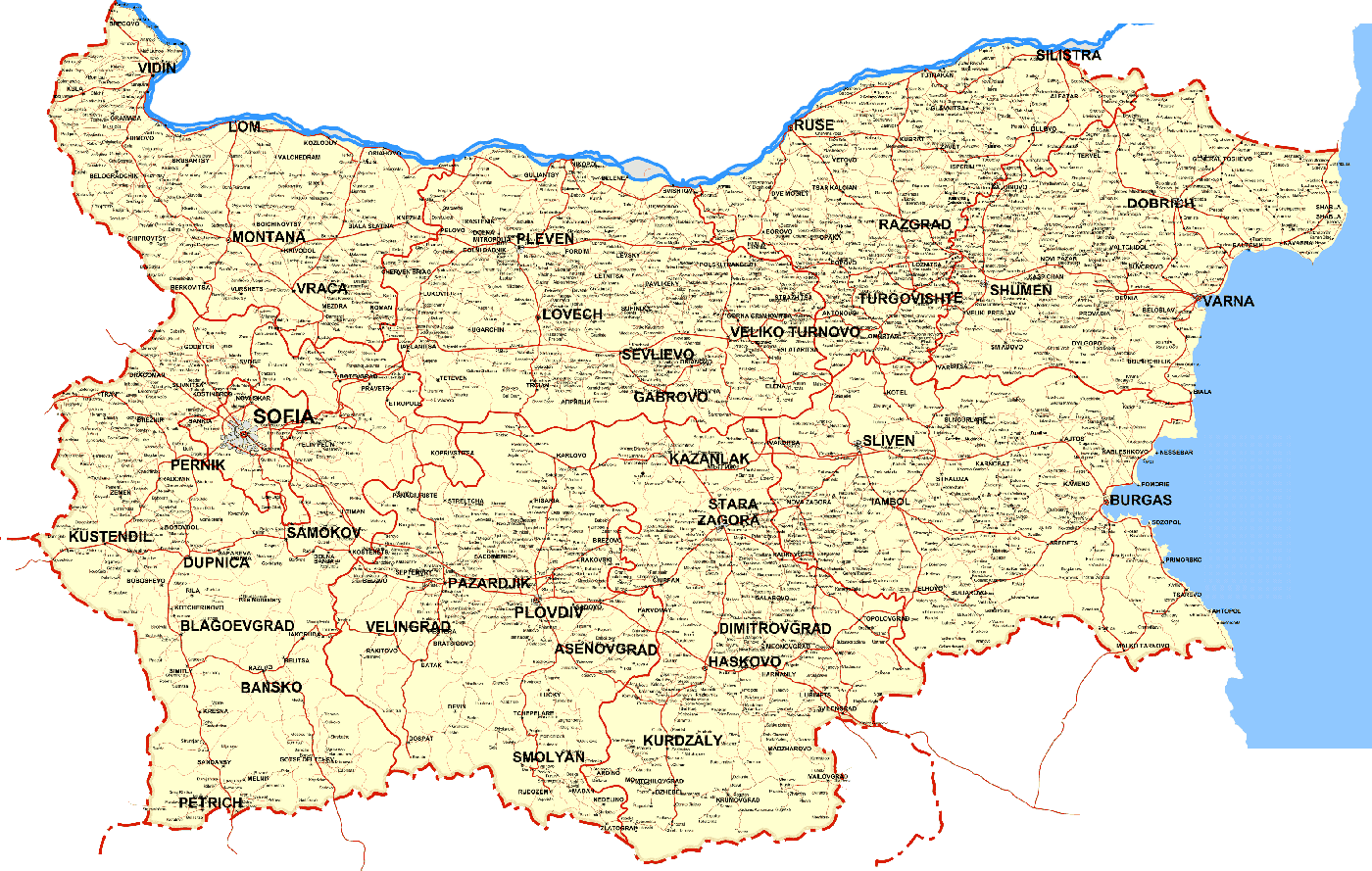
Bulgaria features major cities like Sofia, Plovdiv, Varna, and Burgas, connected by a network of roads. Key regions such as Veliko Tarnovo and Stara Zagora highlight the country’s geographic and administrative divisions, spanning from mountains to the Black Sea coast.
Bulgaria Culture History Map
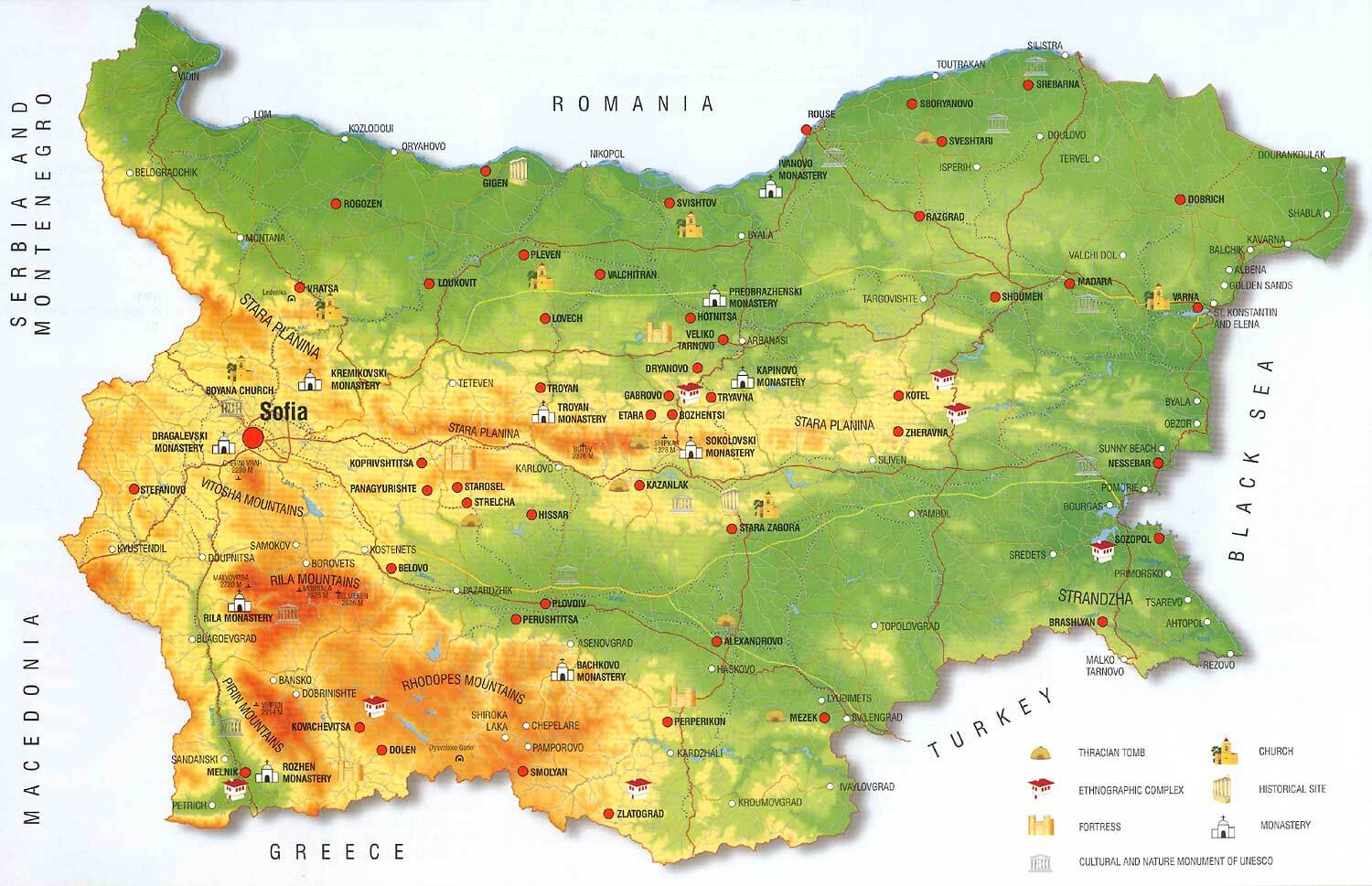
Bulgaria is rich in cultural and historical landmarks, including monasteries, fortresses, and UNESCO sites. Key areas like the Rila and Balkan Mountains house notable sites such as Rila Monastery, while the Black Sea coast features historical spots like Nessebar. Thracian tombs and churches are spread across the country, highlighting its diverse heritage.
Bosnia and Herzegovina Earth Map

Bulgaria Blank Map
Bulgaria Animals Map
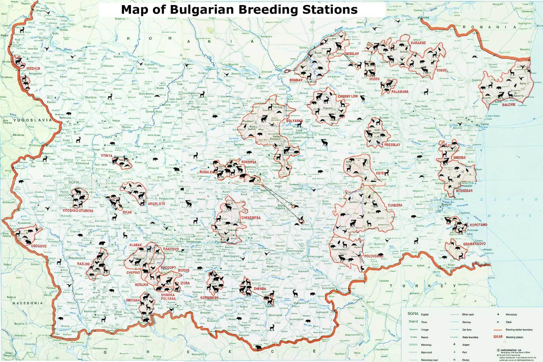
This map displays the breeding stations across Bulgaria, with symbols showing where different animals like deer and wild boar are bred. The stations are spread throughout the country, from the Black Sea coast to the mountainous western regions. Key areas like Sofia, Midzhur, and Vitoshko Studena are noted for their breeding efforts, showcasing Bulgaria’s diverse wildlife management.
Bulgaria Administrative Map
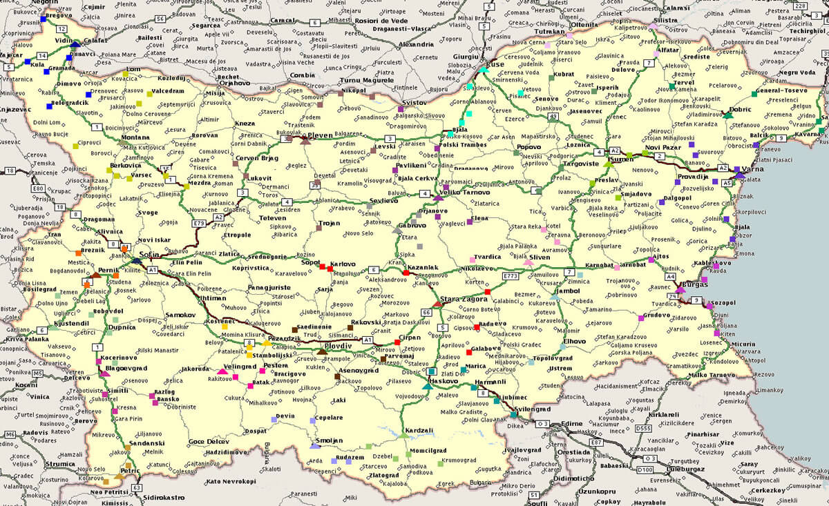
Bulgaria’s administrative divisions are highlighted, showing major cities like Sofia, Plovdiv, and Varna, along with key road and railway routes. Borders with Romania, Greece, and Turkey are clearly defined.
Bulgaria Travel Map
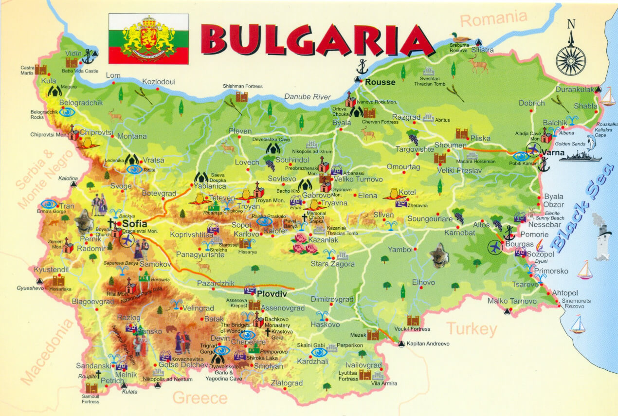
Bulgaria Map with Balkan Mountains
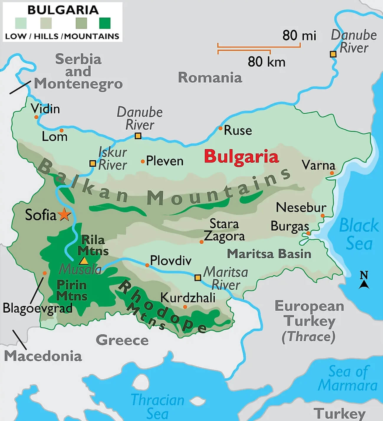 This map of Bulgaria shows the main geographical features of the country, including the Balkan Mountains, which stretch from the western border with Serbia to the Black Sea in the east. It also shows the Rhodope and Rila mountain ranges in the south, the location of the capital city of Sofia, and major rivers such as the Danube, which forms the northern border with Romania, and the Maritsa River in the south. This topographical overview highlights Bulgaria’s varied landscape, from mountainous regions to coastal areas along the Black Sea.
Bulgaria Physical Map
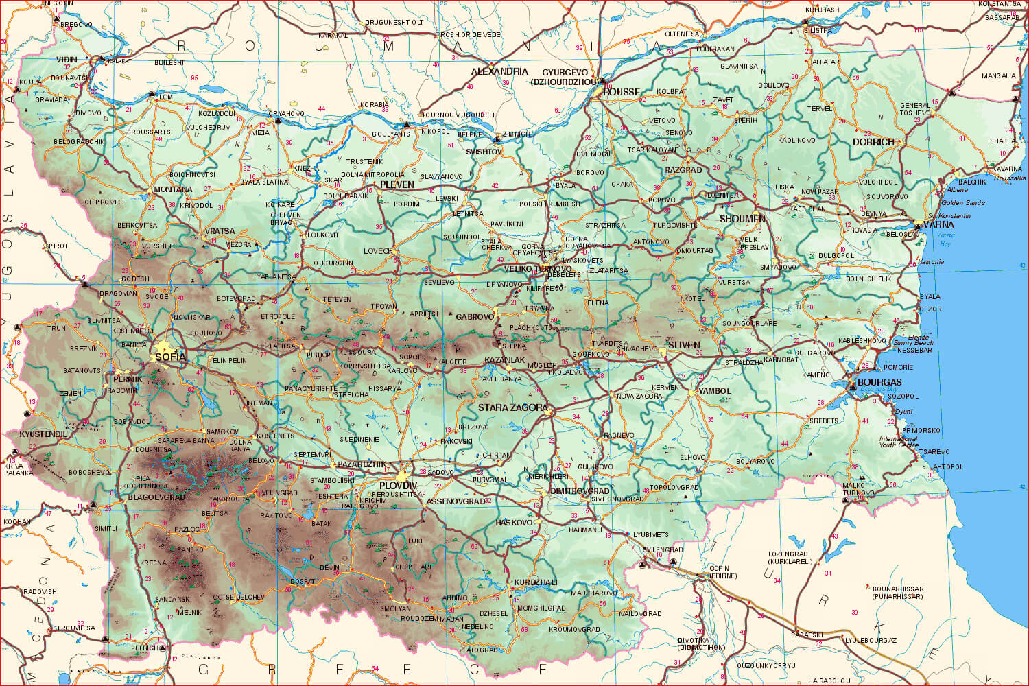 This physical map of Bulgaria provides a detailed view of the country’s diverse landscapes, including mountain ranges such as the Balkan, Rila, Pirin and Rhodope, as well as the Danube River and the Thracian Plain. It highlights key geographical features such as the location of major cities such as Sofia and Plovdiv, river systems and natural elevations, providing a comprehensive view of Bulgaria’s terrain.
Bulgaria Regions Map with Cities Rivers
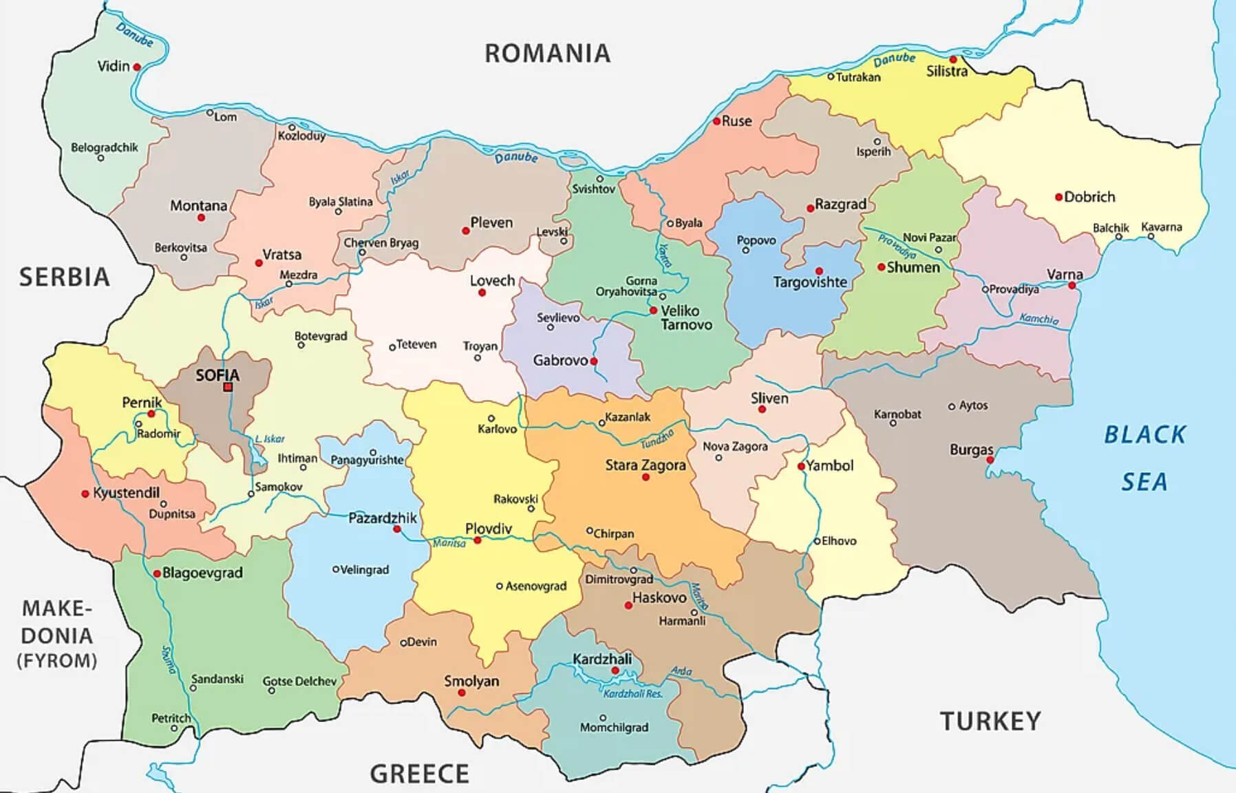 This regional map of Bulgaria with cities and rivers shows the administrative divisions of the country, highlighting major regions such as Sofia, Plovdiv and Varna. It also includes major rivers, such as the Danube along the northern border with Romania, and provides a visual representation of how different cities and rivers are located across Bulgaria’s varied landscape. This map serves as a detailed guide to understanding the geographical distribution of Bulgaria’s regions and major urban centres.
Bulgaria Elevation Map
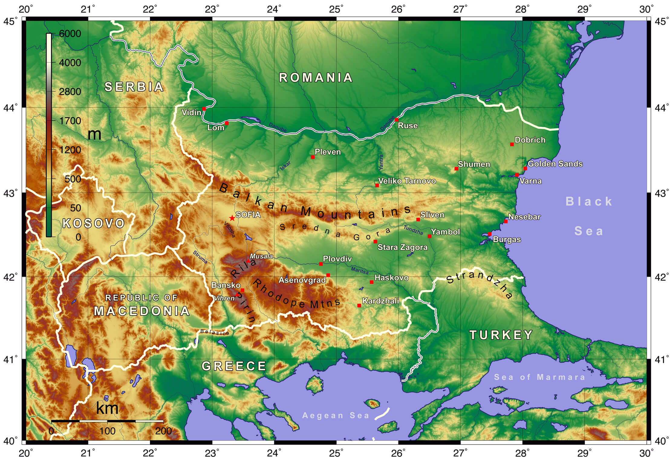 This Bulgaria elevation map highlights the country’s diverse topography, including the prominent Balkan Mountains that stretch across central Bulgaria, the Rhodope Mountains in the south, and the Danube River basin along the northern border with Romania. The map also showcases the lower coastal plains along the Black Sea and the highest peaks like Musala, found in the Rila Mountains. The varying shades indicate changes in altitude, ranging from low-lying areas near the Black Sea to the elevated mountainous regions in the west and southwest.
Bulgaria Provinces Map
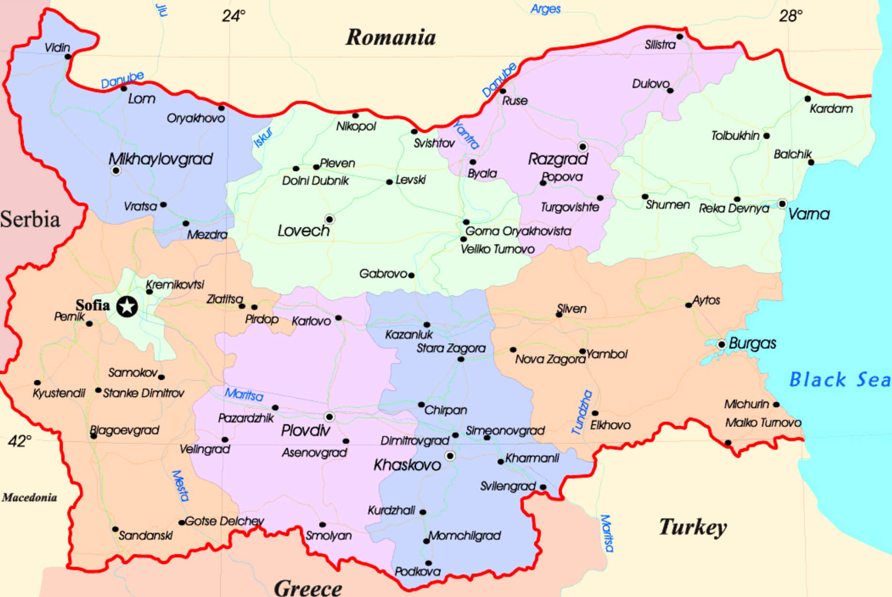 This map of Bulgaria illustrates the country’s provincial divisions, highlighting the different administrative regions and major cities such as Sofia, Plovdiv and Varna. It also shows major rivers such as the Danube, which forms part of Bulgaria’s northern border with Romania, and other important waterways such as the Maritsa and Iskur rivers. The regional breakdown provides a detailed view of Bulgaria’s geographical layout, showing how its provinces are connected to neighbouring countries such as Serbia, North Macedonia, Greece and Turkey.
Bulgaria Rivers Map
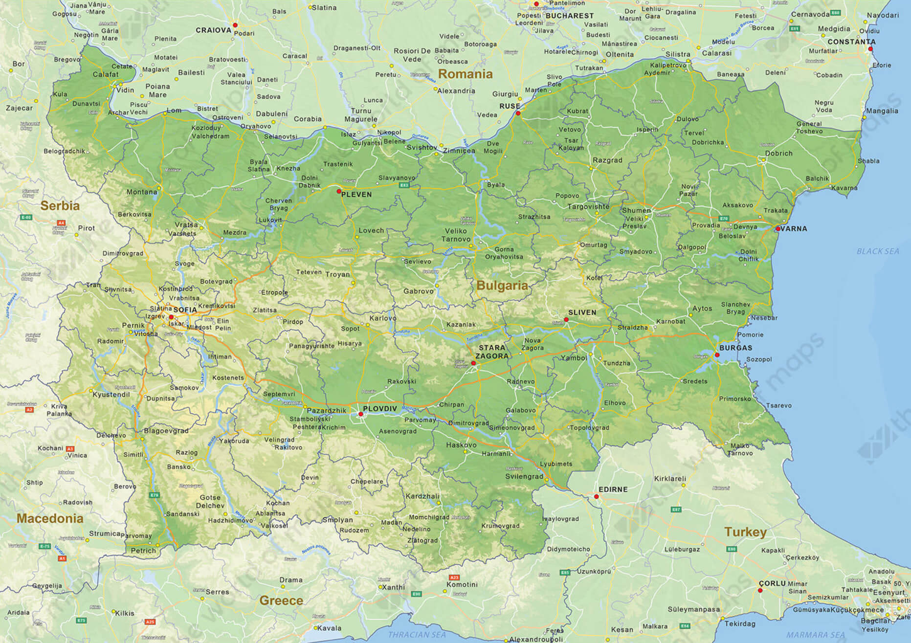 This map of Bulgaria highlights the country’s rivers, including the Danube along the northern border with Romania, and major rivers such as the Maritsa, Iskur and Tundzha, which flow through the interior. The map also outlines various cities, highlighting their geographical location in relation to the rivers, which play an important role in the region’s agriculture, transport and settlement.
Bulgaria Blank Map White Color
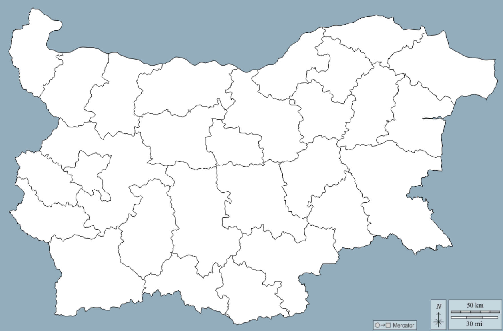
Borders of Bulgaria Treaty of San Stefano in 1878
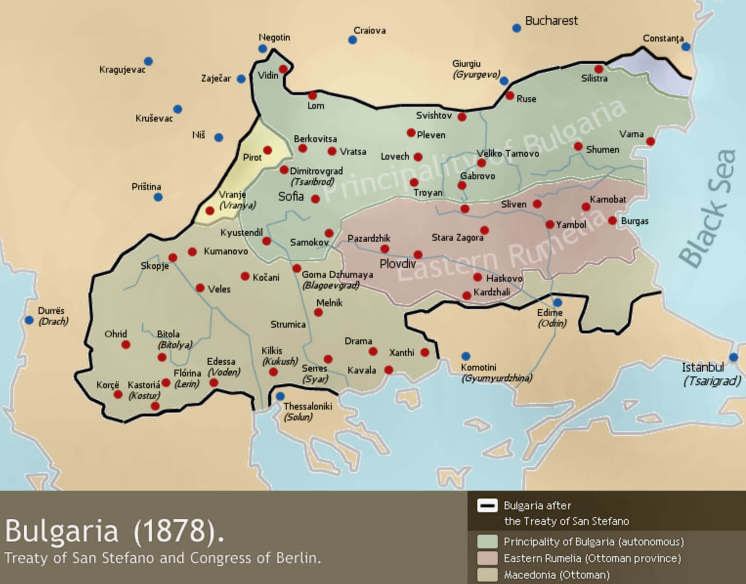 This map shows the borders of Bulgaria after the Treaty of San Stefano in 1878, which was originally intended to create a large autonomous Bulgarian state within the Ottoman Empire. However, the Congress of Berlin, held later that year, significantly revised these borders, reducing the area under Bulgarian control. The map shows regions such as the Principality of Bulgaria and Eastern Rumelia, highlighting how the treaty’s original vision for Bulgaria was altered by subsequent international agreements.
Bulgaria Topographic Map
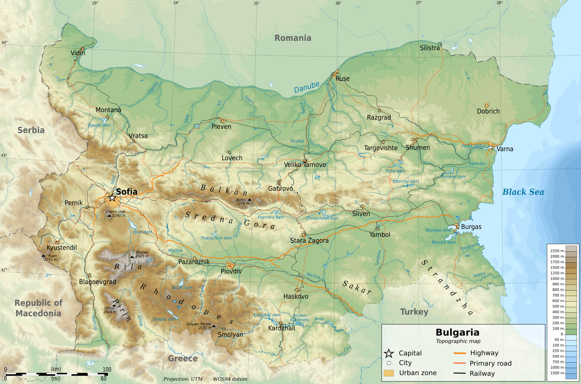 This topographic map of Bulgaria highlights the varied terrain of the country, showcasing mountain ranges such as the Balkan Mountains, Rila, and Rhodope Mountains. The map also features key cities like Sofia, Plovdiv, and Varna, as well as rivers including the Danube, Maritsa, and Iskar, which flow through Bulgaria’s diverse landscape. The shading indicates elevation levels, helping to visualize the geographical features from the mountainous regions to the flatter plains and coastal areas along the Black Sea.
Bulgaria Climate Map
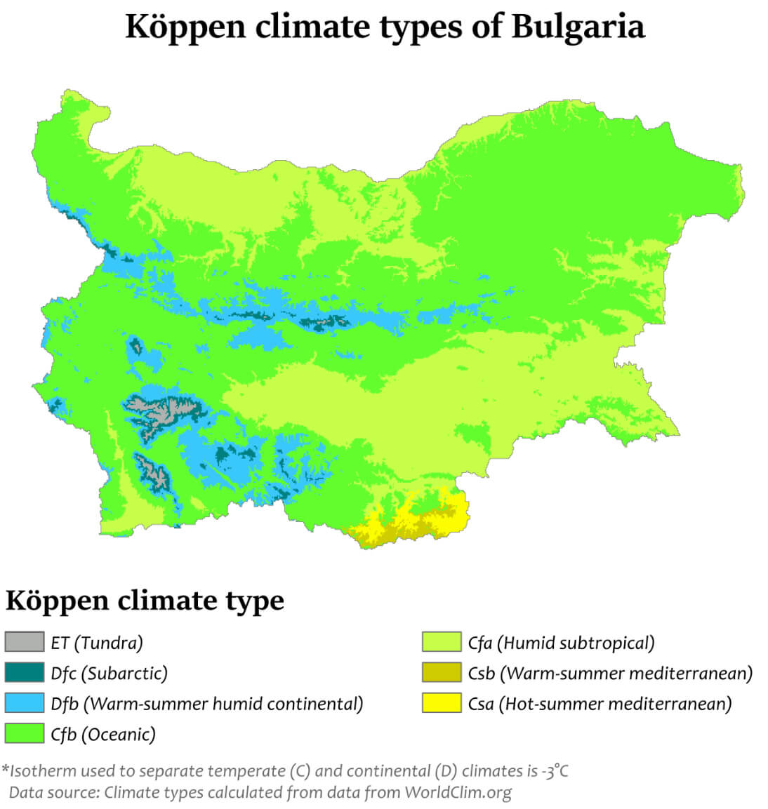 This map of Bulgaria illustrates the different Köppen climate types found throughout the country. It highlights the diversity of climate zones, ranging from humid subtropical areas (Cfa) to regions with a warm summer humid continental climate (Dfb) and small areas with hot summer Mediterranean conditions (Csa), especially in the southern parts. The map visually shows how Bulgaria’s terrain influences its climate, with the mountainous areas contributing to cooler conditions and the southern regions experiencing warmer summers.
Bulgaria Physical Map with Largest Cities
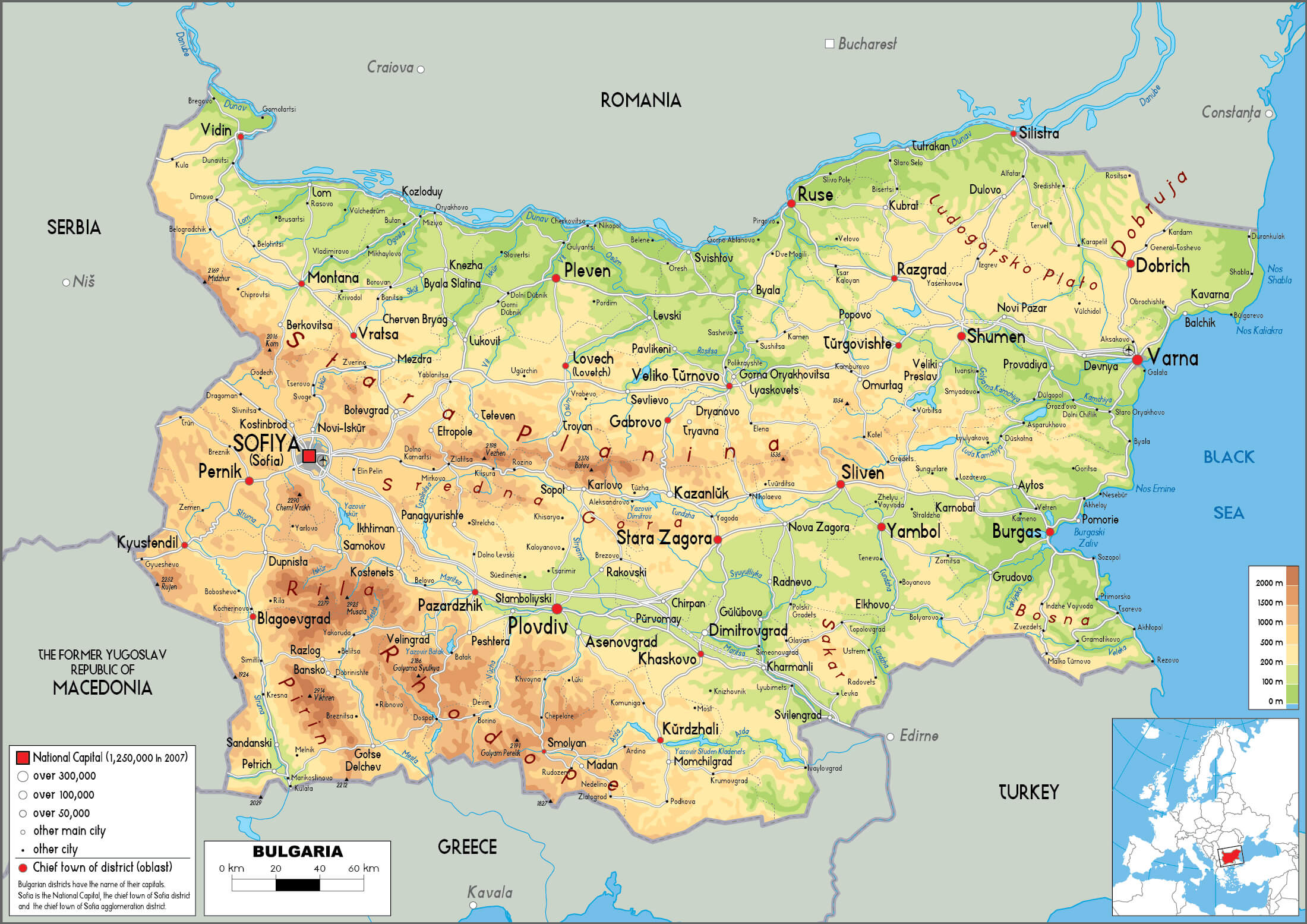 This physical map of Bulgaria highlights the country’s diverse landscape, showing the distribution of mountains, rivers, and valleys alongside the locations of major cities such as Sofia, Plovdiv, Varna, and Burgas. The relief shading emphasizes the mountainous regions, including the Balkan and Rhodope Mountains, while also depicting the lower plains and river basins like the Maritsa River in the south.
Bulgaria Cities Map
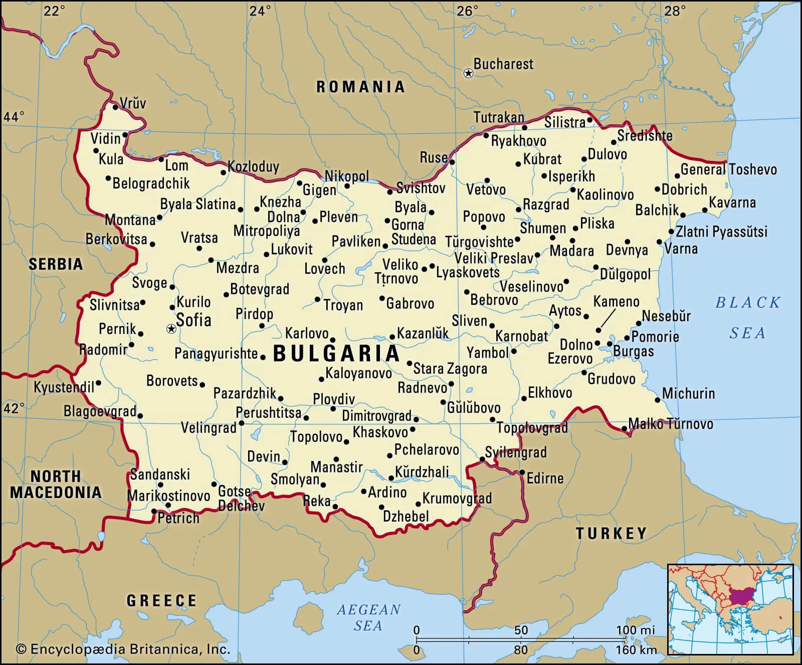 This map of Bulgaria highlights the country’s various cities and their locations, showing the main urban areas such as Sofia, Plovdiv, Varna and Burgas. It provides a clear view of Bulgaria’s position in relation to its neighbours, such as Romania, Serbia, North Macedonia, Greece and Turkey, as well as the Black Sea to the east. The map is useful for understanding the geographical layout of Bulgaria and the distribution of its cities in different regions.
Bulgaria International Boundary Map
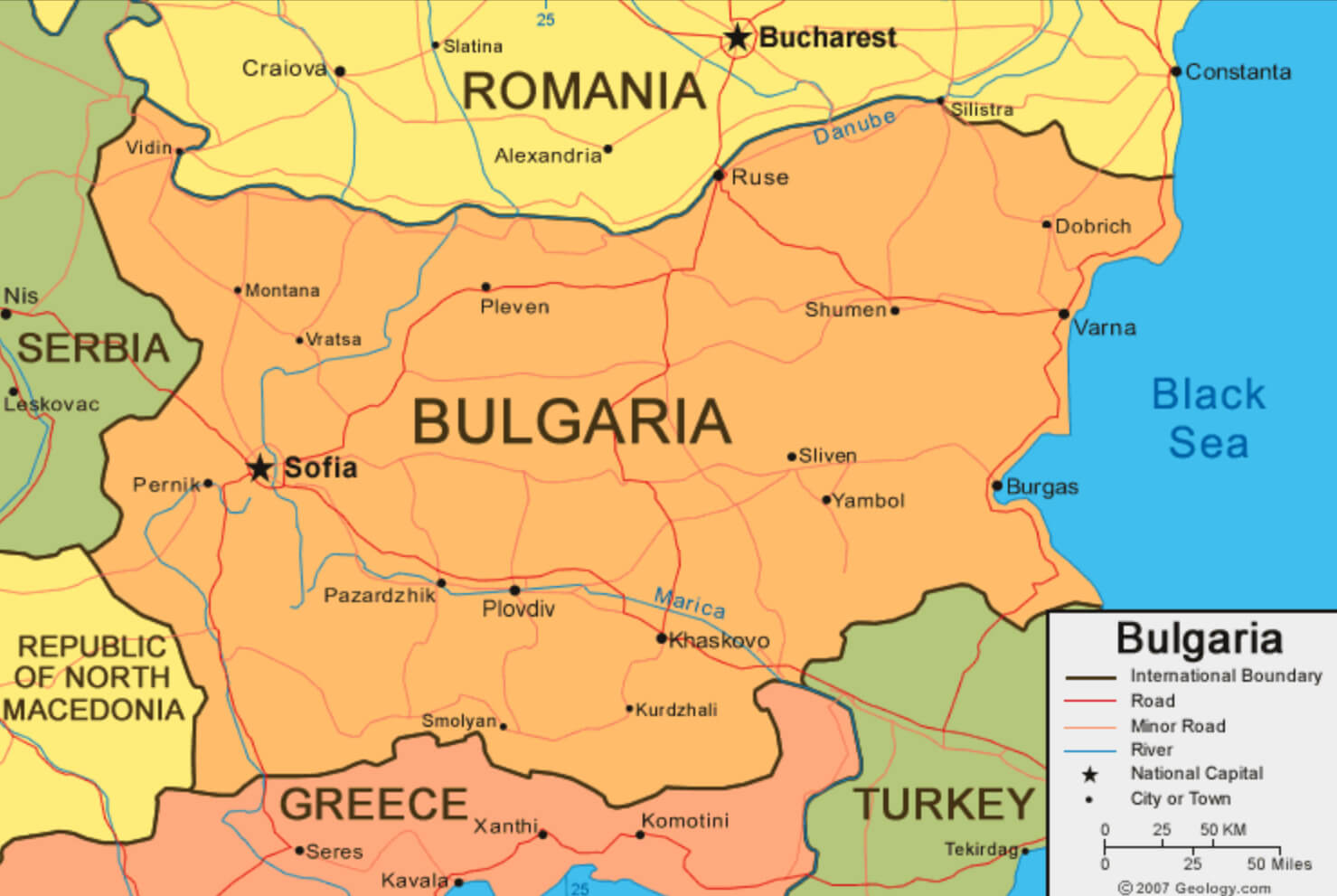 This map of Bulgaria shows international borders with neighbouring countries, including Romania, Serbia, North Macedonia, Greece and Turkey. It also marks key cities such as Sofia, Plovdiv and Varna, as well as major roads and rivers such as the Maritsa and the Danube, emphasising Bulgaria’s connections and geographical position within the Balkan region.
Terrain Map of Bulgaria
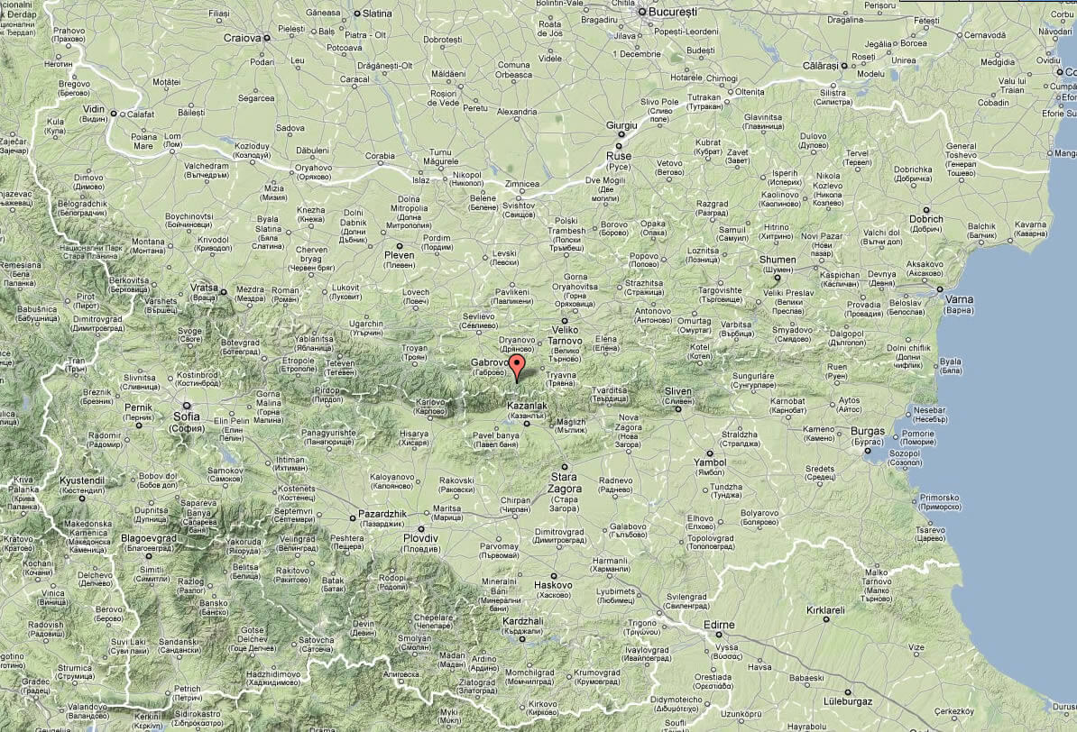
Bulgaria features diverse terrain, including mountains, plains, and a Black Sea coastline. Major cities like Sofia, Plovdiv, and Varna are spread across the country, with the Balkan Mountains cutting through its center, highlighting the country’s geographic variety.
Sketch of Bulgaria
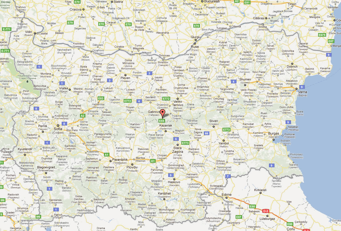
Bulgaria Satellite Map
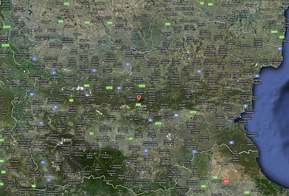
Where is Bulgaria on the Europe Map?
Show Google map, satellite map, where is the country located.
Get directions by driving, walking, bicycling, public transportation and travel with street view.
Feel free to explore these pages as well:
- Greece Map ↗️
- Discover the Timeless Charm of Athens: The Heart of Ancient Greece ↗️
- A Collection of Cyprus Maps ↗️
- Best Mediterranean Cruises Routes 2020 & Best Time to Cruise ↗️
- Top Places to Visit in Athens & Things to do in Athens ↗️
- Discover Bulgaria Through Maps ↗️
- Map of Europe ↗️
- Europe Map ↗️
- A Collection of Europe Maps ↗️
