Europe Historical Map

HomeMapsEurope Historical Map
- Advertisement -

Explore historical and medieval maps of Europe, including Christian pilgrimage routes, political borders from 1330 to 1944, World War maps, and medieval Europe from 950 to 1300. Ideal for history enthusiasts and researchers seeking Europe’s evolving past.

Political Map of Europe in 1500
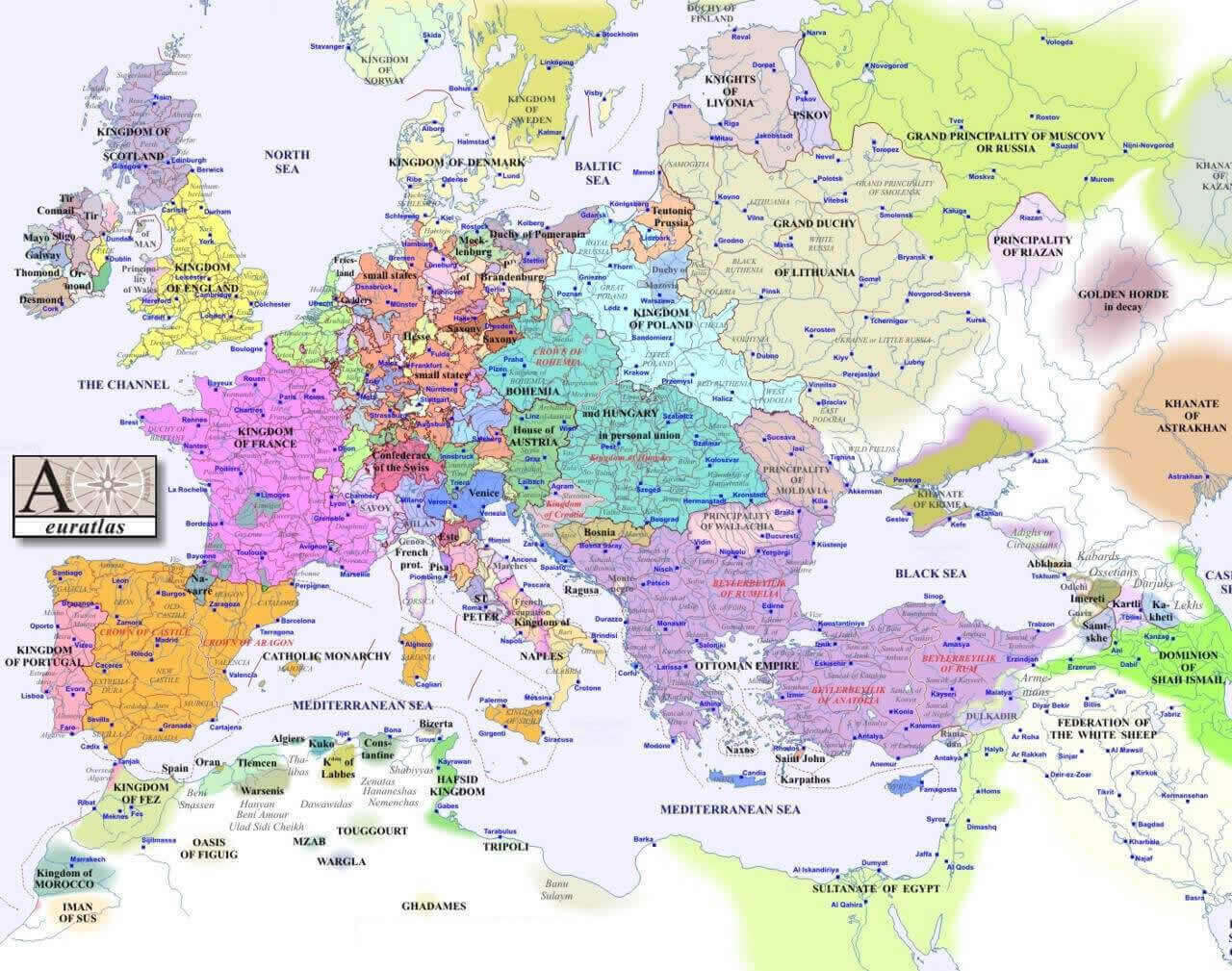
Europe political map in 1500
Europe political map in 1500 showing empires and kingdoms of the early modern era.

This historical map shows the political landscape of Europe in 1500. Highlighting major kingdoms, empires, duchies and territories, such as the Ottoman Empire, the Kingdom of France, the Holy Roman Empire and the Grand Duchy of Lithuania, it offers insight into Europe’s geopolitical divisions at the start of the sixteenth century.

Europe Historical Political Map in 1944
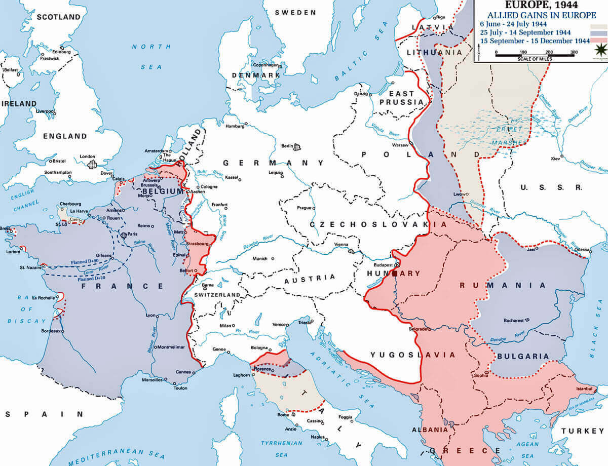
Europe Historical political map in 1944
Europe 1944 political map with WWII frontlines and Allied advances in Europe.

This historical political map of Europe in 1944 illustrates the key frontlines of World War II and the advances made by the Allies between June and December of that year. It illustrates occupied territories, advancing forces and shifting borders during the final phases of the war, providing a clear overview of Europe’s wartime geography and military dynamics.

Europe Christian Pilgrimage map in the Middles 1000
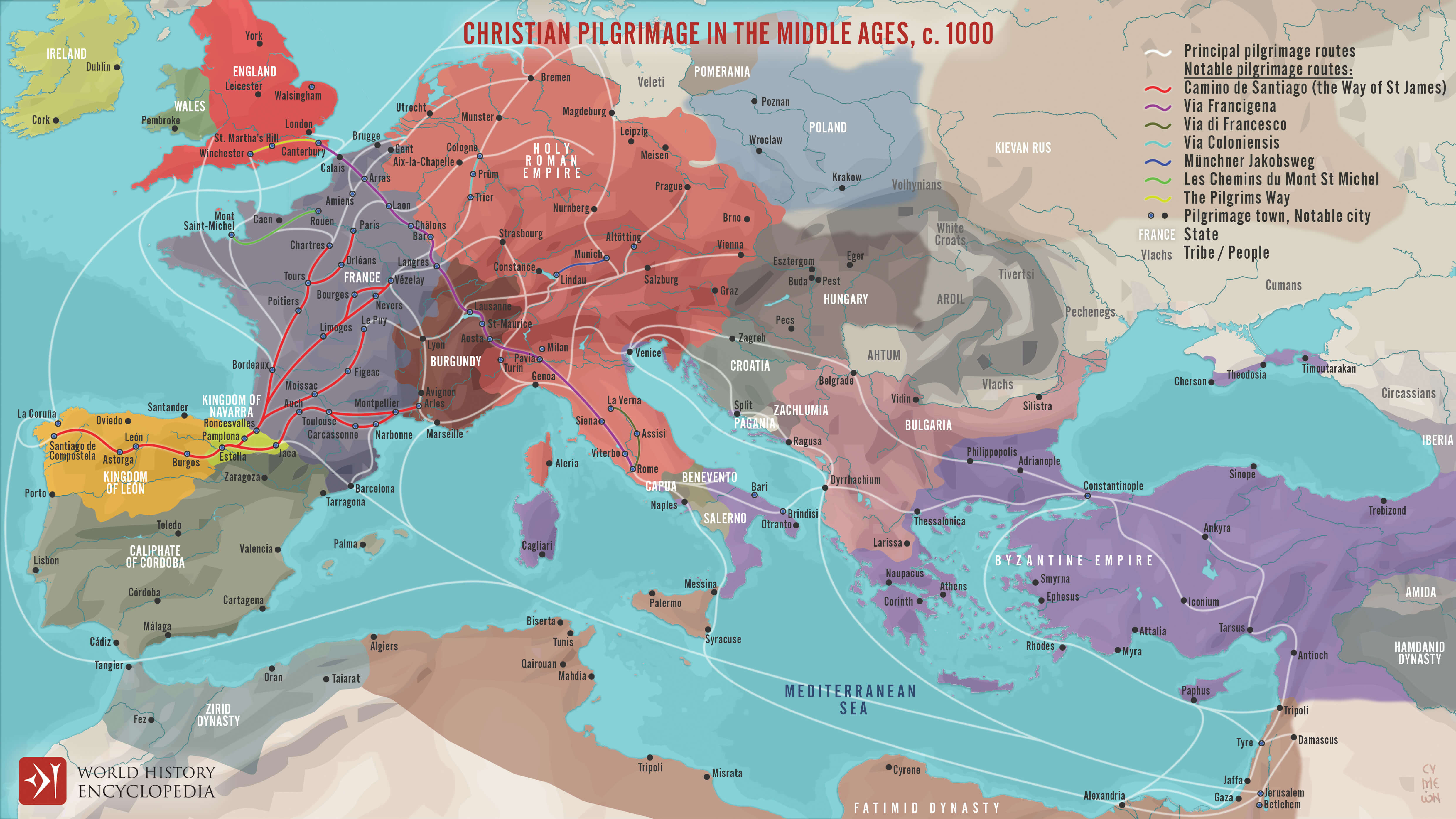
Europe Christian Pilgrimage map in the Middles 1000

Europe Historical map 1494 1560
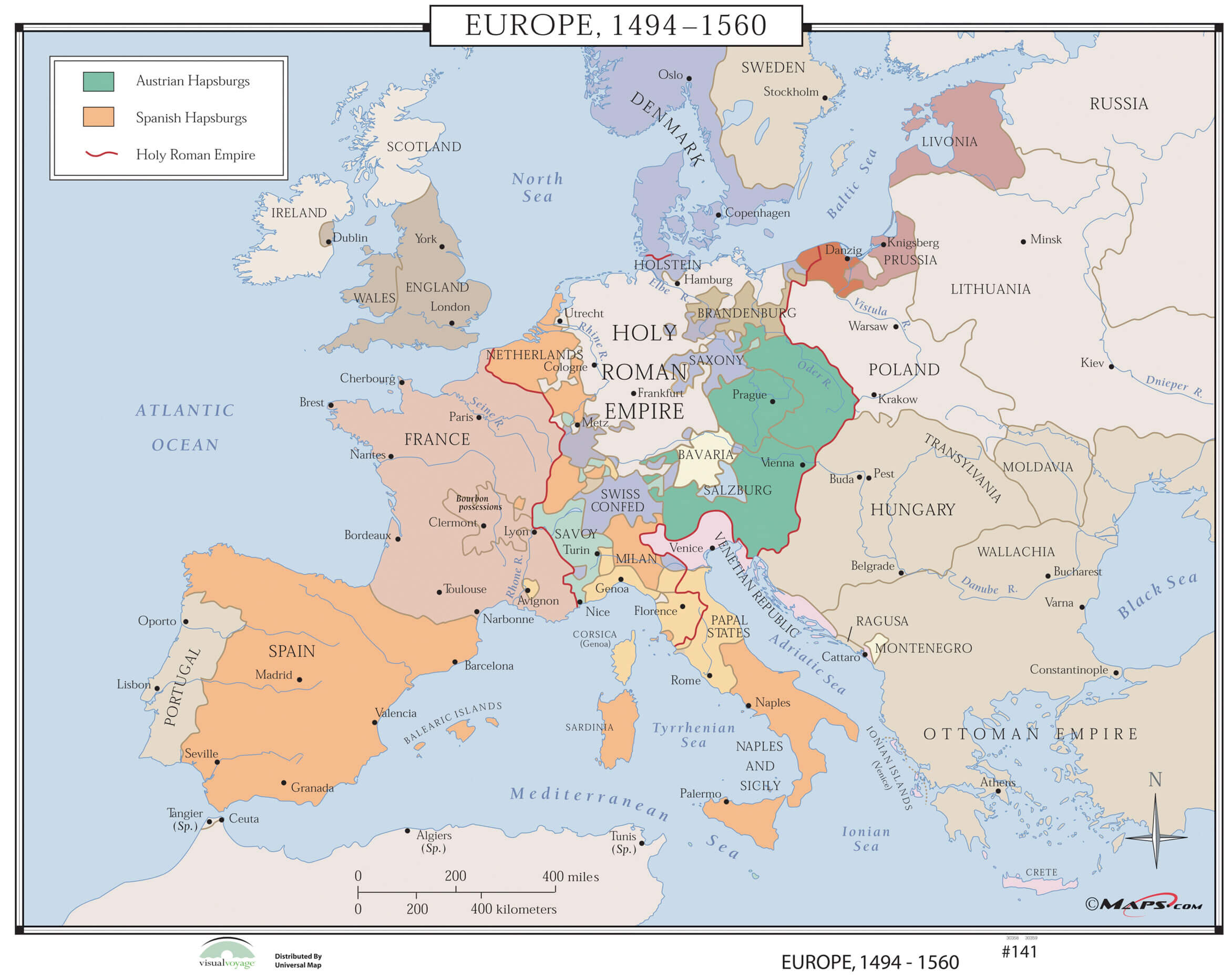
Europe Historical map 1494 1560

Europe Historical map in 1330
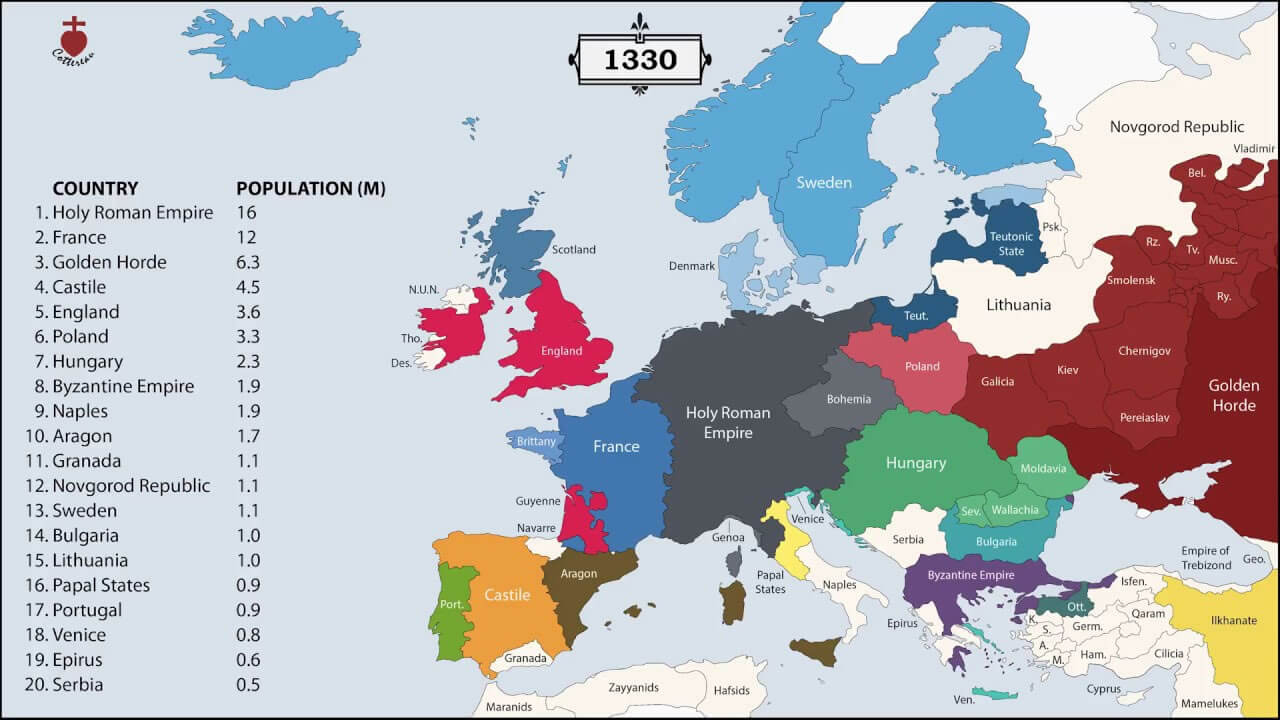
Europe Historical map in 1330

Europe History map 1730
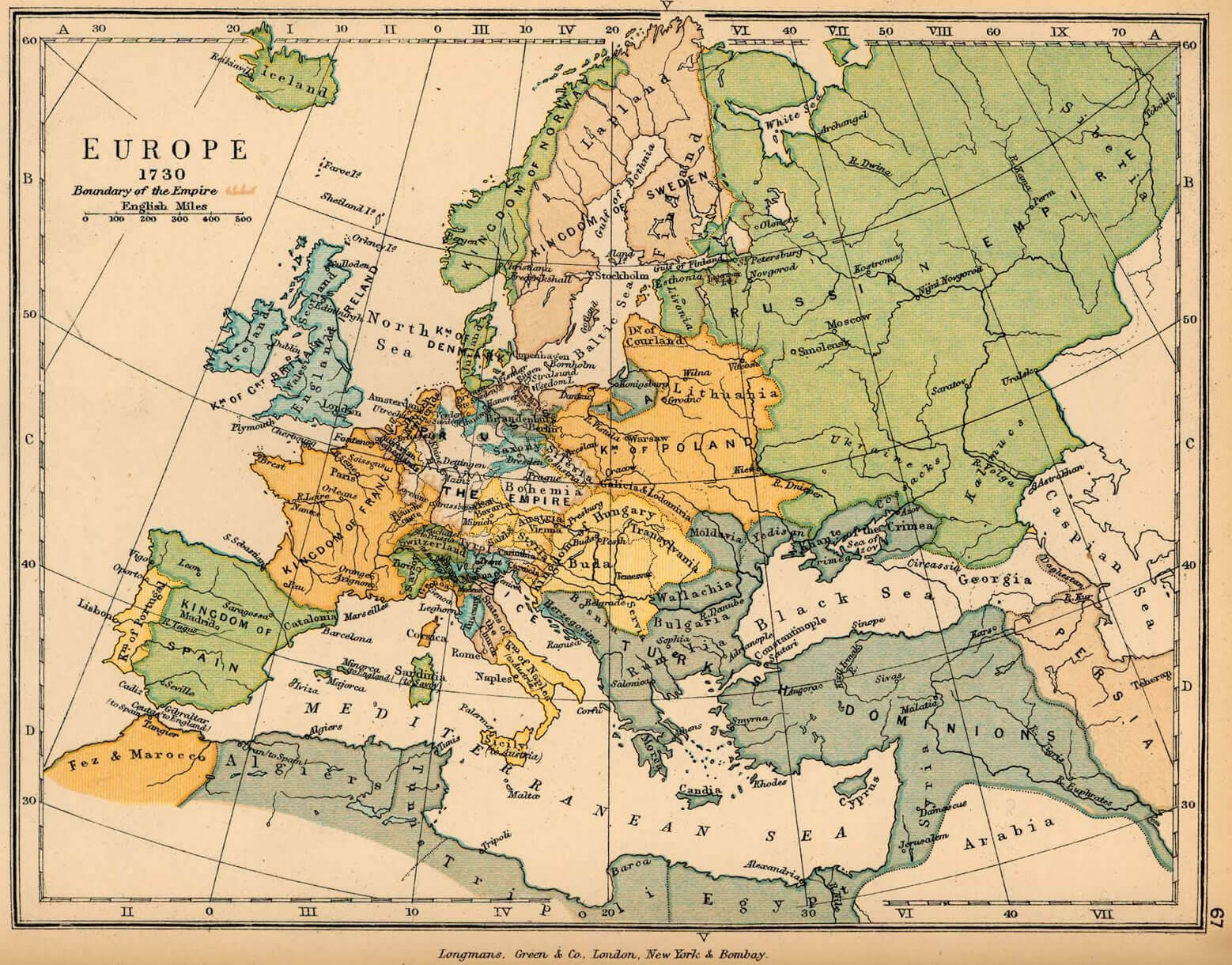
Europe History map 1730

Europe History map 1920
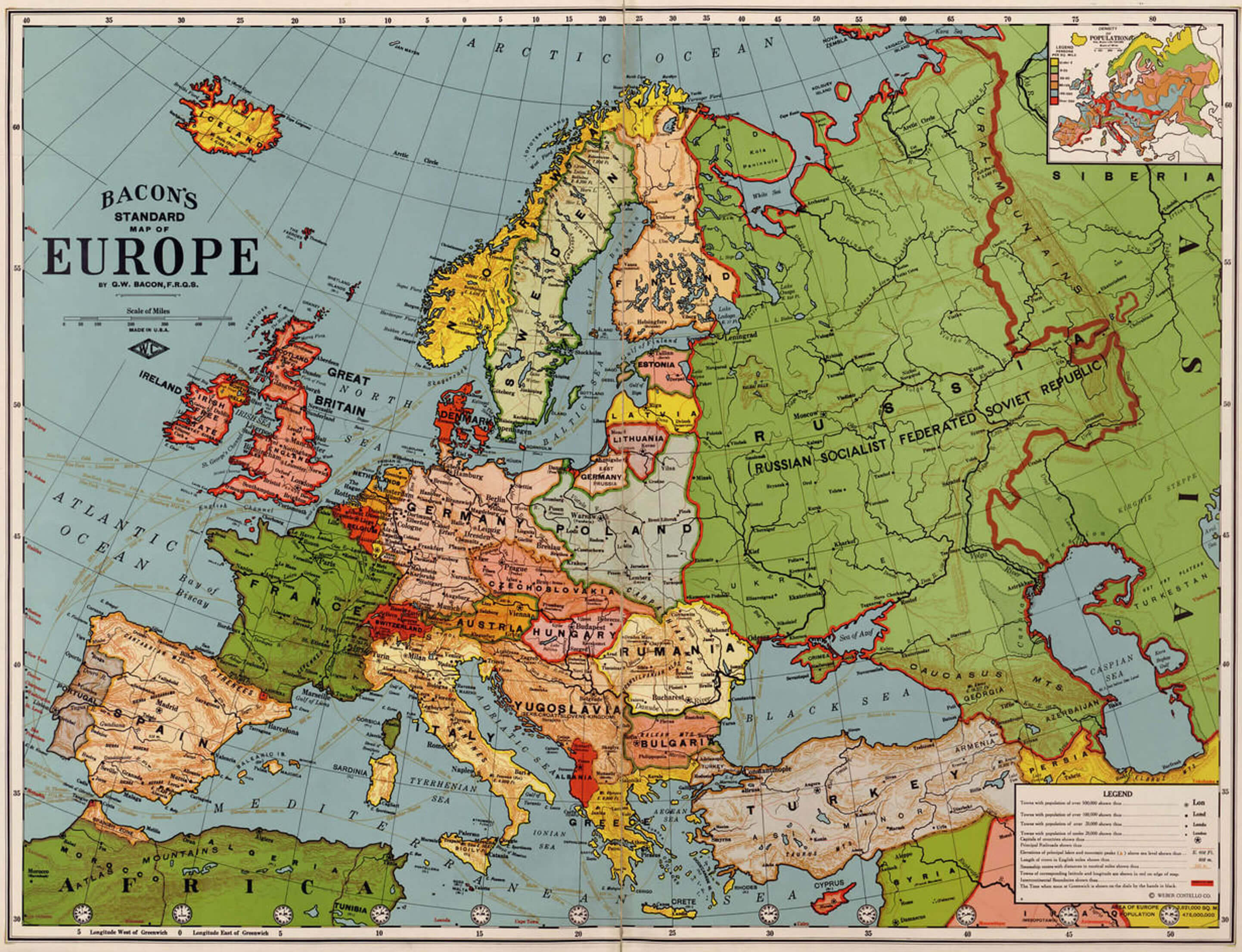
Europe History map 1920

Europe History map in 1648
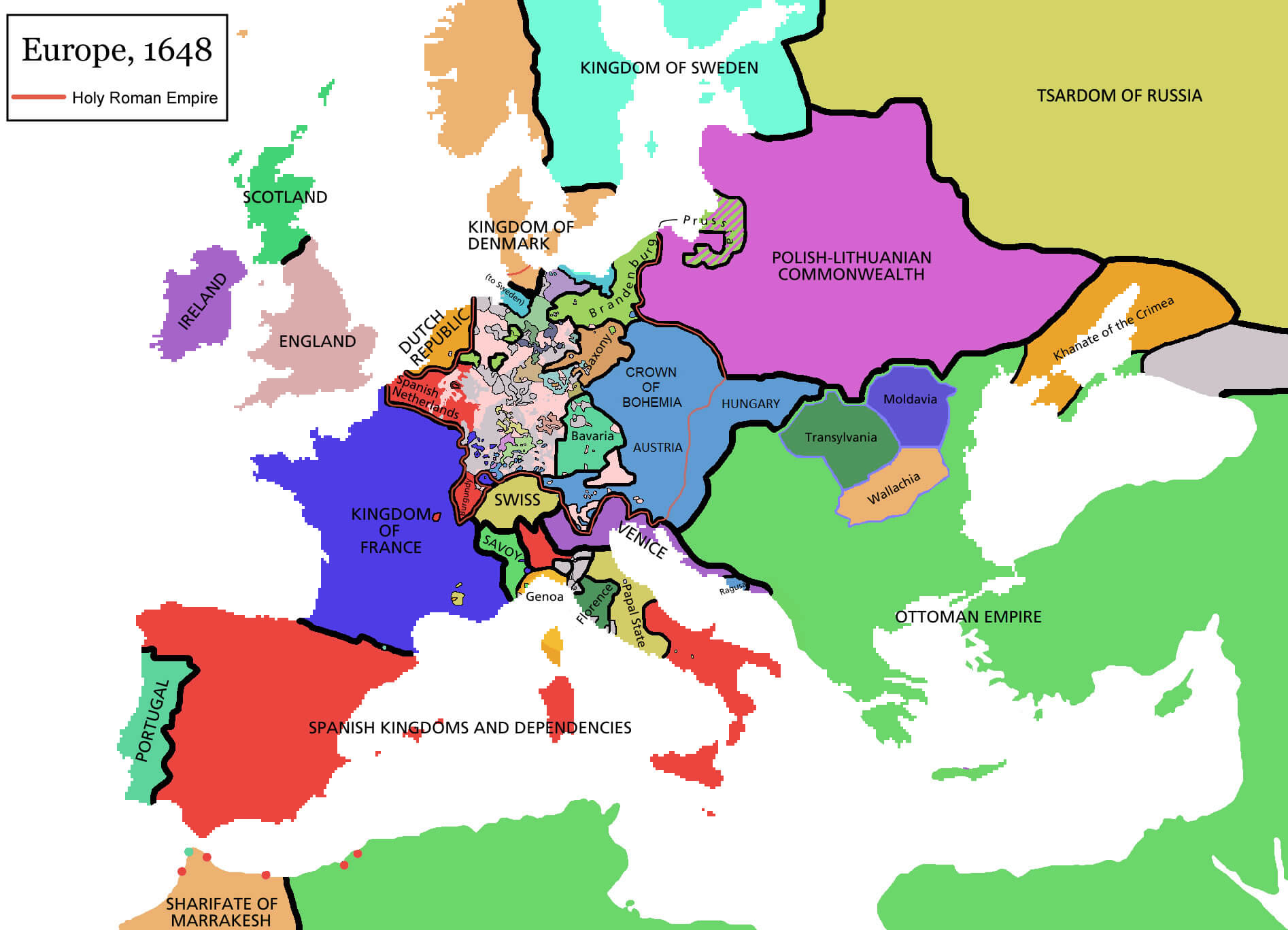
Europe History map in 1648

Europe map of the World war 1914

Europe map of the World war 1914

Europe political map 1871 1914
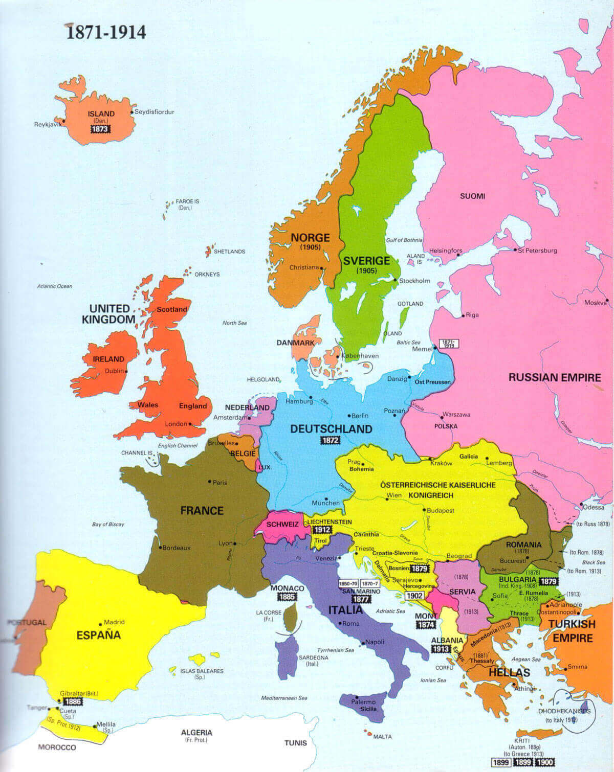
Europe political map 1871 1914

Historical atlas map of Europe
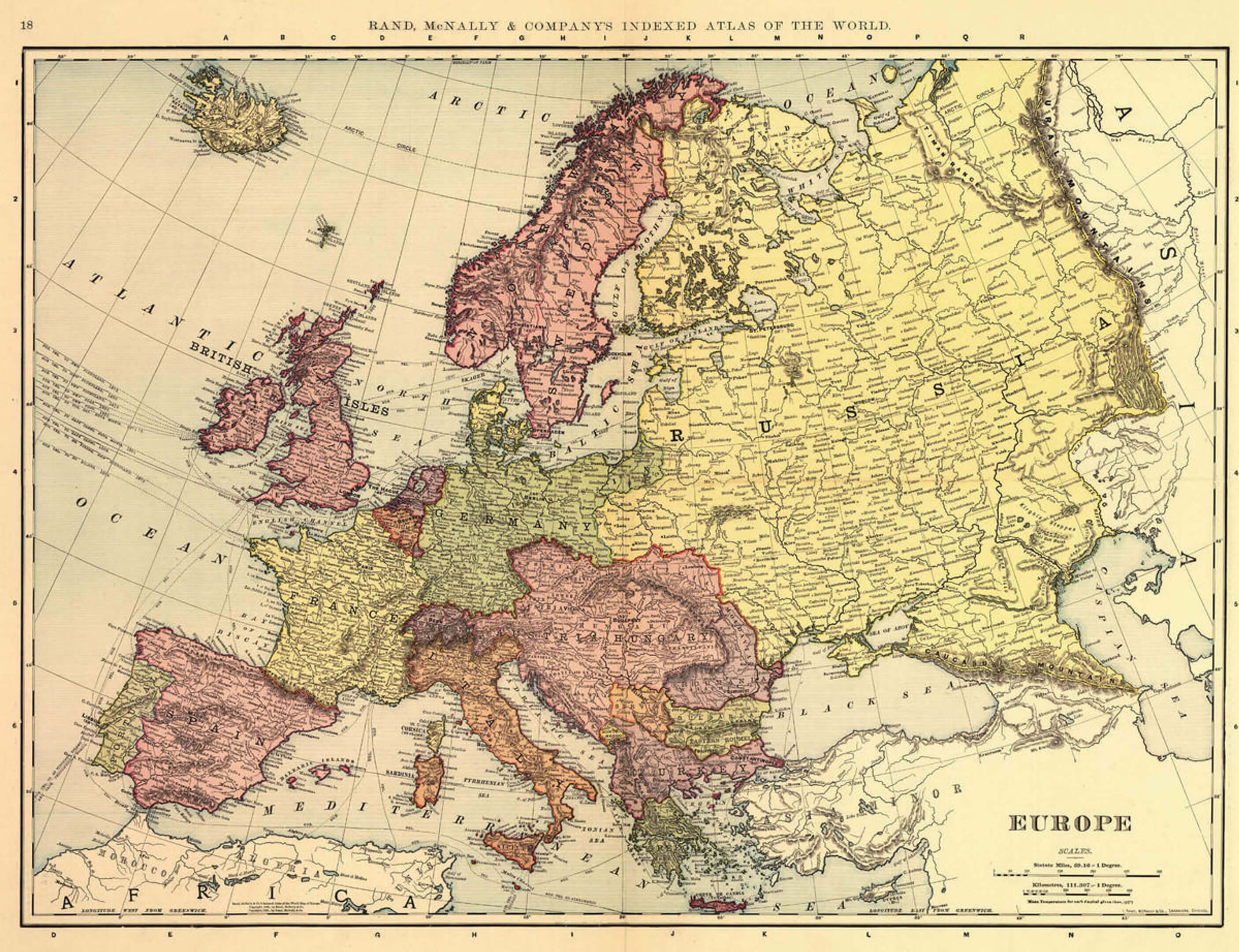
Historical atlas map of Europe

History map of Europe in 1871
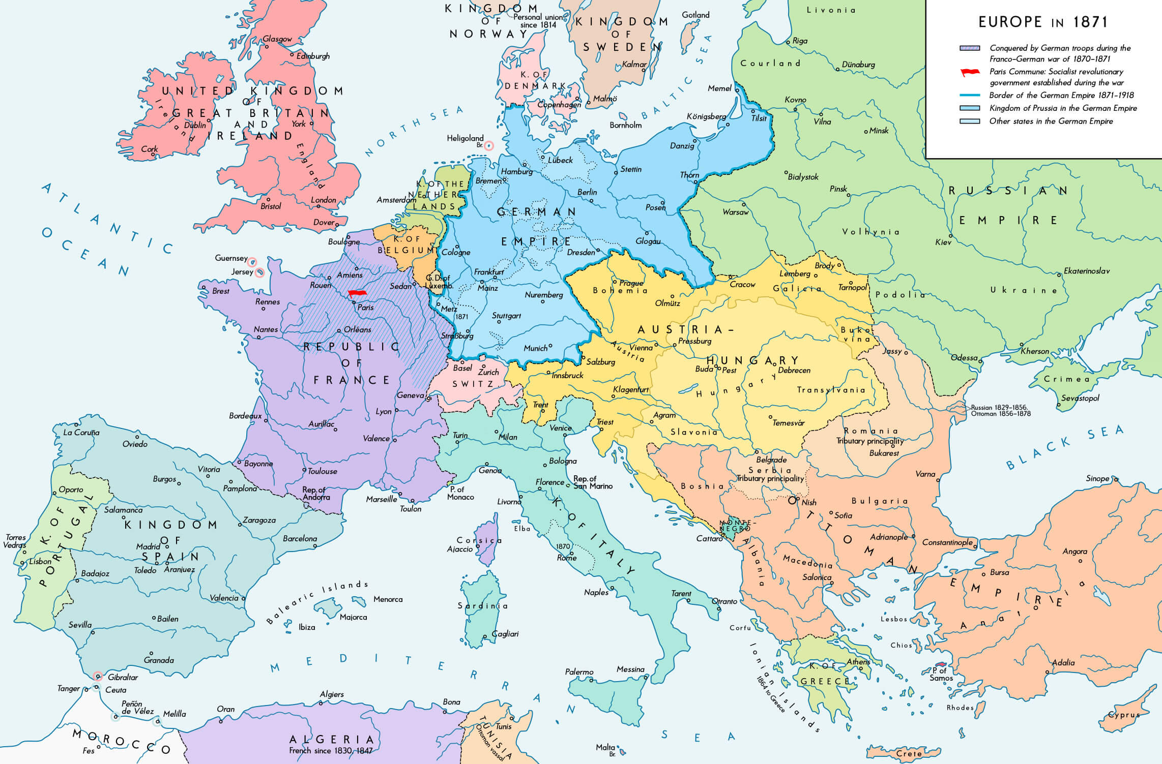
History map of Europe in 1871

History map of Europe in 1914
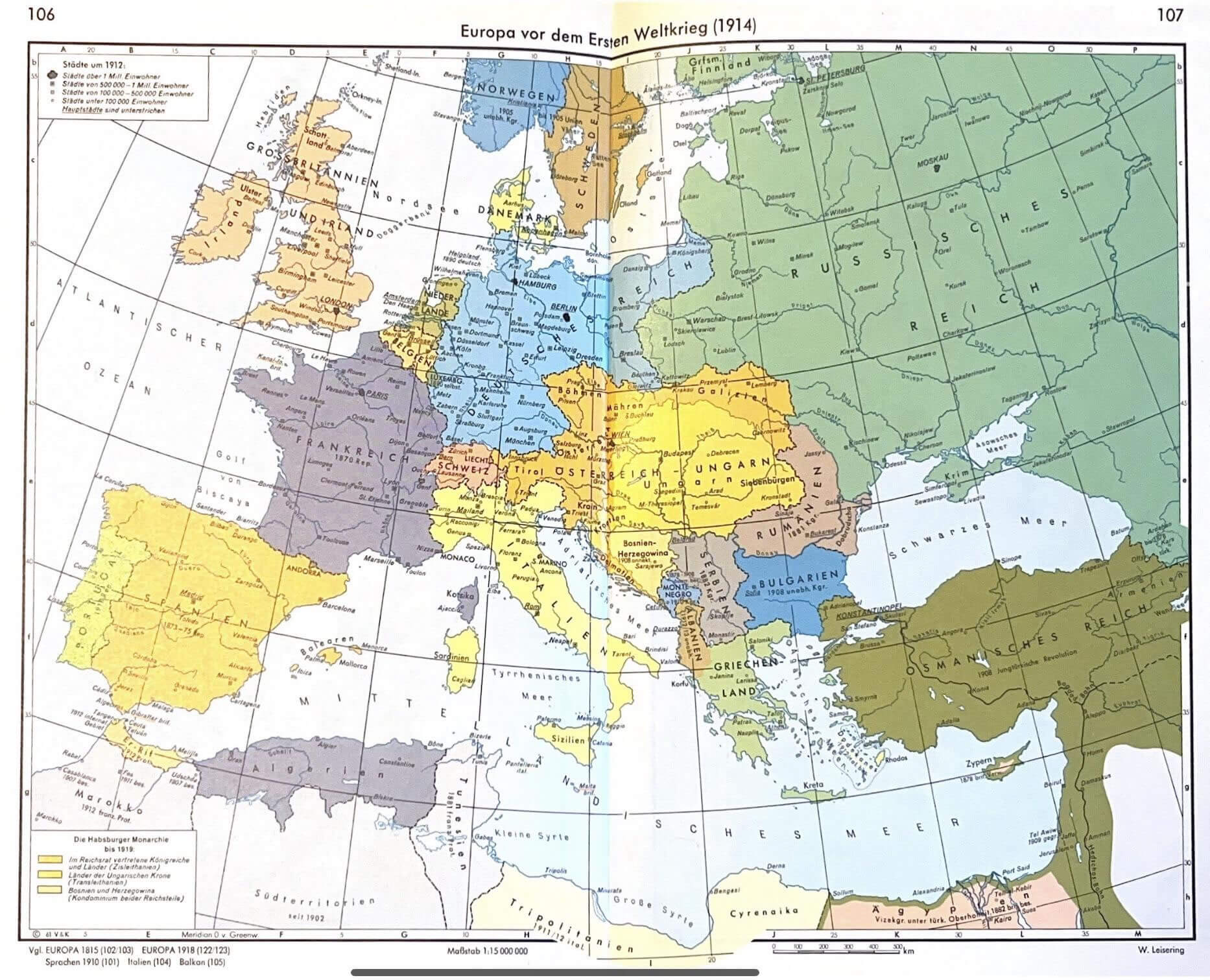
History map of Europe in 1914

Medieval Europe map 950 1300
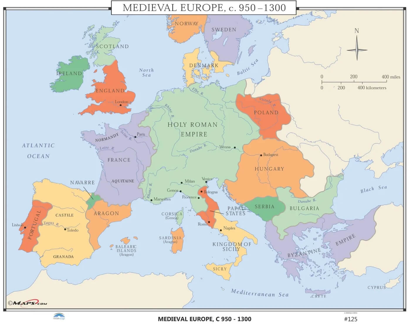
Medieval Europe map 950 1300

Medieval maps of Europe
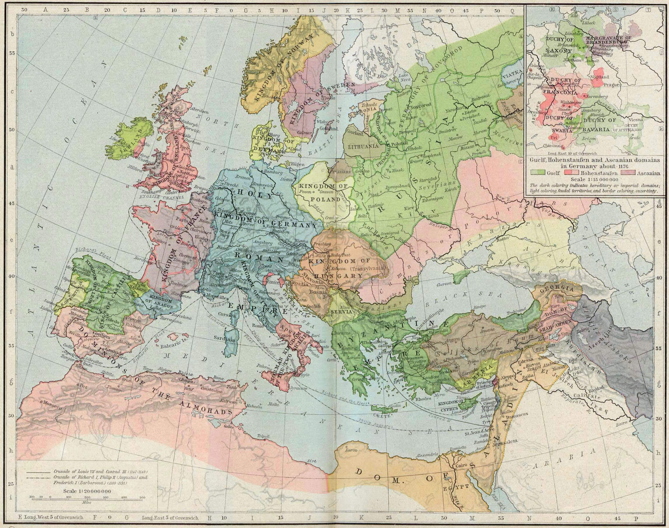
Medieval maps of Europe

Where is Europe on the World Map?

Show Google Interactive Maps and satellite maps of where the country is located.

Get directions by driving, walking, bicycling, public transportation and travel with street view.

Feel free to explore these pages as well:

- Advertisement -
Previous article
Next article

Discover

Sponsor

Latest Posts

Discovering Belek & Side: Two Jewels of Turkey’s Mediterranean Coast

Turkey's Mediterranean coast harbors countless natural and historical treasures. Among these, Belek and Side stand out as two must-visit destinations. With a blend of...

Turkey Map

A collection of Turkey Maps; View a variety of Turkey physical, political, administrative, relief map, Turkey satellite image, higly detalied maps, blank map, Turkey...

Mongolia Map

Explore a variety of maps of Mongolia, including political, physical, satellite and relief maps. Explore major cities, rivers, elevation, terrain and administrative divisions. Learn...

Alexandria Unveiled: The Pearl of the Mediterranean

As the golden sun descends and casts a shimmering hue over the Mediterranean, the city of Alexandria reveals its timeless allure. Once the epicenter...

A Traveler’s Guide to Seoul: Top 10 Must-Visit Spots

Experience Seoul Like Never Before: Top 10 Destinations for the Avid Traveler Step into a city where centuries-old tradition and cutting-edge modernity seamlessly blend, creating...