- Advertisement -
These insightful maps reveal the dynamic and diverse population patterns across Africa—from current population density and growth trends to literacy rates, migration shifts, urban expansion, and religious demographics. Whether you’re exploring how fertility and food security vary by region or projecting population changes by 2050, these visual tools offer a deeper understanding of the continent’s social and demographic landscape.
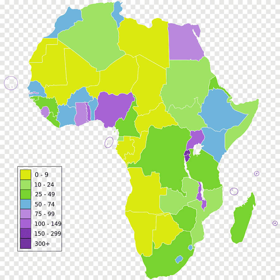
Africa geography population density map
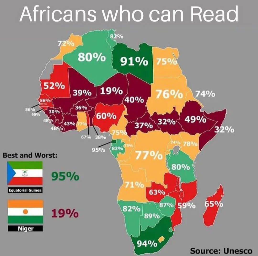
Africa literacy rate map
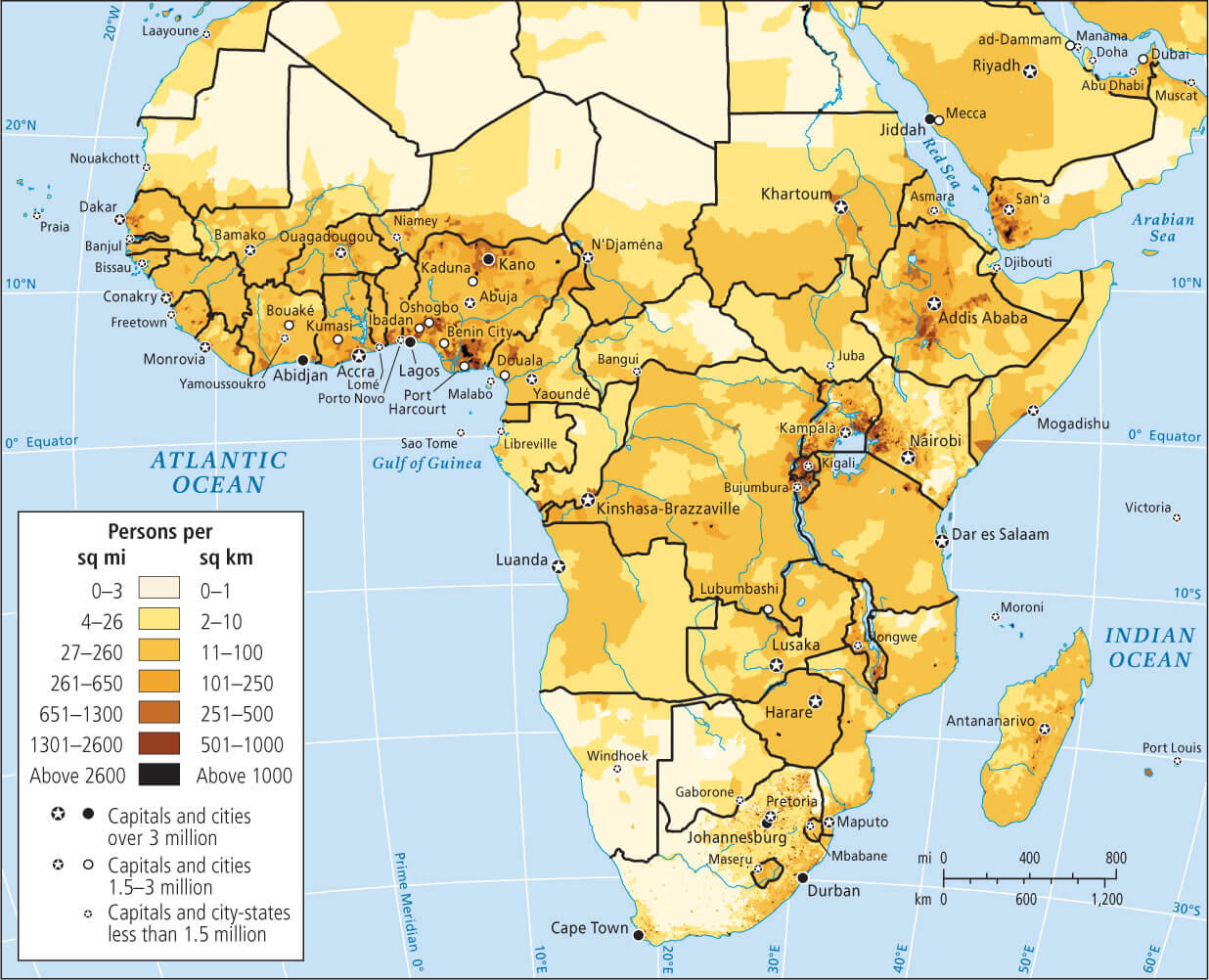
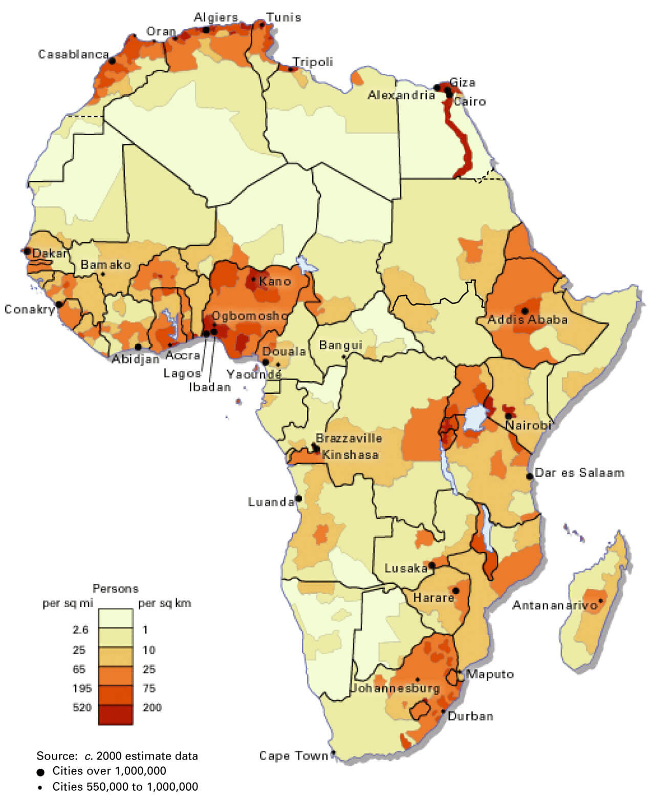
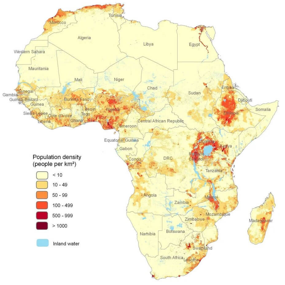
Africa population density map
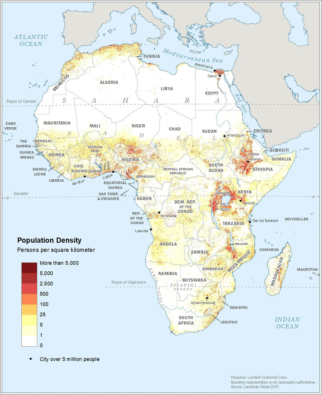
Africa population distribution map
Africa population diversity migration map
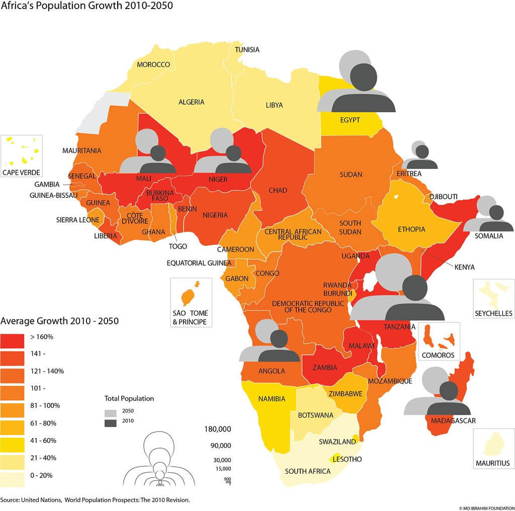
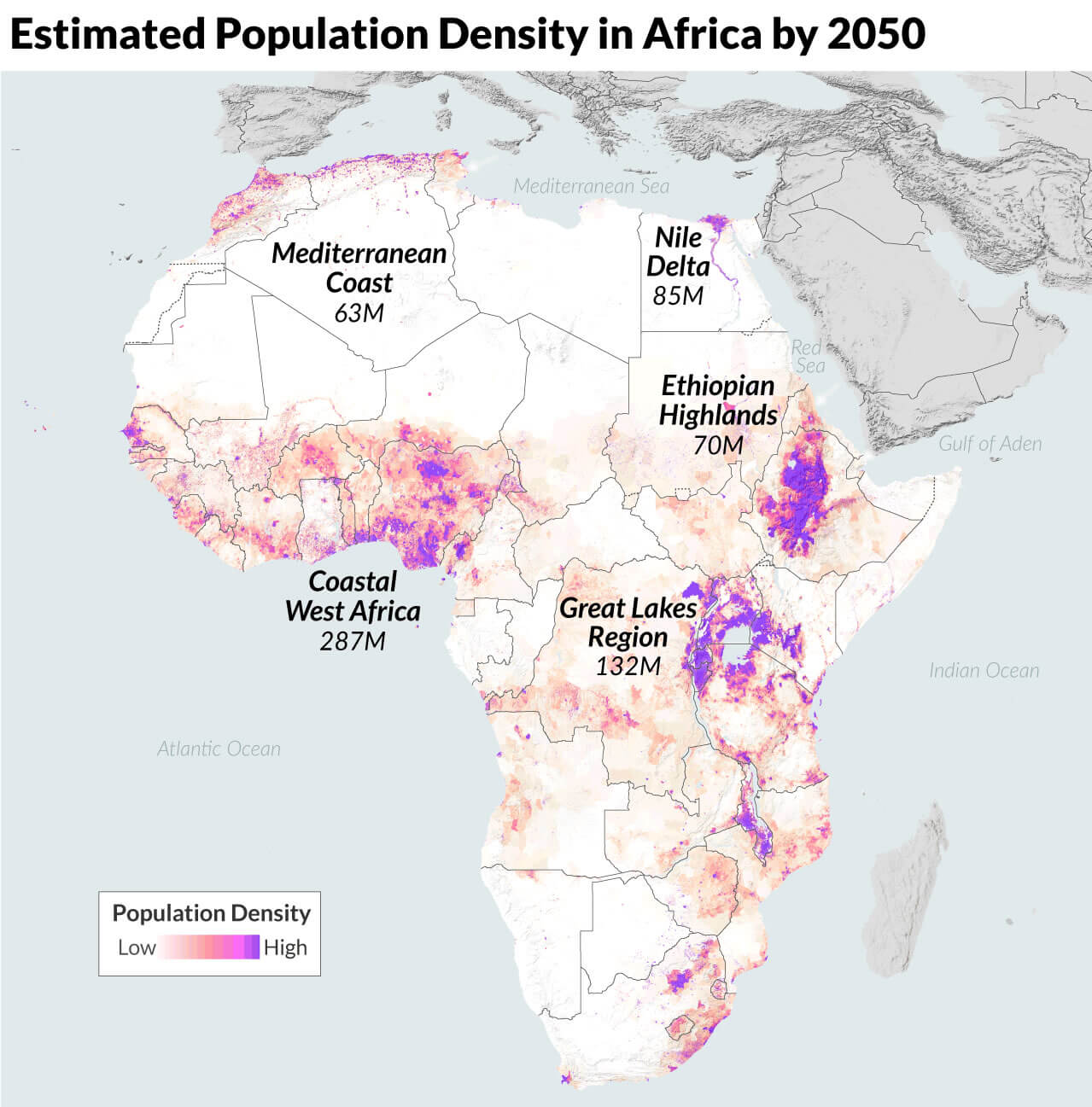
Africa population growth map 2010 2050
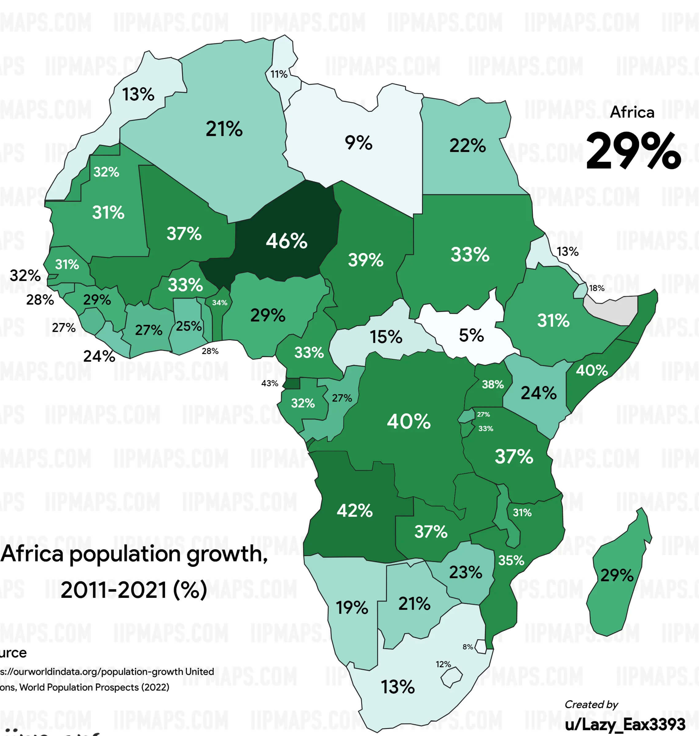
Africa population growth map 2011 2021
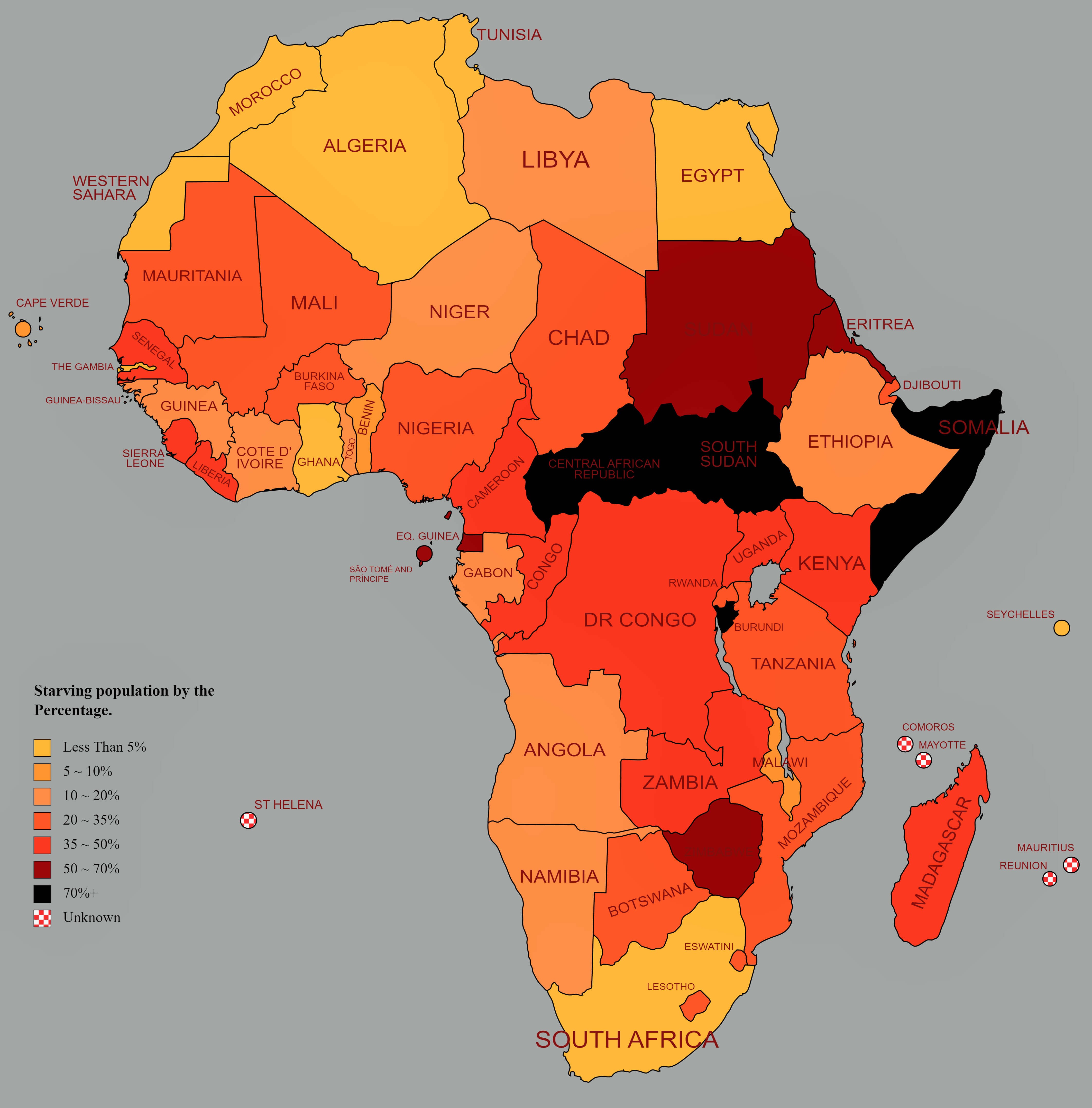
Africa starving population by percentage map
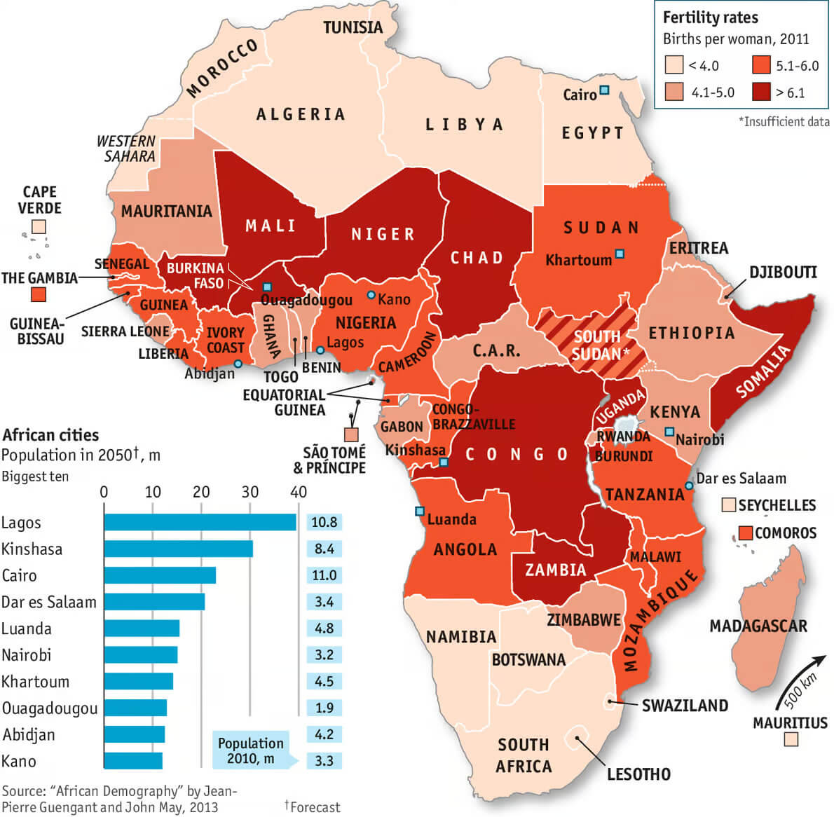
African countries fertility rates map
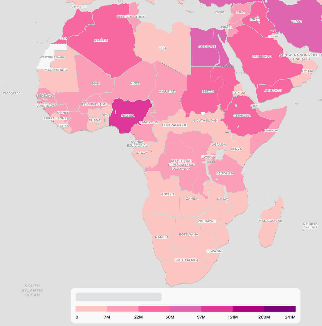
Muslim population map in Africa by country
Population density map in Africa by 2050
Population density map in Africa
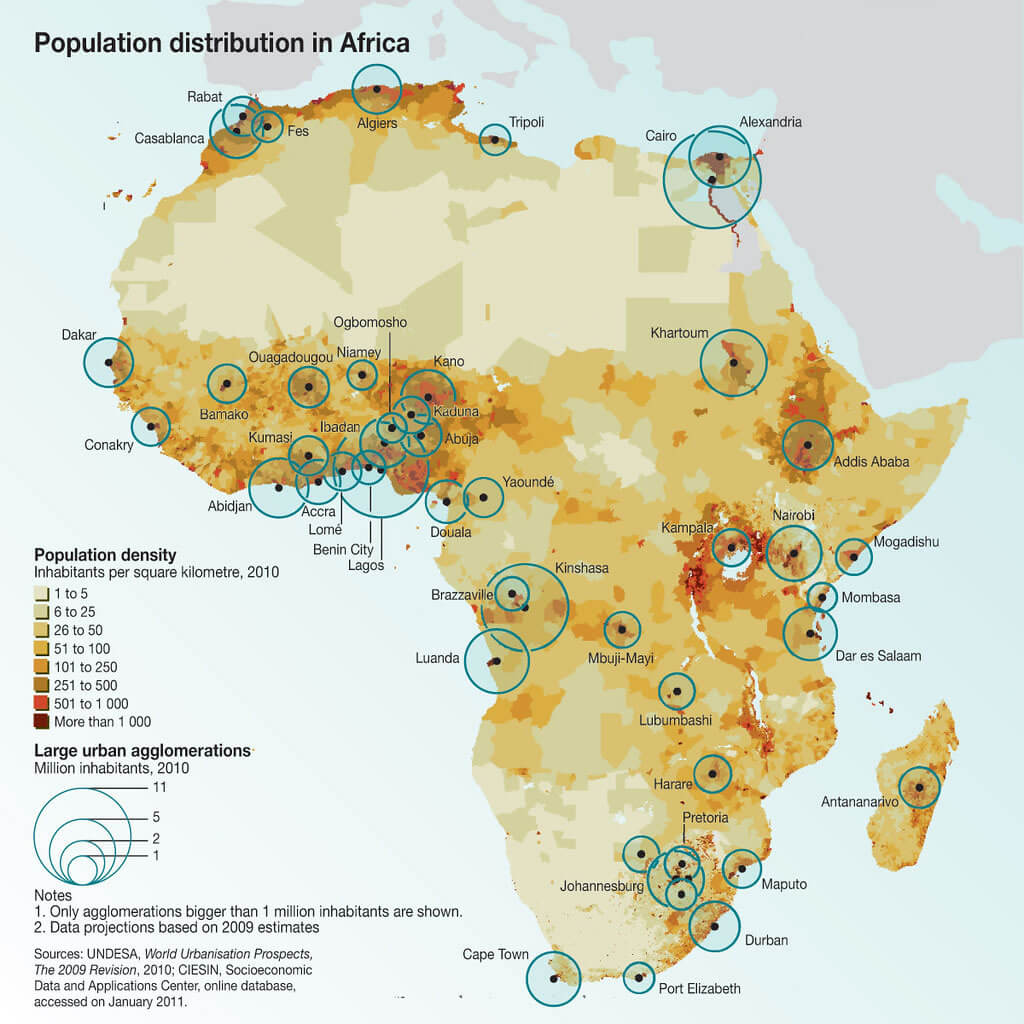
Population distribution map in Africa
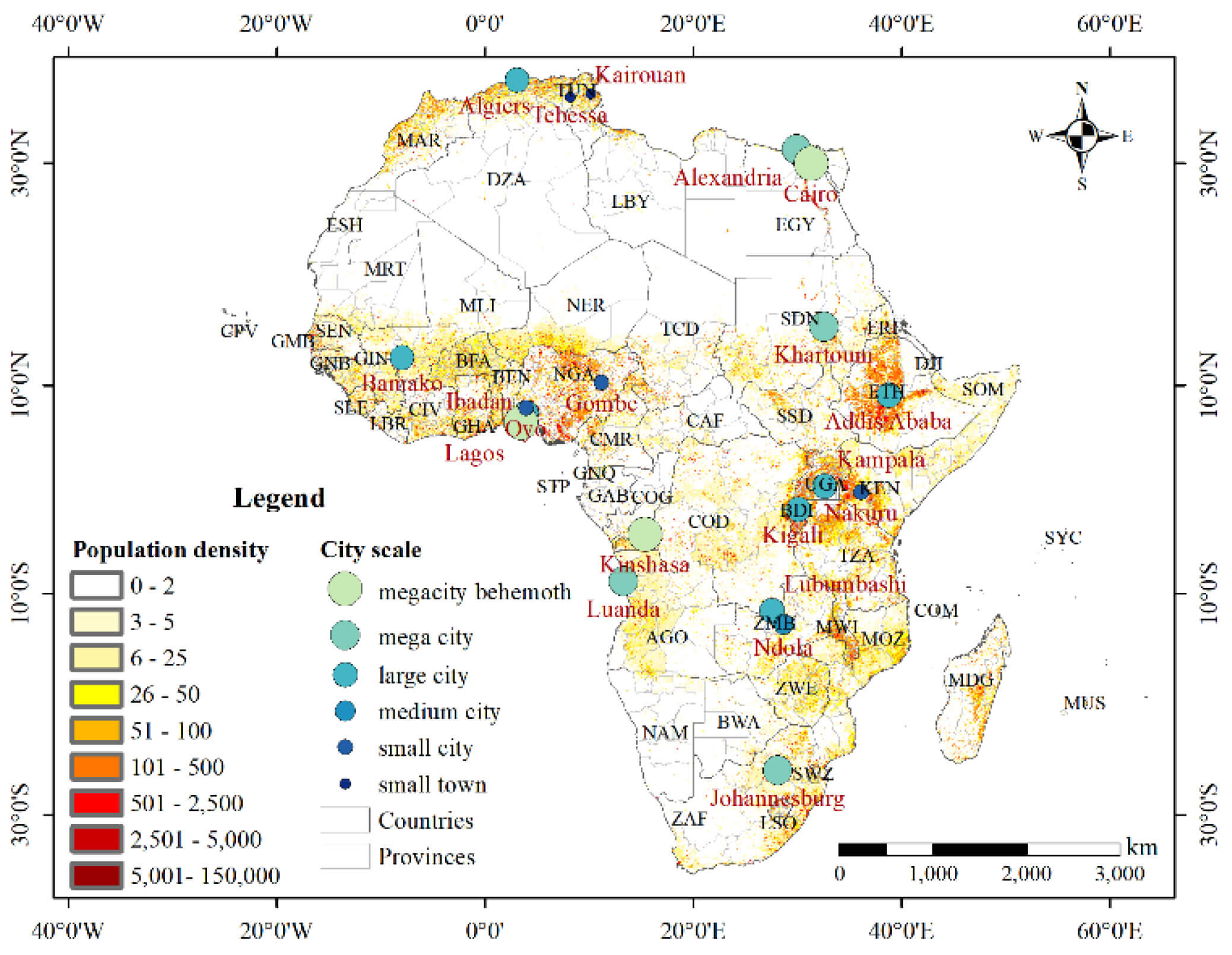
Urban land expansion and population growth map in Africa
Where is Africa on the World Map?
Show Google Interactive Maps and satellite maps of where the country is located.
Get directions by driving, walking, bicycling, public transportation and travel with street view.
Feel free to explore these pages as well:
- Africa Map IV ↗️
- Africa Map ↗️
- Africa High-resolution Map ↗️
- Map of Africa ↗️
- Africa Physical Map ↗️
- Africa Political Map ↗️
- Africa Countries Map ↗️
- Africa Population Map ↗️
- Africa Road Map ↗️
- Africa Topographic Map ↗️
- Africa Religion Map ↗️
- Africa Cities Map ↗️
- Africa Time Zone Map ↗️
- Muslim Population Map in Africa by Country ↗️
- A Collection of Algeria Maps: Exploring a North African Gem via Maps ↗️
- Visit Africa ↗️
- Africa Map I ↗️
- Africa Map II ↗️
- Africa Map III ↗️
- Africa Map V ↗️
- Advertisement -
