Ohio Maps

HomeMapsOhio Maps
- Advertisement -

Ohio A Variaty Maps

Ohoi Interstates Map

ohio interstate map
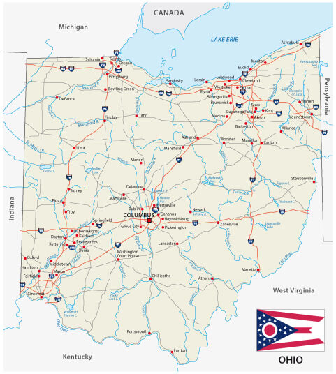
Ohio road map with flag and interstates.

Map of Ohio, US

map of Ohio
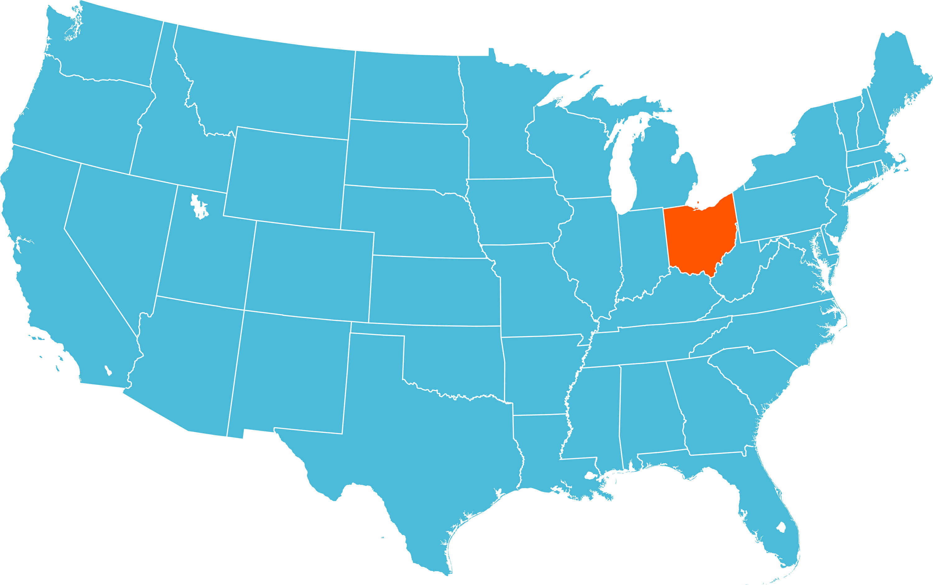
Map of Ohio with US States.

Detailed Map of Ohio

detailed map of Ohio


A large and detailed map of the State of Ohio with all counties and county seats.

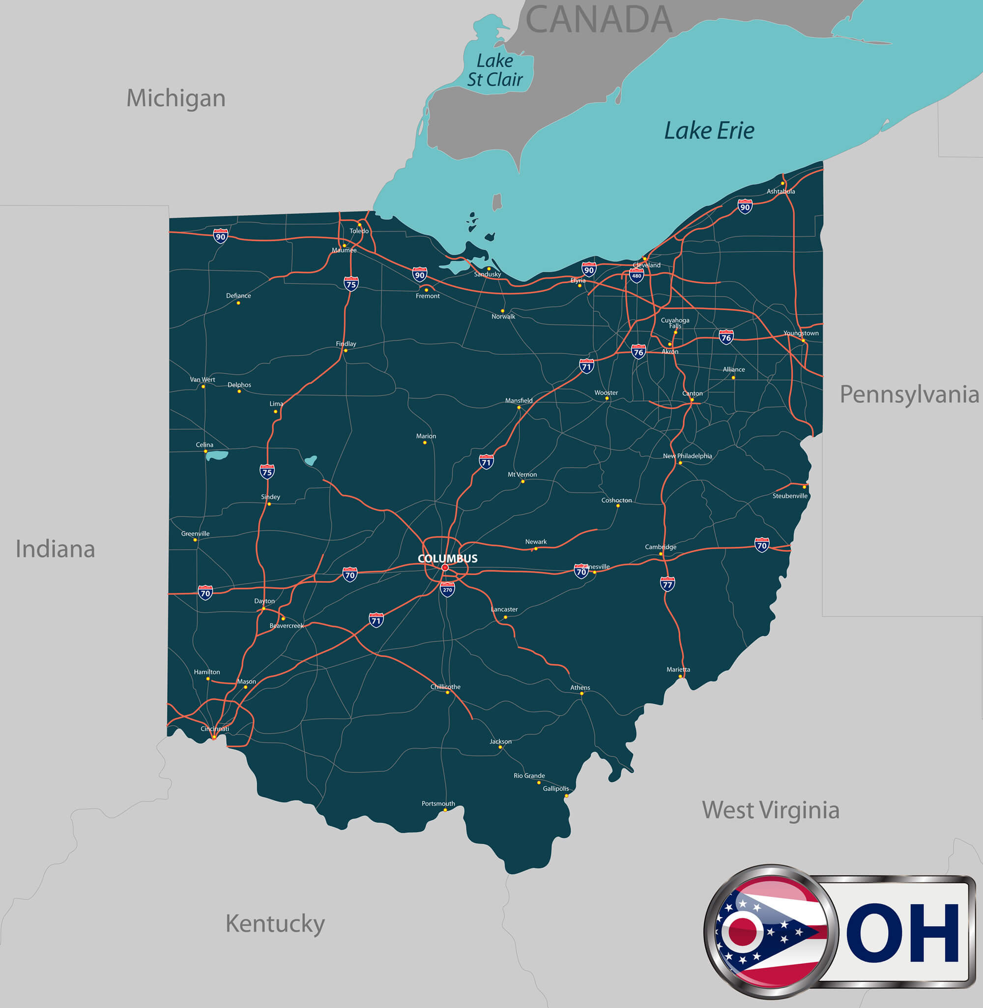
Ohio USA Interstate Road Map

Ohio USA interstate road map
High detailed Ohio USA interstate road map vector.

Ohio USA State Map

Ohio USA State Map
Ohio USA map with states.

Geographic Map of Ohio

Geographic map of Ohio


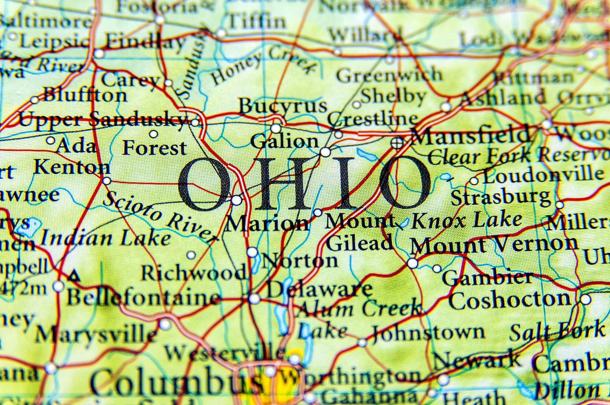
Geographic map of Ohio close Colombus and Mansfield.

Ohio State with Roads Map

Ohio state with roads map
Vector set of Ohio state with roads map, cities and neighboring states.

Where is Ohio in the US?

Show Google map, satellite map, where is the country located.

Get direction by driving, walking, bicycling, public transportaion and travel with street view.

[gmap-embed id=”1712″]

Ohio Maps and Photos

- Advertisement -
Previous article
Next article

Discover

Sponsor

Latest Posts

Saudi Arabia Photos 1

Islamic Holy Place, Mecca Islamic Holy Place, Mecca - Saudi Arabia Land area in Arabians, and India the night from Space Land area in Arabians, and India...

Alhambra Map: Where is Alhambra, Location and Directions in California

Explore Alhambra's map, including city and terrain views, and discover its location within California and the United States. Situated in Los Angeles County, just...

Discovering The Natural State: A Journey Through Arkansas

Nestled between the Mississippi River and the vast expanses of the Ozark Mountains, Arkansas emerges as a land where history, culture, and nature intertwine...

Discovering Palma de Mallorca: The Top 10 Sights to See

Discovering Palma de Mallorca: Your Essential Itinerary to the Island’s Best Spots Welcome to the sparkling jewel of the Mediterranean, Palma de Mallorca. A fusion...

Virginia Map

A collection of Virginia Maps; View a variety of Virginia physical, united states political map, administrative, relief map, Virginia satellite image, higly detalied maps,...