A collection of Czech Republic Maps; View a variety of Czech Republic physical, political, administrative, relief map, Czech Republic satellite image, higly detalied maps, blank map, Czech Republic world and earth map, Czech Republic’s regions, topography, cities, road, direction maps and atlas.
Czech Republic Political Map
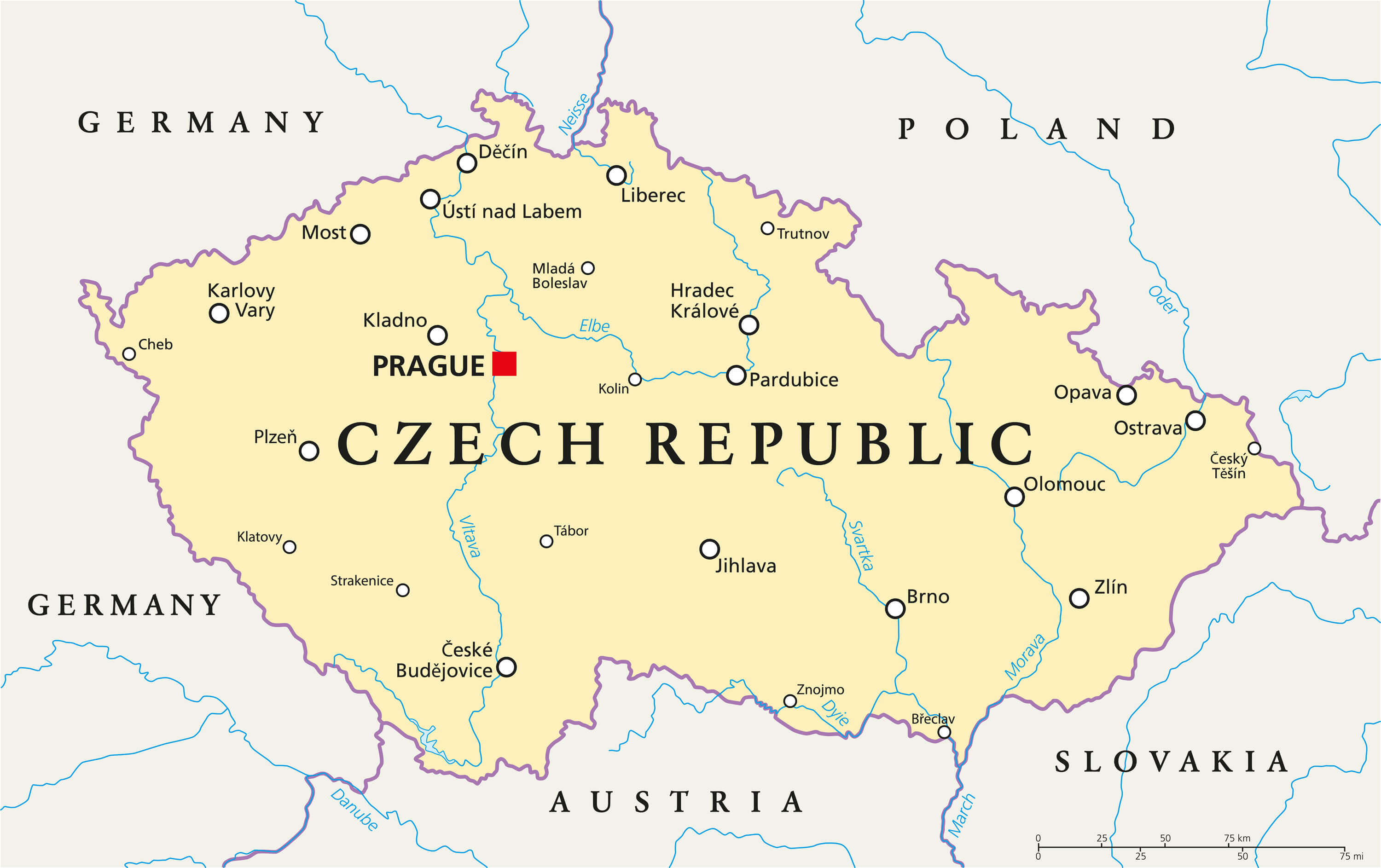 Czech Republic Political Map with capital Prague, national borders, important cities, rivers and lakes. English labeling and scaling.
Czech Republic Shaded Relief Map
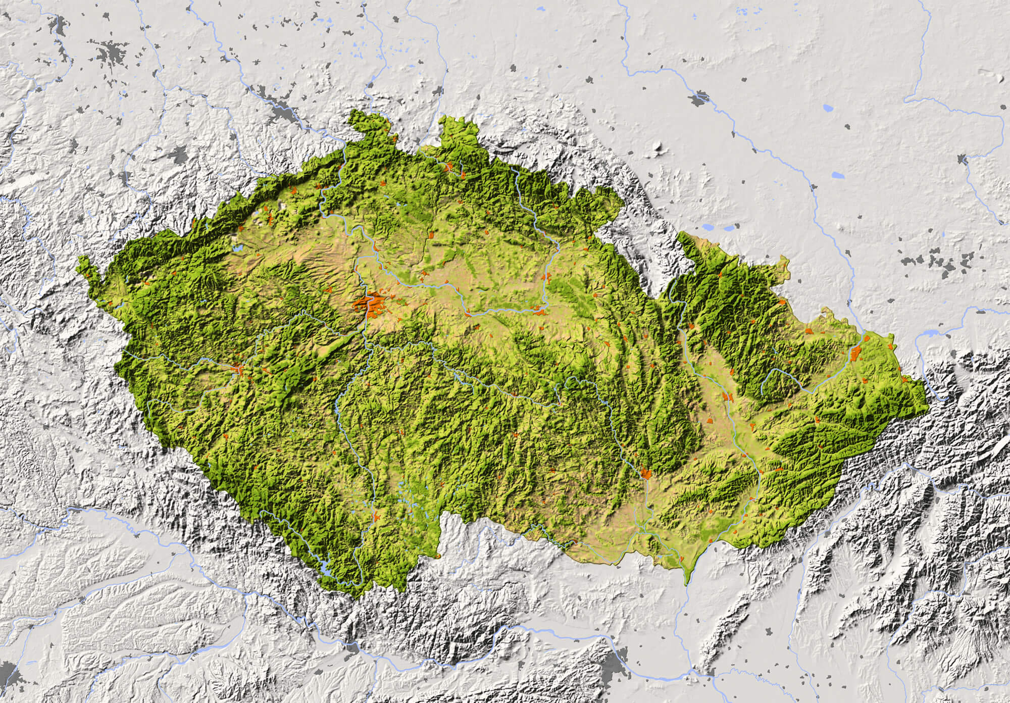
Czech Republic Shaded relief map with major urban areas. Surrounding territory greyed out. Colored according to vegetation. Includes clip path for the state area.
Czech Republic Relief Map
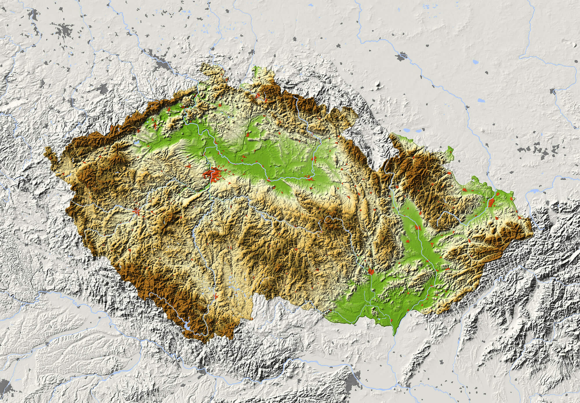
Czech Republic. Shaded relief map with major urban areas. Surrounding territory greyed out. Colored according to elevation. Includes clip path for the state area.
Political Map of Czech Republic
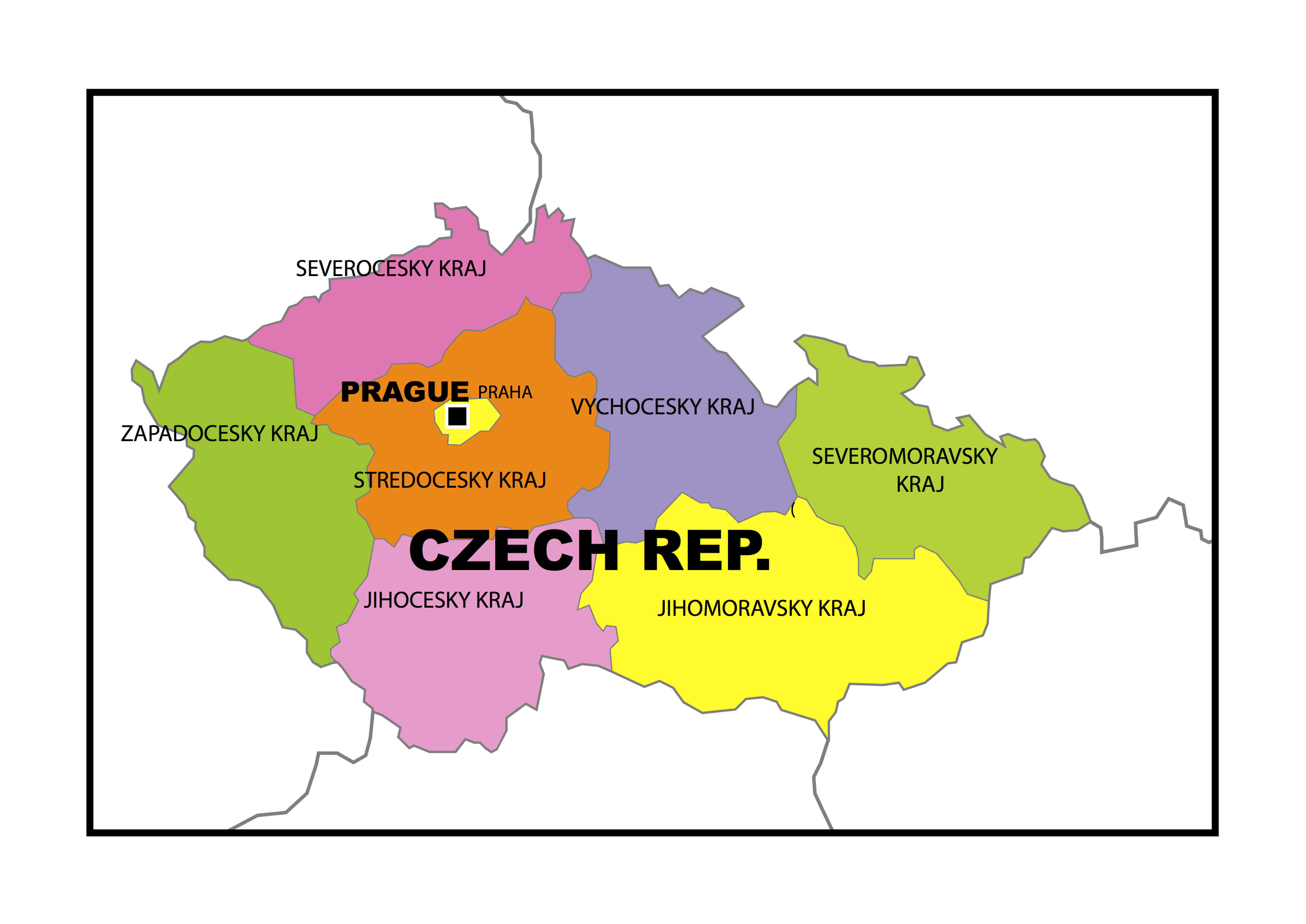
Political map of Czech Republic with provinces.
Map of Czech Republic
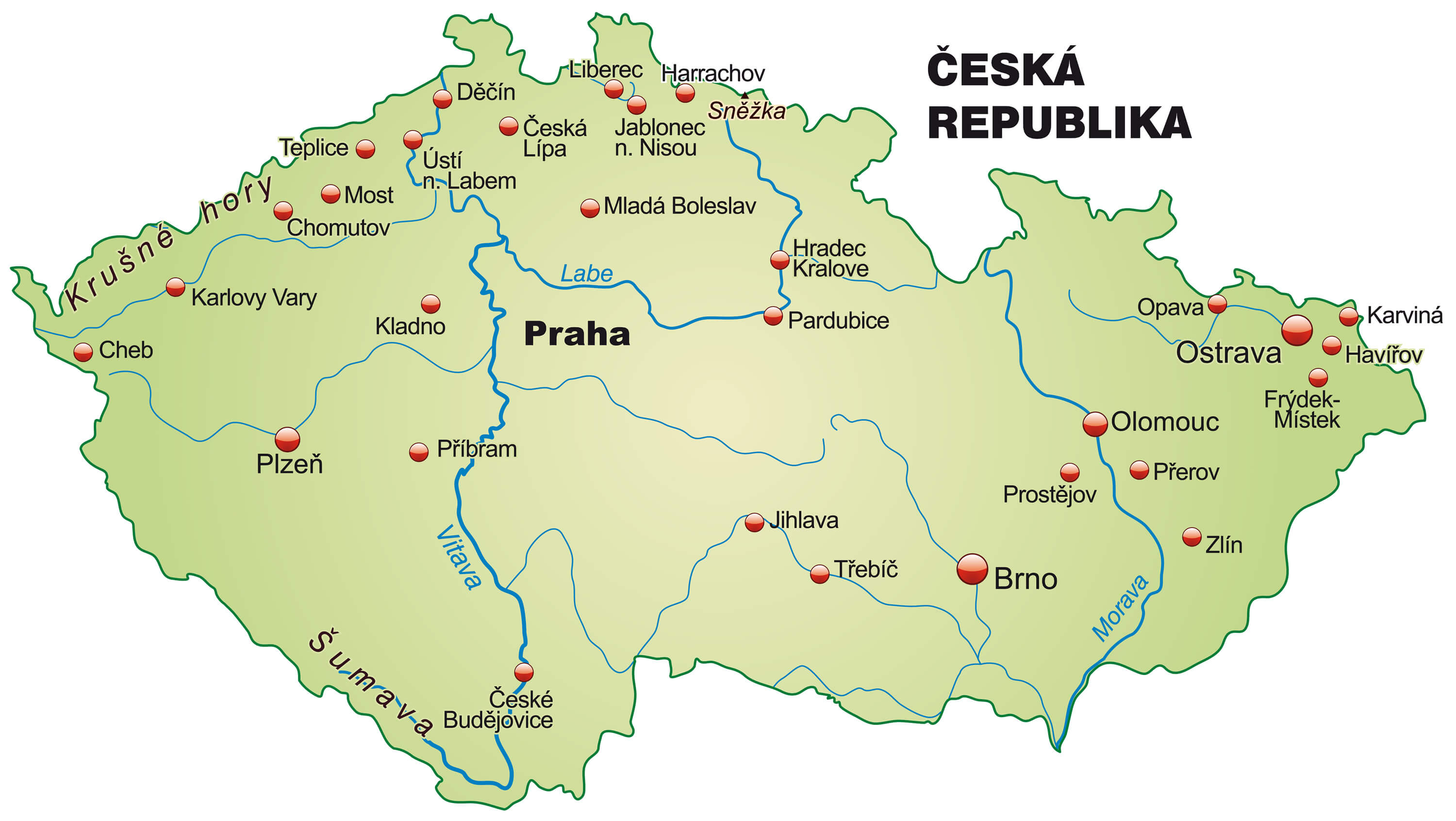
Map of Czech Republic as an overview map in pastel green.
Where is Located Czech Republic on the Europe Map?
Show Google interactive map, satellite map, where is the country located.
Get directions by driving, walking, bicycling, public transportation, and traveling with street view.
Feel free to explore these pages as well:
- Czech Republic Map ↗️
- Czech Republic ↗️
- Czechia Map ↗️
- Czech Republic Photos ↗️
- Map of Czech Republic ↗️
- Slovakia Map ↗️
- Germany Map ↗️
- Europe Map ↗️
