Canada Population Map

HomeMapsCanada Population Map
- Advertisement -

Discover Canada’s population map, which shows the distribution of people across provinces, major cities and rural areas. Explore demographic insights, population density and key statistics to understand Canada’s diverse regions. Perfect for researchers, travellers and data enthusiasts who want to visualise population trends in Canada.

Canada Population Density Map: Explore Urban and Rural Distribution
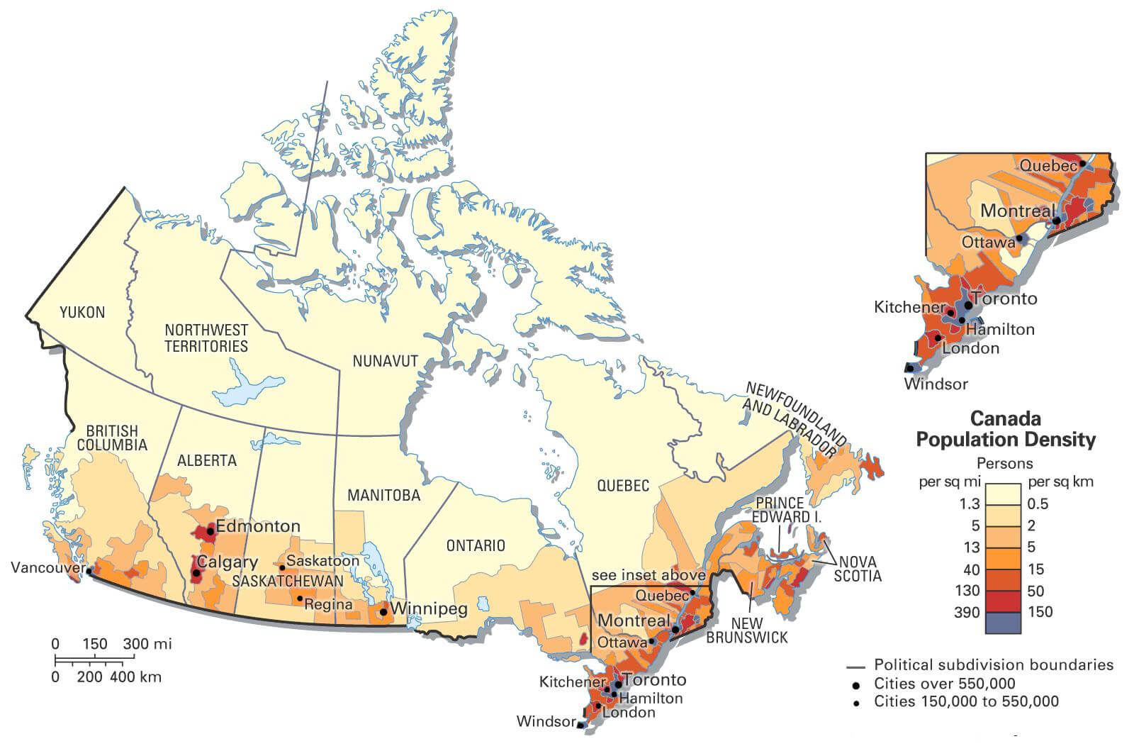
Canada Population Density Map: Explore Urban and Rural Distribution
Map of Canada showing population density in provinces and major cities.

This Canada Population Density Map illustrates the distribution of people across the country. It highlights densely populated cities like Toronto, Vancouver, and Montreal, as well as sparsely populated rural and northern areas. The color gradient represents varying densities, offering insights into urbanization and demographic patterns.

Canada Ethnic Demographic Composition in 2021
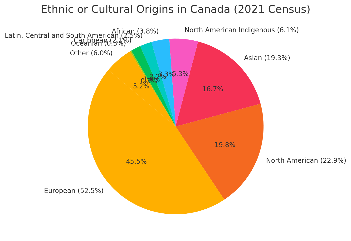
Ethnic Or Cultural Origins In Canada (2021 Census)
Canada Ethnic Demographic Composition in 2024

This pie chart that represents the ethnic or cultural origins reported in the 2021 Canadian census. The major groups include European (52.5%), North American (22.9%), and Asian (19.3%). Smaller portions of the population identify as North American Indigenous, African, Latin, Central and South American, Caribbean, Oceanian, and other origins, showcasing Canada’s cultural diversity.

Canada Languages Map: Distribution of English, French, and Other Languages
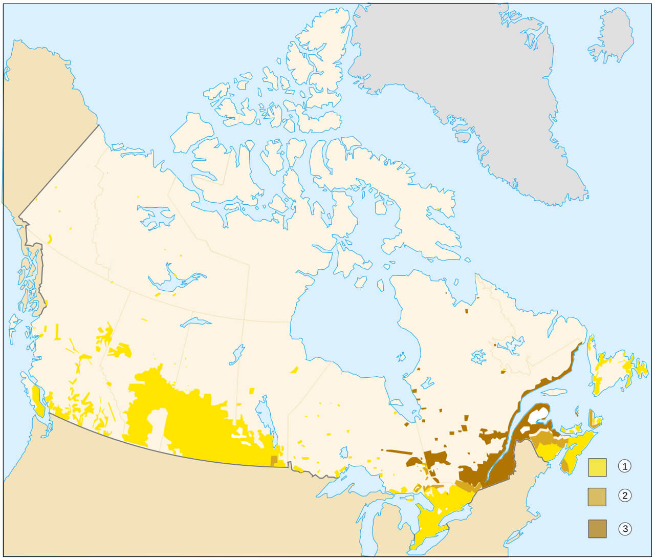
Canada Languages Map: Distribution of English, French, and Other Languages
Map of Canada showing language distribution across provinces and territories.

This map of Canada’s languages shows the distribution of English, French and other languages spoken across the country. It highlights French-speaking regions in Quebec, bilingual areas in New Brunswick, and English-dominant regions in other provinces. The map provides an insight into Canada’s linguistic diversity and the cultural influence of its official languages.
Population: 41,288,599 (2024 estimate)

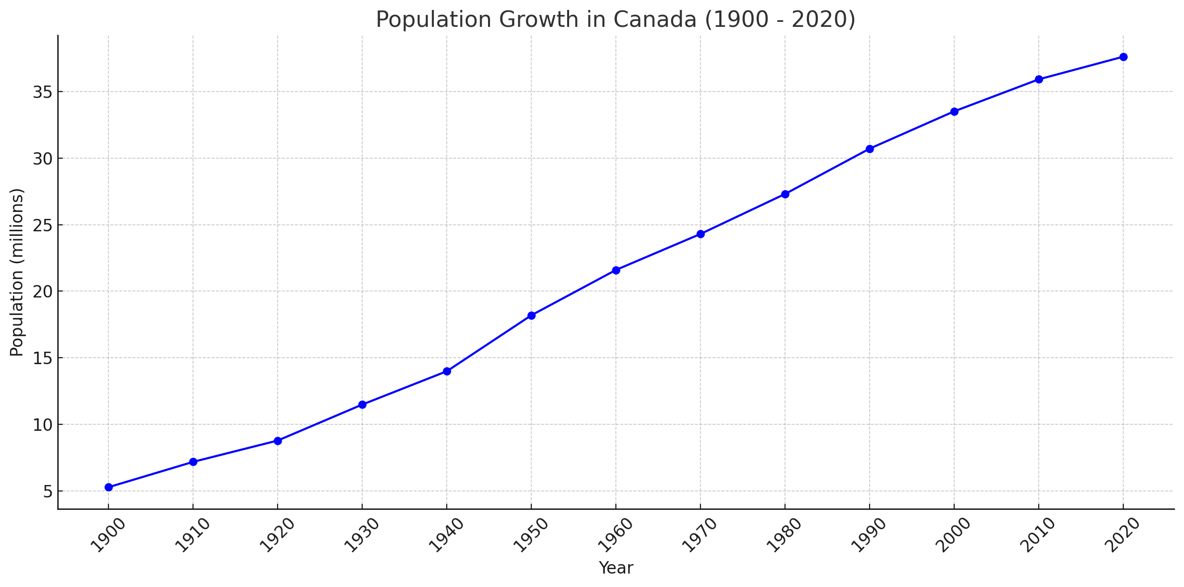
Canada population growth since 1900

Canada population growth from 1900 to 2020<
This chart illustrating the population growth in Canada from 1900 to 2020, showing a steady increase over time. The data indicates significant growth, especially post-World War II, as Canada expanded its population base through natural growth and immigration

Canada Religious Composition in 2021
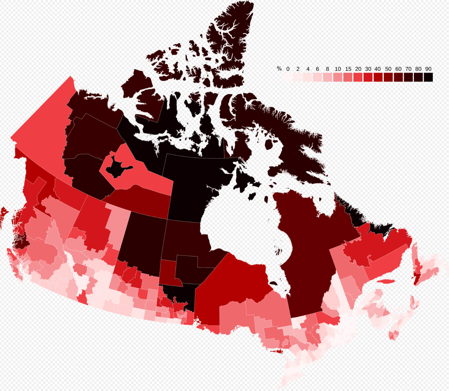
Religious Affiliation In Canada (2021 Census)
Canada Religious Composition in 2024

This pie chart that visualizes the religious affiliations in Canada according to the 2021 census. This chart highlights that Christianity, led by Roman Catholicism, remains the largest religious group at 53.3%, while 34.6% of the population reports having no religion. Other religions, such as Islam, Hinduism, Sikhism, Buddhism, Judaism, and Indigenous spirituality, make up smaller portions of the population.

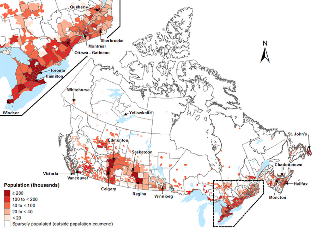
Canada population density map

Canada population density map

Population density map of Canada 2006
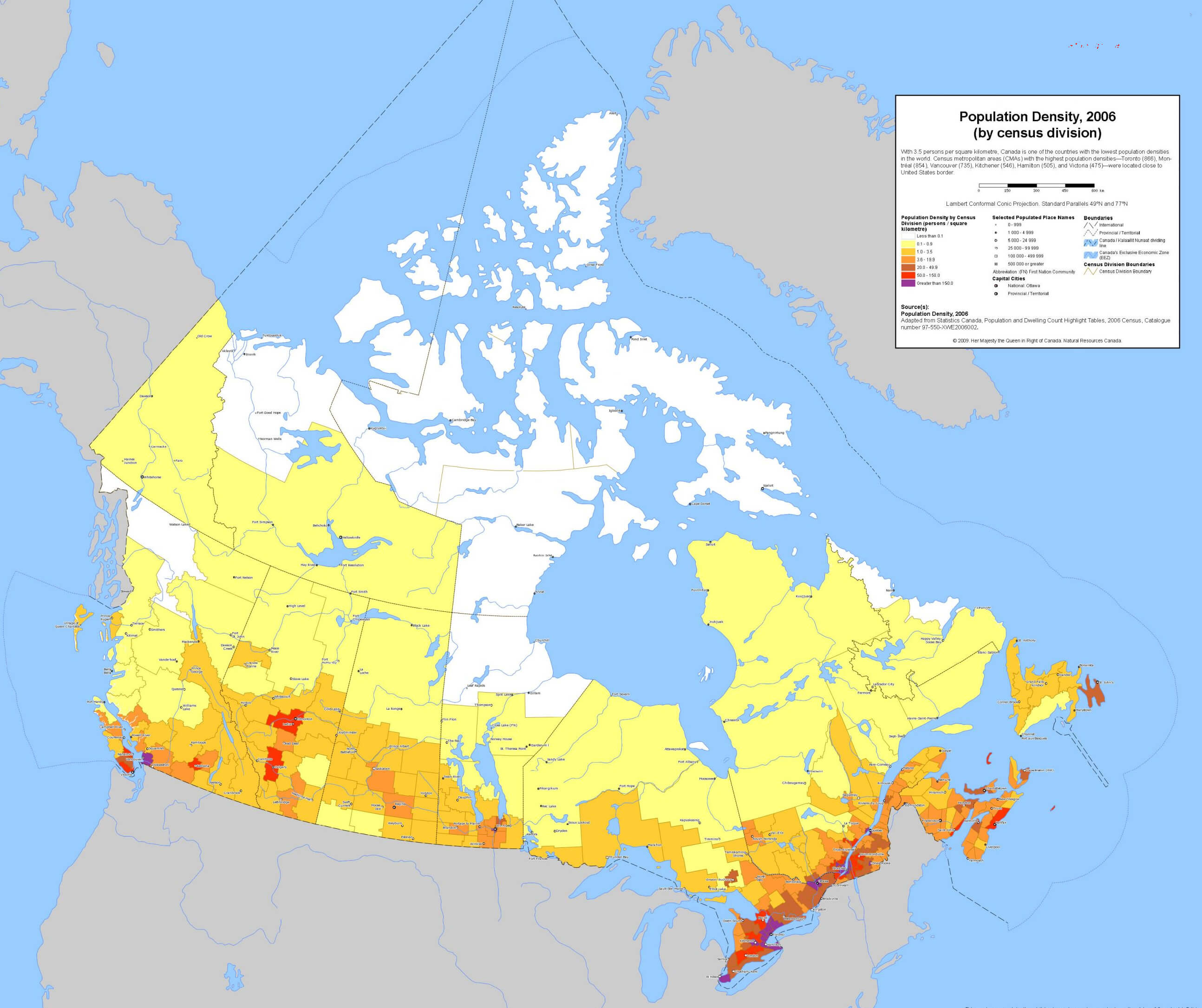
Population density map of Canada 2006

Population density map of canada
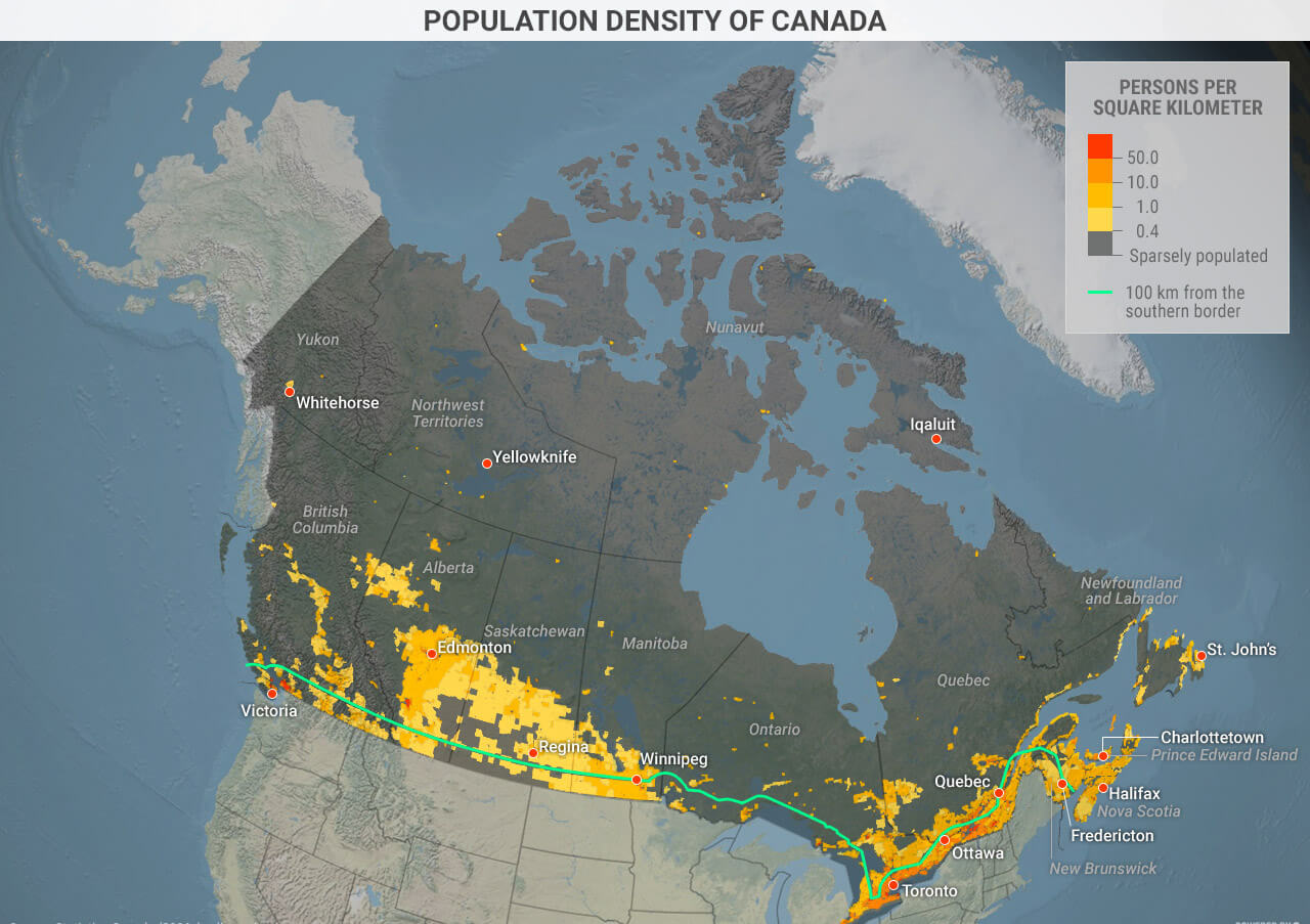
Population density map of canada

Religious affiliation in Canada 2021 census
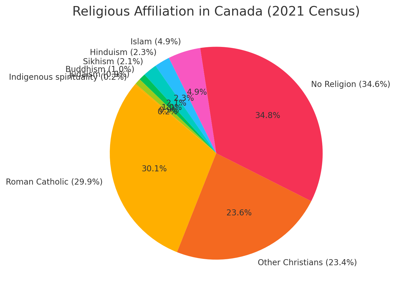
Religious affiliation in Canada 2021 census

Where is Canada on North America Map?

Show Google interactive map, satellite map, where is the country located.

Get direction by driving, walking, bicycling, public transportation and travel with street view.

Feel free to explore these pages as well:

- Advertisement -
Previous article
Next article

Discover

Sponsor

Latest Posts

Exploring the Heart of Egypt: 10 Must-Visit Destinations in Cairo

Dive into a world where time intertwines - the ancient seamlessly blending with the modern - as you explore the bustling city of Cairo,...

All About Florida: Discovering the Sunshine State

With its shores bathed in golden sunsets and kissed by azure waves, Florida stands as a mesmerizing juxtaposition of natural wonders and urban allure;...

A Collection of Taiwan Images and Photos

Taiwan is an island country lies between China and Japan, but it is currently not recognized as an official country in the World, as...

Canada Physical Map

Canada's physical maps and atlases provide a detailed view of its stunning geography, including cities such as Toronto and Vancouver, provinces such as Alberta...

Canada Road Map

Explore Canada's detailed road network with this comprehensive travel map. Includes highways connecting major cities, national railways, rivers, lakes and subway lines in major...