- Advertisement -
Explore high-resolution US maps: colorful political maps, physical maps, road maps, satellite images, time zones, detailed state boundaries, capitals, major cities, Alaska & Hawaii, and historical maps of the USA.
High-Resolution US States and Interstate Highways Map
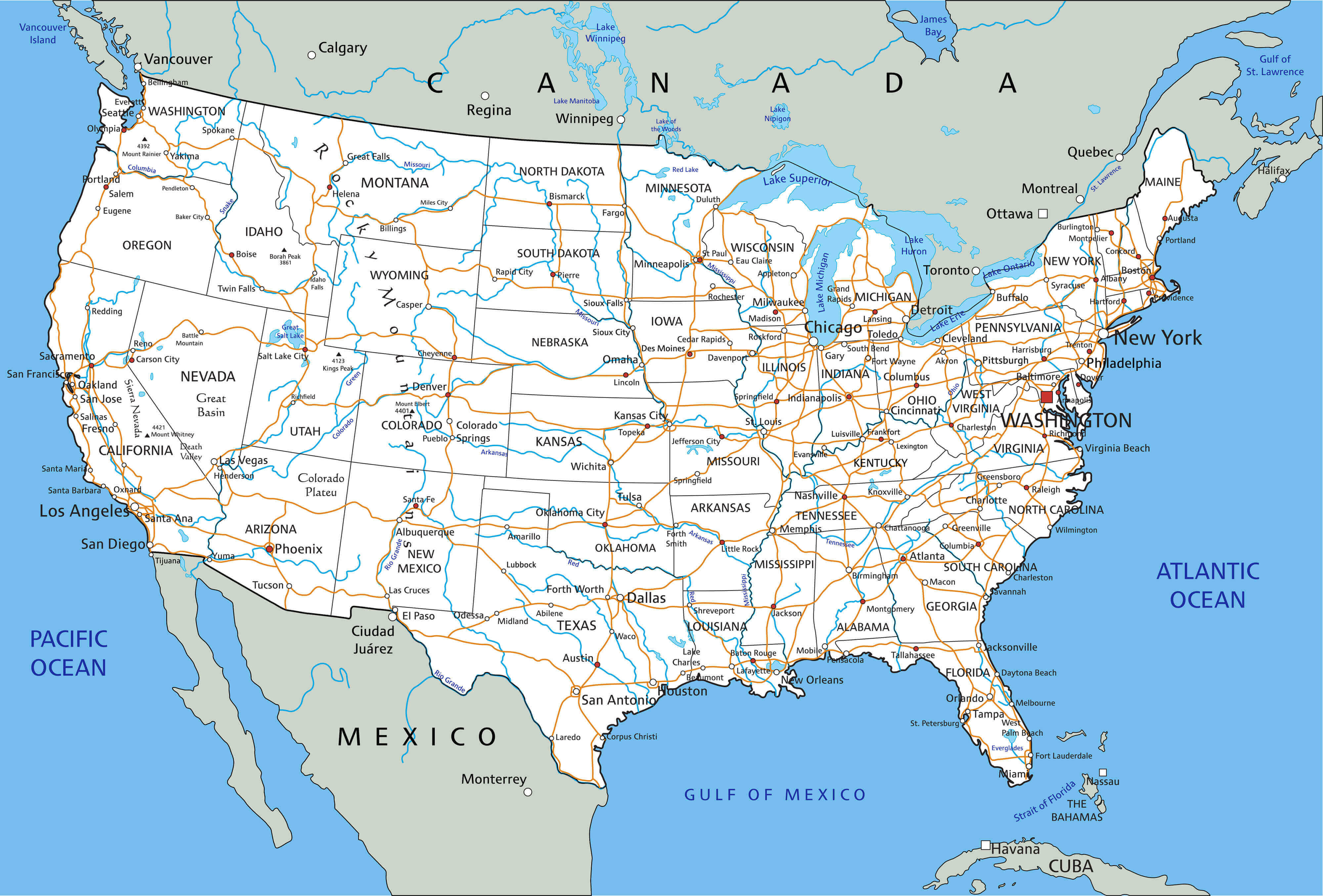 High-resolution map of US states and interstate highways.
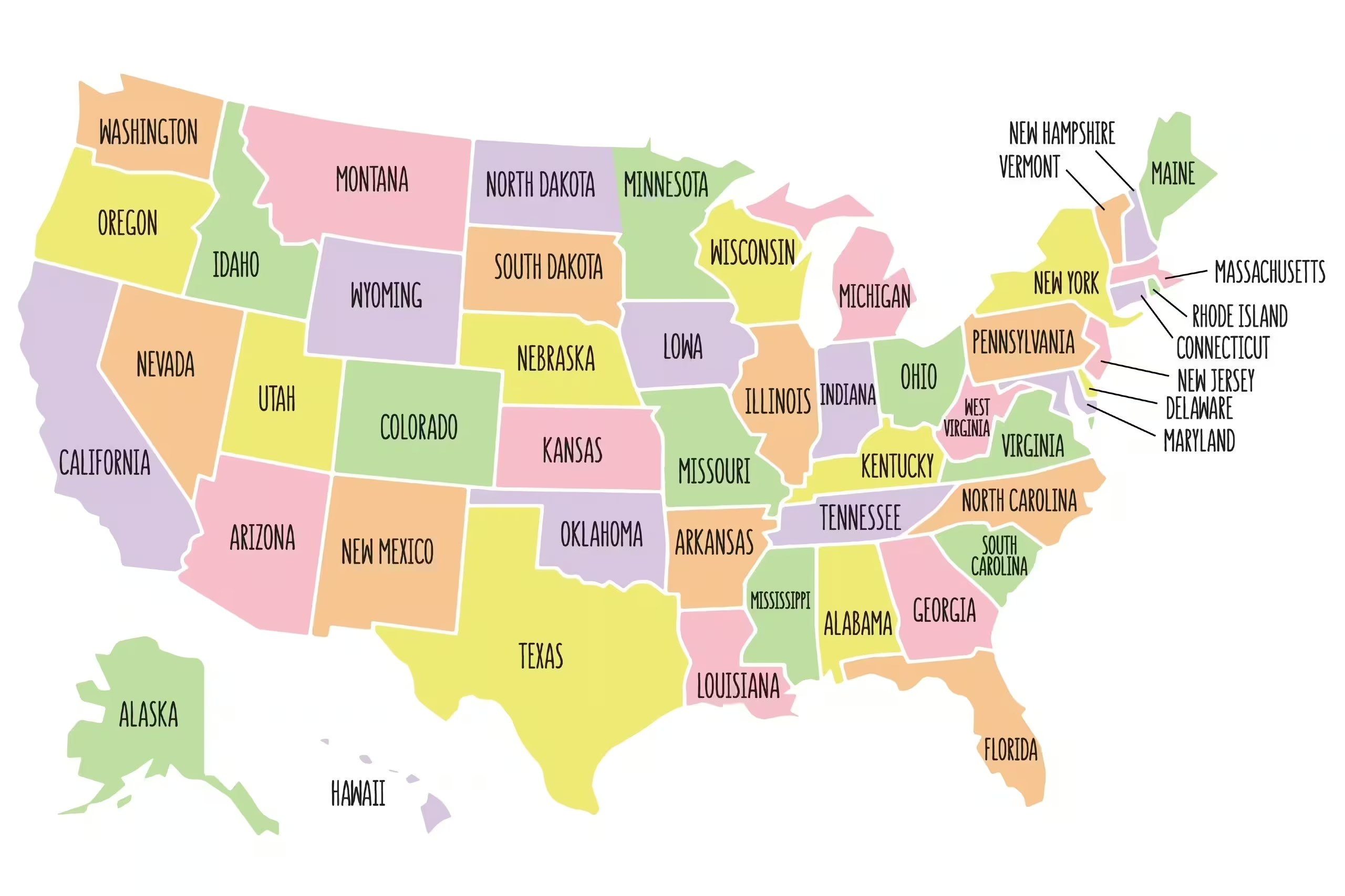
High-resolution colorful US states map
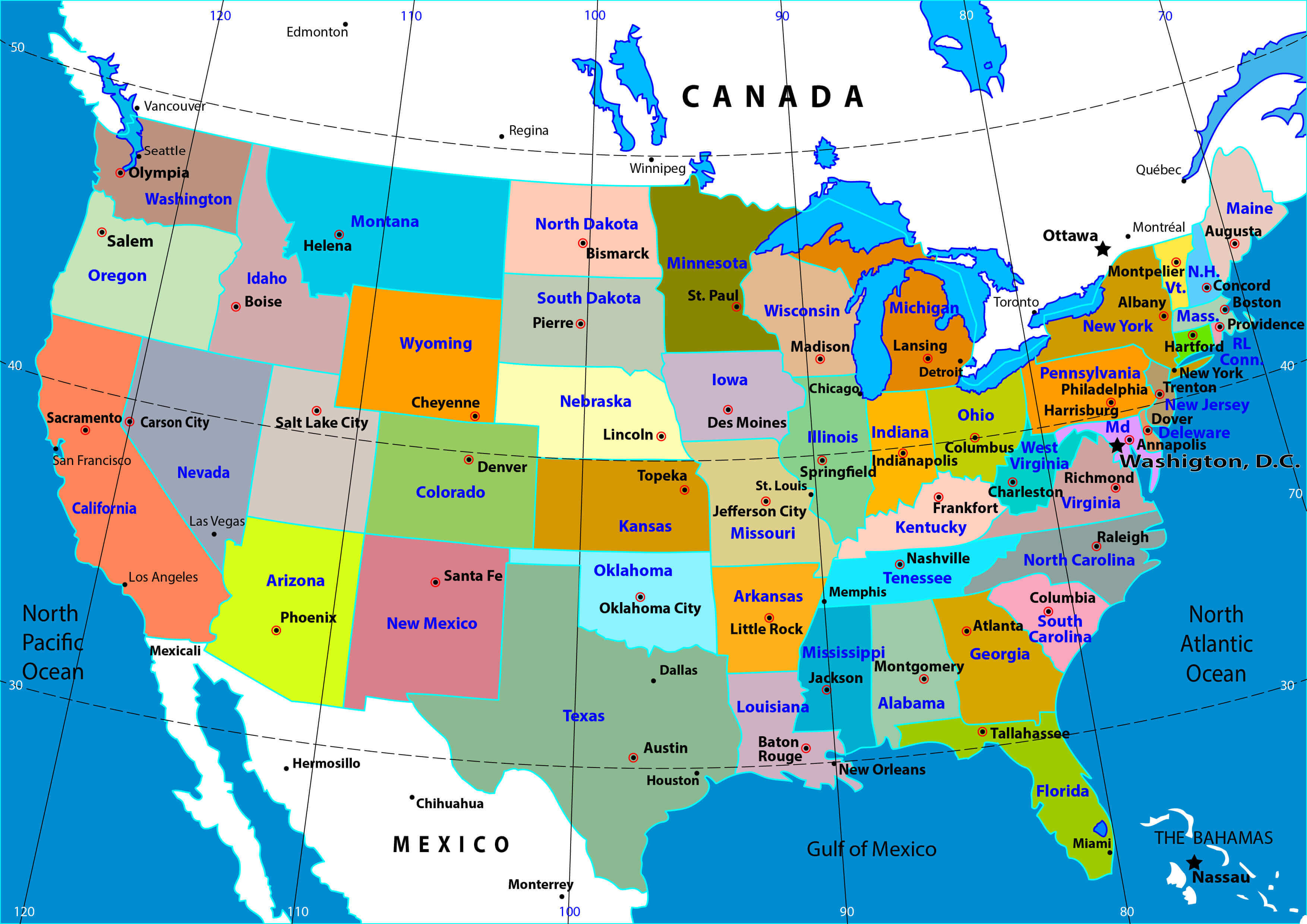
High-resolution map of the US with states
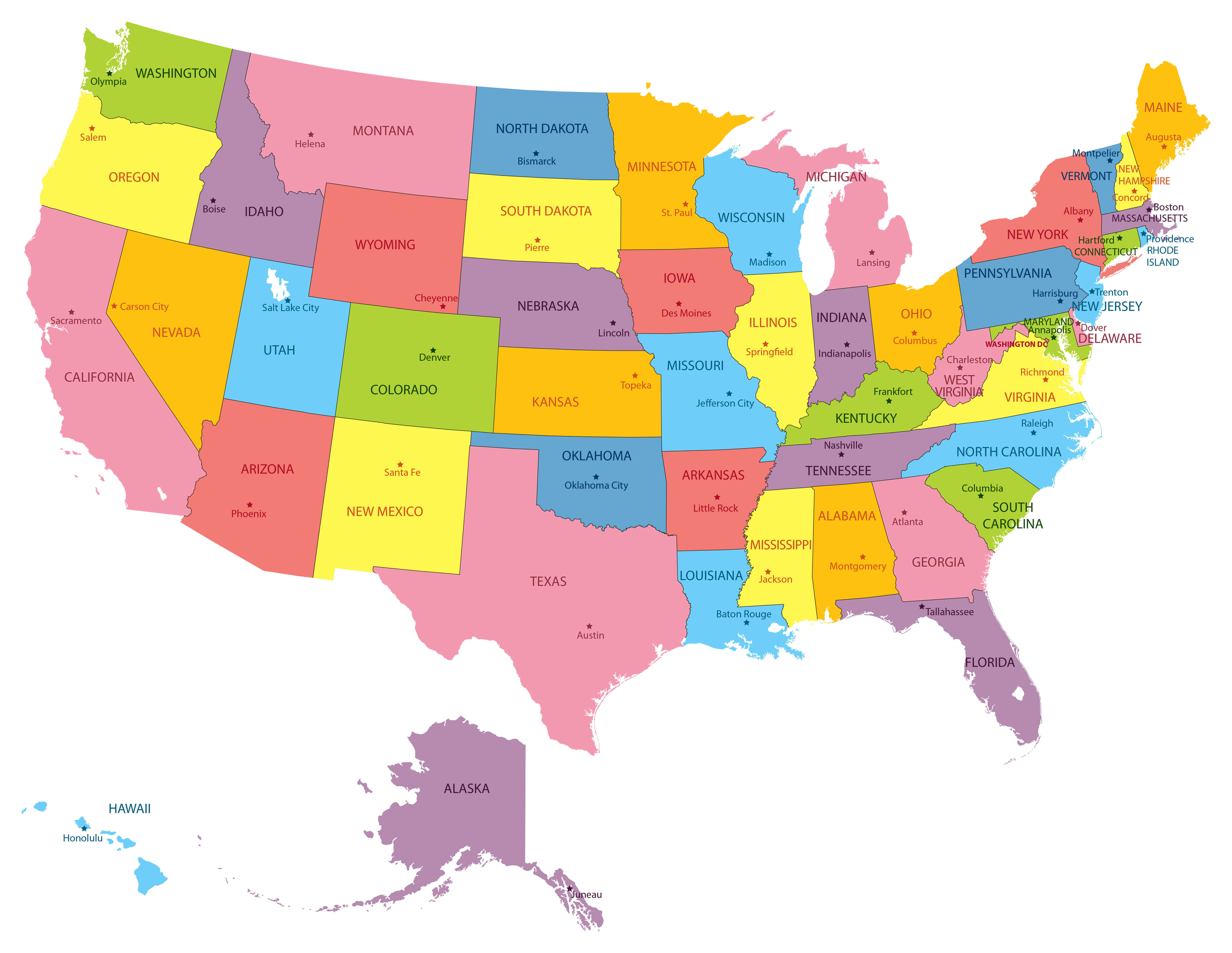
High-resolution physical map of USA
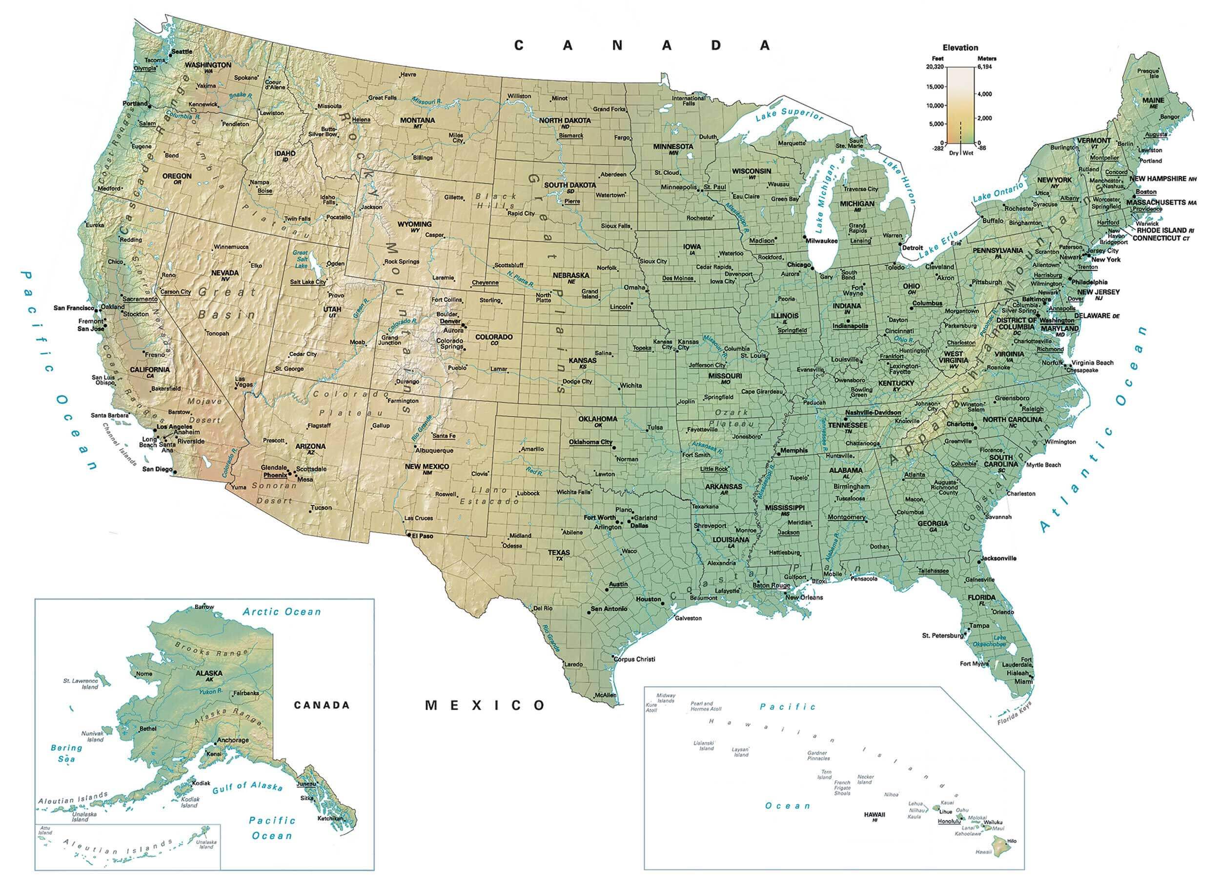
High-resolution physical US map
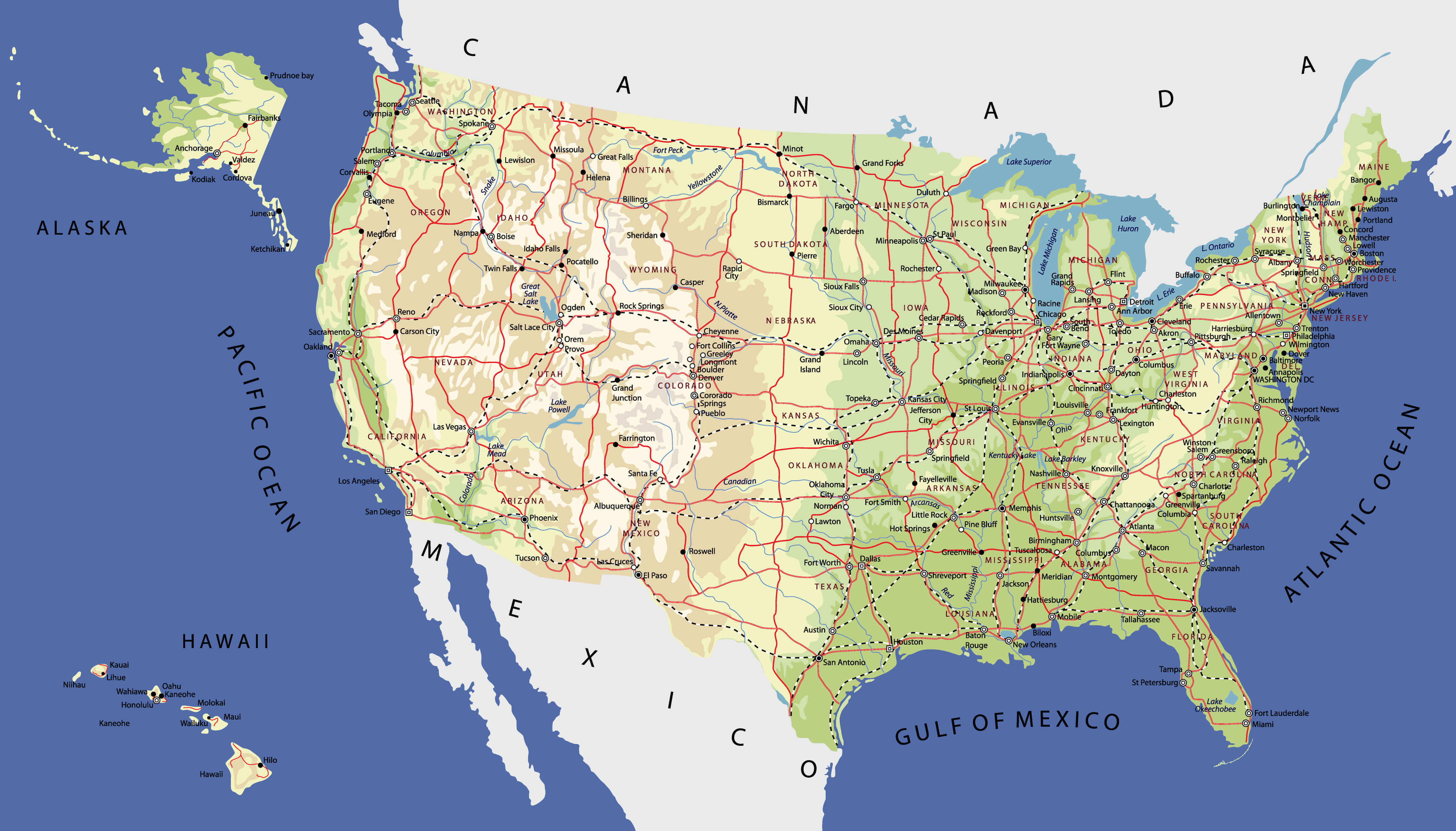
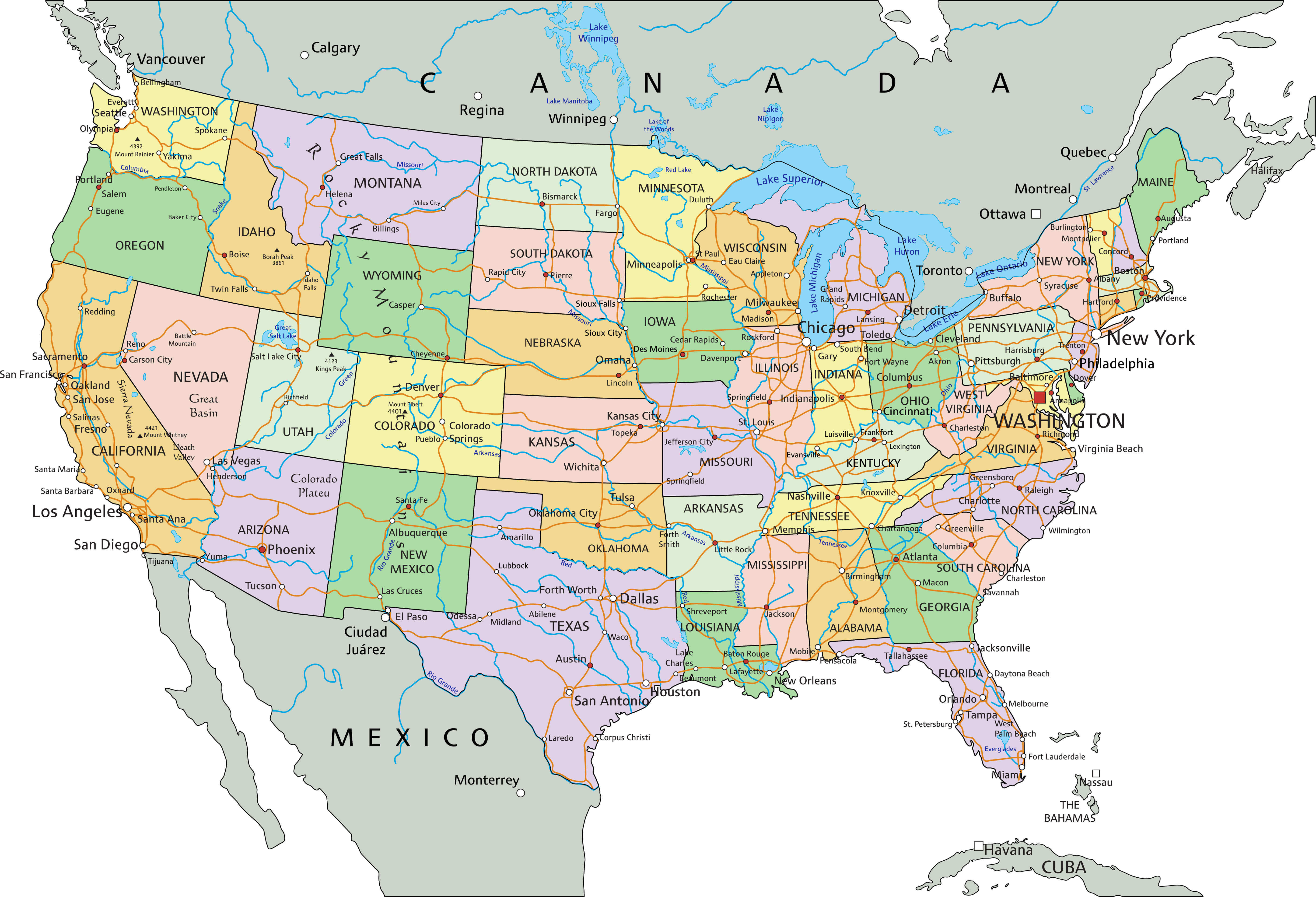
High-resolution political map of the US
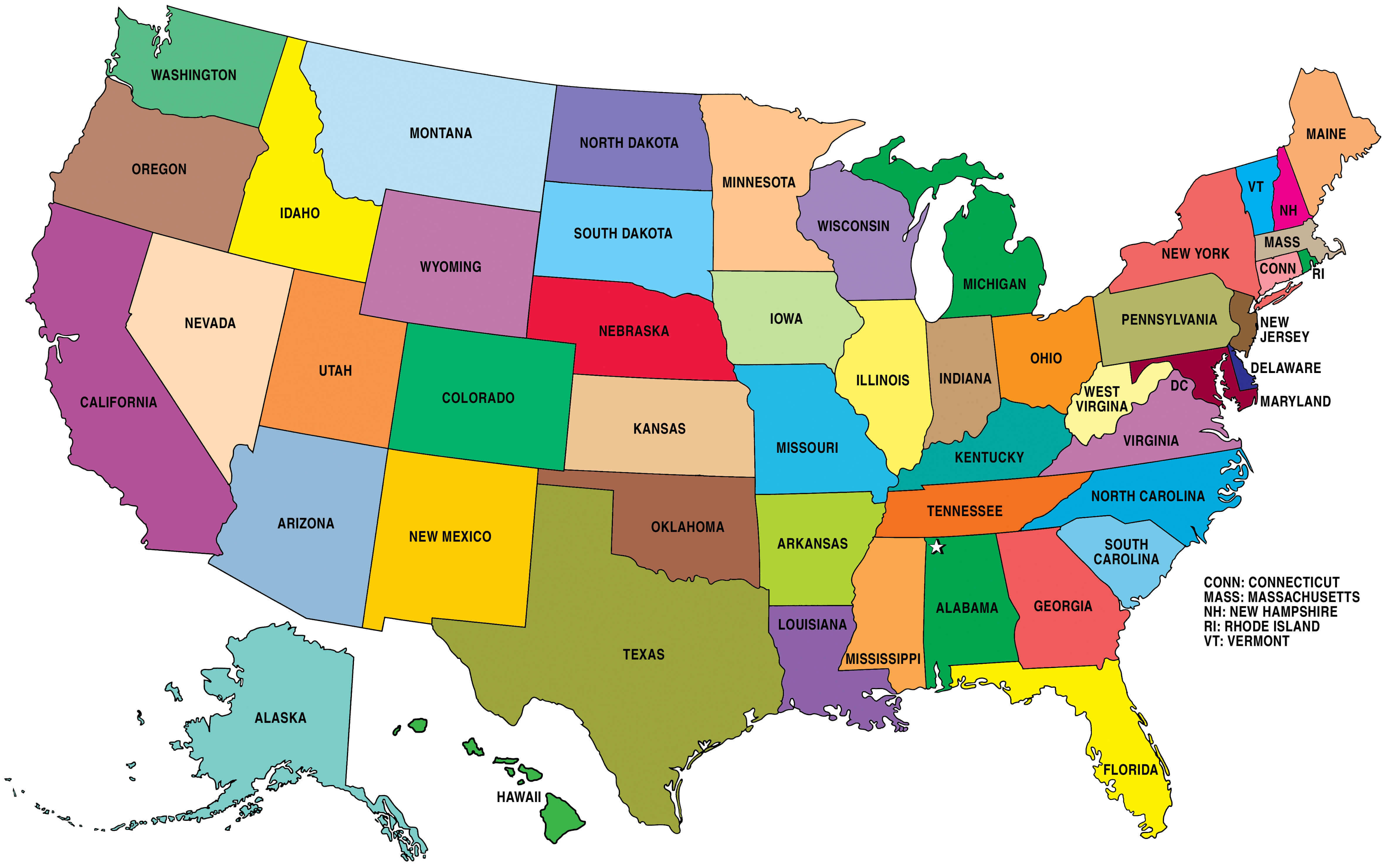
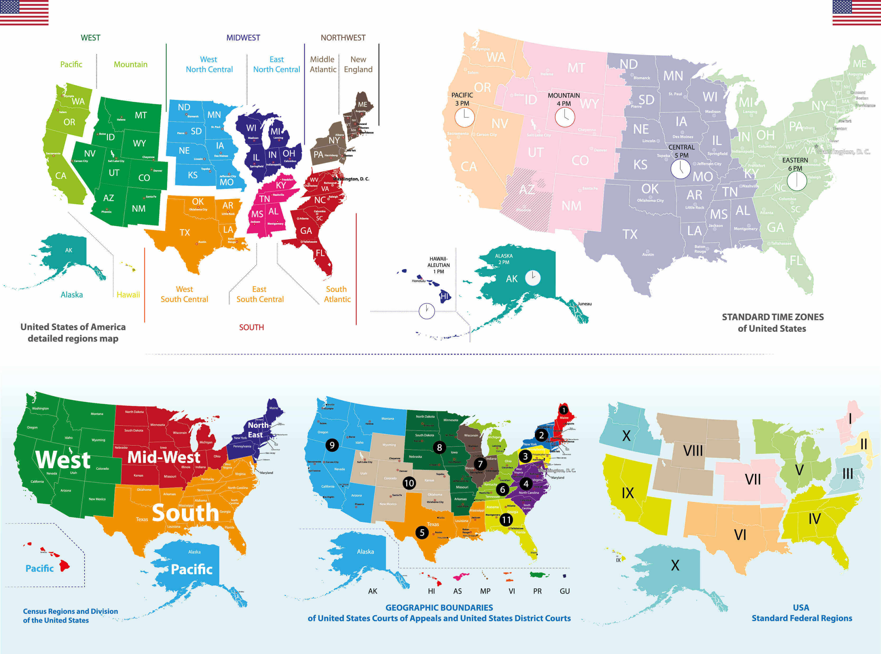
High-resolution the US and states time zone map
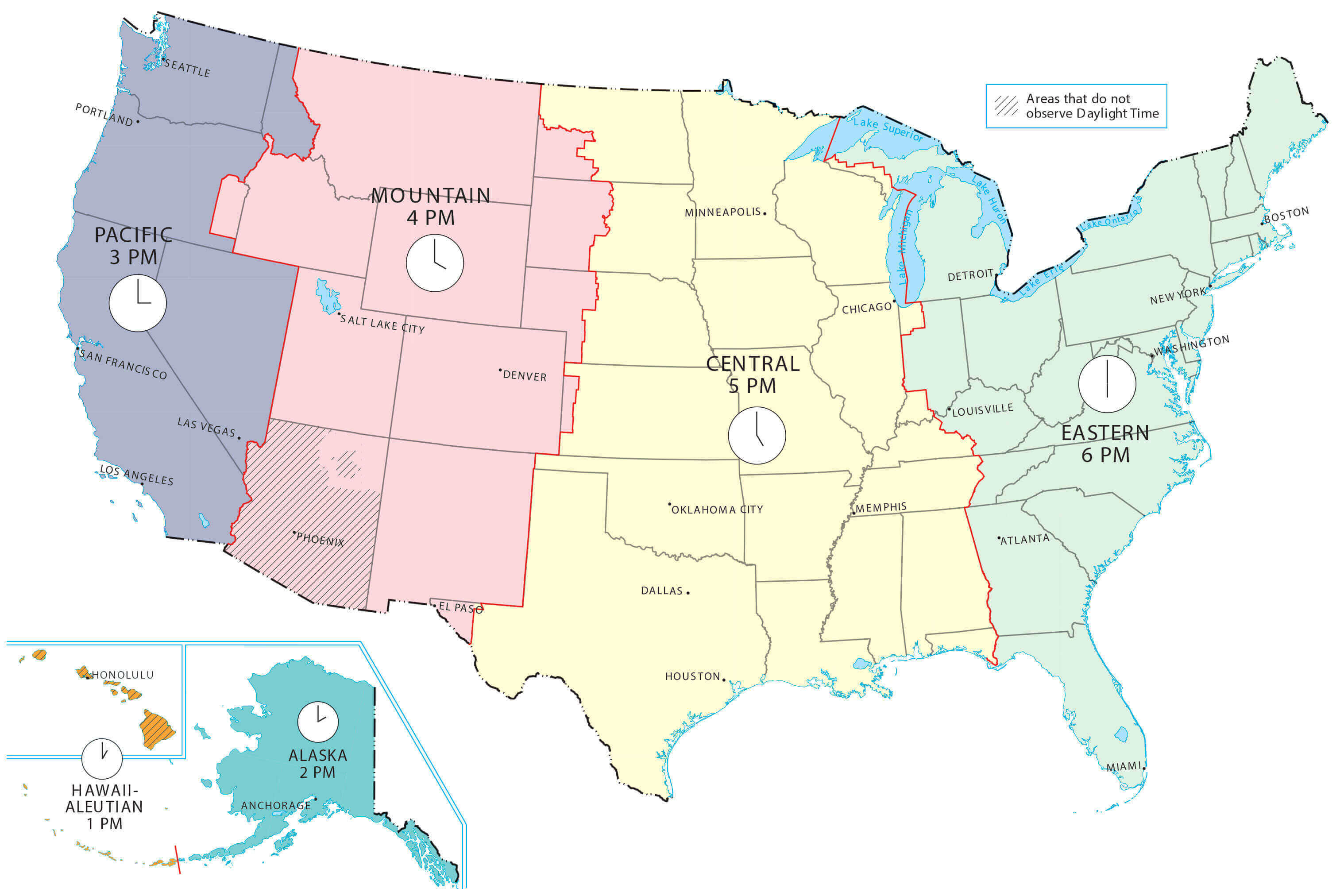
High-resolution US and canada blank physical map
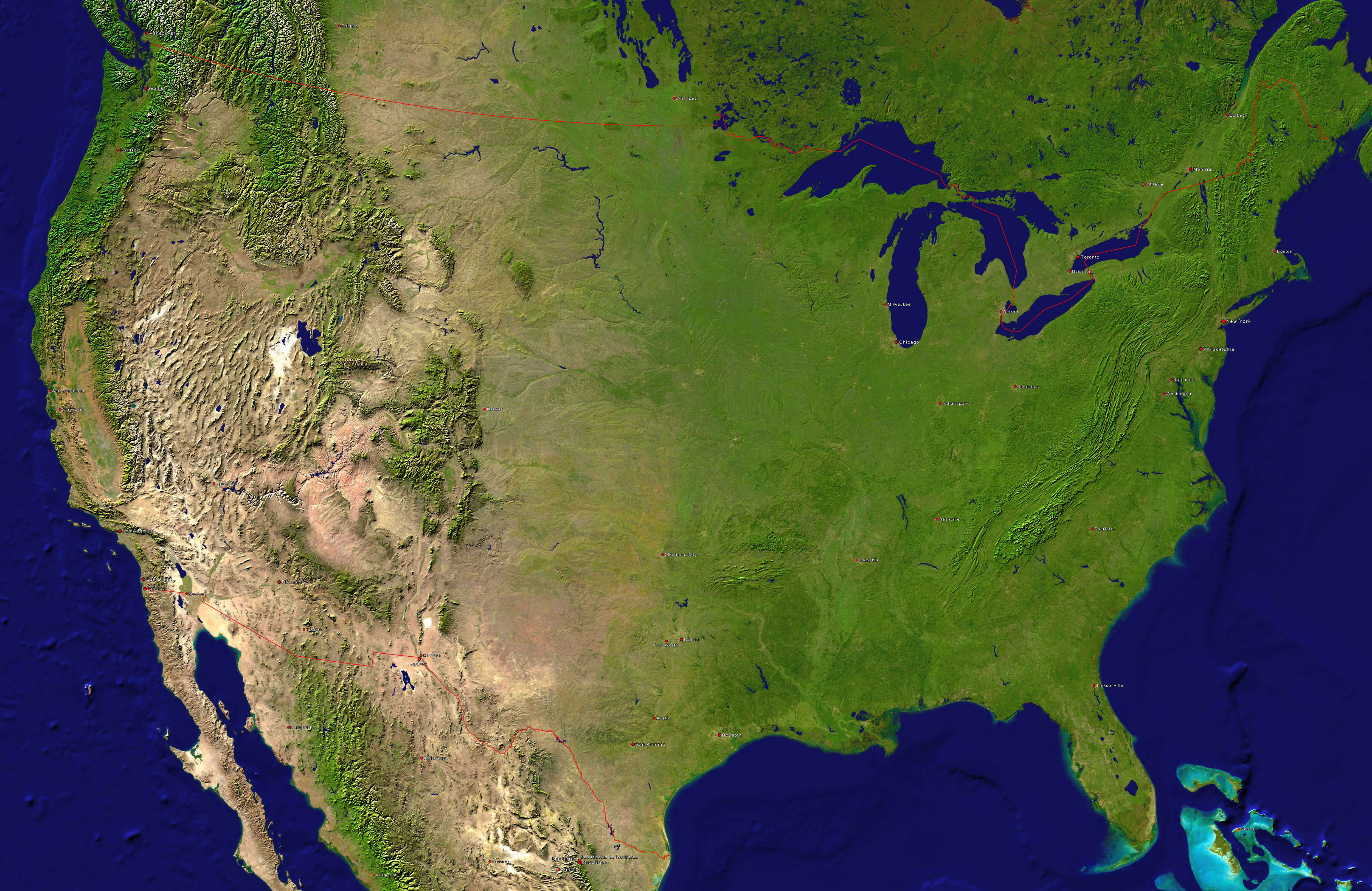
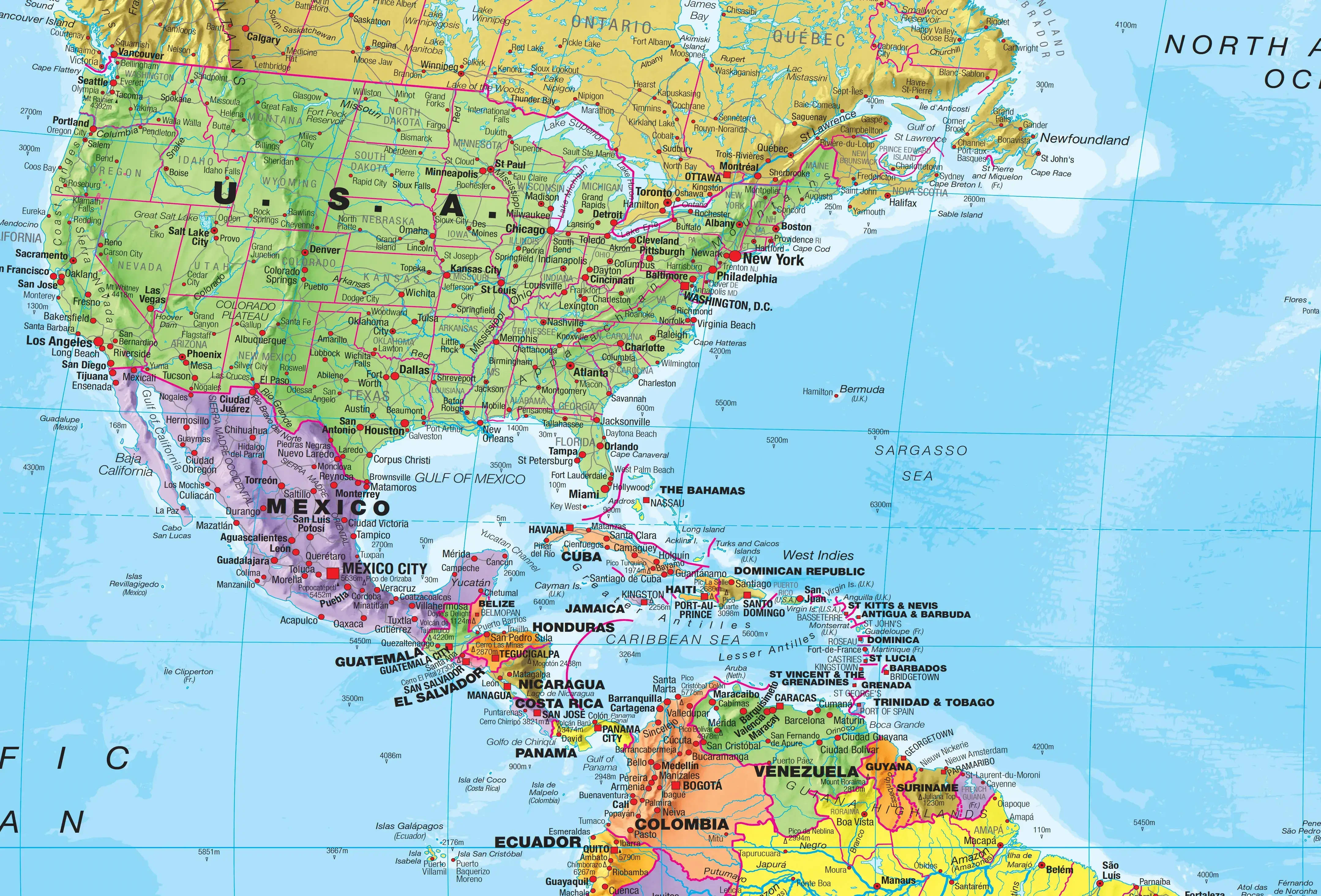
High-resolution US and North America map
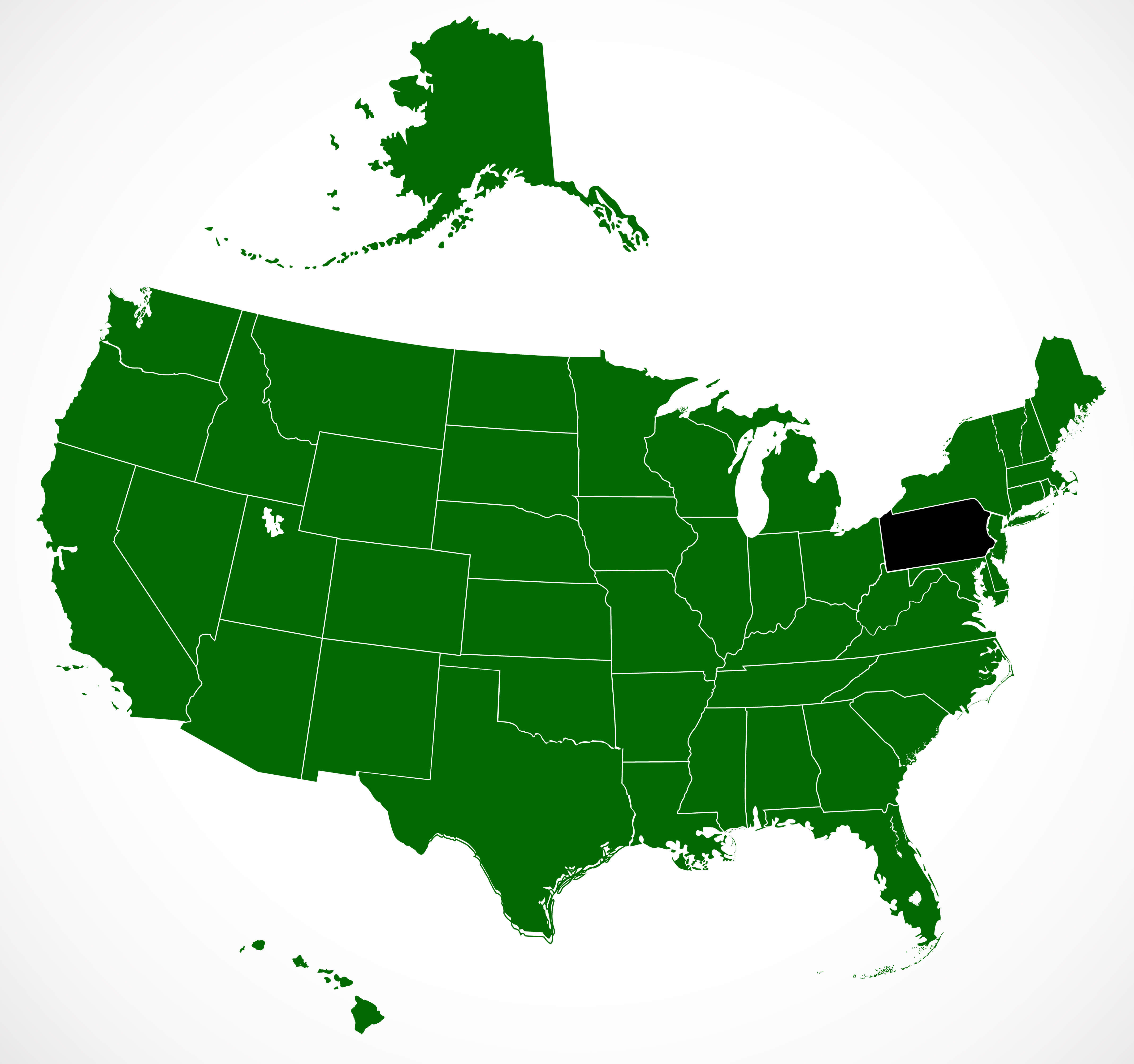
High-resolution US blank states map with pennsylvania
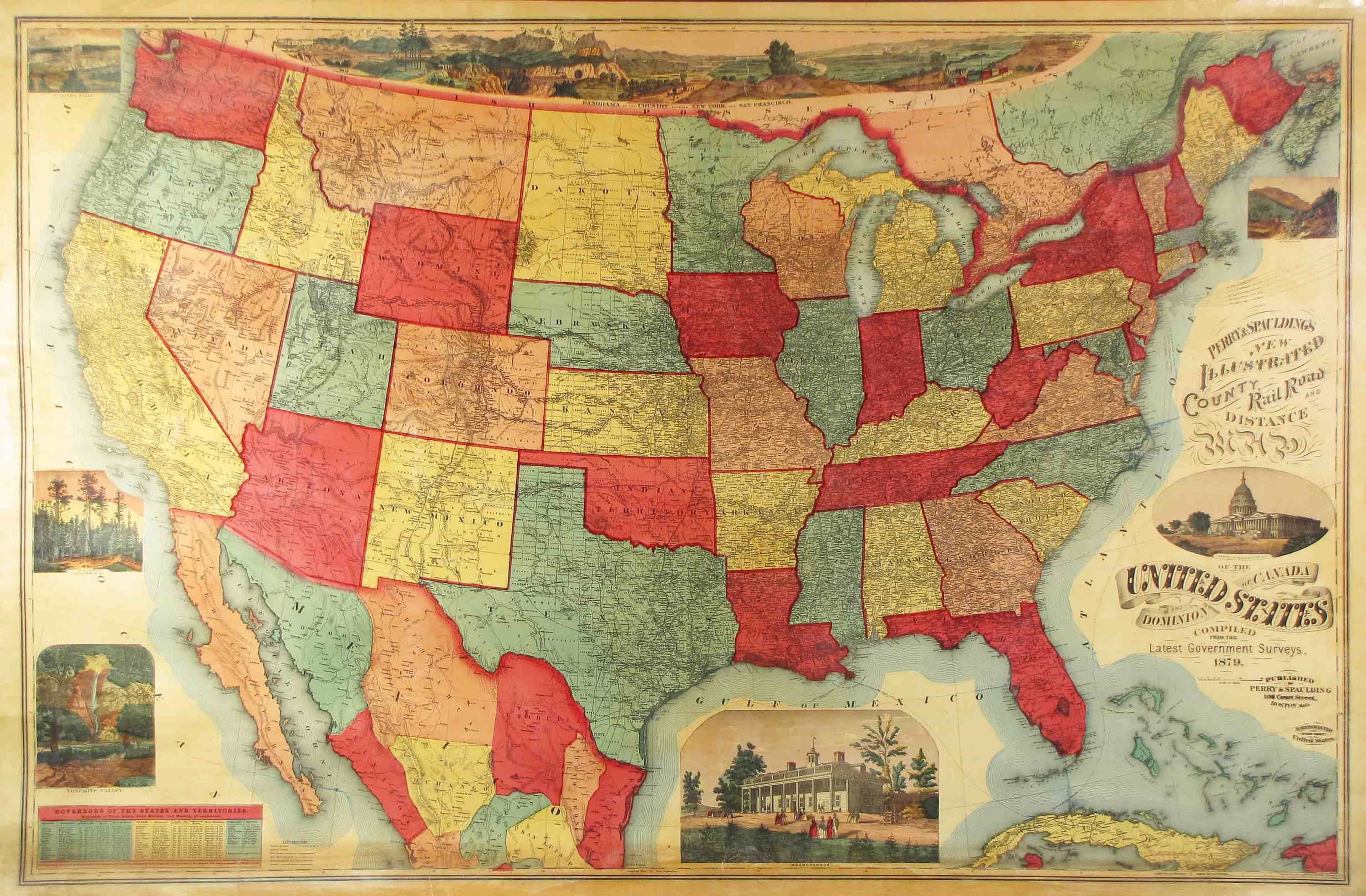
High-resolution US in 1879
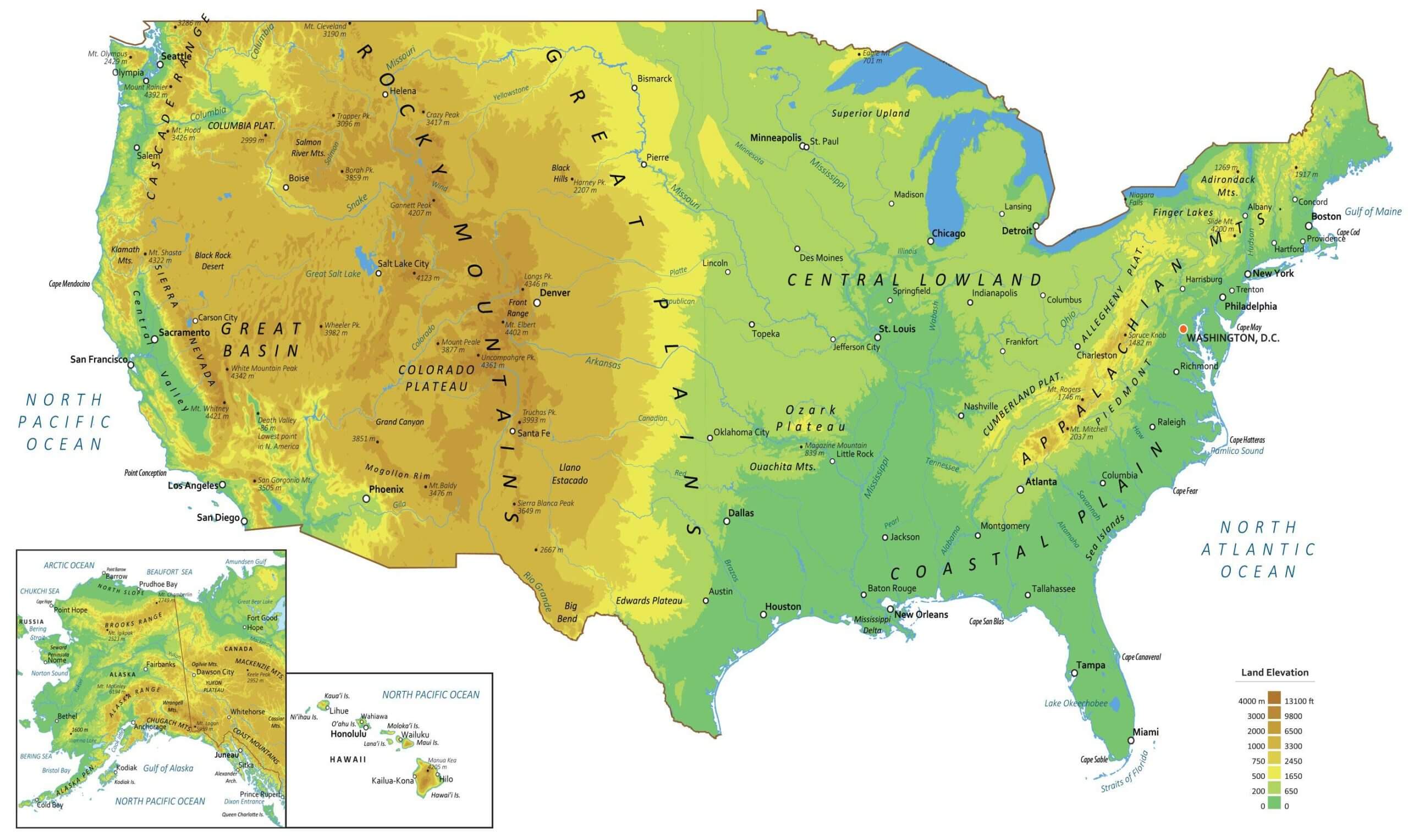
High-resolution US physical map
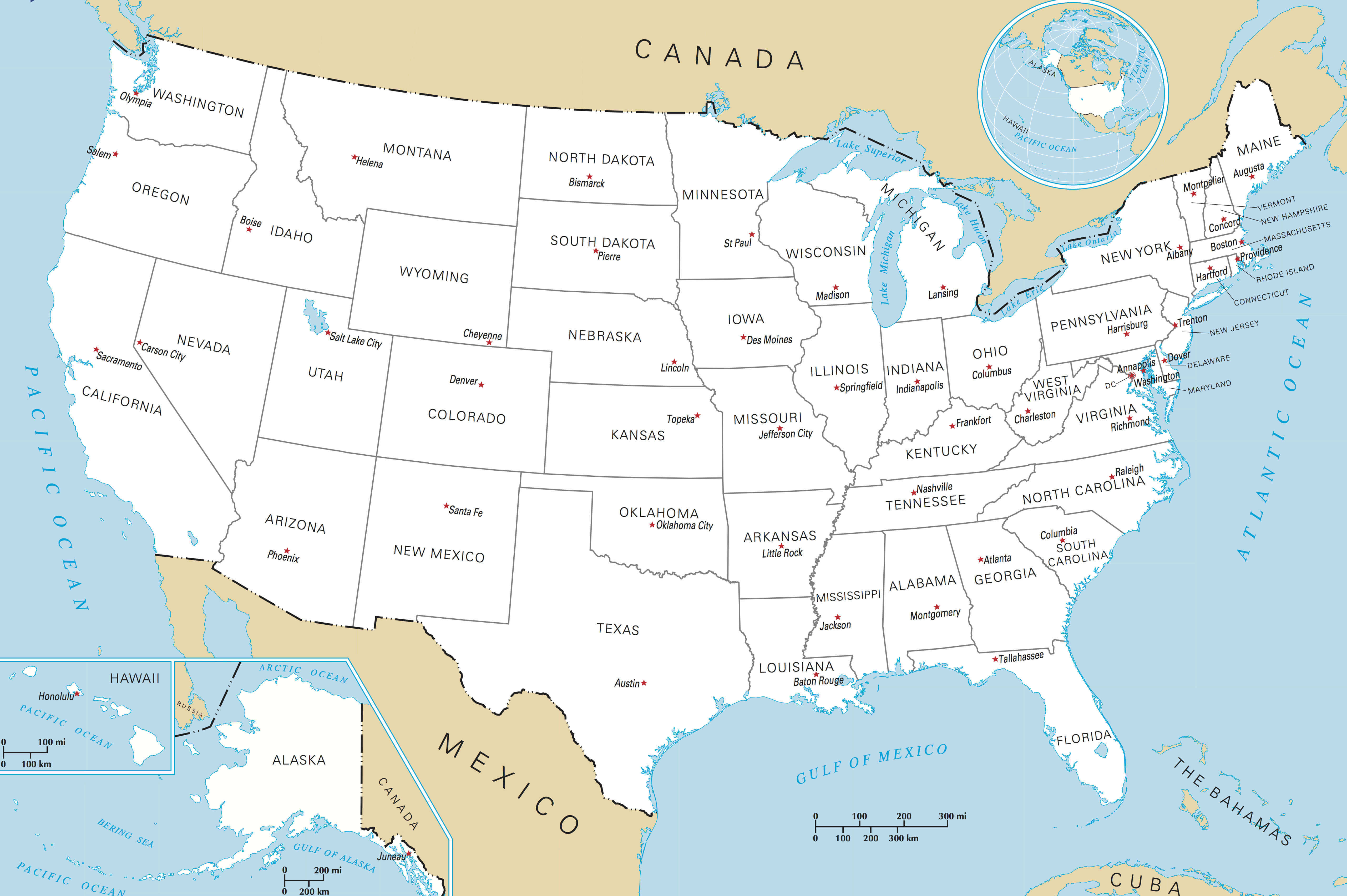
High-resolution US political map states and capitals
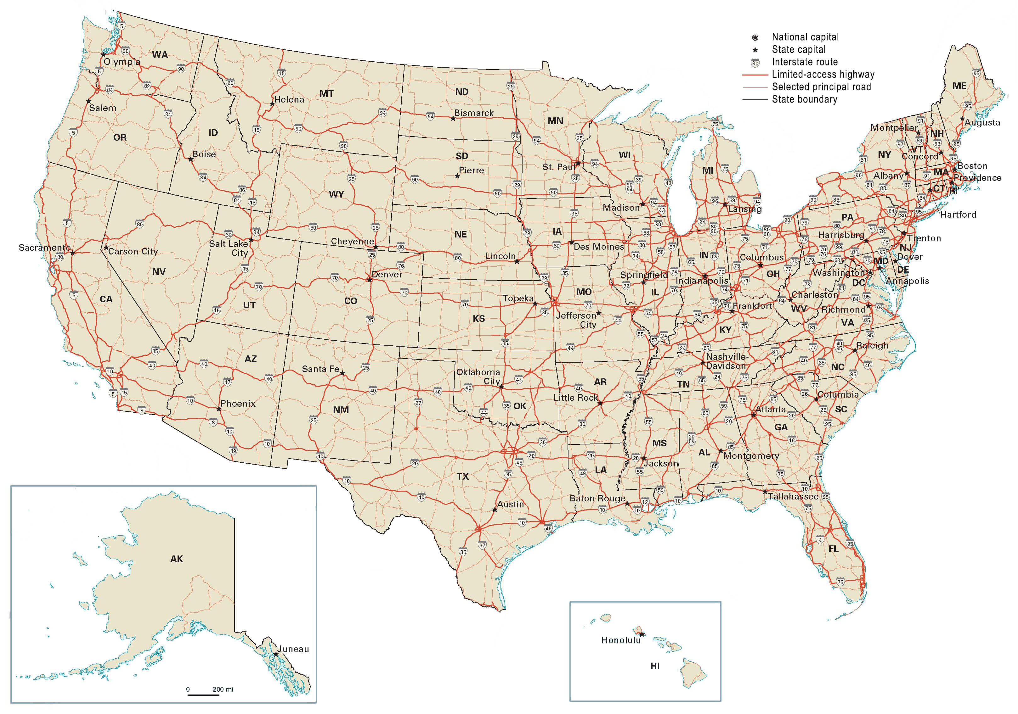
High-resolution US road map
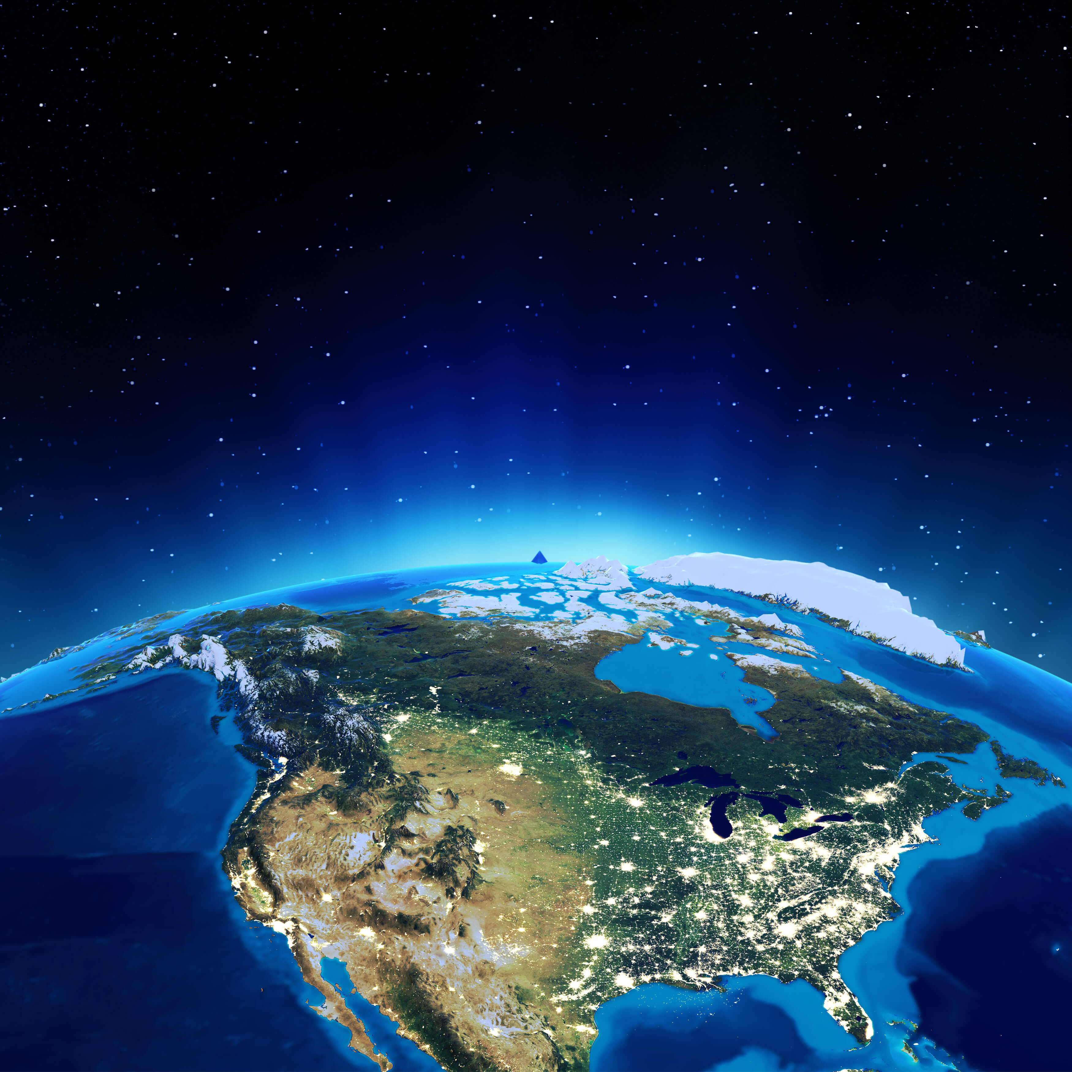
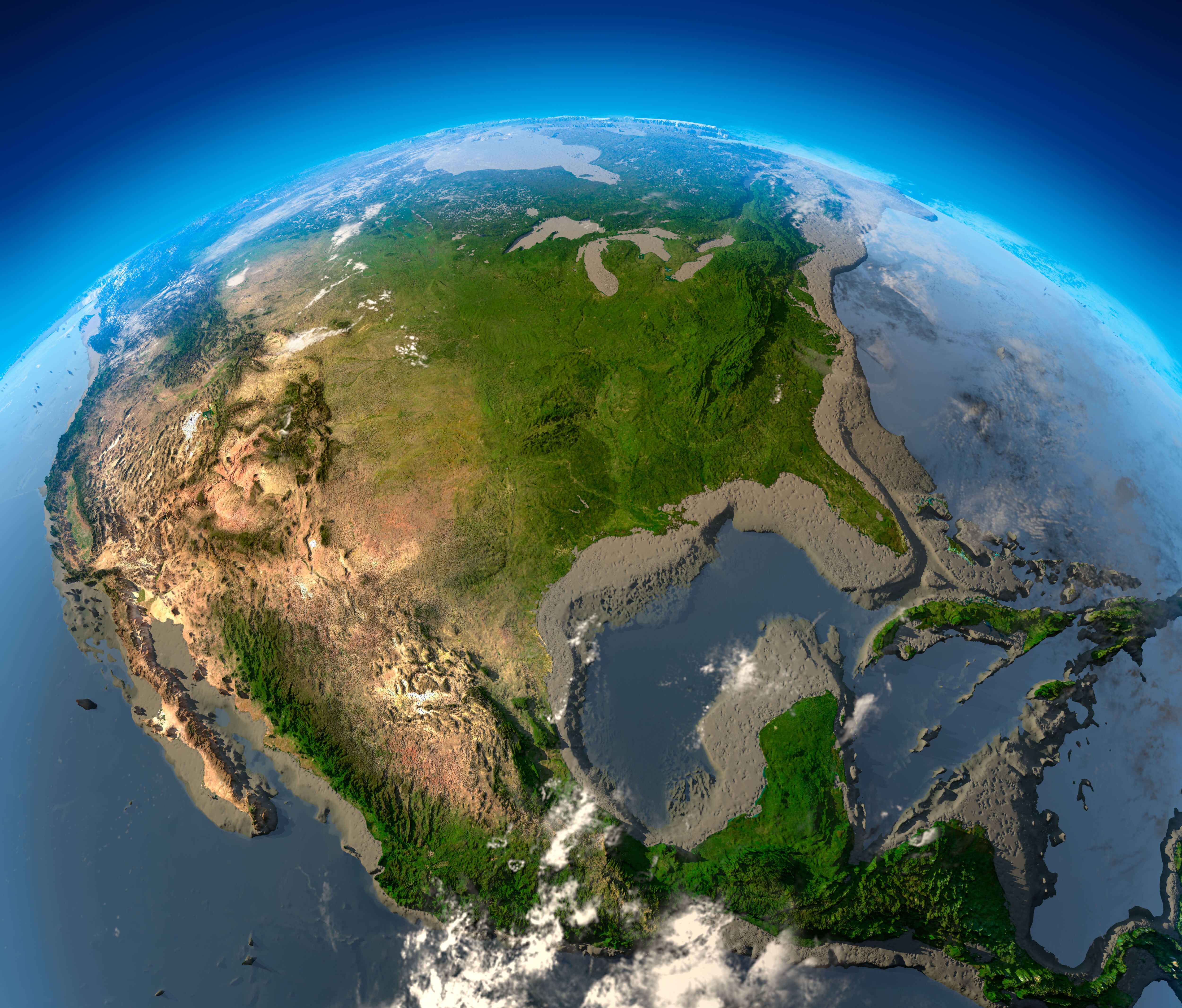
High-resolution US satellite image
High-resolution US states map with Alaska and Hawaii
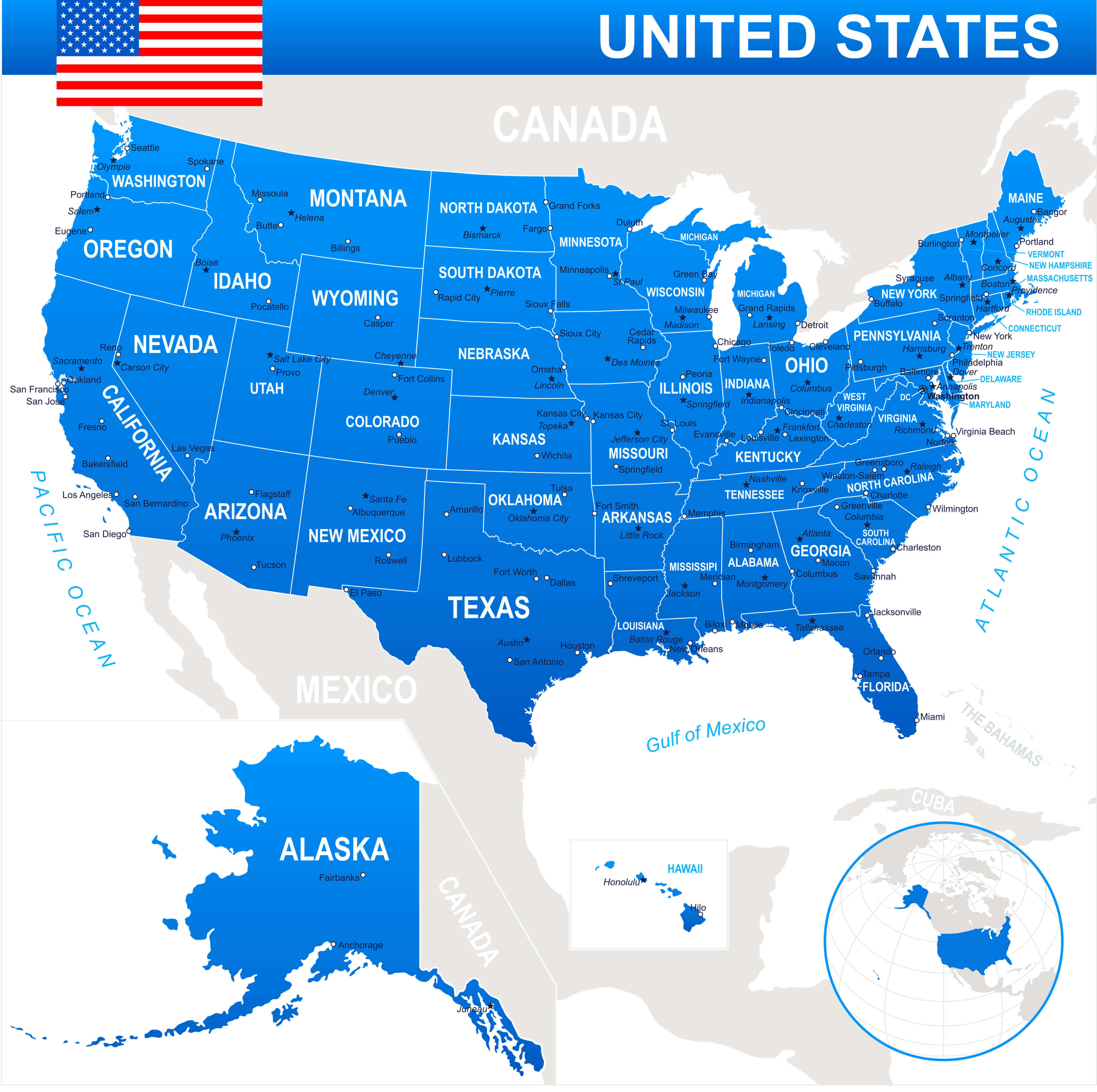
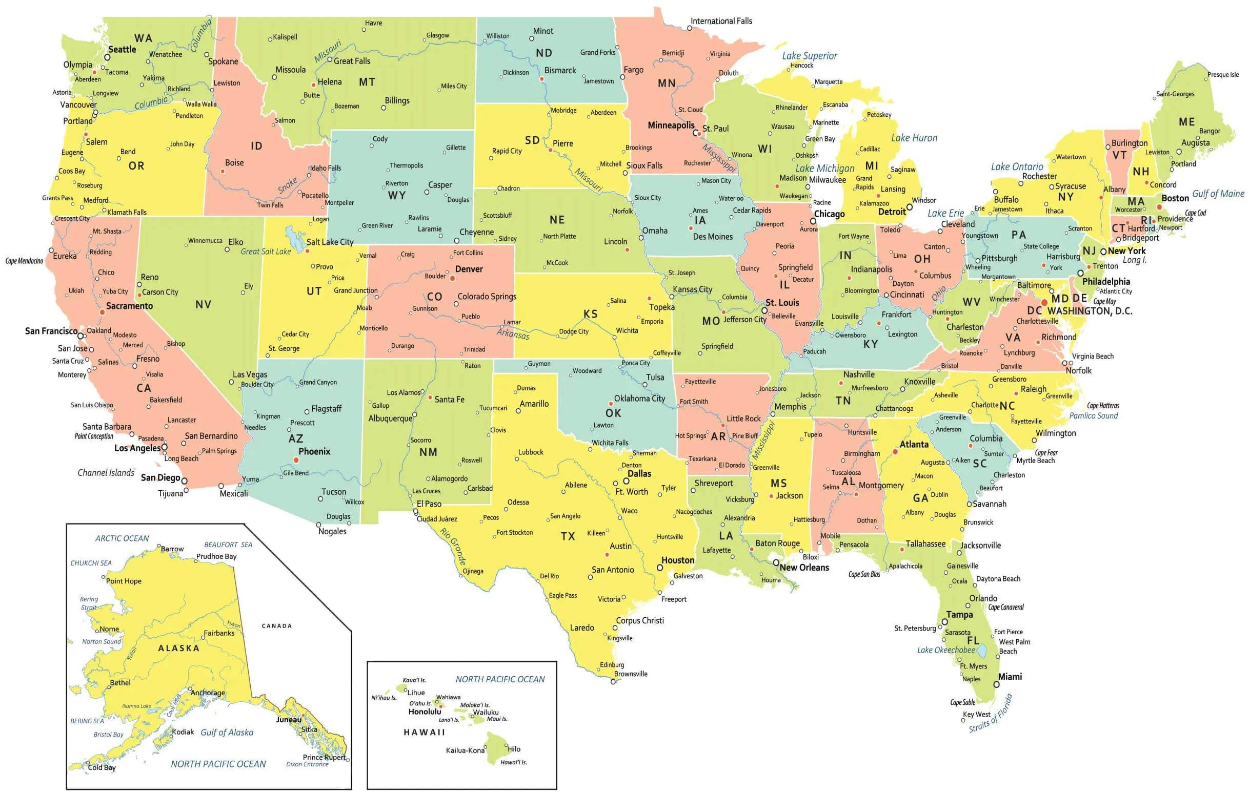
High-resolution USA map with states and cities
High-resolution USA satellite map
High-resolution USA states with national border
The US and states time zone maps
USA High-resolution states map
Where is the United States on the World Map?
Show Google map, satellite map, where is the country located.
Get directions by driving, walking, bicycling, public transportation and travel with street view.
Feel free to explore US states maps:
- United States Map ↗️
- US Maps ↗️
- United States Maps ↗️
- Map of United States ↗️
- US States Map ↗️
- United States States Map ↗️
- United States Cities Map ↗️
- Political Map of the US ↗️
- US Cities Map ↗️
- United States Political Map ↗️
- US Physical Map ↗️
- United States Physical Map ↗️
- United States High-resolution Map ↗️
- US Population Map ↗️
- US Time Zone Map ↗️
- US Blank Map ↗️
- United States Blank Map ↗️
- Gulf of America (The Gulf of Mexico) Map ↗️
- United States Time Zone Map ↗️
- California Time Zone Map ↗️
- Texas Time Zone Map ↗️
- New York Time Zone Map ↗️
- Florida Time Zone Map ↗️
- California Map ↗️
- Texas Map ↗️
- New York Map ↗️
- Florida Map ↗️
- Illinois Map ↗️
- Pennsylvania Map ↗️
- Ohio Map ↗️
- Michigan Map ↗️
- Georgia Map ↗️
- New Jersey Map ↗️
- North Carolina Map ↗️
- Virginia Map ↗️
- Massachusetts Map ↗️
- North America Map ↗️
- Advertisement -
