A collection of India Maps; View a variety of India physical, political, administrative, relief map, India satellite image, higly detalied maps, blank map, India world and earth map, India’s regions, topography, cities, road, direction maps and atlas.
India Vector Map
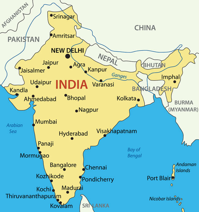
Map of the Republic of India
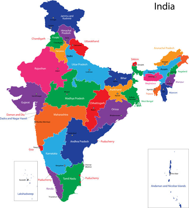
Map of the Republic of India with the states colored in bright colors.
India State Map
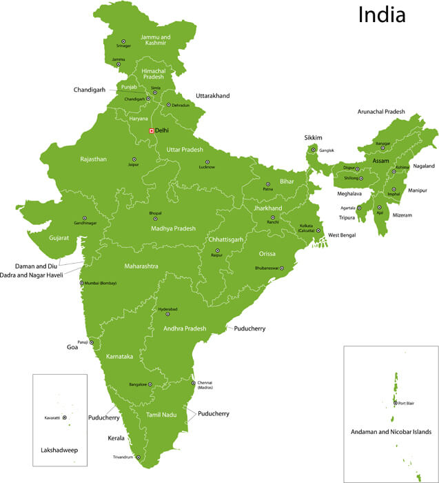
India map with states and capital cities.
India Detailed Map
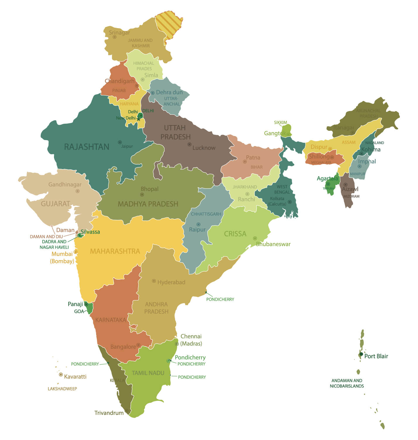
India highly detailed map. All elements are separated in editable layers clearly labeled.
India Administrative Map
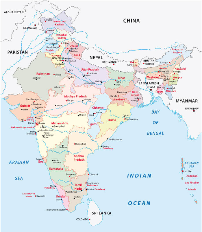
India administrative map with major cities.
India Geographical Map
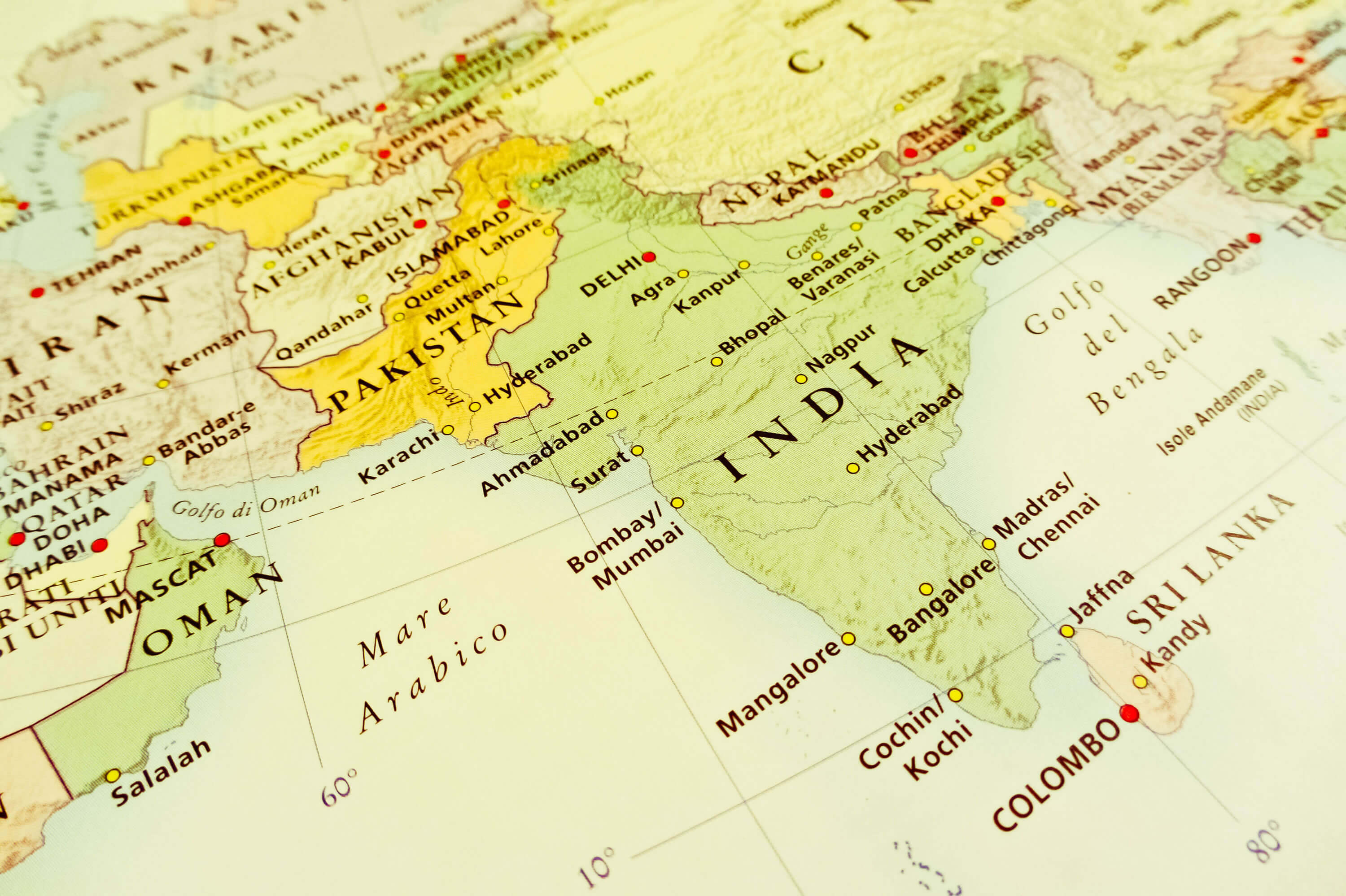
India geographical view (Geographical view altered on colors/perspective and focus on the edge. Names can be partial or incomplete).
Administrative Map of India
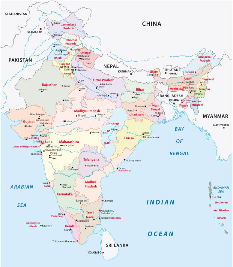
Administrative Map of India with main cities.
Colorful India Political Map
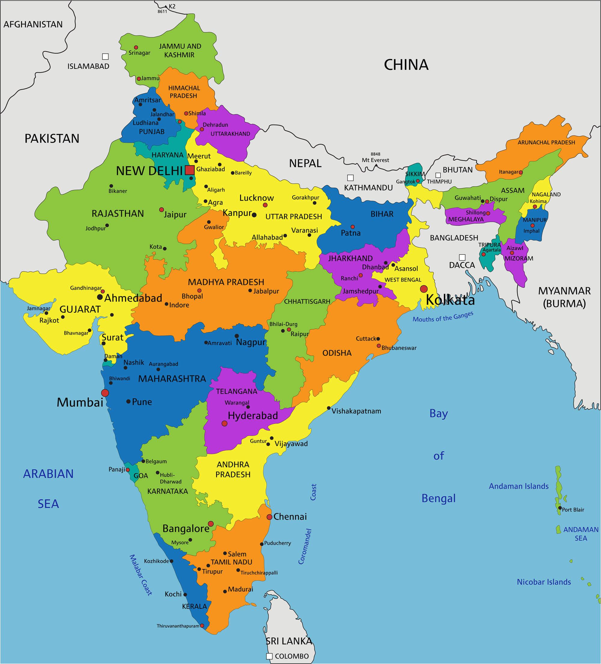
Colorful India political map with clearly labeled, separated layers. Vector illustration.
Where is India on the Asia and the World Map?
Show Google interactive map, satellite map, where is the country located.
Get directions by driving, walking, bicycling, public transportation and travel with street view.
Feel free to explore these pages as well:
- Map of India ↗️
- India ↗️
- India Time Zone Map ↗️
- Mumbai’s Must-Visit Guide to Attractions ↗️
- Delhi’s Top 10 Must-Visit Attractions for Every Traveler ↗️
- Discover Bangalore: The Silicon Valley of India ↗️
- Discovering Ahmedabad: India’s Historical and Cultural Gem ↗️
- Pakistan Map ↗️
- Sri Lanka Map ↗️
- Bangladesh Map ↗️
- Muslim Population Map in Asia by Country ↗️
- A Collection of Bangladesh Maps ↗️
- China Map ↗️
- Maldives Map ↗️
- Nepal Map ↗️
