Explore the political map of the US with states, capitals, boundaries, colorful US political maps, largest cities, outline, rivers, elevation—plus Alaska & Hawaii and US–Canada–Mexico boundaries with a North America view. Learn about America’s divisions, cities, and government regions in detail.
A political map of the United States shows the 50 states with their clearly defined boundaries, capitals, and major cities. Unlike physical maps, which highlight natural features, political maps focus on human-made divisions, helping people understand government regions, state borders, and key urban centers across the country.
US Political Map with Mexico and Canada Boundaries
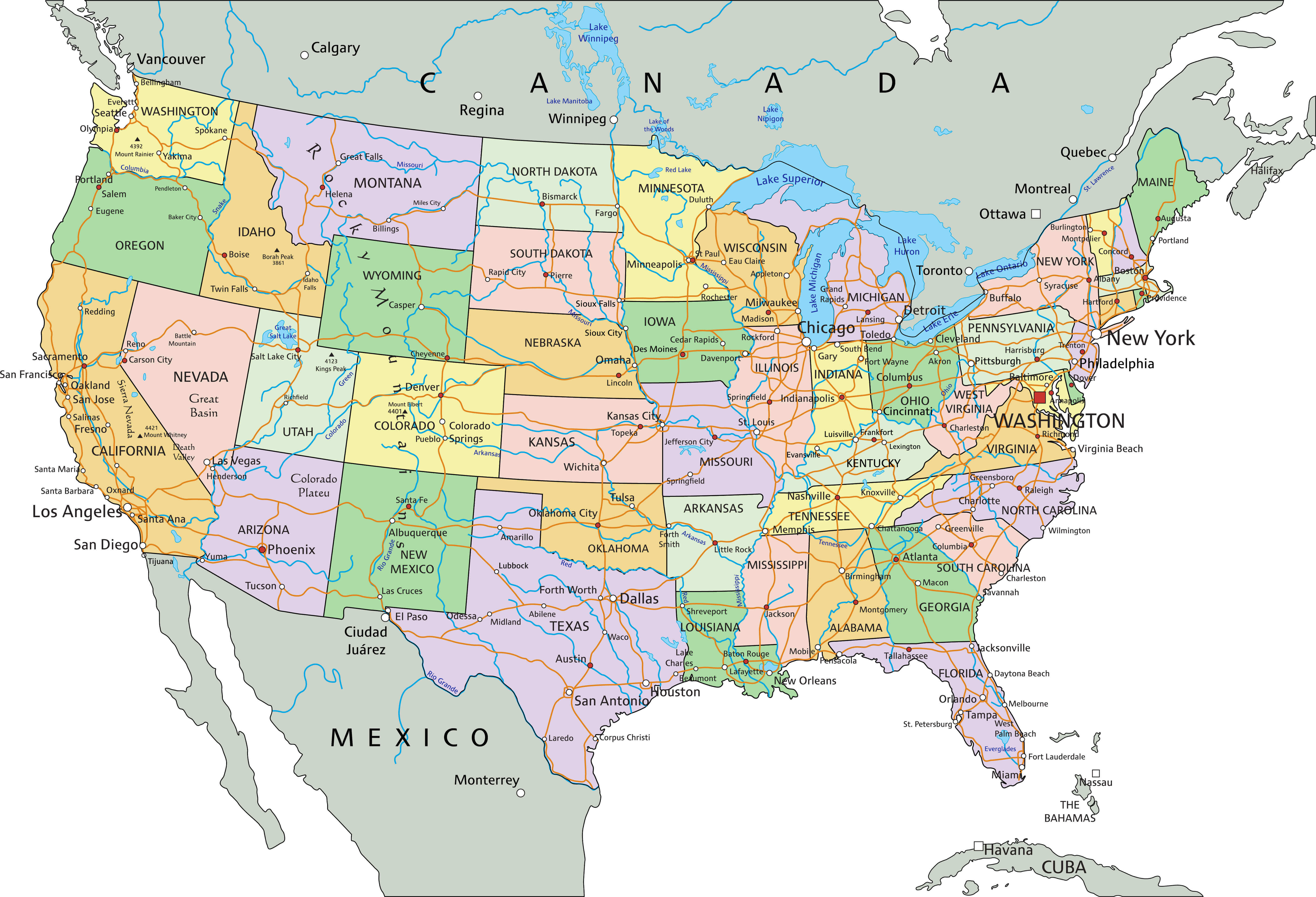 US political map with states, major cities, and boundaries with Mexico and Canada.
Colorful the US political map
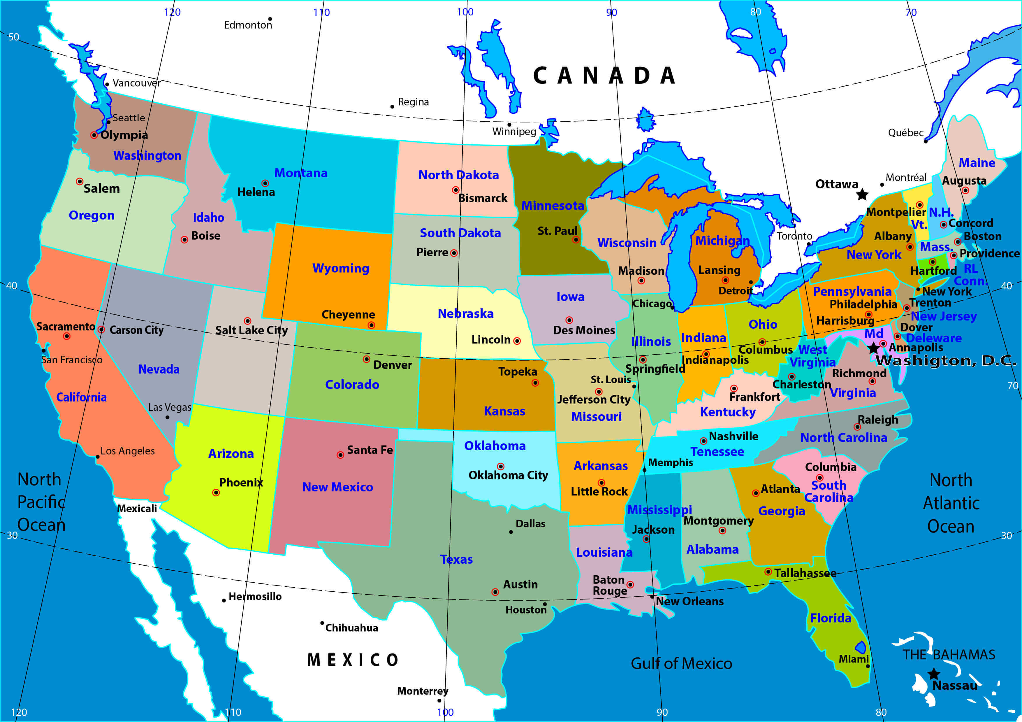
political map of the US with largest cities
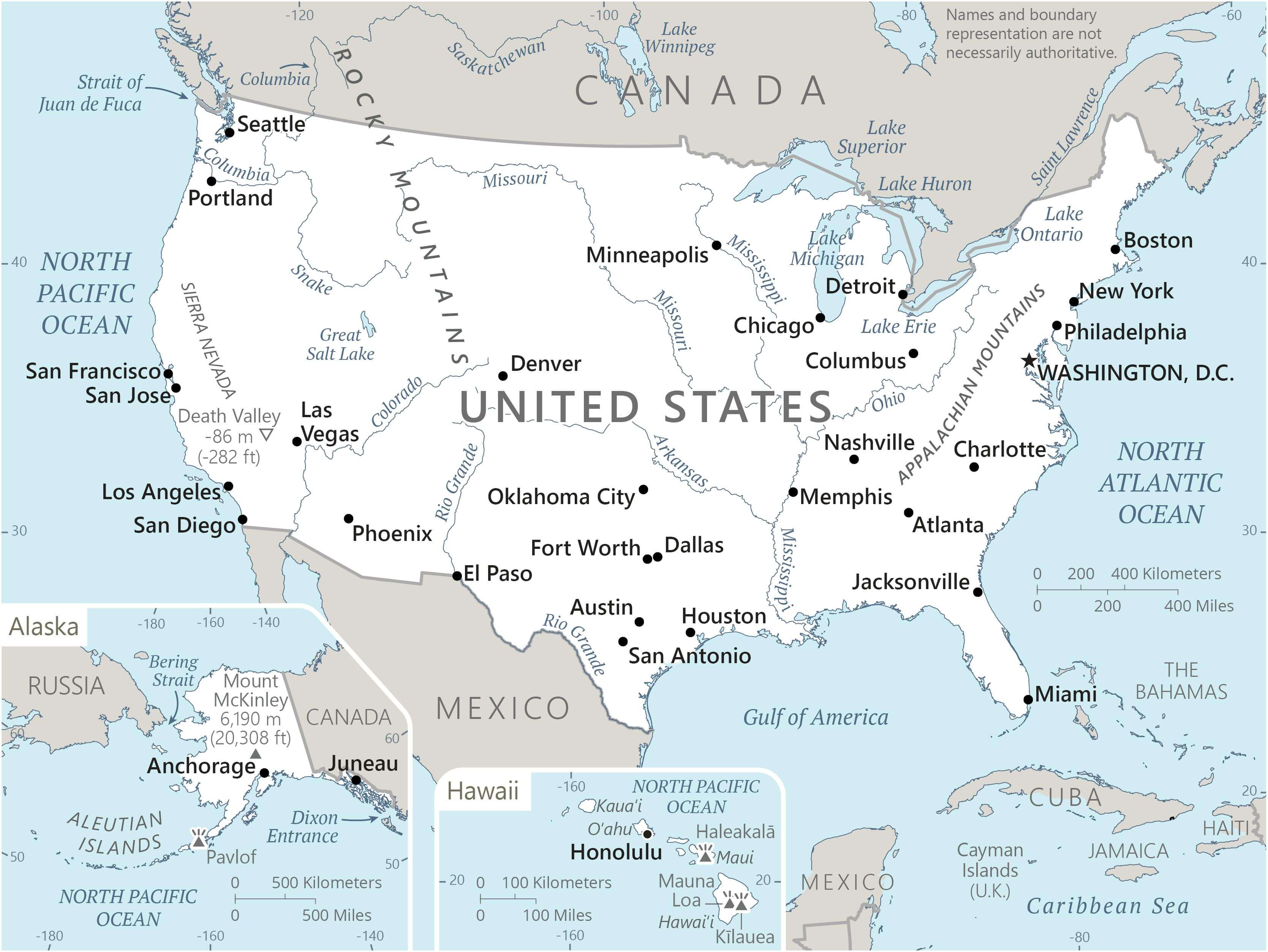
political map of the US with states
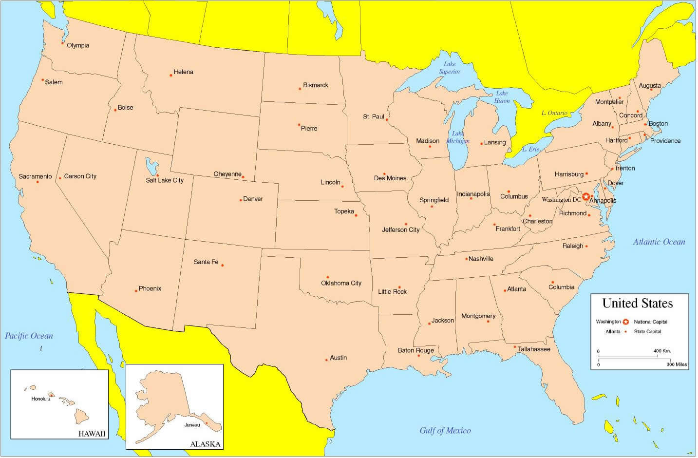
political map of the US
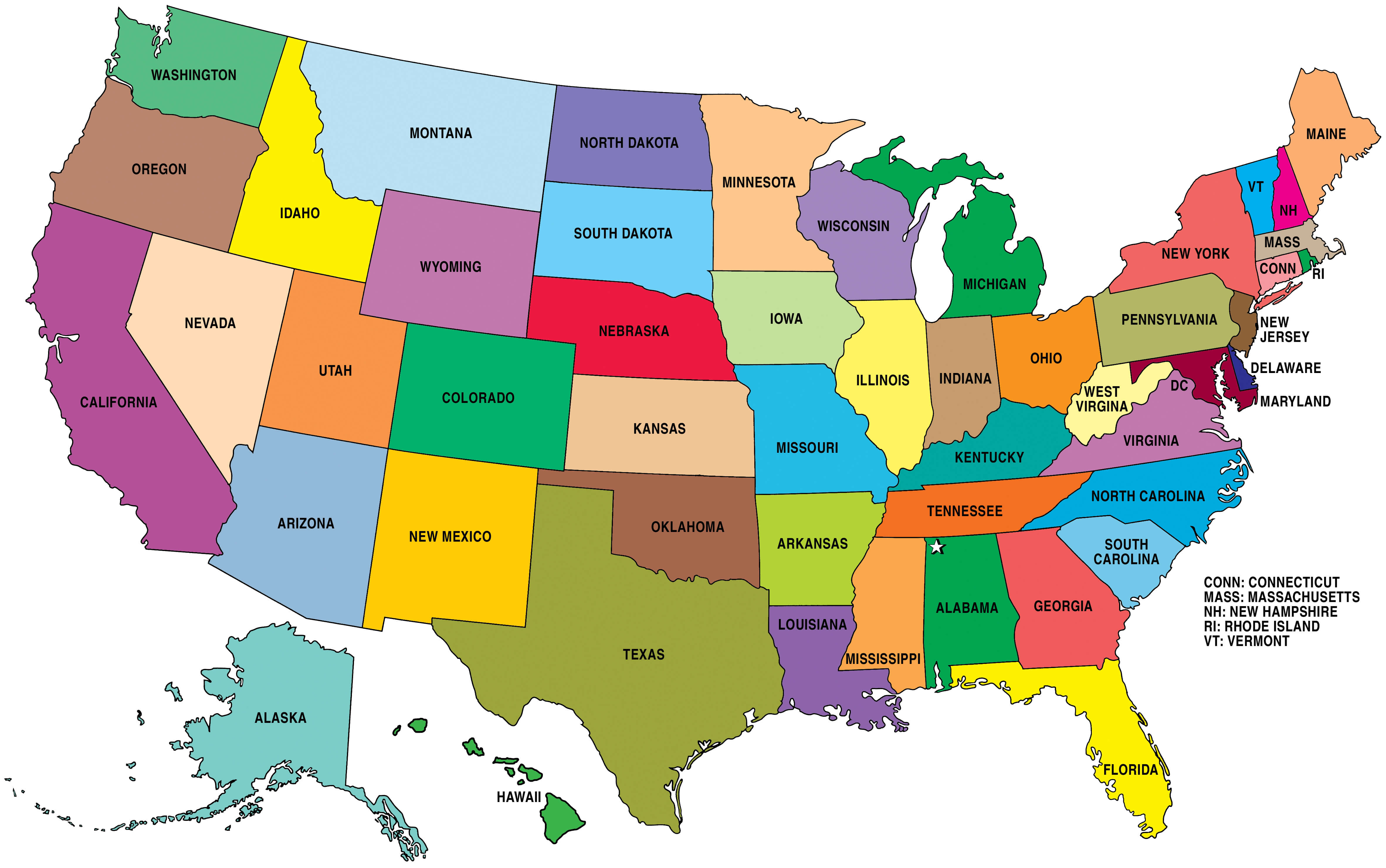
the US political map by states
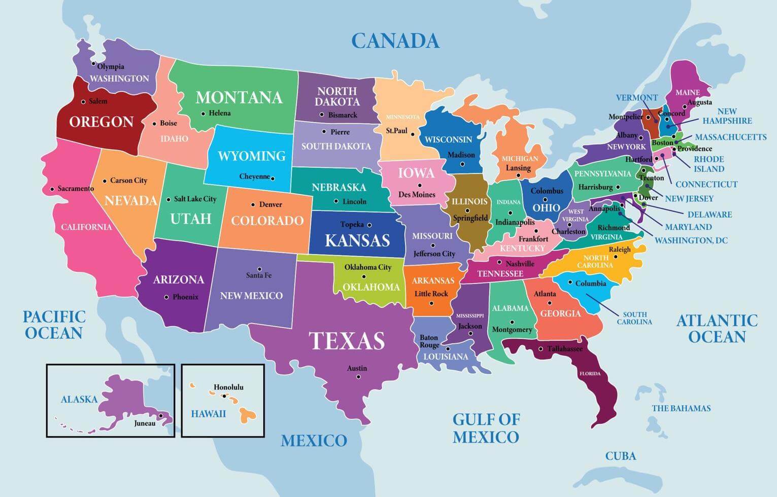
US and North America political map
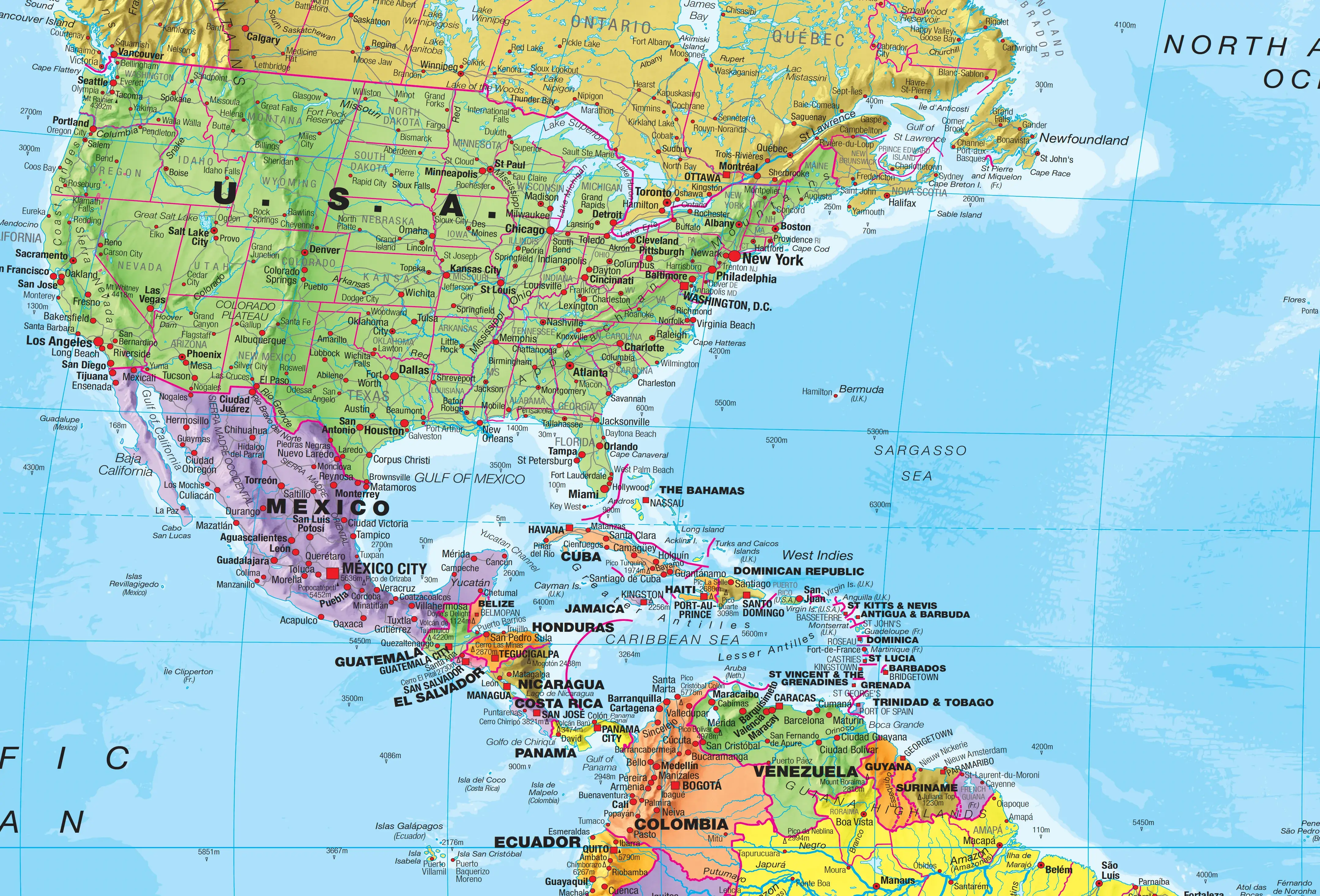
US political map states and capitals
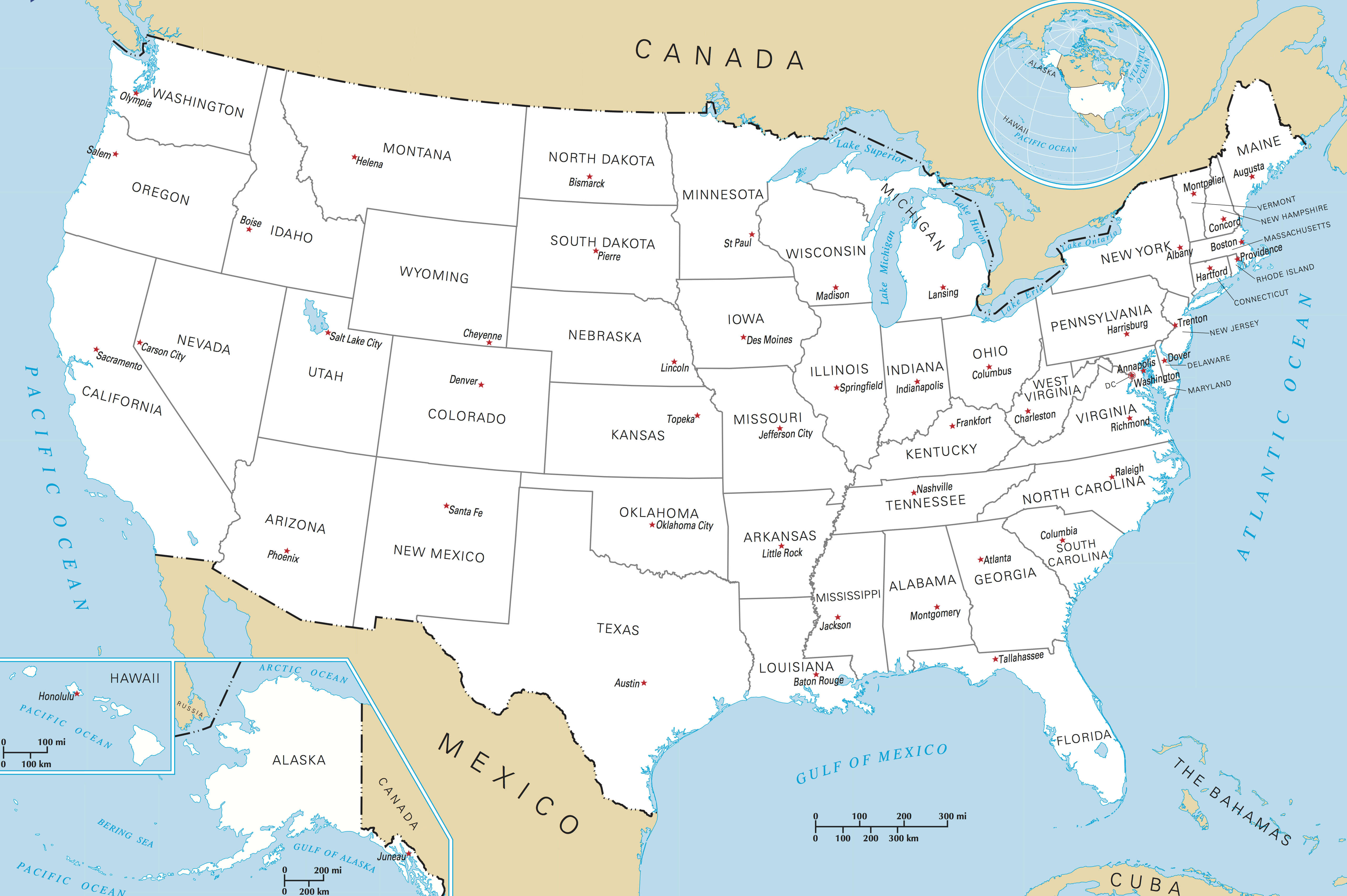
US political map with Alaska and Hawaii
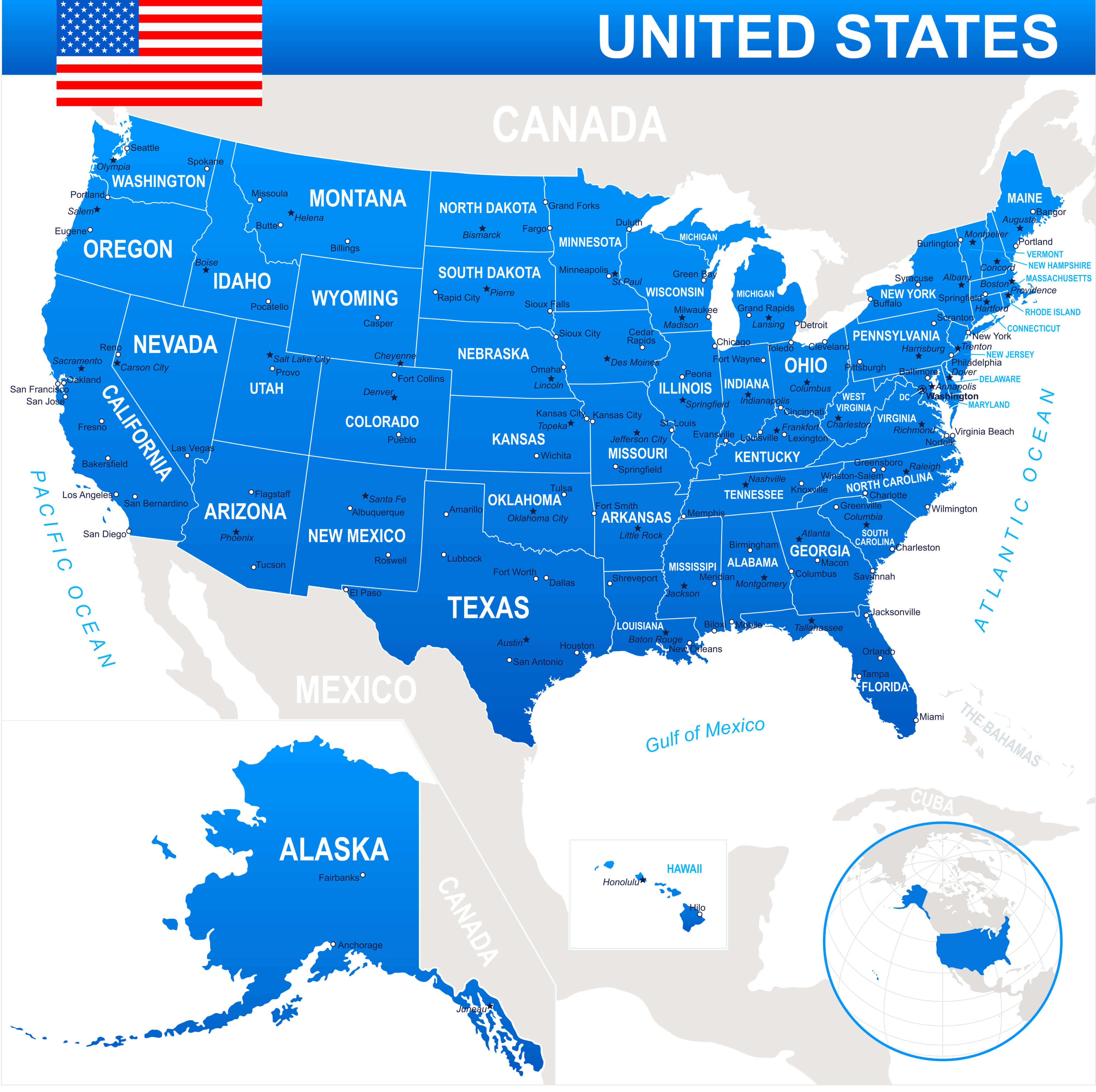
US political map with cities
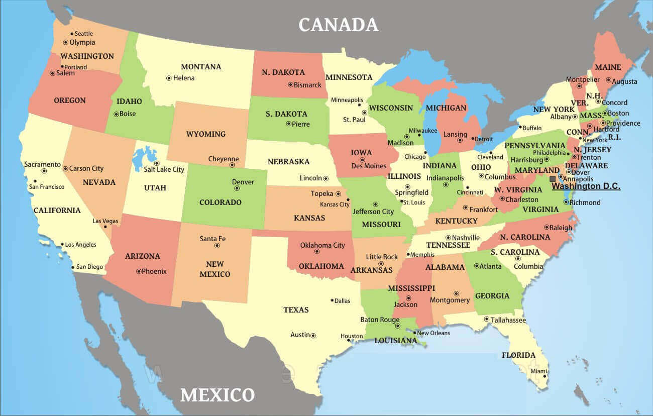
US political map with elevation
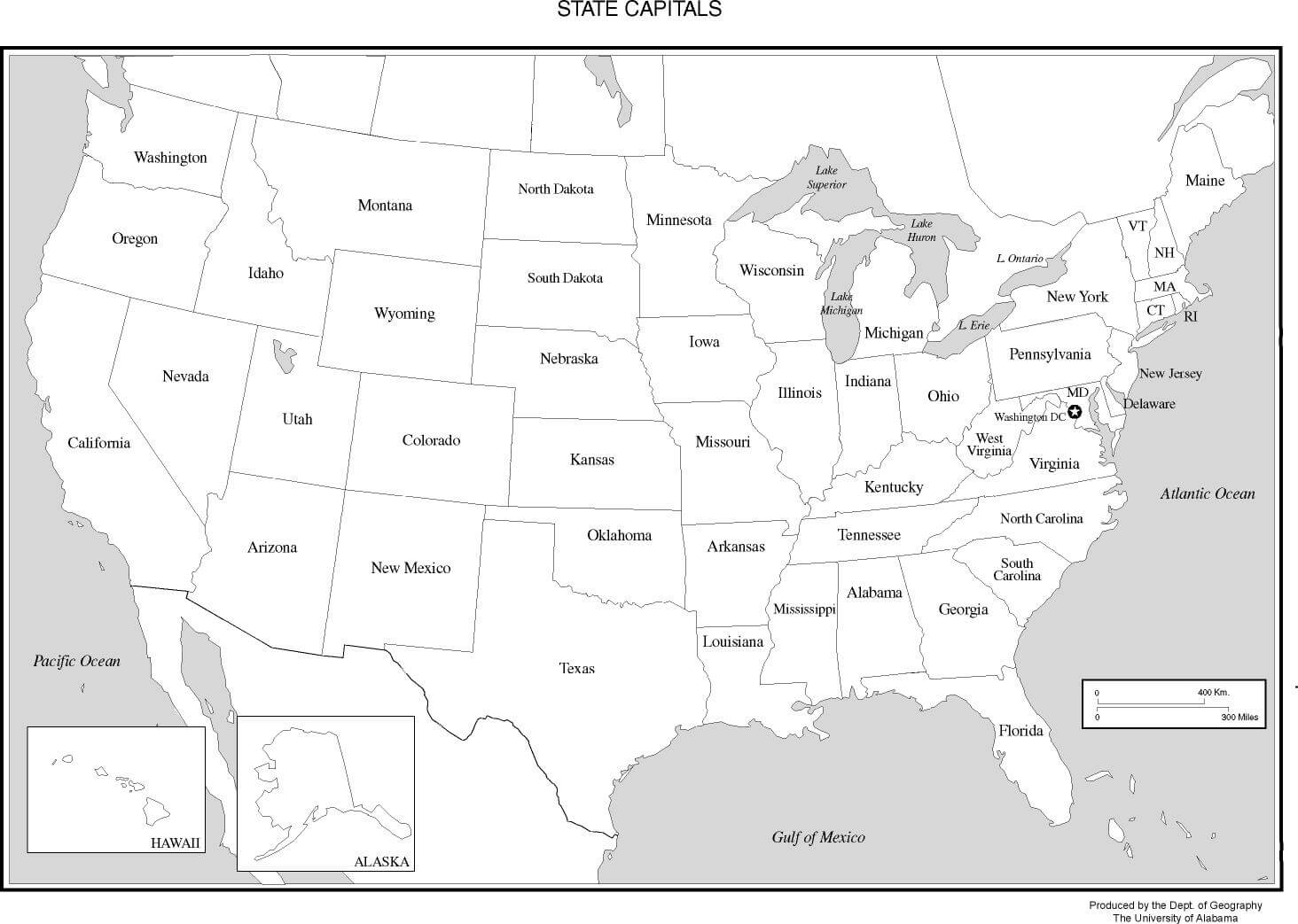
US political outline map
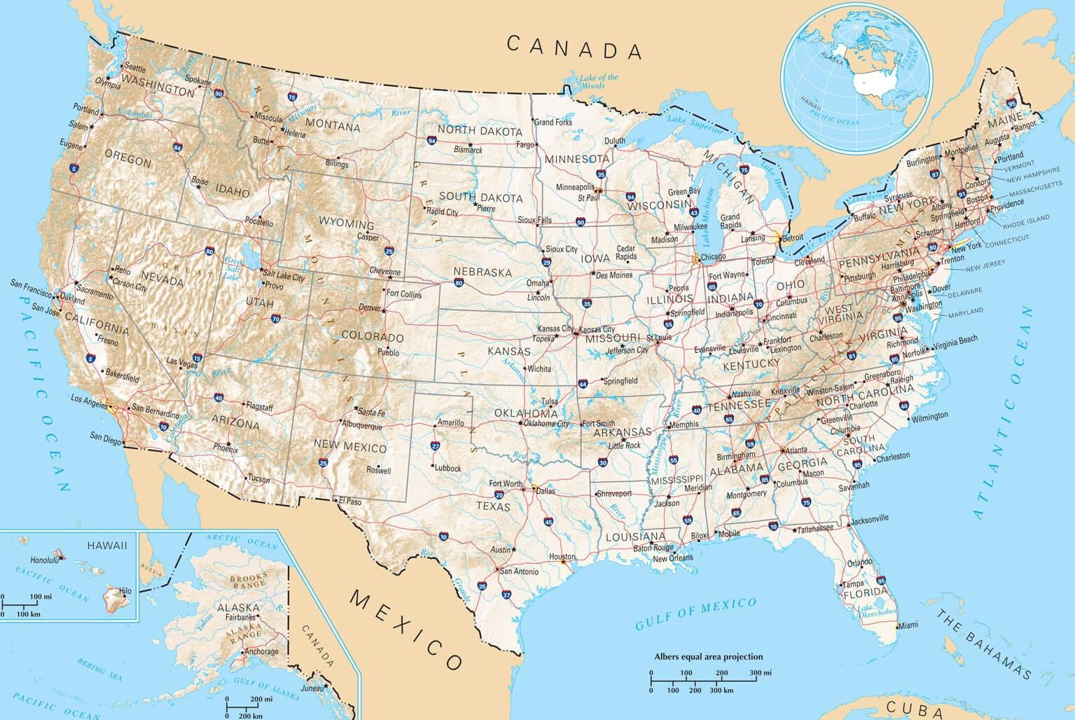
US political states and rivers map
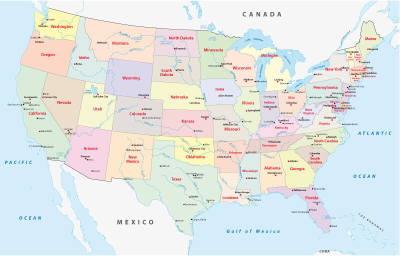
USA political map by states
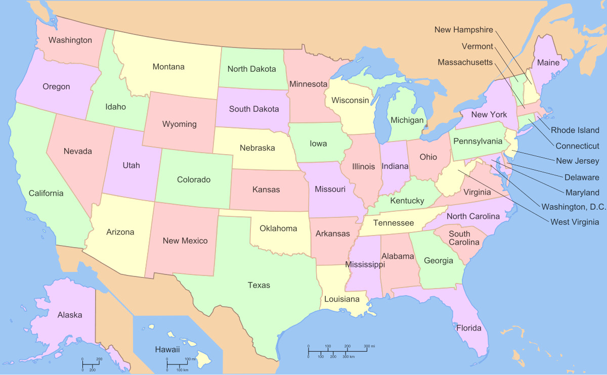
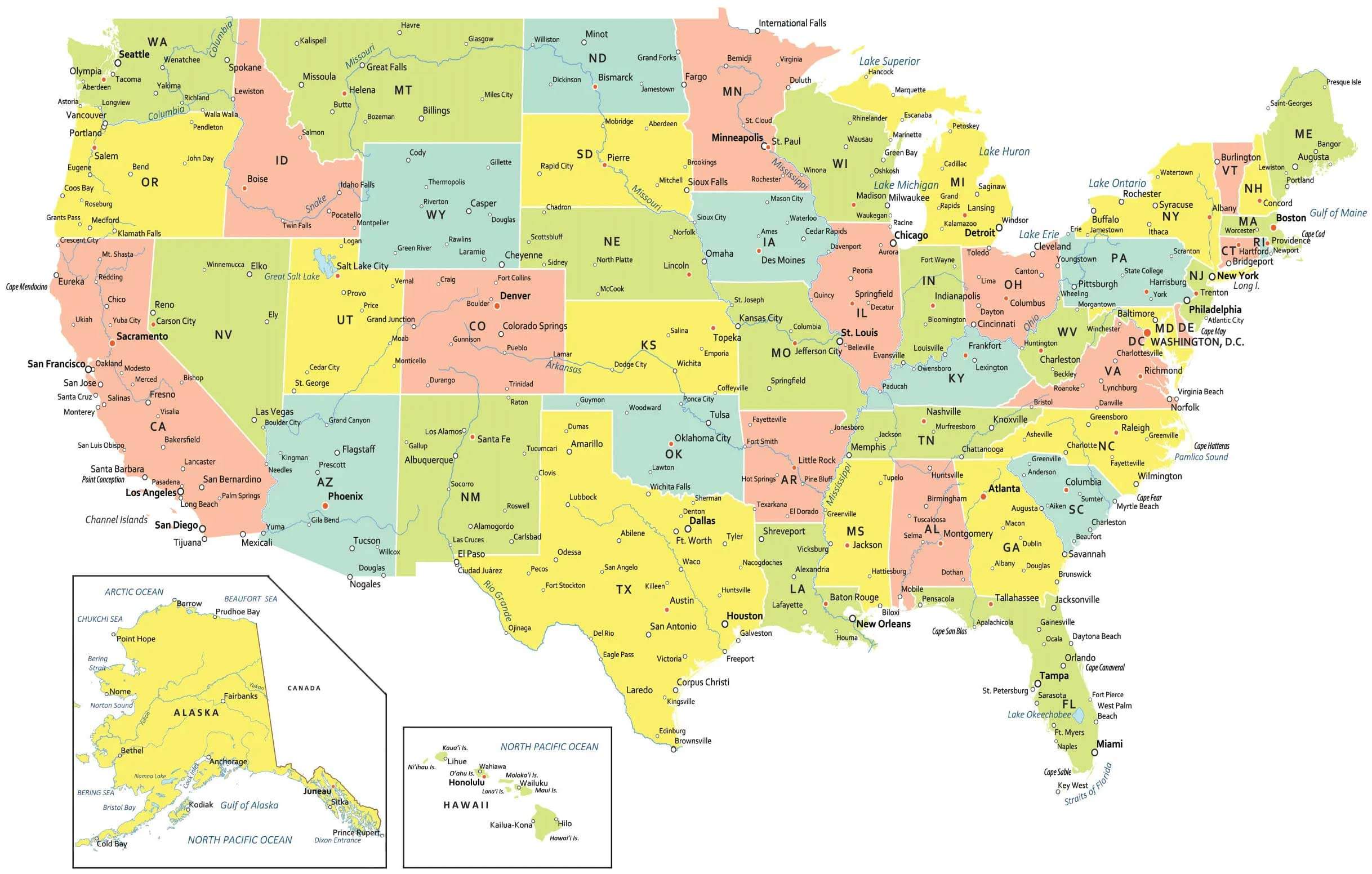
USA political map with states and cities
Where is the United States on the World Map?
Show Google map, satellite map, where is the country located.
Get directions by driving, walking, bicycling, public transportation and travel with street view.
Feel free to explore US states maps:
- United States Map ↗️
- US Maps ↗️
- United States Maps ↗️
- Map of United States ↗️
- US States Map ↗️
- United States States Map ↗️
- United States Cities Map ↗️
- United States Political Map ↗️
- US Cities Map ↗️
- US High-resolution Map ↗️
- United States High-resolution Map ↗️
- US Population Map ↗️
- US Time Zone Map ↗️
- US Blank Map ↗️
- United States Blank Map ↗️
- Gulf of America (The Gulf of Mexico) Map ↗️
- United States Time Zone Map ↗️
- California Time Zone Map ↗️
- Texas Time Zone Map ↗️
- New York Time Zone Map ↗️
- Florida Time Zone Map ↗️
- California Map ↗️
- Texas Map ↗️
- New York Map ↗️
- Florida Map ↗️
- Illinois Map ↗️
- Pennsylvania Map ↗️
- Ohio Map ↗️
- Michigan Map ↗️
- Georgia Map ↗️
- New Jersey Map ↗️
- North Carolina Map ↗️
- Virginia Map ↗️
- Massachusetts Map ↗️
- North America Map ↗️
