Explore detailed maps of Myanmar (Burma), including physical, political, road, terrain, and blank maps. Discover its cities, regions, borders, ethnic groups, population, topography, climate zones, seismic activity, and geographical location in Asia. Includes satellite imagery and Myanmar’s position on the world map.
Political Map of Myanmar (Burma) with States and Major Cities
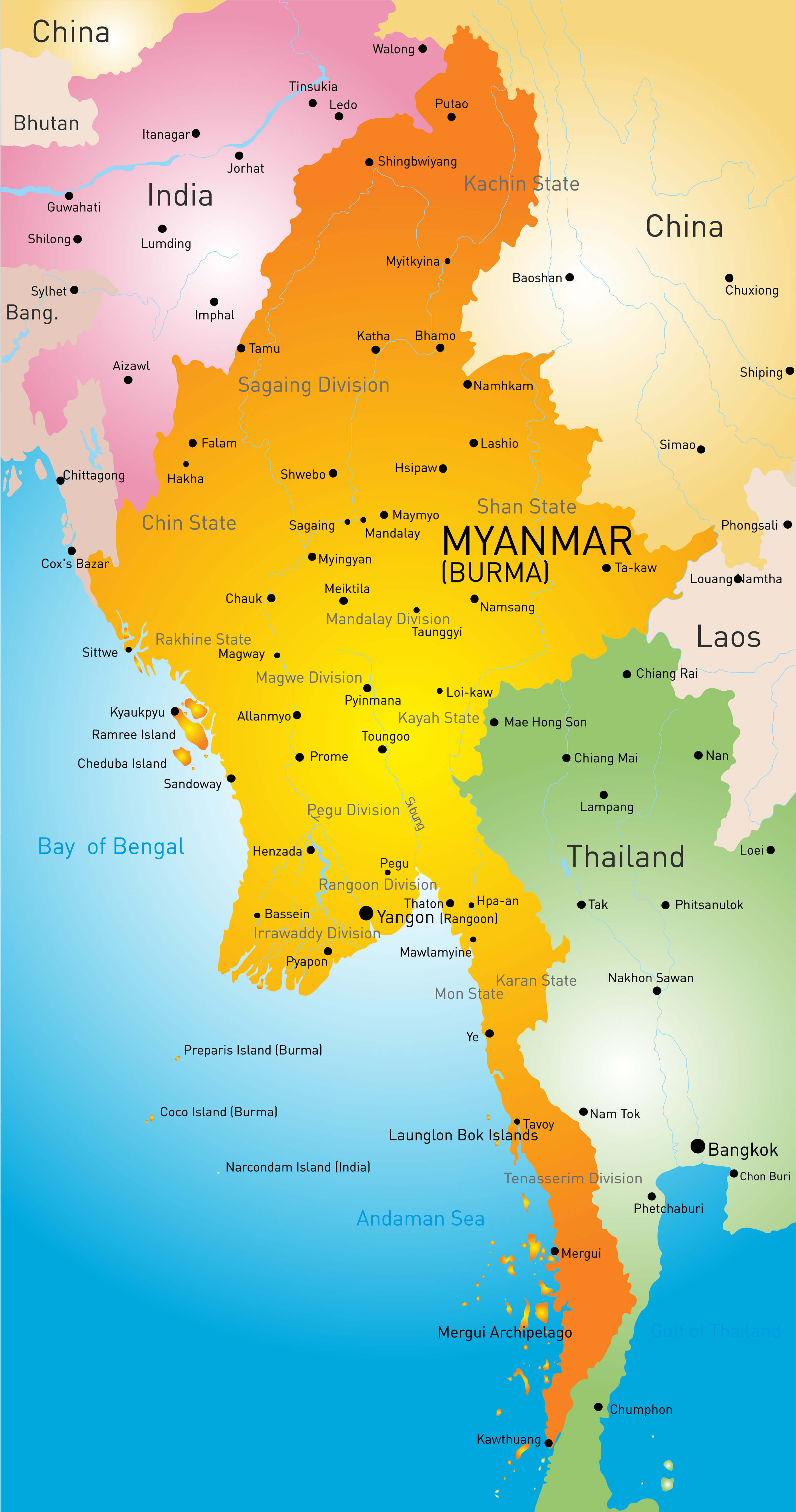 Myanmar Burma political map with states, regions, and major cities labeled.
This political map of Myanmar (Burma) shows the administrative divisions of the country, including states, regions and major cities such as Yangon, Mandalay and Naypyidaw. It also shows boundaries with neighbouring countries and key geographic features such as islands and coastal regions.
Map of Myanmar with Cities and Main Road Network
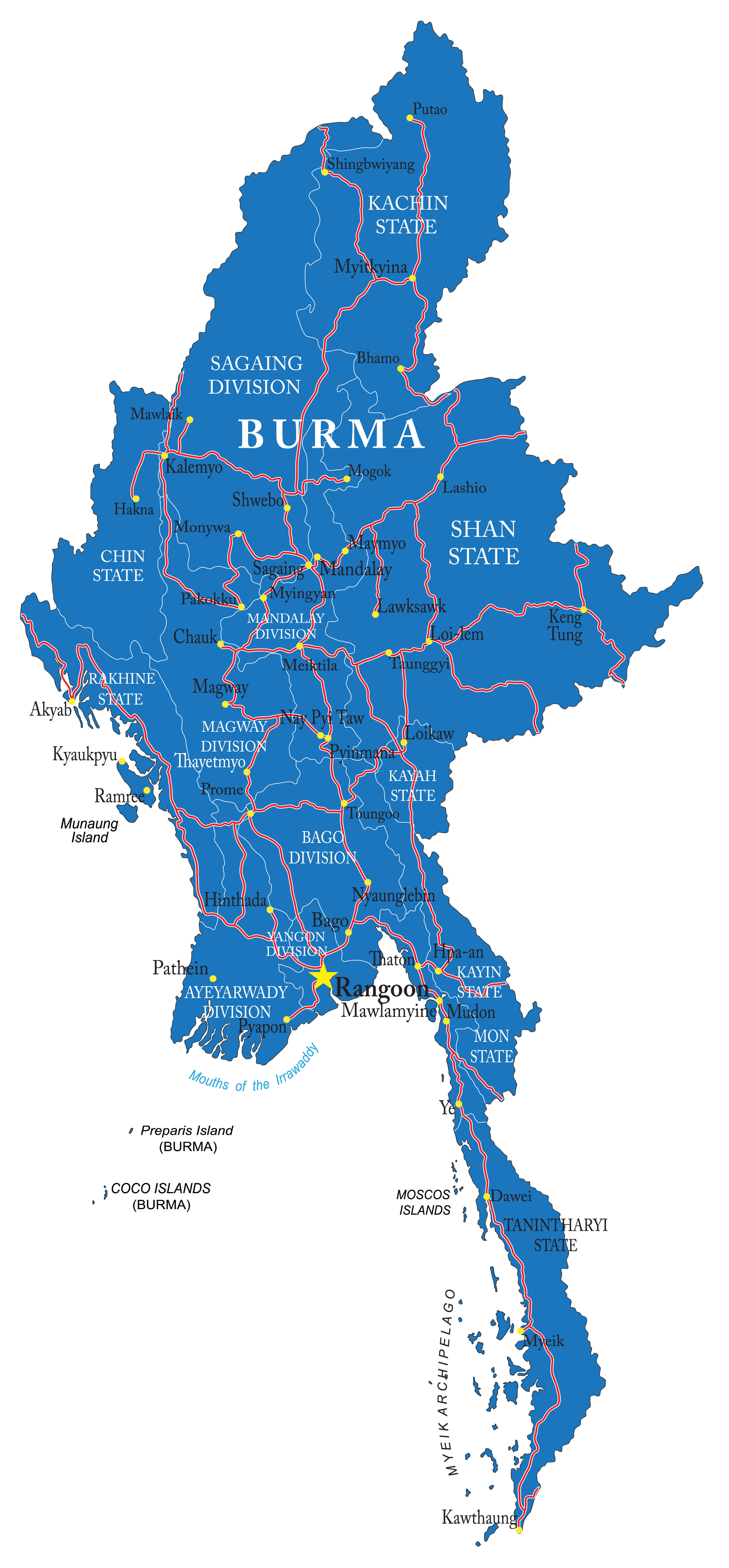 Myanmar map showing major cities and main highways in blue background.
This detailed map of Myanmar (Burma) highlights the country’s major cities and the national road network that connects them. From Yangon and Mandalay to Lashio and Dawei, the map shows regional divisions, key towns and major highways essential for travel and logistics throughout Myanmar.
Brief information about Myanmar
Myanmar, formerly called Burma, is a culturally rich Southeast Asian nation bordered by Bangladesh, India, China, Laos, and Thailand, with scenic coastlines along the Bay of Bengal and the Andaman Sea. Its capital is Naypyidaw, while Yangon (Rangoon) remains the largest city and economic hub. Home to over 54 million people, Myanmar is renowned for its ancient Buddhist temples, including the breathtaking plains of Bagan, and its diverse ethnic landscape, with 135 officially recognized ethnic groups.
Myanmar (Burma) Country Map with Major Cities and Borders
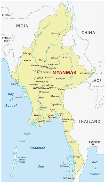
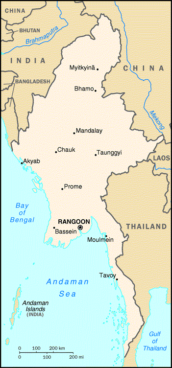
This country map of Myanmar (Burma) shows national borders, major cities like Naypyidaw, Yangon, and Mandalay, and its location in Southeast Asia. It highlights neighboring countries—India, China, Laos, and Thailand—as well as surrounding bodies of water including the Bay of Bengal and Andaman Sea.
Myanmar’s history has been marked by British colonial rule, independence in 1948, and decades of military governance, which led to prolonged economic and political isolation. Recent years have seen upheaval, including a 2021 military coup that derailed its fragile democratic progress. Despite these challenges, Myanmar’s natural wonders—such as the serene Inle Lake and the mighty Irrawaddy River—along with its historic treasures, continue to draw travelers seeking unforgettable cultural and scenic adventures.
Where is located Myanmar on the World Map
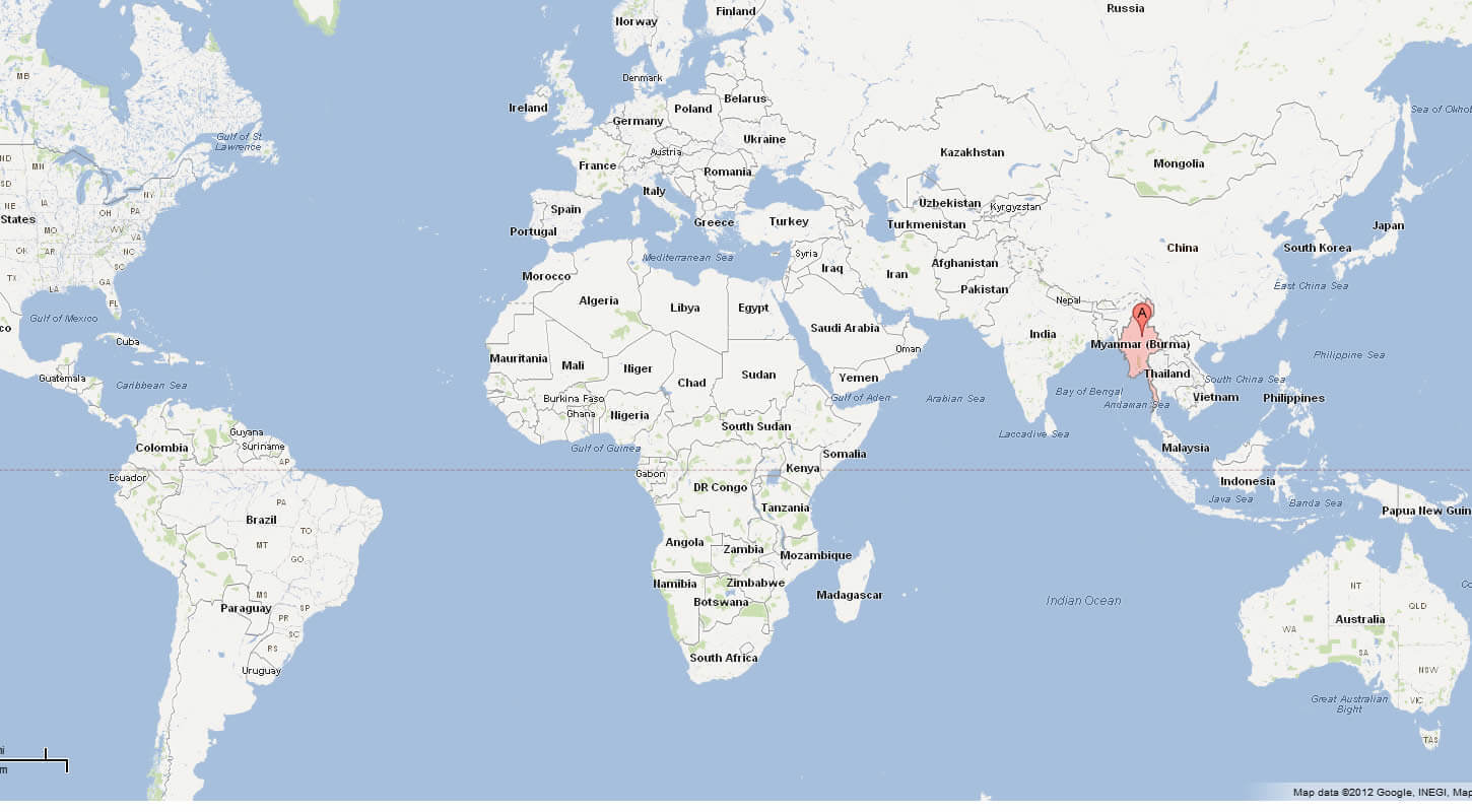
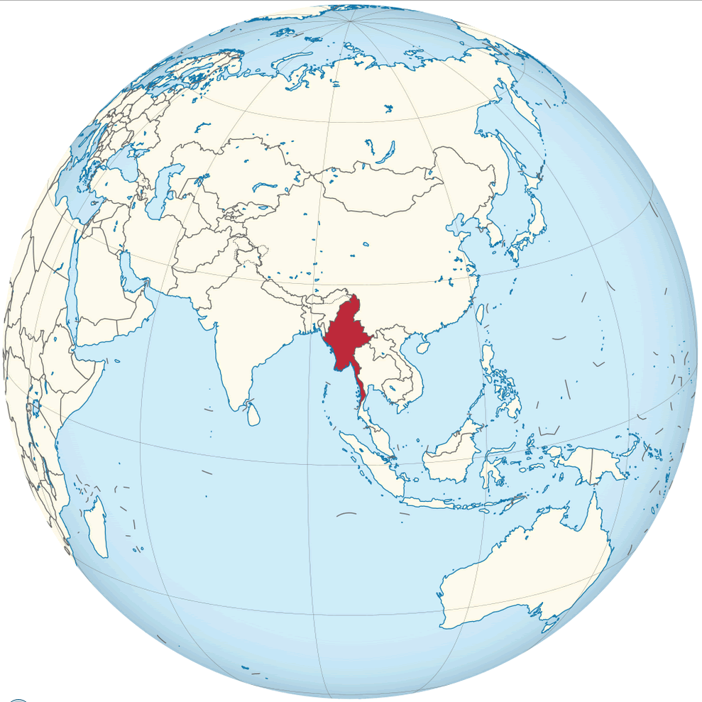 Where is located Myanmar on the World Map
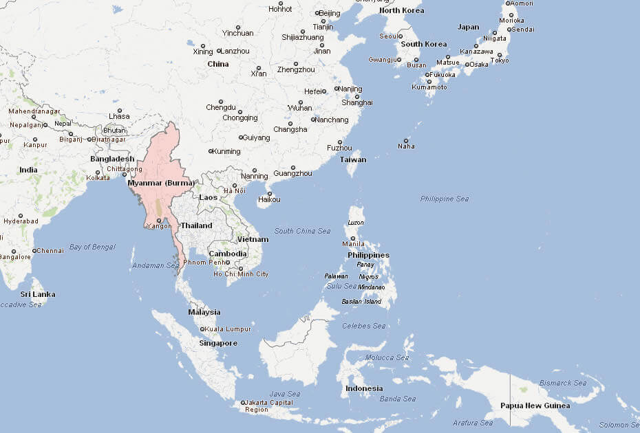
Myanmar, formerly known as Burma, occupies a strategic position in Southeast Asia, serving as a crossroads between South Asia and East Asia. It shares borders with five nations: Bangladesh and India to the northwest, China to the north and northeast, Laos to the east, and Thailand to the southeast. To the southwest, Myanmar boasts a vast coastline stretching over 1,930 kilometers along the Bay of Bengal and the Andaman Sea, reinforcing its role as a key maritime gateway.
Myanmar (Burma) Physical Map with Elevation and Terrain Details
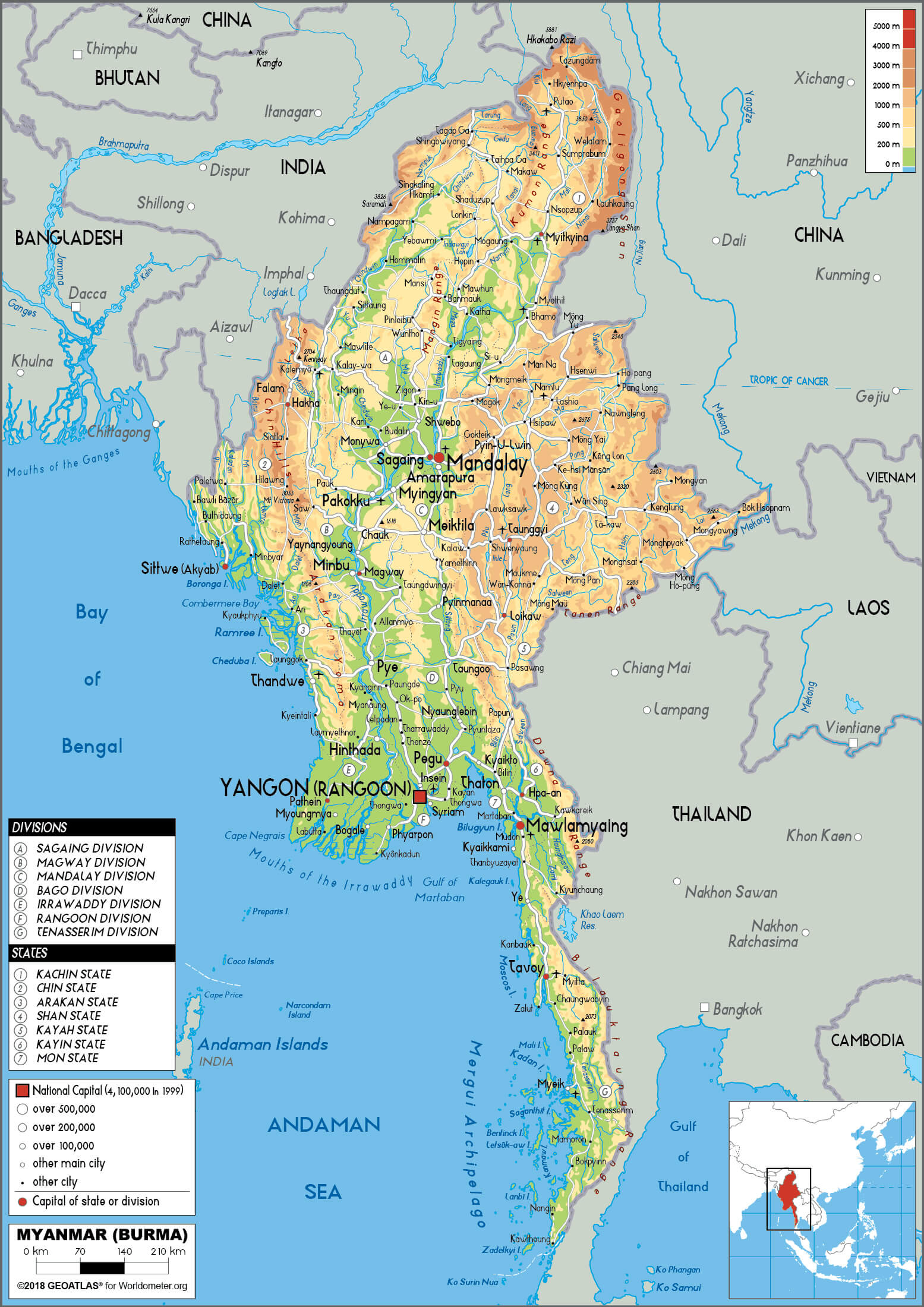 Myanmar physical map with rivers, elevation, and terrain features.
This detailed physical map of Myanmar (Burma) shows mountain ranges, valleys, and major rivers, including elevation levels and natural features. Key cities such as Yangon, Mandalay, and Mawlamyine are marked, alongside surrounding regions like China, India, Thailand, and the Andaman Sea coastline.
This geopolitically significant location has long placed Myanmar at the heart of regional trade and cultural exchange. Historically, it was part of ancient networks like the Silk Road, and today, it remains a crucial land bridge connecting India, China, and Southeast Asia.
Political map of Myanmar

Myanmar’s diverse terrain includes fertile central plains, lush tropical forests, and mountainous regions such as the Himalayan foothills in the north and the Shan Plateau in the east. The mighty Irrawaddy River, the country’s lifeline, flows through the heartland, sustaining agriculture, trade, and transportation. With its strategic importance, breathtaking landscapes, and abundant natural resources, Myanmar stands as a unique and vital part of Southeast Asia.
Here are some statistical information about Myanmar:
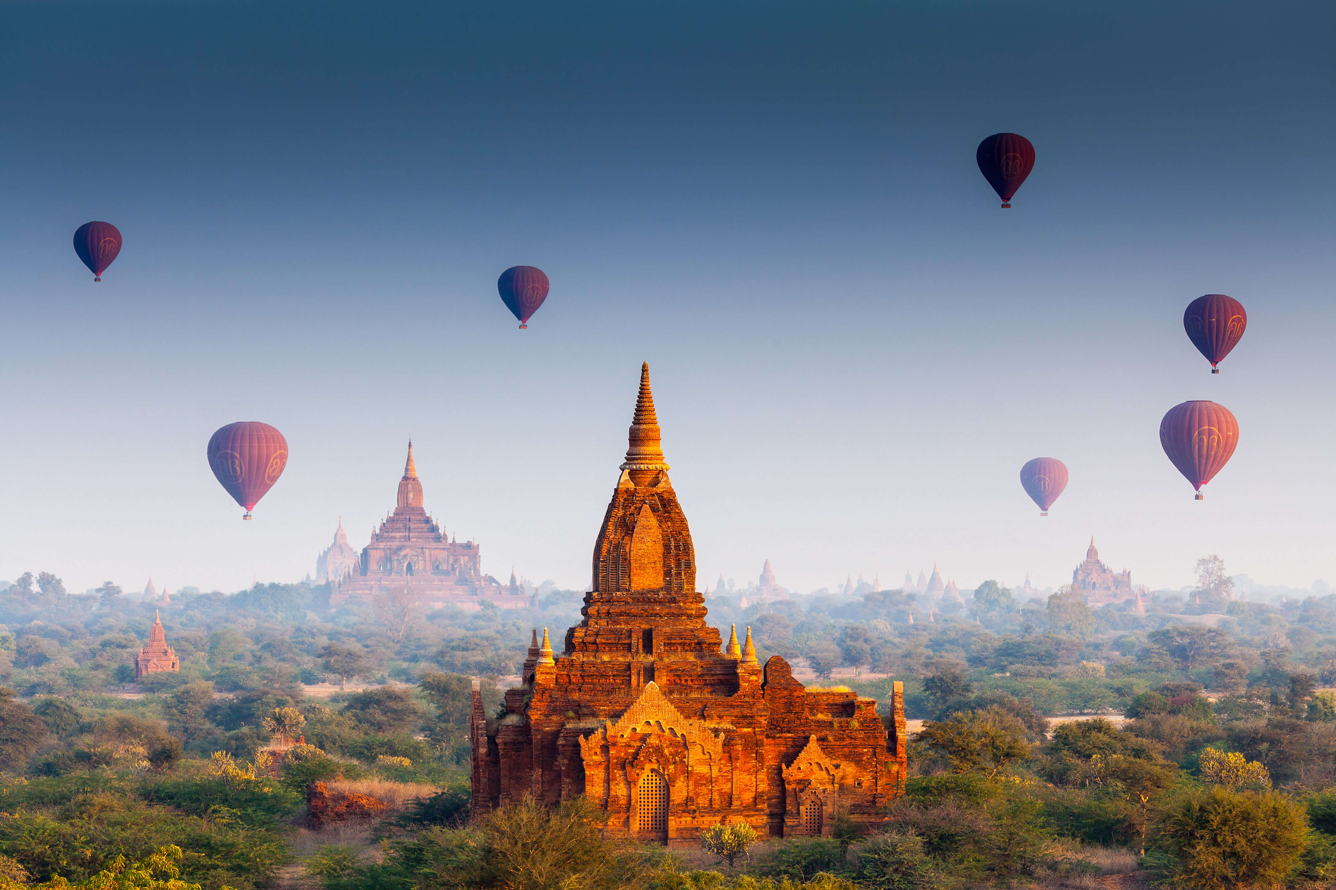 Area: 676,579 km2 (261,229 sq mi)
 Myanmar (Burma) Map Featuring Major Rivers and Geographic Borders
 Myanmar map with rivers, cities, and surrounding countries.
This map of Myanmar (Burma) shows major rivers including the Irrawaddy, Salween and Mekong, and major cities such as Naypyidaw, Yangon and Mandalay. It also outlines Myanmar’s borders with China, India, Thailand, Laos and Bangladesh, and shows nearby bodies of water such as the Bay of Bengal and the Andaman Sea.
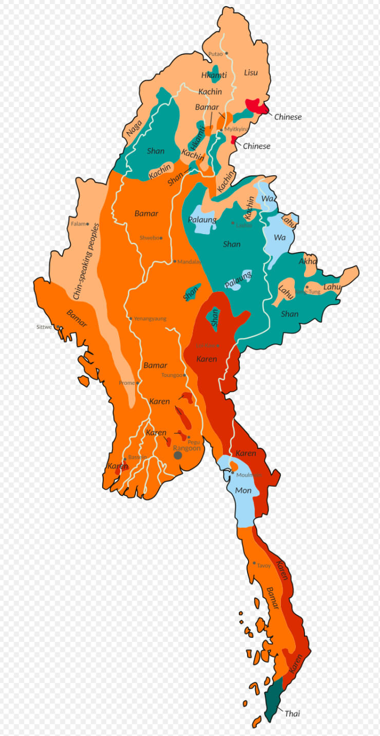
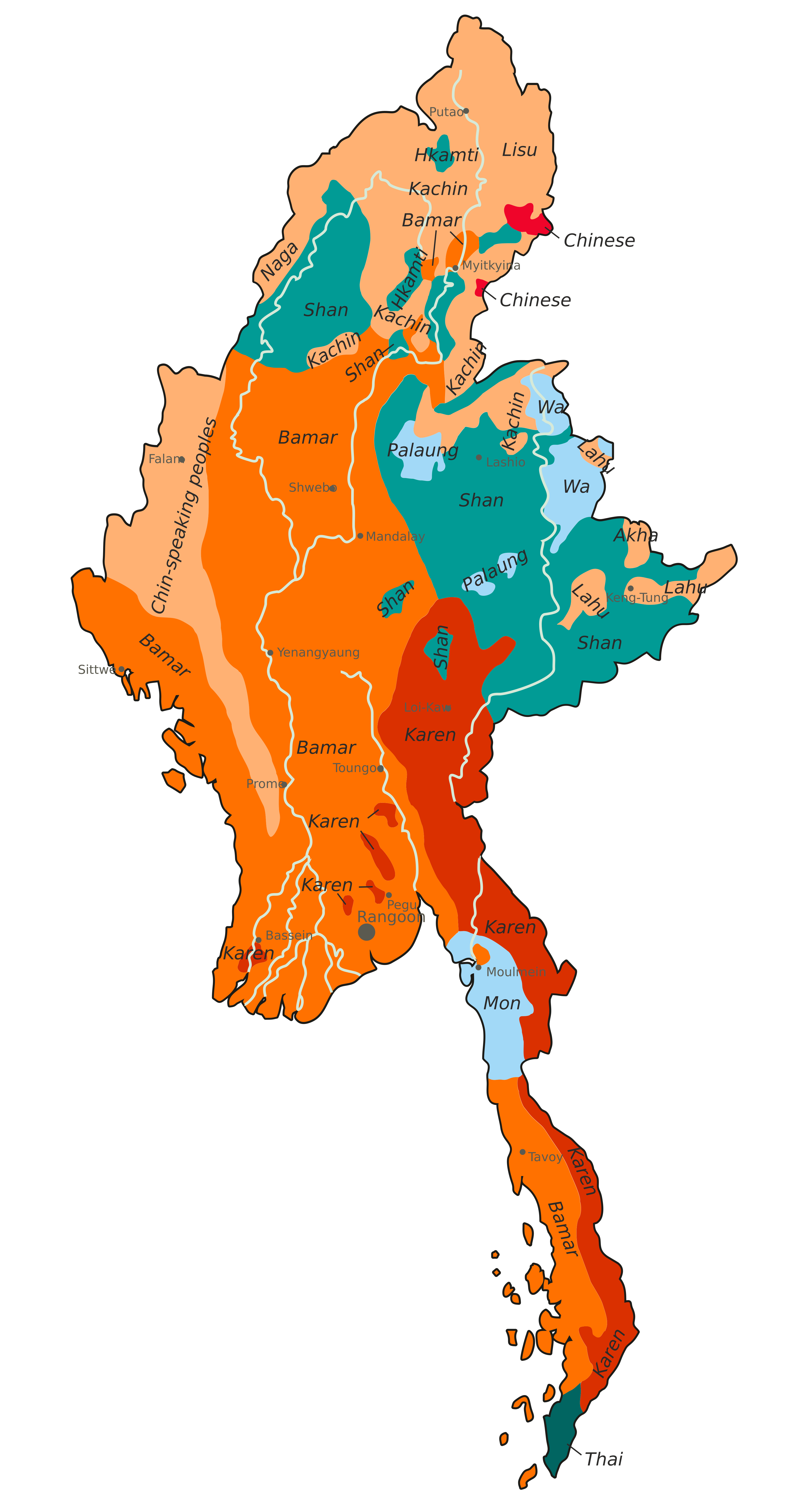
Official languages: BurmeseEthnolinguistic groups map of Burma Myanmar
 Religion: 89.8% Buddhism (official), 6.2% Christianity, 2.3% Islam, 1.6% other.
 Myanmar provinces map
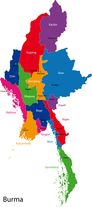
Myanmar Political Map
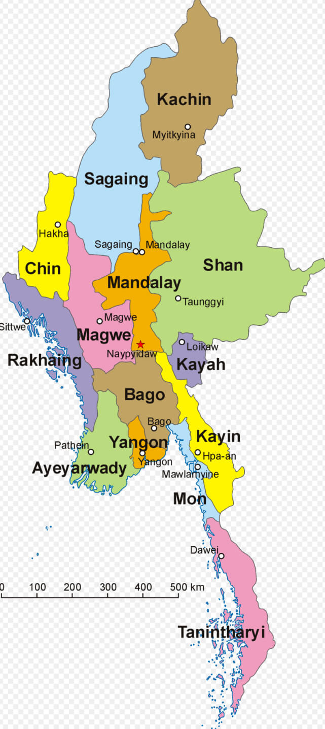 Myanmar political map showing states and regions with capitals
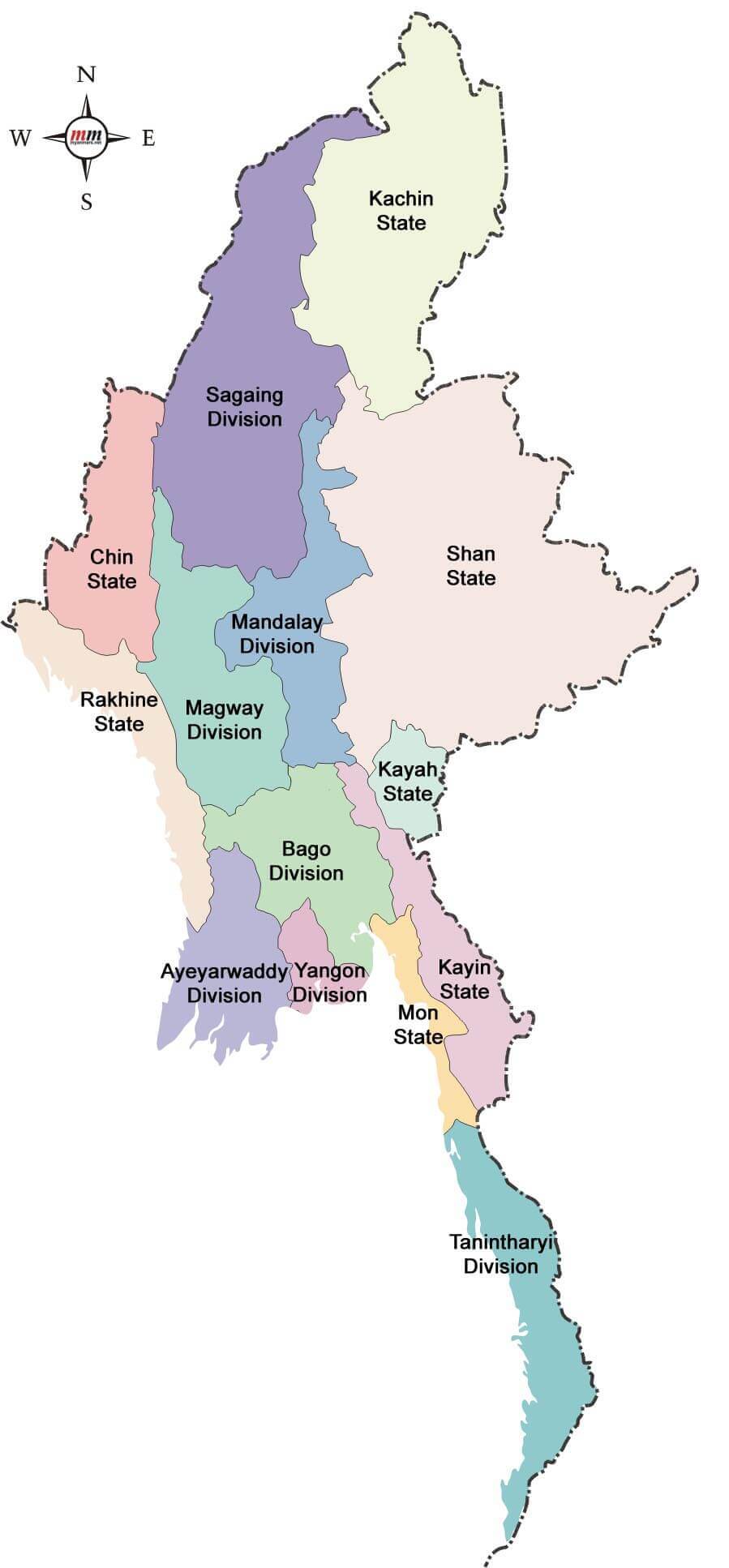
This map displays Myanmar’s administrative divisions, including states and regions such as Kachin, Shan, Mandalay, and Yangon, with capitals clearly marked. It highlights the diverse geographical and political makeup of the country.
Myanmar regions map with main cities
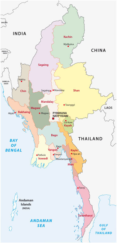
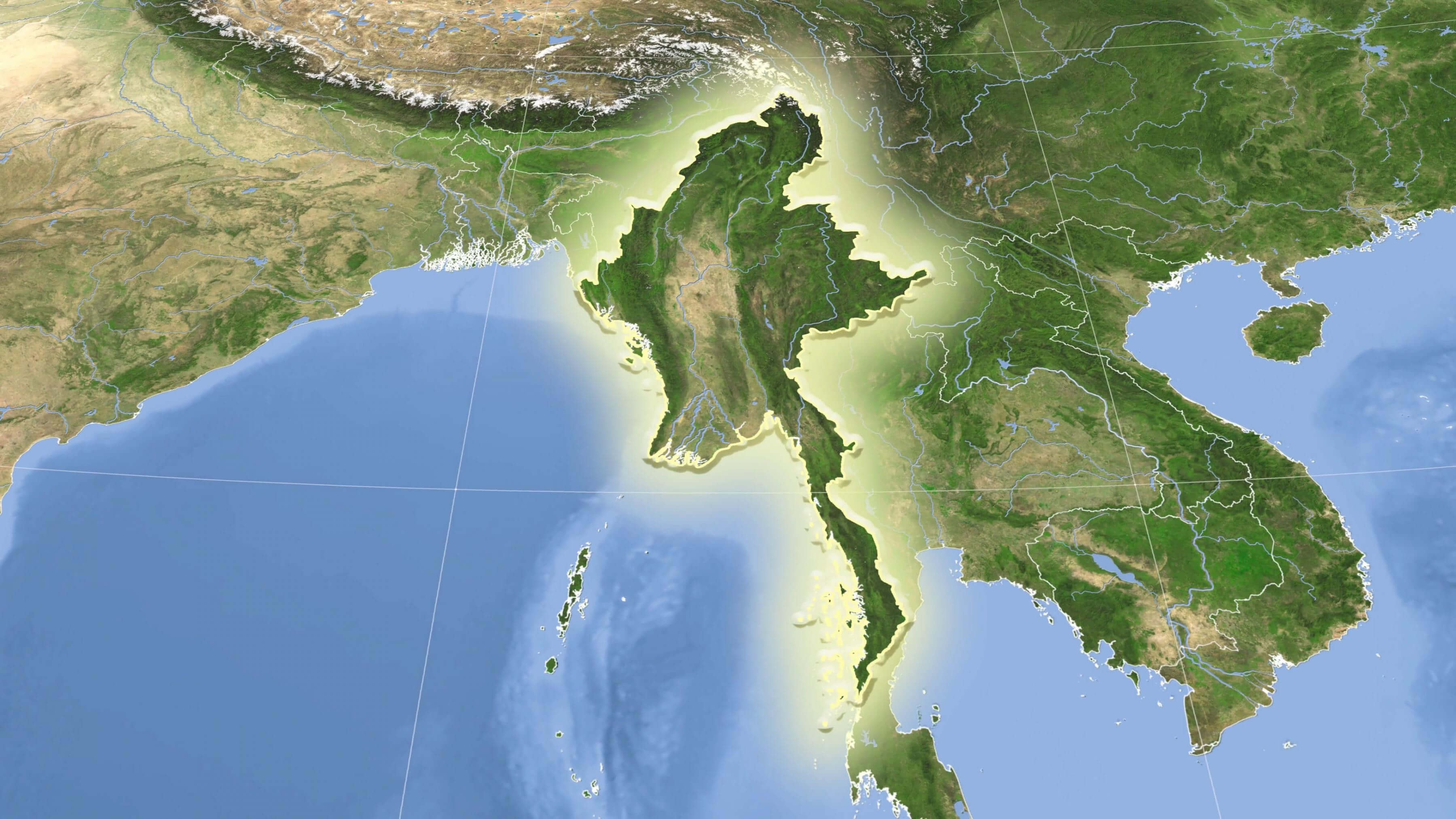
Myanmar satellite map and south east asia
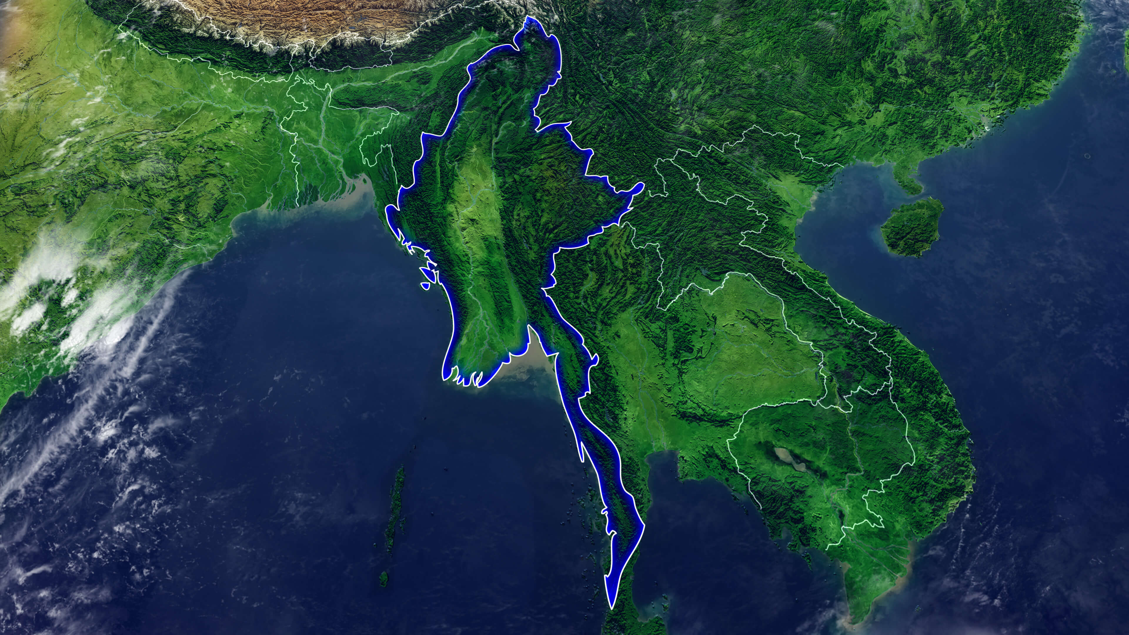
Myanmar blank map
Map of Myanmar
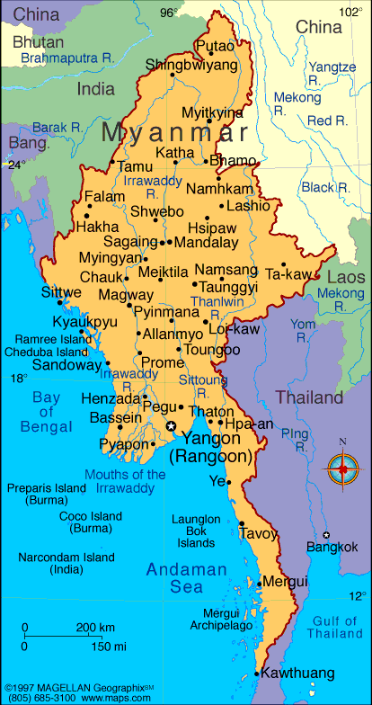
Regional map of Myanmar
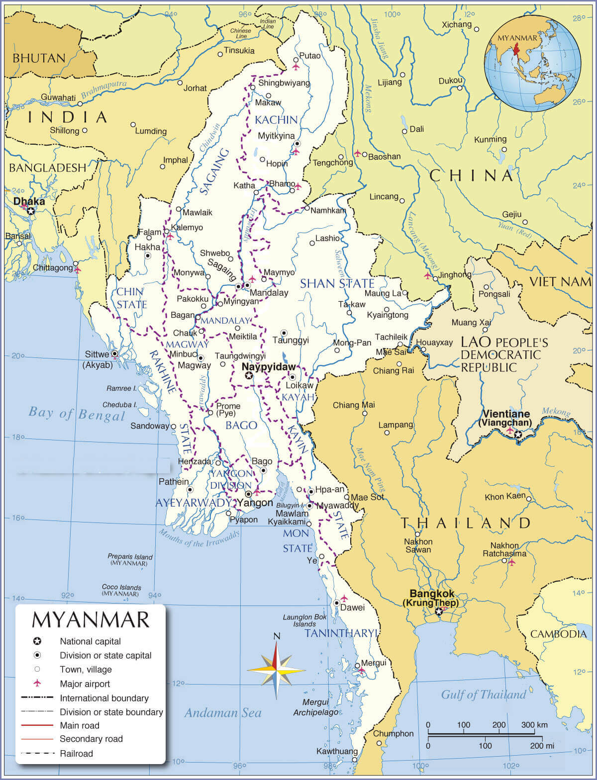
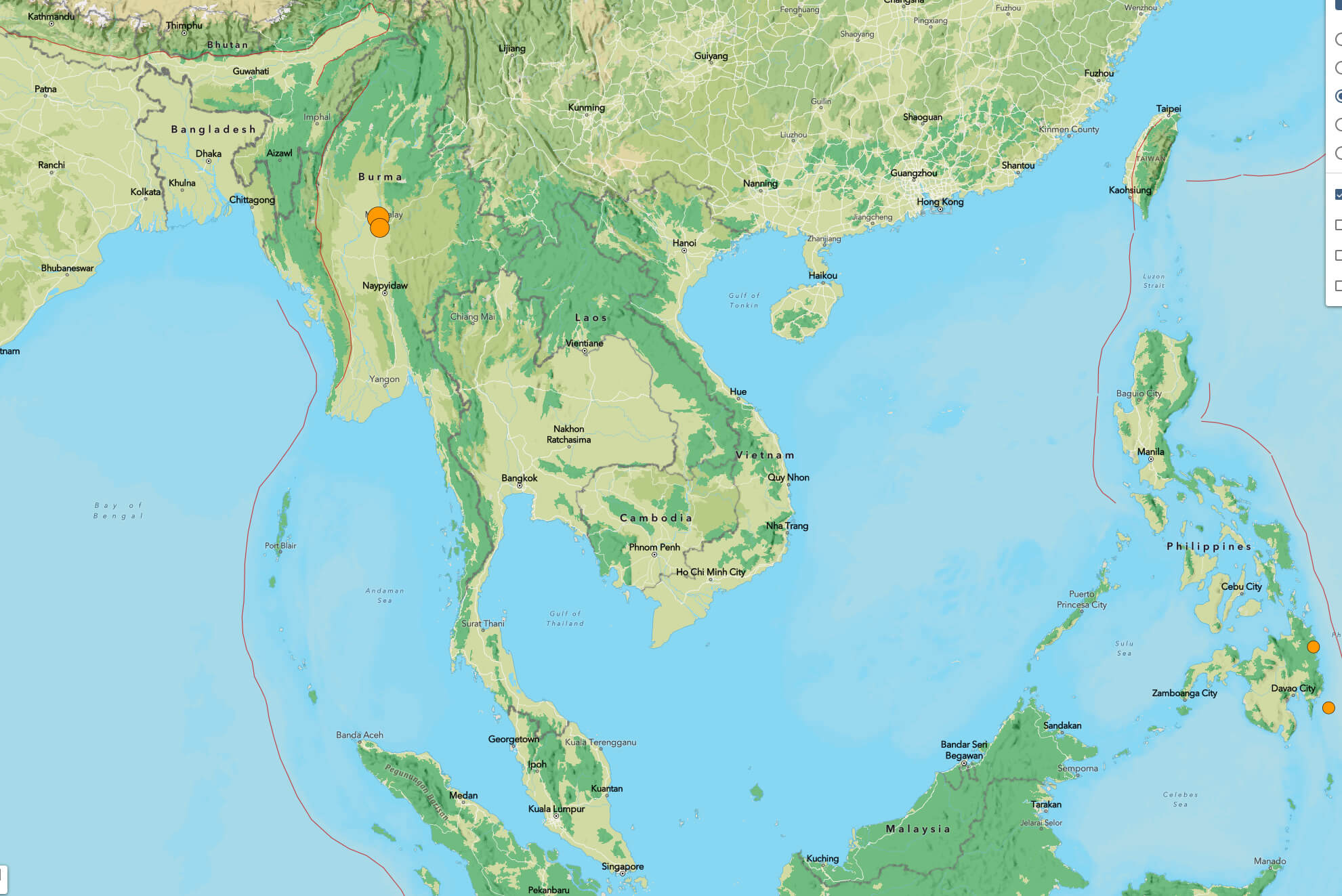
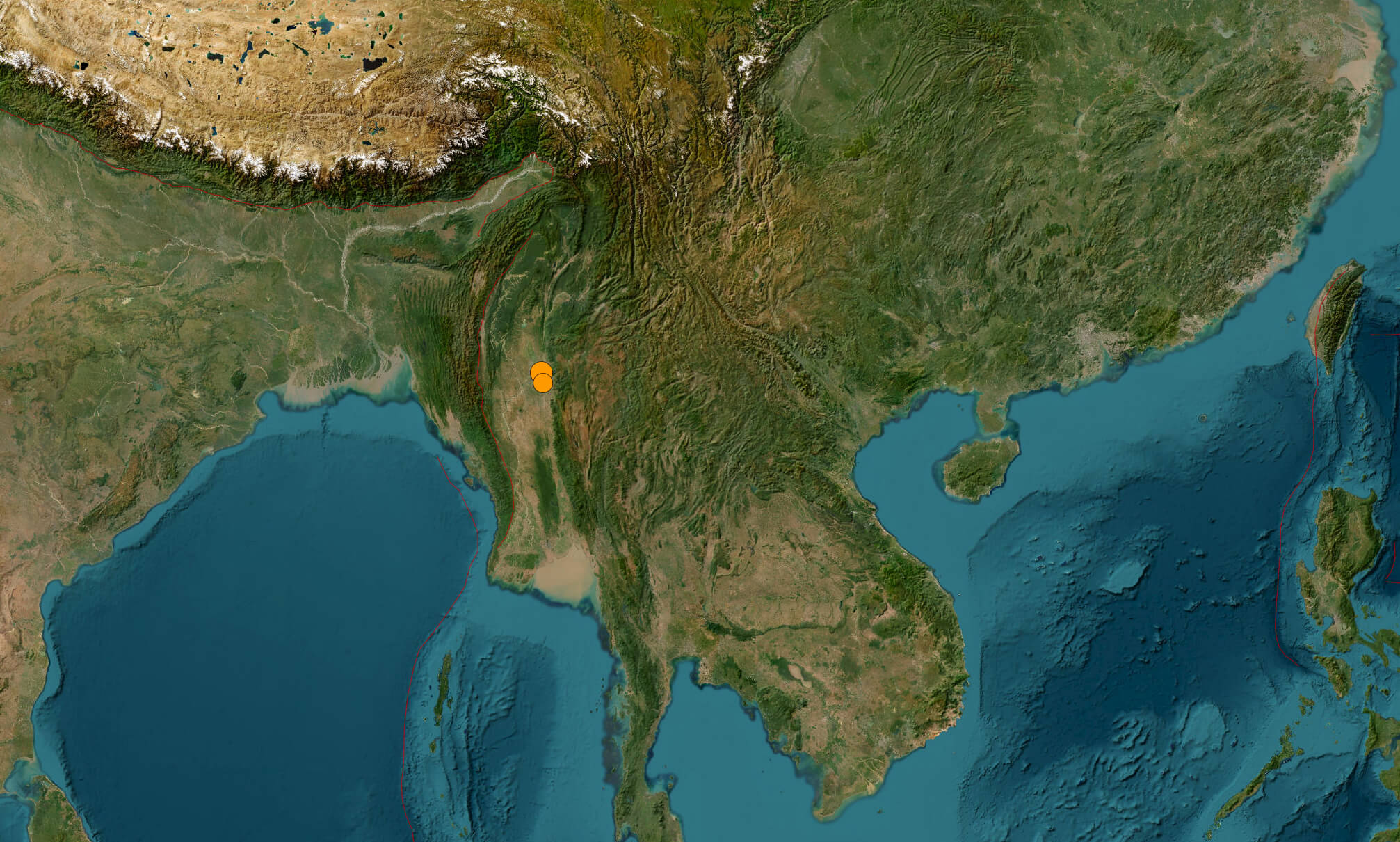
Sagaing Myanmar earthquake map march 2025
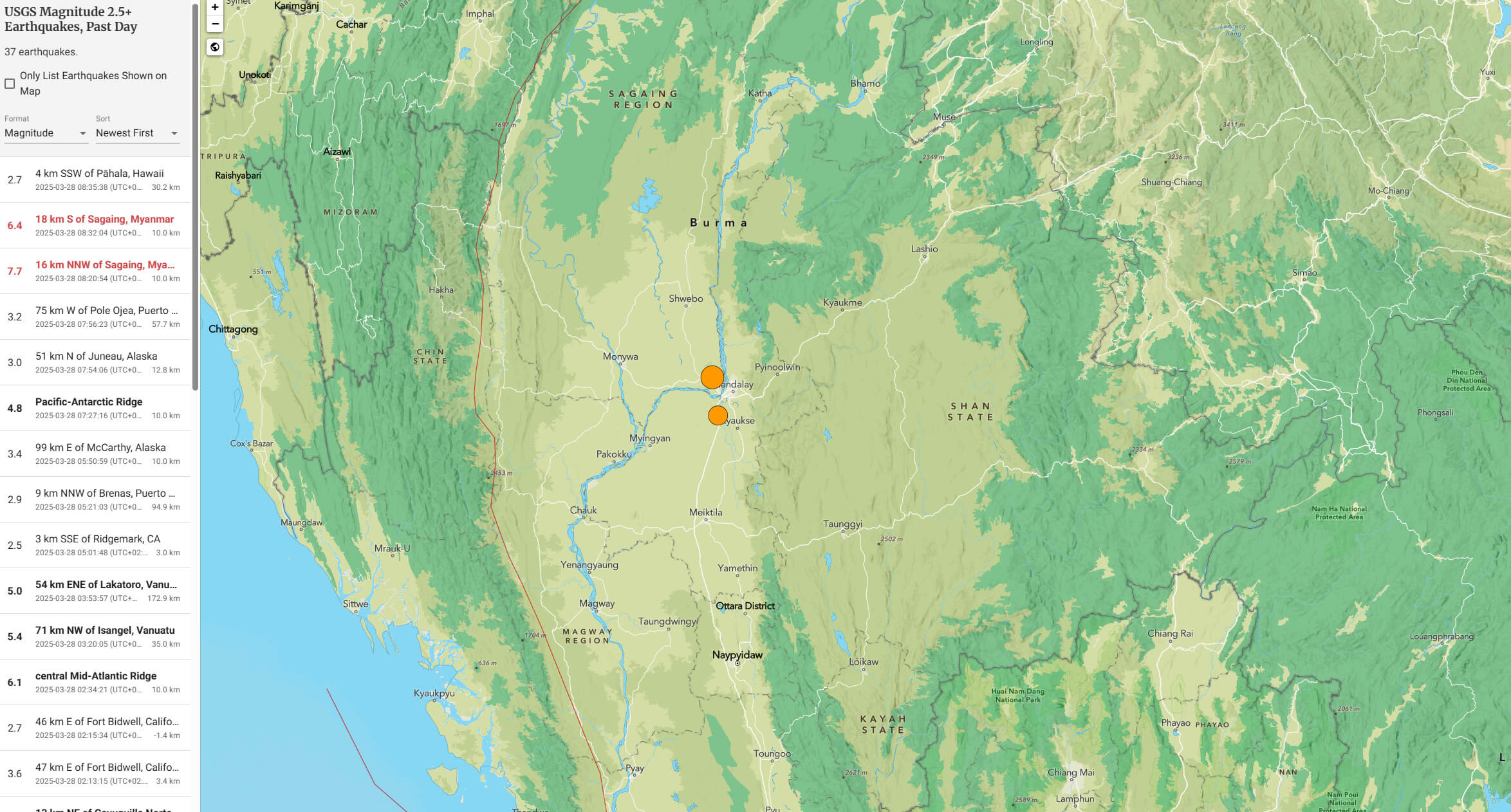
Myanmar Location Map
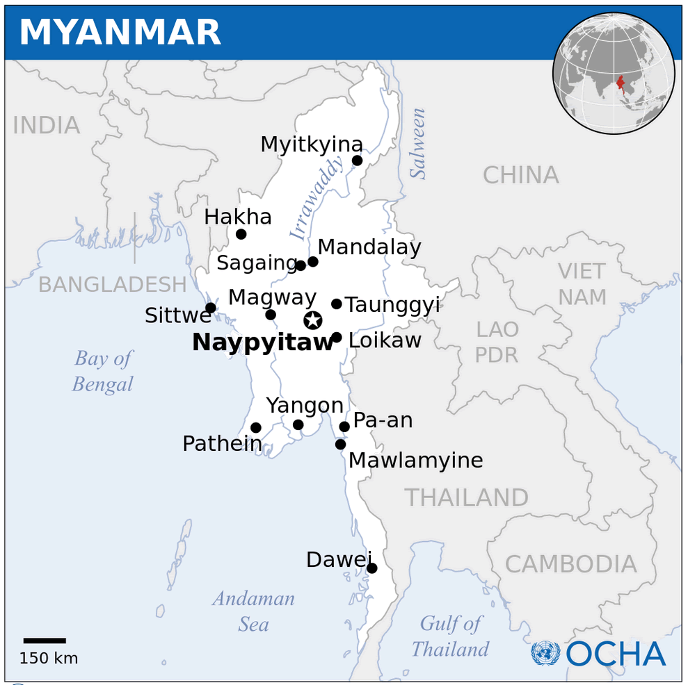
Myanmar terrain earthquake map march 2025
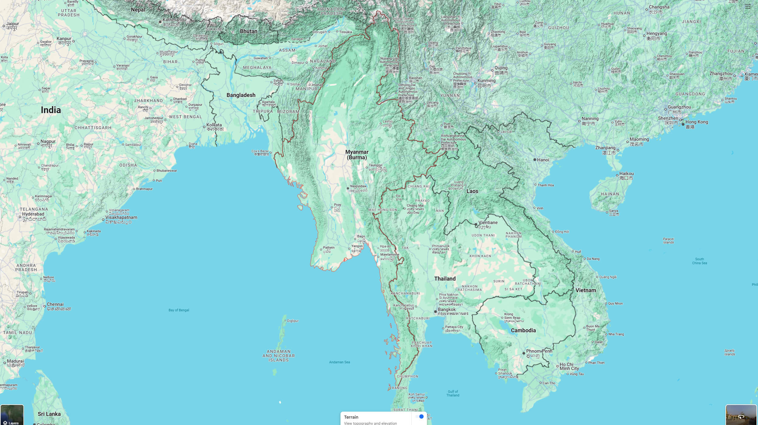
Myanmar terrain map
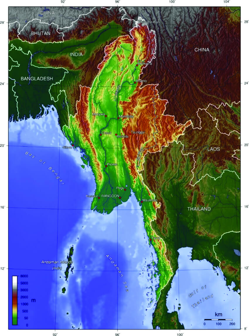
Myanmar topography map
Myanmar cities map
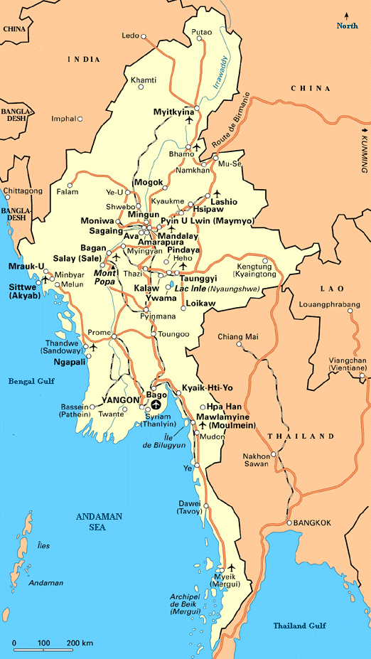
Cities Map of Myanmar
Map of Myanmar Asia
Map of Myanmar World
Myanmar Regions Map
Myanmar Map China India
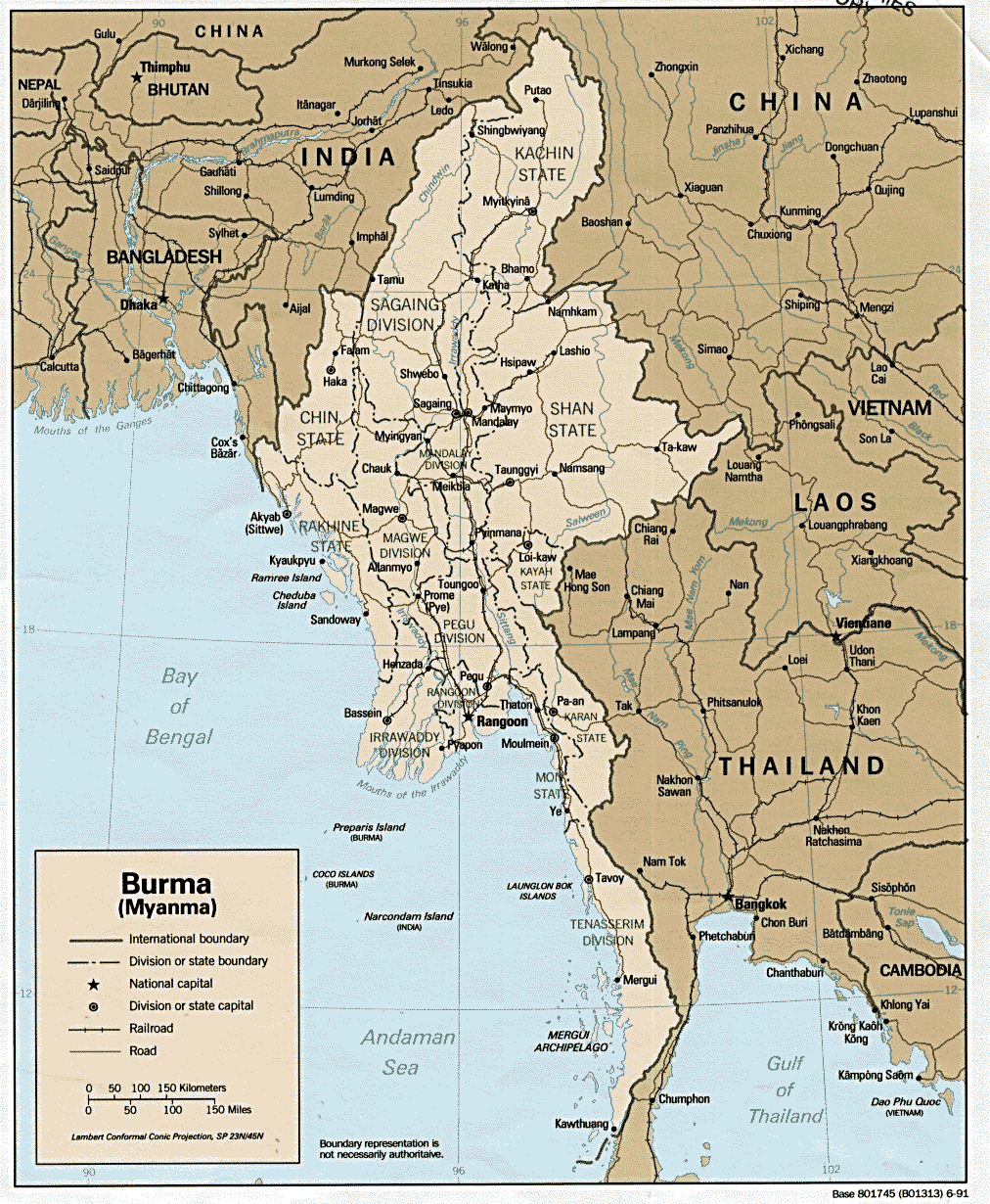 Map of Myanmar highlighting its borders with China, India, and Thailand
This map illustrates Myanmar’s strategic location in Southeast Asia, bordered by China, India, Thailand, Laos, and Bangladesh. It highlights key regions, rivers, and major cities, emphasizing Myanmar’s role as a connector between South and East Asia.
Myanmar Region Map
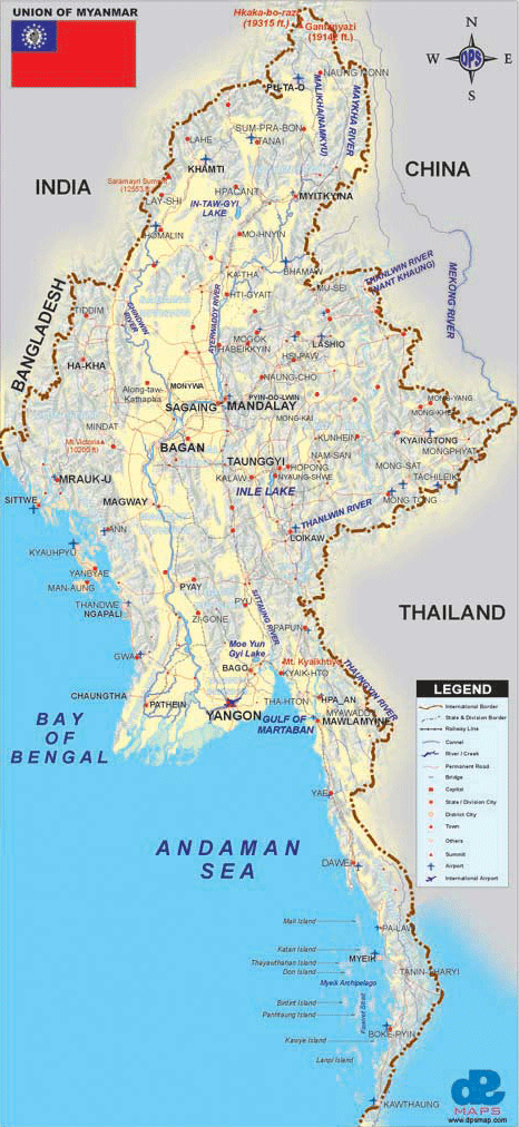 Myanmar regional map showing cities, rivers, and international borders
This map illustrates Myanmar’s regions, major cities like Yangon and Mandalay, key rivers such as the Irrawaddy and Chindwin, and its borders with India, China, and Thailand, along with coastal areas on the Bay of Bengal and Andaman Sea.
Physical Map of Myanmar
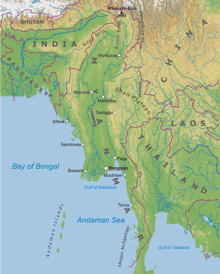 Myanmar physical map highlighting rivers, hills, and regions
This map showcases Myanmar’s physical features, including rivers such as the Irrawaddy, mountain ranges like the Shan Plateau, and key geographical areas near neighboring countries like India, China, and Thailand.
Myanmar infographics map
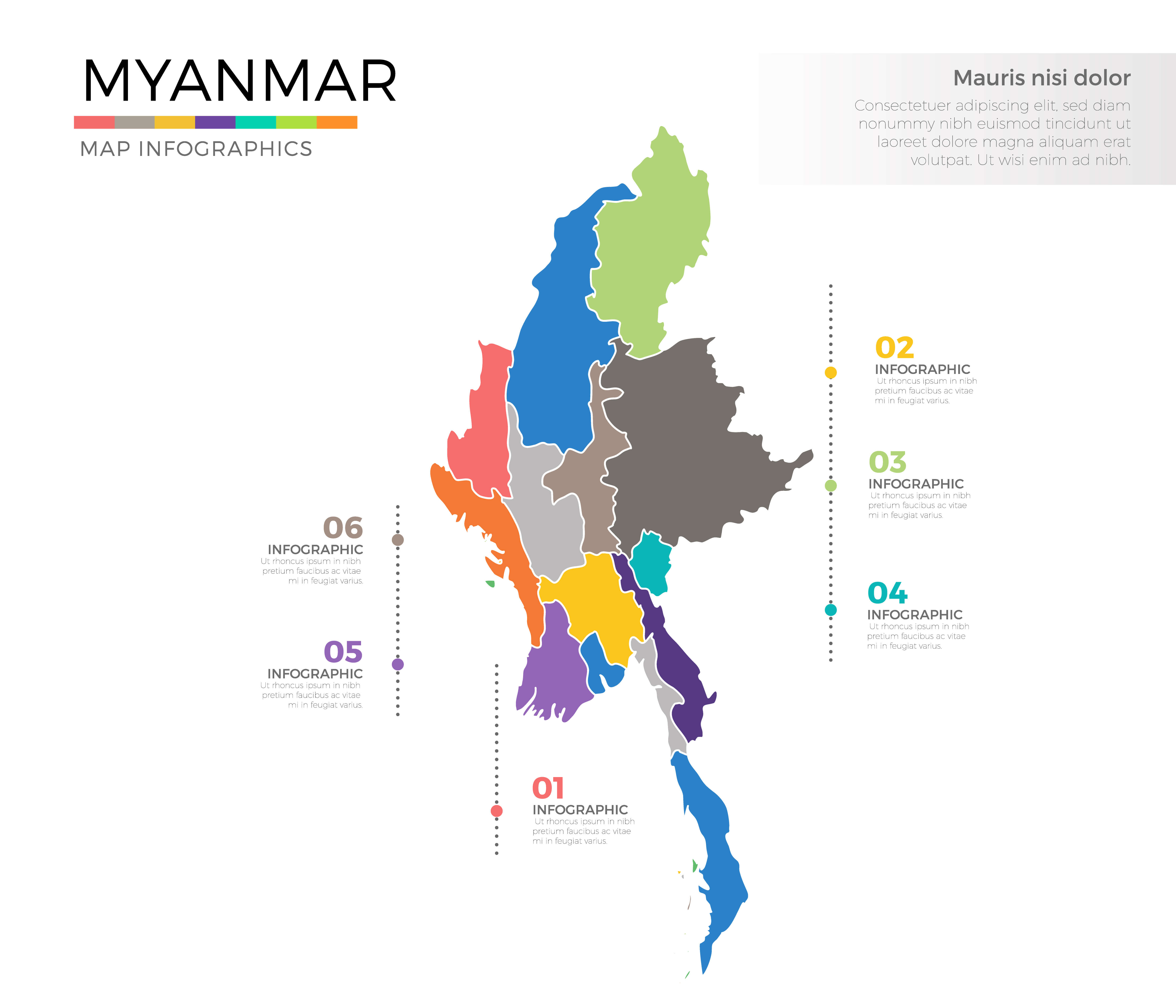
Myanmar major cities map
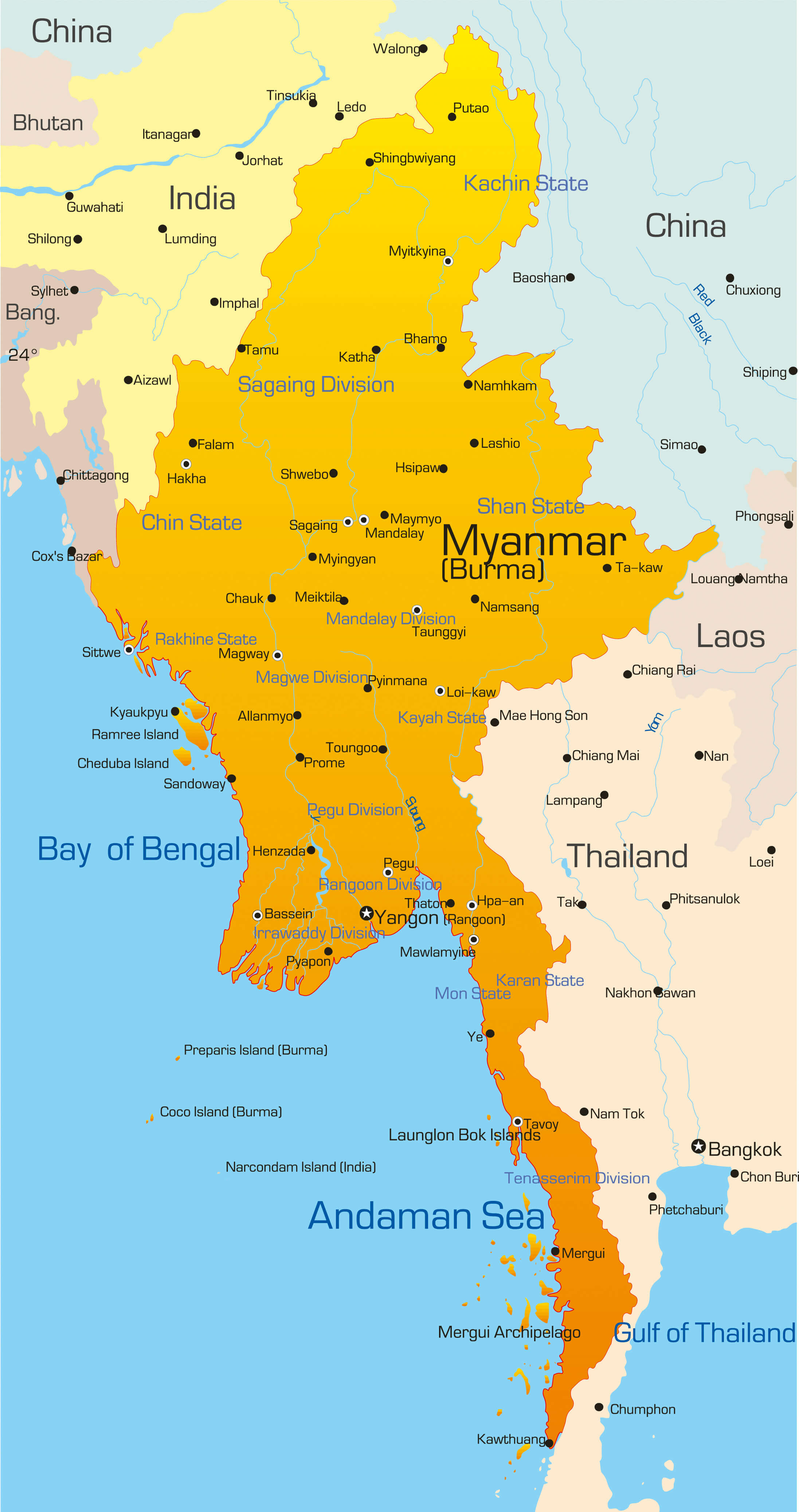
Myanmar map and south east asia
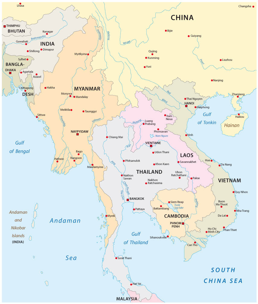
Ehere is located Myanmar on the world map
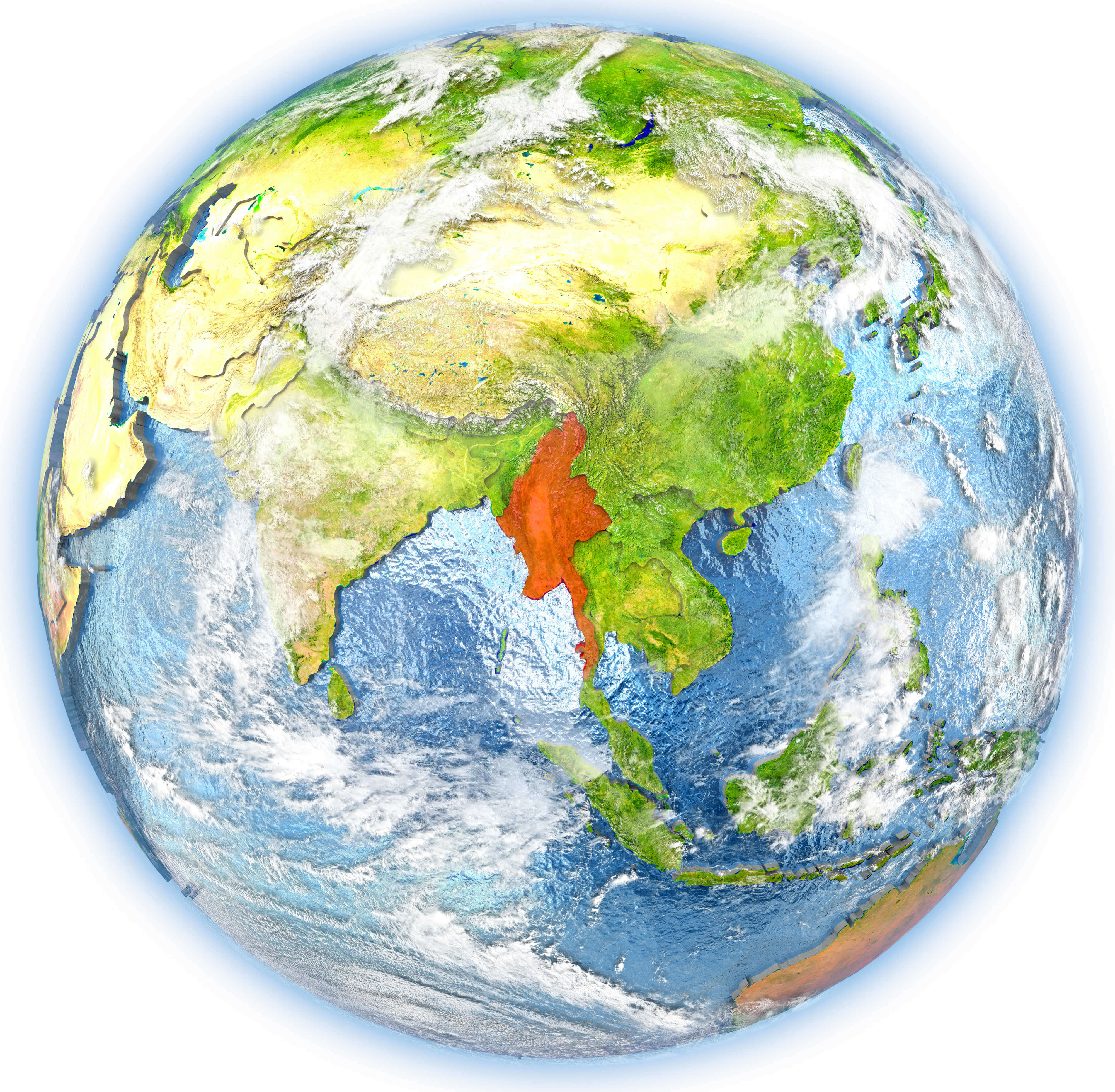
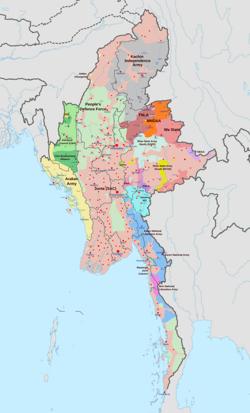
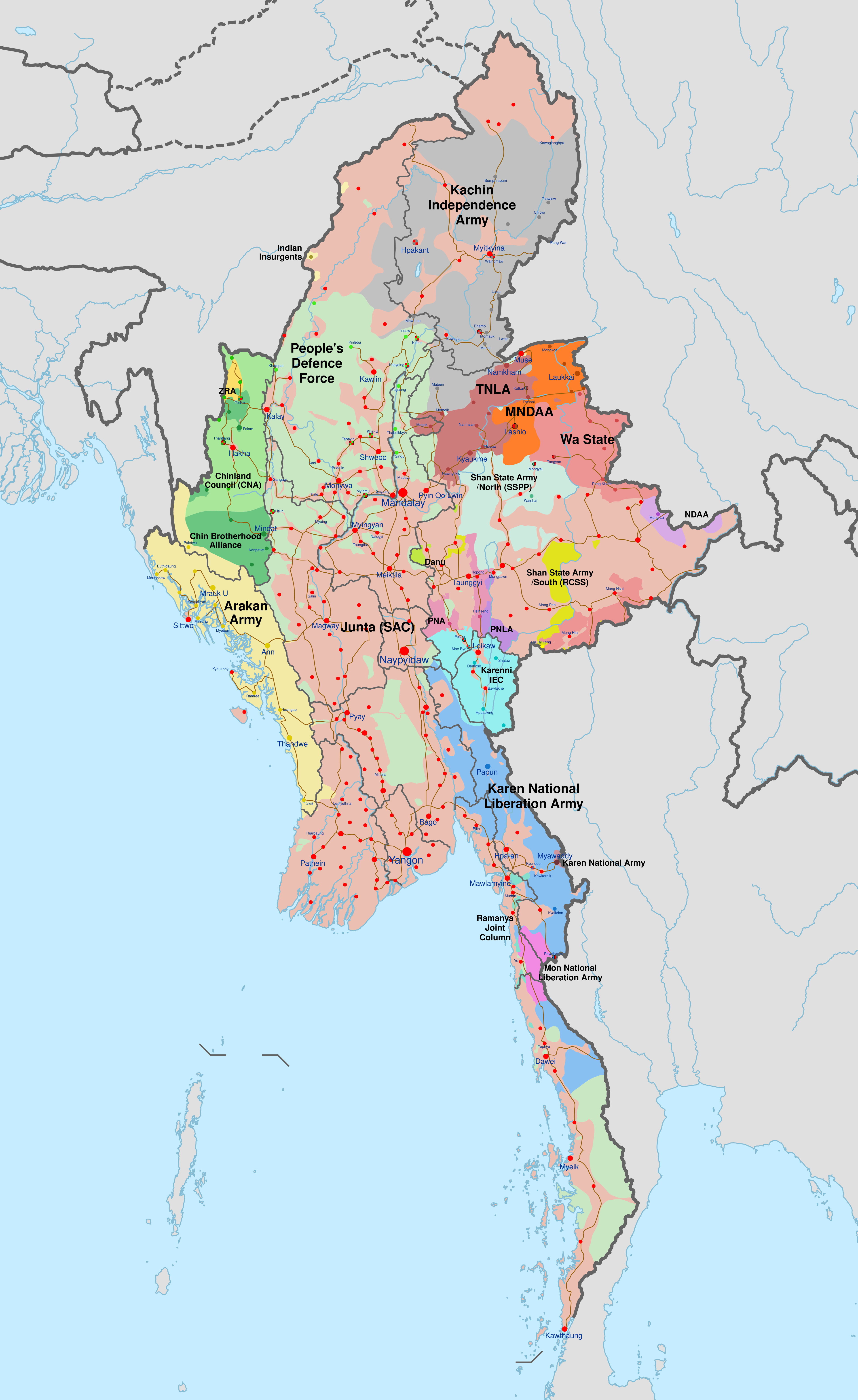
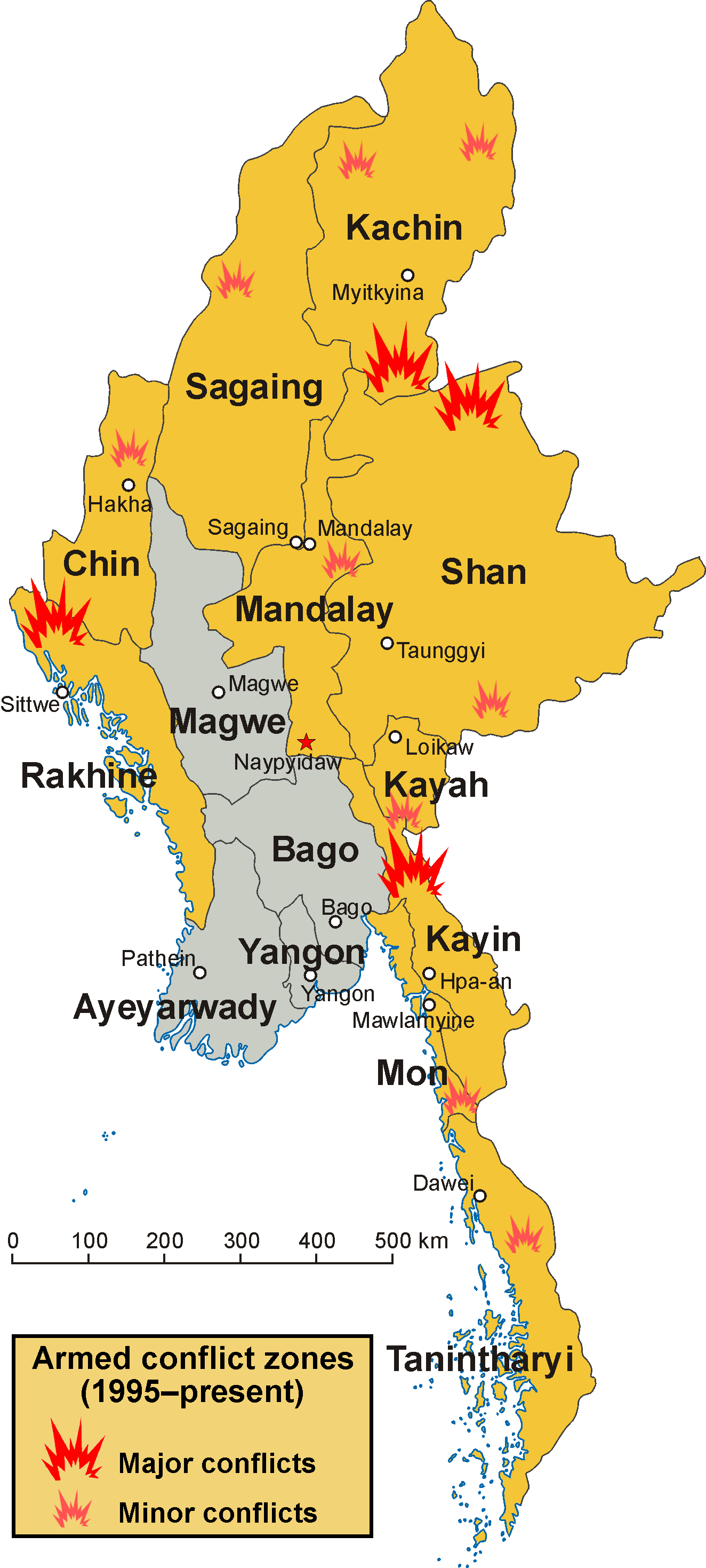
Map of conflict zones in Myanmar
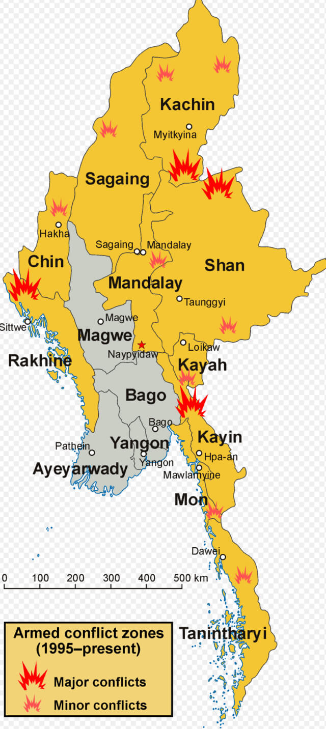
Myanmar map

Myanmar Burma satellite map from space
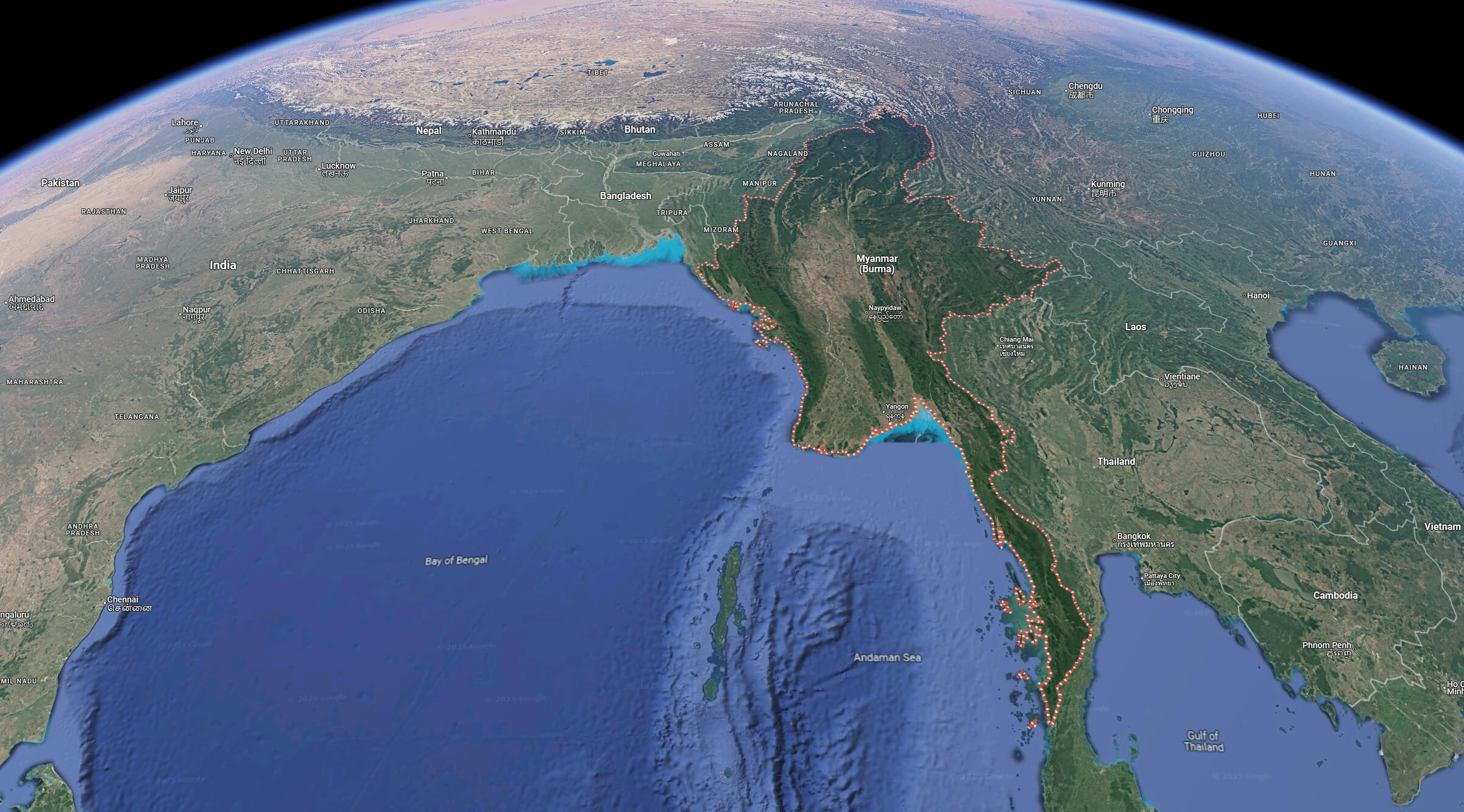
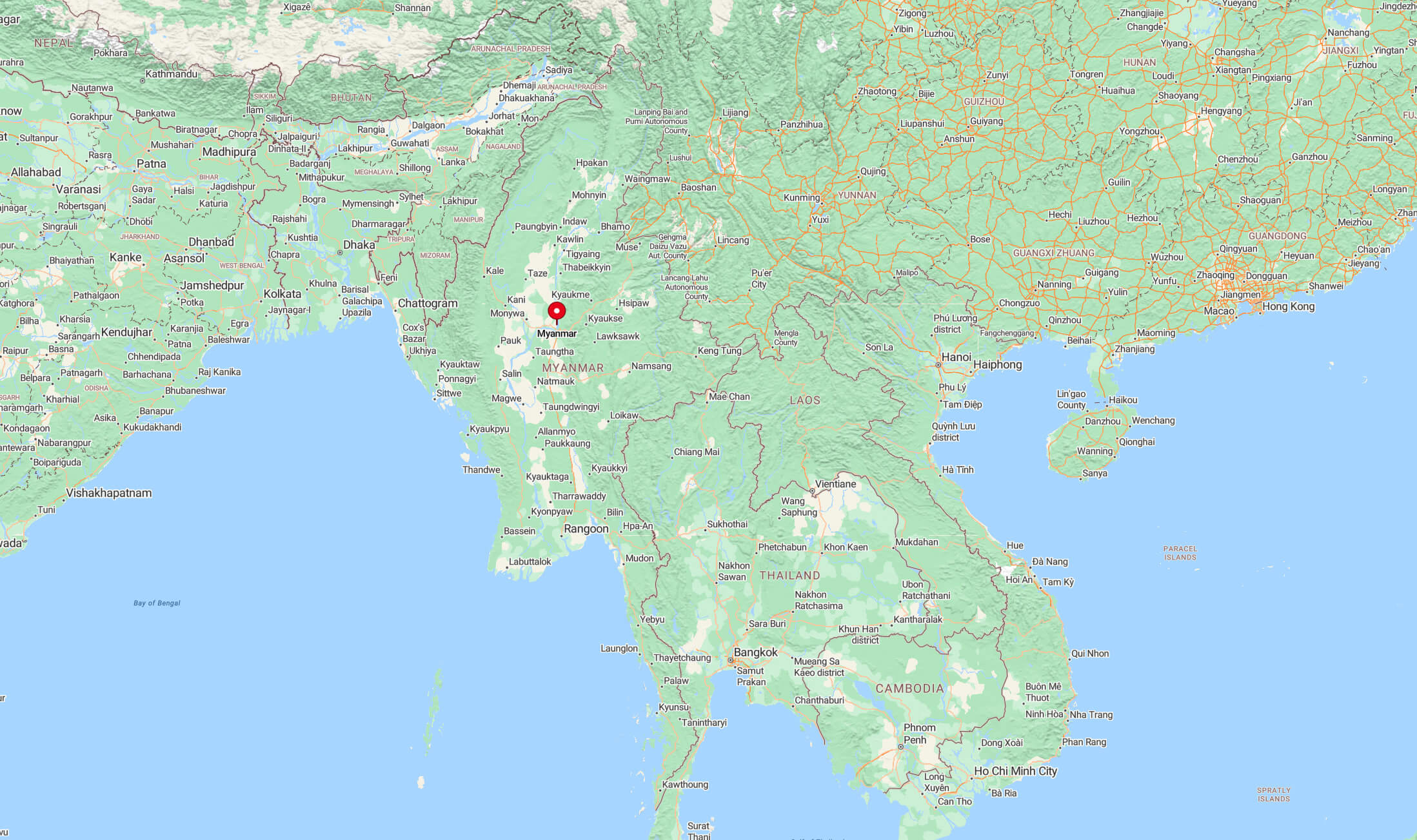
Myanmar cities map
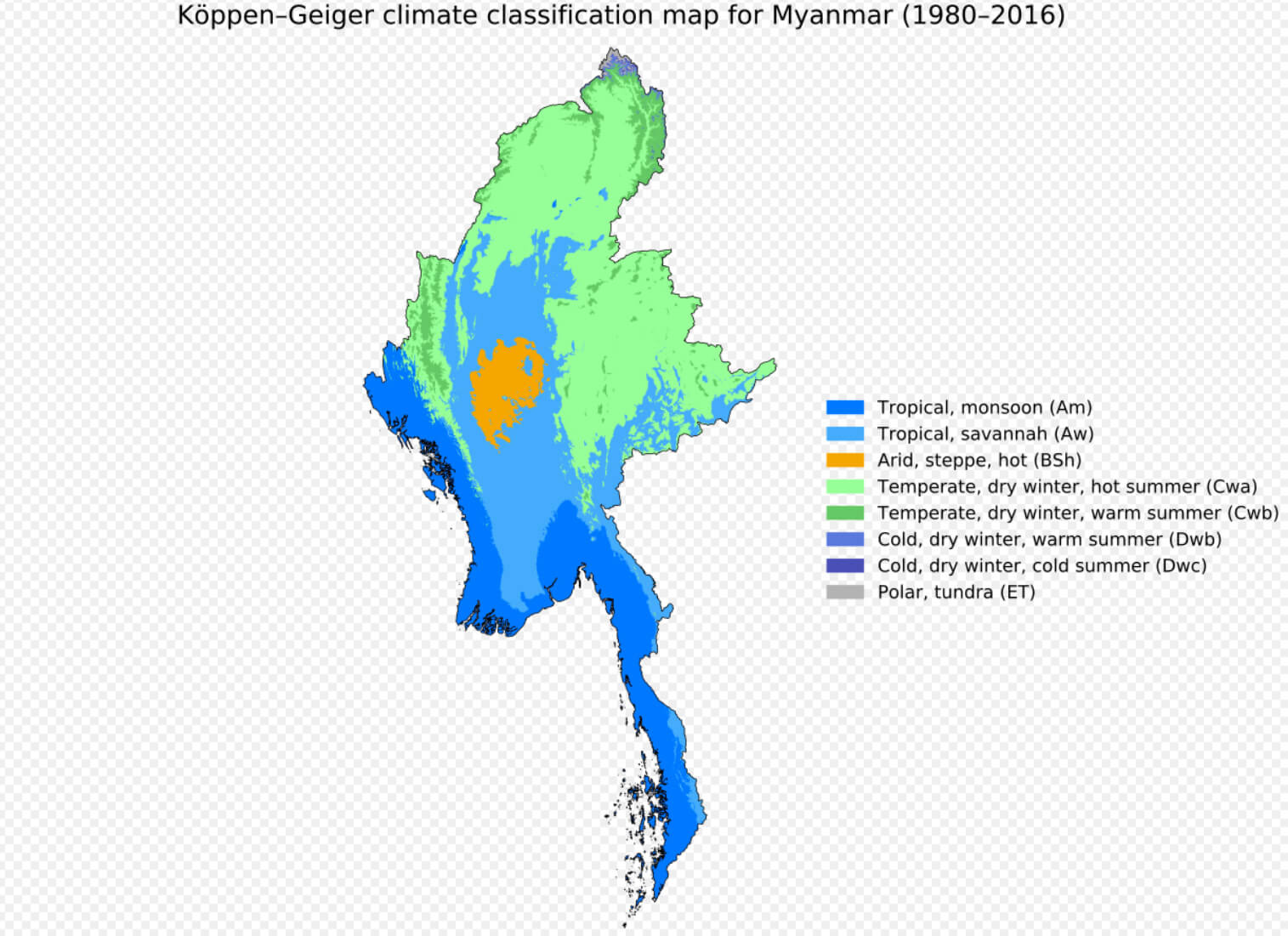
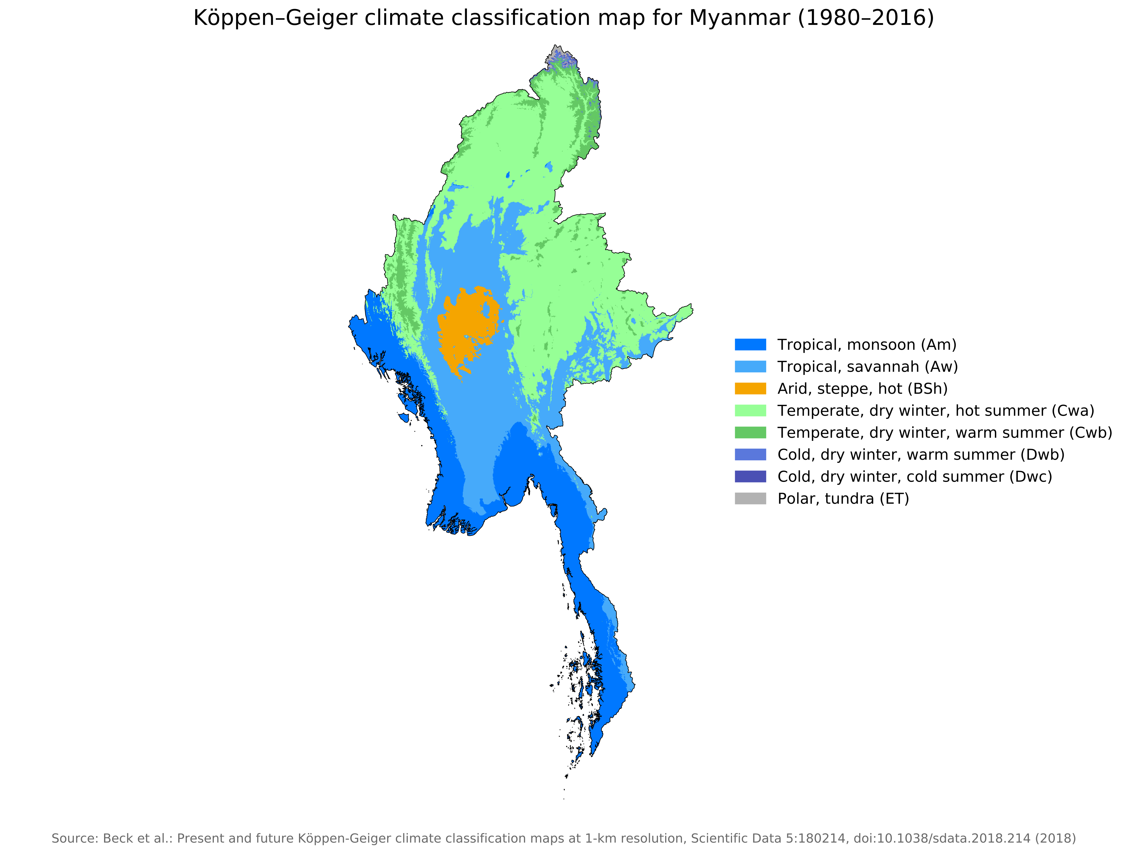
Myanmar climate map
Myanmar earthquake map march 2025
Myanmar military map
Myanmar road map

Myanmar satellite map
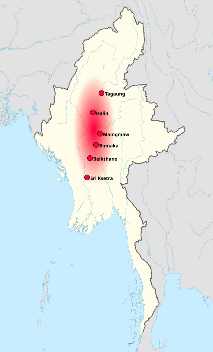
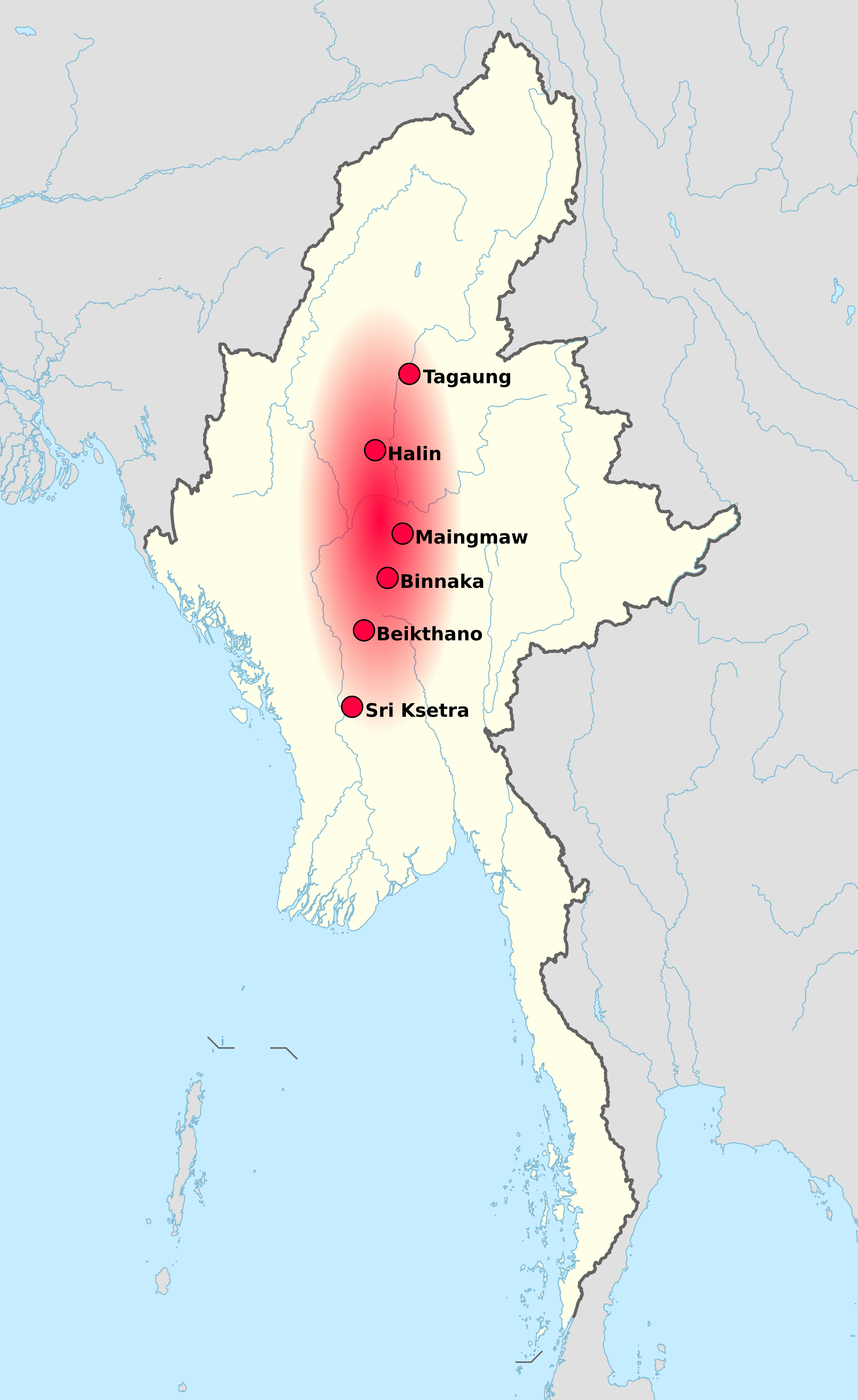
Pyu city states Myanmar map 8th century
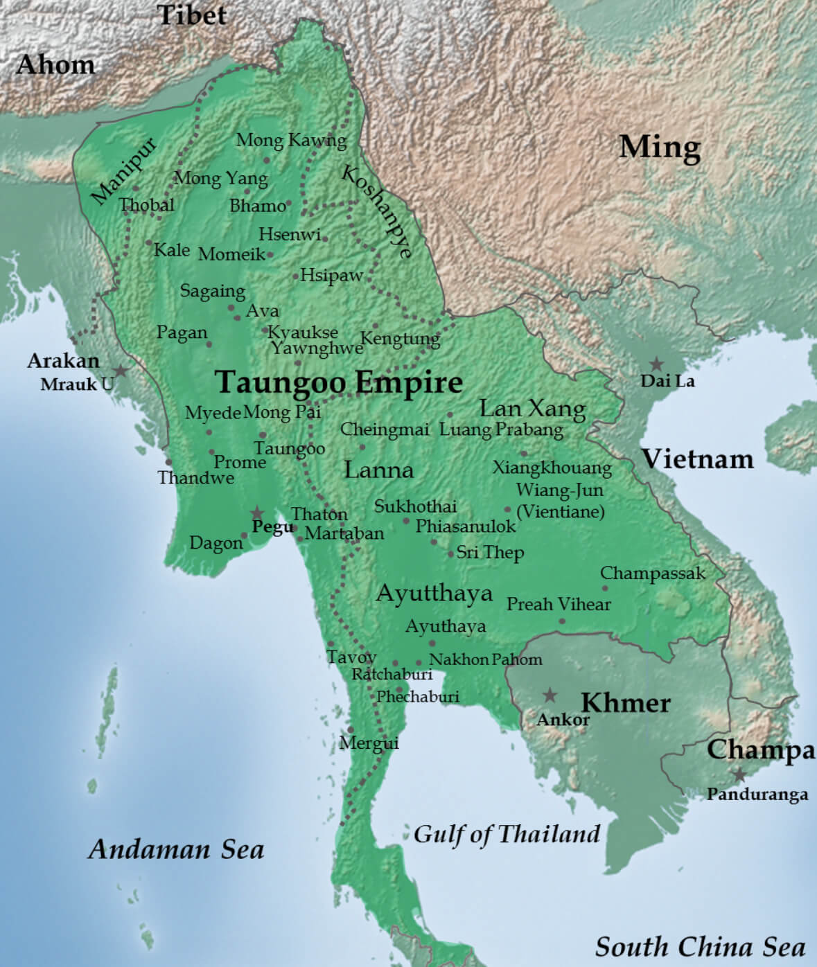
Toungoo Empire map under Bayinnaung in 1580 Myanmar
Myanmar civil war
Pyu city states map
Ethnolinguistic map of Burma 1972
Koppen Geiger climate map of Myanmar
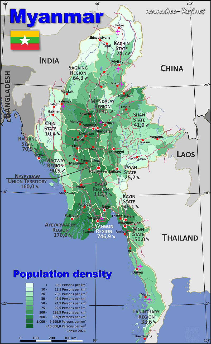
Myanmar population map
Armed conflict zones in Myanmar
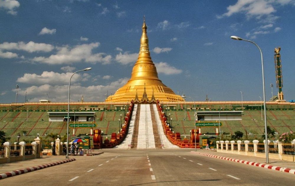
Naypyidaw, Myanmar
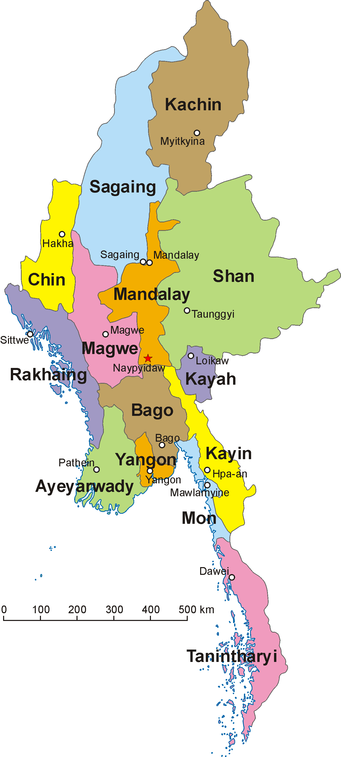
Burma Myanmar map
Where is Myanmar (Burma) on the Asia Map?
Show Google interactive map, satellite map, where is the country located.
Get directions by driving, walking, bicycling, public transportation, and traveling with street view.
Feel free to explore these pages as well:
- Where is Sagaing on the Myanmar Map ↗️
- China Map ↗️
- Vietnam Map ↗️
- Indonesia Map ↗️
- Philippines Map ↗️
- Brunei Map ↗️
- Malaysia Maps ↗️
- Where is Taiwan in the World and A Collection of Taiwan Maps ↗️
- Japan Map ↗️
- North Korea Map ↗️
- South Korea Map ↗️
- Asia Maps ↗️
