Map of World

HomeMapsMap of World
- Advertisement -

A collection maps of World; View a variety maps of World physical, political, relief map. Satellite image of World, higly detalied maps, blank map of World, World and Earth. And find more World’s country, regions, topography, cities, road, rivers, national, directions maps and atlas.

The World Map
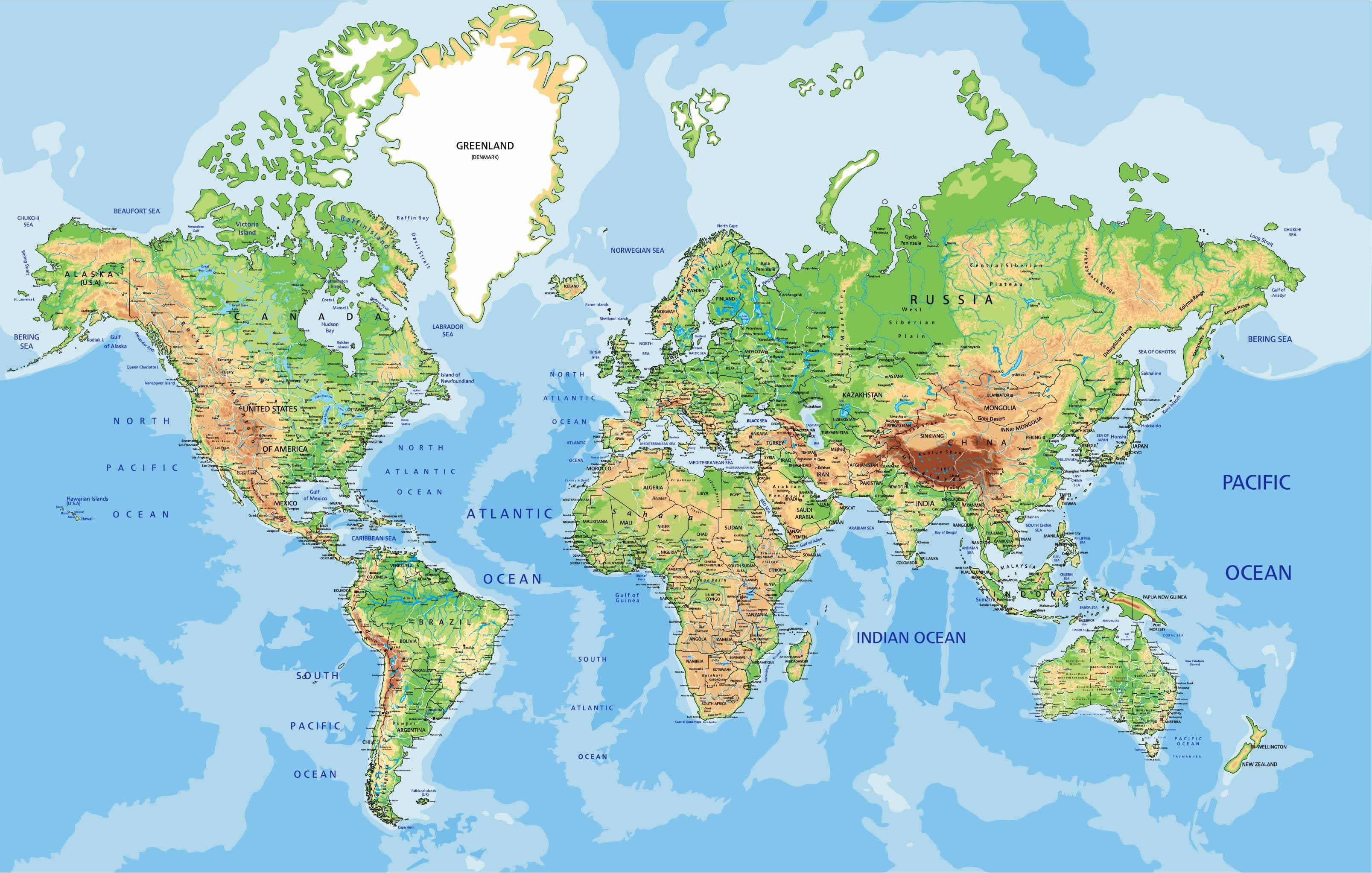
The World MapPhysical Map of the World.

World Map with Countries

World Map with Countries
World Map with Countries without cities indicated.

Map World
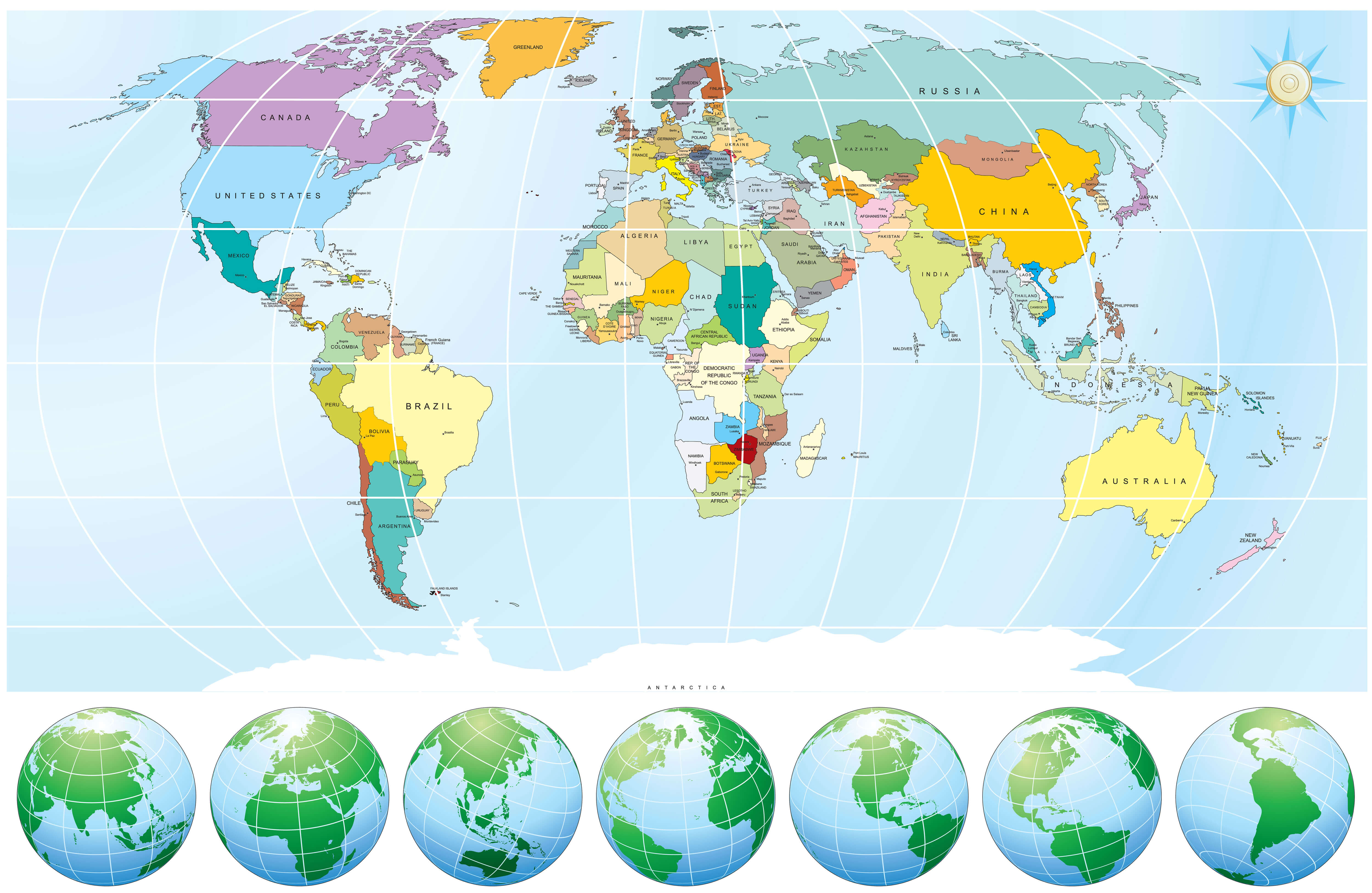
Map World


Map World, United States of America, Canada, Brasil, India, Australia, Germany, China, Japan, United Kingdom.

World Map with Major Cities
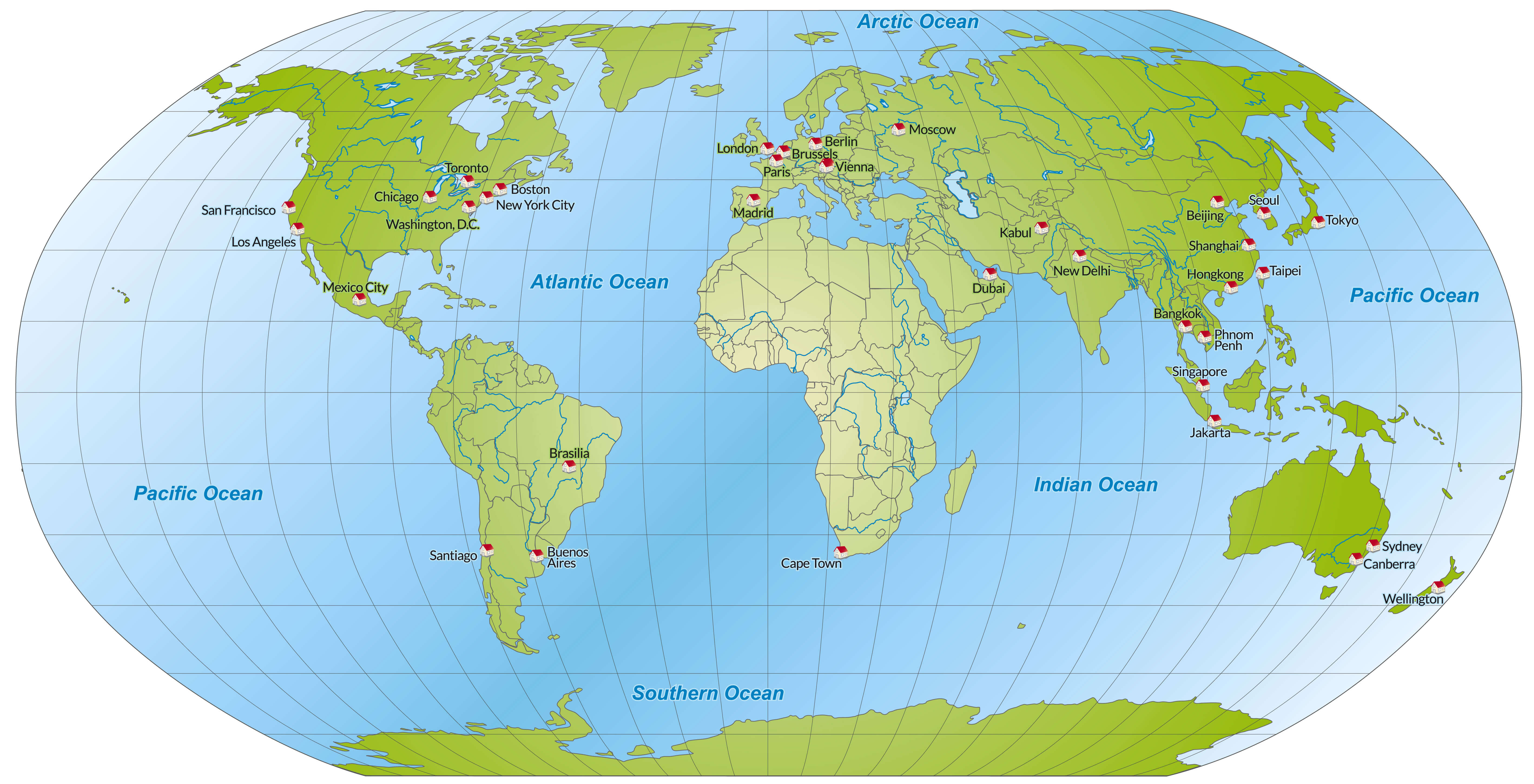
World Map with Major Cities
World Map with Major Metropolitan Cities.

World Satellite Map

World Satellite Map
World Satellite Map without country notional boundaries.

World Maps and Photos

Where are located countries in the World?

Show Google map, satellite map, where is the country located.

Get direction by driving, walking, bicycling, public transportaion and travel with street view.

- Advertisement -
Previous article
Next article

Discover

Sponsor

Latest Posts

California Political Map

Explore the political map of California, showing its 58 counties, major cities and state boundaries, California political and physical map, providing a clear view...

The Essential Collection of Denmark Maps for Travelers and Geographers

Explore Denmark's diverse terrain and vibrant cities through our extensive map collection. From bustling cities like Copenhagen to the serene coastline, these maps offer...

Guide to Los Angeles’ Top 10 Attractions

Experience LA Like Never Before: Your Ultimate List of Top 10 Things to Do In the heart of Southern California lies Los Angeles, a city...

Egypt Map

Explore Egypt with detailed maps showing political and physical features, roads, cities, population, rivers, regions, borders, topography, terrain, satellite views, and Egypt’s location on...

United States Map

A collection of United States Maps; View a variety of United States physical, political, administrative, relief map, United States satellite image, higly detalied maps,...