- Advertisement -
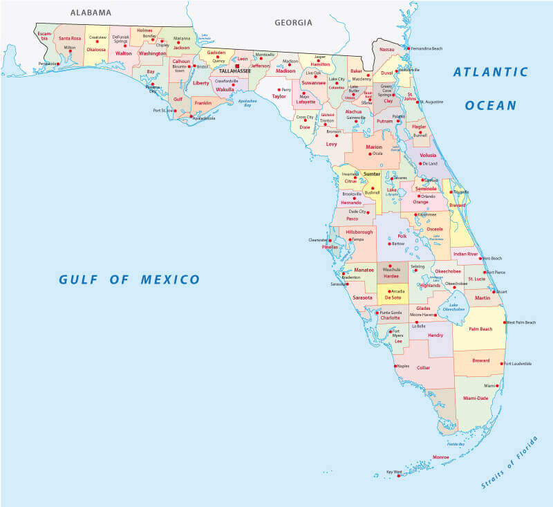
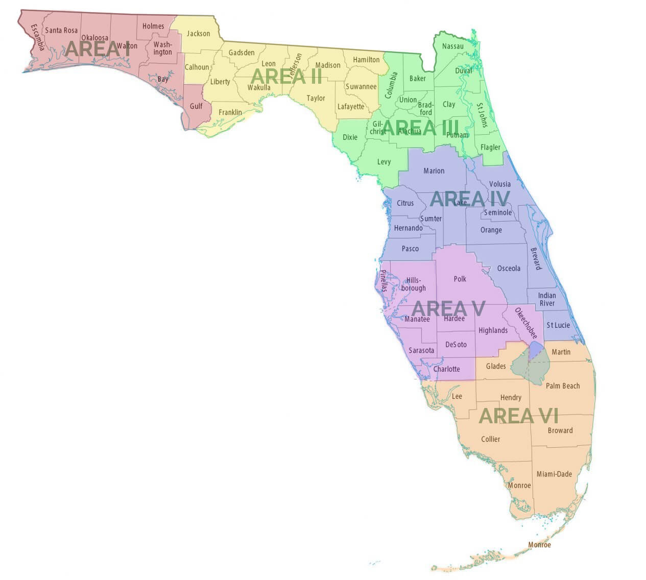
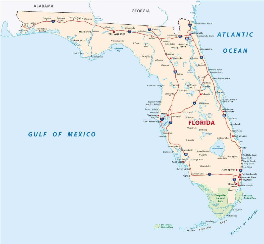
Explore our detailed Florida Cities Map, featuring all 67 counties of Florida and their major cities, roads, and highways. This interactive Florida administrative map helps you easily locate Florida’s regions, national parks, and populated places.
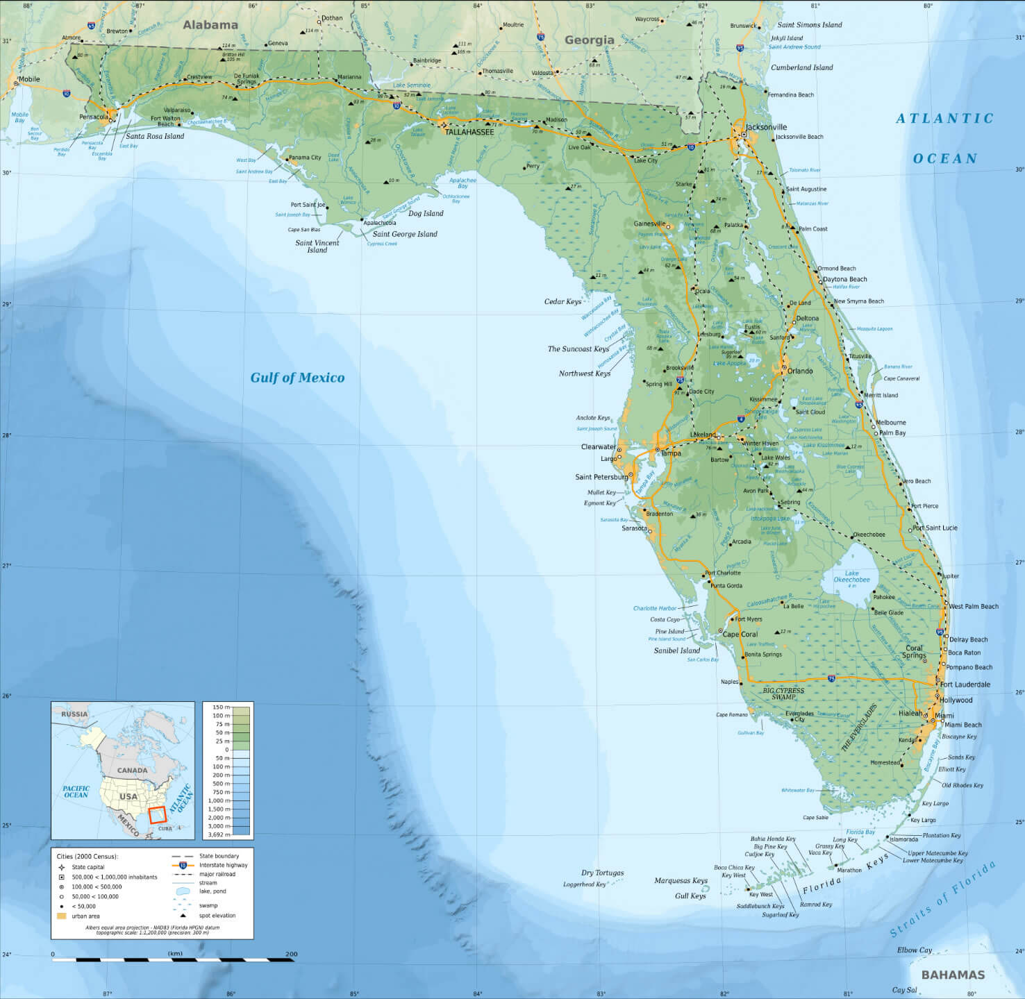
Whether you’re planning a road trip, studying Florida counties by population, or just exploring, this Florida state map with cities and counties provides a clear view of Florida’s major cities, colorful regions, and topographic details across the US state of Florida.
Florida State Map with Largest Cities
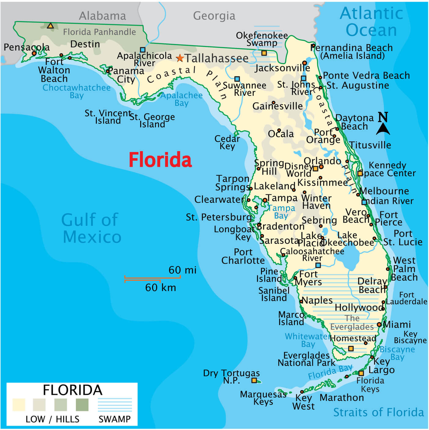 Florida state map showing major cities, roads, rivers, and coastal regions.
Florida counties cities map US
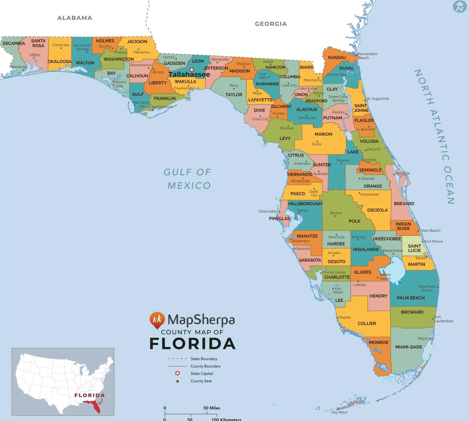
Cities map of Florida
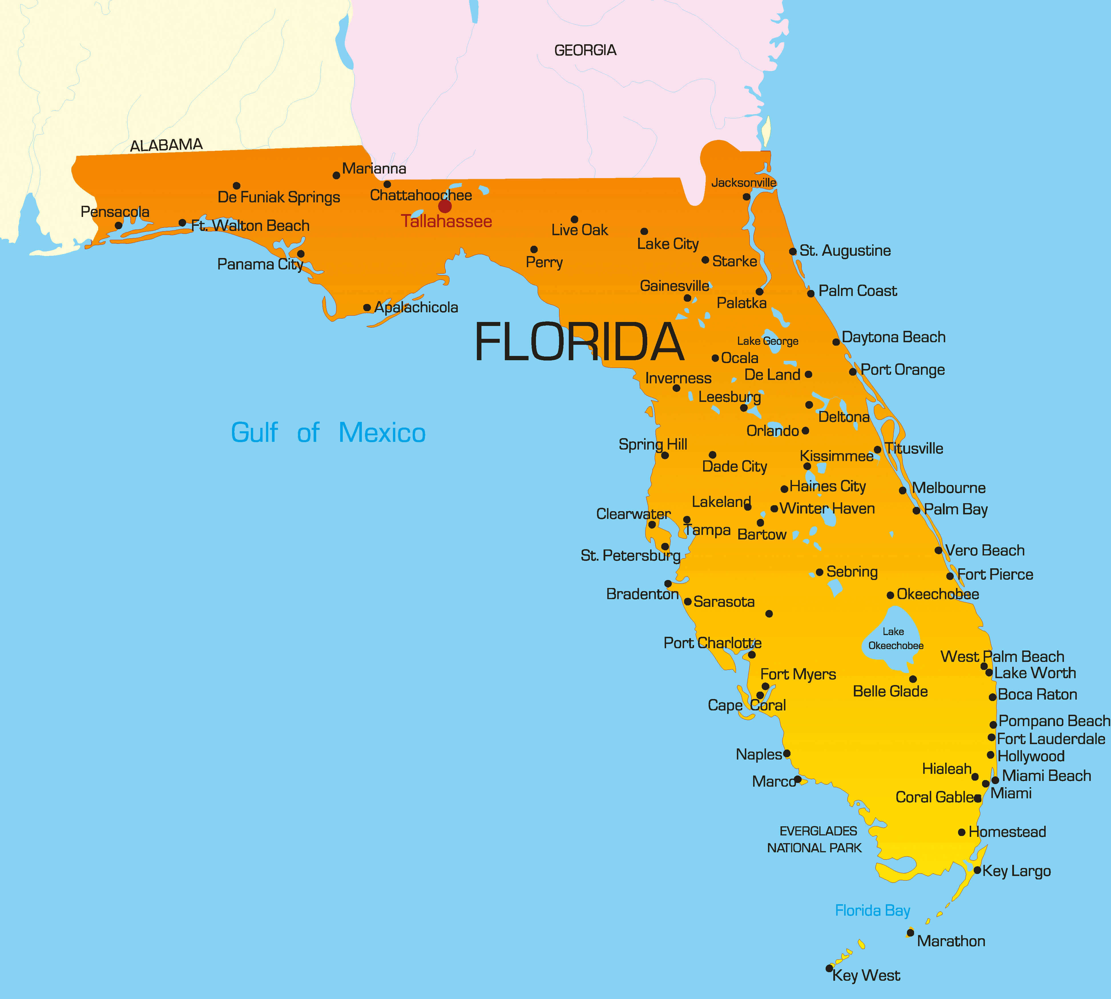
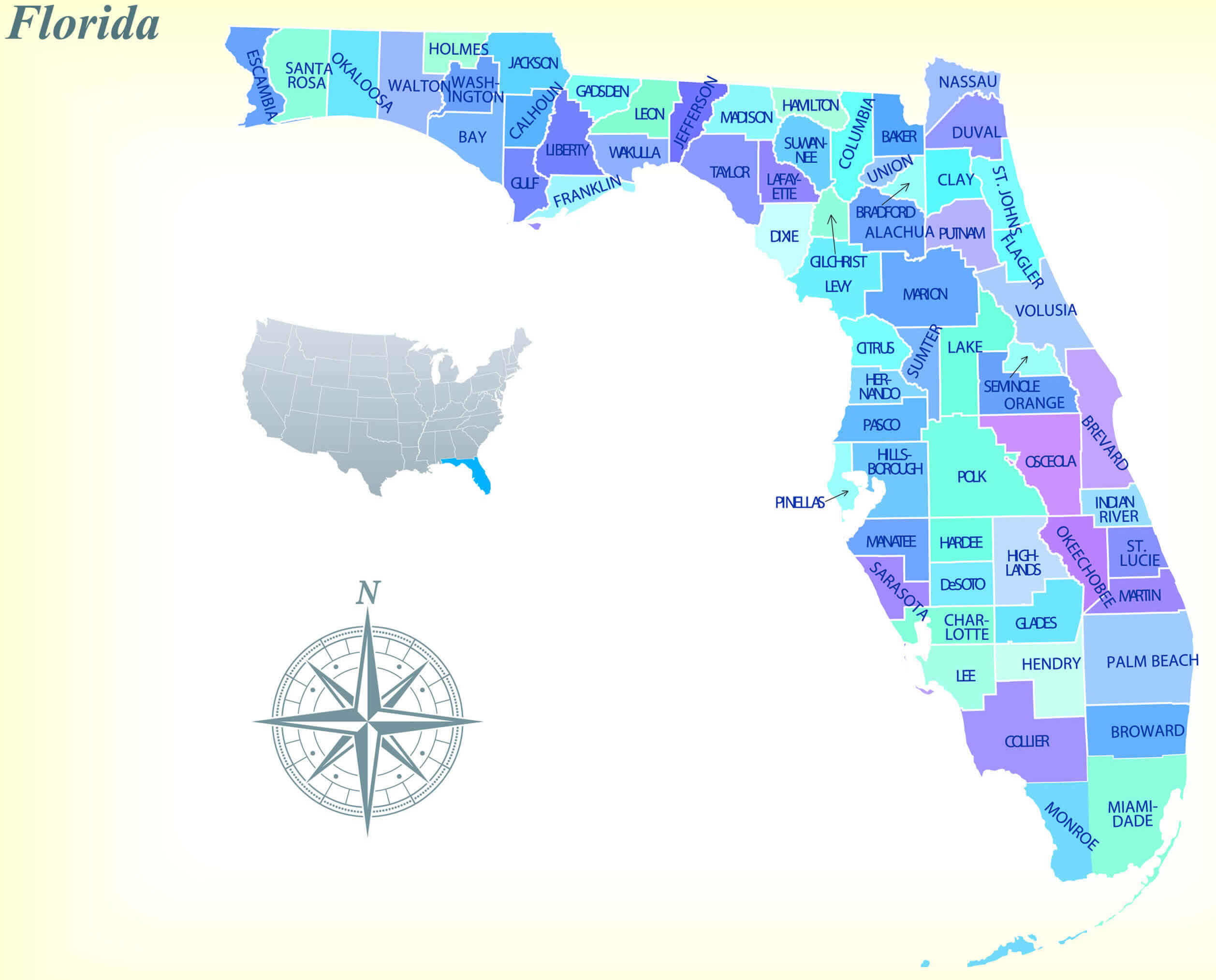
67 counties map in Florida
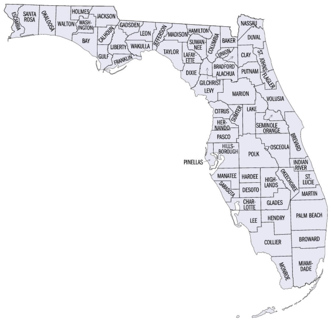
Florida administrative map
Florida area map with cities
Florida cities map by population in the US
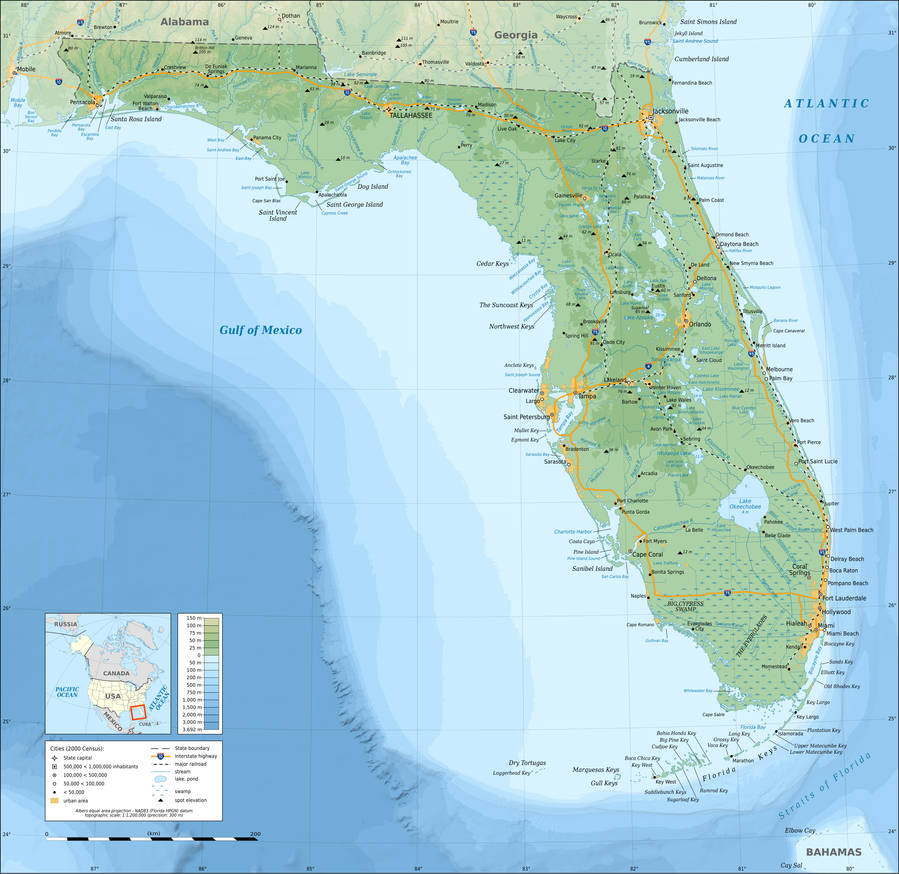
Florida cities map with national parks
Florida counties map US location map
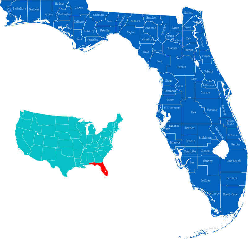
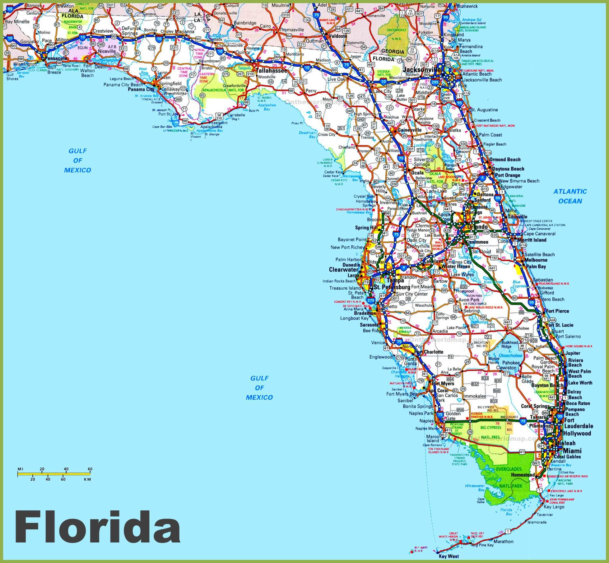
Florida counties road map
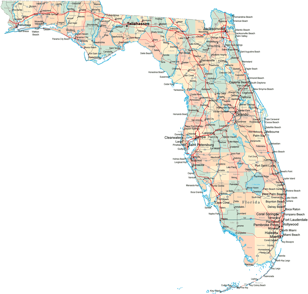
Florida county map with cities
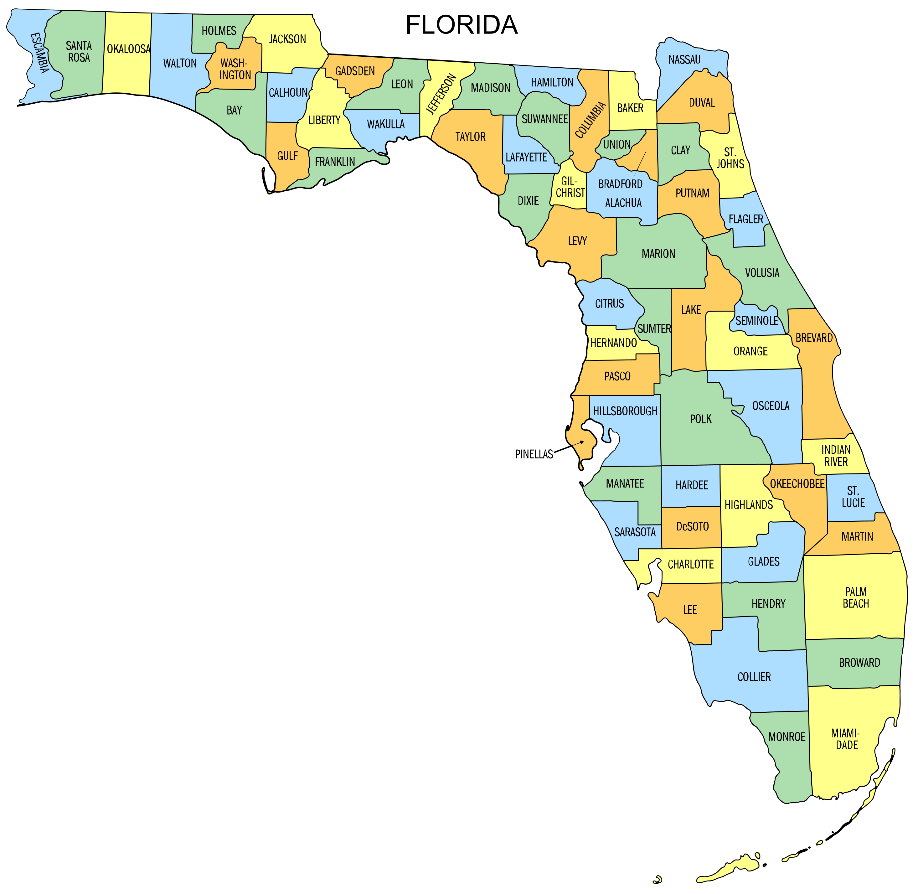
Florida county map

Florida highways cities roads map
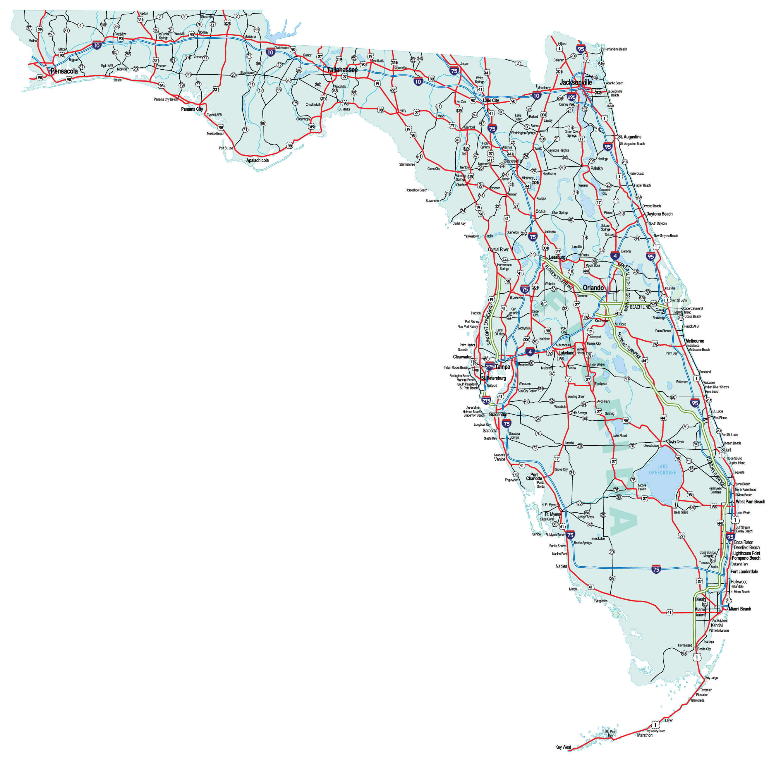
Florida interstate map
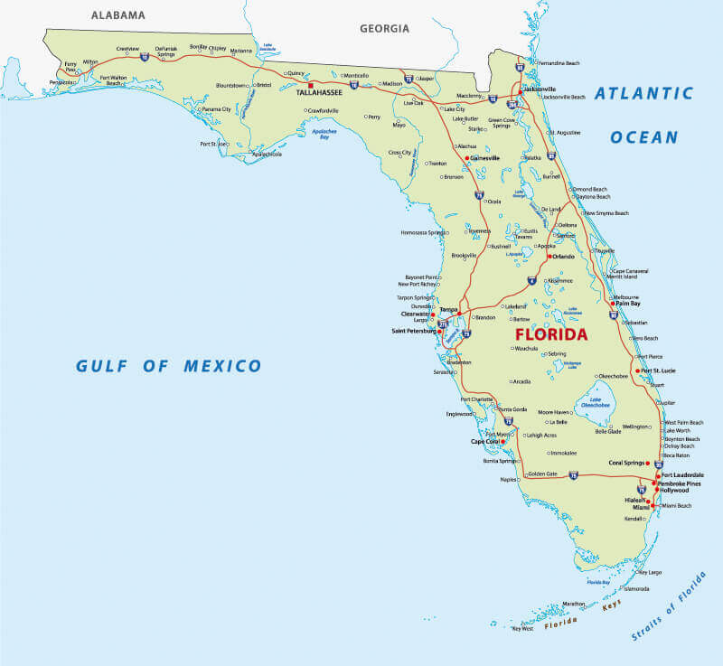
Florida main cities map
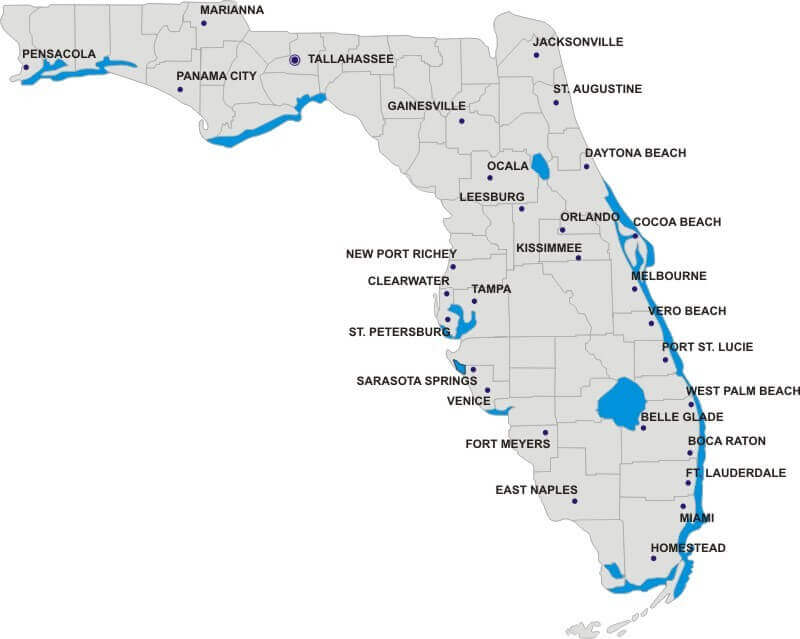
Florida major cities colorful map
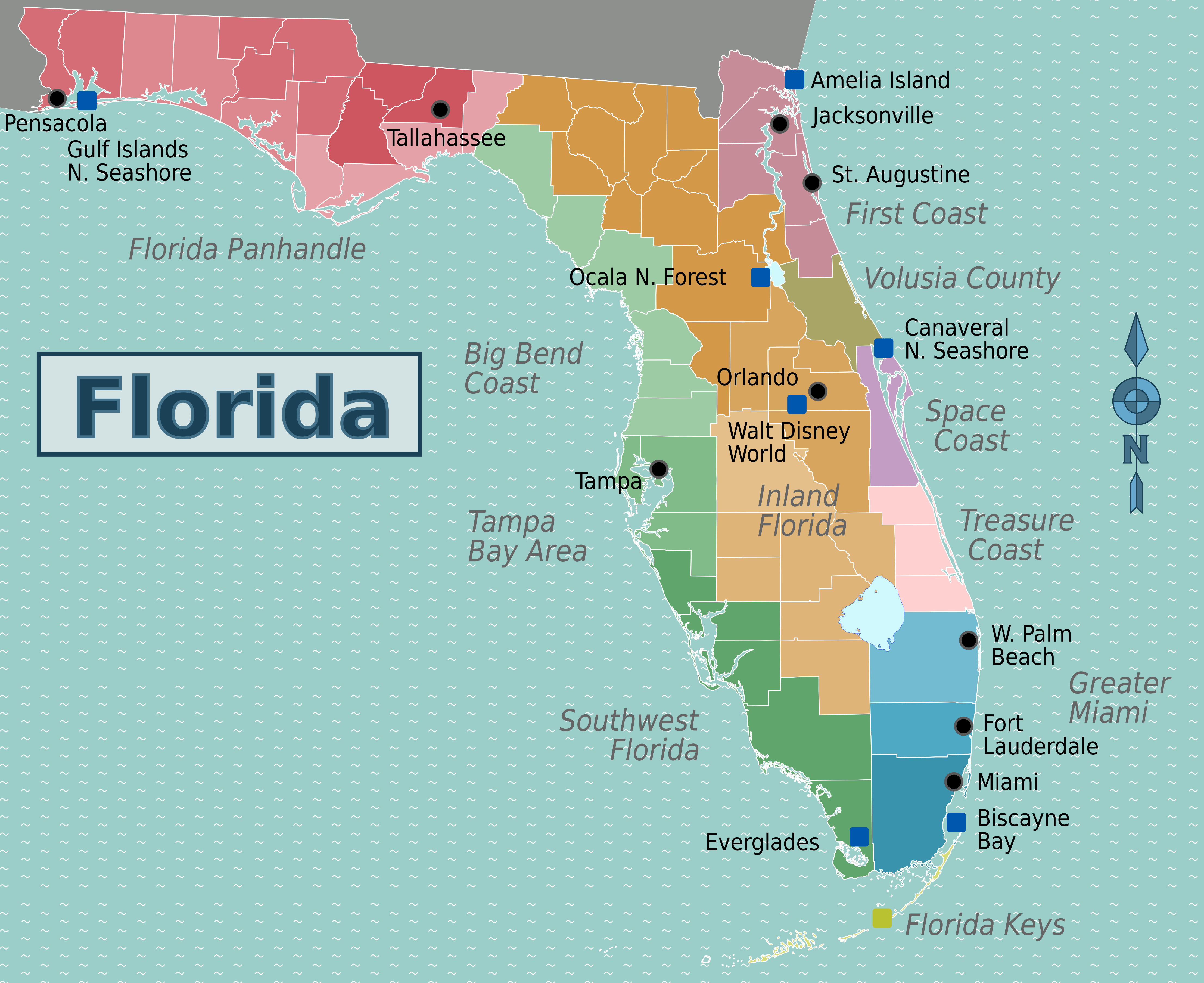
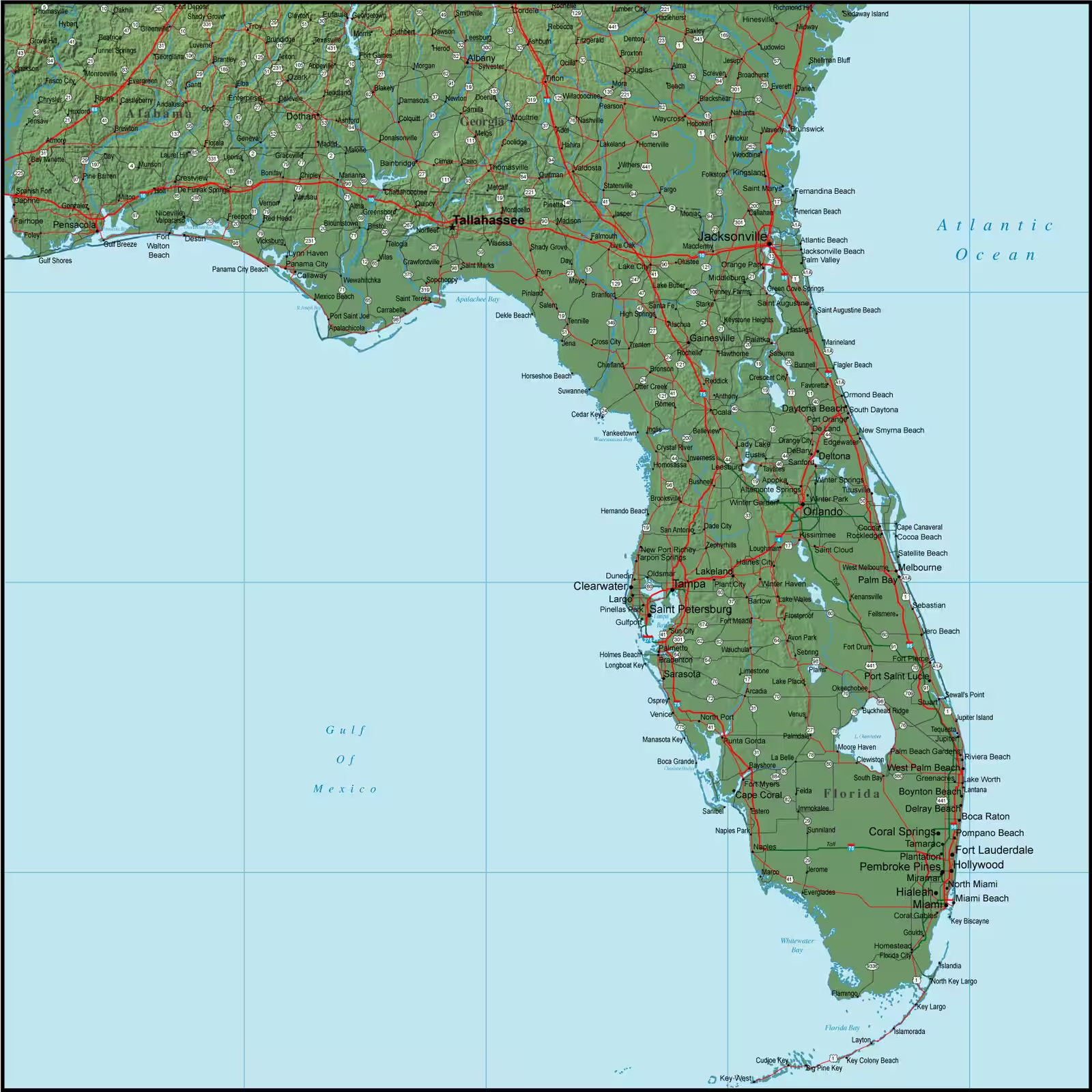
Florida map cities
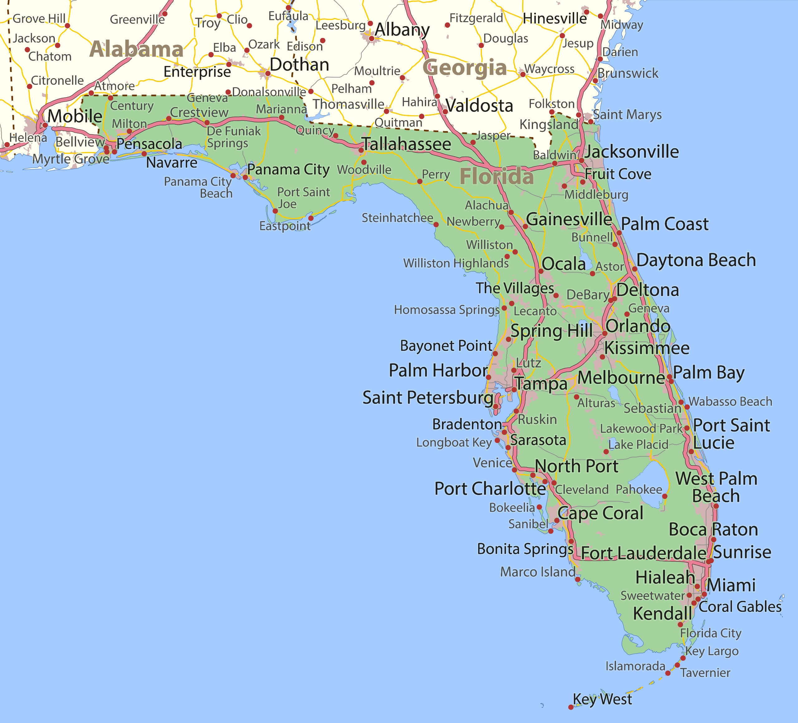
Florida populated places map
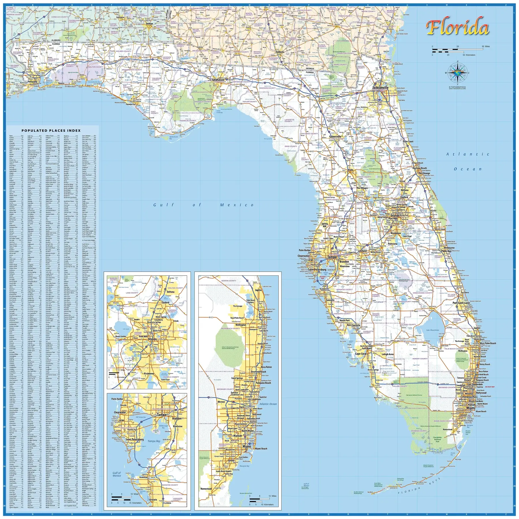
Florida regions and cities map
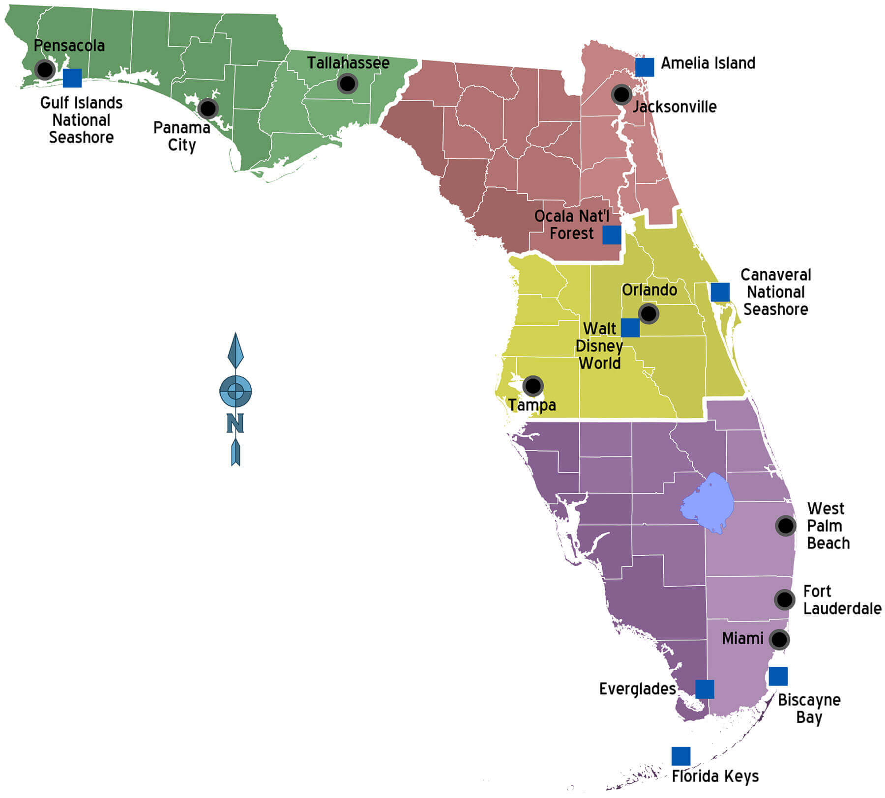
Florida road map with cities
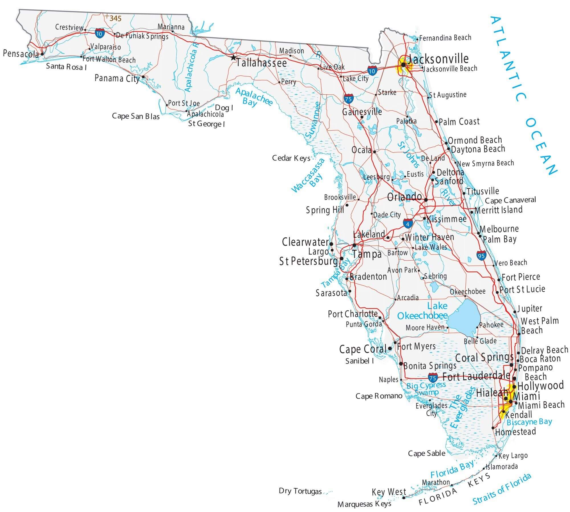
Florida state city road map
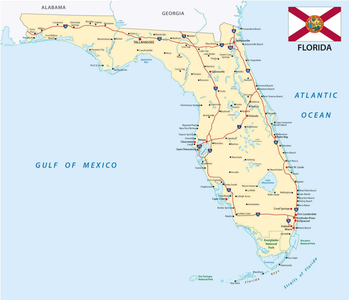
Florida state map with counties and cities
Florida topographic map with cities
Map of Florida with cities
Road map of Florida with cities
Where is Florida on the United States Map?
Show Google map, satellite map, where is the country located.
Get directions by driving, walking, bicycling, public transportation and travel with street view.
Feel free to explore these pages as well:
- Florida Map ↗️
- Map of Florida ↗️
- Florida Time Zone Map ↗️
- All About Florida ↗️
- US Cities Map ↗️
- United States Cities Map ↗️
- California Cities Map ↗️
- Texas Cities Map ↗️
- New York Cities Map ↗️
- Advertisement -
