Map of Kentucky

HomeMapsMap of Kentucky
- Advertisement -

A collection maps of Kentucky; View a variety maps of Kentucky physical, political, relief map. Satellite image of Kentucky, higly detalied maps, blank map of Kentucky, US and Earth. And find more Kentucky’s country, regions, topography, cities, road, rivers, national, directions maps and USA state atlas.

Kentucky Road Map
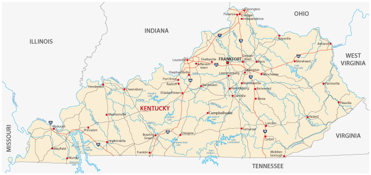
Kentucky Road Map
Kentucky road map with counties and cities, USA.

Map of Kentucky
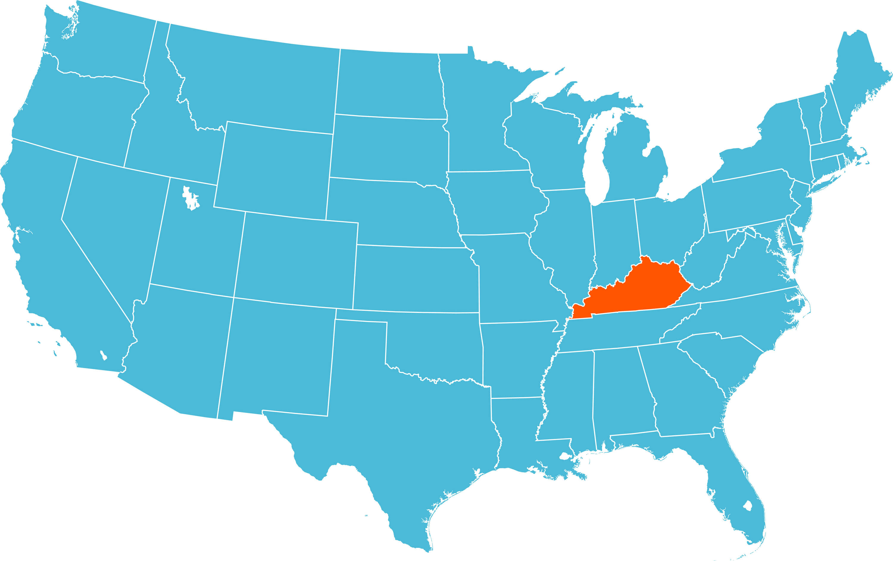
Map of Kentucky
Map of Kentucky, United States.

Kentucky Detailed Map
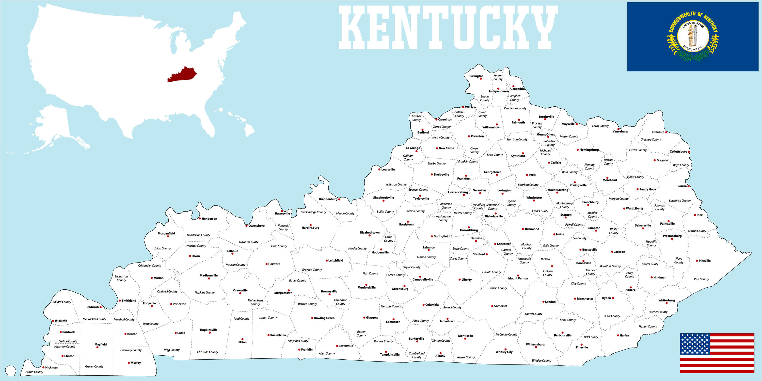
Kentucky Detailed Map


A large and detailed map of the State of Kentucky with all counties and main cities, USA.

Kentucky Administrative Map
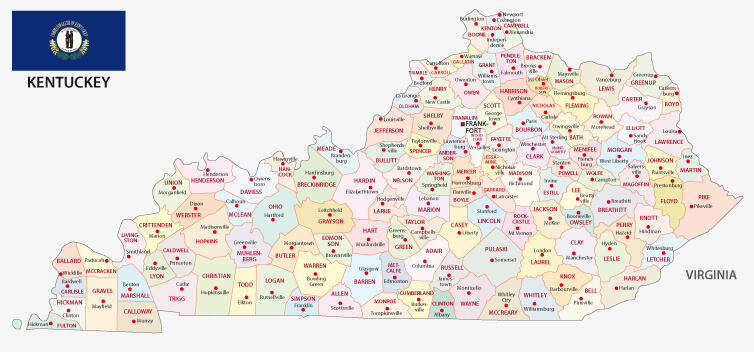
Kentucky Administrative Map
Administrative map with flag of the US state kentucky

Where is Kentucky in the World?

Show Google map, satellite map, where is the country located.

Get direction by driving, walking, bicycling, public transportaion and travel with street view.

[gmap-embed id=”2005″]

Kentucky Maps and Photos

- Advertisement -
Previous article
Next article

Discover

Sponsor

Latest Posts

Morocco Map

Discover detailed maps of Morocco including its physical and political boundaries, road and terrain maps, major cities, population distribution, national parks, highways, administrative regions,...

Kenosha Travel Guide, Kenosha Protests and 4K Aerial View

Kenosha is situated along Lake Michigan, Wisconsin state in the United States. Kenosha has a population of 99,944 as of 1 July 2019 census,...

World Geography Map

Discover a wide range of world geography maps, from detailed physical and topography maps to colorful atlas versions and printable wall maps. Explore maps...

Blida Map

Where is Blida, geography of Blida, enlargeable topographic map of Blida, including political maps, physical map, cities map, satellite images of Blida, location, itinerary,...

Map of Texas

A collection maps of Texas; View a variety maps of Texas physical, political, relief map. Satellite image of Texas, higly detalied maps, blank map...