- Advertisement -
A collection maps of Virginia; View a variety maps of Virginia physical, political, relief map. Satellite image of Virginia, higly detalied maps, blank map of Virginia, USA and Earth. And find more Virginia’s country, regions, topography, cities, road, rivers, national, directions maps and United States atlas.
Map of Virginia state
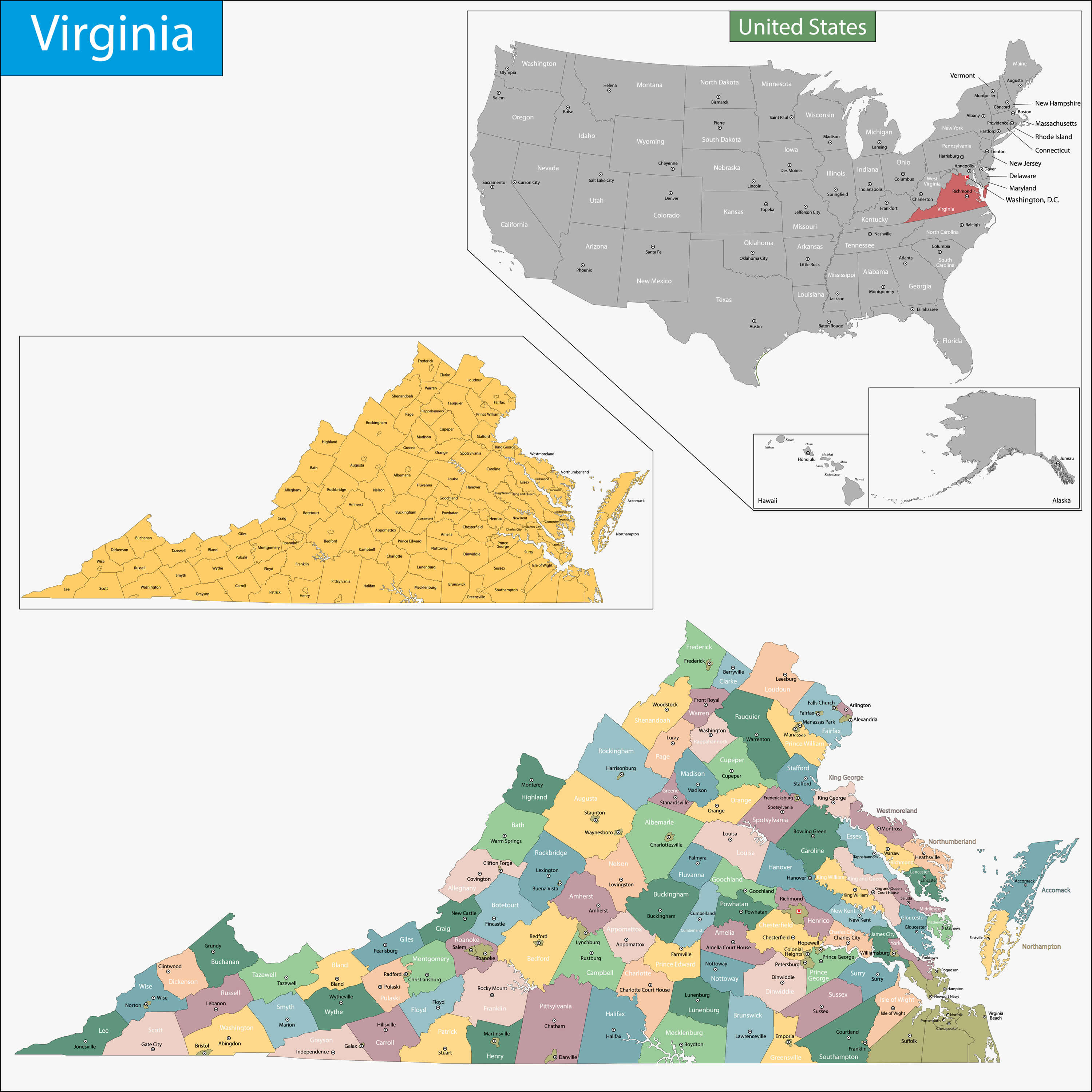
Map of Virginia state designed in illustration with the counties and the county seats.
Virginia Map, USA
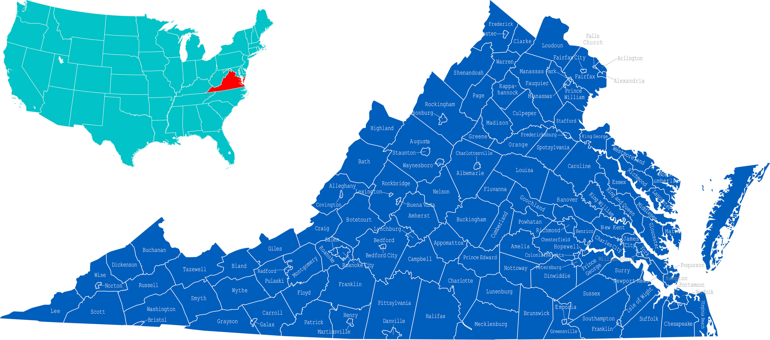
Virginia Map where the state is located in the USA.
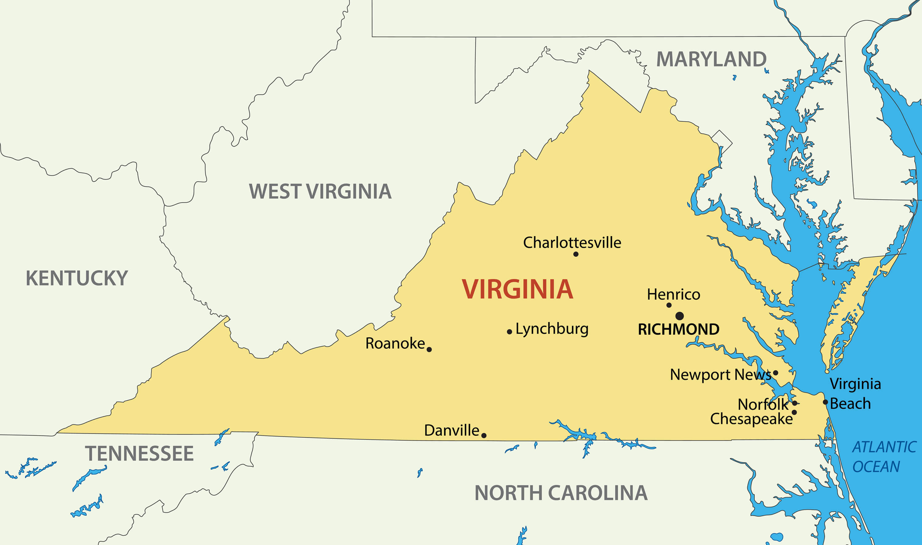
Virginia Administrative Map, US
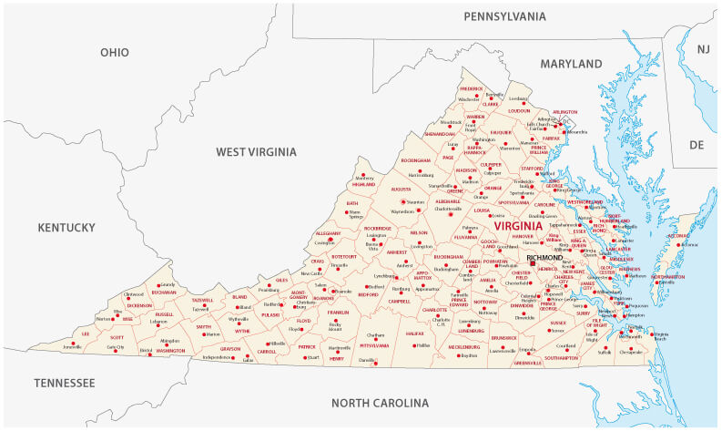
Virginia administrative Map US, with counties and cities.
Virginia Blank Map, US
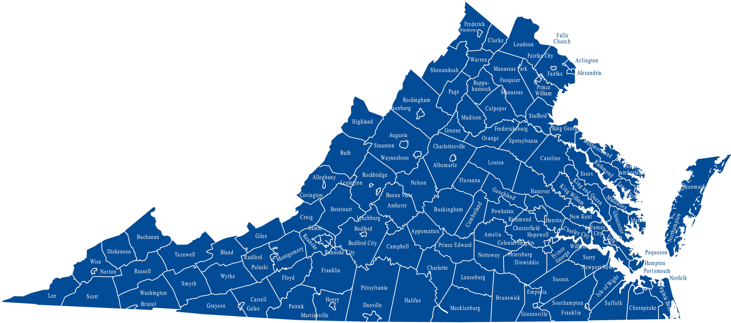
Virginia blank Map US, with counties and cities.
Commonwealth of Virginia vector map
Commonwealth of Virginia vector map with major cities.
Relief map of Virginia
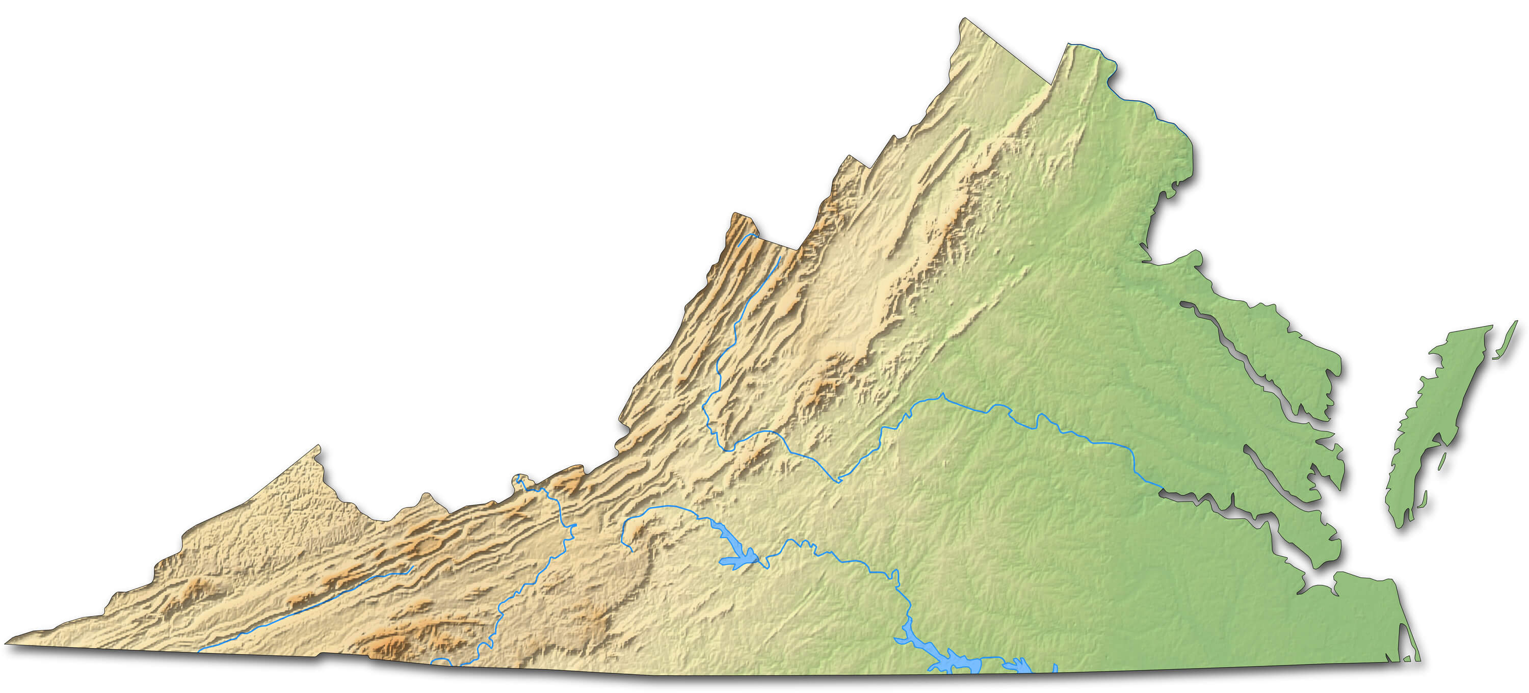
Relief map of Virginia (United States) – 3D-Rendering.
Geographic map of Virginia

Geographic map of Virginia close Lakeside, Charlottesville, Madison Heights.
Where is Virginia in the US?
Show Google map, satellite map, where is the country located.
Get direction by driving, walking, bicycling, public transportaion and travel with street view.
Virginia Maps and Photos
- Please Click for more Virginia Map
- Please Click for more Info About Map of Virginia
- Please Click for more About Virginia
- Please Click for more Virginia Photos
- Advertisement -