- Advertisement -
A collection of Belgium Maps; View a variety of Belgium physical, political, administrative, relief map, Belgium satellite image, higly detalied maps, blank map, Belgium world and earth map, Belgium’s regions, topography, cities, road, direction maps and atlas.
Belgium Road Map
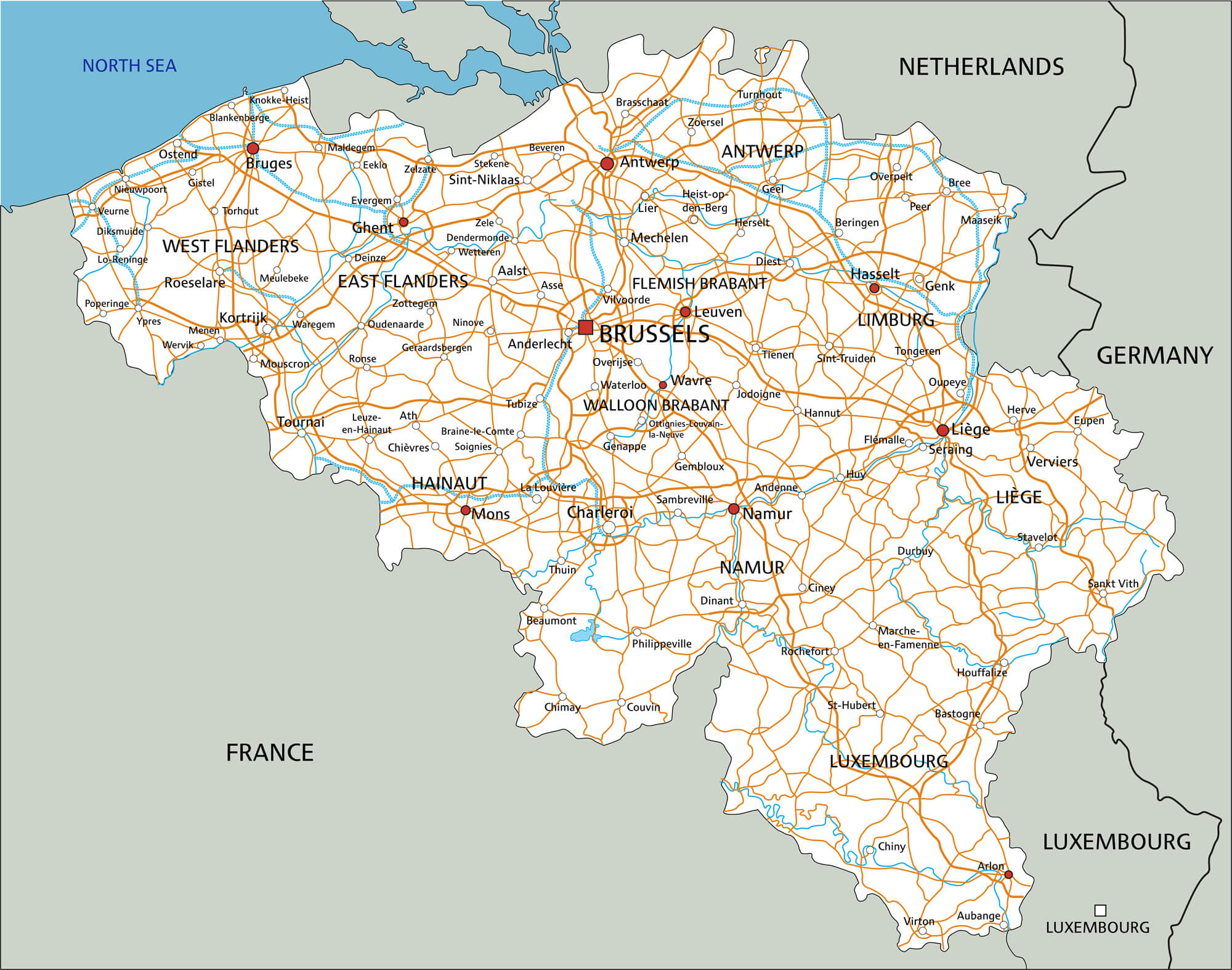 High detailed Belgium road map with labeling.
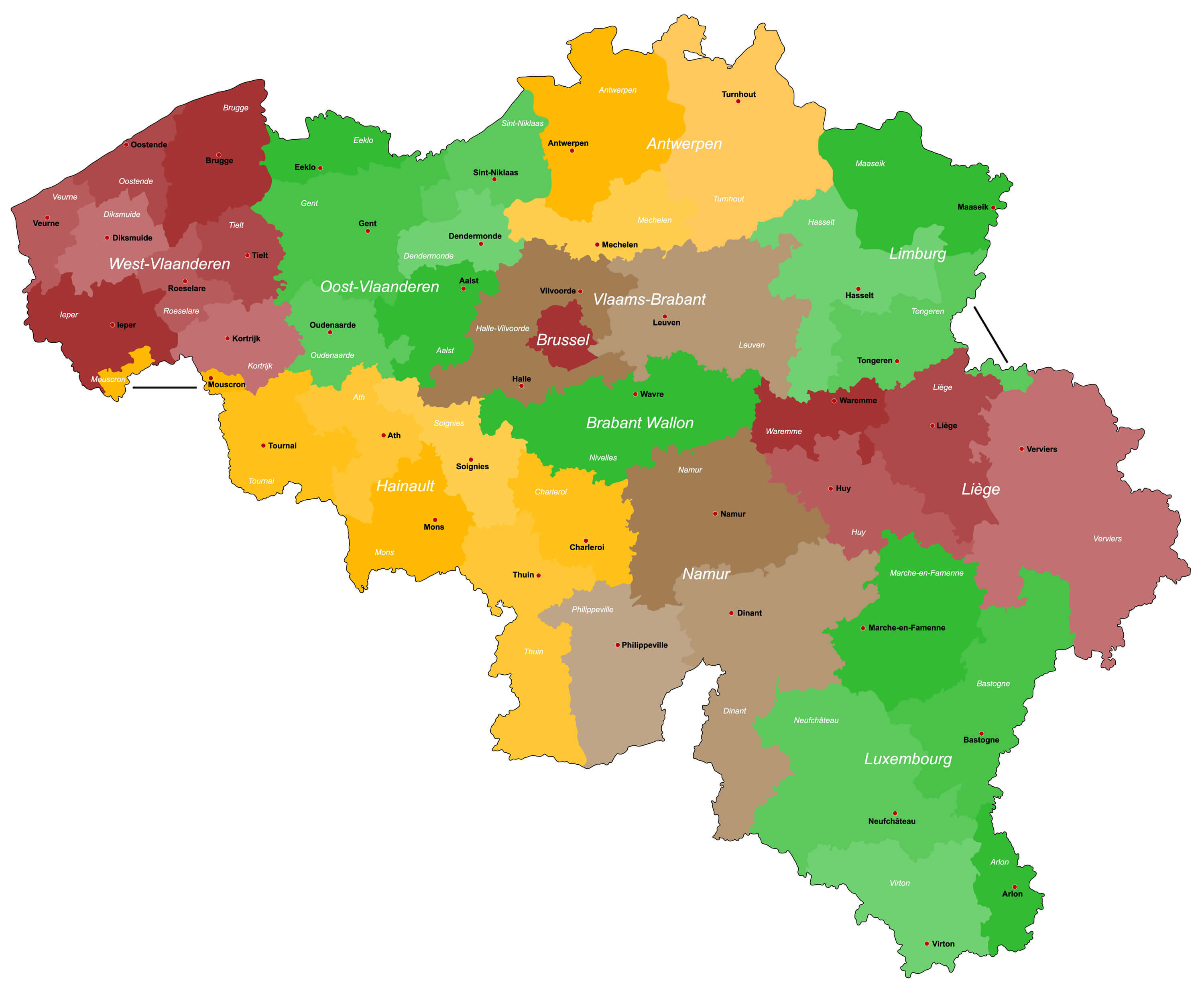
Belgium Provinces Map
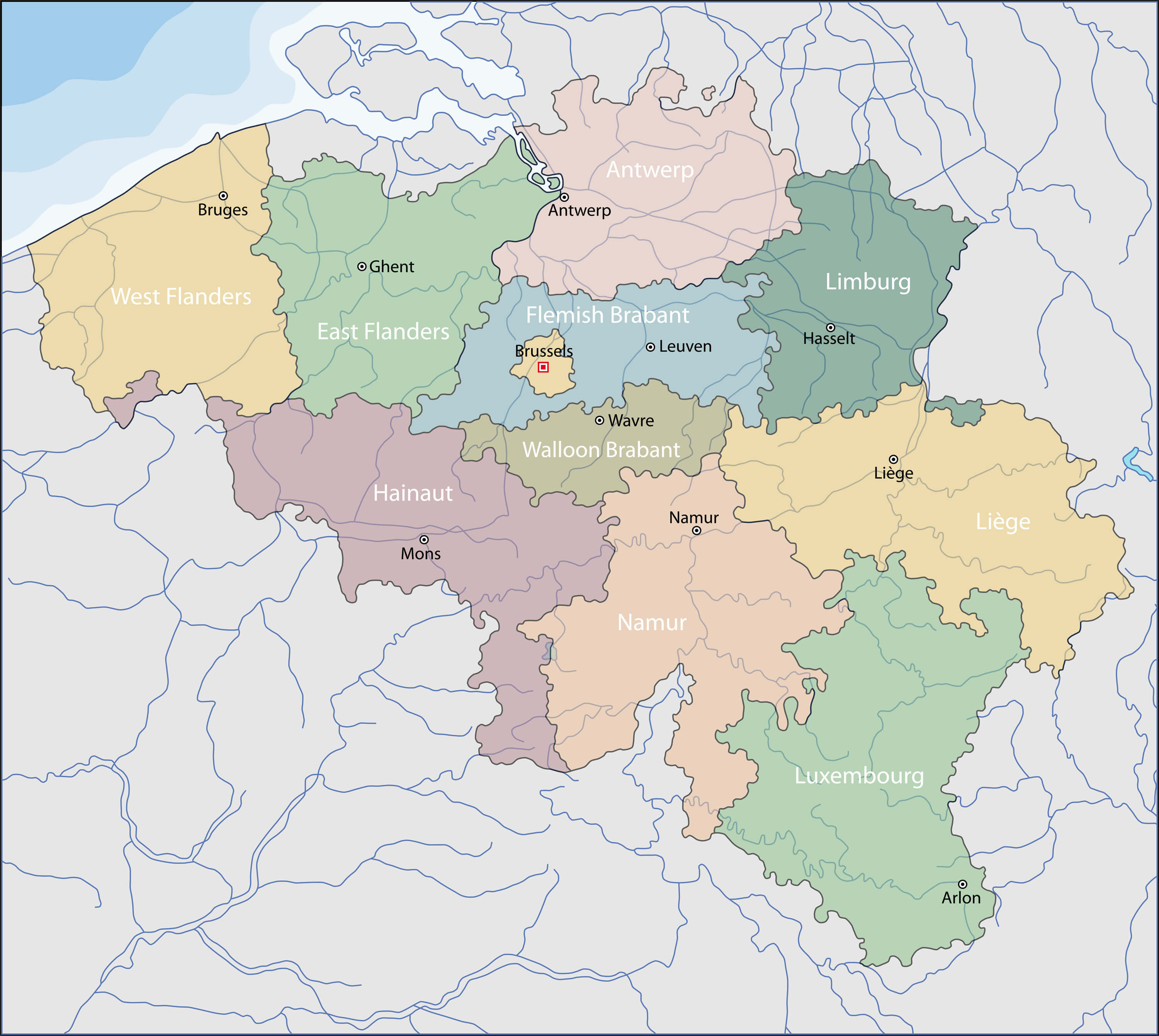
Provinces Map of Belgium.
Belgium Physical Map
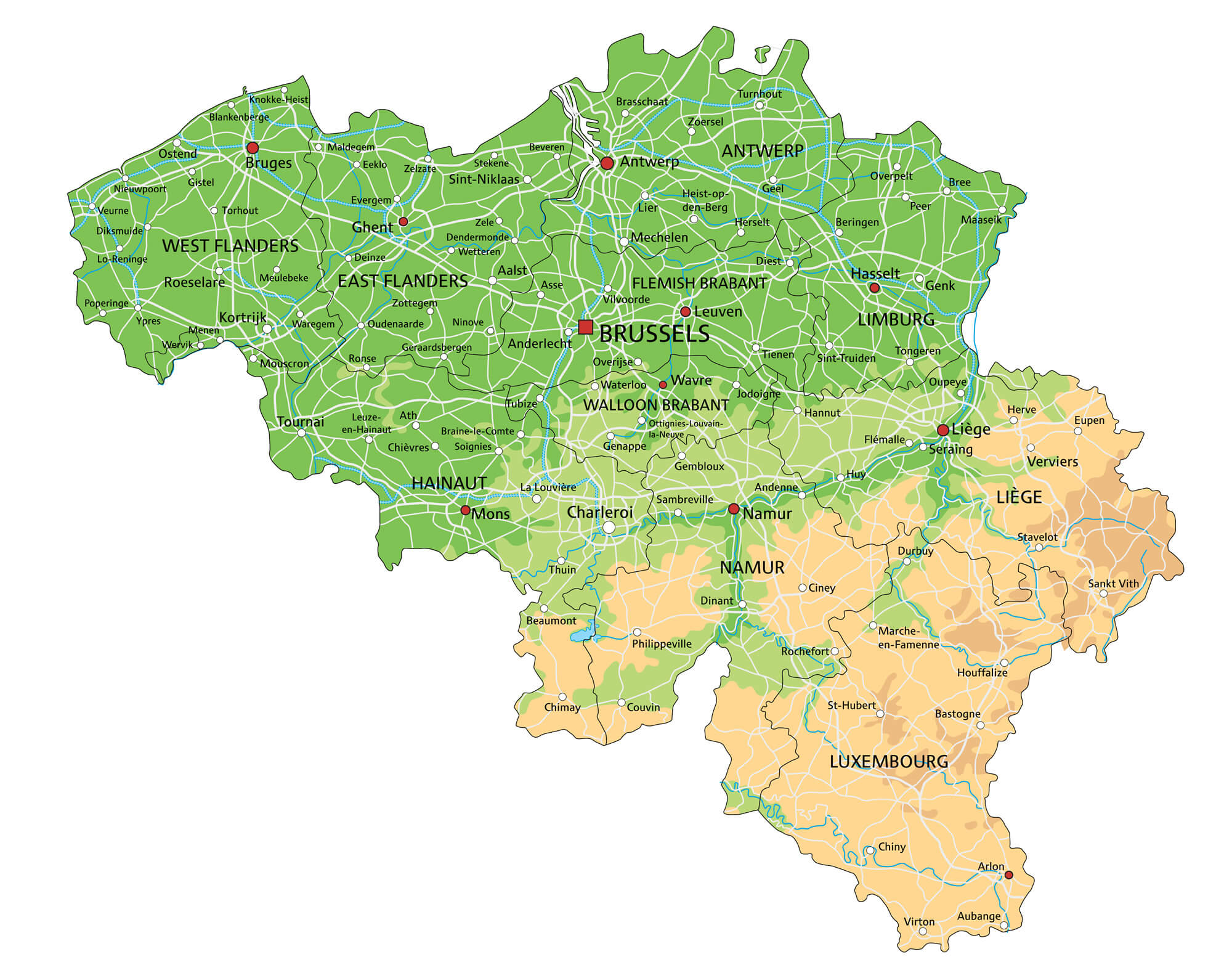
High detailed Belgium physical map with labeling.
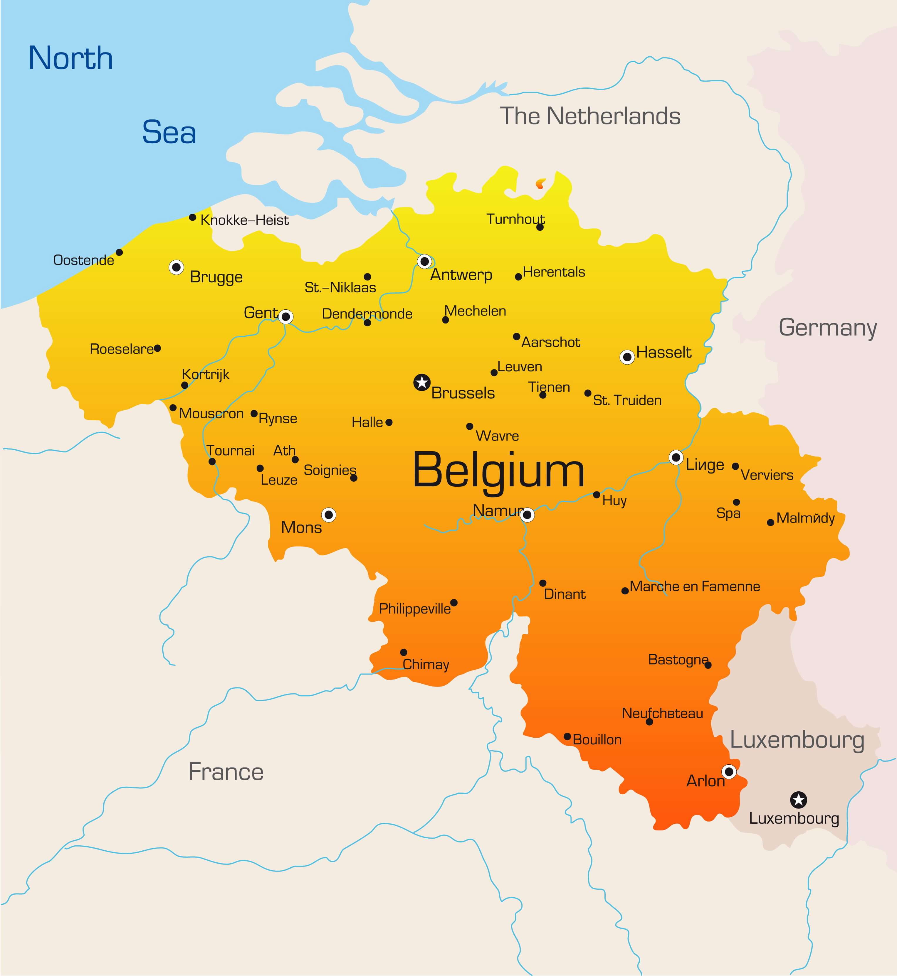
Belgium Map
Belgium map with major cities.
Belgium Country Map
Abstract vector color map of Belgium country.
Belgium Europe Infographic Map
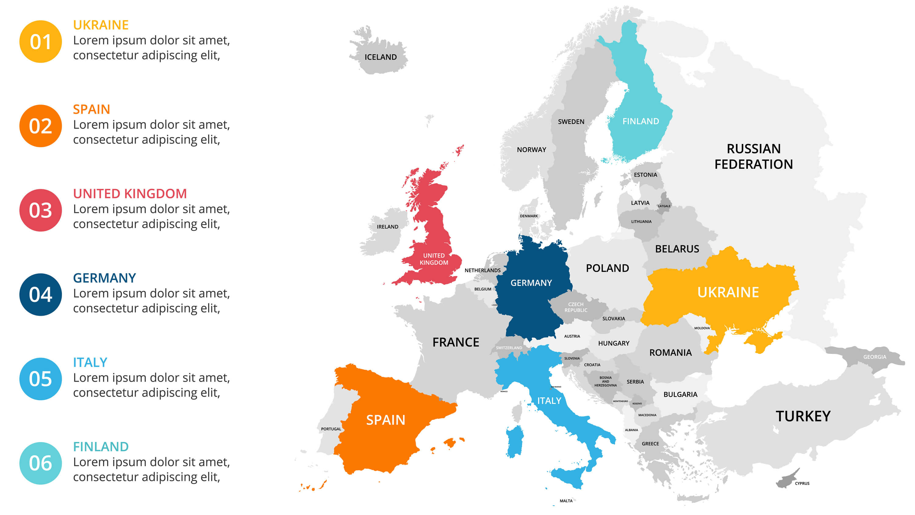
Belgium Europe map infographic. Slide presentation. Global business marketing concept. Color country. World transportation infographics data. Economic statistic template.
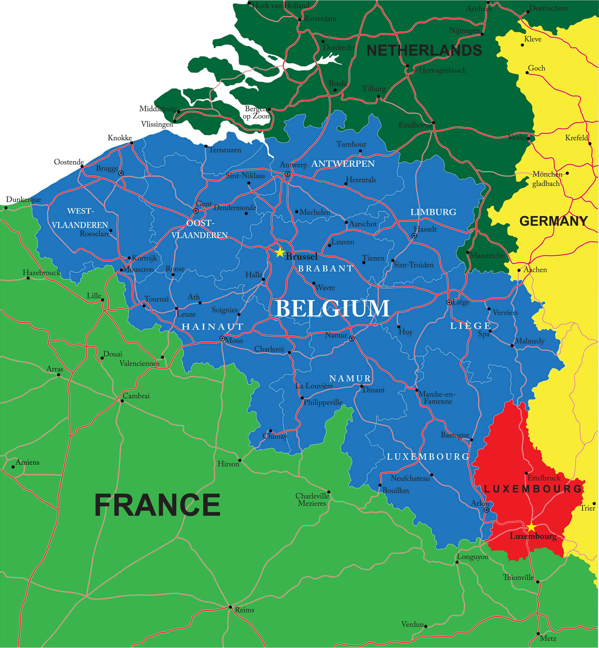
Detailed Map of Belgium
A large, detailed map of Belgium with all districts and main cities.
Where is Belgium in the World?
Show Google map, satellite map, where is the country located.
Get direction by driving, walking, bicycling, public transportaion and travel with street view.
About Belgium, Maps and Photos
- Please Click For More Belgium Map
- Please Click For Map of Belgium
- Please Click For More Belgium
- Advertisement -